PL/ENG
Mój pierwszy tegoroczny trening to wyprawa na pobliską górę Klimczok.
Kilka zdjęć, których nie zobaczycie w tym poście, możecie zobaczyć o tutaj - link
My first workout this year is a trip to the nearby Klimczok mountain.
Some photos that you won't see in this post can be seen here - link
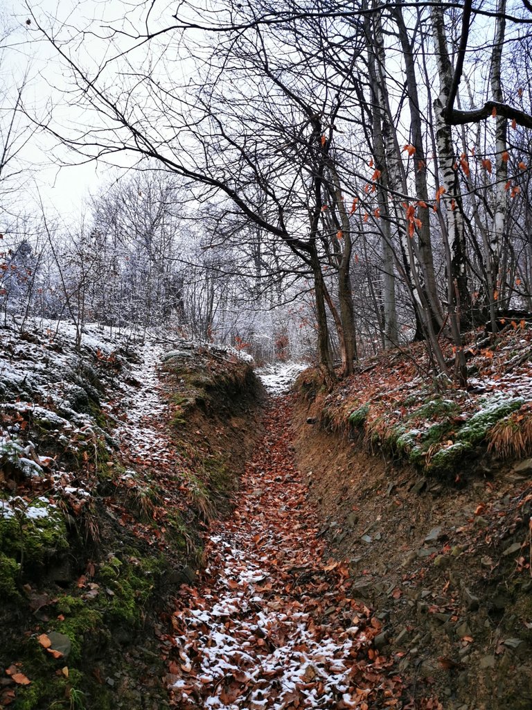
W zeszłym roku - link - wytyczyłem sobie trasę zejścia jak najbliżej mojego domu, a teraz postanowiłem tą samą trasą wyjść w górę.
Początek do łatwych nie należy - strome wyjście żlebem do ściągania drzewa. Pełno luźnych kamieni ukrytych pod liśćmi nie ułatwiało wspinaczki.
Po kilku metrach byłem już porządnie rozgrzany.
Last year - link - I made a descent route as close to my home as possible, and now I have decided to follow the same route to go up.
The beginning is not an easy one - the steep exit through the tree-collecting gully. A lot of loose stones hidden under the leaves did not make climbing easier.
After a few meters, I was really warm.
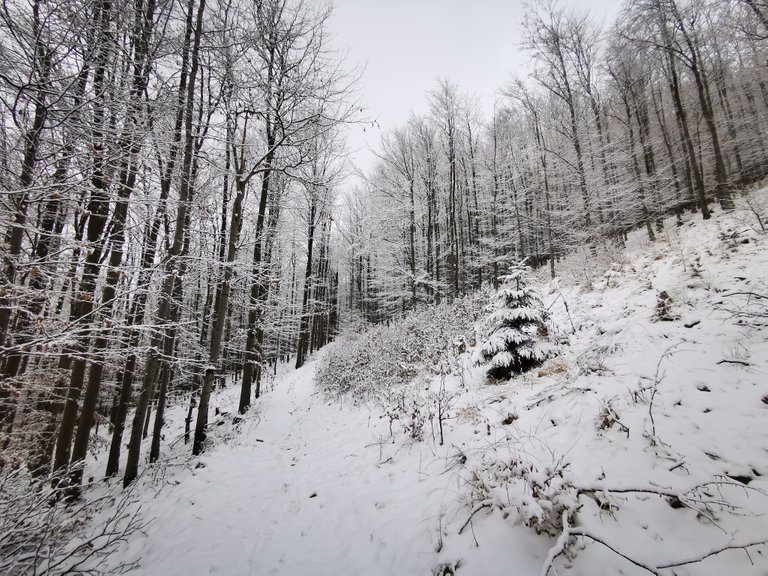
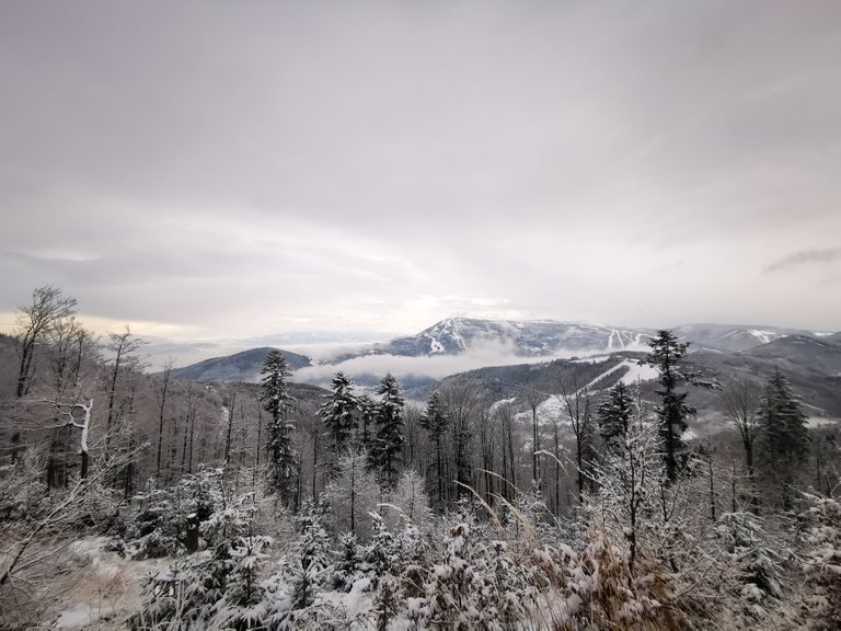
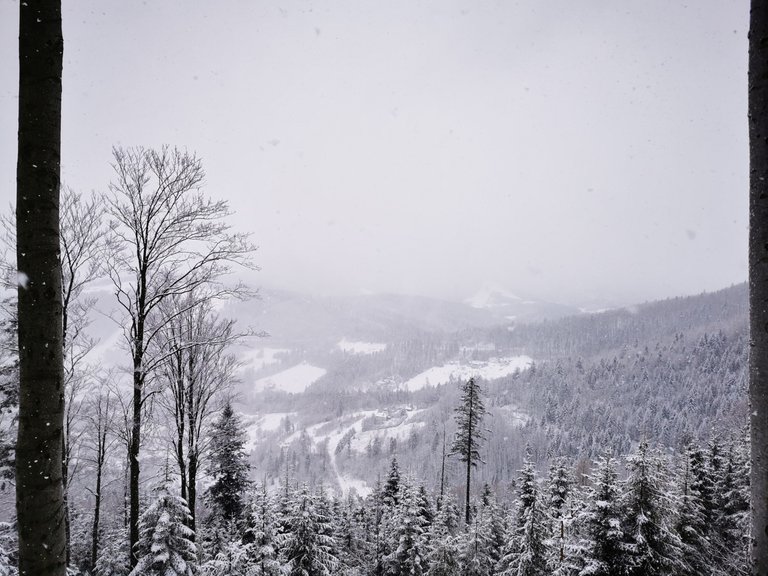
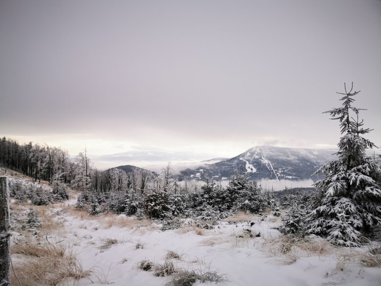
Kilkaset metrów powyżej żlebu klimat mocno się zmienił.
Tutaj zima zawitała na dobre.
Idąć dalej, śniegu było coraz więcej.
Patrząc pod kątem treningu szło mi się całkiem dobrze. Wydolnościowo było ok, problem niestety pojawił się w moim prawym kolanie, o którym już nie raz wspominałem.
Na szczęście część trasy w tym miejscu przebiegała w miarę po płaskim, i bój w kolanie odpuścił na tyle, że mogłem kontynuować wędrówkę.
Do szczytu miałem stąd jakieś pół godziny drogi, więc szkoda było mi odpuścić wyprawę akurat teraz, choć nie ukrywam, że jeszcze pół godziny wcześniej (gdy ból w skali do 10ciu wynosił 12) myślałem, czy nie dzwonić po kumpla z samochodem terenowym, by zwiózł mnie na dół.
A few hundred meters above the gully, the climate changed significantly.
Here, winter has come for good.
Move on, there was more and more snow.
In terms of training, I was doing quite well. The efficiency was ok, unfortunately the problem appeared in my right knee, which I have mentioned many times.
Fortunately, part of the route at this point was quite flat, and the knee pain was relieved enough for me to continue my journey.
I was about half an hour away from here to the top, so it was a pity to let go of the trip right now, although I admit that even half an hour earlier (when the pain on a scale of 10 was 12) I was thinking to call my friend with an off-road car, to take me to home.
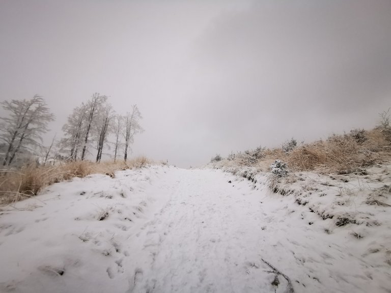
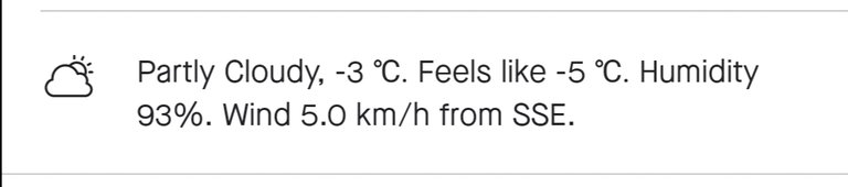
Pogoda była zmienna.
W trakcie drogi dwa razy dopadła mnie przelotna śnieżyca.
The weather was changeable.
On the way, I was hit by a blizzard twice.
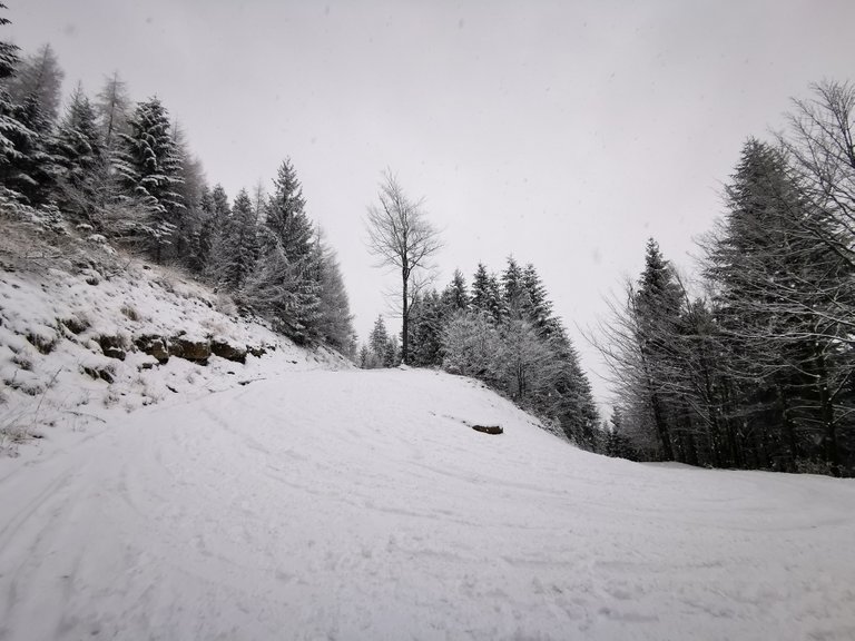
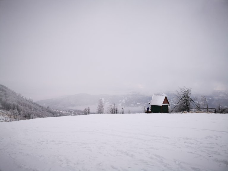
Na rozstaju szlaków wybrałem krótsze, ale bardzo strome podejście do siodła pod Klimczokiem.
W miejscu gdzie zrobiłem powyższe zdjęcie, musiałem się zatrzymać, by dopiąć kaptur do kurtki, gdyż wydawało mi się, że huraganowy wiatr urwie mi głowę.
At the crossroads of the trails, I chose a shorter but very steep climb to the saddle at Klimczok.
In the place where I took the above photo, I had to stop to fasten the hood to my jacket, because it seemed to me that the hurricane wind would tear my head off.
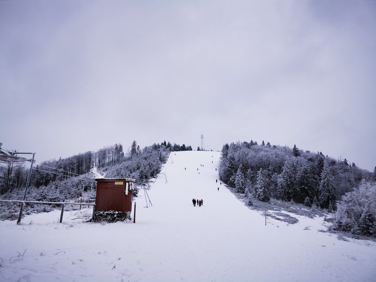
Z siodła pod Klimczokiem czekało mnie jeszcze jedno podejście na szczyt góry, oznaczony anteną. Ta ostatnia górka może wyglądać niewinnie, ale nachylenie stoku, plus mocno zmarznięty śnieg, nie ułatwiały wyjścia.
Po tej wędrówce zakupiłem turystyczne raczki, gdyż zejście również do łatwych nie należało.
One more climb to the top of the mountain, marked with an antenna, awaited me from the saddle under Klimczok. This last hill may look innocent, but the slope of the slope, plus the cold snow, did not make the climb easier.
After this trip, I bought light little tourist crampons, because the descent was also not easy.
Kolejną porcję zdjęć, wraz z opisem zejścia z góry, zamieszczę w przyszłości, w poście travelfeed. Teraz skupmy się na wynikach "treningu".
Another portion of photos, along with a description of the descent from the top, will be posted in the future in the travelfeed post. Now let's focus on the results of the "training".
Warunki pogodowe nie należały do najłatwiejszych, ale (prócz ostatniego podejścia) były przyzwoite.
The weather conditions were not the easiest, but (except for the last attempt) they were decent.
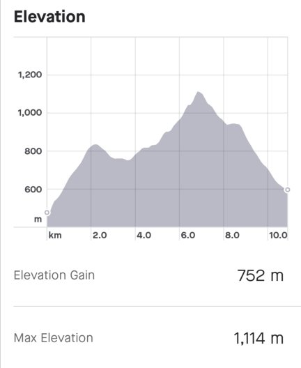
Na powyższym wykresie świetnie widać pierwsze podejście żlebem.
Pomiędzy 2 a 4 kilometrem był etap, w którym myślałem o rezygnacji ze wspinaczki z powodu bólu kolana. Szedłem w bok góry, by dostać się do osiedla Podmagura, skąd mógłby mnie zabrać transport.
Na tym, w miarę płaskim terenie, ból ustąpił na tyle, że zdecydowałem się kontynuować wędrówkę, w górę.
The first part on the graph above shows the first steep approach along the gully.
Next there was a stage between 2 and 4 kilometers where I thought about giving up climbing because of knee pain. I was walking to the side of the mountain to get to the Podmagura estate, from where the transport could take me.
On this relatively flat ground, the pain subsided enough that I decided to continue my trek up.
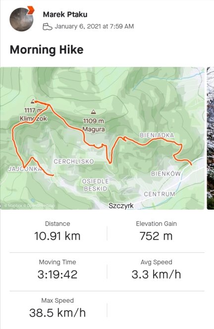
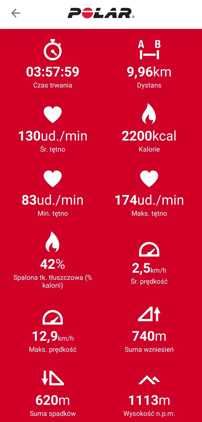
To była moja pierwsza wyprawa z zegarkiem Polar.
Porównując te dwa zdjęcia sam się na początku lekko zdziwiłem.
Pierwsze zdjęcie jest z aplikacji Strava.
Aplikacja Strava zatrzymuje się wraz z użytkownikiem, stąd taka duża rozbieżność w czasie treningu.
Mogę wnioskować, że całość przejścia zajęła mi prawie 4 godziny (co widać na zrzucie z zegarka Polar), natomiast aktywnie w ruchu pozostawałem przez prawie 3.20 minut (co widać w aplikacji Strava).
Dystans różni się o 1 kilometr -10.91km do 9.96 km.
Przewyższenie jest bardzo zbliżone - 752m do 740m.
Maksymalna wysokość jest prawie identyczna - 1114 do 1113 m n.p.m.
Pod kątem treningowym ważna jest dla mnie oczywiście ilość spalonych kalorii - tutaj zegarek Polar mierzył mi tętno swoim czujnikiem, i wyliczył, że spaliłem 2200 kcal.
It was my first trip with a Polar watch.
Comparing these two photos, I was a bit surprised at the beginning.
The first photo is from the Strava app.
The Strava app stops with the user, hence the large discrepancy in training time.
I can conclude that the whole transition took me almost 4 hours (as can be seen in the Polar watch screenshot), while I was actively moving for almost 3.20 minutes (as seen in the Strava app).
The distance varies by 1 kilometer -10.91km to 9.96km.
The altitude difference is very close - 752m to 740m.
The maximum altitude is almost identical - 1114 to 1113 m above sea level.
In terms of training, of course, the number of calories burned is important to me - here the Polar watch measured my heart rate with its sensor, and calculated that I burned 2200 kcal.
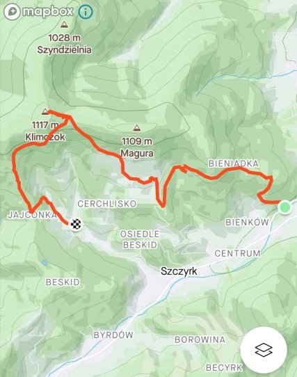
Na koniec wrzucam mapkę całej trasy.
Jak na rozpoczęcie sezonu treningowego, to dałem sobie niezły wycisk ;)
Gdyby nie kolano, to wycieczkę zaliczyłbym do udanych na 110%.
Następna wyprawa po rehabilitacji, bo nie ma sensu się męczyć.
Finally, I put in a map of the entire route.
As for the start of the training season, I gave myself a good impression ;)
If it weren't for the knee, I would have counted the trip as successful at 110%.
Next trip after rehabilitation, because there is no point in getting tired in pain.
Ładna wyprawa 😁
!BEER
używając #aroundworld
View or trade
BEER.Hey @ptaku, here is a little bit of
BEERfrom @bucipuci for you. Enjoy it!Learn how to earn FREE BEER each day by staking your
BEER.