The rawest form of natural medicine is to be out in nature. You don't have to consume Terra Firma's vegetation to receive the benefits. Just being out in the sun supplies your body with nutrients and any exercise you perform is the best medicine. Here's a great area to visit and practice walking meditation to pamper your mind and heart.
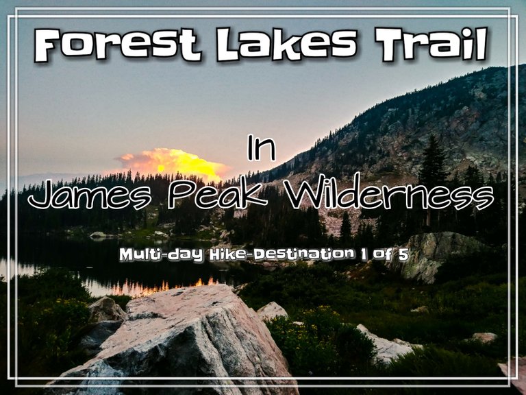
The James's Peak Wilderness is a great area within an hours drive of Denver, Colorado for day and multi-day hiking in the Front Range area of the Colorado Rockies Mountains. With five different hikes from just one of its trailheads, so there are plenty to choose from and reason to return.
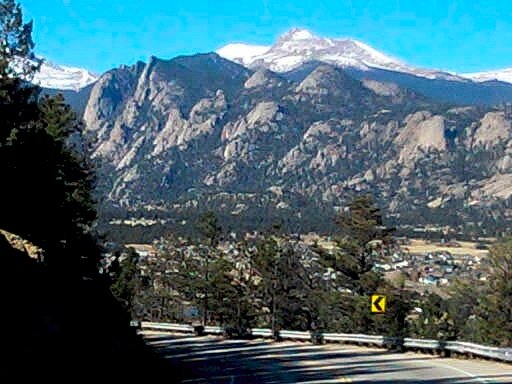
Since 2009 after leaving my birth state of Michigan for good, I've driven through Colorado quite a few times, but never got to experience the mountains until 2013. This is because my childhood bestie moved to Cheyenne, WY and invited me out for a three day hike to Blue Lake(there will be an article about it). Every since that experience I've returned annually and even biannually for many of them. In 2015 I even volunteered my whole summer building a Cob Cottage in Coal Creek Canyon, which was an amazing experience.
This particular time I had decided to backpack a popular trail in Boulder County called the Diamond Lake Trail. The trip was hastily planned and I decided on making a four day trip out of it during Labor Day Weekend, when there is notoriously heavy traffic.
The thought about needing a permit, never crossed my mind. It wasn't until after arriving in Denver that I decided to check and see if one was necessary and it was.
This wasn't a very big deal, because I know of many places to hike there, but like most ill-planned activities I hit a roadblock. There were only 2 permits left for the weekend with multiple parties waiting in line to purchase theirs and I didn't want to hike a trail I've already hiked.
This is where the convenience of having access to the internet shines. A quick search for permit free hiking pointed me to the James Peak Wilderness, which happens to have many great hikes to choose from, all just as amazing as any of the more popular ones. A few of them even connect to the Continental Divide Trail and to some in Boulder County that require permits.
Boulder charges for everything, even parking at the day hike access points where permits aren't required. Few of the surrounding counties do, so if you want a cheaper experience, without having to pay or stop at a Ranger Station, avoid Boulder.
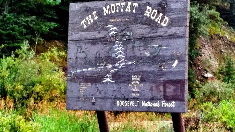
Then using the AllTrails.com app I decided on the Forest Lakes Trail beginning at the East Portal Trailhead, which begins at the mouth of the Moffat Tunnel. The area was easy to find using my navigation app, of course and I was pleasantly surprised that the parking area was huge. For many trails it's important to get to the trailhead either early or quite late if you plan on a multi-day adventure. Day hikers are plentiful throughout Colorado and most spots are taken from lunch-dinner time.
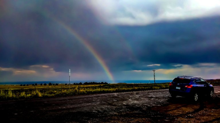
Whenever I drive long distance for a multi-day hike I always arrive the night before and truck camp for the night. This way I can start right out first thing in the morning on my adventure not feeling rushed to reach my destination. Then I have plenty of time to take in the sights, reach my destination and set up camp before cooking supper.
Once you hit the trail, the East Portal Trailhead runs for about 3/4 of a mile before it splits into the South Boulder Creek Trail 900(there are many different sections). It's the first fork that takes you to Forest Lakes. I'll be showing you the sights that you'll be experiencing on the way to Forest Lakes. If you stay on the SBCT you have four more options. They are Crater Lake, Heart Lake, James Peak and Rogers Pass. You can also connect to the Continental Divide Trail.
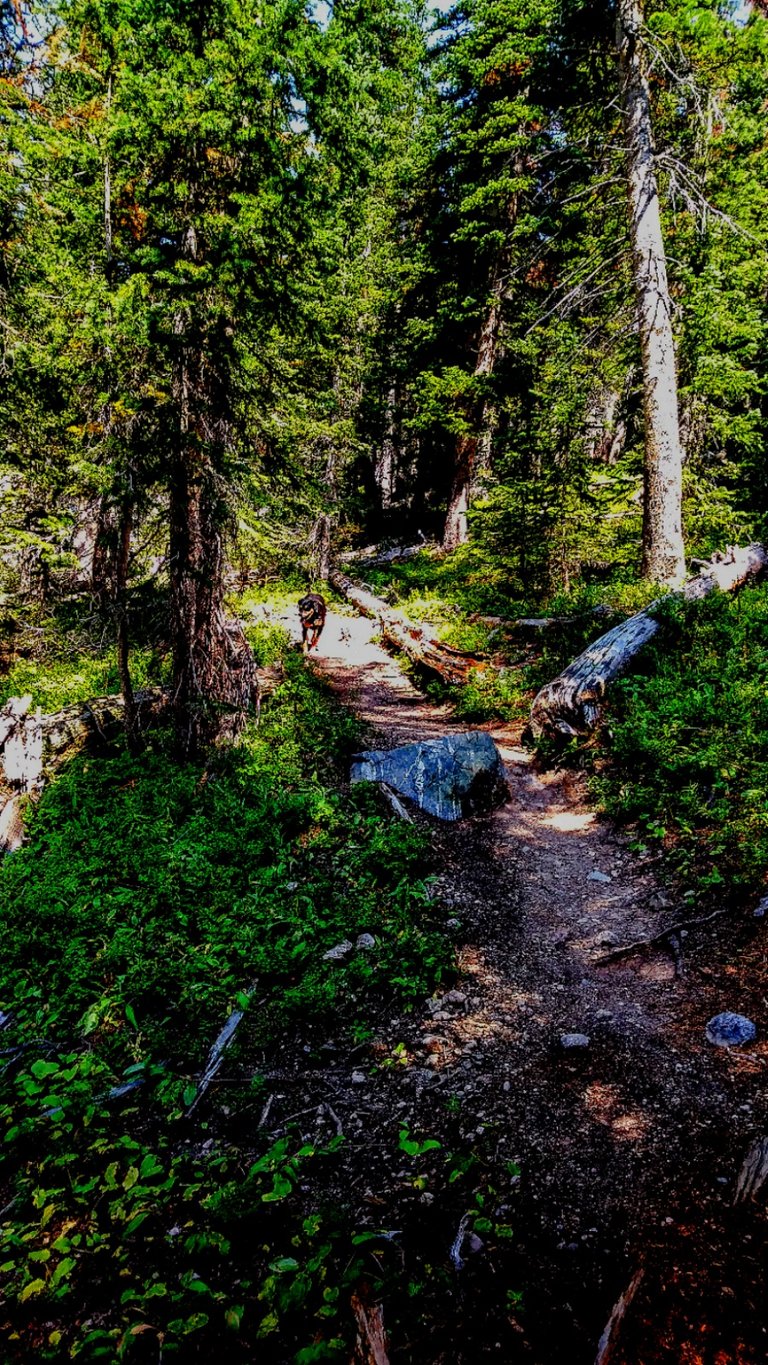
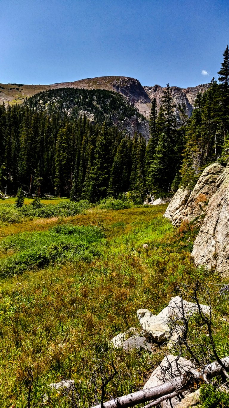
The East Portal Trailhead starts off in a low valley where you walk through a mountain meadow with obscured views of the mountains. Once you turn off on the Forest Lakes Trail you begin to quickly ascend crossing a creek often, so there are plenty of opportunities to refill your water supply throughout. The ascent is quite steep throughout much of the 3.0 miles to the higher lake, with most trail guides rating it moderate to hard. I myself didn't find it very hard, but if you are out of shape or a smoker, your opinion will probably differ from mine.
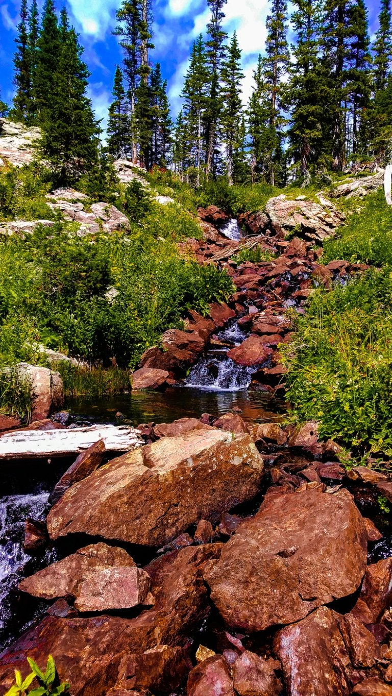
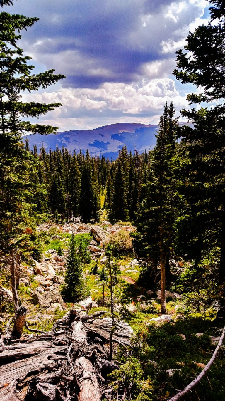
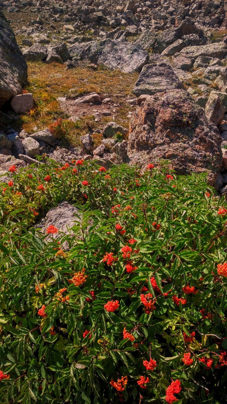
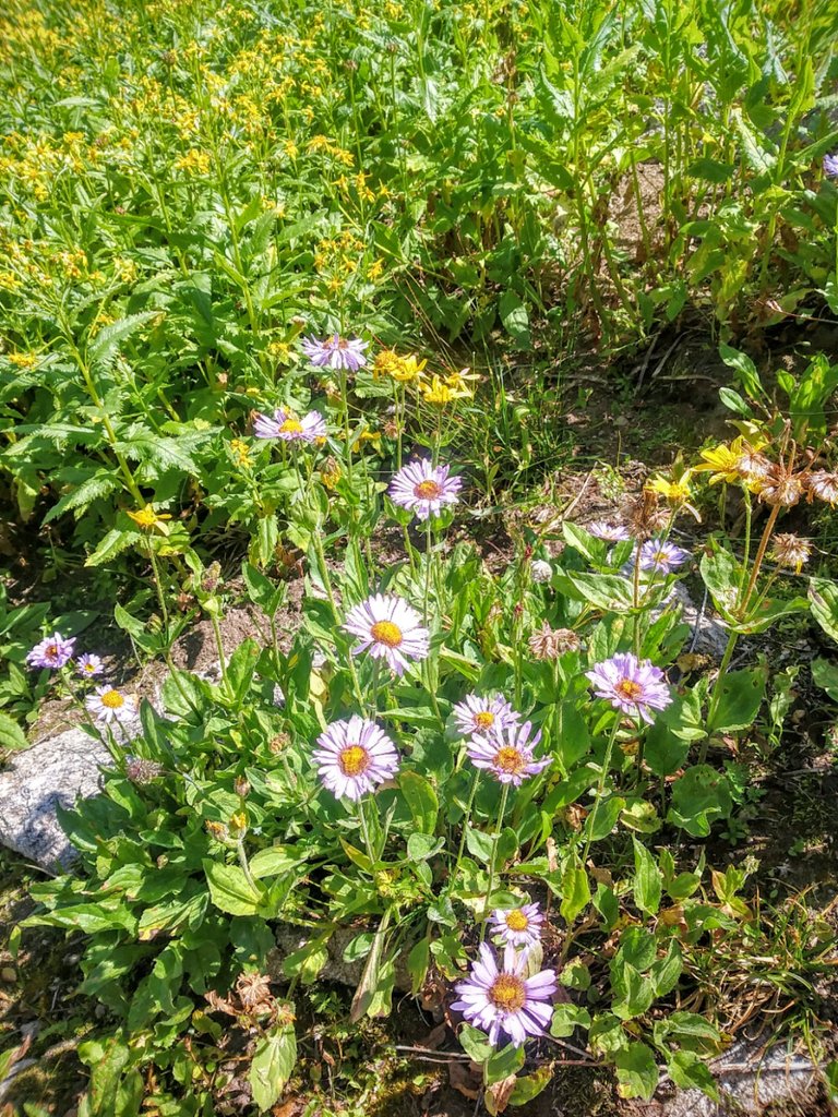
Much of the hike is in the tree's, with the views pretty well blocked, though there are quite a few clearings throughout. The serenity of the surroundings, altitude, many open meadows filled with wildflowers and the slow rolling waterfalls makes for a wondrous experience.
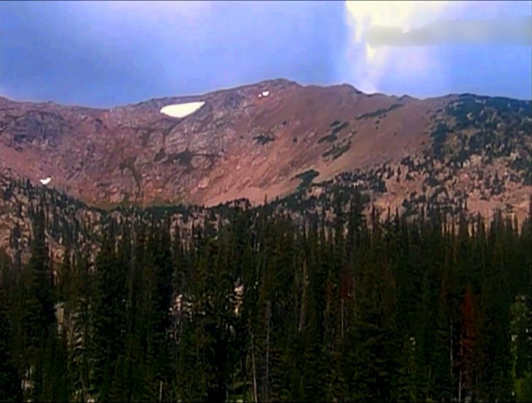
Even though it was the later portion of the season, there were many remnants of the winter glaciers still lingering in the shaded areas. As you near the canyon that house's the lakes there was a great view of the Continental Divide.
Forest Lakes is apply named, because there are two good size lakes. An upper and lower with quite a few shallow ponds suspended in the upper crevices. The lower lake provides a more secluded camping experience, because most hikers camp and fish around the upper lake.
There is another trailhead a meer 3/4 of a mile from the upper lake, for the fisherman to drive up to the lake who are not interested in the hiking aspect of the trip. For this reason the Upper Lake can become quite populated during the busy season. The trout fishing is great and you are sure to get them with any small black fly lure, which is why it gets so busy.
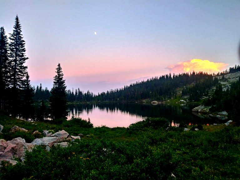
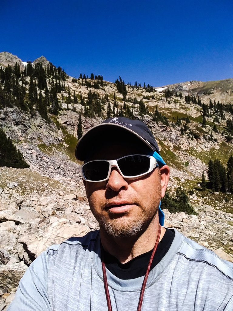
The upper lake is about a 20 minute hike further up from the lower one and nestles in the lower bowl of the canyon peaks. There is plenty of camping around 2/3 of the lake with the best spot being on a 30ft high rock peninsula at the Westside of the lake. I was fortunate to have been one of the first to make it up there and find this spot.
I always survey the whole area before chosing and it doesn't get better than this. The epic photo I used as the cover for this article was shot from there.
Once you reach your destination and set up there's a tonne to explore and some challenging climbs if you so choose. There is a great secondary ridge between the peaks and the lake with two hanging ponds, one almost as large as the upper Forest Lake with a hidden meadow and near full seclusion. The whole time I was there, only one other person hiked up to that spot.
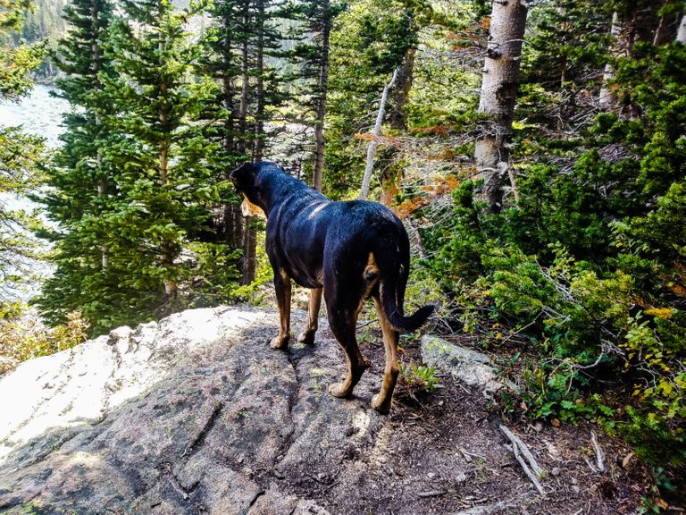
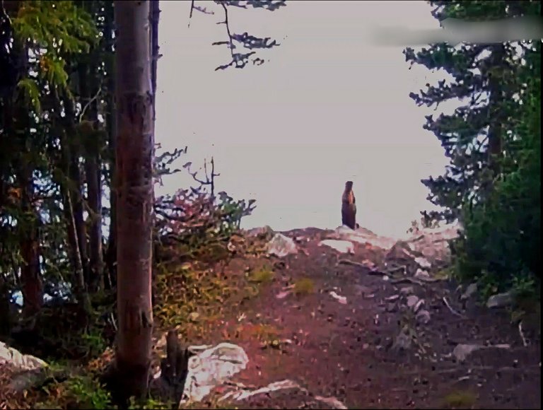
The canyon was so serene and beautiful, I could have thrown up a hammock and chilled just staring at the scenery for hours, being fully content. There is a pretty large colony of Marmots living in the rocks who came out quite often to hollar at us, teasing Nietzsche a bit, yet being quite tolerant neighbors. The birds had no issues with us being around and were glad to clean up Nietzsche's meals. I would definitely recommend this hike.
If you like long distance hiking this could be your first days destination and the next you could continue on to the Continental Divide Trail to head in whatever direction you want, but if you head Northwest you make it to Rogers Pass in time for supper.
If you head South from there you can make a full loop by Summiting James Peak and backtracking a bit to connect back up with South Boulder Creek Trail once again. Doing so brings you to Heart Lake, which is another primitive camping area with two lakes surrounded by the high Peaks. I hiked to this spot for my return trip the following year, which I'll be sharing with you in the near future.
The possibilities are endless for planning your adventure here. I chose to hike to one location at a time, camping for 3-4 days each and leisurely exploring in every direction. I will eventually show you all five destinations mentioned in this article. I plan to head back this year and hiking to Rogers Pass, checking out James Peak along the way.
See you next time and hope you plan to tag along.

Every new experience adds to the respect, wonder and awe I feel when bonding with this living entity we call 🌎.
Please make sure to take the time to get outside and bond with your environment. Your health will thank you at every level of your being and please share your experiences with the world. Personal communal knowledge is beneficial to us all, because this interaction is essential to our evolution.

Thank you and I hope your day unfolds on your terms.
All image's and text are property of the author- All Right's Reserved


Join The Best Natural Health Community on Hive

Creating Abundance for all on Hive
Awesome hike
Yes it was and isn't far from you. It's between Nederland and Rollinsville off hwy 119 I believe.
Oh, i didn't even think of marmots being in that landscape!!!! How cute. Looks like an awesome trail - that one of the lake is stunning! Nietzche must love it out there - what smells!!!!
Oh it is beautiful and Nietzsche loves it if we are moving forward, especially in areas with new smells.(Is this what you last phrase referred to?)
My next one to publish is about the Heart Lake section, which is even more beautiful and I had my Canon T7i for that hike.
This hike I only had my cellphone and a Gopro knock-off, so the images weren't as good.
This post was shared in the Curation Collective Discord community for curators, and upvoted and reblogged by the @c-squared community account after manual review.
@c-squared runs a community witness. Please consider using one of your witness votes on us here
oh wow what a stunning place and I agree nature is the best medicine for sure. I would love to be able to go camping there, another reason for me wanting to visit America one day. I look forward to the next posts, this is exactly the time of medicine we need now xxx
I hope you get over here to do just that. There are many great hikes here, but the mountains in the West are the best.
Beautiful scenery! I just moved to Utah (from Oregon) so now I am not far away from there, might check it out some day. But there is so much to see just in Utah, almost every single weekend we are exploring a new place :)
Oh yes! Utah is beautiful with a lot of great hikes.
I haven't hiked there yet, but have driven through the Southeast corner on my way to Phoenix and loved the many subsurface valleys and outcrops with the multicolored layers of earth within them.
Of course the desolate landscape and few towns with services made me feel very small too. I was crossing my fingers that my vehicle didn't breakdown while traveling through there. 😂
Nice to meet you.
Hi there @solcycler this is an awesome hike in the wilderness and I'd love to curate it if you want to pin it on Pinmapple (I used to be called Steemitworldmap on Steem). You can find out more about me on https://pinmapple.com/. Just click on the 'get code' at the top of the map and follow the instructions or check out the FAQ to get your post on the map. Hope to see your travel posts soon! 🍍
@pinmapple doesn't work for me at all on brave. I can't pin a location, generate a code, nothing. I would love to use your Dapp though. 😀
I figured it out using Firefox, I think.
Hey yeah, we heard there are some issues with Brave blocking certain scripts which makes Pinmapple not load properly. I will look into it! Chrome is the browser I used for testing during development, so it should be most stable!
I'm one of those that won't use Google...
I understand that, I think I've managed to sort out the issues with Brave. Can you hard refresh the page and tell me if it's working fine for you now? 😄
It didn't, but worked after turning of the ad/tracking blocker.
Congratulations, your post has been added to Pinmapple! 🎉🥳🍍
Did you know every user has their own profile map?
And so does every post as well!
Want to have your post on the map too?
Hiya, lizanomadsoul here, just swinging by to let you know that this post made it into our Top 3 in Daily Travel Digest 816.
Your post has been manually curated by the @pinmapple team. If you like what we're doing, please drop by to check out all the rest of today's great posts and consider supporting other authors like yourself and us so we can keep the project going!
Become part of our travel community:
Beautiful place for a hike, so many colors! Also kudos for finding an alternative to the roadblock, didn't know such an app existed.
Thank you very much😀