All Rights Reserved.
All the images contained in this post are taken, created and/or edited by me. All the contents in this post are copyright-protected. All the uses of the contents - and their derivatives -, except for the spread without modifications through social media channels, are strictly prohibited without the explicit consent of the author.
Hello!
Today I want to propose a series of photos that I took a few days ago, when I cycled on the hills behind the city of Sarzana. From there, you soon return to the province of Massa-Carrara, and then up towards the town of Fosdinovo. Before completing the tour that also took me to Castelpoggio and Noceto, I reached a place I hadn't visited for a year: Giucano.
Giucano is a small town located on the hills about 300 meters above sea level, with the features of a historic village, especially when you arrive and you are faced with an arch in rough stones that reminds us of the past. It can be reached on several sides: using an asphalted road from Sarzana or a second one that comes from Fosdinovo, as well as some dirt paths that I have never taken. I noticed one of these thanks to a small signal that referred to a ring path in the hills capable of leading up to La Vagina locality.
Returning to us, I discovered Giucano a few years ago, although I had never traveled the main road due to a landslide that hit it violently and for which there are still signs that require a secondary route, through a fast and fairly small variant between some vineyards and a scorching sun. On this occasion I wanted to try the old refurbished road: it hasn't been refurbished yet, part of it has been converted to a dirt road. Having crossed it on my mountain bike at a walking speed, it didn't create any problems, but I noticed that the danger signs are still present.
In these photos, I have tried to report the main points of interest that can be found at first glance. I am not an expert, and the inhabitants certainly will be able to give additional indications to reach some corner better hidden within the walls of the houses. A handful of inhabitants who, according to an old census found on the web, speak of 25 effective residents (updated to 2011).
For a small village like this, I noticed the many religious structures, which are - I learned - oratories, chapels, majesties, and so on and so forth. The history of this place is ancient, there are traces of its existence since 1200. The buildings have persisted over the centuries, kept in a good state. It has long been part of various types of districts with neighboring countries, starting from Fosdinovo up to many of the villages spread over the territory from here to the basin of the Aulella water stream.
Between the houses, I noticed the brick passages, some that appeared as narrow tunnels, others as much wider walks. The most important works that I have found mentioned on the web are the main church, clearly visible to the right of the entrance arch and indicated as Saint Fabiano and Sebastiano Church, built - according to the construction date reported above - in 1636; then the Bianchi's Brotherhood Oratory, adjacent to the main church and dating back to 1650.
Having discovered this distinction, I underline that the church of Santi Fabiano and Sebastiano should not be confused with the chapel of the same name, the one also known under the name of Cappella di Santa Burlanda, older and located nearby but still outside the center of Giucano.
And nothing more, my experience ends here. I can only add that I have noticed a series of chairs and tables at the entrance to the village. I imagine that there is the possibility of refreshment for those who want it. You can search for “Giucano” on the web to find some more hints on its complete history. There is also a Wikipedia page but I noticed that it is only in Italian language.
A big hello from Italy and to the next adventure!
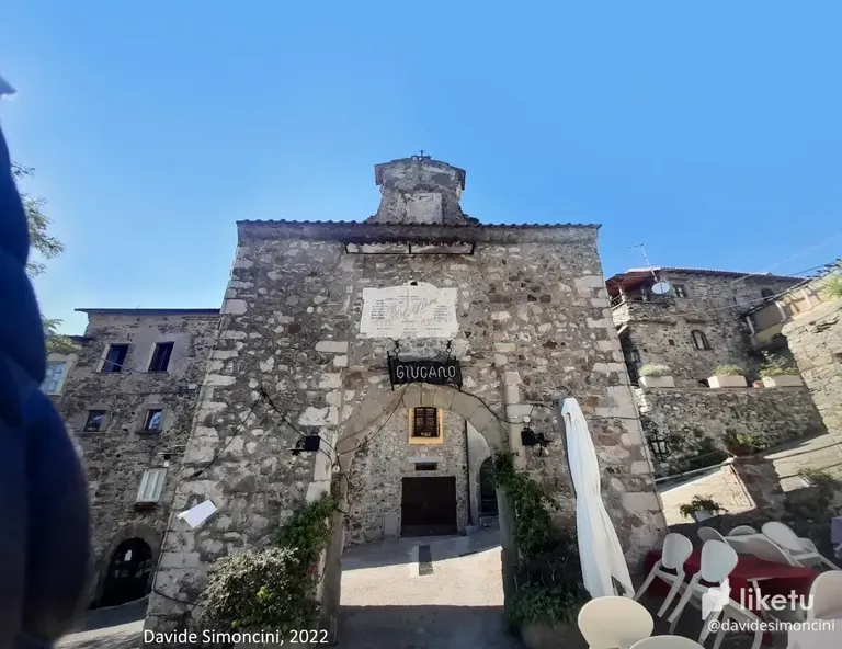
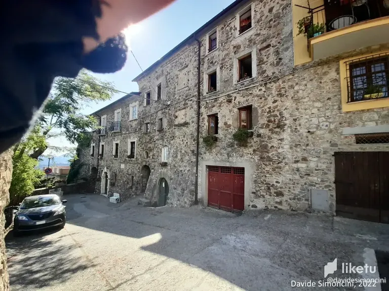
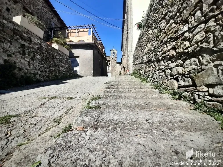
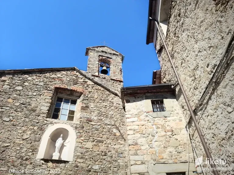
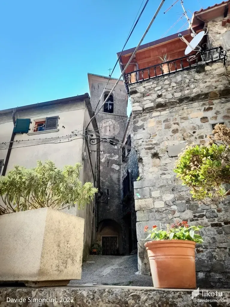
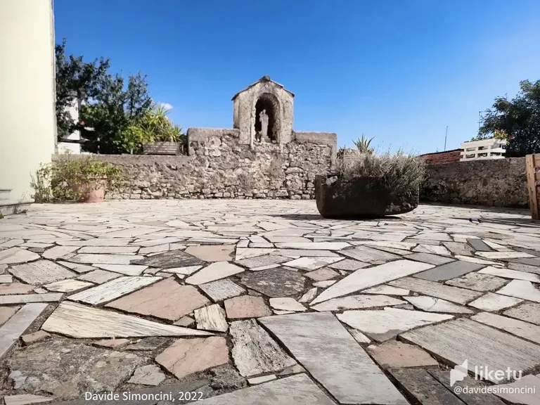
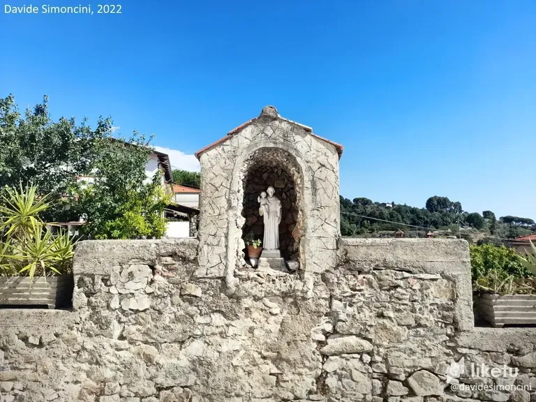
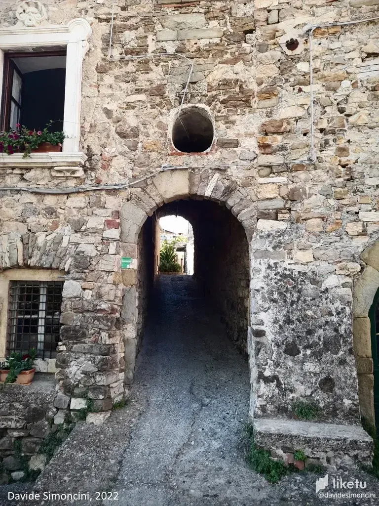
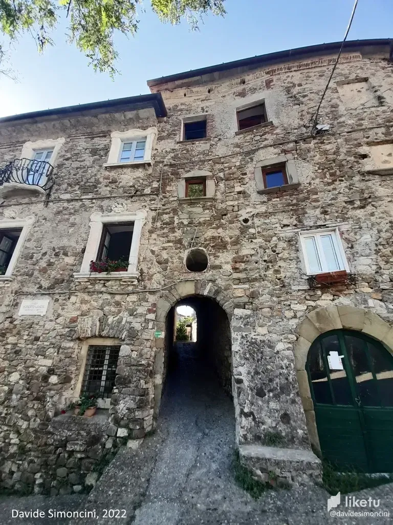
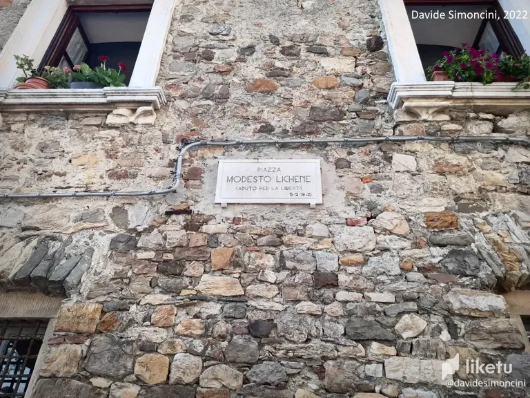
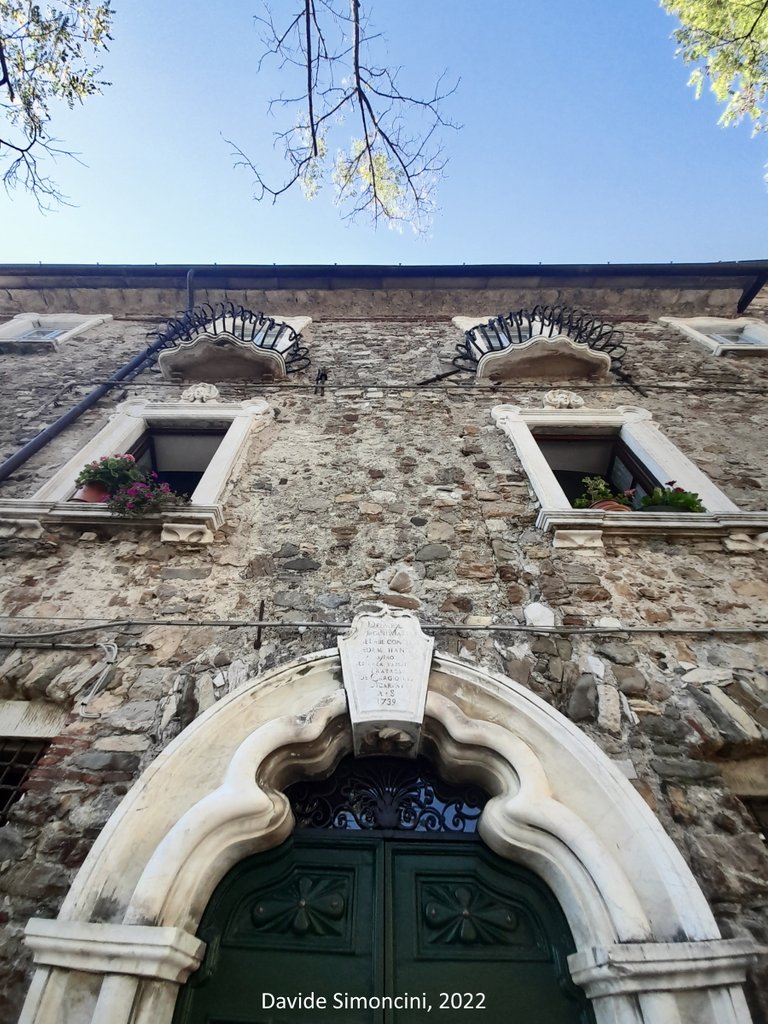
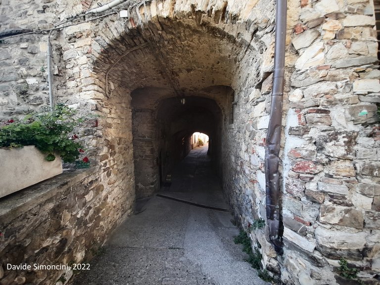
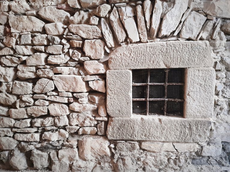
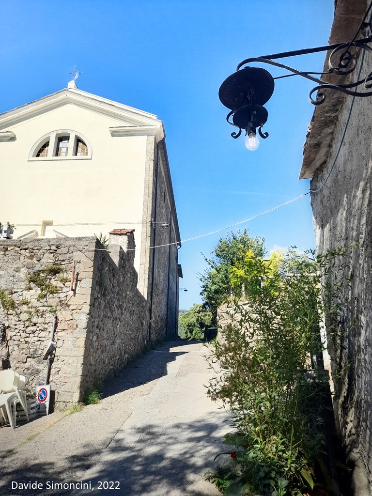

Photo taken by smartphone / automatic mode
Traduzione ITALIANA
Tutti i diritti riservati.
Tutte le immagini contenute in questo post sono state scattate, create e/o modificate da me. Tutti i contenuti di questo post sono protetti da diritto d'autore. Tutti gli usi dei contenuti - e di qualsiasi loro derivato -, a eccezione della diffusione senza modifiche attraverso canali social media, sono strettamente proibiti senza l'esplicito consenso dell'autore.
Ciao!
Oggi voglio proporre una serie di foto che ho scattato qualche giorno fa, quando ho pedalato sulle colline dietro la città di Sarzana. Da lì, ben presto si ritorna in provincia di Massa-Carrara, e poi su, verso il paese di Fosdinovo. Prima di completare il giro che mi ha portato anche a Castelpoggio e a Noceto, ho raggiunto una località che non visitavo da un annetto: Giucano.
Giucano è un piccolo paese situato sulle colline a 300 metri circa sopra il livello del mare, con le fattezze di un borgo storico, specialmente quando si arriva e ci si trova di fronte un arco in pietre grezze che ci rimanda al passato. Si può raggiungere su più versanti: sfruttando una strada asfaltata da Sarzana oppure una seconda che arriva da Fosdinovo, oltre ad alcuni sentieri sterrati che non ho mai battuto. Mi sono accorto di uno di questi grazie a un piccolo segnale che rimandava a un anello sulle colline in grado di condurre fino in località La Vagina.
Ritornando a noi, scoprii Giucano alcuni anni fa, sebbene non avessi mai percorso la strada principale a causa di una frana che la colpì in modo violento e per la quale esistono ancora oggi cartelli che obbligano a un percorso secondario, attraverso una veloce e abbastanza minuta variante tra alcuni vigneti e un sole cocente. In questa occasione ho voluto provare la vecchia strada rimessa a nuovo: a nuovo non è ancora stata rimessa, una parte è stata riconvertita a sterrato. Avendola attraversata a passo d'uomo con la mia mountain bike non ha creato problemi, ma ho notato che i cartelli di pericolo sono comunque ancora presenti.
In queste foto ho cercato di riportare i principali punti d'interesse che si possono trovare a primo acchito. Non sono un esperto, e certamente gli abitanti potranno dare delle indicazioni aggiuntive per raggiungere qualche angolo meglio nascosto tra le mura delle abitazioni. Un manipolo di abitanti che, stando a un vecchio censimento trovato sul web, parla di 25 residenti effettivi (aggiornati all'anno 2011).
Per un paesino ristretto come questo, ho notato le molte strutture religiose, che poi ho imparato essere degli oratori, delle cappelle, delle maestà, e chi più ne ha più ne metta. La storia di questo luogo è antica, ci sono tracce della sua esistenza fin dal 1200. Gli edifici sono perdurati nei secoli, mantenuti in un discreto stato. È stato a lungo parte di comprensori di vario genere con i paesi vicini, a partire da Fosdinovo fino a molti dei paesi dislocati sul territorio da qui fino al bacino del torrente Aulella.
Tra le case, ho notato i passaggi in mattoni, alcuni che apparivano come stretti cunicoli, altri come ben più ampie passeggiate. Le opere più importanti che ho trovato menzionate sul web sono la chiesa principale, ben visibile alla destra dell'arco d'ingresso e indicata come Chiesa dei Santi Fabiano e Sebastiano, costruita – secondo la data di costruzione riportata sopra – nel 1636; poi l'Oratorio della Confraternita dei Bianchi, adiacente alla chiesa principale e risalente al 1650.
Avendo scoperto questa distinzione, sottolineo che la chiesa dei Santi Fabiano e Sebastiano non va confusa con l'omonima cappella, quella conosciuta anche sotto il nome di Cappella di Santa Burlanda, più antica e situata nelle vicinanze ma comunque fuori dal centro di Giucano.
E nulla, la mia esperienza termina qui. Posso solo aggiungere di aver notato una serie di sedie e tavolini all'entrata del borgo. Immagino che esista la possibilità di rifocillarsi per chi lo desideri. Potete cercare “Giucano” sul web per trovare qualche cenno in più sulla sua storia completa. Esiste anche una pagina Wikipedia che però ho notato essere presente solo in lingua italiana.
Un gran saluto dall'Italia e alla prossima avventura!
For the best experience view this post on Liketu
The rewards earned on this comment will go directly to the people( @davidesimoncini ) sharing the post on Twitter as long as they are registered with @poshtoken. Sign up at https://hiveposh.com.
Congratulations, your post has been added to Pinmapple! 🎉🥳🍍
Did you know you have your own profile map?
And every post has their own map too!
Want to have your post on the map too?
I !love "the dirt path to La Vagina" hahaha
Giucano seems an interesting place to visit: very samll but very beautiful, considering your pictures...
A good place, I think. Thank you for stopping and the !LUV 1 :)
Hey! What espectacular place 😃 The name es very interesting hehe... Thank you for sharing with us ☺️
Thank you for stopping :) !PIZZA