I think our natural enemy during the trip to El Chaltén was the dense cloud cover that accumulated on the mountain peaks we wanted to see. And this was not something that could be predicted, because in a matter of minutes the whole landscape was covered or cleared, so it was a matter of luck. But these landscapes are totally beautiful even if it rains or whatever, so this didn't worry us so much. The day had finally arrived when we would start the longest trail we had planned: it was the Path to Cerro Fitz Roy, which took 6 hours of walking one way. Glad we all had a good rest the night before 😃!
Creo que nuestro enemigo natural durante el viaje a El Chaltén fue la nubosidad densa que se acumulaba en los picos de las montañas que queríamos ver. Y esto no era algo que pudiera predecirse, porque en cuestión de minutos todo el paisaje se tapaba o se despejaba, así que era una cuestión de suerte. Pero estos paisajes son totalmente hermosos aunque llueva o lo que sea, así que esto no nos preocupó tanto. Finalmente había llegado el día que iniciariamos el sendero más largo que teníamos planeado: se trataba de la Senda al Cerro Fitz Roy, el cual tuvo 6 horas de caminata solo de ida. ¡Que bueno que todos descansamos bien la noche anterior 😃!
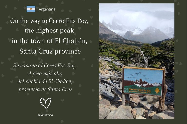
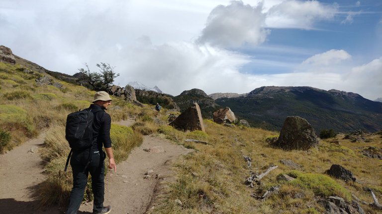
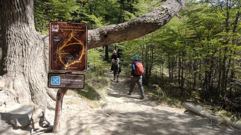
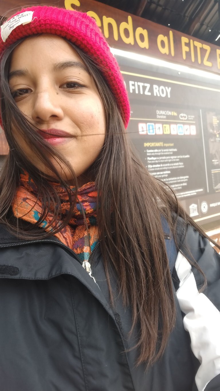
The town of El Chaltén in the province of Santa Cruz is considered "the national capital of trekking" for all the beautiful trails that start from it. You can choose which one you want to do based on your available time and your physical conditions, there is something for everyone. My cousin and I started doing small trails to test the resistance of our legs, and 2 days later we were ready to start doing one of the longest trails there is, which started just 800m from our hostel 😃.
El pueblo de El Chaltén en la provincia de Santa Cruz es considerado "la capital nacional del trekking" por todos los hermosos senderos que parten desde él. Podes elegir cual queres hacer en base a tu tiempo disponible y a tus condiciones físicas, hay para todos los gustos. Mi prima y yo empezamos haciendo pequeños senderos para testear la resistencia de nuestras piernas, y 2 días después ya estuvimos listas para empezar a hacer uno de los senderos más largos que hay, el cual partía a tan solo 800m de nuestro hostel 😃.
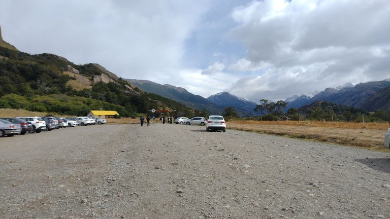
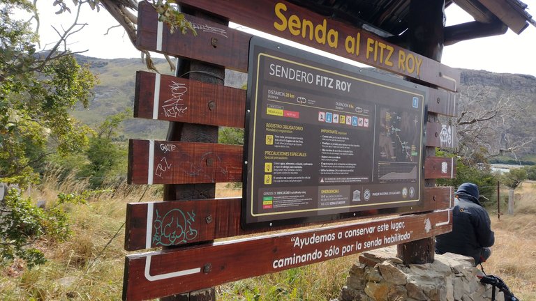
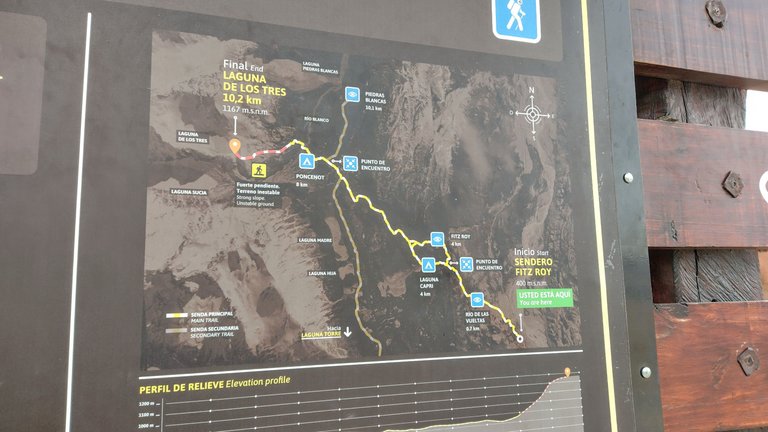
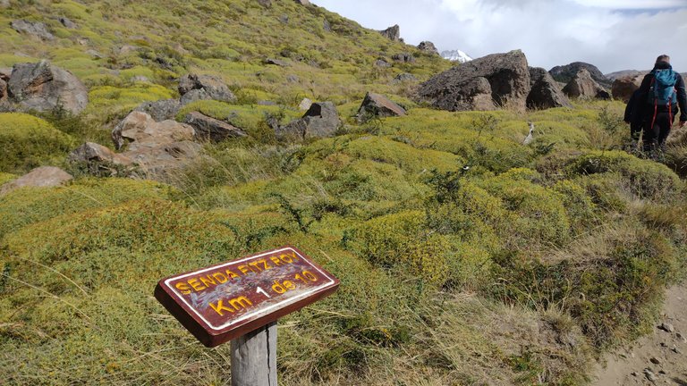
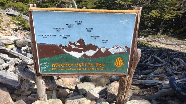
This trail is one of those considered "difficult" since it is 10 km one way, at times quite steep and rocky. The good thing is that everything is delimited with signs that tell you which kilometer you are going for and you have several places to stop and rest a bit. From what those who had already done this tour told us, first we wanted to get to the Cerro Fitz Roy Viewpoint and there make a stop to rest our legs. This viewpoint is reached after two hours of walking and from it you could see the imposing mountain from the front (supposedly) 😅.
Este sendero es uno de los considerados "difíciles" ya que tiene 10 km solo de ida, por momentos bastante empinado y rocoso. Lo bueno es que está todo delimitado con cartelería que te indica por cual kilómetro vas y tenes varios lugares para parar a descansar un poco. Por lo que nos indicaron los que ya habían hecho este recorrido, primero queríamos llegar hasta el Mirador del Cerro Fitz Roy y allí hacer una parada para descansar las piernas. Este mirador se alcanza tras dos horas de caminata y desde él se podía ver la imponente montaña desde el frente (supuestamente) 😅.
After my experience going to the Chorrillo del Salto waterfall with my regular sneakers, I learned my lesson and rented some special hiking boots. These were quite hard and resistant boots that helped me keep my footing firm throughout the trail. I hope that on my next long trekking trip I already have my own special footwear 😃.
Después de mi experiencia yendo a la cascada Chorrillo del Salto con mis zapatillas comunes, aprendí la lección y me alquilé unas botas especiales para trekking. Estas eran unos borcegos bastante duros y resistentes que me ayudaron a mantener la pisada firme en todo el camino. Ojalá que en mi próximo viaje de trekkings largos ya tenga mi calzado especial propio 😃.
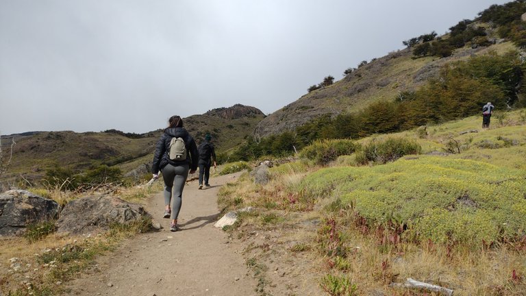
I think the first few minutes of each walk we did are the worst because it is literally the climb up the mountain. All of them recommended that we not hurry and that we not overexert ourselves physically because the road is quite long and the idea was to go and return whole. I paid close attention to this and that is why I always followed my cousin, at my snail's pace but enjoying everything around me ❤️.
Yo creo que los primeros minutos de cada caminata que hicimos son los peores porque es literalmente la subida a la montaña. Todo todos nos recomendaron que no nos apuremos y que no nos sobreexijamos fisicamente porque el camino es bastante largo y la idea era ir y volver enteros. Yo hice mucho caso a esto y por eso siempre iba atrás de mi prima, a mi ritmo de tortuga pero disfrutando todo a mi alrededor ❤️.
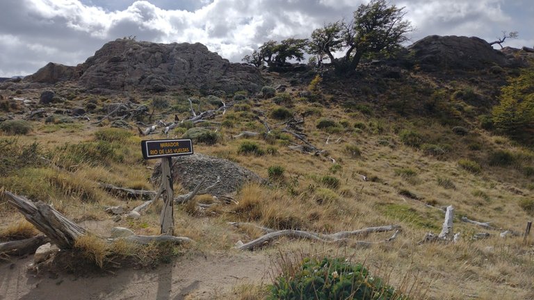
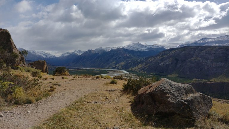
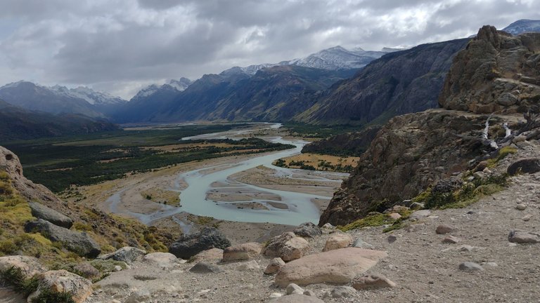
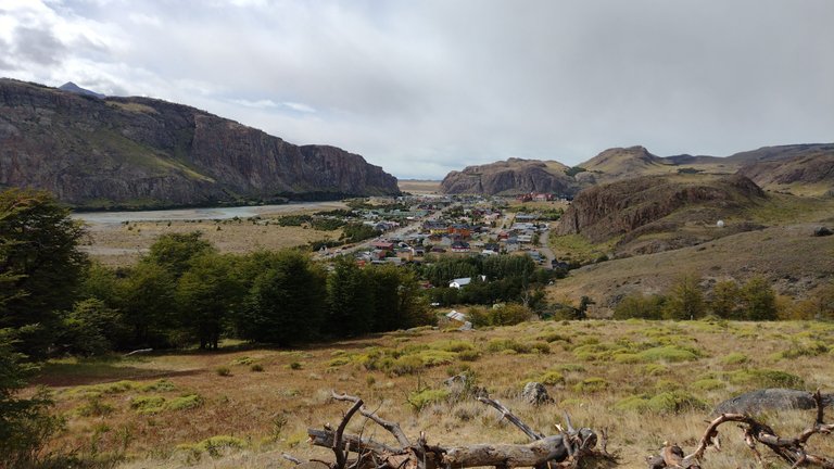
We saw the first beautiful panoramic landscape 20 minutes after starting the walk, at km 1 of the entire route. It was the Mirador del Río de Las Vueltas, that wonderful turquoise river that we had seen on the way to the waterfall. This landscape was incredible, even though I was seeing it with my own eyes it didn't seem real. Throughout the walk I was thanking the Universe for being in this beautiful place, for the turns of life that made it possible for me to be there at that moment ❤️.
El primer paisaje panorámico hermoso lo vimos a los 20 minutos de haber empezado la caminata, en el km 1 de todo el recorrido. Se trataba del Mirador del Río de Las Vueltas, ese río turquesa maravilloso que habíamos visto camino a la cascada. Este paisaje era increíble, aunque lo estaba viendo con mis propios ojos no parecía real. Durante todo el paseo fui agradeciendo al Universo por estar en este lugar hermoso, por las vueltas de la vida que hicieron que yo pudiera estar ahí en ese momento ❤️.
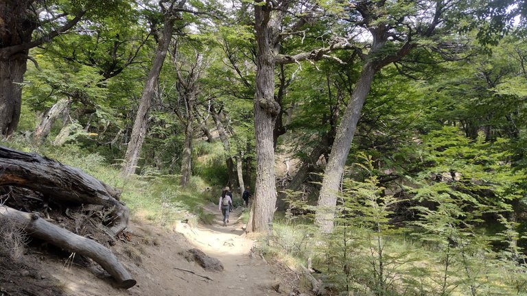
After the steep climb the road became quite flat and full of trees. Unlike the two-hour trek I had done in Córdoba under the sun, this trail was quite pleasant because you could take refuge in the shade and because it was in the south of Argentina in summer, the temperature was 10°C, so if you had heat, it was enough to undress you a little to recover. Everything was going well for the moment, no one was tired and everyone went with a smile because it was the first km of the trail 😅.
Después de la subida abrupta camino se volvió bastante plano y lleno de árboles. A diferencia del trekking de dos horas que había hecho en Córdoba bajo el rayo del sol, este sendero era bastante agradable porque podías refugiarte en la sombra y por estar en el sur de Argentina, la temperatura era 10°C en verano, por lo que si tenías calor solo bastaba con desabrigarte un poco para recuperarte. Todo marchaba bien por el momento, nadie estaba cansado y todos iban con una sonrisa porque eran los primeros km del sendero 😅.
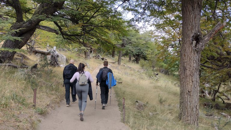
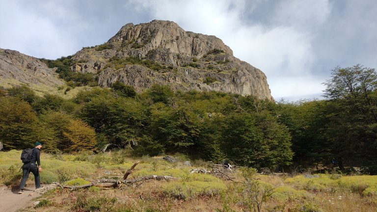
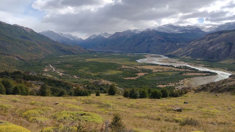
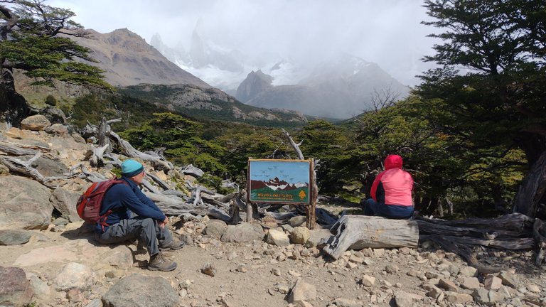
We were measuring how long it took us from one sign to the other and we were going at a pace of about half an hour per km. At first the step was energetic but later on it became a little heavier, it all depended on whether there were ups or downs. Unlike the day before when it had rained while we went to Laguna Torre, that morning was beautiful so we passed a lot of people who also went for a walk to take advantage of the good weather. In addition, we all wanted to see the imposing Cerro Fitz Roy with its more than 3,400 meters high up close: although this peak can be seen from the town, you can only see that, and from the viewpoint you could see a little more 😶.
Fuimos midiendo cuanto tiempo tardabamos desde un cartel hasta el otro e ibamos a un paso de aprox media hora por km. Al principio el paso era enérgico pero más adelante se fue haciendo un poco más pesado, todo dependía si habían subidas o bajadas. A diferencia del día anterior que había llovido mientras fuimos a la Laguna Torre, esa mañana estaba hermosa así que nos cruzamos con un montón de gente que también salió a caminar para aprovechar el buen clima. Además, todos queríamos ver al imponente Cerro Fitz Roy con sus más de 3400 metros de altura bien de cerca: si bien este pico se ve desde el pueblo, solo se ve eso, y desde el mirador se podría ver un poco más 😶.
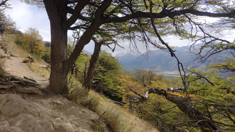
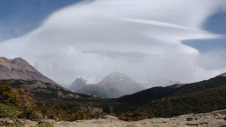
But that was if the clouds allowed us, and when we finally reached the main viewpoint we realized that we couldn't see almost anything. The exact same thing happened to us when we went to the Mirador del Cerro Torre. Apparently the cloudiness was not on our side on either of the two outings, but at least we settled for the fact that it wasn't raining 😅.
Pero eso si las nubes nos lo permitían, y cuando finalmente llegamos al mirador principal nos dimos cuenta de que no se veía casi nada. Nos pasó exactamente lo mismo que cuando fuimos al Mirador del Cerro Torre. Aparentemente la nubosidad no estuvo de nuestro lado en ninguno de los dos paseos, pero al menos nos conformamos con que no llovía 😅.
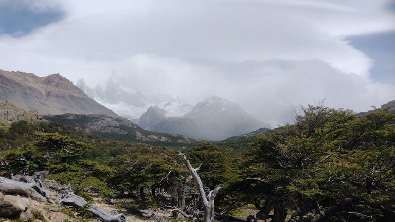
All of us who were there were amused that literally the only clouds in the sky were all concentrated there, on top of the mountain, obstructing the landscape. The good thing is that the path continued, we still had about 7 km of walking to go in which we could get closer to the hill, so we did not lose hope of having a slightly better view. We just had to keep walking 😅.
A todos los que estábamos ahí nos causaba gracia que literalmente las únicas nubes del cielo estaban todas concentradas ahí, arriba de la montaña, obstruyendo el paisaje. Lo bueno es que el sendero continuaba, todavía nos faltaban como 7 km de caminata en los que nos podríamos acercar más al cerro, así que no perdíamos la esperanza de tener una vista un poco mejor. Solo había que seguir caminando 😅.
We started walking along this trail at 10 AM and by 12 we had already reached the viewpoint of Cerro Fitz Roy. We still had a long day ahead of us and we had already seen several beautiful landscapes. This tour is one of the main ones you have to do during your trip to El Chaltén, I would say almost mandatory. It is one of the longest, so I recommend that if you plan to go, do not go out partying the night before: it is better to put all your energy into this if you want to reach the end of the path, which is where the higher reward is ❤️.
Empezamos a caminar por este sendero a las 10 AM y para las 12 ya habíamos llegado al mirador del Cerro Fitz Roy. Todavía teníamos un largo día por delante y ya habíamos visto varios paisajes hermosos. Este recorrido es uno de los principales que tenes que hacer durante tu viaje a El Chaltén, casi obligatorio diría yo. Es uno de los más largos, por lo que te recomiendo que si tenes planeado ir, no salgas de fiesta la noche anterior: mejor estar con toda tu energía puesta en esto si deseas llegar hasta el final del sendero, que es donde donde está la mayor recompensa ❤️.
❤️ Hope you liked this post! Thanks for reading. ❤️
❤️¡Espero que les haya gustado este post! Gracias por leer. ❤️
Lau 💕.
📸 Portada creada en Canva. Todas las imágenes son de mi propiedad 💕.
The rewards earned on this comment will go directly to the people( @lauramica ) sharing the post on Twitter as long as they are registered with @poshtoken. Sign up at https://hiveposh.com.
Congratulations, your post has been added to Pinmapple! 🎉🥳🍍
Did you know you have your own profile map?
And every post has their own map too!
Want to have your post on the map too?
What a nature hike with its expansive panoramic vistas and breathtaking views!
Yess, it was amazing 💖
Despite the thick clouds, the view is still great 😊
I wanted to hike a mountain to see a sea of clouds but it's always been gloomy and sometimes no clouds recently.. Might gonna pursue this plan in autumn (again 🤣).. I don't want to hike in summer, lol
It was a nice rarity to see, luckily the sky cleared up a bit afterwards. And walking in the summer... it's tiring, unless you're in a fairly cool place like this 😅
I love the fact that the town promotes the beauty of nature
Yeah! That's what makes this place attractive ❤️.
Hola bella aunque no pudistes lograr tu objetivo ya que la naturaleza no estaba de tu lado en ese momento pude disfrutar mucho todo ese grandioso recorrido que hiciste mostrando este grato paisaje
Tus pulmones están como nuevos con esta gran caminata y con todo ese aire puro
😍😍😍😍🤗🤗👏👏😍🤗✨✨✨🤗🤗😍🤗
¡Asi es! Y mis piernas bien entrenadas jajaja. Saludos, gracias por tu visita ❤️
Primeros minutos en subida muy complicados tomando el cuenta que el cuerpo esta frío y mas con esa temperatura, pero la aventura lo vale. Esos parajes parecen sacados del Señor de Los Anillos, me encantaría correr por esas praderas. Hermosas fotos! Saludos!
Si, te quedabas sin aire muy fácil jaja. Pero todo era tan increíble, no parecia un paisaje real, te emocionaba ❤️.
Gracias a vos por pasar. Que tengas un lindo día 😃.
A spectacular place, I also love hiking in the mountains and whenever I have the opportunity I pack my backpack and go to the mountains, here you live unique experiences.
It is the best way to invest your time.. everything is so beautiful ❤️.
You're absolutely right, and it's also a healthy way to invest your money, lol.
Hiya, @LivingUKTaiwan here, just swinging by to let you know that this post made it into our Honorable Mentions in Daily Travel Digest #1825.
Your post has been manually curated by the @pinmapple team. If you like what we're doing, please drop by to check out all the rest of today's great posts and consider supporting other authors like yourself and us so we can keep the project going!
Become part of our travel community:
Thank you ❤️
My stamina won't endure this long walk haha. I might train my legs and cardiorespiratory endurance before going to a place like this 😅.
Congrats on the successful trekking! I had a fun time reading your blog; feels like you also brought us to that marvelous place.
Thank you so much! I assure you that it was not so terrible, you have to do something like that in life :)
Have a nice day, glad you visited my post ❤️.
10 km one way in such terrain is quite challenging 🙂 but it was worth the views. I actually like hikes when the weather is changing quickly as you can take ton of pictures of one place that all look different 😉 I'm looking forward to another post from this place.
Thank you for sharing! 🙂
I think this trail must be the easiest of the difficult ones... there were other trails that took 7 or 8 hours one way, and many others that take about 3 days to get there. Those must be amazing 😃!
This post today is the second part of this walk: https://peakd.com/@lauramica/wednesday-walk-walking-among-the-most-beautiful-mountains-in-southern-argentina-caminando-entre-las-montanas-mas-hermosas-del-s
I decided to divide the whole trail into three parts because I have more than 100 beautiful photos hahaha. I'm writing the third post for tomorrow right now, which is when we finally complete the walk :)
Thanks for stopping by. Have a nice day ❤️.