Cassis is a small resort town located in the Southern part of France along the coast of the Mediterranean sea. Its about an hour and a half drive from Avignon and about 40 minutes from Marseille and its the place that we spent most of the last day of our trip in the Provence region.
Though we did pop into town in the afternoon it wasn't our main reason for being there. We were there to hike the Calanques, which are a series of marine valleys that were carved out of the coastal cliffs thousands of years ago by the elements and by ancient rivers. The results are these long knarled and twisted finger-like inlets that are only accessible by boat or by hiking through the rocky National Park in which they reside.
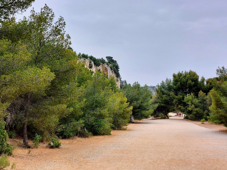
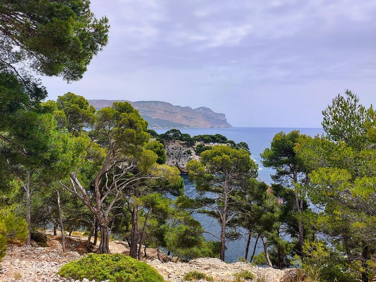
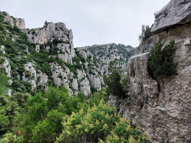
The area along the coast between Marseille and Cassis is collectively known as Les Massif des Calanques and is a 20 km span of rocky mountainous terrain. It's home to at least seven different Calanques in total. From Cassis you are easily able to hike to three of the rocky inlets and that is what we did on the last day of our trip in Provence.
Port Miou
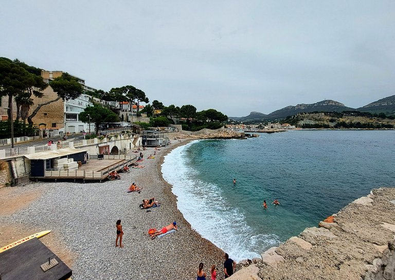
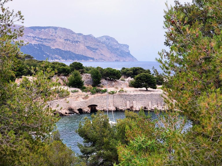
We drove to Cassis early in the morning and parked our car at a free parking lot directly in front of Calanque de Port Miou. We arrived quite early, maybe around 10am or so, but the lot was already filling up fast. Before we finished grabbing our stuff and preping the dog for a day of walking, at least five more cars had already parked beside us. The lot was nearly full by the time we started on our hike.
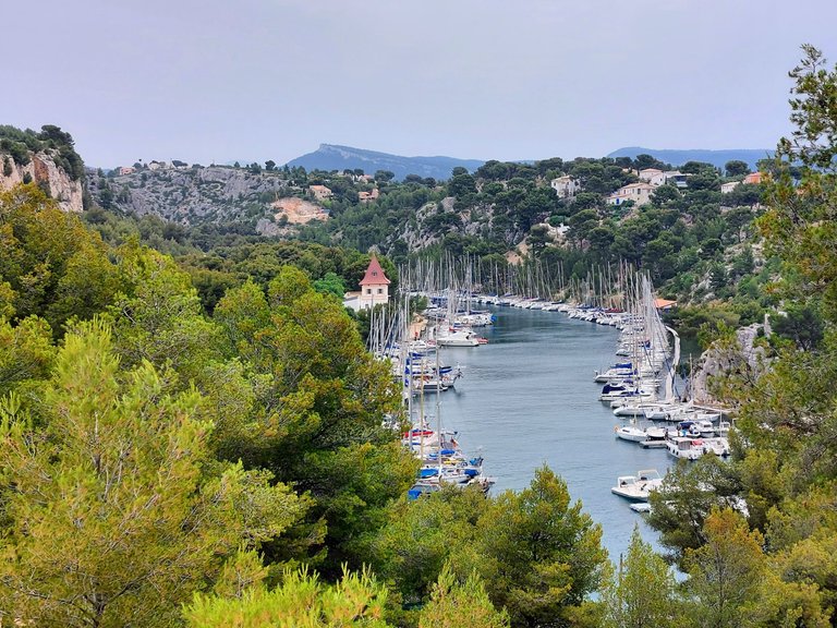
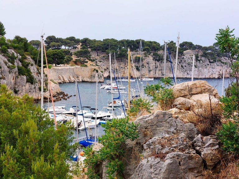
From there we viewed Port Miou and headed to the marked walking path that lead to the second calanque - Port Pin.
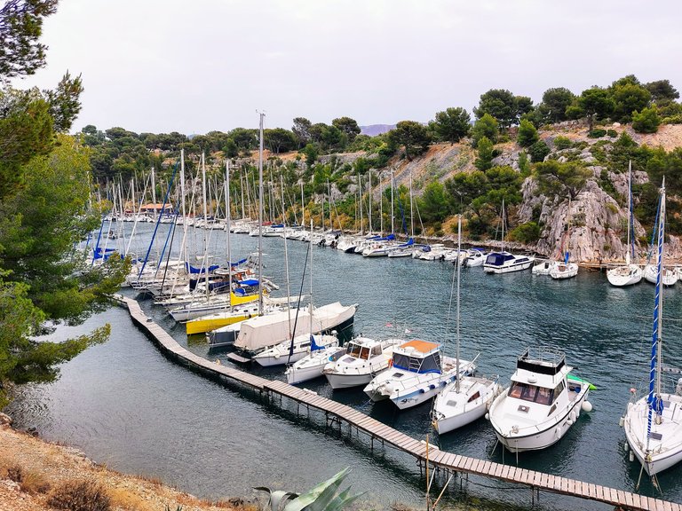
The path runs next to Calanque Port Miou, which is the only one of the three that is used as a marina.
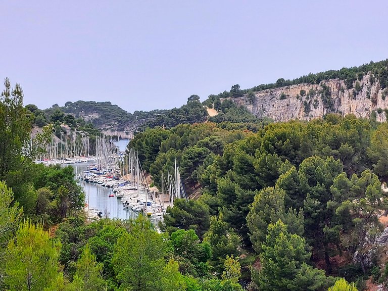
Dozens, if not hundreds of boats were docked within its rocky boarders. We took some photos here but didn't linger for too long because the hike to our final destination would be over an hour and there would be plenty more to see along the way.
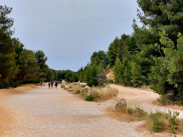
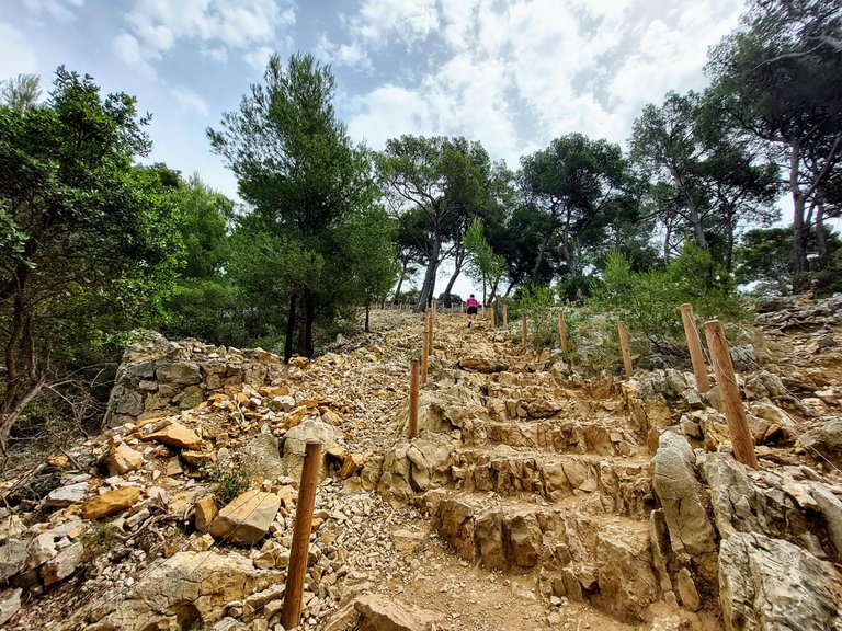
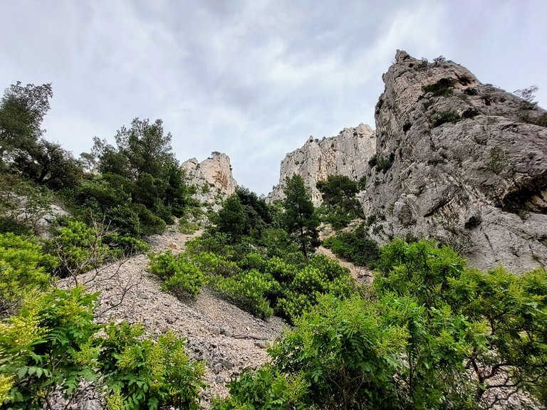
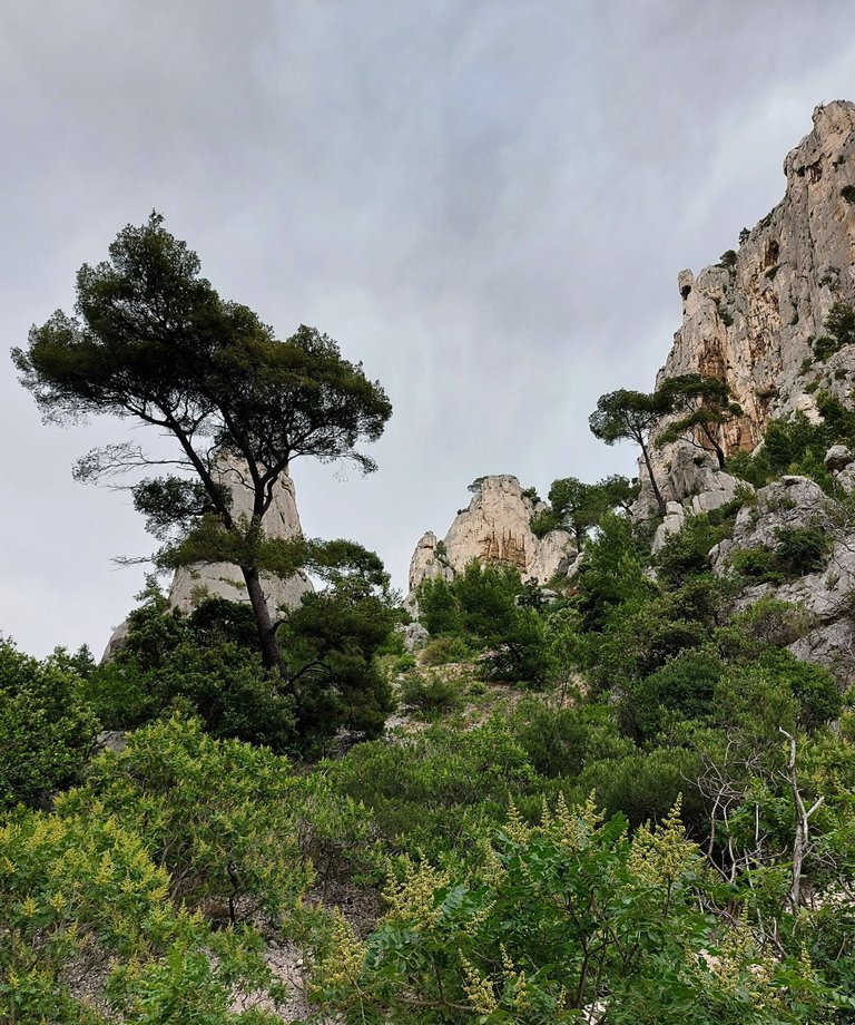
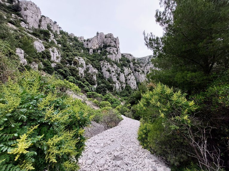
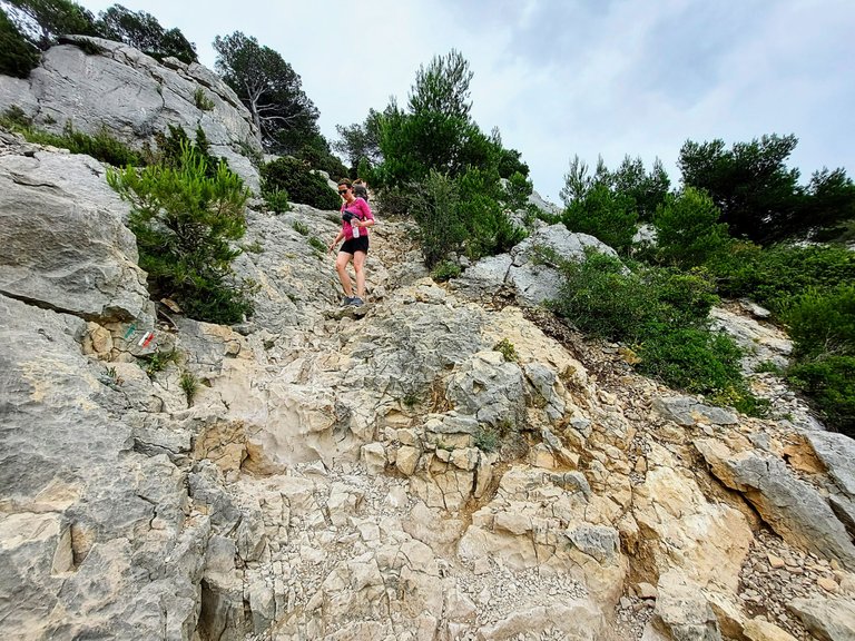
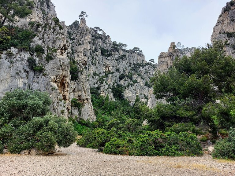
The hike starts out very easy but gets much more challenging as you go along. The flat ground turns steep and the smooth shale path turns into loose jagged rock as it ascends up the mountain.
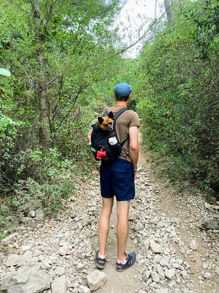
My wife was smart to bring her hiking shoes, but me - not so much. I could feel every jagged rock digging in through my runners, which was fine, but the terrain really did a number on my shoes. Proper hiking shoes are recommended.
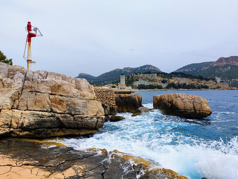
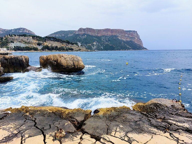
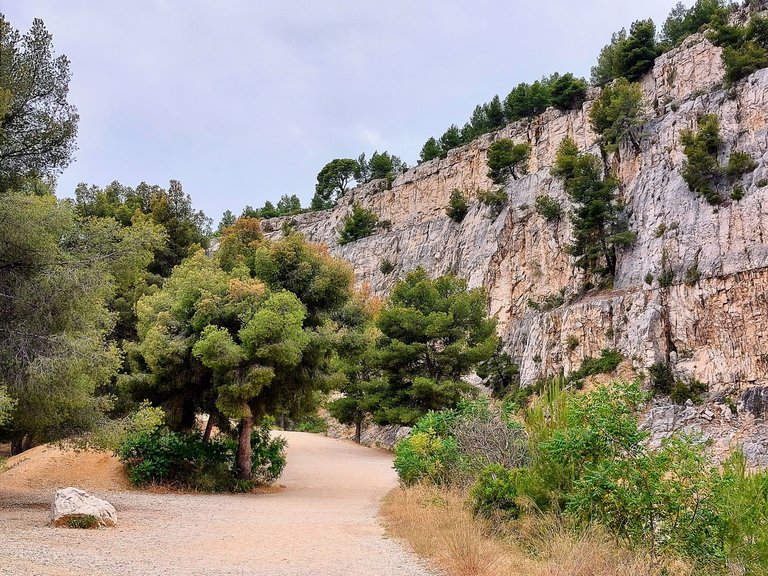
The path begins along the water before heading a little deeper into the forest. There are some great views of the sea here as well as the mountains across the bay and the begining of the inlet of Port Miou.
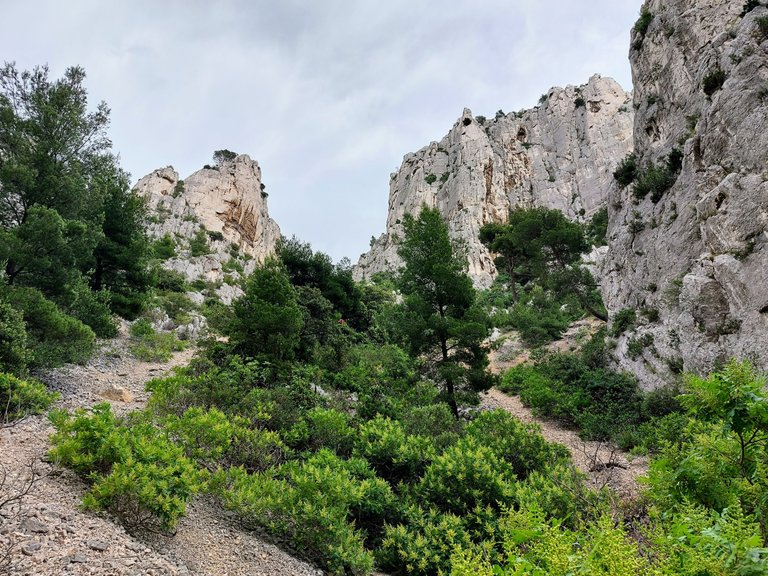
As you get close to Port Pin you come to a series of steps carved into the rock cliff. They're helpful but also very rough and uneven. The hike isn't difficult but the terrain is rough - just something to keep in mind when preparing for your visit.
From here you can begin to see Calanque de Port Pin through the trees.
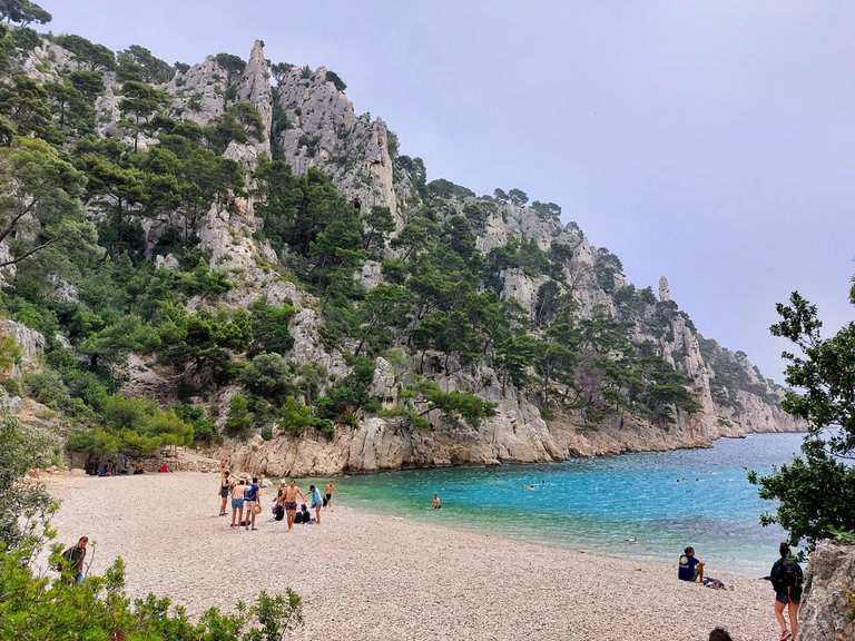
Calanque Port Pin
Port Pin is about a 35 minute hike from Port Miou. Its a picturesque spot with a small sandy beach and tourqois blue water. The water is surrounded on both sides by a natural rocky outcropping. The area feels secluded and tropical and in a way, very exclusive.
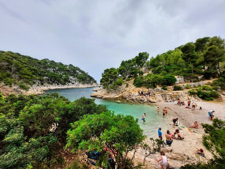
When we first got to the site in the morning there were a few people there swimming in the water but overall it wasn't very busy at all. We didn't plan on going swimming that day and we didn't stay long because we wanted to make sure that we made it to Calanque D'en Vau.
In the afternoon when we passed by Port Pin again on our return, the feeling of exclusivity had all but vanish. By midday there were significantly more people swimming in the water and the small beach was quite busy.
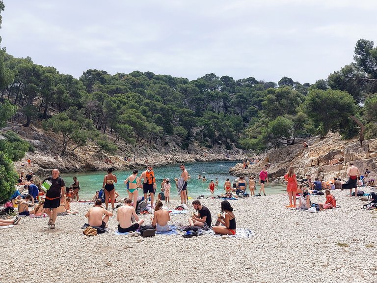
Port Pin is closer and much easier to access than D'en Vau so it's not surprising that so many people stop there for the day instead of going on.
Calanque D'en Vau
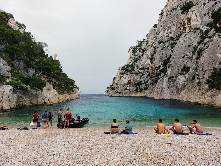
Calanque d'en Vau is the furthest and most difficult Calanque to reach, but it's well worth it if you are able to. It's has the most secluded beach and is also said to be the most beautiful of the three locations.
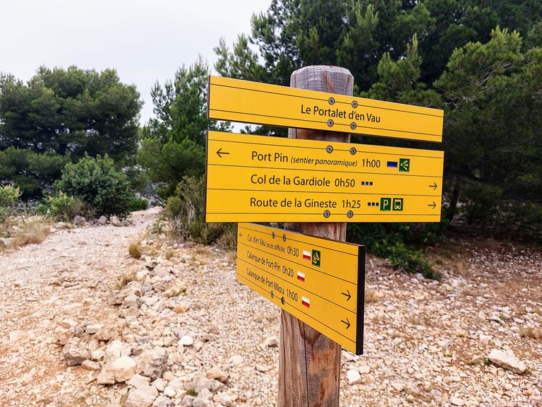
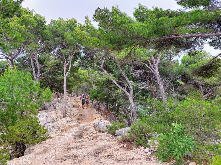
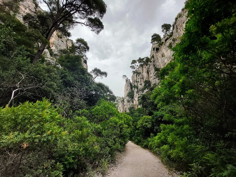
The hike to Vau begins from Port Pin. There are actually two paths that you can take here, so you have options depending on your preferences. The first travels closer to the waters edge. Its significantly longer but has much better views of the Calanque and the sea. The second route is a shorter and more direct path to Vau that goes through the forest.
Something else to keep in mind is that there are no fountains or stores or even garbage bins along the way, so you definitely need to bring lots of water with you, especially if it's hot out. You also need to carry any garbage you have with you back out of the forest.
We ended up taking the direct trail through the forest that day, both to the location and then back to our car, so unfortunately we did miss out on the seaside views. The path along this route was an uphill climb once again on loose rocky terrain.
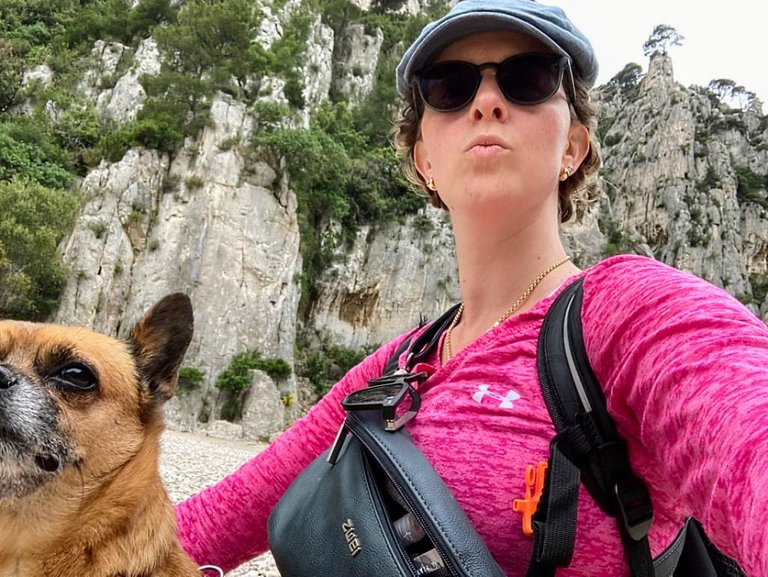
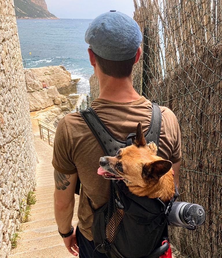
In some areas the rocks were worn smooth from the shear quantity of visitors that had passed over them and at times it was a bit slippery. I had a dog strapped to my back, which didn't make the climb any easier.
Knarled roots sticking up from the ground in some places are used as hand holds presumably by 1000's of people each year. They are worn smooth and have a freshly oiled look about them, no doubt created by the countless hands that have passed over their surface over the years.
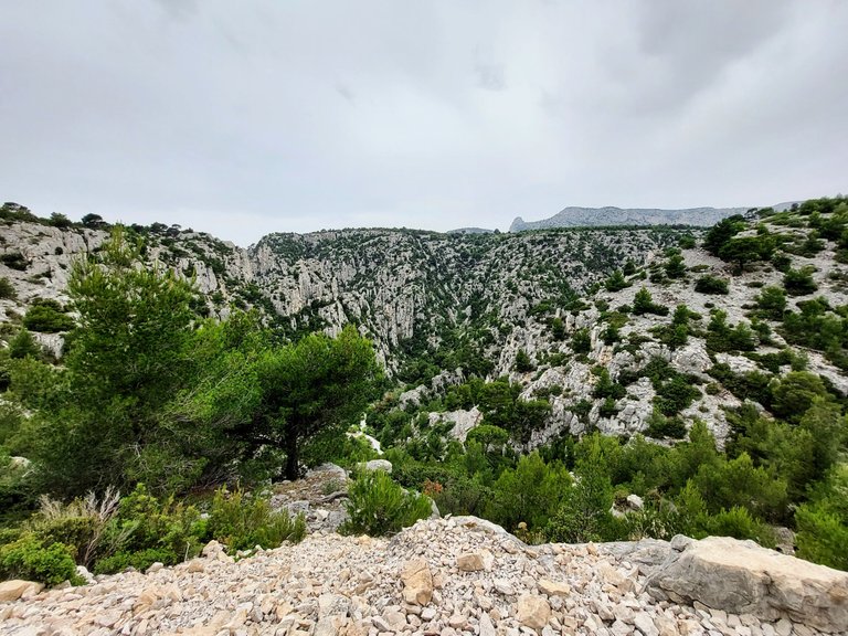
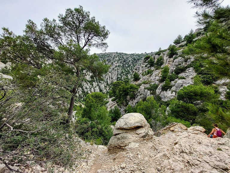
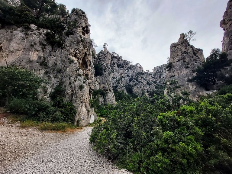
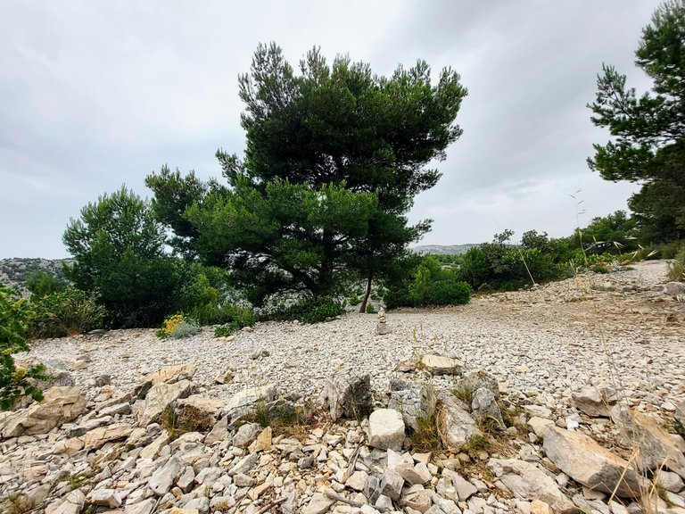
At the top of the hill you come to a large bowl like canyon and its here where things actually truly start to get a bit difficult.
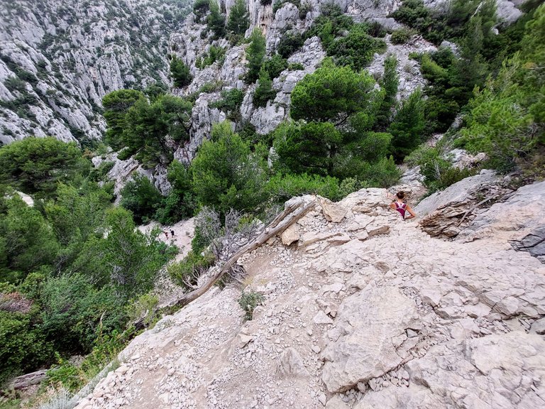
You have to work your way down the canyon on a very narrow natural pathway. I wouldn't say that it's rock climbing from here but here it's definitely a single file decent that requires you to use your hands and sometimes sit on your butt in order to slide down to the next foothold.
Here the path is narrow and you have to travel in single file with other hikers. There are no places to pass and there are a few spots that create a natural bottleneck. Hikers coming up and going down use the same path so you really have to be patient and wait your turn at times.
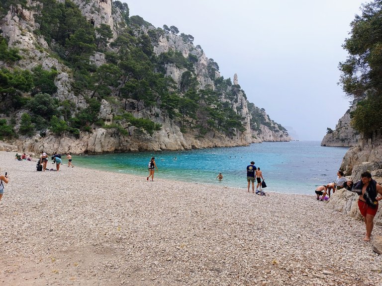
The bottom of the canyon is stunningly beautiful. The green forest against the white rock of the mountains gives the space a unique jungle-like feel. It reminded me of the movie Kong.
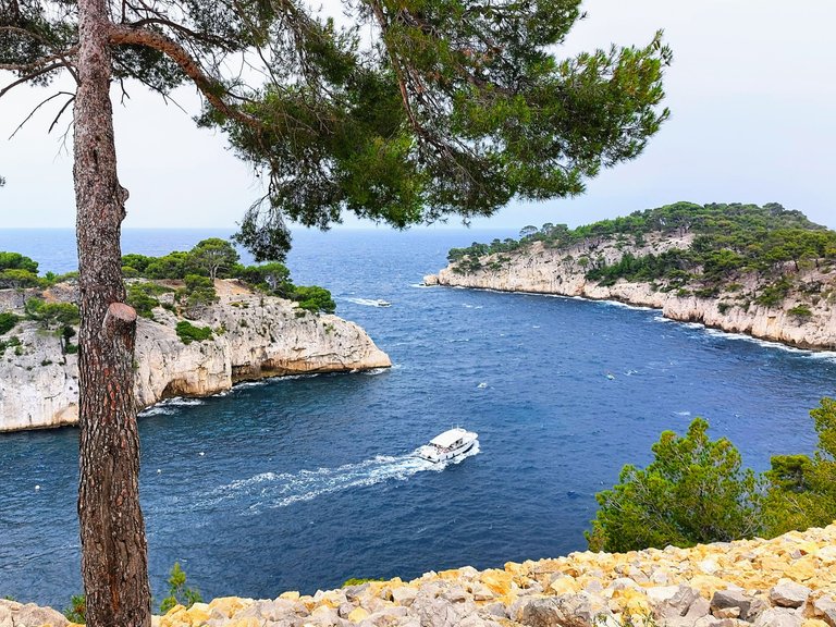
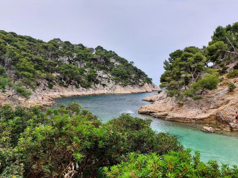
From there it's just a short walk to the Calanque d'en Vau. The forest opens up to a spectacular cove surrounded on both sides by high steep limestone cliffs.
The water is blue and inviting and though I hadn't planned on going swimming that day, it seemed like something that had to be done in such a location.
I went swimming while my wife and dog watched our belongings. Unlike Port Pin, the beach at D'en Vau is stoney and hard to walk on in bare feet. I would recommend bringing water shoes if you plan on going in the water.
We stayed at the water for maybe an hour before making our way back up the mountain. When we first arrived at Vau there were probably 20 people or so but more continued to trickle in from the path the entire time that we were there and eventually a large boat dropped off a large group as well. I presume that it was a tour or excusion that can be bought in the town of Cassis.
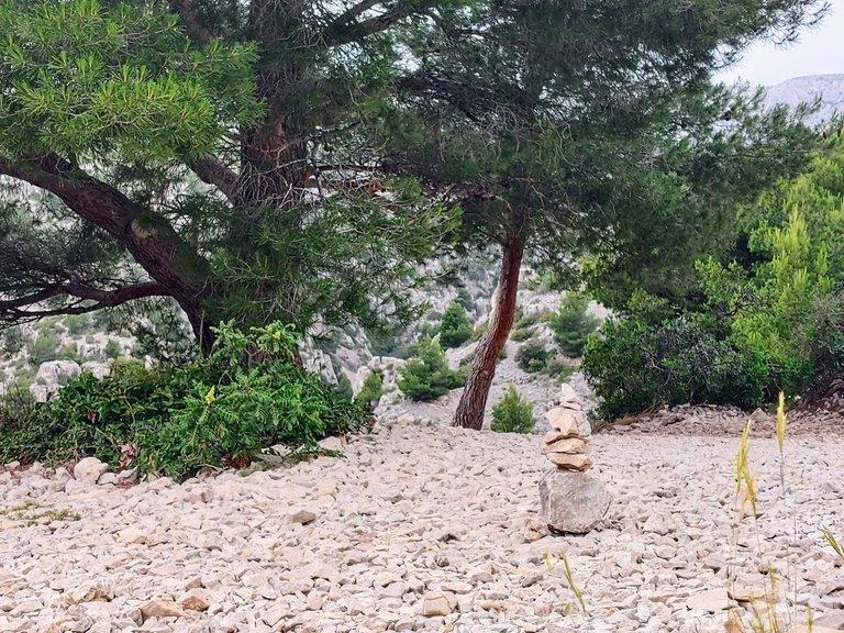
After climbing back up the canyon I left my mark at top of the mountain to tell the world that I had been there.
Surprisingly, I think that I was the only person to have done that in that location. But I bet by the end of the day others had followed suite.
From here we walked back to Port Pin and Port Miou, continuing past our car to walk the additional 20 minutes into the town of Cassis.
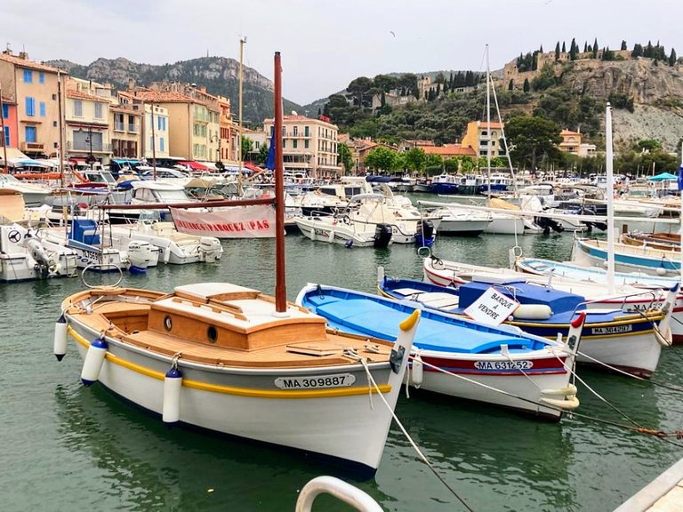
Cassis
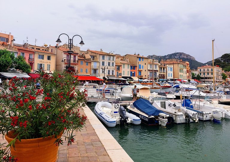
Maybe it was because the weather that day was a bit dreary and humid or maybe it was because I had been walking for the better part of the day with a dog on my back, but to be honest, I wasn't all that thrilled with the town of Cassis.
The small harbor town was nice enough, but overall I just found it to be a bit... "meh."
I did like the harbor though with all of the colorful sail boats.
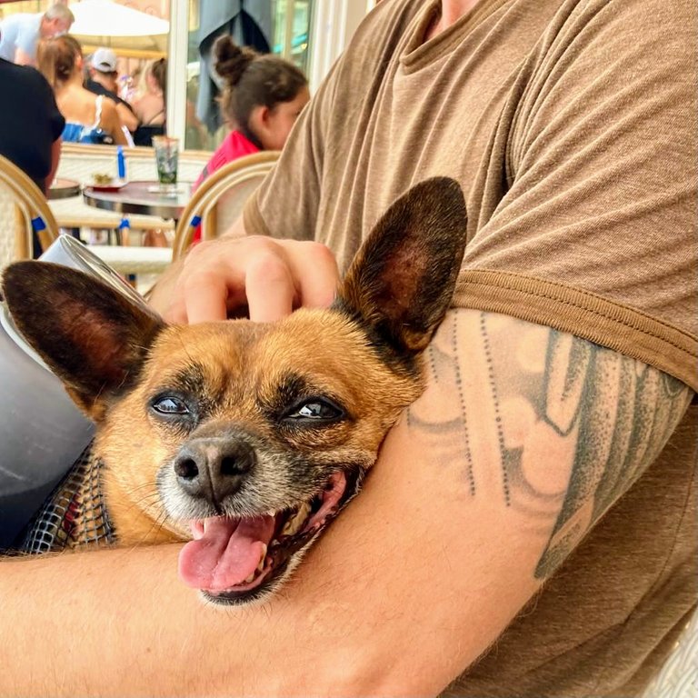
We stopped off at a restaurant bar located on the boardwalk and had a beer and a mojito to cool off. The beer was good but the mojito was nothing special and I was slightly taken aback when we got a bill for 22 euros for the two very standard drinks. I feel like drinks like that would normally cost 17-20 euros - tops, but everything seemed to be priced higher than normal in town. I guess it is because Cassis is considered a resort town?
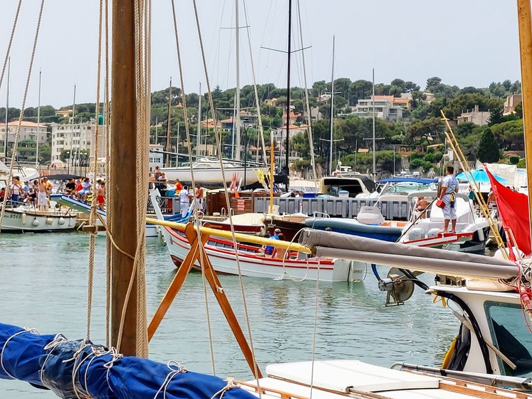
One thing that was really neat though was an event that was taking place in the harbor. You probably can't tell from the photograph above but there is a man on the boat wearing heavy padding and carrying a long blunted lance. In Cassis the local sport is boat jousting!
We watched a few rounds while we drank our drinks before doing a quick loop through town and then heading back to our car.
Overall it was a really good day of hiking, one that I won't soon forget. I know that the dog definitely had fun.
The canyons are impressive as well as the descent. Quite scary though that some rocks could be quite slippery.
Yeah the rocks are worn smooth in some places from the thousands of people walking over them each year. Overall it's a pretty safe hike it's just good to be prepared with hiking shoes
Yes, I have been in Port Pin, 3 weeks ago
That's awesome! First time or do you go often Did? Did you enjoy it?
It is a wonderful place. I have been there 2 times. I have been to the cascade des fées in Angon, too. I am living in Annecy. Please do not advertise too much for these wonderful places. Next time you go to Annecy, we can have a coffee.
I'll keep that in mind if I ever go back to Annecy. It is a beautiful city.
Your content has been voted as a part of Encouragement program. Keep up the good work!
Use Ecency daily to boost your growth on platform!
Support Ecency
Vote for Proposal
Delegate HP and earn more
Se ve realmente hermoso!!
Thank you! :)
Congratulations, your post has been added to Pinmapple! 🎉🥳🍍
Did you know you have your own profile map?
And every post has their own map too!
Want to have your post on the map too?
Beautiful place and nice shots!!!
Thank you!
Hiya, @choogirl here, just swinging by to let you know that this post made it into our Honorable Mentions in Daily Travel Digest #1276.
Your post has been manually curated by the @pinmapple team. If you like what we're doing, please drop by to check out all the rest of today's great posts and consider supporting other authors like yourself and us so we can keep the project going!
Become part of our travel community:
Yeah there were quite a few indeed. So many boats!