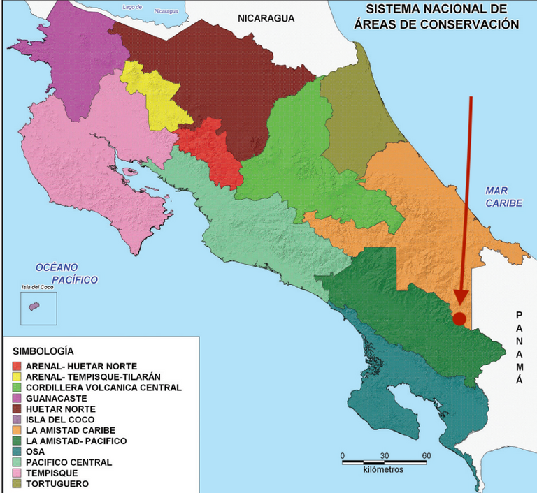
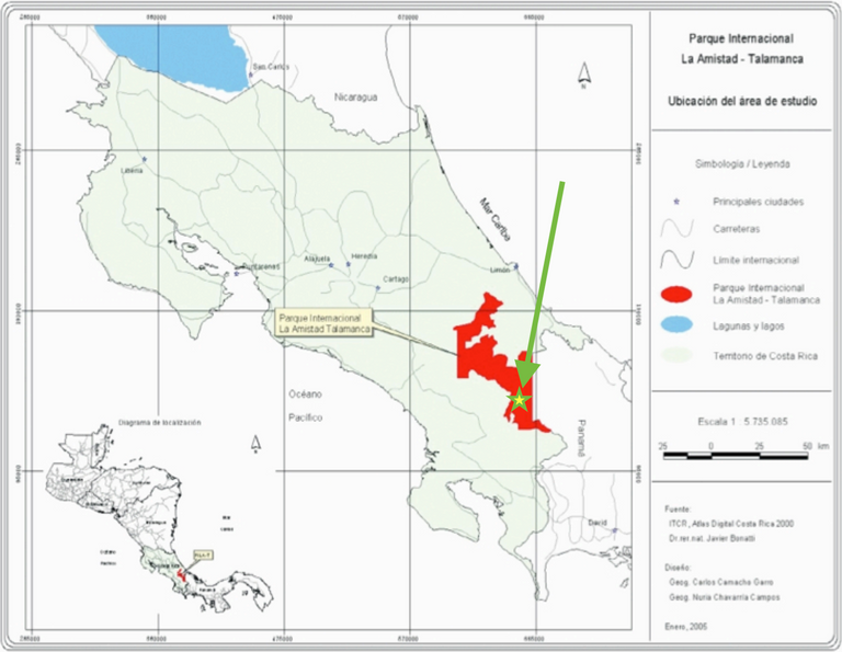
The Valley of Silence is a pristine place, located in the high mountains of La Amistad National Park, the largest in Costa Rica and whose extension is shared with neighboring Panama.
It is a long walk, which is added to the six-hour drive from the capital San José to the town of Biolley in the canton of Coto Brus. We get up early and have a light breakfast, and with the first light of the sun we start the march. The first landscapes that appear during the day look spectacular, a good omen
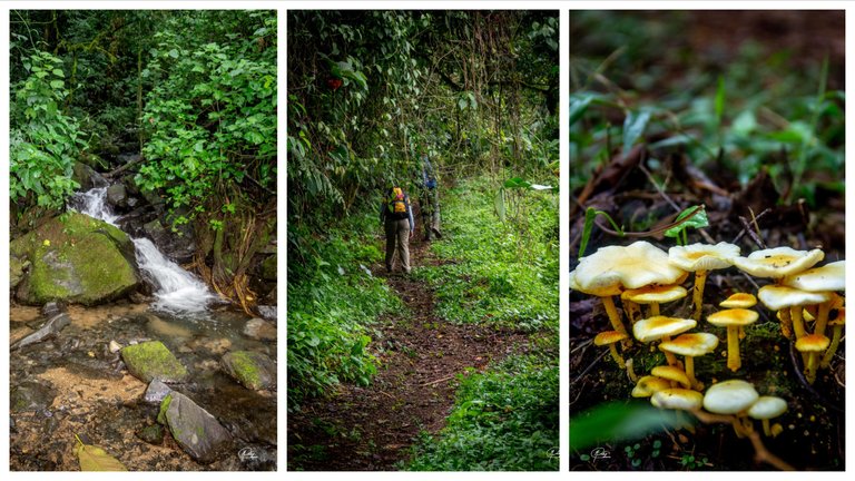
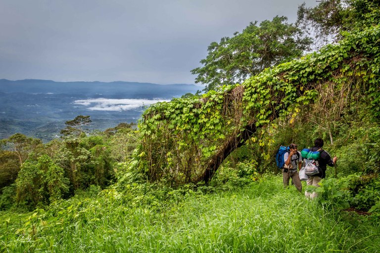
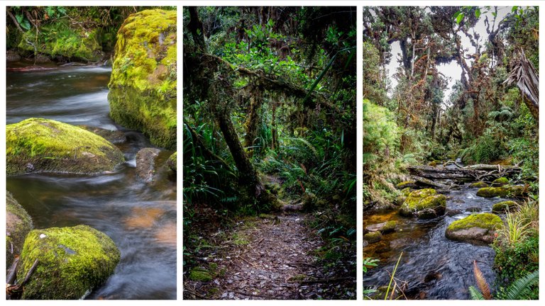
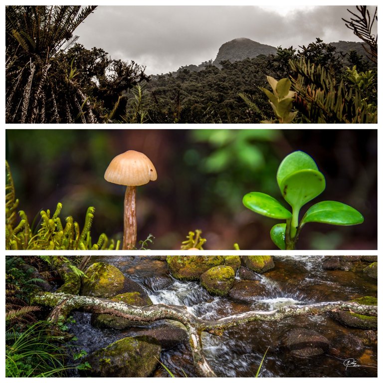
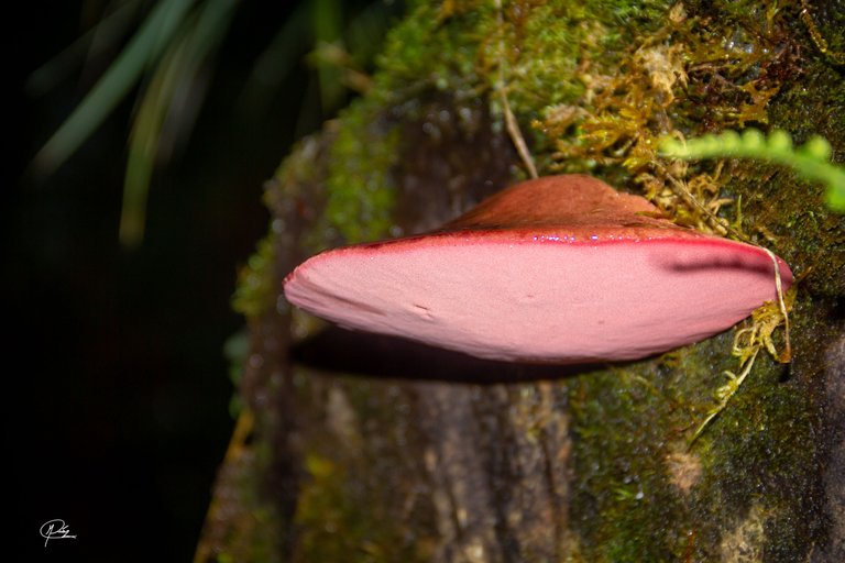
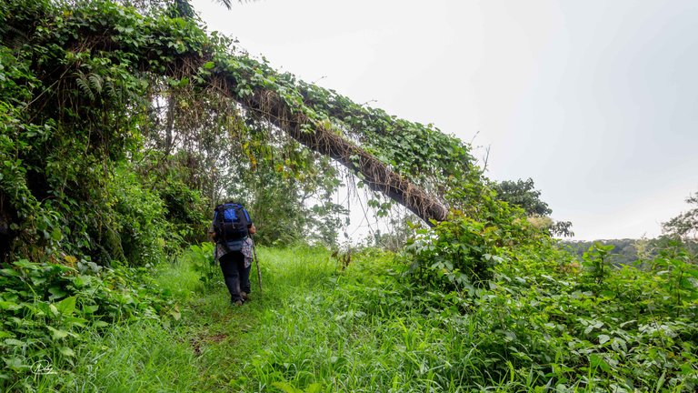
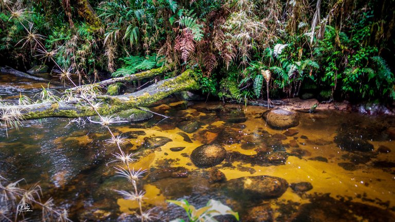
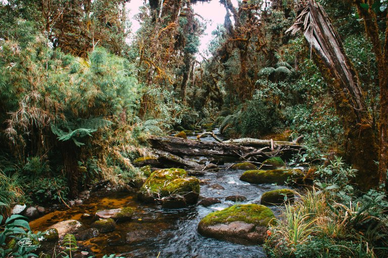
We follow a wide but steep path from the beginning, as the path implies an ascent from 800 meters above sea level to 2,500 meters. But the effort is rewarded with all the wonderful things that are found along the way, sources of clean water, mushrooms, birds and spectacular views.
The first hour is usually one of the most tiring, the body must adapt to the march and support the weight of all the things necessary for the trip. I estimate that each one carried 15 kilograms on their backs, including clothing, food, and research equipment. For this reason, short breaks are important to catch your breath.
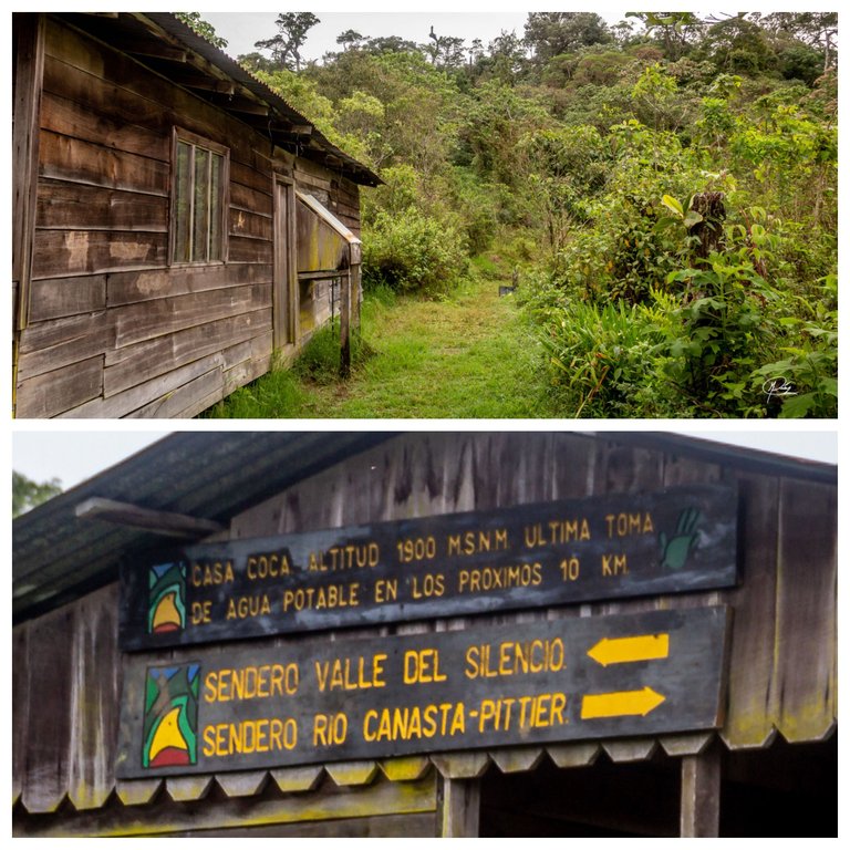
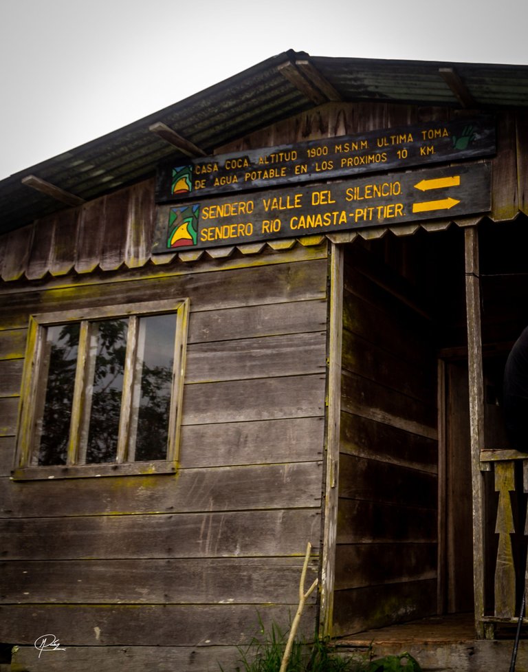
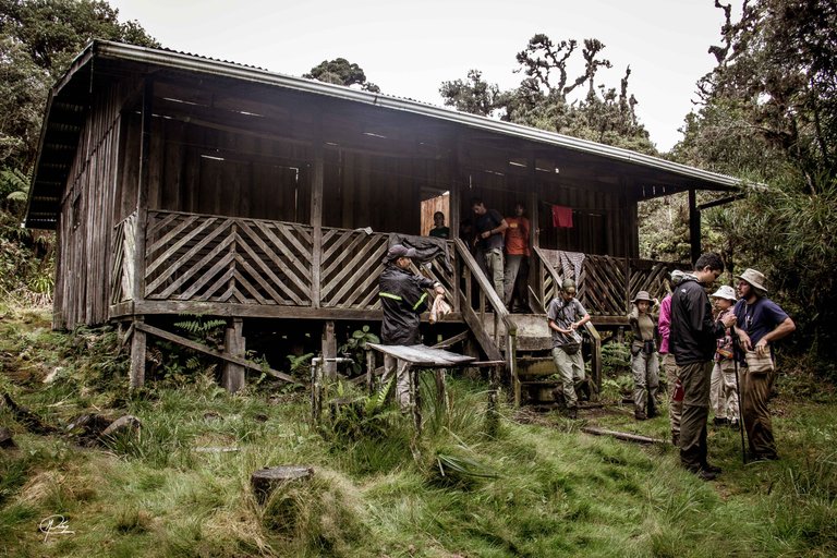
After 3 hours of walking and 10 kilometers traveled, we arrive at our first resting point, an old cabin that serves as a refuge for forest guards and where we can recharge our batteries, use a rustic bathroom and recharge water, something very important, because a sign reminds us that there are no water sources in the next 10 kilometers, the steepest of the road.
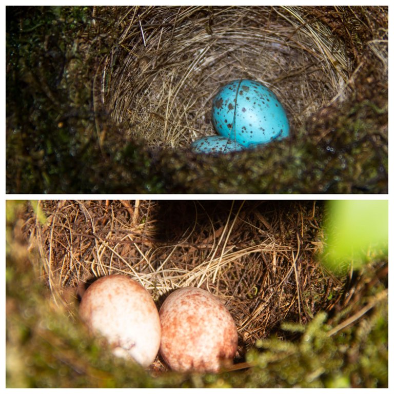
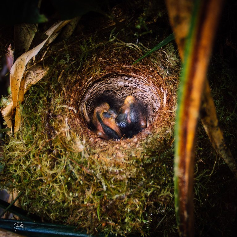
After a stop of half an hour we continued with the march, and at each step we found evidence of the little human presence on the way. The birds lay their eggs of brown, blue and greenish colors, in nests at the edge of the path and low above the ground, in other places they would be easy prey for looters and hunters.
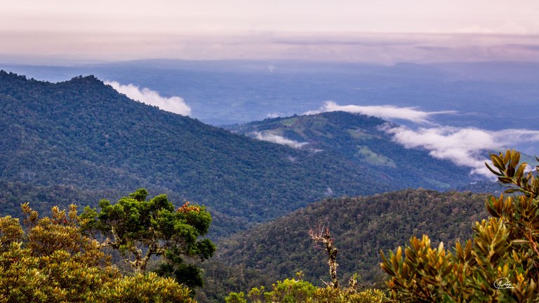
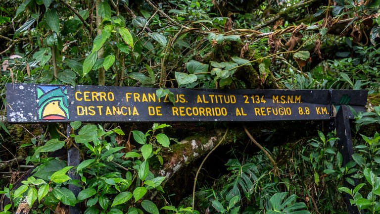
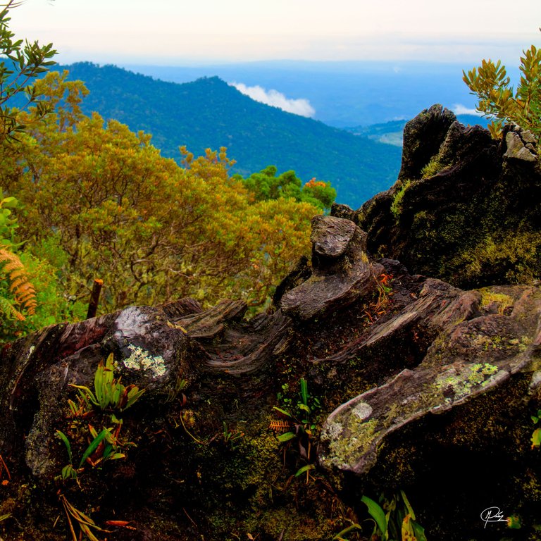
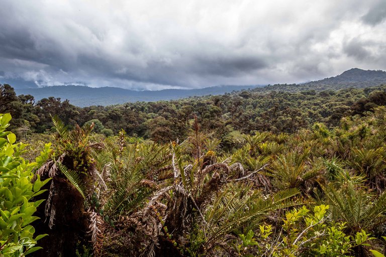
Little by little we go further into the mountain and approach the first challenge, the Frantzius hill located at 2,134 meters above sea level, named after the great German physician and naturalist Alexander von Frantzius, who made great contributions to the country.

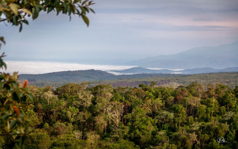
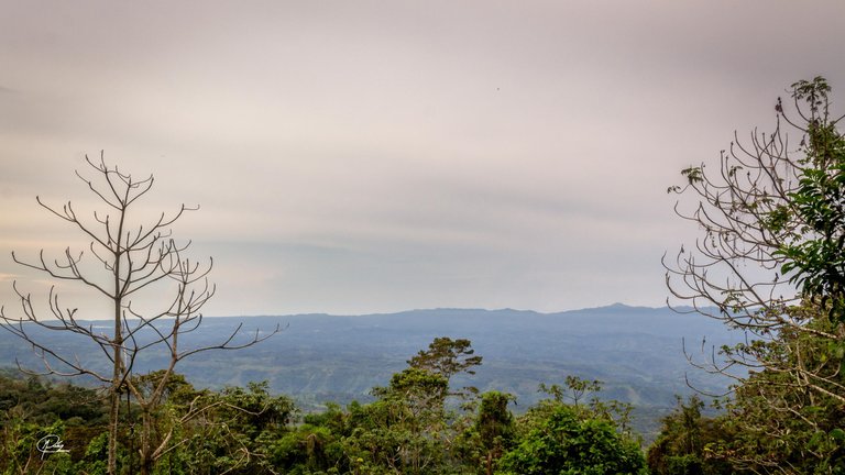
When we reach the top, we stop for a while to contemplate the spectacular scenery. Mountains covered with oaks and a view of southern Costa Rica, where we can appreciate the valleys of Buenos Aires from Puntarenas.
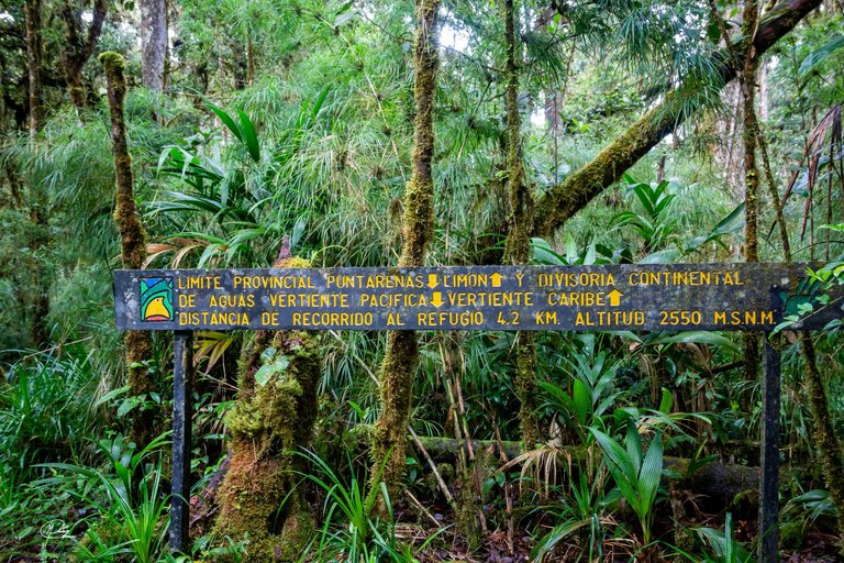
We continue walking for a couple of hours on a path steeper than the previous ones, the weight of the load is already felt on our battered shoulders and fatigue begins to appear. However, in the distance we can see a flat road and a sign in the distance that informs us that we have reached the watershed, which means that all the waters that fall from the left side of the road will come through the rivers. to the Caribbean Sea and all the waters to the right of the road will flow into the Pacific Ocean. Spectacular!!
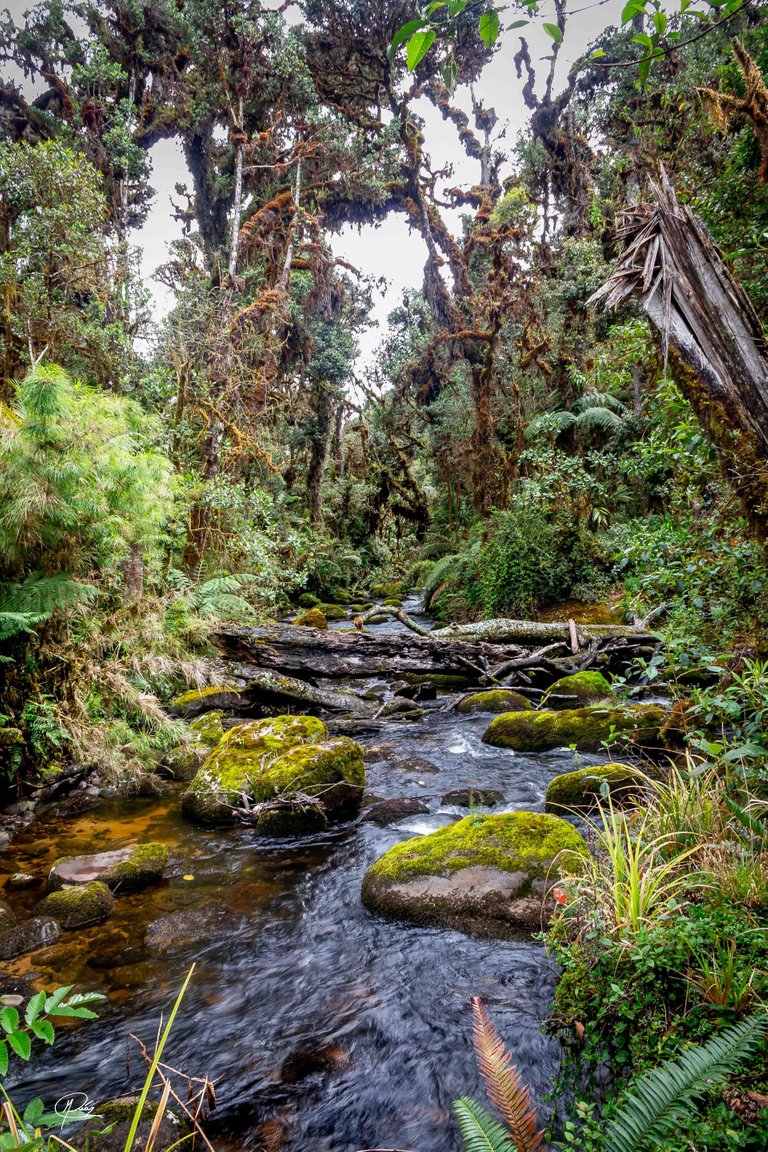
This point marks the end of our journey, the goal and the well-deserved rest is getting closer and closer. Little by little the day begins to wane and we must hurry to avoid the night. The heavy slopes disappear and give rise to a gentle descent, which together with the distant and constant sound of a river announce our arrival at the refuge.
Upon arrival we discovered a small wooden cabin in a valley next to the river, an almost idyllic landscape.
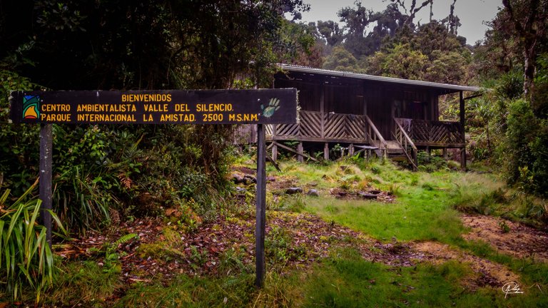
The long miles and sore body has been worth it and every step is rewarded by the undisturbed nature, pristine waters, and the sense of peace that only a place away from human bustle can provide.
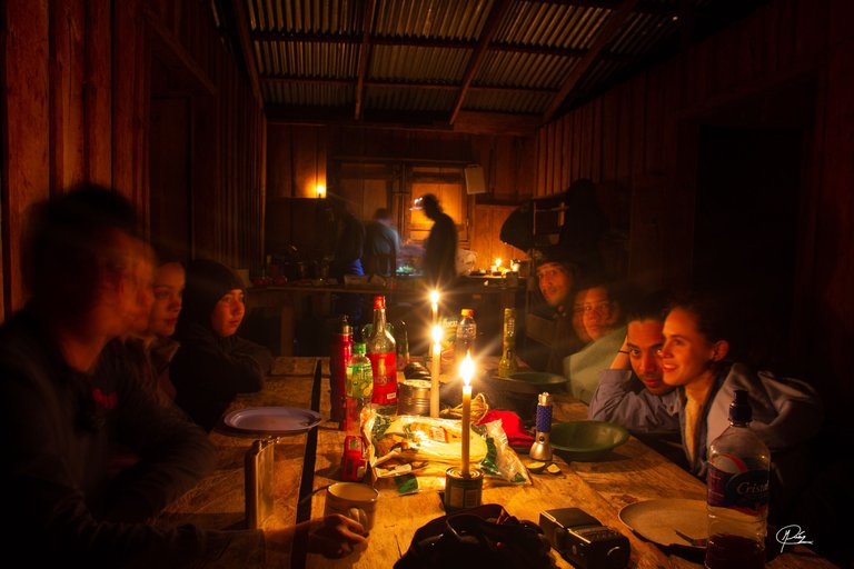
There is still much to see and discover, but the night has come and in a place where only candles and a few lanterns light up, it is deeper than any other place. But that is history for another time, now it is time to eat and rest, remember the wonders of the road and look forward to those that will arrive tomorrow with dawn.
Versión en español
El valle del silencio es un lugar prístino, ubicado en las altas montañas del parque nacional La Amistad, el más grande de Costa Rica y cuya extensión se comparte con el vecino Panamá.
Es una camita larga, que se suma a las seis horas de viaje en auto desde la capital San José hasta el pueblo de Biolley en el cantón de Coto Brus. Nos levantamos temprano y tomamos un desayuno ligero, y con la primera luz del sol iniciamos la marcha. Los primeros paisajes que se asoman con el día lucen espectaculares, lo que es un buen augurio.
Seguimos un sendero ancho pero empinado desde el comienzo, pues el camino implica un ascenso desde los 800 metros sobre el nivel del mar, hasta los 2500. Pero el esfuerzo se ve recompensado con todas las cosas maravillosas que encuentras en el camino, fuentes de agua limpias, hongos, aves y vistas espectaculares.
La primera hora suele ser una de las mas fatigosas, el cuerpo debe acostumbrarse a la marcha y soportar el peso de todas las cosas necesarias para el viaje. Estimo que cada uno cargaba a sus espaldas uno 15 kilos, entre ropa, comida y equipos de investigación. Por este motivo las pequeñas pausas son importantes para recuperar el impulso.
Después de 3 horas de caminata y 10 kilómetros recorridos, llegamos a nuestro primer punto de descanso, una vieja cabaña que sirve de refugio para los guarda bosques y donde podemos reponer fuerzas, usar un rústico baño y recargar agua, algo muy importante, pues un letrero nos recuerda que no hay fuentes de agua en los siguientes 10 kilómetros, los más empinados del camino.
Después de una parada de media hora continuamos con la marcha, y a cada paso encontramos evidencias de la escasa presencia humana en el camino. La aves colocan sus huevos de colores café, azules y verdosos, en nidos a la orilla del sendero y a baja altura del suelo, en otros lugares serían presa fácil de saqueadores y cazadores.
Poco a poco nos adentramos más en la montaña y nos acercamos al primer reto, el cerro Frantzius situado a 2134 metros sobre el nivel del mar, bautizado así por el gran médico y naturalista alemán Alexander von Frantzius, que grandes aportes realizó al país.
Al llegar a la cima nos detenemos un rato para contemplar el paisaje espectacular. Montañas cubiertas de robles y una vista del sur de Costa Rica, donde podemos apreciar los valles del cantón de Buenos Aires de Puntarenas.
Seguimos caminando durante un par de horas por un sendero más empinado que los anteriores, el peso de la carga ya se siente en nuestros maltratados hombros y la fatiga empieza a aparecer. Sin embargo, a la distancia logramos apreciar un camino llano y un letrero a la distancia que nos informa que hemos llegado a la linea divisoria de aguas, lo cual significa que todas las aguas que caigan del lado izquierdo llegaran a través de los ríos hasta el mar Caribe y todas las aguas de la derecha desembocaran en el océano pacífico.
Este punto marca el final de nuestra travesía, la meta y el descanso merecido esta cada vez más cerca. El día poco a poco empieza a menguar y hay que darse prisa para evitar la noche. Desaparecen las pesadas cuestas y dan lugar a un suave descenso, que junto al sonido lejano y constante de un río nos anuncian la llegada al refugio.
Al llegar descubrimos una pequeña cabaña de madera en un valle junto al rio, un paisaje casi idílico. Los largos kilómetros y el cuerpo adolorido han valido la pena y cada paso es recompensado por la naturaleza inmaculada, las aguas prístinas y la sensación de paz que solo un lugar alejado del ajetreo humano puede brindar.
Aun hay mucho que ver y descubrir, pero la noche ha llegado y en un lugar donde solo iluminan las velas y algunas linternas, ésta es mas profunda que cualquier otro lugar. Pero esa es historia para otro momento, ahora toca comer y descansar, recordar las maravillas del camino y esperar con ansias las que llegaran mañana con el amanecer.
Great capture my friend. The river was crystal clear.
Reveal spoiler
This photo reminds me of one of the river near a waterfall here named Kionsom Waterfall. But this Kionsom waterfall is not that far from the main road. Still can hear some of the cars passing by.
I envy you guys can have this awesome adventure into the mountains and rivers. Great sharing. !PIZZA
Oh by the way how many camera gear did you bring in this trip?
Hi, thanks for your comment. I have seen photos of nature in Malaysia and it amazes me how similar our forests look, different species but similar in appearance. This is because both countries are practically at the same latitude.
For this tour I thought a lot about what equipment to bring, at first I was going to take two cameras, but I remembered that my physical condition was not at its best. so I only packed a body and two lenses, the Sigma 17-50mm f2.8 and the Sigma 70-200mm f2.8 which is quite heavy. Plus a lightweight tripod, flash, extra batteries, and filters. It was the best decision, in the end, the equipment, clothes and food weighed 18 kilos. I barely made it. 😅
THAT IS VERY HEAVY!! 😂😱 I remember last time I went to climb the Mount Kinabalu with around 6-7Kg of things. it feels heavier overtime 😅, but yours, 18Kg THATS A LOT!
This focal length already got you covered. Only that the Sigma 70-200mm is like lifting a brick 🤣 but its worth it right? You have great shoot on the journey.
Yes, it was incredibly heavy, I ended up with bruises on my shoulders, but being such an isolated place, we had to carry everything. I lay on a bed in the cabin for almost two hours to recover a bit 🥵. And yes, the sigma lenses weigh like stone, in the end the best decision was not to bring the other camera and the macro lens. I will remember to exercise more before another hike of this style. 😂🏃
Congratulations @photographercr! You have completed the following achievement on the Hive blockchain and have been rewarded with new badge(s):
Your next target is to reach 86000 upvotes.
You can view your badges on your board and compare yourself to others in the Ranking
If you no longer want to receive notifications, reply to this comment with the word
STOPHiya, @LivingUKTaiwan here, just swinging by to let you know that this post made it into our Honorable Mentions in Daily Travel Digest #1385.
Your post has been manually curated by the @pinmapple team. If you like what we're doing, please drop by to check out all the rest of today's great posts and consider supporting other authors like yourself and us so we can keep the project going!
Become part of our travel community:
what a wonderful place. thanks for sharing these nice shots
Spread love.
!PIZZA
Enhorabuena. Has recibido apoyo
The Creative Coin Fund.
Únete al servidor de Creative Coin y comparte tus publicaciones.
Congratulations. You have received support from
The Creative Coin Fund.
Join the Creative Coin server and share your posts.
Selección manual de @elemarg25
Image by barbara-orenya
Amazing photos! I was taken away to another world by your post and now I am feeling inspired: time to get my walking boots on and get outside.
Thank you, I'm glad you like it, mission accomplished. Have a nice trip!!! 😆
amazing landscapes. you live in a paradise!
Owao! So beautiful place. Lets cheers with !wine
Thanks!!!
Yay! 🤗
Your content has been boosted with Ecency Points, by @sketch.and.jam.
Use Ecency daily to boost your growth on platform!
Support Ecency
Vote for Proposal
Delegate HP and earn more
Congratulations, your post has been added to Pinmapple! 🎉🥳🍍
Did you know you have your own profile map?
And every post has their own map too!
Want to have your post on the map too?