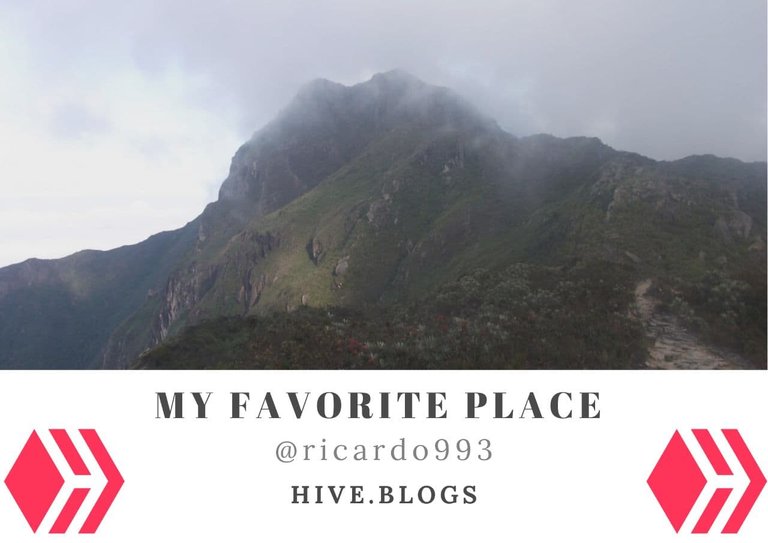

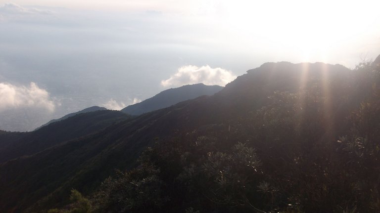
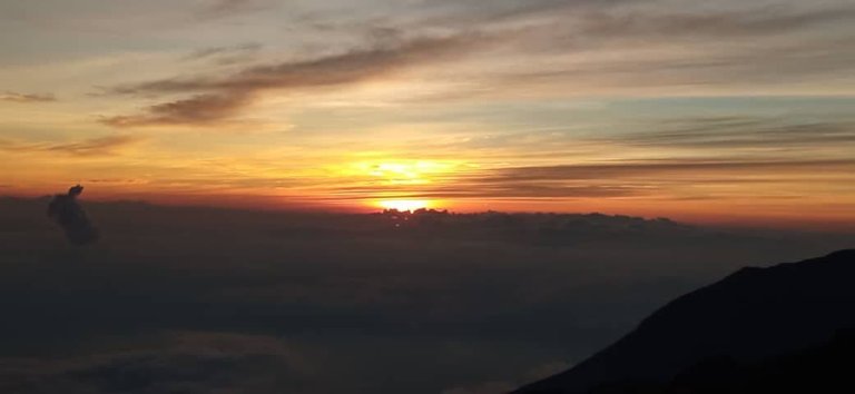
Mi lugar favorito en todo el mundo hasta los momentos es el Parque Nacional Waraira Repano. Pero para ustedes mis amigos de Hive debo ser más concreto. Me gusta estar en el Pico Naiguatá, observando tanto el amanecer como el atardecer, así como también poder contemplar el mar hacia el norte y hacia el sur la bella ciudad de Caracas.
My favorite place in the whole world so far is the Waraira Repano National Park. But for you my Hive friends I must be more specific. I like to be on the Naiguatá Peak, watching both the sunrise and sunset, as well as being able to contemplate the sea to the north and the south of the beautiful city of Caracas.
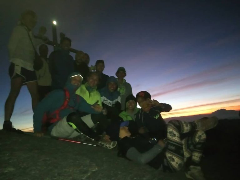
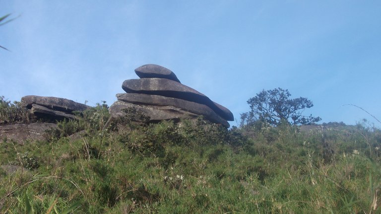
Y claro tengo fotos del lugar, bastantes guardadas en mi nube personal. He subido más de 10 veces, pero subiré unas fotos más recientes. Tomadas en diciembre faltando poco para año nuevo, si la memoria no me falla. Allá el 30 de diciembre fueron capturadas. Fue una de esas excursiones heavy que era subir por la Julia e ir al pico Naiguatá luego recorrer toda la fila para hacer cumbre en los cinco picos del Ávila, pero esa es otra historia aparte.
And of course, I have photos of the place, quite a few saved in my cloud. I have uploaded more than 10 times, but I will upload some more recent photos. Taken in December, just before the new year, if memory serves me correctly. They were taken on December 30th. It was one of those heavy excursions that were to climb the Julia and go to Naiguatá peak and then go all the way to the summit of the five peaks of Ávila, but that is another story.
Llegar al Pico Naiguatá
Tampoco iba a dejarles sin indicaciones de cómo llegar. La verdad hay muchos caminos que llevan al pico. Todos los puntos convergen en un mismo lugar. Uno puede partir desde el mismo Humboldt y transitar la Fila Maestra hasta llegar al pico, pero sería muy largo para las que recién se inician en el senderismo o la acampada.
Por los momentos hablaremos del más conocido La Julia, que queda a la altura del distribuidor el Marqués. Puedes llegar desde la estación del Metro Los Dos Caminos o La California. Recomiendo la primera opción, actualmente hay más disponibilidad de autobuses, si vas en coche te será más fácil. Se detienen en el Central Madeirense ubicado en el Marques. De ahí suben hasta la Cota Mil y encontrarán la entrada del parque.
I wasn't going to leave you without directions on how to get there either. The truth is that many roads lead to the peak. All points converge in the same place. One can start from Humboldt itself and go through the Fila Maestra until reaching the peak, but it would be too long for those who are just starting hiking or camping.
For the moment we will talk about the best known La Julia, which is at the height of the distributor El Marqués. You can get there from the Metro station Los Dos Caminos or La California. I recommend the first option, currently, there are more buses available, if you go by car it will be easier. They stop at the Central Madeirense located in El Marques. From there go up to Cota Mil and you will find the entrance to the park.
Después de ahí les espera una ardua travesía. Llegando al puesto de guardaparques de la Julia deben atravesar los siguientes puntos: El Tanque, El Mirador, aquí hay dos caminos a seguir Ruta 77 que es más largo, pero menos agotador o Dos Banderas que afecta mucho tu rendimiento si no estás habituado a esos trotes. De ahí seguirán hasta los Toyotas, La Explanada, El topo Goering, El Urquijo y por fin llegarán al cruce de la Fila Maestra. Desde aquí estamos cerca. De ahí vamos hasta La Arepa, el Cruce a Miguel Delgado y cuando contemplemos los famosos Platos del Diablo abrimos llegado al Anfiteatro, el lugar de acampar.
After that, an arduous journey awaits you. Arriving at the ranger station of La Julia you must cross the following points: El Tanque, El Mirador, where there are two paths to follow Ruta 77 which is longer, but less strenuous, or Dos Banderas which greatly affects your performance if you are not used to such trots. From there you will continue to Los Toyotas, La Explanada, El Topo Goering, El Urquijo, and finally, reach the Fila Maestra junction. From here we are close. From there we go to La Arepa, the Cruce a Miguel Delgado, and when we contemplate the famous Platos del Diablo we have arrived at the Amphitheater, the place to camp.
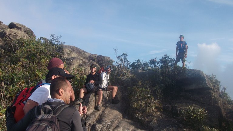
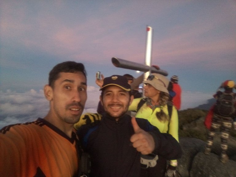
Lo único que les faltara es llegar a la cumbre que está ahí mismo.
The only thing missing is to reach the summit, which is right there.
El Pico Naiguatá
Esta es una breve reseña parafraseando Wikipedia:
This is a brief review paraphrasing Wikipedia:
Es el pico más elevado de la Cordillera de la costa. Se encuentra entre el estado La Guaira y Miranda, así como la capital Caracas. Su nombre proviene del pueblo de Naiguatá ubicado en La Guaira, es un nombre indígena.Tiene una altitud de 2765 metros sobre el nivel del mar.
It is the highest peak of the Cordillera de la costa. It is located between the states of La Guaira and Miranda, as well as the capital Caracas. Its name comes from the town of Naiguatá located in La Guaira, it is an indigenous name. It has an altitude of 2765 meters above sea level.
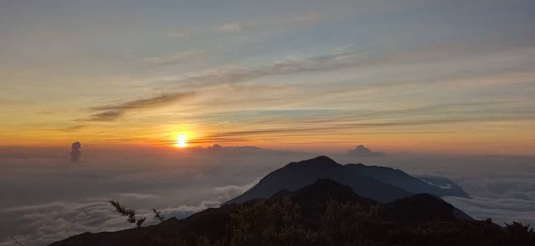
Un dato importante es que si actualmente no hubiera contaminación en el aire se pudiera avistar desde la cumbre El Archipiélago de los Roques, y desde Tucacas (Estado Falcón) se pudiera contemplar el pico.
An important fact is that if there were no pollution in the air, you could see from the summit the Archipelago of Los Roques, and from Tucacas (Falcon State) you could see the peak.
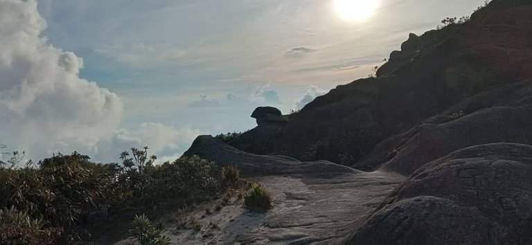
En fin, es mi lugar favorito. Contemplar la sombra de la montaña es otro nivel que vale la pena ver con sus propios ojos. Espero que el extranjero o venezolano que aún no ha venido, venga y quede enamorado al igual que yo.
Anyway, it's my favorite place. Contemplating the shadow of the mountain is another level worth seeing with your own eyes. I hope that the foreigner or Venezuelan who has not yet come, come and fall in love as I did.
Congratulations, your post has been added to Pinmapple! 🎉🥳🍍
Did you know you have your own profile map?
And every post has their own map too!
Want to have your post on the map too?
Un lugar hermoso donde tocas las nubes😻
Algun dia tendremos que ir @madefrance yo te llevo.
Wooow simplemente increible la vista que hay al subir, un recorrido que vale completamente la pena hacer, Increible!!.
Muchas gracias por unirte a la iniciativa y mostrarnos este increible lugar
Gracias a ustedes por darme la oportunidad de presentar este lugar. Es un santuario que vale la pena el esfuerzo.
Awesome 👍