In between most of our camp spots, we usually try to plan a few stops along the way. On this particular route we had set a slight detour to the top of Phu Chee Duen to arrive in the early afternoon. It hadn't been planned anymore than that was the time and place we would be passing mid route.
Phu Chee Duen is a peak along a lengthy mountain ridge that divides Thailand and Laos. We had previously visited other sections and peaks along the ridge and were always surprised with how amazing the views were.
Many of the peaks in this northern region of Thailand are only accessible by 4x4 vehicles or on foot. The mountain view points are popular among Thai tourists and many of the 4x4 tracks to the top have restricted access. For those that wish to visit, there are designated car parks along the main road and local 4x4 tour operators that will drive you and your group up.
Since we were seeking our own adventure, had our own 4x4 and didn't want to join a slow paced group, we were hoping that we could go alone. Fortunately for us, the normally busy Christmas and New year season was totally dead due to COVID19. We were the only tourists and even if we had wanted to join one of the tours, there were none open.
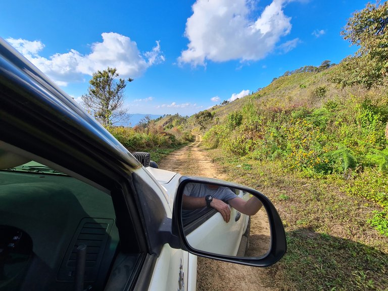
A convenient sign and arrow confirmed the correct track and we were heading up!
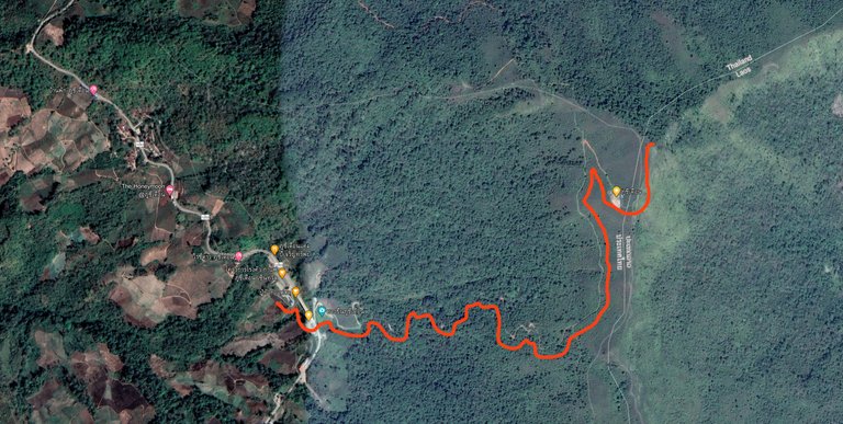
Source: Google Maps
As great as Google Maps is, it can't always set a route to off-road destinations, probably because the roads are not registered and haven't been officially recognised. Maps does make up for it by offering excellent and usually up to date satellite images and with basic map reading skills, a sense of direction and understanding your given GPS tag, it's very simple to find where you want to go.
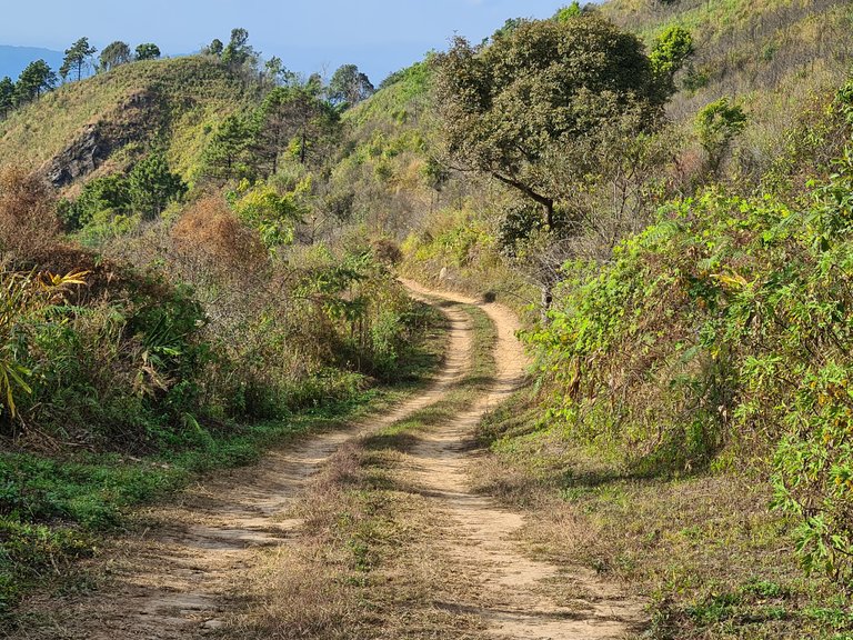
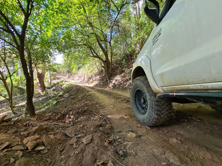
The track was only a few kilometers long and there wasn't really any need to engage 4WD. A simple rut-free track lead us to the top within about 15-20 minutes.
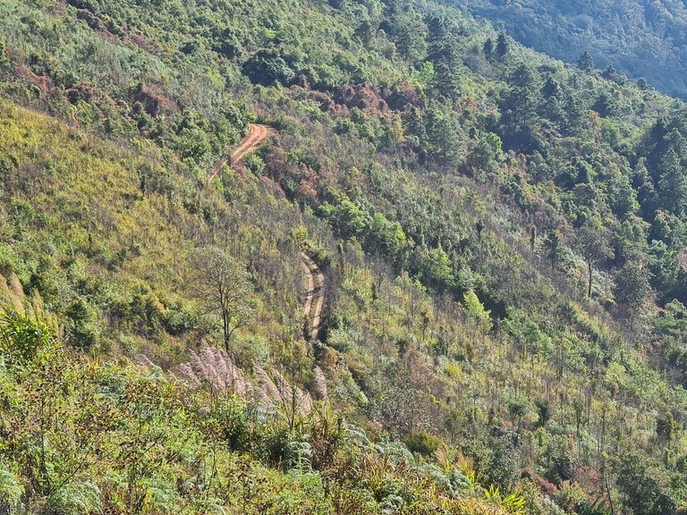
The track weaved in and out of shady forests and bush scrub.
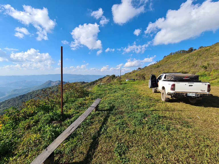
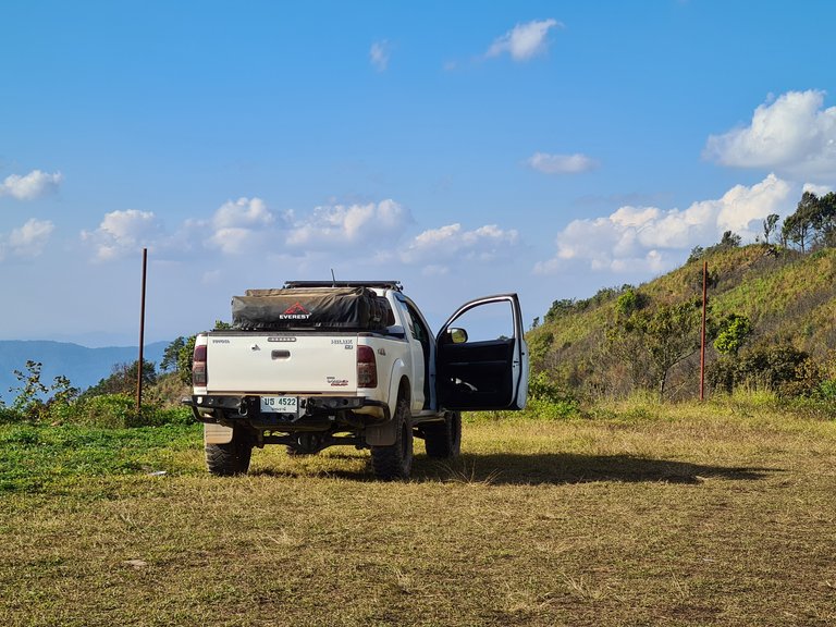
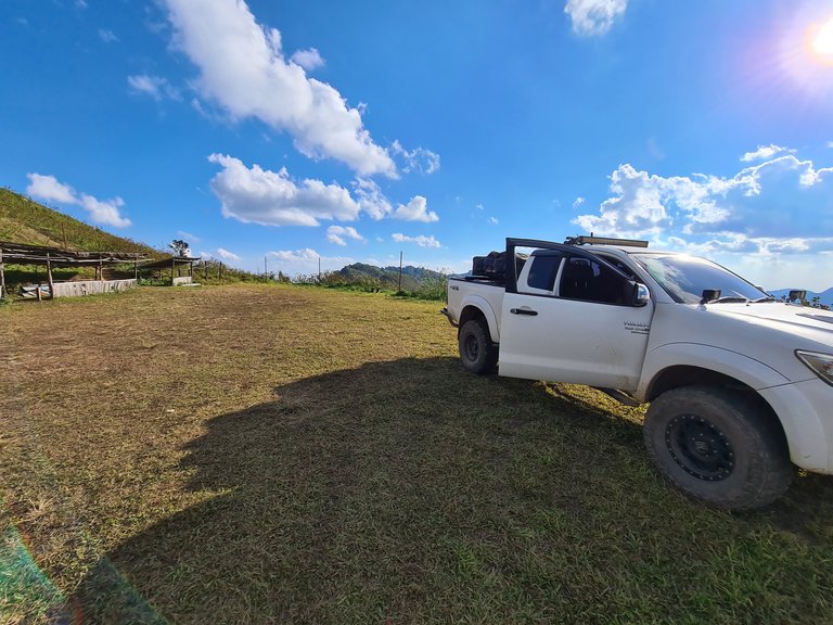
We arrived at a flat grassy parking area complete with an old wooden viewing platform, a crude 2 cubicle toilet block and some abandoned makeshift stalls. We assumed that this was the drop off point for the 4x4 operators when open and that the stalls would be selling cold drinks, snacks and souvenirs - not today though!
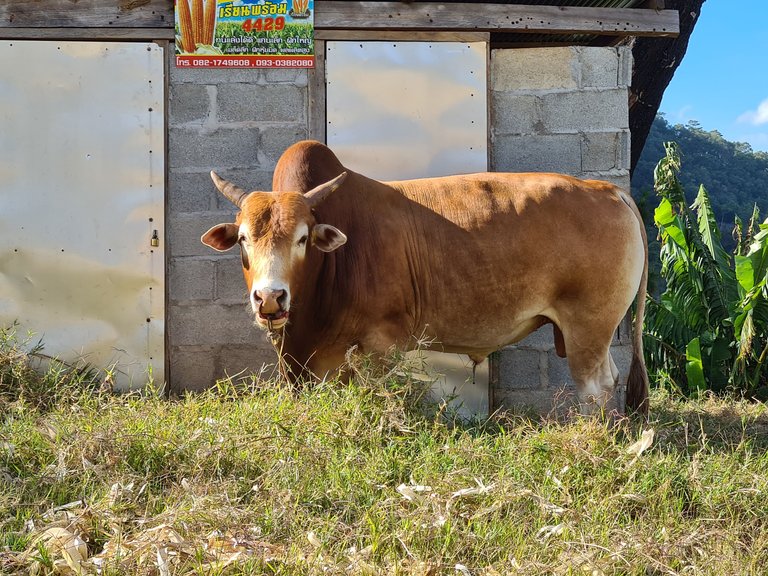
As quiet as it was, we realised we weren't the only ones there. In fact, we were being watched! A lone bull with a huge shoulder hump was casually chewing on some grass in front of the toilet block watching our every move.
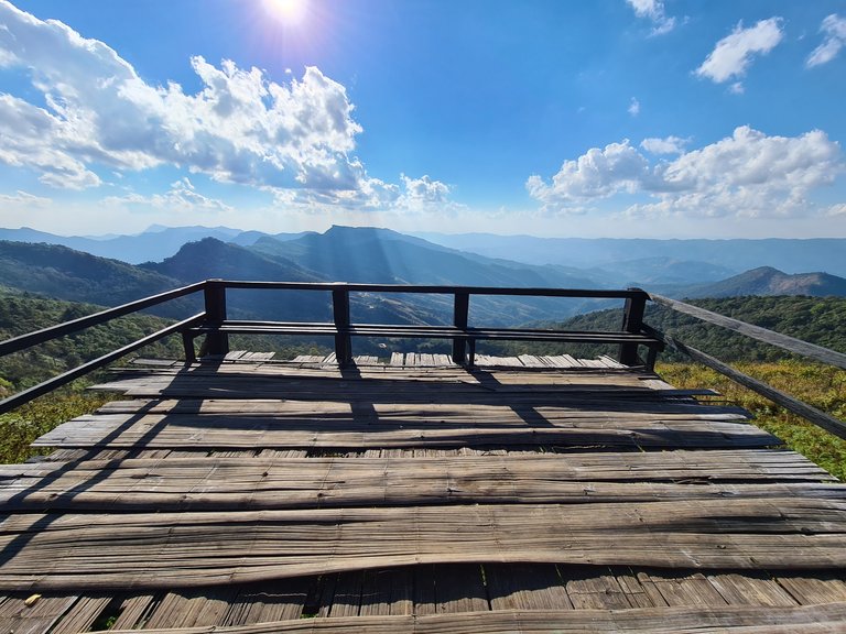
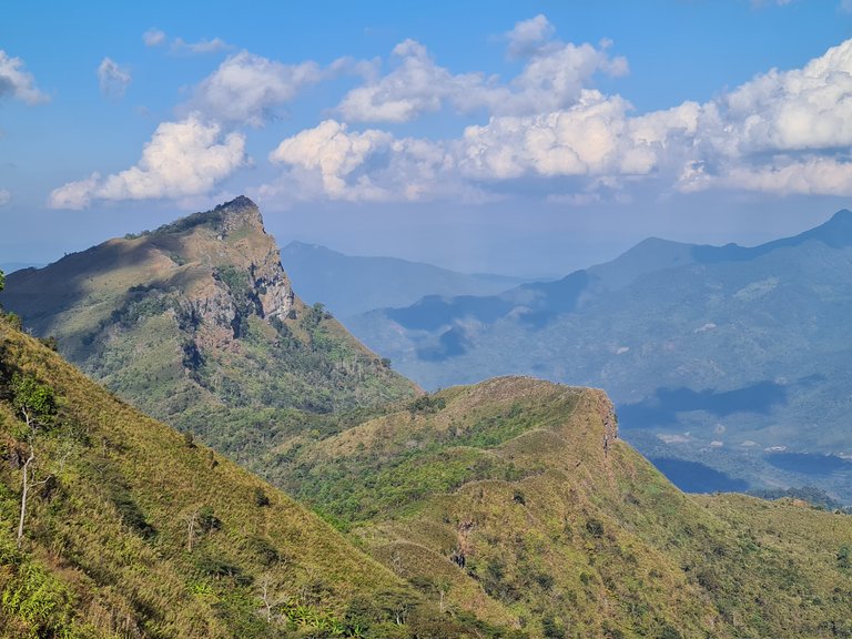
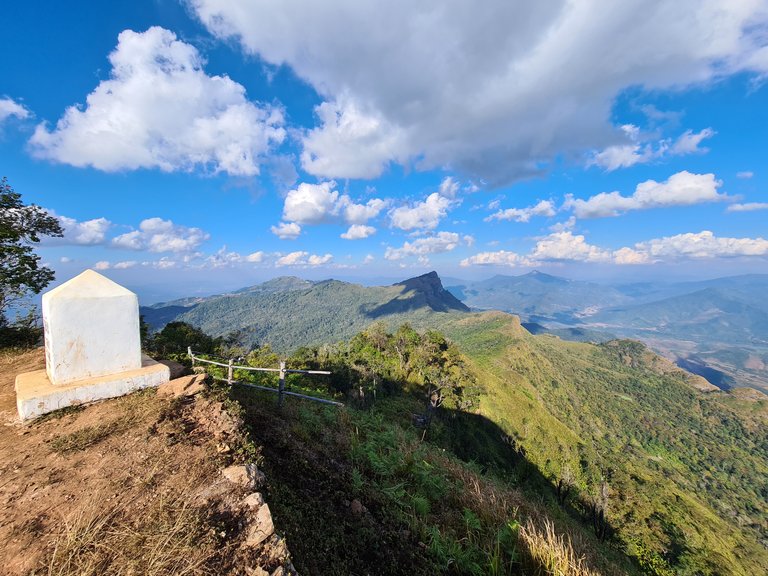
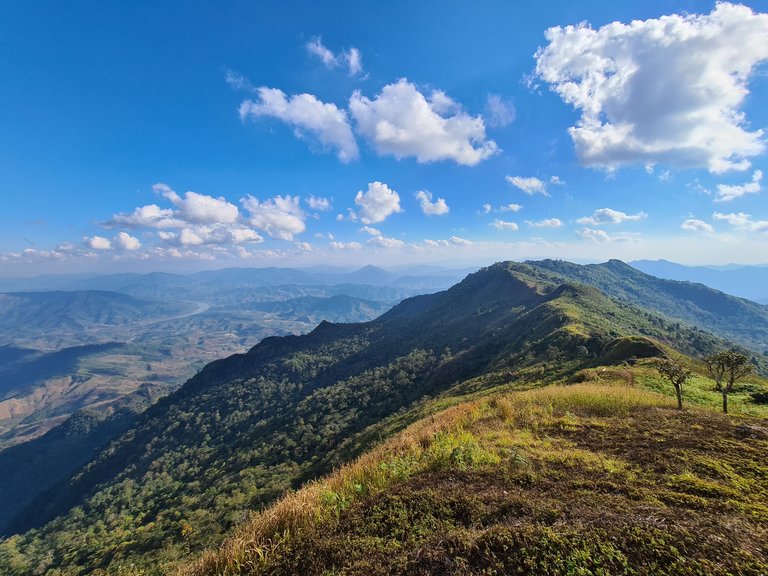
Behind the grassy car park was a narrow footpath leading up to the ridge and peak. We walked up and took our first look down into Laos. Literally straddling the border, we had views in every direction.
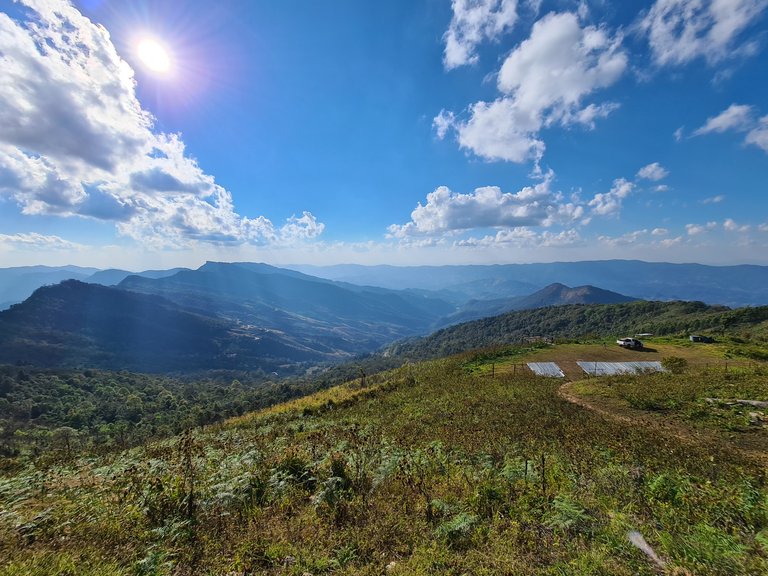
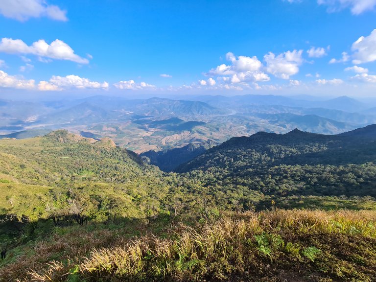
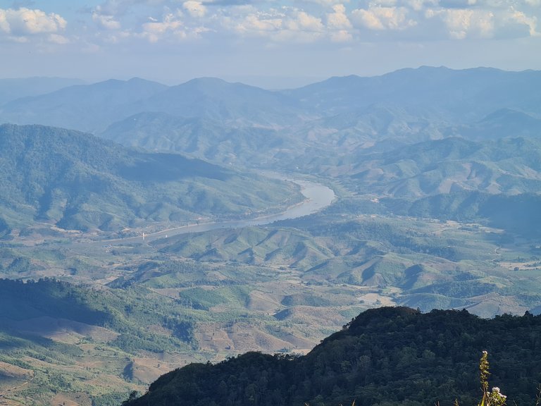
On the Laos side at the bottom of the mountain along the valley floor was the Mekong River. Farmland scared much of the landscape but there were still vast areas of untouched forest.
We continued to walk up to the highest peak.
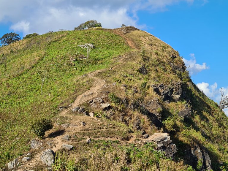
We passed more wooden markers, the same kind that we had previously found at other locations along the same ridge. The markers were official points that divided the 2 countries. There was no other form of division and nothing to stop travel back and forth from either side other than the overgrown forest and steep slopes.
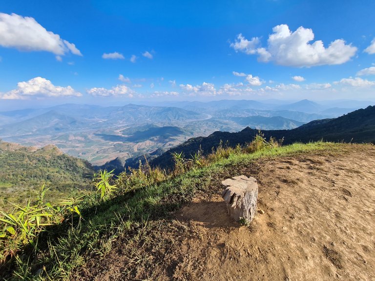
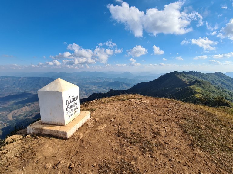
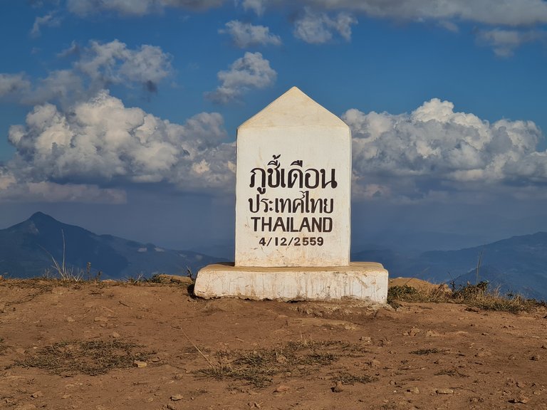
The peak had a slightly more official looking marker than just a half buried log but didn't state the altitude or coordinates.
It turned out that the peak stood at 1,739m and the GPS tag is: https://goo.gl/maps/veRg5aEWbc64Ht6M6
We spent about an hour at the top just sitting and looking out across the 2 countries.
As we checked the time and knew we had to still get to the next stop to set up camp, we started our walk down but didn't even consider just staying put and setting up camp right where we were.
We already had everything we needed, the views from the tent would have been amazing, there was a perfectly flat and grassy spot to set up on, it was quiet and very peaceful but it just wasn't on our mind to stay!
Looking back, it was definitely a missed opportunity and an opportunity that may not come about again especially if tourists start to return to the area and access to the top starts to be restricted once again.
We headed down back to the main road and continued to our next destination. We had high expectations of where we were heading to as it was the main view point with the most dramatic views in the area - so they said!
I hope you enjoyed this post and please follow for more like it in the future.
All content is original: the photos (unless stated), the writing and the adventure!
Hi @thinkit, your post has been upvoted by @bdcommunity courtesy of @rehan12!
Support us by voting as a Hive Witness and/or by delegating HIVE POWER.
JOIN US ON
Thanks for the upvote will check out @bdcommunity
Congratulations, your post has been added to Pinmapple! 🎉🥳🍍
Did you know you have your own profile map?
And every post has their own map too!
Want to have your post on the map too?
Hiya, @choogirl here, just swinging by to let you know that this post made it into our Honorable Mentions in Daily Travel Digest #1120.
Your post has been manually curated by the @pinmapple team. If you like what we're doing, please drop by to check out all the rest of today's great posts and consider supporting other authors like yourself and us so we can keep the project going!
Become part of our travel community:
Really want to go up north soon and change the scenery! Only been to Chiang Mai once and this year missed the winter season unfortunately.
Yeah thats exactly when we went- some nights down to single figures, real cold but a nice change. had been a long time since we were in the north too but loads of places to go and its so quiet now.
Yeah the one positive thing about Covid is how quiet everywhere around Thailand is. It's the best time for travelling.
Awesome hike and views! As we often say.. the best view comes after the hardest climb.
You also got some nice weather out there, and I love it! I so miss seeing colours and sun these days when we are covered in snow :(
LOL and hear I am wishing for a winter adventure in the snow - the grass is always greener on the other side!!!
Snow is really amazing, but as long as it snows as it is supposed to, while the winter got really crazy over here just because seasons are not like they were a few years ago 😔
That's definitely a fantastic view. Even the bull was enjoying it. Great adventure!
Thanks for checking it out :)