What's Buzzin Hive!
During our recent visit with a friend, we had a chance to visit other areas of the Rockies/ foothills we had never seen before having a local as our unofficial guide. I feel like I'm going backwards here with my posts starting with the last day instead of first but hey, I'm a mess and always have been anyway so why change now! With the truck still broken down on this day, our friend became our chauffeur so we stuck closer to Turner Valley rather then going deep into the Rockies via unknown roads. Just outside of Turner Valley near Okotoks Alberta, hides many wonderful provincial parks to be discovered with some amazing trails and some rather eerie local rumors and folk stories based around a hidden abandoned mining town.
.jpg)
.jpg)
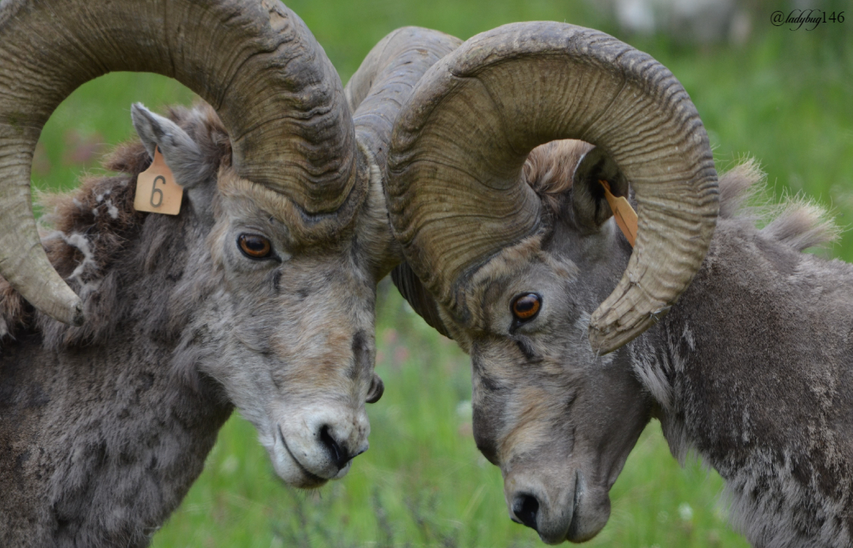
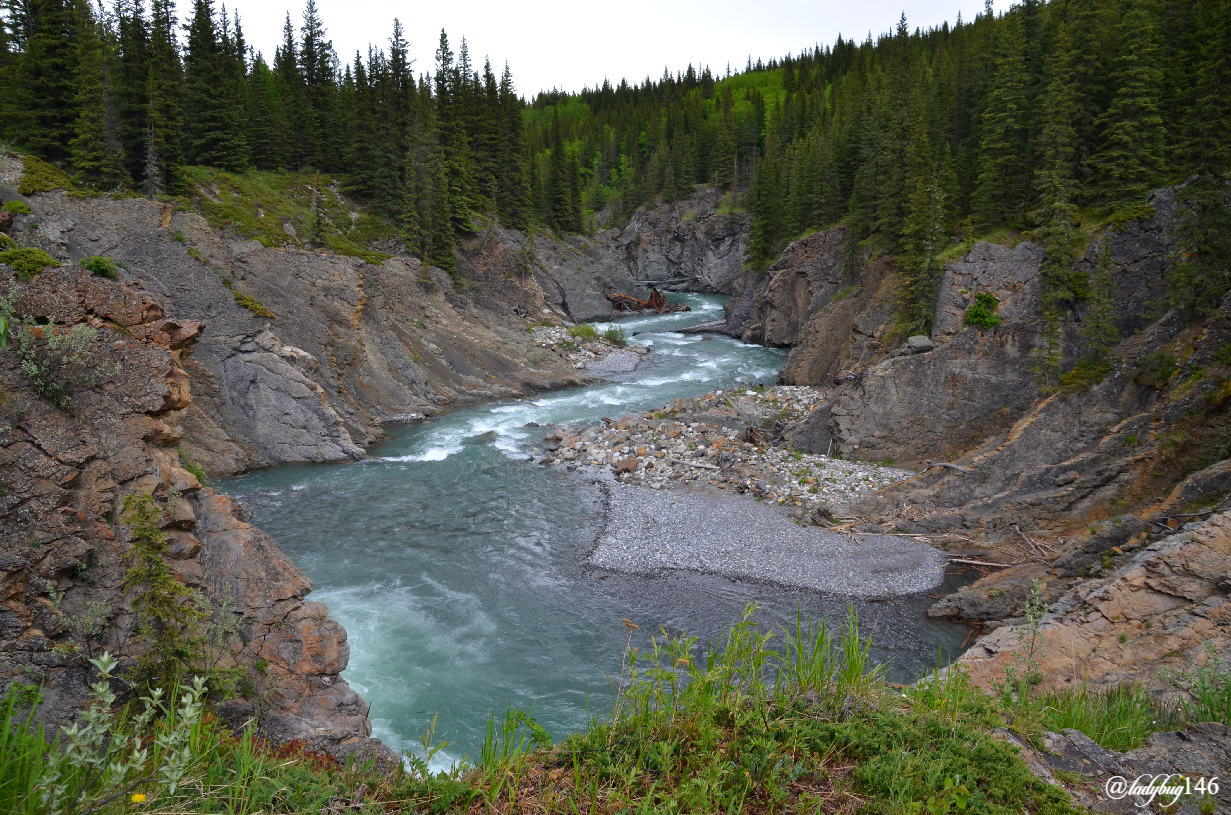
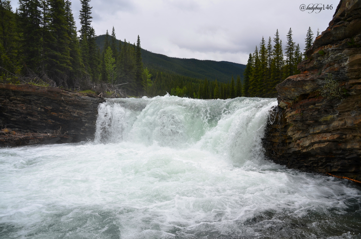
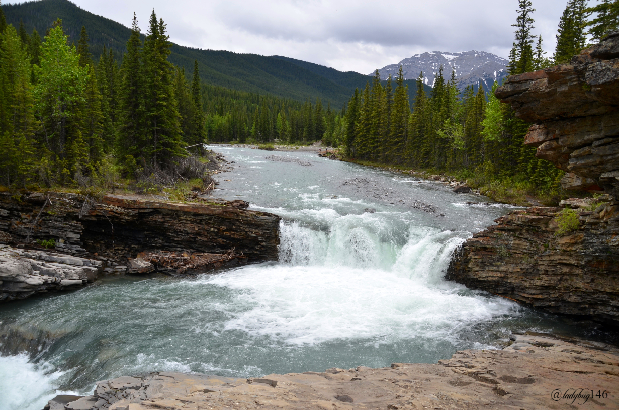
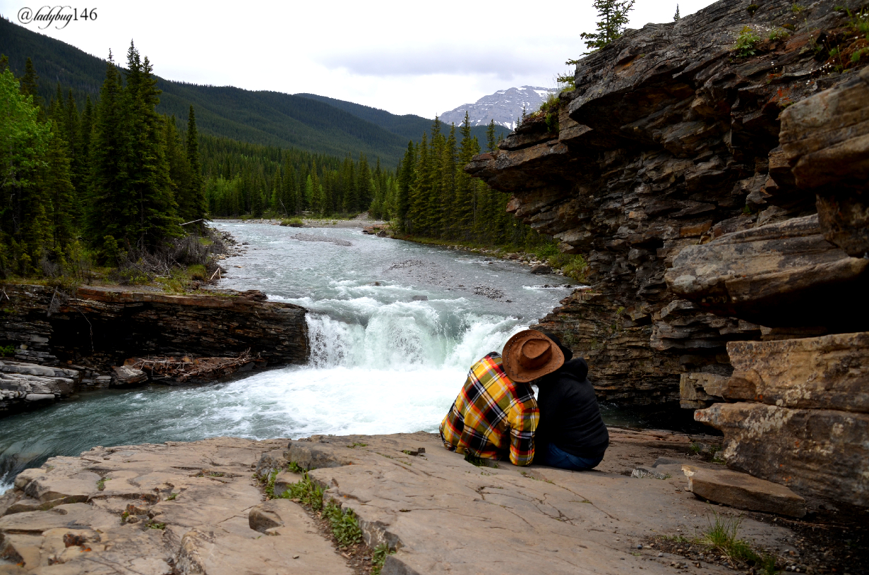
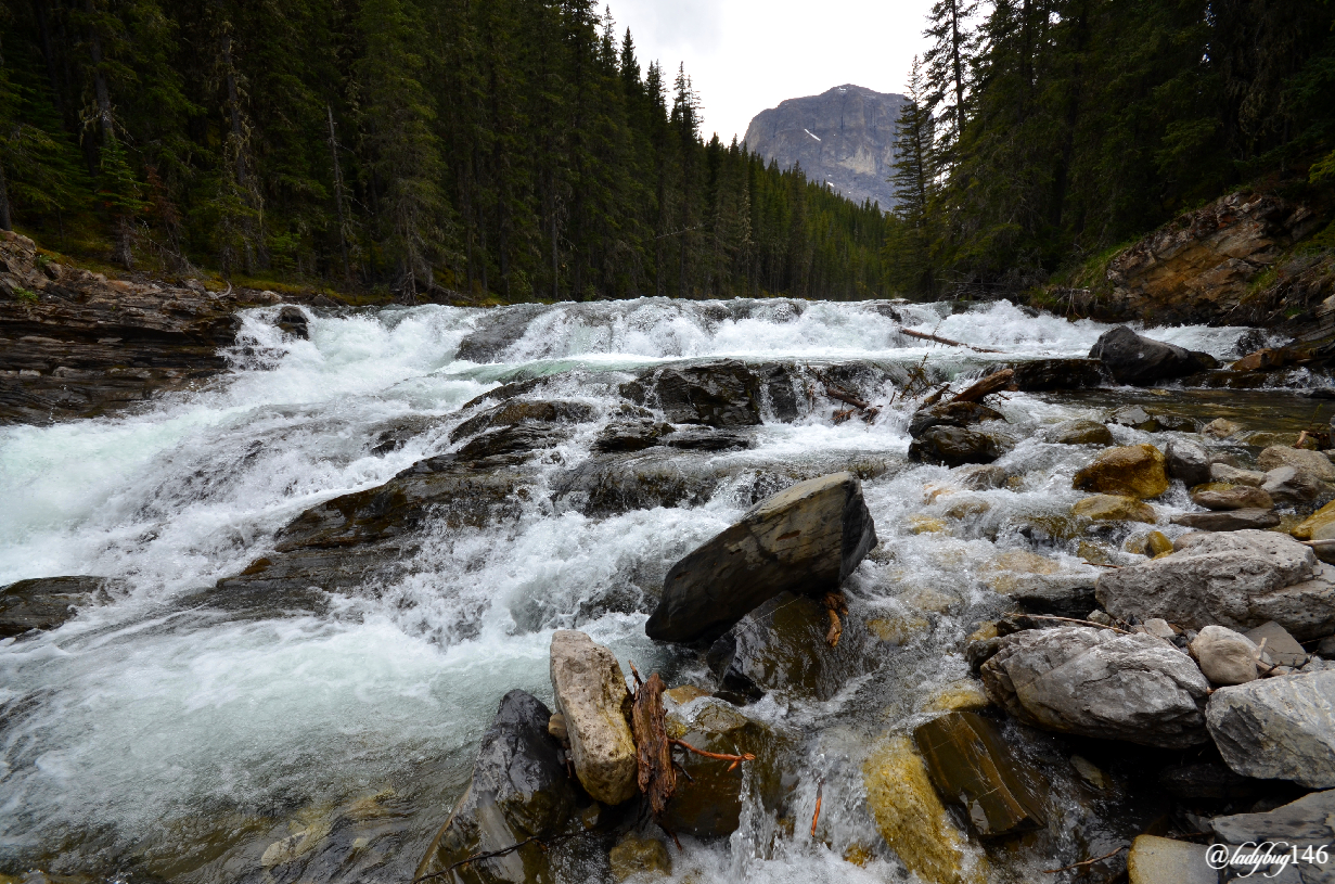
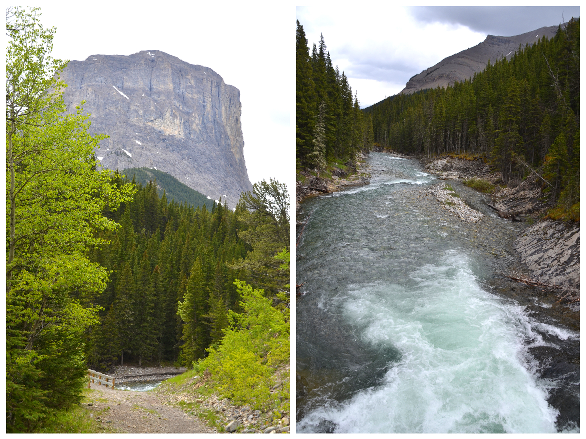
We decided to visit Sheep Valley Provincial Park, of course given it's name, herds of Mountain Sheep aka Rams roam the hills and can be spotted at anytime especially in late spring before they make their way up the mountain but that will be for another post since we didn't really see them the day of our hike. We did see them the day before so maybe I'll give you a sneak peek of what's to come in a future post as I continue to go backwards in time. Sheep Valley is also the home of many smaller but violent waterfalls of the Rockies. Spring melts and higher than average snowfall over the winter with a dash of intense rain/hail that tore thru Calgary just days before gave us some intense river flow for our visit. The water was kind of murky, so not it's usual mesmerizing blue colors we expect out of the Rockies but on the other hand, the murky waters carry the rock flour down from the mountain and that is the silt that gives our lakes and rivers it's intense colors as it settles at the bottom when the flow of the water returns to normal.
.jpg)
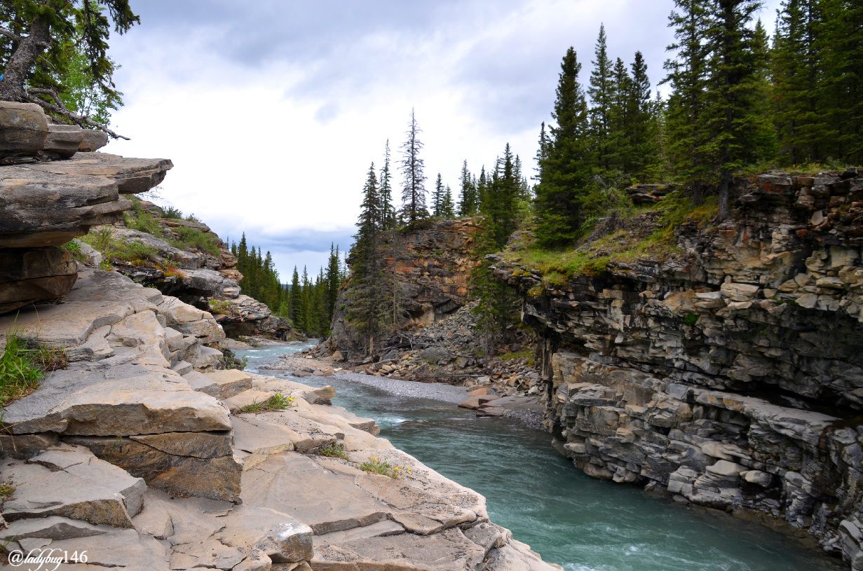
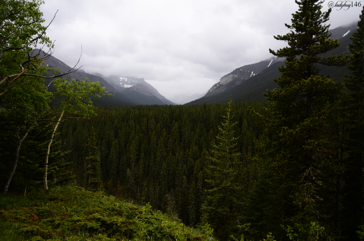
As we drove up the park on the way to the trail-head, we drove along the Sheep river that snakes around the valley dividing the Rockies and the foothills area with a few stops along the way to view different sections of rapids or small waterfalls. Unlike what we see in national parks with barricades preventing daring travelers to climb down the rocks into the waterfalls, this park offers the agile a closer view from below. I advise to not go in the rain as these rocks can get slippery and could easily end in falling into the river or injury but on this day, it was mostly dry...well at least for the first part of the day. Other activities like fishing (with appropriate provincial park fishing license & following park's guidelines), horseback ridding, cross-country skiing (in winter) are popular. Camping is generally available but with covid, things are a little quieter and no promises on the current available activities (horseback ridding should be available but camping is a grey area at the moment). Being part of the foothills, all the snow is melted by this time in the lower areas but can still be seen on the rocky peaks on the horizon.
.jpg)
For the most part, the park is only accessible from mid-June until closure in October partly because of snow and bad conditions an other reason most of Kananaskis remains closed later than other parks to allow the wildlife to feed and have their young in peace as food is abundant in the valley but scarce higher up on the mountains at this time. The park areas are still available to hikers and bikers just no motorized vehicle access. In other words, your chances of seeing wildlife during the closed season and shortly after opening is greater than normal. What once was a quiet more local part of our landscape is becoming a more popular tourist attraction being a little over one hour's drive from Calgary and the Banff area and is getting busier as the years pass.
The Sheep River is protected under provincial law being an important part of the local watershed derived from the Bow river and Mount Rae (Rae Glacier) supplying the near-by towns of Turner Valley, Black Diamond and Okotoks with a fresh drinking water supply. The area was first established for access to a failed coal mine that was trying to take root after a large deposit was found in the early 1900's near Mount Burns. Named after Mr. Pat Burns a known politician and rancher at the turn of the century also one of the men responsible for establishing the first Calgary Stampede, a popular cowboy summer festival in Alberta. They were expecting a railway to be built but never came making it too costly and time consuming to carry the coal extracted to consumers and with already well established mines in the Canmore, Drumheller , East Coulee and other parts of southern Alberta. The project was abandoned in the early 1920's as they were unable to compete with cheaper prices of the above mentioned along with the decline in the resource's demand and popularity. Here is some information on the area and Mr.Burns and a link to my previously posted hike to Rae Glacier from a few years back.
The trail we took known as the Sheep River Trail is part of the road to the ghost mine therefore it was pretty wide and somewhat manicured, no bush-wacking required. The first part is on a bit of an incline but not too bad and the rest was mostly flat with a few small hills, moderate level of fitness should be able to make it on this trail as we walked the ridge following the river. To make it to the mine is quite a walk so if your intention is to visit the old mine, be prepared for a long day hike of approximately 10 km each way. Due to past floods, the bridges were washed out and only one has been rebuilt as they are rebuilding the more popular trails first, the rest requires crossing the river at 2 other locations. Most of the trail is part of the park but closer to Mount Burns and the abandoned mining town, it becomes private property owned by the Burns family, the owners of the failed mine and well established business owners to Burnco concrete making companies and other enterprises. For years there was many disputes over access to the property why some of the bridges haven't been rebuilt but time proved it to be a loosing battle and they abandoned trying to control access to the old mine.
The property is shrouded in mystery with local tales of UFO sightings, mysterious hiker disappearances after venturing onto the property to never be seen again along with other strange myths, sounds and screams coming from the property surrounding the Burns family. Finding information online on these local claims seems impossible at this time but near-by residents have plenty of odd stories to tell surrounding this property especially around frequent UFO sightings, it was mentioned by several without even bringing up any word of the rumors or claims. Are they fact or fiction? Part of an over active imagination? Who knows...to be fair there is a UFO landing pad somewhere in Alberta, maybe there is a reason behind the oddity. Perhaps I can continue investigating at a later time.
.jpg)
Unfortunately, we couldn't make it all the way to the ghost town due to higher than normal river flow, many of the trails and access are washed out until water levels come down later this summer, maybe I can have a second attempt to get to the mine then since I love exploring old mines and mining towns. The first un-bridged section we were able to cross no problem with a little bit of up and down the riverbank and some rock-hopping across but during our journey, we met with two other hikers that tried to access the mine and informed us that the river was too high to cross on foot. Given it was pouring rain on my camera gear at this time and we had a 7 km hike back to the vehicle, we decided that perhaps it's for another time and best to turn around before we get caught up in a tennis ball sized hail storm that have plagued the Calgary area a few times within the past week that we somehow managed to dodge, not once but twice! Seriously, seems like the last 5 years, Albertan's just can't catch a break between bad politics, oil crash and natural disasters. Good thing we are a resilient community...Welcome to THE WILD WILD WEST! YEEHAA! Our necks might be a little red but our big hearts makes up for it. 💓
The closer we got to the mine, we started to find old equipment left to rust in the bushes, we never really determined what they were but the ruins looked like mid-century scraps left behind, perhaps an old windmill or something. I didn't take any pictures of the metal ruins because it wasn't that interesting and I didn't want to take out my camera in pouring rain. In total, we walked over 15.5 km on the day. When I told my friends, lets go on a hike, I'm not sure that's quite what they were expecting (bahaha, poor souls...they will recover I'm sure😆😂 😝 ). Strangely enough, even at my age I'm able to go from full covid couch potato to hiking 20km a day in a snap...@silvergingerman's health tracking app must be awfully confused right about now!
.jpg)
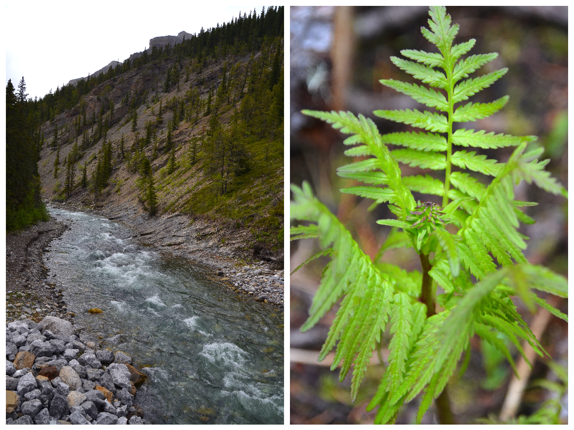
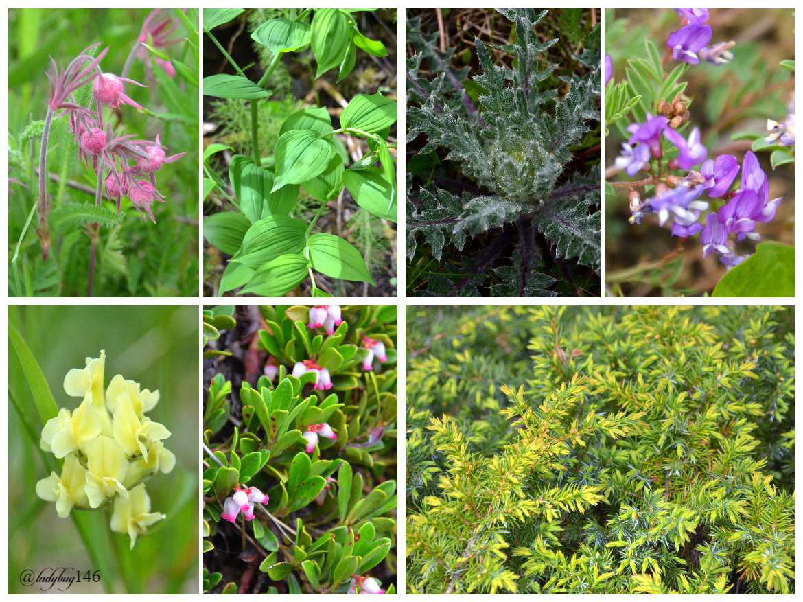
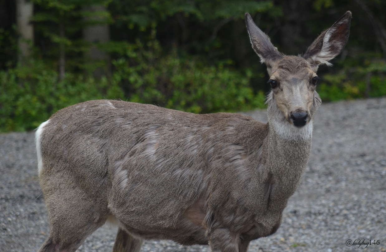
Given the late winter, many of the wildflowers that lined the trail weren't in bloom yet but we noticed rare species at the very least one the decline in Alberta like wild ladyslipper and other common or invasive flower species alike lining the trail along with buffalo berry bushes (grizzly's favorite meal), mountain strawberries in bloom, raspberry bushes and an abundance of common juniper berries and bushes. It also appeared to have many different types of mushrooms but it's very early in the season to tell what species and if edible or not. It is illegal to harvest anything for sale in a provincial park but immediate consumption and a little stash for later personal consumption is allowed. Be respectful when harvesting anything not to damage the plant or it's ability to propagate along with knowing your species in order to not destroy rare specimens, in other words no picking random things to discard down the trail just cause it's there. Canada is host to over 200 plant species at risk for extinction and a large variety is found within Alberta's park boundaries. Other wildlife that can be found is plenty of deer, grizzly roam them hills, coyotes and smaller wildlife like squirrels. It is wise to bring bear spray just in case of an encounter and a bear bell is a deterrent, wanting to avoid human interactions, they often pick a different route knowing of human presence but it is currently cub season where they can be more aggressive, be cautious.
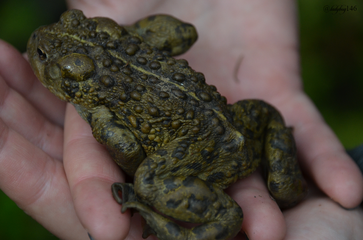
If you pay close attention, large toads can be spotted in the bushes. With our last few summers being dry and on the verge of wildfire crisis, the toad population was on the decline for a few years but last year and this spring, being blessed with abundant rain, the numbers should start to rise again, hopefully it will be a continuing trend. These dry summers combined with intense lightning storms are scary and once wildfires start with their speed and intensity, they are nearly impossible to extinguish until winter comes due to our hot and dry summers and hard to access locations and can result in devastating loss both human and eco-system within our vast dry forested regions. We are known for our eternal blue skies and long summer days (about 20 hours of sunlight on the longest days) but it comes at a cost. No matter what, we love our land and always recover from these tragedies in time. One of the reasons I'm into photography now, somethings will never be experienced the same in our lifetime and we never know where and when these fires will alter the landscape clearing the path for a new eco-system to form, nonetheless it's always unfortunate when these transformation initially take place. Here are a few example below the photo from recent years:
.jpg)
https://www.cbc.ca/news/canada/edmonton/wildfire-world-on-fire-waterton-park-alberta-1.5578357
Gonna have to put this area on my “To Do” list. Great pics. You could spend your whole life exploring the Canadian Rockies!
Thanks! It's definitely visit worthy, I highly recommend it for a lovely walk even if you don't make it to the mine. You are right, I could spend a lifetime exploring the Rockies and I plan on it! Document as much as I can. Thanks for stopping by :)
Had a trip and shuttle booked for Lake O'Hara next month, but was just cancelled due to that pesky virus. Very disappointed. Have you been there?
No I haven't! That's in the Kooteney's or Yoho isn't it? I was looking to book a camping trip there too in the next couple of weeks but same as you...that pesky cold put a damper on it...both parks, boo lol.
In Yoho, you can still walk the 11km one way. Camping, not sure what’s available there. That was going to be my main adventure this summer. Have to figure something else out. Nothing crazy though cause my boy is coming.
Camping in a tent is pretty much forbidden and all the shower/bathroom facilities are closed, pretty much the only option is staying in a hotel or camping with a trailer equipped with bathroom and shower. Sounds likea good time with your boy coming! The road to Moraine lake opened up today, Peyto is closed until the end of next year. I bet Lake Minewanka might be a good spot not too crazy! I have to figure something out too, no way I'm missing mountain time even if I got to rough it on crown land and wash up in a cold river. I'm due to go back to work around mid July so tik tok, the timer's on.
Moraine Lake could be a good option if it isn’t too crowded. Let’s hope for some great mountain time!
Well well this is nice, I laughed when I read about the full covid couch potato adventures lol. Quite a trip! Loved the river photos! A hike is a hike, no matter the rain or the terrain.
I'm like a cat, I don't like the rain much especially when it's cold but I can tolerate it if I'm somewhere fun. Haha yes, the couch potato adventures, might as well have fun with it. Covid has got everyone bummed on lockdown excited with nowhere to go! Thanks for stopping by :)
Hahaha I love rain, I actually love it when it catches me and I love the smell of it. But I get that it can make others feel really uncomfortable.
As long as you take yourself out and breath fresh air, lockdown is just a word
I know right! People take the word lockdown a little too seriously, the outdoor isn't banned! lol. Lots of people whining about people leaving the house around here, weird.
The rain does smell nice, I'll give you that one :)
Oh going outside is a must. Yeah, the smell is divine😍
Congratulations, your post has been added to Pinmapple! 🎉🥳🍍
Did you know every user has their own profile map?
And so does every post as well!
Want to have your post on the map too?
Top notch landscape and wildlife shots as always. The toad close up is spectacular :)
Thanks! That toad was pretty big, just about the size of my fist. I agree the close-ups came out pretty cool, one of my favorite pictures of that day. I normally only see the little ones.
Hiya, @LivingUKTaiwan here, just swinging by to let you know that this post made it into our Top 3 in Daily Travel Digest #890.
Your post has been manually curated by the @pinmapple team. If you like what we're doing, please drop by to check out all the rest of today's great posts and consider supporting other authors like yourself and us so we can keep the project going!
Become part of our travel community:
Thanks @livinguktaiwan! :)
Nice photos! Too bad about the mine, though. It would be amazing to see that, although extreme caution would be recommended. Love that first photo, too, especially with the one on the left wearing that earring so proudly!
The waterfalls look spectacular, with all that rain. Does anyone try to kayak that river? It would be pretty dangerous...
Yeah, I was half expecting the road to the mine to be washed out, we did hit a few other trails a few days prior and everything near the river is washed out for now until water levels get back to normal, lots of snow on the mountains need to melt still. Caution is definitely needed in the mine, not sure if I would actually go in but more so to visit the abandoned town around it. I'm sure you can kayak that waterfall...White water rafting is fun, I have done similar rapids before it looks worse than it is but still have to be careful and guide your raft properly not to crash into the rocks. The sheep were pretty cool, they gave us a quite a ramming show. Lol yeah they wear their tags proudly! I think it wrecks the photo a bit but better than no photo lol! I'm pretty sure the one wearing it proudly is the boss of the herd.
What a great post, what a great area. I'm relatively familiar with the 'southern Rockies' and some of the places in Canada (Fairmont and Radium Hot Springs) but most of your side is a mystery to me.
I also love old mines and abandoned towns. I live in Arizona and they are really plentiful..
@galenkp suggested I read your posts. Once again, he was right.
In the next few weeks I'll post about an area in recovery from a fire about 25 years ago. It's in the Blue Mountains in Oregon and it's really quite impressive how the forest has returned.
I will have to keep an eye out for that post, we have quite a few burned out areas in our mountains that are fairly recent, it will be interesting to read what to expect. Much of it was a forest of over 200 years old so it's still a bit of a mystery how it will change the eco-system.
I have never been to the southern Rockies, I bet they look just as amazing as ours. Kananaskis isn't a well known area but it borders Banff National Park and is quiet and amazing full of wonderful hikes and bright blue lakes. I have never been to the Kooteney's and Radium yet, it was supposed to be our summer trip but that covid stuff put a bit of a dent in that plan for now, maybe next year. I do live just a few hours away from the Rockies so I spend my fair share of time exploring the landscape, much being in the Banff and Jasper area for now but I want to cover more territory, it's all so magical.
Old mines are great, so full of history. We have a rich coal history mixed with important fossil discoveries associated with the mines, I love to go visit and learn (I feel like a bit of a nerd for it).
Ahh , @galenkp is such a sweetheart! Thank you both :)
!ENGAGE 50
ENGAGEtokens.