I had done the Bike Trip just before the lockdown started but could not able to post it. Today when I was checking my Camera photos, I stumbled upon the trekking photos and thus started writing about my experiment.
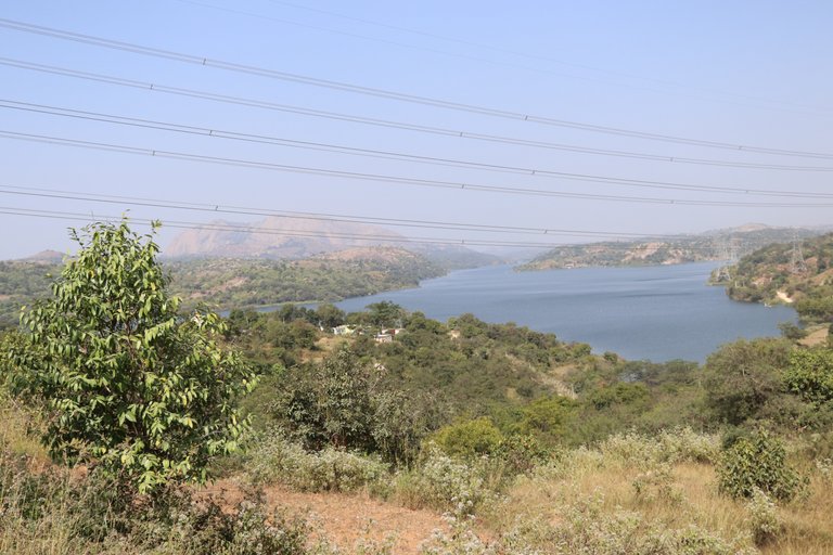
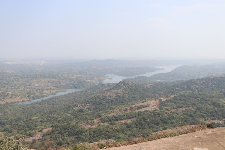
Manchanabele Dam/Reservoir is situated in the Magadi taluk of Ramanagara district in Karnataka. This reservoir is built across river Arkavathi. It's located at a distance of 35 km from Bangalore and it's known for film shooting place because of its picturesque look.
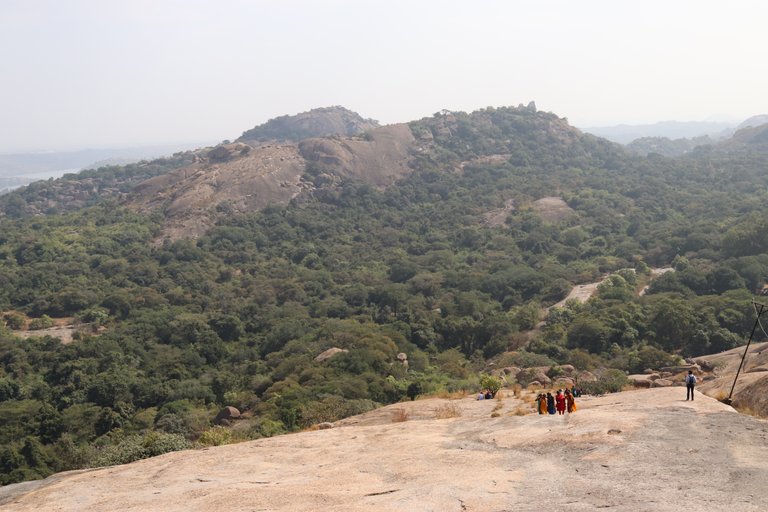
Savandurga Hill is among the largest monolithic hills in Asia and is located around 50 km from Bangalore. It is formed of two hills Karigudda and Biligudda.
Route Taken - Bangalore -> Kengeri Bus Terminal -> Dodda Aladmara Road -> Donnenahalli Road -> Manchanabele Reservoir -> Savanadurga - Manchanabele Road -> Savanadurga Hill
Google Map - Bike Trip Google Route Map
I started from Bangalore around 10 AM. The ride was smooth throughout and around 11:30 AM I got the first glimpse of Manchinabele Reservoir and I pulled over for a couple of minutes to enjoy the scenic beauty.
Manchanabele Dam
The visitors are not allowed inside the dam because of the frequent deaths happens there but the security guard will allow you to enter if you have BWSSB pass. The guard advised me to not enter in water as it is not safe.
The scenic beauty from inside is spectacular too. Bluewater surrounded by lush green trees and mountains perfect for photoshoots. There is another entry to view the reservoir if you do not have a BWSSB pass.
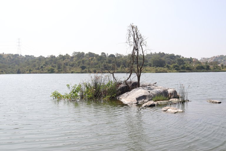
Inside Manchanabele Reservoir
After spending around half an hour inside the reservoir I headed towards Savanadurga Hill which is around 15 km from Manchanabele Dam. The Savanadurga - Manchanabele Road is excellent and the road was through Savanadurga reserved forest.
I parked my bike at the foothills and walk-up the hill on the trek route. I also need to sign a register before starting the trek, in this way the forest department keeps track of every people.
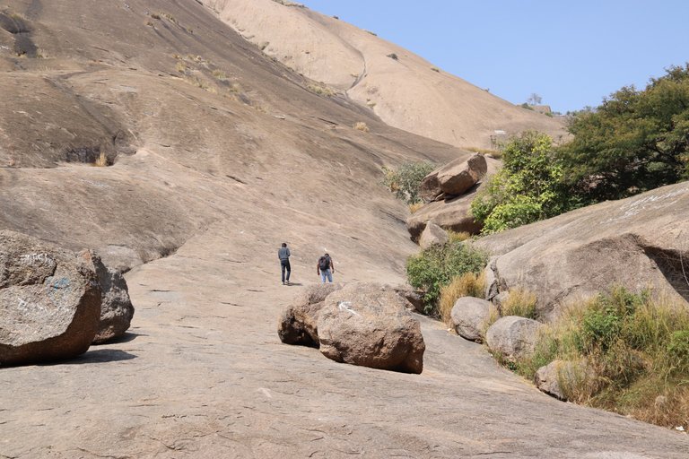
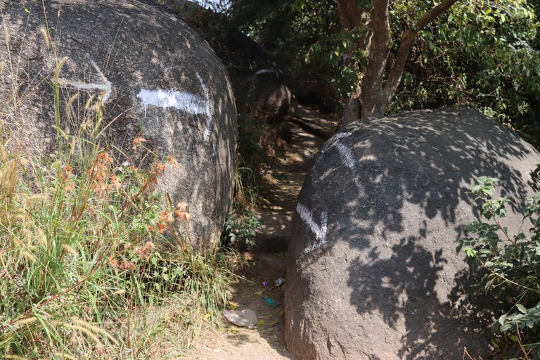
Savanadurga Trek Starting
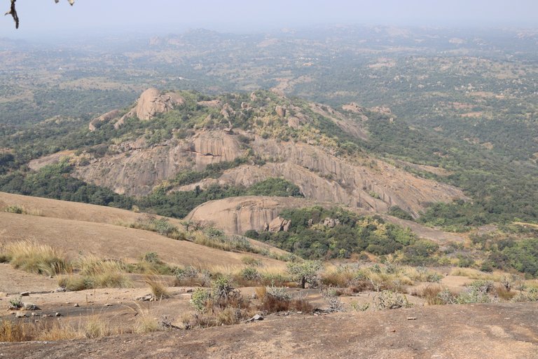
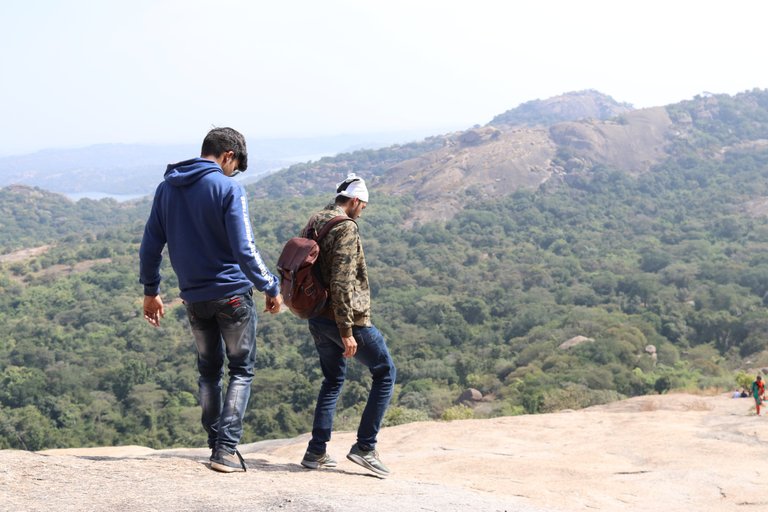
The trek was not that difficult though the hills have gentle trek which can be climbed by first time trekker. The problem which I faced was that it got quite hot as the sun was on the top. Luckily I had water as well as few chocolates with me to keep my hydrated. At one point of time, the trek was very steep and thus I had to literally held my nerves to climb that.
The initial stretch seems to be the toughest one for everyone because the slope was very steep which makes it hard to climb and thus it makes one exhausted while starting the trek itself and thus you need to keep yourself hydrated. Since the rock is steep, you need good grip shoes. Because of the nature of these slopes, the hill is named Savandurga (Savina = death + Durga = fort) which means the Fort of Death in Kannada.
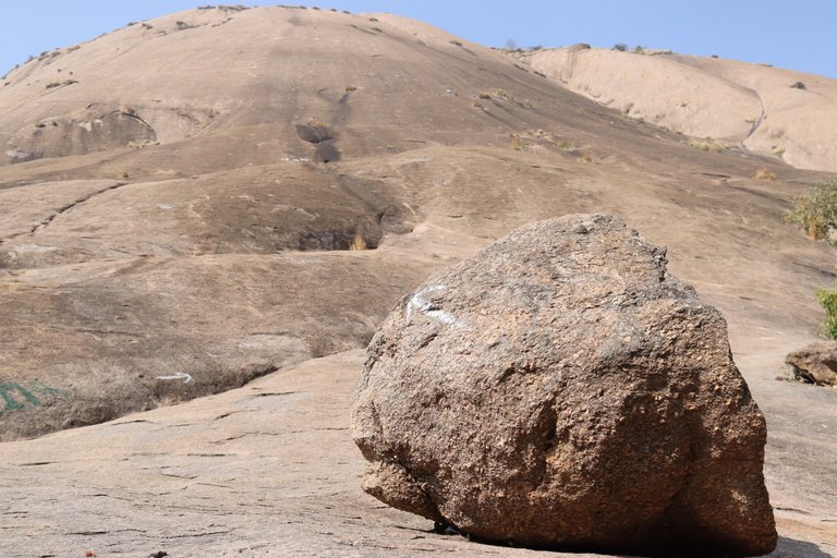
The trekking had signs at which direction to go, but if you miss one of the signs you might able to get lost in the forest and a lot of time will be lost. After an hour or so I have reached the first fort wall from there the trek became relatively easy.
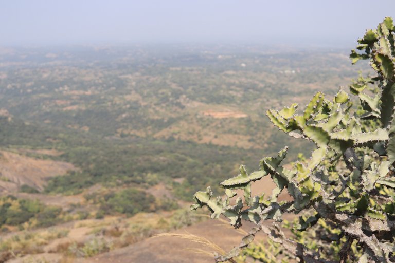
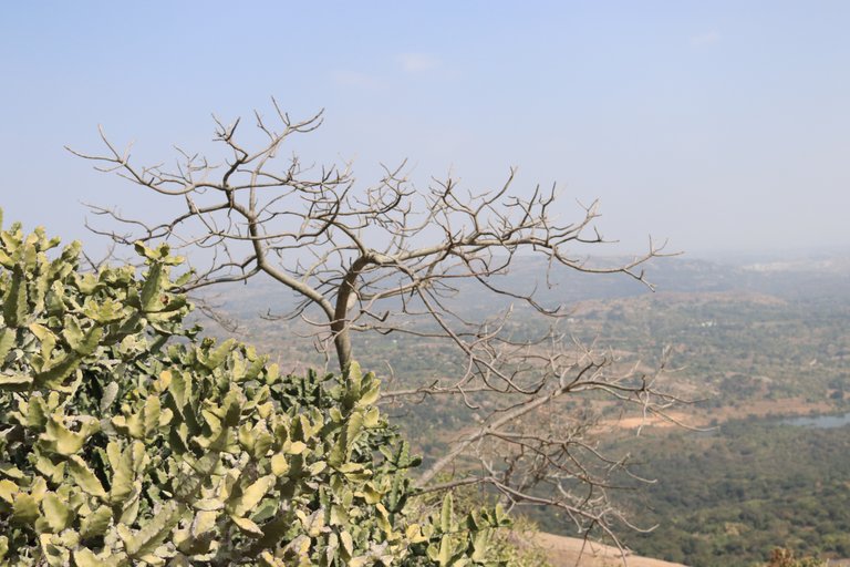
Once you reach the top, you will be astonished to see the beauty of the surroundings. There was forest cover just adjacent to the hill and you can actually see all those while standing on top.
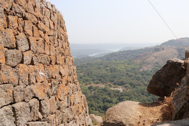
After crossing the first fort wall the slope becomes gentle and I can see a lot of people standing near the top and doing photoshoots. The second fort wall seems to be more beautiful than the first one and people tend to spend more time on this fort wall.
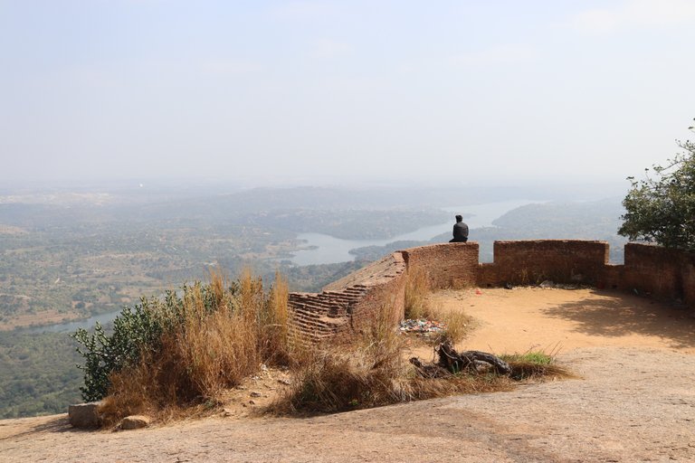
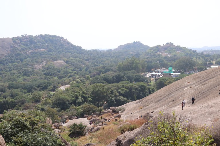
The final stretch is the quickest one, as well as the easiest one, where I have passed through the caves then, ascend very steep boulder. The clear blue sky and the expanse of green below it make for a mesmerizing sight. It is one of the excellent places for photography, as it provides a vantage point for landscape photography.
Coming down was quite easy as the gravity did the rest of the work.

#posh initiative
How did you get the BWSSB pass ? 😀
I think he didn't 😆
Hahahaha, I did not had the BWSSB pass that's why I could not see the whole dam though since I was alone he allowed me to go to inside few meters.
this looks kind of interesting site to visit 🙏
Yes these two sites are interesting as well as tiring too.
I have put this spot in my wishlist
At first I was searching for the dam in these pictures but as I started reading the post I probably knew the reason why I can't see it. Beautiful sceneries.
So may be one more destination to be written in my bucket list. Thanks for sharing .
Yeah the water which you can see is just on the dam, dam is actually not visible, and if you had to really see the Dam then you need that pass. Yes, it's a nice trekking location.
Cool brother,
Have made many trips here and the best memory was in 2013, when it was not guarded and we swam in the back waters. I guess a BMTC bus still gets inside the gates with out checks. Better to hop in 😁
And Savandurga is a hell of a climb. The air blow on top.
Thanks for writing, reminded me all those days 😊😊
Wow, great to hear about your memories. The BMTC bus is not allowed anymore inside the gate as far as I know. Many people tried to bribe the gate keeper, but they were not allowed. Savan durga was a great trekking experience like most of the other trek I have done.
I remember there is a small village where the bus service is allowed. Saw the BMTC entering the gates in Feb this year.
Ohh, then I am not sure might be they have come for picnic by taking the BWSSB pass.
May be we should try after the lockdown or enter from Magadi Roads (Just checked Google maps) 😁
Yes I am ok with that, let's go.
Superb photos.
Thanks man
Great pictures. It is really wonderful going down with gravity.
Thanks, yes it was good expeience