Read this post on TravelFeed.io for the best experience
Up is the new down, soluble coffee the new gingertea and St. Miguel beer the new Everest Beer. Today we have to walk from Langtang to Kyangjin Gompa, the where our summit storm should start. Under bright sunshine, we leave Langtang and head back on our feet out onto the plateau, past magnificent looking water treatment plants, next to which in Germany there would inevitably be a sign pointing to EU funding.
Here it is missing and the plant at the edge of the village does not work at all. But it looks like good engeneering! Along an endless Mani wall than the way goes up very slowly, this time the mission is only three hours long, then we are in Kyangjin Gompa and at an altitude of 3.800 meters.
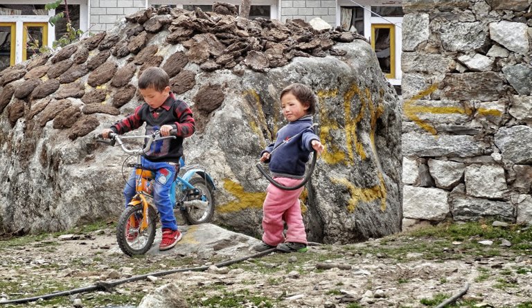
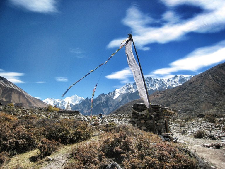
For us, who have been walking for more than a week now, what feels like a year, this is actually just a walk. Along beautiful mountain meadows we walk over even more mountain meadows, now and then a house appears, then a mani stone, a shepherd's hut and a few prayer flags in the neighbourhood. Prayerstones are piled up to whole towers. The stone carving industry must be booming here - but it must be, because apart from carving mani stones, herding animals and hauling wood there is not much work in this region, because this dream paths under prayer flags are still largely forgotten by tourism.
Right next to the lodge is the imaginative peak called Kyangjin Li, which is scheduled for the afternoon as a test for the big mountain run tomorrow at the morning. The summit does not look very impressive, the people in the village call it the local mountain. For us he looks high enough.
Down in the village, which actually only exists because trekkers like to rest here at the end of the valley before they climb the next mountain and then turn around and go back home, there is not much going on. The final part of the Langtang Valley is a kind of an end of the world. Le's sing a little bit Jim Morrison: "This is the end, my only friend, the end of our elaborate plans, the end of everything that stands, the end". From here you can see for the first time that the valley owes its shape mainly to the glaciers of the last ice age, which dredged out the whole mighty area.
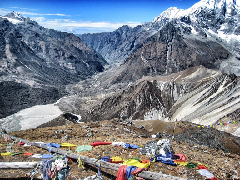
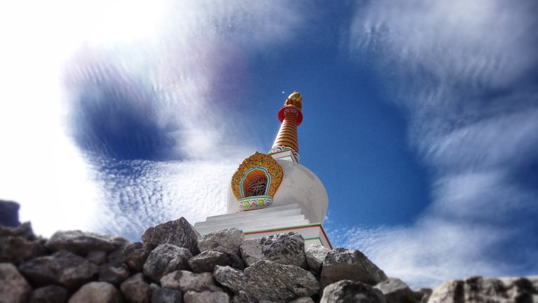
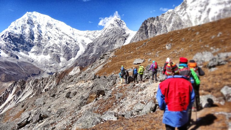
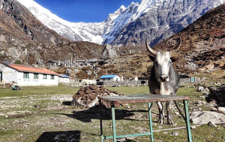
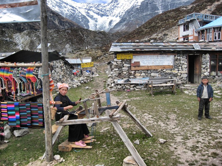
In its upper part, the bottom of the valley is flat and enables pleasant hiking, the mountains are at the left and right side and in front, where it is not possible to continue. But it is still possible to get close to some glacier tongues that have deeply cut into side valleys and mountain flanks without any problem. A Buddhist prayer room and an old cheese plant set up on a Swiss initiative are the two sights, along with intrusive mules and large rocks where yak droppings are dried for the evening fire.
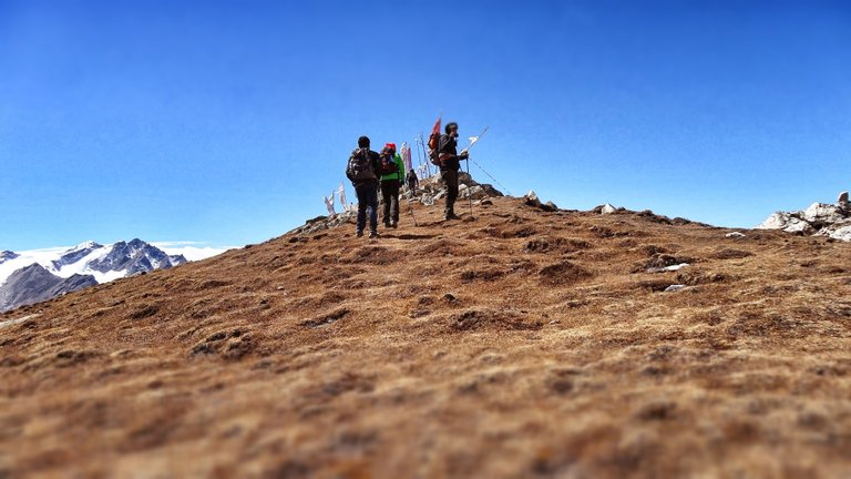
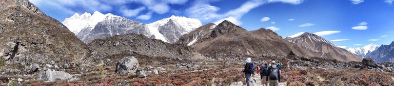
After the midday rest, the tour starts, steeply up to the higher of the two Kyangjin Peaks, which should be reached in a tight hour. But the way is more exhausting than expected. We climb endless serpentines on the right flank of the mountain straight up. Suddenly we notice the altitude of well over 4.000m in our lungs, despite the many days of acclimatization. We constantly have to take breaks in order to catch our breath. Air!!!!
At the top stone pyramids and prayer flags fluttering in the wind, deep down the lodge, in front of which the lazy part of the group is sitting in the sun. We lie in each other's arms, very happy. From 4.300 meters we see the glacier next door, a bunch of six-thousand-metre peaks and the main Langtang peaks, but also the Tsergo-Ri.
The big, big one, which tomorrow has to come.
If you like my work please follow me Travelfeed
Last round here
Some more picture:

View this post on TravelFeed for the best experience.
Congratulations @koenau! You received the biggest smile and some love from TravelFeed! Keep up the amazing blog. 😍 Your post was also chosen as top pick of the day and is now featured on the TravelFeed.io front page.
Thanks for using TravelFeed!
@worldcapture (TravelFeed team)
PS: TravelFeed is in social media to reach out more people, follow us on Facebook, Instagram, and Twitter.
Hiya, @choogirl here, just swinging by to let you know that this post made it into our Top 3 in Daily Travel Digest #835.
Your post has been manually curated by the @pinmapple team. If you like what we're doing, please drop by to check out all the rest of today's great posts and consider supporting other authors like yourself and us so we can keep the project going!
Become part of our travel community:
Congratulations, your post has been added to Pinmapple! 🎉🥳🍍
Did you know every user has their own profile map?
And so does every post as well!
Want to have your post on the map too?
@tipu curate
Looks like TipU let me down this time. But still an amazing post which will get great recognition.
Thank you for the journey! In days of lockdown, seeing such an adventure makes us less stressed. I wonder when we'll be able to go out again. It also makes me wonder, do people in such isolated places even know about the pandemics. Happier life I imagine.