I started the third day of my journey again with the sunrise. Unfortunately, I woke up to a cloudy morning, so even this morning there was no morning photo shoot. I packed up and set out to explore the town of Scheiblingkirchen, which was a few hundred meters from where I had spent the night. It was Sunday, so I was sure I wouldn't buy anything, but I was short of water. I remembered that there was water in the cemeteries, so I went to the nearest one, which was also the way I wanted to go. Succeeded. The water was replenished and I could go further in the direction of Thann.
Třetí den mého putování jsem zahájil opět s východem slunce. Bohužel jsem se probudil do zamračeného rána a tak se ani tento den nekonalo ranní focení. Zabalil jsem se a vyrazil jsem na průzkum města Scheiblingkirchen, které bylo pár stovek metrů od místa kde jsem nocoval. Byla neděle a tak bylo jisté, že nic nekoupím, ale chyběla mi voda. Vzpomněl jsem si, že na hřbitovech bývá voda a tak jsem šel k nejbližšímu, který byl navíc cestou, kterou jsem chtěl jít. Povedlo se. Voda byla doplněna a já mohl jít dále směr Thann.
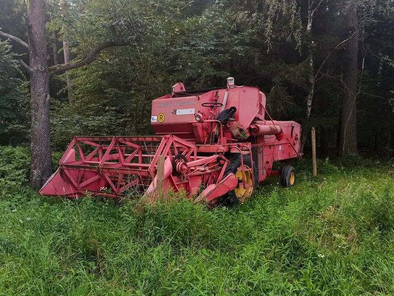
There were only a few fields and meadows between Thann and Kulm, and sometimes agricultural machinery was parked here in places I wouldn't really expect. For example, this combine on the edge of the forest. From Kulm to Hassbach it was only a short distance through the forest, although I lost a few meters of height descending to the stream. A wedding with a large band took place in Hassbach in front of the church, so it was not possible to walk. So I stopped for a moment and watched and listened to the music. Mostly waltz was played and most of the village attended the wedding. When the road cleared, I started climbing from 500 meters to 900 meters to a place called Odenkirchen.
Mezi Thann a Kulm bylo jen několik polí a luk a občas zde byl zaparkován zemědělských stroj na místech kde bych je opravdu nečekal. Třeba na kraji lesa tento kombajn. Z Kulm do Hassbach to bylo jen kousek přes les i když jsem zde ztratil pár metrů výšky klesáním k potoku. V Hassbach před kostelem se konala svatba s velkou kapelou a tak nabylo možné projít. Na chvíli jsem se tedy zastavil a sledoval a poslouchal muziku. Hrál se převážně valčík a svatby se účastnila většina vesnice. Když se cesta uvolnila, začal jsem stoupat z 500 metrů do 900 metrů do místa se jménem Odenkirchen.
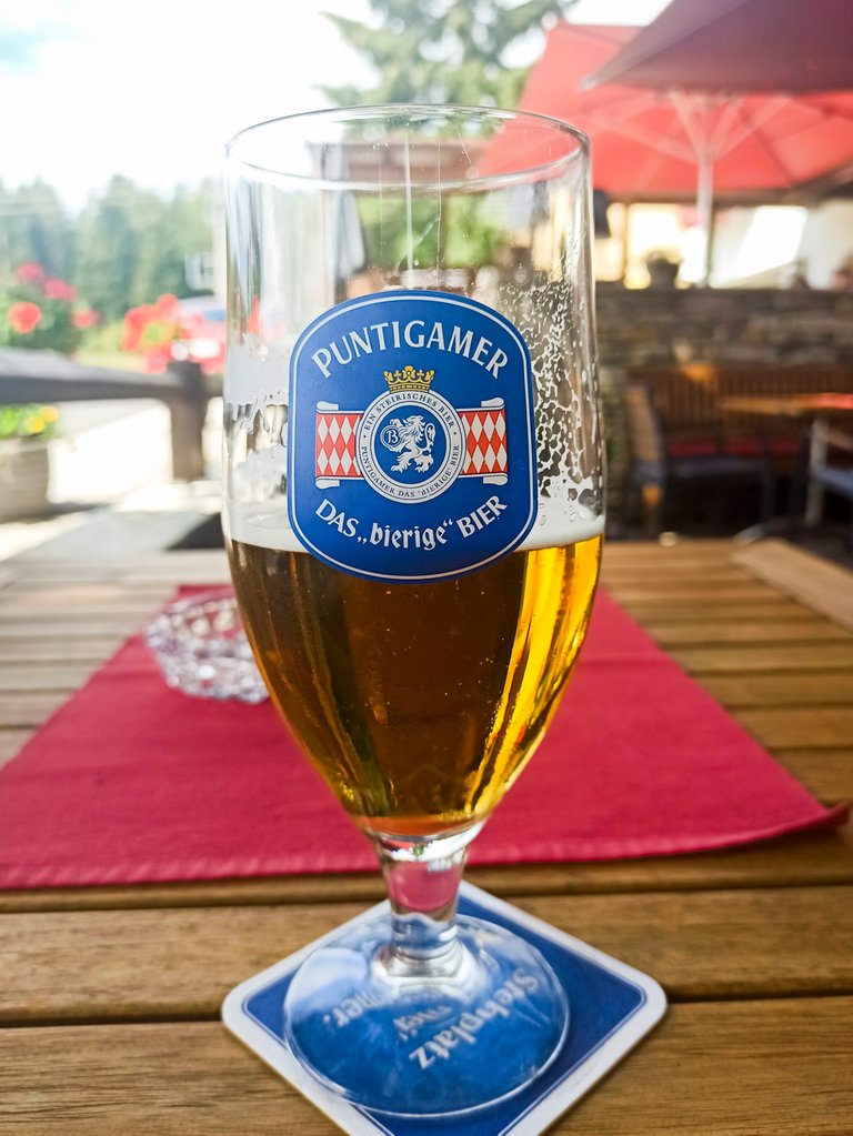
In Odenkirchen there is only a restaurant with accommodation called Zum Fally. I just wanted to have a few beers, but when I saw the food worn from the kitchen. I couldn't resist and I also had a Sunday lunch in the form of Roast Pork with potato dumplings and cabbage. The final number of beers was three, which was quite right on a hot day. After this refreshment, we had no choice but to continue towards the highest point of the day in Karlshohe at an altitude of 943 meters above sea level.
V Odenkirchen je pouze restaurace s ubytováním, který se jmenuje Zum Fally. Chtěl jsem si dát jen pár piv, ale když jsem viděl jaké jídla nosí z kuchyně. Neodolal jsem a také jsem si dal nedělní oběd v podobě Vepřové pečeně s bramborovým knedlíkem a zelým. Konečný počet piv byl tři, což bylo v horkém dni docela akorát. Po tomto občerstvení nezbývalo než pokračovat dále vstříc nejvyššímu bodu dne Karlshohe s výškou 943 metrů nad mořem.
From Karlshohe I had to descend a little more to the Ramssattel pass 824 m, from where a tractor with a trailer with tourists rode and drove them to a viewing platform made from silo. Then, practically on the plain, I went to the Nebelsteinhöhle cave, where I wanted to sleep. Unfortunately, I did not find the cave. Just a view of Nebelstein, from where nothing could be seen anyway due to the overgrown vegetation. In the rough terrain, I found a small place where my tent could fit. I made food and fell asleep at sunset.
Z Karlshohe jsem musel ještě trochu klesnout do průsmyku Ramssattel 824 m, odkud jezdil traktor s vlekem s turisty a vozil je na vyhlídkovou plošinu udělanou ze sila. Pak prakticky po rovině jsem se vydal k jeskyni Nebelsteinhöhle, kde jsem chtěl přespat. Bohužel jeskyni jsem nenašel. Jen vyhlídku Nebelstein, odkud stejně nebylo nic vidět díky přerostlé vegetaci. V nerovném terénu jsem našel, malé místo kam se mi vešel stan. Udělal jsem si jídlo a se západem slunce usnul.
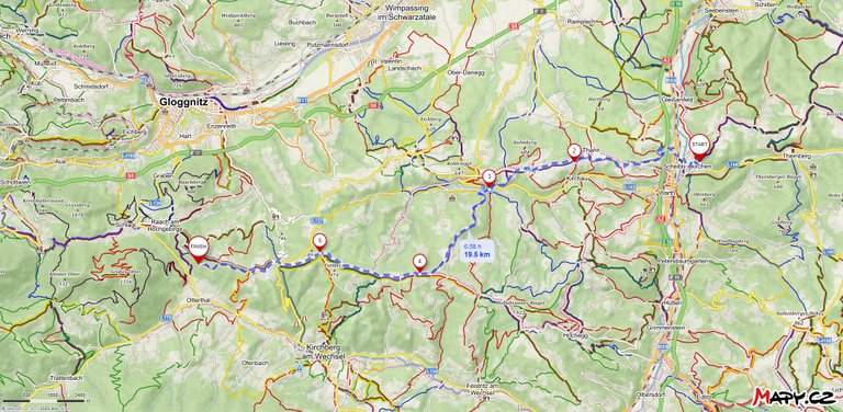
On the third day I did not find it difficult, despite the fact that I walked 19.5 km and climbed 787 meters and fell by 385 meters. I didn't even take pictures of this day, because I spent most of my time in the woods or on the road. Sometimes I had to look for a hiking trail, because this part was not very touristy.
Třetí den mi nepřišel ani nijak náročný, i přes to že jsem ušel 19,5 km a vystoupal 787 metrů a klesl o 385 metrů. Dokonce jsem ani tento den nefotil, protože jsem většinu času strávil v lese a nebo na silnici. Občas jsem musel hledat turistickou stezku, protože zrovna tato část nebyla moc turistická.
Through Austria on the E4 (part 1)
Through Austria on the E4 (part 2)
Congratulations, your post has been added to Pinmapple! 🎉🥳🍍
Did you know every user has their own profile map?
And so does every post as well!
Want to have your post on the map too?
Hiya, @LivingUKTaiwan here, just swinging by to let you know that this post made it into our Honorable Mentions in Daily Travel Digest #965.
Your post has been manually curated by the @pinmapple team. If you like what we're doing, please drop by to check out all the rest of today's great posts and consider supporting other authors like yourself and us so we can keep the project going!
Did you know if you post from our haveyoubeenhere and pinmapple community you could get greater support from us https://peakd.com/c/hive-163772/created. You can find out more about it in this post here
https://peakd.com/hive-163772/@steemitworldmap/good-bye-from-steemitworldmap
Become part of our travel community: