Well that was miserable...

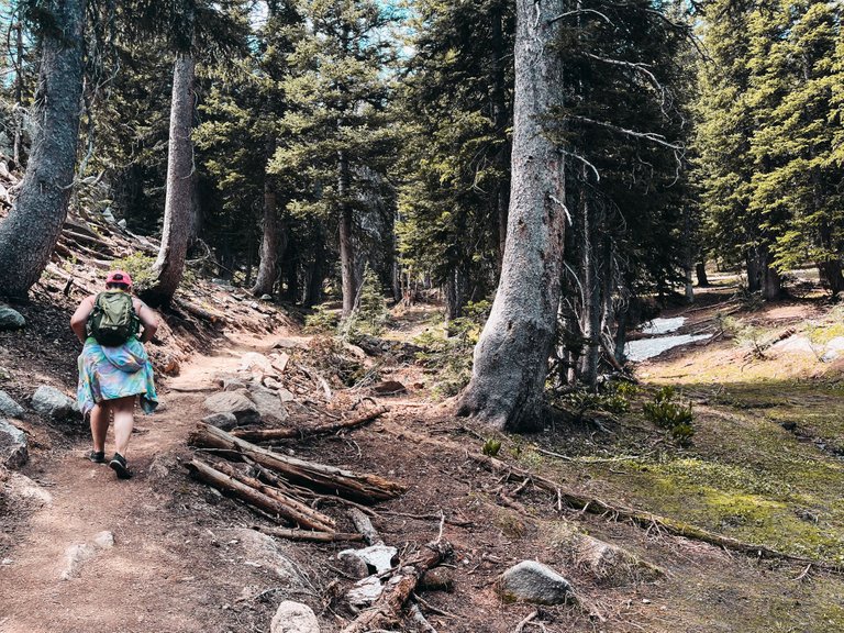
So yesterday, my wife and I set out on a hike for Gloria Falls up in Little Cottonwood Canyon in Sandy, Utah.
What started as a short 2.8 mile hike that should have taken just over an hour or so ended up being over 6 hours and nearly 10 miles. It would have been fine if that was what we had planned for, but we were not prepared for this hike AT ALL.
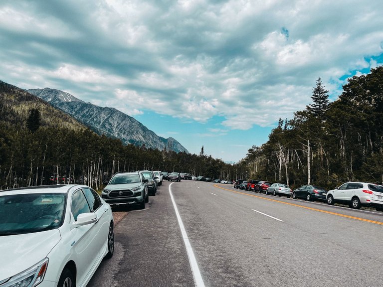
When we got to the trail head at around 9am, it was already packed with cars and we had to park about a mile up the road, so we were already getting almost an extra mile just hiking down to the start of the hike.
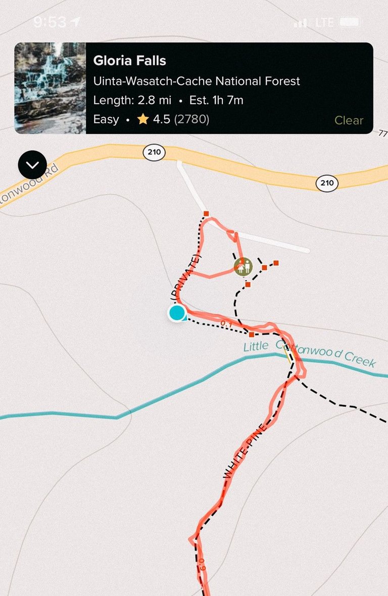
The trailhead is the start of about 3 or 4 different hikes and there are little signs that point you which direction you need to go, but there was nothing for Gloria Falls, but luckily I had my AllTrails App that has GPS and the trail marked on it. So we headed out.
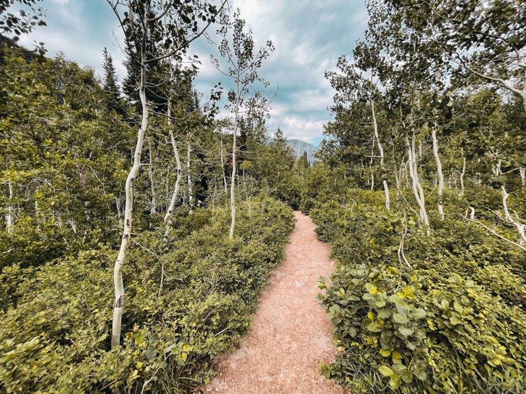
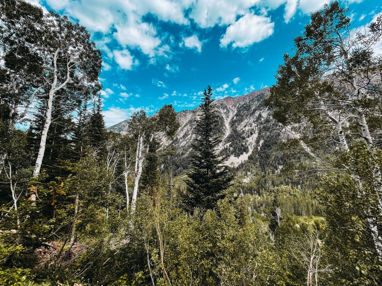
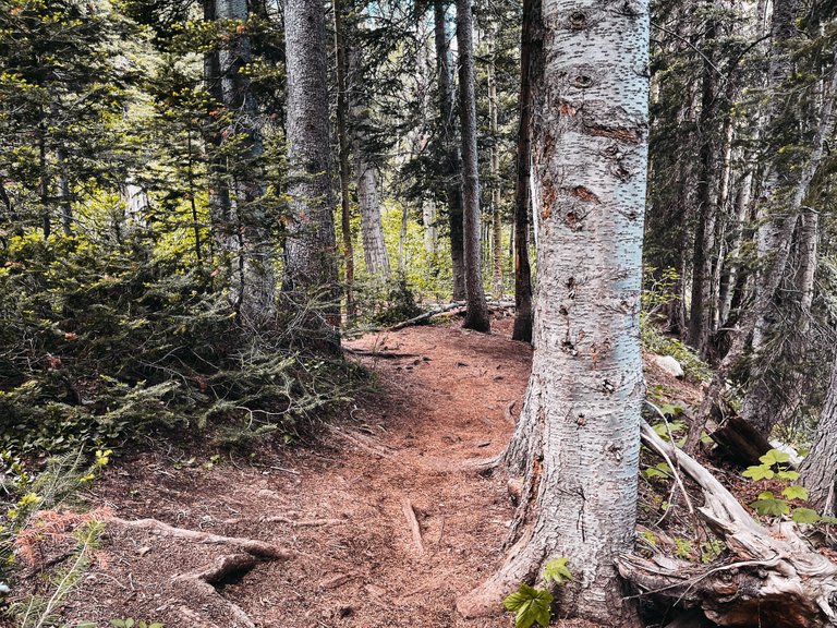
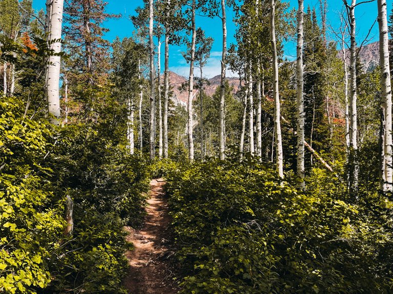
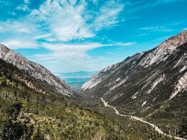
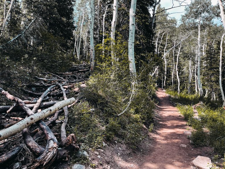
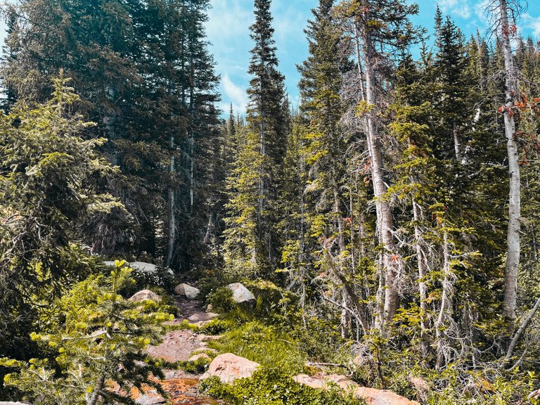
It started off as a pretty awesome hike. The scenery was beautiful and the weather was a nice cool 67 degrees. We even had a light rain as we started.
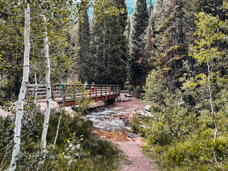
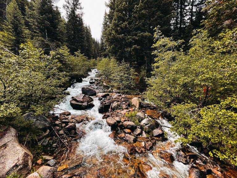
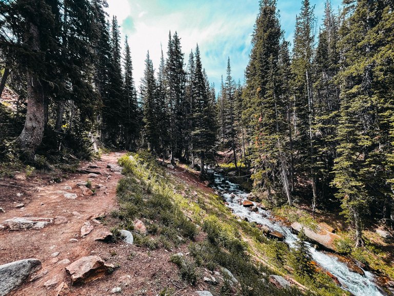
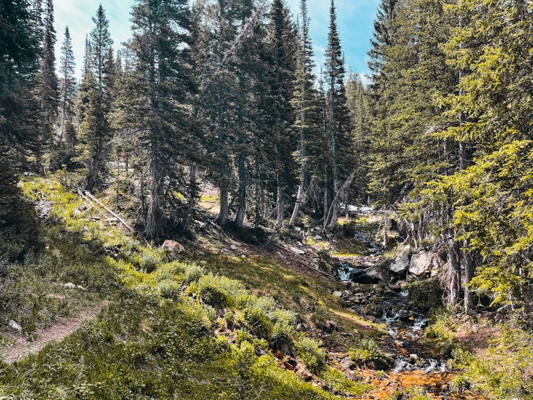
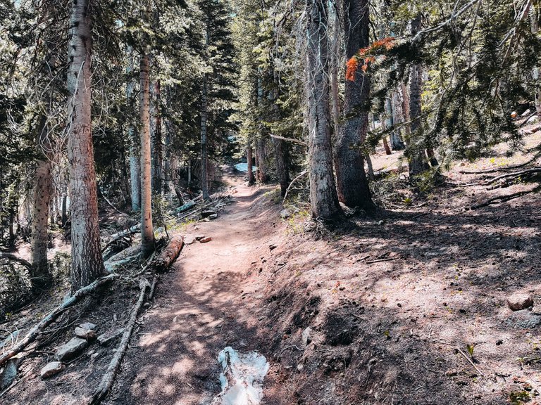
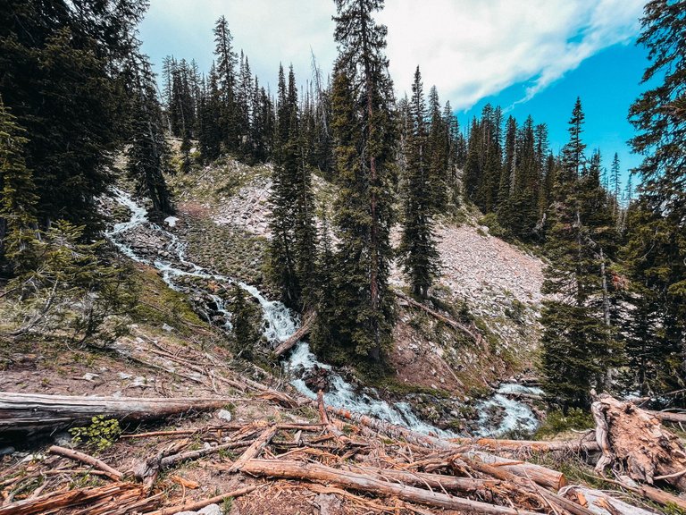
There are a lot of bridges over the water that is coming down the mountain. The water was nice and cold too, which would feel great when it gets too hot.

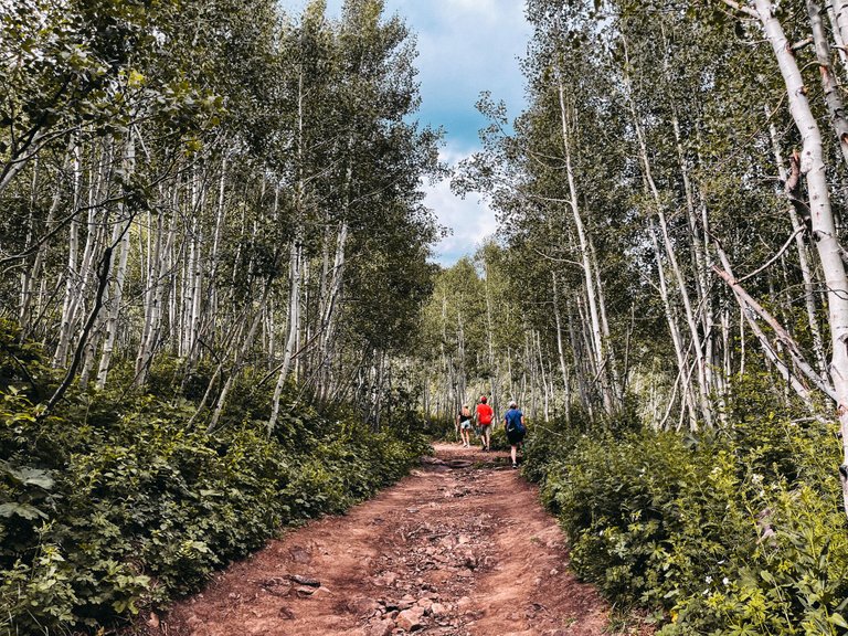
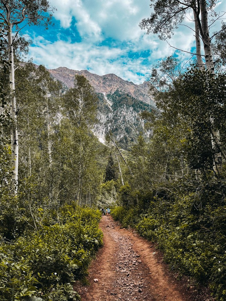
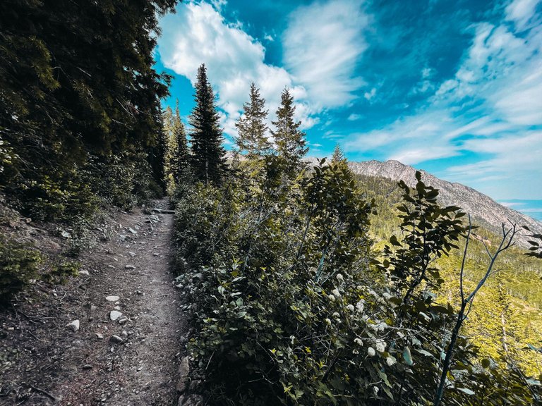
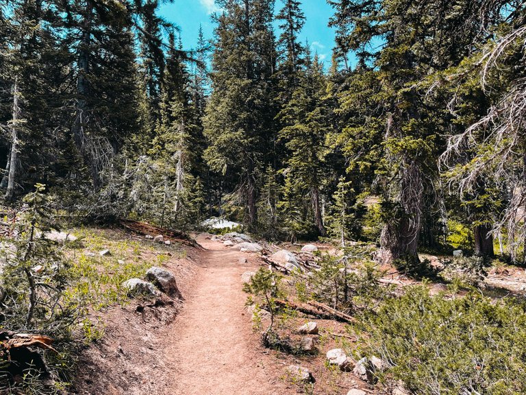
The trail was pretty crowded with people as we headed up. Normally I don't like it being crowded, but on hikes that we don't know yet, it is nice to have people to follow so we know we are heading the right way.
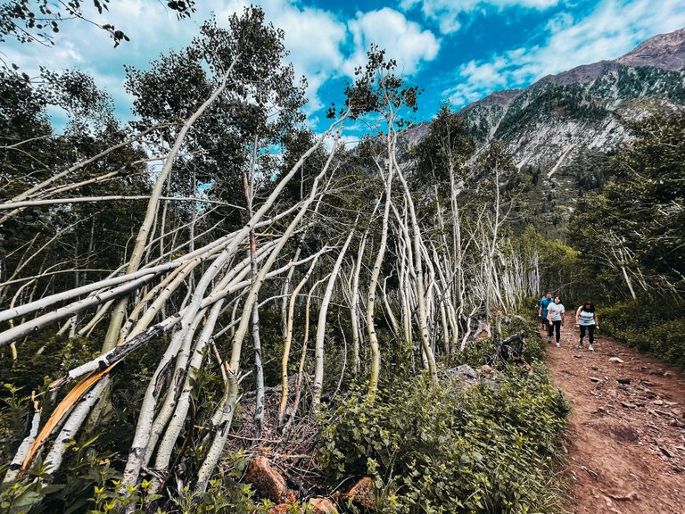
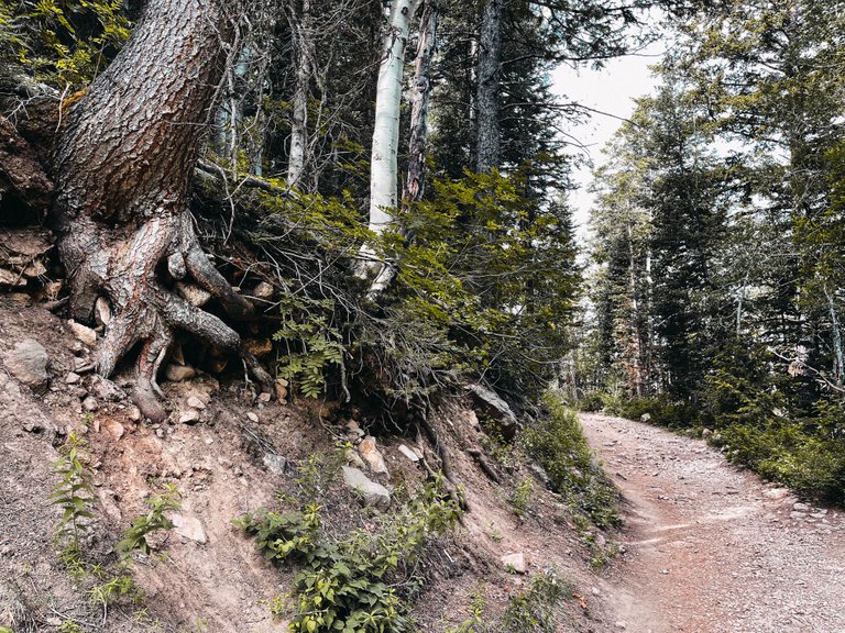
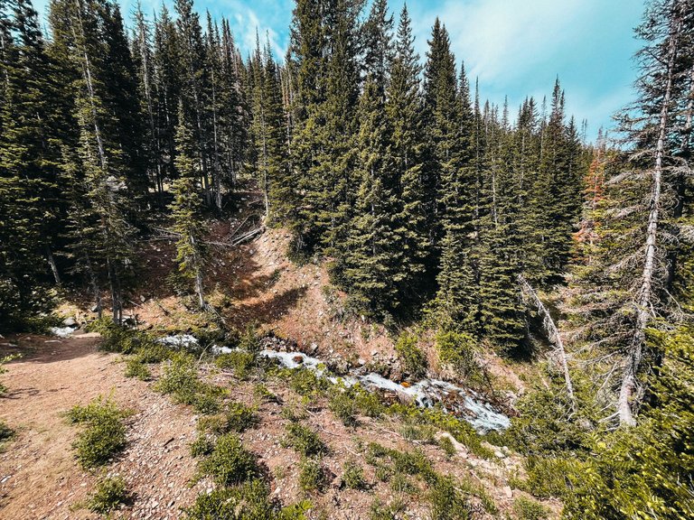
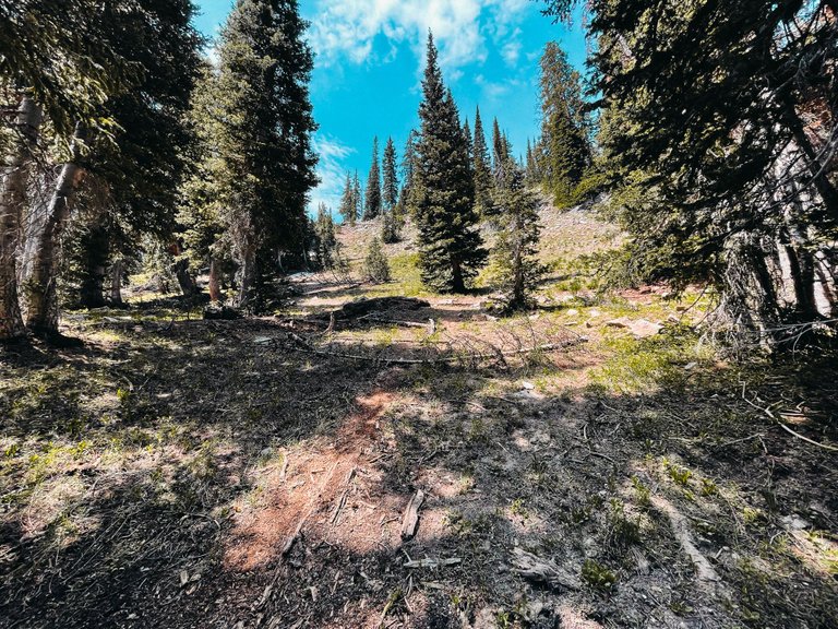
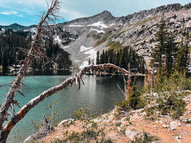
This area get a lot of snow during the winter and I think it had an avalanche during this past winter because there were spots where the trees were bent over like this.
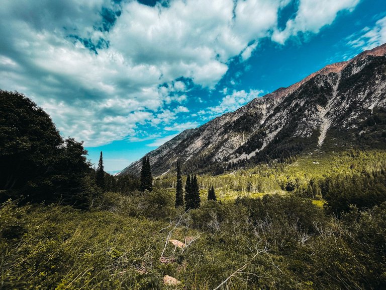
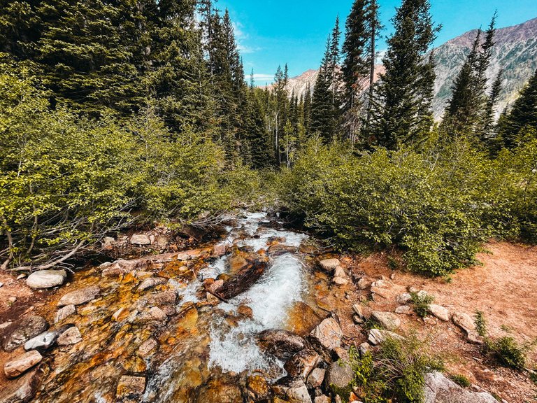
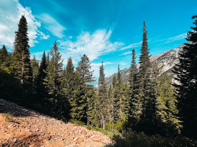
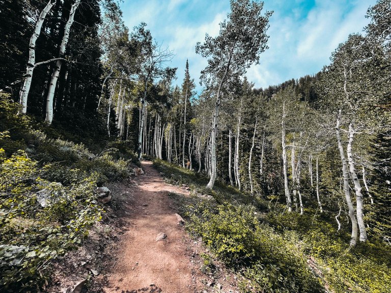
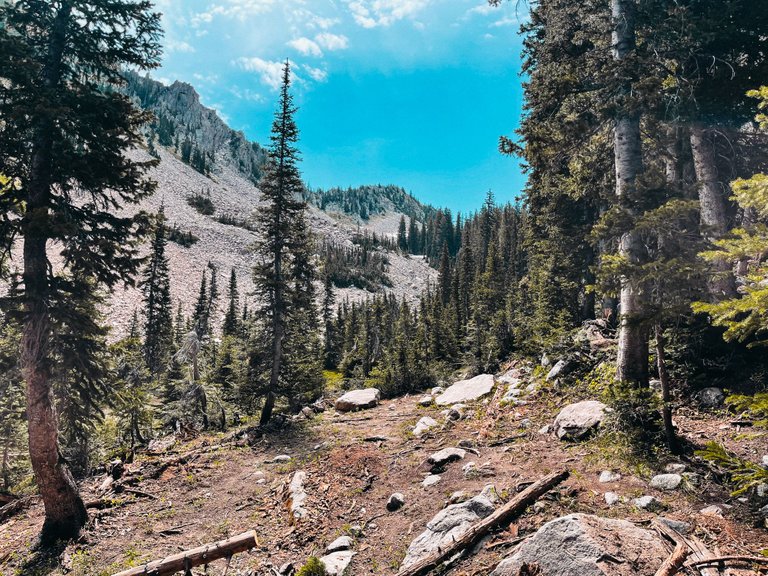
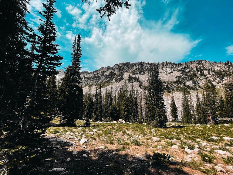
Such an incredible view that just keeps getting better the higher you head up the mountain.
The weather was perfect.
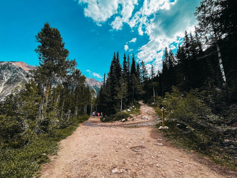
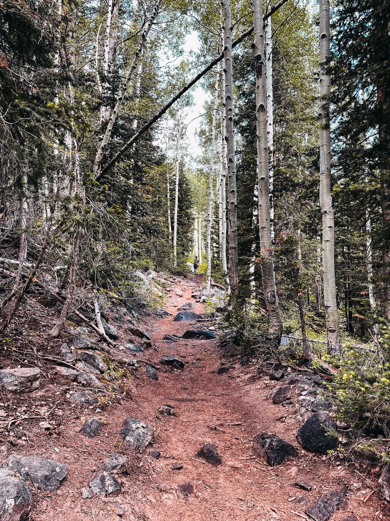
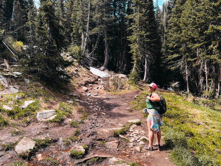
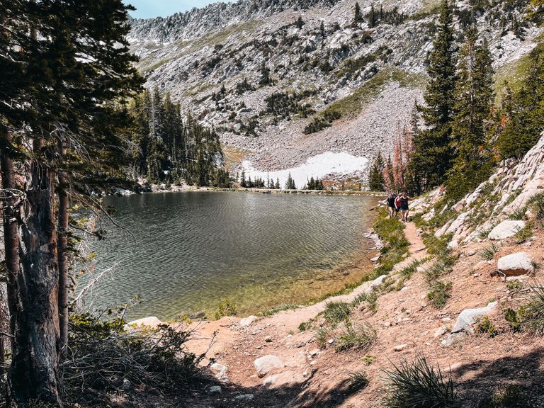
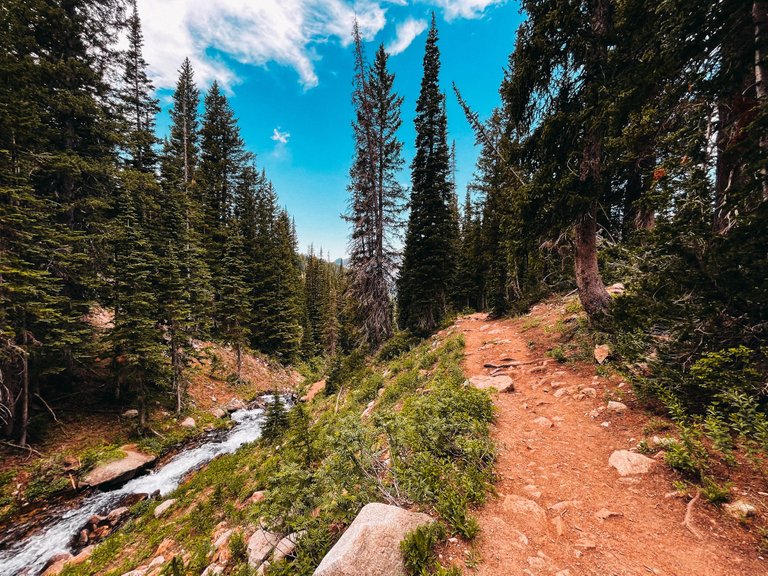
This was the first split in the trail. If you take this trail up, it will take you to White Pine Lake. We didn't know anything about that hike, we we stayed on the trail we were on. I checked my AllTrails app to see how much further we had, and noticed that I had no cell service, so the app wouldn't open and display any information. So from here on out, it was pretty much a guessing game on whether or not we were heading in the right direction.

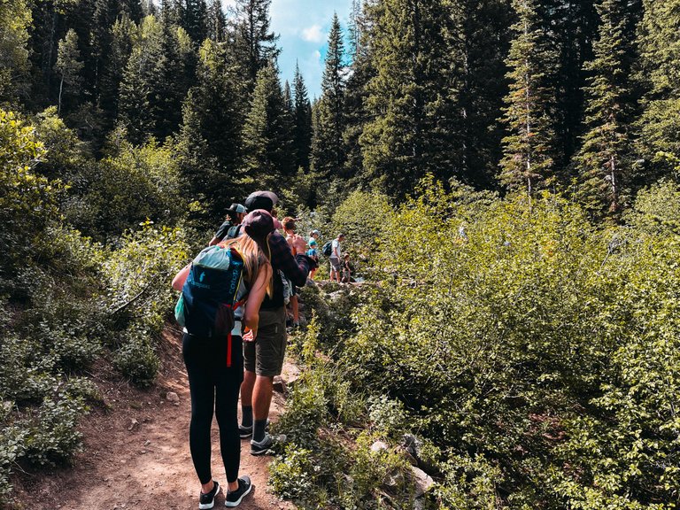
Luckily we had people ahead of us still that we could follow.
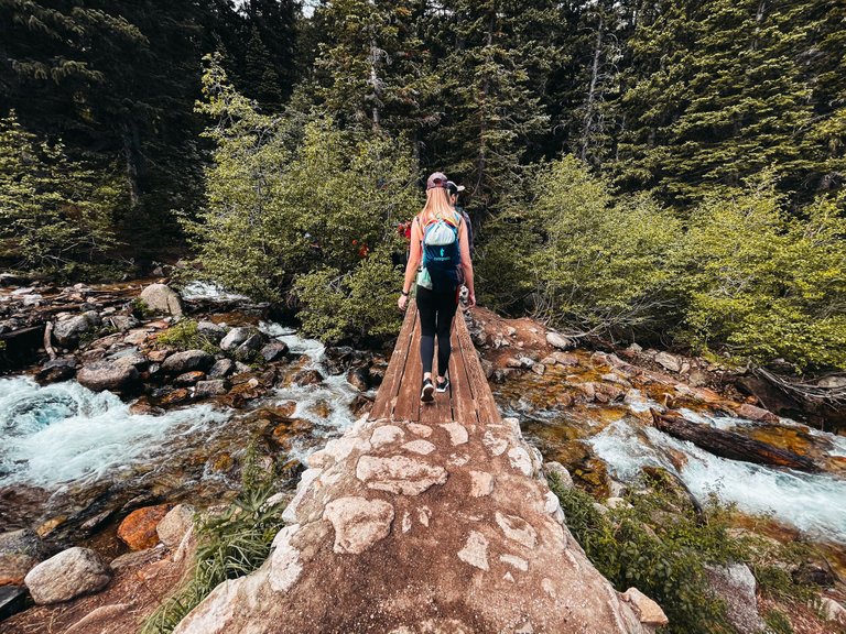
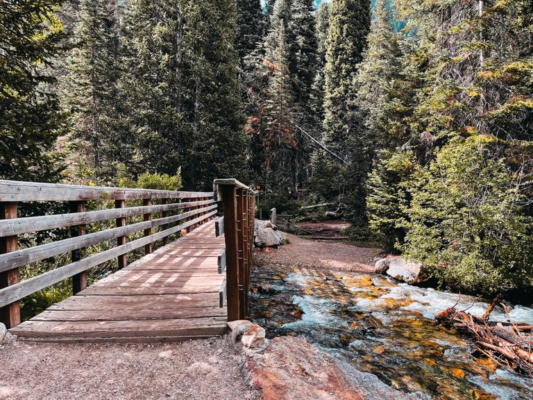
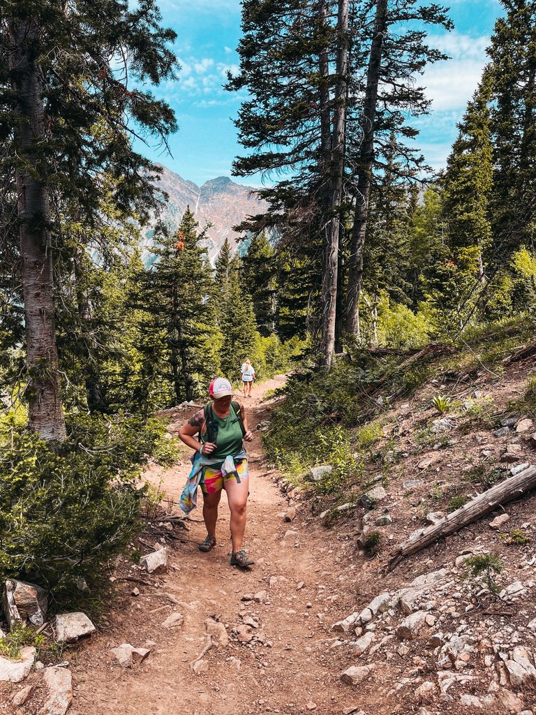
This is the point of the hike where everything changed. There was some old lady at the end of this bridge that was just standing there and blocking everything, so we all started getting backed up on this bridge.
It gave me some time to take a few pictures on the bridge though, but I was started to get annoyed and the line behind us was backing up as well.
So I let the old lady know she was holding up EVERYONE and that we needed to get by her. So we squeezed past her and everyone else and headed up the trail.
The trail split right after the bridge and to the left it went alongside the water and to the right was a nice looking trail that went further into the woods. Well when we went past the old lady and everyone she was with, they all moved to the left, which blocked our view of that trail and we didn't even know that existed and all we saw was the trail to the right.
Ya, the trail to the left is the one we should have taken. With no service on our phones so we couldn't check the app, we headed up the mountain further. At this point we were almost an hour or so in, so I figured we should be getting close.
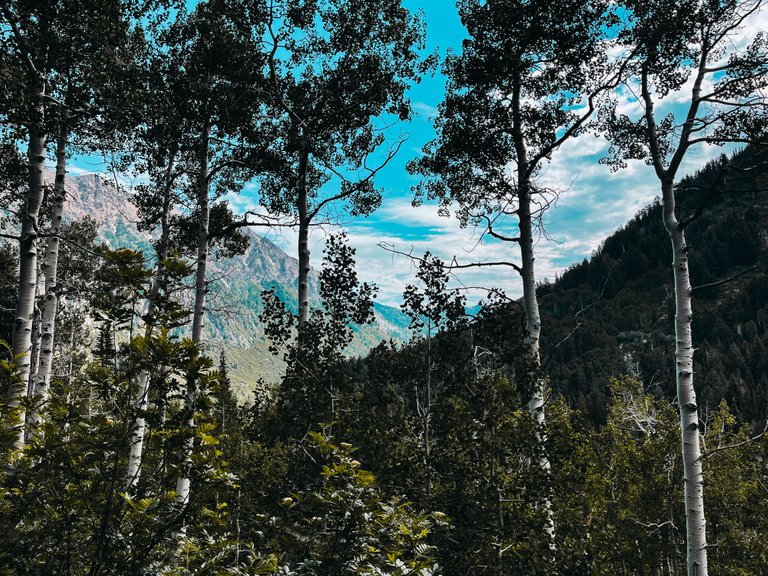
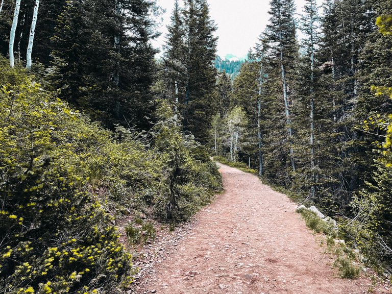
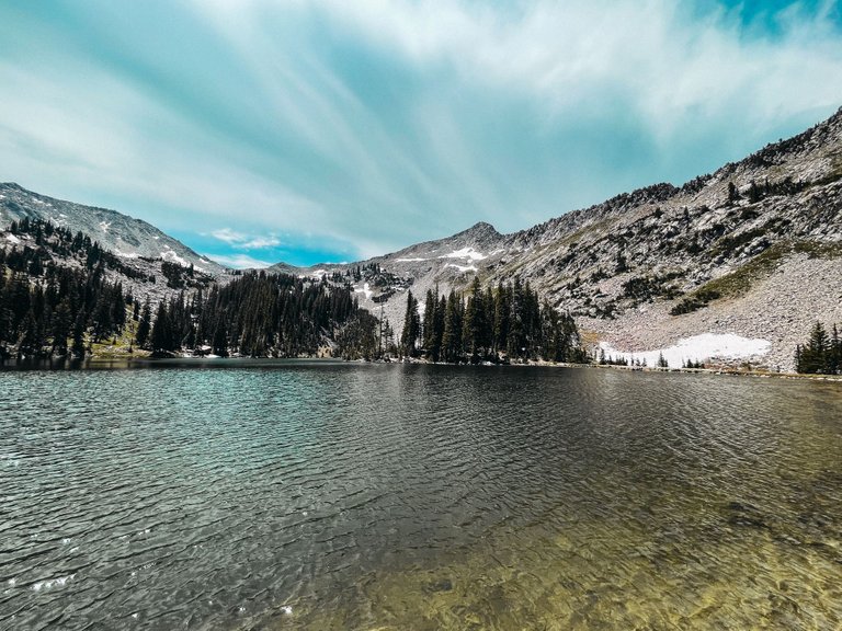
We kept walking and checking out the awesome views.
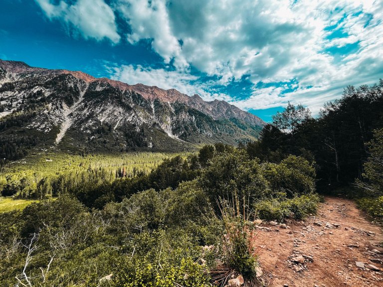
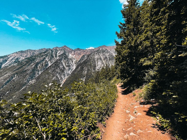
This hike did have some of the best views from any of the hikes that we have done, but I started to think that we were heading the wrong direction cause time kept on passing.
We also did not have any groups ahead of us or behind us on the trail anymore.
We started seeing some people coming down the trail, which was good, cause it let us know we weren't just wandering around lost.
It was close to this part where I asked some random dude coming down the trail if we were getting close to the falls. He told us we were heading up to a lake and not the falls and said we were about 2.5 miles away from the lake. This was where we had a decision to make. We have already been hiking for nearly 2 hours and going up another 2.5 miles means that we would have 2.5 miles back down just to get to this point again. So we decided to just go for it.
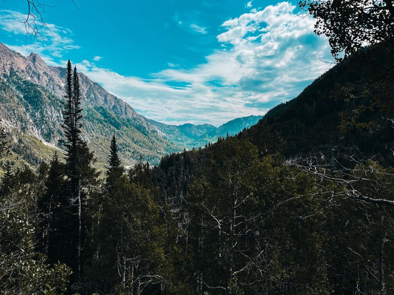
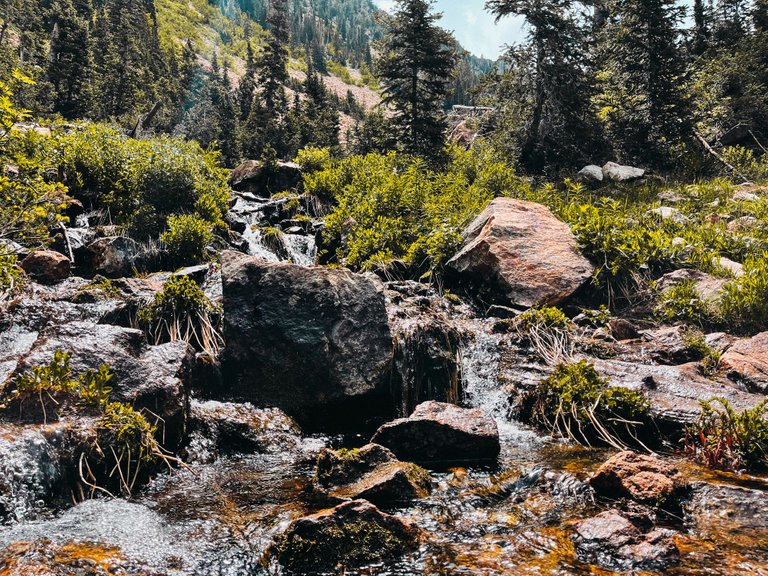
With views like this on the hike, why would we want to turn back? Well for one, we should have turned back because we didn't pack any food because we were only expecting to be hiking for about 2 hours. We should have turned back at this point before we had gone up too much further.
The trail started to get steeper and steeper the further we went up. This slowed down our speed quite a bit. Luckily it was getting cooler the further up the mountain we headed.
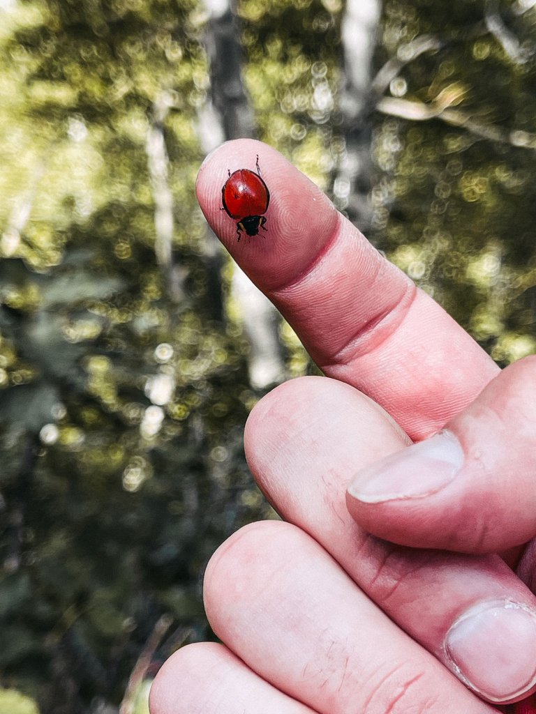
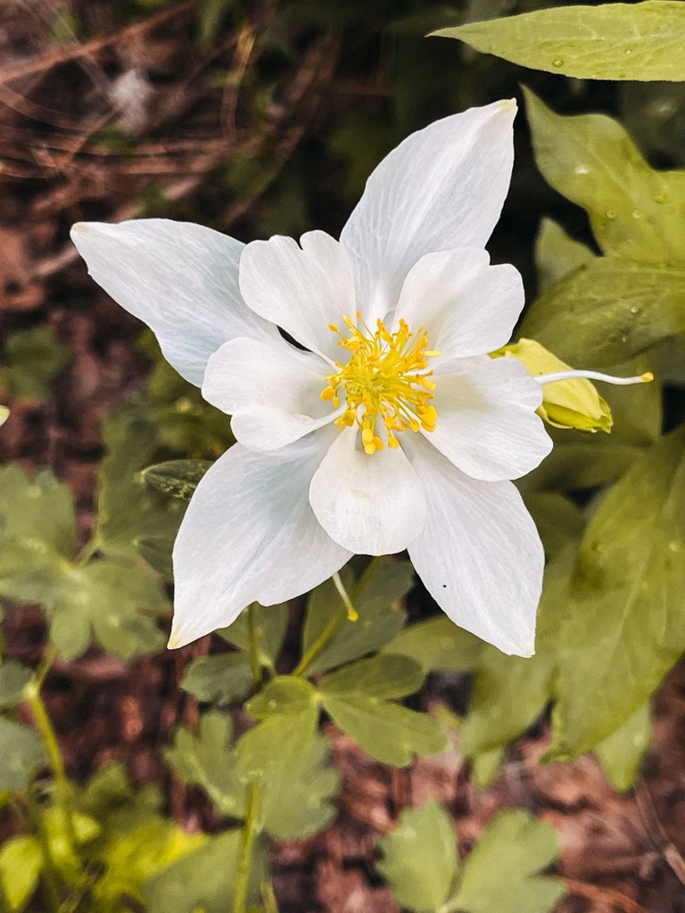
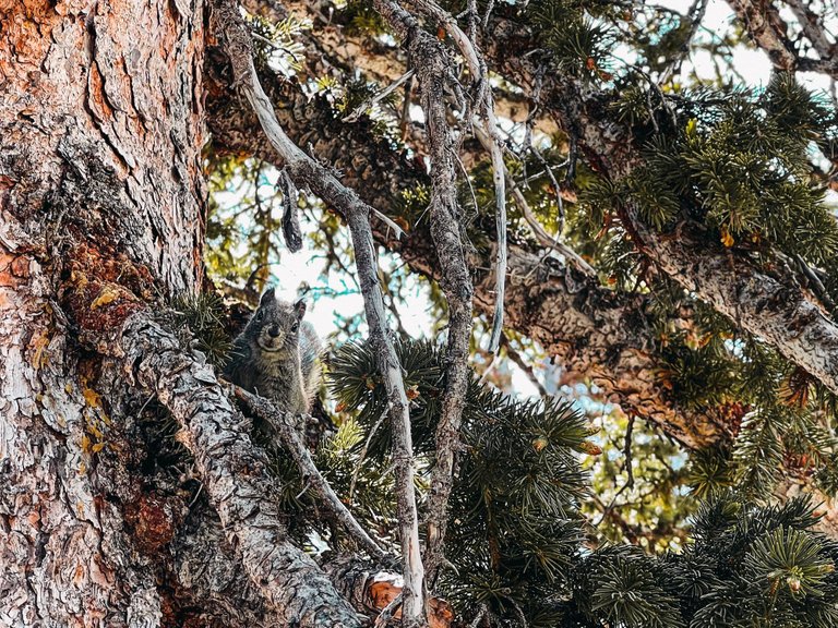
I found a lady bug with just one dot on it. Thought that was cool.
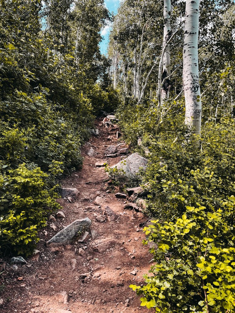
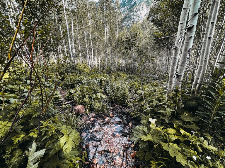
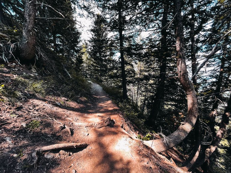
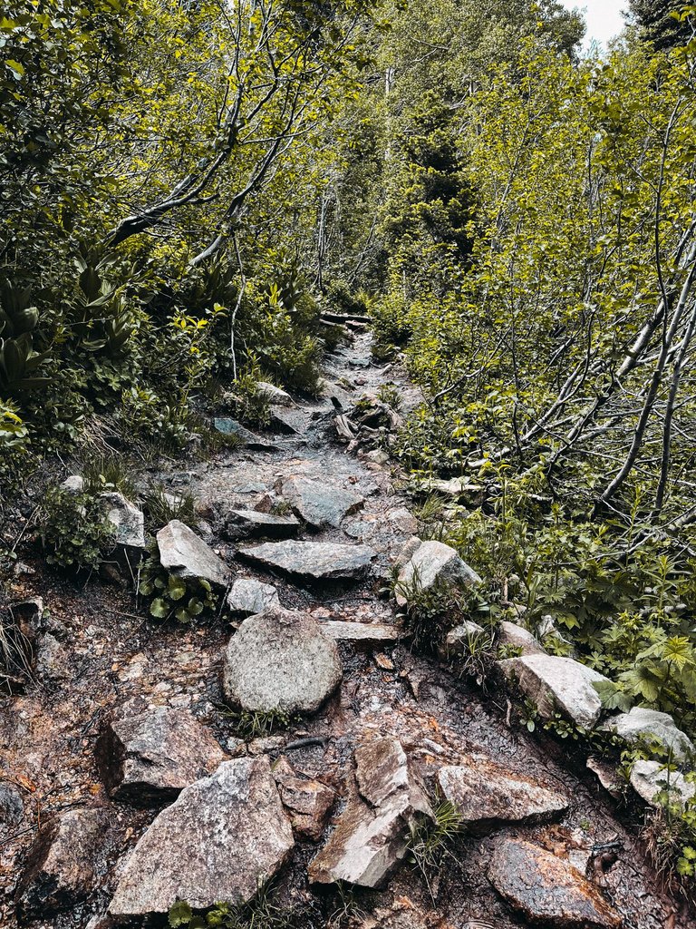
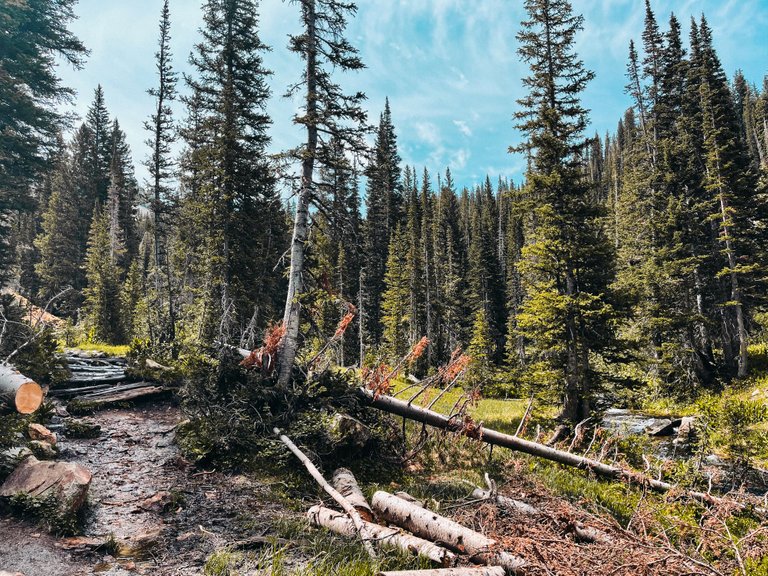
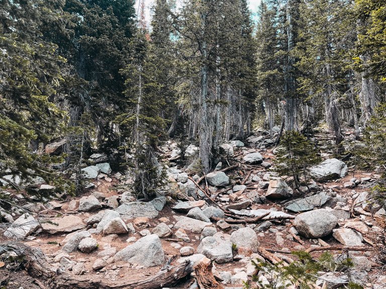
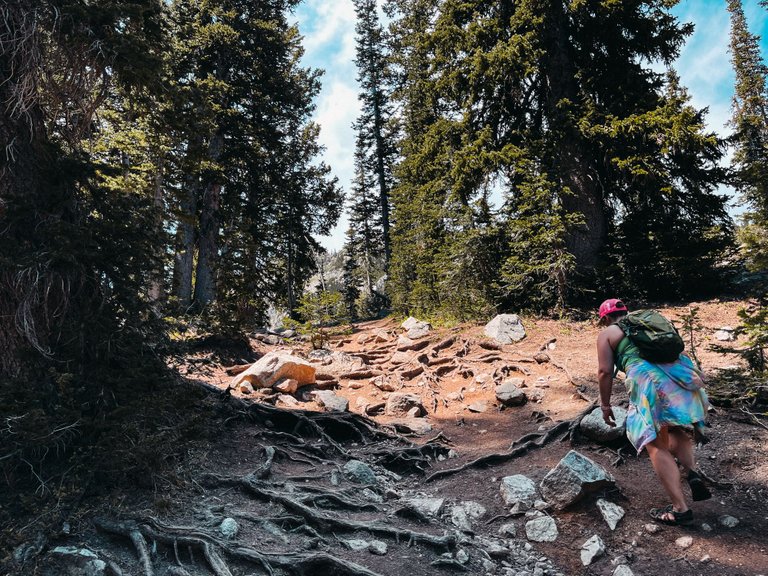
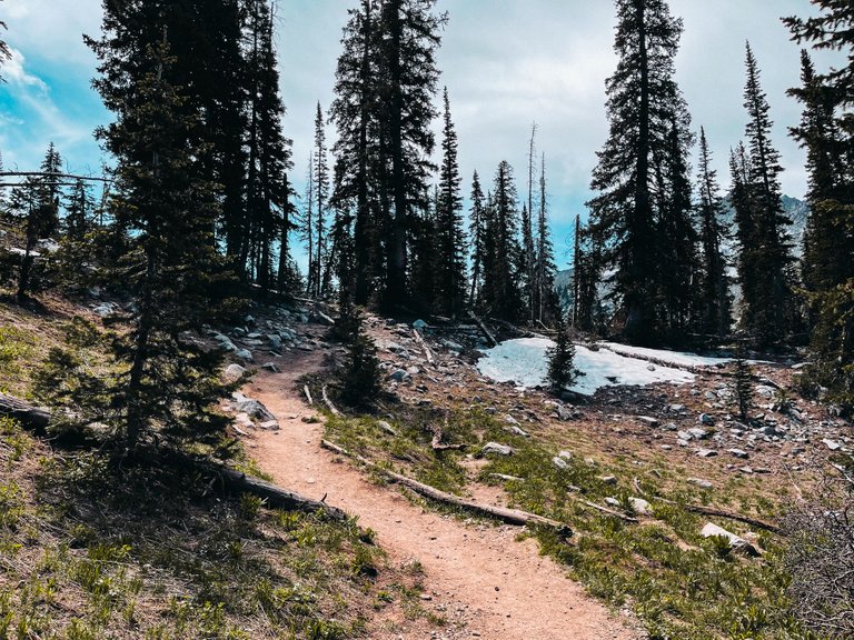
The trail was getting rockier and rockier too.
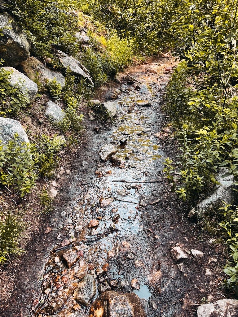
Then it started to get wet as well. Making it slippery.
It started to get pretty miserable from this point on. My ankle hurt cause I twisted it at the beginning of the hike when I was checking the map and didn't see some uneven rocks and we were starting to get pretty hungry.
I think we had been going nearly three hours by this point, and we wanted it to be over. It sucked not having any idea how closer you were to the finish of the hike. And by finish, I mean, the halfway point because we would still have to hike everything again on the way down.
But at least we got to see some amazing scenery, so that is one thing that kept up going. That and we didn't want to quit this hike because I guarantee if we had quit, we would have been like 100 meters from the lake, so we just kept pushing and expecting to see the lake over each ridge that we made it up.
Some guys were on their way down and we asked them how much further it was. They told us it was like 20 to 30 more minutes and that it was worth it. So we kept going. But it was not 30 minutes more. It was a lot more than that.
The last hour of the hike was the worst. It was the steepest and wettest parts of the hike and it just seemed to never end.
Then we started to see snow. I have no idea how high up we were, but we had been going for quite a while and now we were reaching snowy elevations.
These parts of the hike were pretty miserable. There was no real defined trail in some spots and it was like, "Hey you just climb up through these rocks any way you can and the trail will restart again once you get passed all this shit."
We started to contemplate the meaning of life and our decisions the further we headed up and there was no end in site.
But hey, at least we were outside and enjoying nature, right? That's what we kept telling ourselves. I just knew that the pain I was feeling in my body was just going to keep getting worse the further we walked because we had not even hit the halfway point yet. This hike was a very mentally challenging hike and I think the worst part of it was that we were not prepared or had not even planned on this hike.
We started talking about ways that we would prevent this from happening to us again. There are options on the AllTrails app to download the map before you head out, so if you lose service, you will still be able to find your way. So ya, that is definitely going to be something we do from this point forward.
We also are going to be bringing food with us on EVERY hike we do now. Even if it is just a short 2 hour hike, we will have some food with us because these hunger pains were crazy. Our bodies were beginning to shut down from lack of calories. When the hike was over, we would have burned nearly 3000 calories and our small breakfast was not providing enough calories to keep us going at a decent pace.
But we kept pushing...
We stopped under this tree to rest for a bit and drink some water. Luckily we had packed plenty of water in our camelbacks. While we were resting under this tree, we talked about turning back from here, but we both assumed that we were very close and if we gave up now, it would not have been worth it.
So we kept going, even though both of us wanted to turn back because we knew how much it was going to suck on the way down as well. When you get near the top of the mountain, how much further is there to even go, so we figured we didn't have too much longer.
Could this be the end? It looks like it is because there really isn't much further up we could go from here.
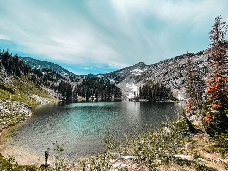
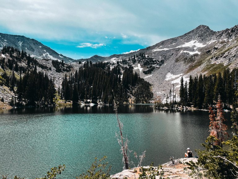
We had made it! I was so happy to see this lake and to know that we were done going up. Now all we had to do was make it back down after we relaxed here at the lake for a bit.
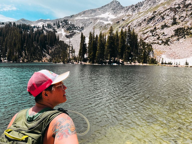
This is a glacial lake and the water is just a few degrees above freezing, so it was super cold and refreshing.
There were groups of people that had hiked up here and set up tents near the water. That is the way to do it. Not hike up and then hike down in the same day.
It was so peaceful up here at the lake. I was not looking forward to the trip down. We probably spent close to an hour just sitting up there with our feet in the water.
Then we started the miserable trek back down the mountain to our car. Luckily we were able to go a bit faster and it only took us a bit over two hours to make it back down to our car.
The way down was horrible in its own way. The rocky and wet parts sucked going down and we had to be extra careful. I didn't want to break an ankle on this trail and have to be carried down.
This hike sucked. It sucked bad. But that was just because we were not expecting it and we were not prepared for it. If I was mentally ready to hike almost 10 miles, I think it would have been quite different. It was quite a learning experience for us because we learned what NOT to do while hiking and how to prepare ourselves for future hikes.
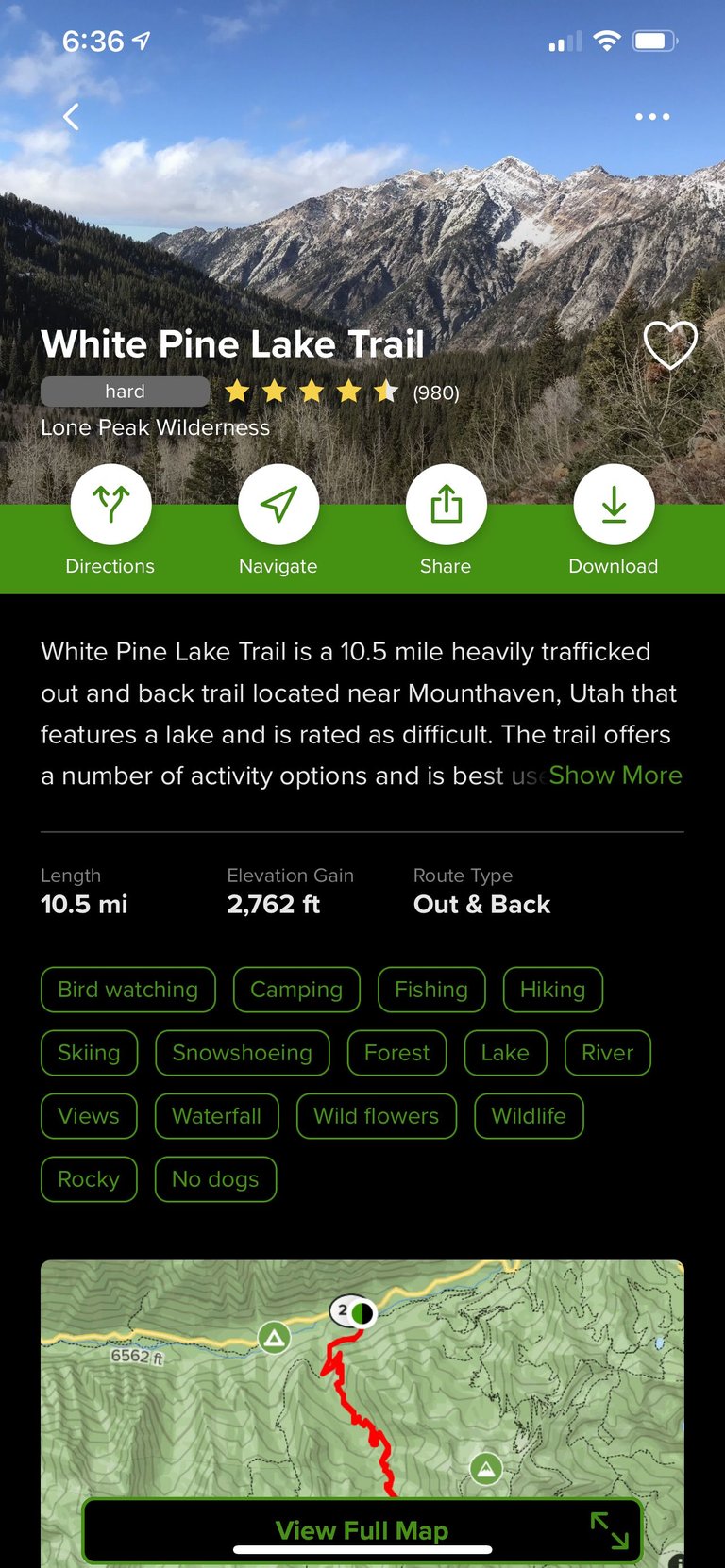
When we got back, we checked out the hike on AllTrails and saw that this hike was marked as "hard" and had an elevation gain of nearly 3000 feet. The scenery was amazing on the hike, but I do not think it is one that we will be doing again any time soon.
One of the worst parts of the hike was when we got back to the parking lot at the start of the trailhead, we still had almost a mile to hike up the road to our car. We were pretty miserable by this point. Our heads were killing us from being in the sun and being pretty dehydrated. We were super hungry and out bodies were going into full revolt mode and our feet didn't have the energy to keep moving.
But we made it and made some awesome memories along the way. We learned a lot on this hike and we will be better prepared for the next one. Now it is the day after our hike and we are still trying to recover. I think I will be sore for the next week after this one.
If you ever played King's Quest growing up then you might have stopped and talked to that old lady for a map and directions...😁
That old lady was even more lost than we were. She was the cause of all this mess. But at least we survived and got some dope pictures from it. Edibles work wonders when you are in this much pain.
Sure blame the old person(I don't know if she identifies as an old lady or not!) for your sugary brownie or ooowie gooey rice crispy treat intake you toxic white man you! JK old ladies are typically the same way out on the road ways especially on AARP tuesdays where they 10% off on groceries at the local kroger...
That’s a fair bit of elevation gain, especially with an injury. Time to recuperate!
Feeling a lot better this afternoon. I thought I was gonna be miserable today.
Relative to being dropped in the middle of the ocean and not knowing how far away or which direction land is. Much better pictures though 😁
And less chance of getting eaten by a shark.
LMAO I was just talking to the girls about that. We were watching 72 Deadliest some area or another and they had a Bull Shark on there. I was like - that's why I don't swim in the ocean or bigger rivers. On land, I can see something coming pretty well and guns work. In the water? Not my territory LMAO! DO wanna catch some more sharks tho.
wow, what lovely views! Def worth it! ...hahaha, I think I would have turned back when I got too hungry. Props for going all the way, 3k elevation gain is no joke especially with no food! Way to go!! Cheers!!
Ya, we wish we would have turned back, but it is fine now. We arent as sore. It was good to finish the hike though. We will be more prepared for the next one, thats for sure.
Stunning scenery and lets face it a better tale to tell than if it had all gone smoothly. Our misery was way easier as we got a 20km tow. Even saved on diesel! 😃
It was a nice looking hike and we do have stories to tell about this one. Next hike we go on we will be better prepared.
Wow, what beautiful landscapes, especially those of the lake and the mountains. I think it was worth it to endure the fatigue and the sun. Next time you go better prepared. It is a spectacular place to visit again. :-)
Thanks. We are definitely going to be better prepared for our next hikes. This was a good learning experience.
In addition to downloading a map in case of no cell service, there’s a lot to be said for having a hard copy on old-fashioned paper. 😅
Ya. Next time we will be more prepared.
damm hahahaha.. 10 miles is a lot.
i would probably stick with the "we should go back" part. and would come another day better equipped. i hate the felling when you are already tired and still didnt even made the half way lol =p
but that's a damm beautifull place... wow.
Ya. It was a miserable hike. lol. Lucky I have plenty of natural herbs to make my body feel less pain.
i wonder how much was consumed in the whole hike .. kkkkkkkk
peace bro !
None. I had thought about bringing some, but was glad I didn't. There would be no telling where we would have ended up.
@derangedvisions, you were given LUV from @lxsxl. About and LUVstore: https://peakd.com/@luvshares http://ipfs.io/ipfs/QmUptF5k64xBvsQ9B6MjZo1dc2JwvXTWjWJAnyMCtWZxqM
Great report! Walks like these put at peace the mind and the body, in immersion with nature and clean air...
Congratulations, your post has been added to Pinmapple! 🎉🥳🍍
Did you know you have your own profile map?
And every post has their own map too!
Want to have your post on the map too?
Hiya, @ybanezkim26 here, just swinging by to let you know that this post made it into our Top 3 in Daily Travel Digest #1237.
Your post has been manually curated by the @pinmapple team. If you like what we're doing, please drop by to check out all the rest of today's great posts and consider supporting other authors like yourself and us so we can keep the project going!
Become part of our travel community:
What a lovely place! The views are gorgeous! Hiking with not enough water or food can be very uncomfortable, I guess it will be better next time as you all now have experience.
How about the feet? So many hours walking along the trail is not easy. From my personal experience with trekking I have noticed how bady feet can get without proper shoes. I just ordered some trekking shoes because I realized I can't walk for hours in normal shoes. Blisters, pain, sore soles.... And I have seen special socks for this too, as they reduce discomfort. Were you prepared in this area? Or did your feet hurt too after this?
Our feet were killing us by the end of it. It need to wear my hiking shoes from now on. We learned a lot on this hike and we will be better prepared for the next ones. So it was worth it.
So much beauty in this world! Wouldn't it be cool to see all of it. BTW my wife's name is Gloria, she will like this.
Ya. This was a happy accident.