 |  |
|---|---|
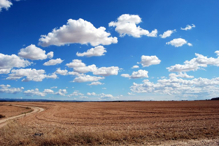
| We all look at the sky and sometimes we found some clouds. The word meteorology is actually from ancient Greek and it is composed by two words: μετέωρος metéōros (meteor, or better, "thing up in the sky") and -λογία -logia (-(o)logy, meaning language or study) so this is literally "the study of the things in the sky". I will try to explain here some basics facts about clouds. First of all: clouds are composed of liquid (or even solid) water, not vapors. Water vapor, sometimes called moisture, is not visible in air. The white or gray clouds that we can spot are made of tiny droplets of water. Liquid or frozen water. Their color is mainly influenced by the Sun position (and by their dimensions) so, if from the ground we can see a variety of cloud colors from dark gray to bright white, when we see the top of the cloud from an aircraft in daylight the only visible color will be white. Technically the cloud is formed by liquid droplets (or tiny ice crystals) in suspension so it can be classified as an aerosol. These water or ice particles are so small that simply do not fall (at least not before it will start to rain). We can classify clouds referring primary to their altitude, so we have high-level, mid level , low-level and even towering vertical clouds. Meteorologists started to assign names to the clouds at the end of XIX century. In my opinion their naming was heavily influenced by the Linnaean taxonomy used by biologists and I will report the names of the cloud using the latest accepted terms by the World Meteorological Organization: as an example we can have a Genus and a specie like Altocumulus lenticularis (Ac Len). As You can see, they all will be in Latin. I will mainly report the clouds types from high to low level, in order to achieve a better understanding of their location when a computer user scrolls down the page, so producing a gentle dive from the upper levels to the lower ones. | Tutti alziamo lo sguardo al cielo e quando lo facciamo spesso troviamo qualche nube (il termine nuvola non è scientificamente corretto). La stessa parola Meteorologia è derivata dal greco dove troviamo μετέωρος metéōros (meteora, o meglio, "cosa che sta in aria") e -λογία -logia (linguaggio o, per estensione, studio) quindi stiamo letteralmente parlando dello studio delle cose che stanno in aria. Cercherò di spiegare qualche nozione di base sulle nuvole. Prima di tutto: esse sono composte da goccioline di acqua allo stato liquido (o da piccoli cristalli di ghiaccio). Il vapore acqueo (a volte definito umidità) nell'atmosfera è trasparente e non può essere osservato visivamente. Le nubi bianche o grigie che possiamo osservare sono composte o da goccioline d'acqua o da cristalli di ghiaccio ed il loro colore è influenzato principalmente dalla posizione del sole (e dalla loro dimensione): osservate da terra potranno assumere tutta la gamma di colori dal grigio scuro al bianco ma osservandole dall'alto, generalmente a bordo di un aeromobile, saranno tutte soltanto bianche. Tecnicamente quindi la nube è formata da goccioline d'acqua o da aghetti di giaccio in sospensione ovvero è un aerosol. Queste microparticelle sono così piccole che semplicemente non riescono a cadere (almeno fino a quando non inizia a piovere). Possiamo classificare le nubi principalmente attraverso la loro altitudine ed avremo così nubi alte, medie, basse o ancora a sviluppo verticale. I meteorologi hanno iniziato a dare un nome alle nubi ed il sistema è stato a mio parere molto influenzato dalla classificazione biologica di Linneo che i biologi applicano alle specie viventi. Possiamo quindi trovare Generi e specie come ad esempio Altocumulo lenticolare. Qui riporterò i nomi come attualmente accettati dalla Organizzazione Meteorologica Internazionale (WMO) partendo dalle nubi alte e scendendo verso i livelli più bassi in modo che al lettore possa apparire di effettuare una discesa nell'atmosfera un po' come avviene per lo scrolling della pagina. Userò quando possibile il nome latino tradotto in italiano. |
| High Level Clouds | Nubi alte |
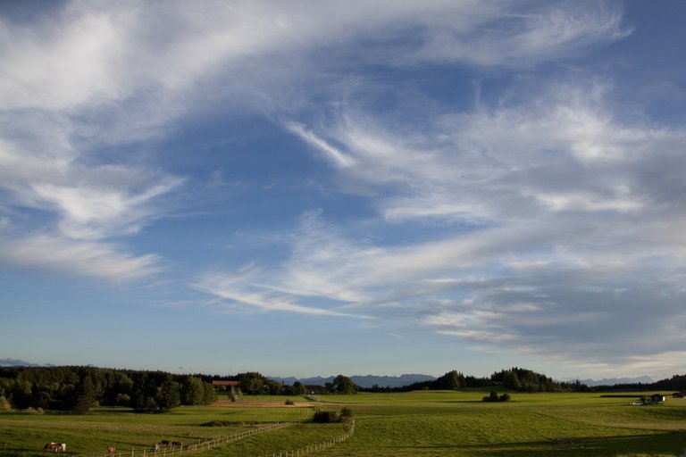
| Composed by ice crystals, they floats in the sky between 7000 and 12000 meters of altitude. We can find Cirrus (Ci), Cirrocumulus (Cc) and Cirrostratus (Cs): differences are about their texture being the Cirrus almost like a filament, it can be found also as a stratus (Cs) or a little agglomerate (Cc).Sometimes all of these forms coexists. | Formate interamente da cristalli di ghiaccio, si trovano tra 7000 e 12000 metri di altitudine. Possiamo classificare i Cirri (Ci), Cirrocumuli (Cc) e Cirrostrati (Cs) in base alla loro estensione. Il cirro (Ci) è quasi filamentoso ma può trovarsi anche anche in forma stratiforme (Cs) o in patterns agglomerati (Cc). Spesso si trovano combinazioni di tutte e tre le forme. |
| High level man made Clouds | Nubi alte da attività antropica |
|---|---|
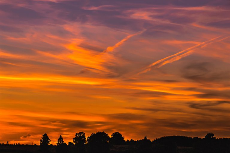
| Sometimes Cirrus can born as airplanes' contrails. We talk in this case of Cirrus homogenitus that can evolve in Cirrostratus homomutatus | A volte i cirri possono nascere dalle scie di condensazione dei velivoli. Parleremo in questo caso di Cirrus homogenitus che a volte può evolvere in Cirrostratus homomutatus |
| Mid Level Clouds | Nubi medie |
|---|---|
| Composed by liquid water, they can be found between 7000 and 12000 meters of altitude. Like for their upper level iced brother, we can classify them by patterns as Altocumulus (Ac) and Altostratus (As) | Formate da goccioline d'acqua, si trovano tra 2000 e 7000 metri di altitudine e come per i loro simili ghiacciati del piano superiore possiamo classificarle per via del pattern tra Altocumulo (Ac) e Altostrato (As). |
| Nimbostratus | Nembostrati |
|---|---|
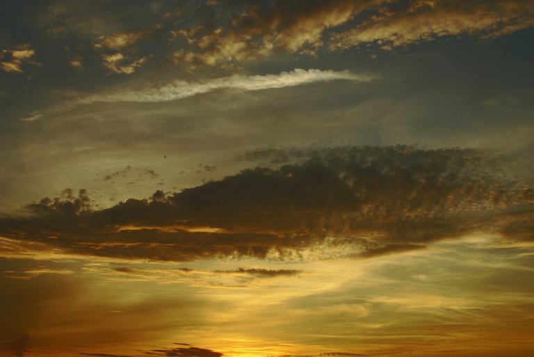
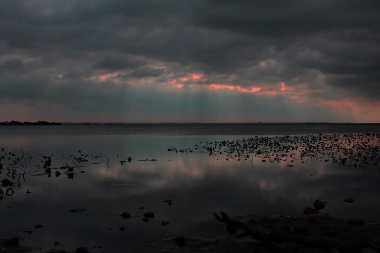
| Between mid and low level clouds, these are the "grayest" of the clouds. The color is due to their thickness that shadows the sunlight. Their altitude can be between 0 and 7000 meters. The Nimbostratus (Ns) can "produce" rain and snow (even if it is snowing, they are still formed by liquid droplets). | Tra nubi medie e basse troviamo i nembostrati (Ns). Sono le nubi più "grigie" in quanto il loro spessore filtra molto la luce solare. Possono estendersi praticamente dal suolo a 7000 metri e sono le principali responsabili di precipitazioni piovose o nevose (ma anche in caso di neve, saranno sempre formate da microgoccioline di acqua liquida). |
| Low level clouds | Nubi basse |
|---|---|
| Under 2000 meters of altitude, clouds can all be classified as "low level". We can find Cumulus (Cu), Stratus (St) and Stratocumulus (Sc). We will talk about Cumulus later since it can be the first stage of a bigger cloud. Like the clouds seen before, the shape of the clouds can change their classification. A round shaped little single cloud is a Cumulus, what appears to be from the ground as a flat surface of clouds is a stratus. Many round and little clouds grouped together and having an almost flat base are a stratocumulus. | Sotto i 2000 metri di altitudine le nuvole vengono classificate come basse. Troviamo in questa fascia cumuli (Cu), strati (St) e stratocumuli (Sc). Possiamo considerare come cumulo ogni piccola nube isolata e rotondeggiante ma dal momento che questo può essere l'embrione di una nube diversa ne parleremo in seguito. Come le nubi viste in precedenza, anche qui la forma e la disposizione delle nubi possono influire sulla loro classificazione. Possiamo infatti trovare Strati (St) e Stratocumuli (Sc): una nube diffusa a base piatta sarà uno strato mentre tanti "batuffoli di cotone" vicini ma non proprio a contatto saranno uno stratocumulo (cielo a pecorelle...) |
| An interesting type of Stratus | Uno strato molto interessante |
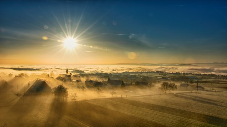
| The lowest cloud is Stratus nebulosus also known as fog | La nube più bassa è lo strato nebuloso ovvero la nebbia |
| Cumulus | Cumulo |
|---|---|
| This is a Cumulus (Cu): | Questo è un cumulo (Cu): |
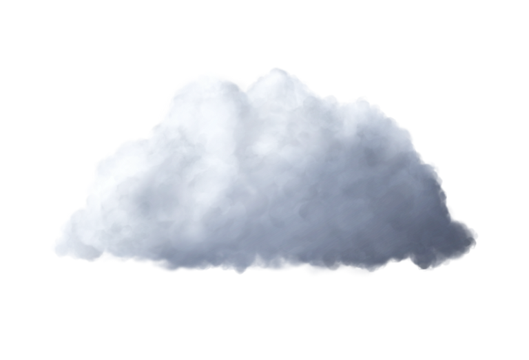
| Cumulus can be a modest (humilis) low cloud but it can evolve in a towering vertical cloud when certain conditions in the air strengthen the convective motion that generated it. The next step is the towering cumulus or Cumulus congestus | Il cumulo può essere una modesta nube tondeggiante ma, quando alcune condizioni dell'aria rafforzano il moto convettivo che lo ha generato, può evolvere in una nube a sviluppo verticale. Il secondo passaggio è il cumulo torreggiante (Cumulus congestus) |
|---|

| Finally, the Cumulus Congestus can evolve in a Cumulonimbus (Cb) that can extend vertically from a few hundreds meters above ground up to the top of the troposphere (about 11.000 meters of altitude) and it is normally called thundercloud. It is the cloud in which thunders can appear and the most dangerous one. | Successivamente il cumulo torreggiante può evolvere in un cumulonembo che si estende verticalmente da poche centinaia di metri sul terreno fino ai limiti superiori della troposfera (circa 11000 metri) ed è generalmente chiamato nube temporalesca. Nelle immagini seguenti a sinistra un Cumulonimbus (Cb) visto da terra e a destra visto dall'alto |
|---|---|
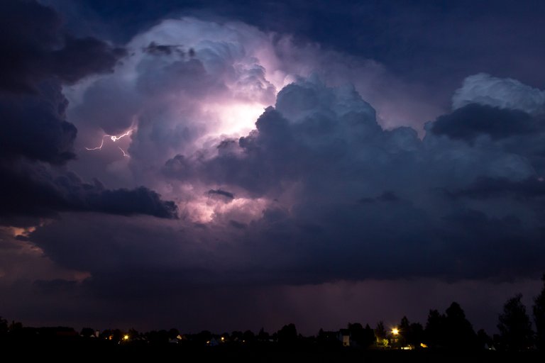 | 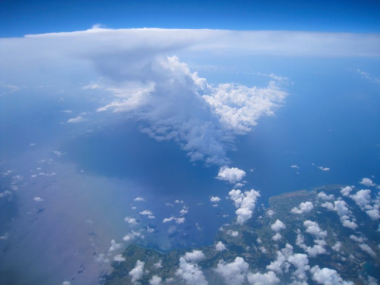 |
| Cumulonimbus as seen from the ground | Cumulonimbus as seen from the sky |
| The only lesson You must understand here is this one: beware of Cumulunimbus. With this warning safety, not only the one of air travel, will surely improve. | L'unica lezione che dovreste comprendere è questa: prestate attenzione ai cumulonembi. Con questa raccomandazione la sicurezza, non solo quella del volo, non può far altro che beneficiarne. |
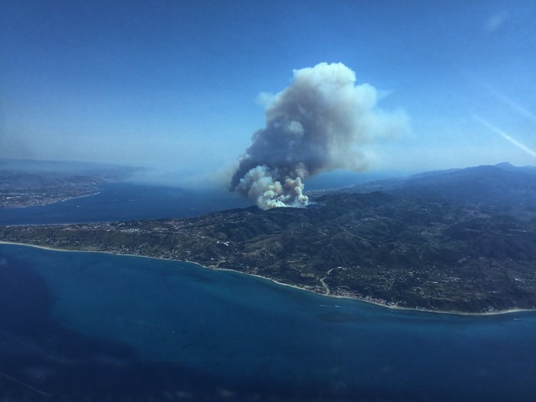
| Fire cloud "Cumulus congestus flammagenitus" in sicily - photo by Author | Incendio: Cumulo torreggiante flammagenitus in Sicilia - foto dell' Autore |
|---|---|
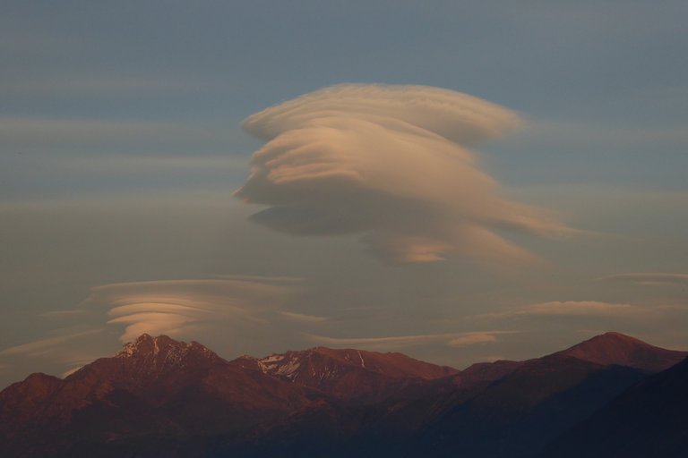
| There are also other clouds: funnel clouds, lenticular clouds (Ac lenticularis actually) and so on: for further information please check below in the source section. | Ci sono anche alti tipi di nube come le lenticolari (Ac lenticolare in realtà) o le trombe d'aria. Per ulteriori informazioni sono disponibili i riferimenti nella successiva sezione "fonti" |
| Sources | Fonti |
|---|---|
| - Images: Pixabay CC0 | - Immagini: CCO Pixabay |
| - Cloud Atlas of the International Meteorological Organization | - Atlante delle nubi dell' Organizzazione Meteorologica Internazionale |
Questo post è stato condiviso e votato dal team di curatori di discovery-it.
Questo post è stato condiviso nel canale #italia-curation e votato della comunità @c-squared Discord, dopo aver ricevuto una revisione manuale. @c-squared dispone anche di una witness all'interno della comunità. Si invita l'utilizzo di uno dei voti destinati alle witness per supportare questo progetto.
This post was shared in the #italia-curation channel in the Curation Collective Discord community for curators, and upvoted and resteemed by the @c-squared community account after manual review. @c-squared runs a community witness. Please consider using one of your witness votes on us here
Ciao, ho visto che hai preso delle immagini dall'atlante delle nubi, mi sai dire se quelle immagini sono libere o protette da copyright? Grazie
@aboutcoolscience ciao! No l’atlante delle nubi è solo il riferimento classificatorio le immagini sono tutte CC0 da Pixabay tranne l’ultima che è mia.
Posted using Partiko iOS
Congratulations @omodei! You have completed the following achievement on the Steem blockchain and have been rewarded with new badge(s) :
You can view your badges on your Steem Board and compare to others on the Steem Ranking
If you no longer want to receive notifications, reply to this comment with the word
STOPThis post has been voted on by the SteemSTEM curation team and voting trail. It is elligible for support from @curie.
If you appreciate the work we are doing, then consider supporting our witness stem.witness. Additional witness support to the curie witness would be appreciated as well.
For additional information please join us on the SteemSTEM discord and to get to know the rest of the community!
Please consider setting @steemstem as a beneficiary to your post to get a stronger support.
Please consider using the steemstem.io app to get a stronger support.