This is the story of Vukovarska Ada, an island on the Danube between Croatia and Serbia. The scene is similar but the circumstances are different. The amicable resolution of the Vukovarska Ada situation gives hope for diplomacy prevailing in other, similar situations.
https://liberlandpress.com/2022/07/11/vukovarska-ada/
Preface
The following is based on a publication by Professor Miloš Petrović, a professor of Legal Studies at the State University in Novy Pazdar. His article, currently only available in Serbian, concerns the situation regarding a territorial pocket on the Serbian side of the Danube left there after the Yugoslavian Civil War, the Vukovarska Ada. It also touches on problems regarding other such pockets, chiefly the Gornja Siga in the Upper Danubelands (Gornje Podunavi). We are presenting certain ideas from that article here to the international audience.
Introduction
The Republic of Serbia and the Republic of Croatia, once members of the Yugoslav Federation and today neighbouring, sovereign, internationally recognized States, have a common border of two hundred and fifty-two kilometres.
The river Danube makes up one hundred and thirty-eight kilometres of this border. The precise measurement of the border on the Danube and where it goes is the subject of different interpretations by the two sides – and resulting disputes.
In practice, these differences lead to numerous problems, primarily regarding navigation safety, prevention of migration, poaching, flood defence and other security challenges.
One of the points of contention is Vukovarska Ada, a river island over which both sides seek to emphasize their sovereignty.
Background
Under the Security Council Resolution 1244, the disintegration of the Socialist Federal Republic of Yugoslavia resulted in the emergence of six internationally recognized states: Slovenia, Croatia, Bosnia and Herzegovina, Montenegro, Northern Macedonia and Serbia.
Based on the decision of the so-called Badinter Commission, an internationally appointed body which sought to resolve questions between these new countries, in order to ensure lasting peace and dispute resolution, the former mutual borders of the federal units of the former SFR Yugoslavia were given the status of interstate borders.
There were several places where this demarcation proved more difficult than previously anticipated.
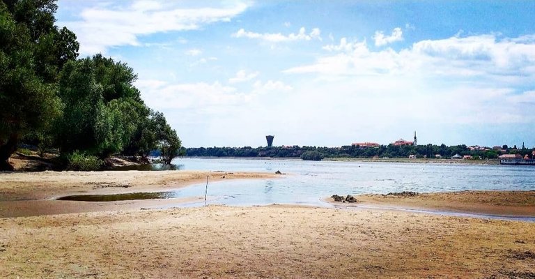
One such typical example is Vukovarska Ada, a river island located on the left side of the middle of the Danube waterway. This island, with a total area of about 32,000 square meters. You may find it on the map near the left bank of the river, separated from the bank by a canal up to thirty meters wide, and on the right side of the city of Vukovar.
The pre-war delimitation of the borders by a Law made in 1945 by the then-federal Socialist Republic of Serbia ran as follows:
This border runs along the Danube from the Hungarian border to Ilok, crosses the Danube leaving Ilok, Sharengrad and Mohovo in Croatia and goes south, leaving the villages of the current Shida district, Opatovac, Lovas, Tovarnik, Podgradje, Adasevci, Lipovac, Strošinci and Jamena in Croatia.Batorivci and Morovic in Vojvodina.
This has been interpreted, especially by the Serbians, to mean that the border goes through the middle of the Danube’s waterway. This would place Vukovarska Ada in Serbia.
After the war, this wording was disputed by Croatia. They cited the historical connectedness between Ada and Vukovar city and the records in Croatian historical cadastral books. They added that the Ada was traditionally a picnic spot for and culturally connected with the inhabitants of Vukovar. Additionally, they pointed out the lack of major settlements on the Serbian side, at least quite as near the island as the major city of Vukovar was.
Based on these reasons, they wanted the Ada to become a part of the Republic of Croatia.
Uti Possidetis Iuris
The parties presented the dispute to the Badinter Commission. One of the questions that arose before the Commission was: According to international public law, can the internal demarcation line between Croatia and Serbia, on the one hand, and between Serbia and Bosnia and Herzegovina, on the other hand, be considered borders?
The Commission’s answer to this question was very important because it defined the standards of border resolution in the region. The most remarkable part of the answer to the question rests in the following sentence: “Unless otherwise agreed, the earlier borders take on the character of borders protected by international law”.
The principle of classical jurisprudence of Uti Possidetis Iuris was thus used, a somewhat rare construction in border delimitation by an international commission. This principle in practice meant: that the 1945 delimitation holds even after the federation’s breakup, and Serbia retains Vukovarska Ada.
Uti Possidetis arose in the ancient Roman world. It was a type of decree a Praetor (a kind of Roman public attorney) could issue in a dispute over possession of a property. It meant: that the current possessor shall keep what they possess. Please note: no question is raised on the eventual ownership title. Uti Possidetis can also later be challenged (by a third party), so it is not truly a final decision. It is a settlement between the (given) parties to deescalate/resolve the (actual) dispute in the now.
This temporary and challengeable nature of Uti Possidetis was to become emblematic of the Vukovarska Ada situation because it didn’t resolve the issue with any finality. Croatians disputed the resolution almost immediately and continued claiming the island.
Grey Area
With the escalation of the armed conflict in 1991, the Serbian border on the Danube was secured by the Yugoslav National Army, i.e. Serbia, and remained at the border until 2006.
On the 15th of September that year, an Agreement on Cooperation was struck between Bac and Vukovar with the international support of the Kingdom of the Netherlands. According to the agreement, the island would be open for public entry every day from seven to twenty, without requiring customs and police formalities.
It is questionable how much the Republic of Serbia consciously conceded here for good neighbourly relations or whether it was concerned about its claim potentially complicating traffic on an important international waterway, i.e. the Danube.
The final determination of the border between Serbia and Croatia on the Danube must take place one day, but what form will such a settlement take remains unclear, a grey area of the map, one of many in the context of that river border.
It is important to note that if additional criteria are considered, both sides can make strong arguments.
The Croatian side can claim (in addition to its argumentation based on the Croatian cadastral books) that up to the beginning of the armed conflict, it exercised de facto power over the island and that Ada is economically connected with Vukovar, i.e. it is the centre of tourist activities in Vukovar and amongst the most popular Croatian summer tourist destinations in the area.
The Serbians would then argue that Ada’s transition to Croatian sovereignty leaves Serbia in a bad position in terms of flood protection measures, arranging and maintaining the waterway, construction of water facilities, and protection of flora and fauna near the Danube, prevention of illicit trade and illegal migration. And was not then-federated Croatia in agreement with the delimitation that left the Ada in Serbia’s hands?
An additional issue is that there are more such grey areas along the Danube. Should Serbia renounce its claim, it might reopen the possibility of discussing the future of these territories as well; some of them are currently in the factual possession of Serbia.
Mutual disagreements and unresolved State borders between the two countries extend to about ten thousand hectares located on the left (Serbian) bank of the Danube, which Croatia claims to be entitled to and about a thousand hectares on the right (Croatian) side, which Serbia is claiming.
Like the Ada, these other territories are the parts of the border cadastral municipalities of the two countries that remained on the opposite side of the coast as “pockets”. These pockets came to be after the course of the Danube had been altered artificially at the end of the 19th and the beginning of the 20th centuries. During the existence of Federal Yugoslavia, the need wasn’t so pressing as to solve the issue, and the new situation was not adequately reflected in the cadastral books.
Thus, on the left bank of the Danube, there remained pockets in otherwise Serbian territory in Karapandža, Kenđija, Blaževica, Kolondjoš, Zmajevac, Kučka, Poluostrvo, Zverinjak, Srebrenica, Šarengradska and Vukovarska Ada; and on the right side the Gornja Siga, Zeleni otok and Vergašova Ada.
Amicable Disagreement
In 2011, the local governments of Bac and Vukovar signed the Agreement on Friendship and Cooperation, which significantly affected the actual position of Vukovar Ada, further opening it, even compared to the 2006 situation.
The current status of Vukovar Ada is such that both coastal states have the same right, and members of fishing associations from Vukovar take care of arranging the bathing area and organizing activities in it. All residents of Vukovar and Bac enjoy access without special customs and police procedures and formalities, further improved by introducing organized river transport.
Within the last 15 years, it is estimated that more than 3 million people visited Ada. This is one of the rare positive examples of cross-border cooperation between local governments in Serbia and Croatia, which has resulted in benefits on the part of the citizens of the two local governments.
At this point, we must emphasize that Vukovar is not the only place where the two countries could profit from working together. Some eighty kilometres upstream, there lays another interesting peninsula, Gornja Siga.
The situation of the Siga is the exact opposite of that of Vukovarska Ada:
Vukovarska Ada is an island on the left bank, while Gornja Siga is a peninsula on the right bank.
Both states have territorial claims on Vukovar Ada concerning Gornja Siga; both declare that the territory belongs to the other State.
An additional interesting challenge arises from the fact that such an interpretation opens the space for the Gornja Siga area to be treated as terra nullius, and this hasn’t gone internationally unnoticed. In 2015, Vit Jedlicka, a Czech citizen and politician, proclaimed the sovereign nation of Liberland in Siga’s territory.
Although this State does not have a widespread international recognition yet, we cannot escape the impression that Serbia and Croatia, with their stubborn and decades-long refusal to resolve the issue of mutual delimitation on the Danube, actually enabled the formation of Liberland. Liberland has been followed by the State of Verdis and other attempts in other pockets, enjoying the same type of a grey area status as the Siga.
In addition to the delimitation problem, Serbia and Croatia have the additional issues of involving another interested party, which will, as time goes by and the border issue is not resolved, probably take various activities to strengthen its position.
Preface
The following is based on a publication by Professor Miloš Petrović, a professor of Legal Studies at the State University in Novy Pazdar. His article, currently only available in Serbian, concerns the situation regarding a territorial pocket on the Serbian side of the Danube left there after the Yugoslavian Civil War, the Vukovarska Ada. It also touches on problems regarding other such pockets, chiefly the Gornja Siga in the Upper Danubelands (Gornje Podunavi). We are presenting certain ideas from that article here to the international audience.
Introduction
The Republic of Serbia and the Republic of Croatia, once members of the Yugoslav Federation and today neighbouring, sovereign, internationally recognized States, have a common border of two hundred and fifty-two kilometres.
The river Danube makes up one hundred and thirty-eight kilometres of this border. The precise measurement of the border on the Danube and where it goes is the subject of different interpretations by the two sides – and resulting disputes.
In practice, these differences lead to numerous problems, primarily regarding navigation safety, prevention of migration, poaching, flood defence and other security challenges.
One of the points of contention is Vukovarska Ada, a river island over which both sides seek to emphasize their sovereignty.
Background
Under the Security Council Resolution 1244, the disintegration of the Socialist Federal Republic of Yugoslavia resulted in the emergence of six internationally recognized states: Slovenia, Croatia, Bosnia and Herzegovina, Montenegro, Northern Macedonia and Serbia.
Based on the decision of the so-called Badinter Commission, an internationally appointed body which sought to resolve questions between these new countries, in order to ensure lasting peace and dispute resolution, the former mutual borders of the federal units of the former SFR Yugoslavia were given the status of interstate borders.
There were several places where this demarcation proved more difficult than previously anticipated.
One such typical example is Vukovarska Ada, a river island located on the left side of the middle of the Danube waterway. This island, with a total area of about 32,000 square meters. You may find it on the map near the left bank of the river, separated from the bank by a canal up to thirty meters wide, and on the right side of the city of Vukovar.
The pre-war delimitation of the borders by a Law made in 1945 by the then-federal Socialist Republic of Serbia ran as follows:
This border runs along the Danube from the Hungarian border to Ilok, crosses the Danube leaving Ilok, Sharengrad and Mohovo in Croatia and goes south, leaving the villages of the current Shida district, Opatovac, Lovas, Tovarnik, Podgradje, Adasevci, Lipovac, Strošinci and Jamena in Croatia.Batorivci and Morovic in Vojvodina.
This has been interpreted, especially by the Serbians, to mean that the border goes through the middle of the Danube’s waterway. This would place Vukovarska Ada in Serbia.
After the war, this wording was disputed by Croatia. They cited the historical connectedness between Ada and Vukovar city and the records in Croatian historical cadastral books. They added that the Ada was traditionally a picnic spot for and culturally connected with the inhabitants of Vukovar. Additionally, they pointed out the lack of major settlements on the Serbian side, at least quite as near the island as the major city of Vukovar was.
Based on these reasons, they wanted the Ada to become a part of the Republic of Croatia.
Uti Possidetis Iuris
The parties presented the dispute to the Badinter Commission. One of the questions that arose before the Commission was: According to international public law, can the internal demarcation line between Croatia and Serbia, on the one hand, and between Serbia and Bosnia and Herzegovina, on the other hand, be considered borders?
The Commission’s answer to this question was very important because it defined the standards of border resolution in the region. The most remarkable part of the answer to the question rests in the following sentence: “Unless otherwise agreed, the earlier borders take on the character of borders protected by international law”.
The principle of classical jurisprudence of Uti Possidetis Iuris was thus used, a somewhat rare construction in border delimitation by an international commission. This principle in practice meant: that the 1945 delimitation holds even after the federation’s breakup, and Serbia retains Vukovarska Ada.
Uti Possidetis arose in the ancient Roman world. It was a type of decree a Praetor (a kind of Roman public attorney) could issue in a dispute over possession of a property. It meant: that the current possessor shall keep what they possess. Please note: no question is raised on the eventual ownership title. Uti Possidetis can also later be challenged (by a third party), so it is not truly a final decision. It is a settlement between the (given) parties to deescalate/resolve the (actual) dispute in the now.
This temporary and challengeable nature of Uti Possidetis was to become emblematic of the Vukovarska Ada situation because it didn’t resolve the issue with any finality. Croatians disputed the resolution almost immediately and continued claiming the island.
Grey Area
With the escalation of the armed conflict in 1991, the Serbian border on the Danube was secured by the Yugoslav National Army, i.e. Serbia, and remained at the border until 2006.
On the 15th of September that year, an Agreement on Cooperation was struck between Bac and Vukovar with the international support of the Kingdom of the Netherlands. According to the agreement, the island would be open for public entry every day from seven to twenty, without requiring customs and police formalities.
It is questionable how much the Republic of Serbia consciously conceded here for good neighbourly relations or whether it was concerned about its claim potentially complicating traffic on an important international waterway, i.e. the Danube.
The final determination of the border between Serbia and Croatia on the Danube must take place one day, but what form will such a settlement take remains unclear, a grey area of the map, one of many in the context of that river border.
It is important to note that if additional criteria are considered, both sides can make strong arguments.
The Croatian side can claim (in addition to its argumentation based on the Croatian cadastral books) that up to the beginning of the armed conflict, it exercised de facto power over the island and that Ada is economically connected with Vukovar, i.e. it is the centre of tourist activities in Vukovar and amongst the most popular Croatian summer tourist destinations in the area.
The Serbians would then argue that Ada’s transition to Croatian sovereignty leaves Serbia in a bad position in terms of flood protection measures, arranging and maintaining the waterway, construction of water facilities, and protection of flora and fauna near the Danube, prevention of illicit trade and illegal migration. And was not then-federated Croatia in agreement with the delimitation that left the Ada in Serbia’s hands?
An additional issue is that there are more such grey areas along the Danube. Should Serbia renounce its claim, it might reopen the possibility of discussing the future of these territories as well; some of them are currently in the factual possession of Serbia.
Mutual disagreements and unresolved State borders between the two countries extend to about ten thousand hectares located on the left (Serbian) bank of the Danube, which Croatia claims to be entitled to and about a thousand hectares on the right (Croatian) side, which Serbia is claiming.
Like the Ada, these other territories are the parts of the border cadastral municipalities of the two countries that remained on the opposite side of the coast as “pockets”. These pockets came to be after the course of the Danube had been altered artificially at the end of the 19th and the beginning of the 20th centuries. During the existence of Federal Yugoslavia, the need wasn’t so pressing as to solve the issue, and the new situation was not adequately reflected in the cadastral books.
Thus, on the left bank of the Danube, there remained pockets in otherwise Serbian territory in Karapandža, Kenđija, Blaževica, Kolondjoš, Zmajevac, Kučka, Poluostrvo, Zverinjak, Srebrenica, Šarengradska and Vukovarska Ada; and on the right side the Gornja Siga, Zeleni otok and Vergašova Ada.
Amicable Disagreement
In 2011, the local governments of Bac and Vukovar signed the Agreement on Friendship and Cooperation, which significantly affected the actual position of Vukovar Ada, further opening it, even compared to the 2006 situation.
The current status of Vukovar Ada is such that both coastal states have the same right, and members of fishing associations from Vukovar take care of arranging the bathing area and organizing activities in it. All residents of Vukovar and Bac enjoy access without special customs and police procedures and formalities, further improved by introducing organized river transport.
Within the last 15 years, it is estimated that more than 3 million people visited Ada. This is one of the rare positive examples of cross-border cooperation between local governments in Serbia and Croatia, which has resulted in benefits on the part of the citizens of the two local governments.
At this point, we must emphasize that Vukovar is not the only place where the two countries could profit from working together. Some eighty kilometres upstream, there lays another interesting peninsula, Gornja Siga.
The situation of the Siga is the exact opposite of that of Vukovarska Ada:
Vukovarska Ada is an island on the left bank, while Gornja Siga is a peninsula on the right bank.
Both states have territorial claims on Vukovar Ada concerning Gornja Siga; both declare that the territory belongs to the other State.
An additional interesting challenge arises from the fact that such an interpretation opens the space for the Gornja Siga area to be treated as terra nullius, and this hasn’t gone internationally unnoticed. In 2015, Vit Jedlicka, a Czech citizen and politician, proclaimed the sovereign nation of Liberland in Siga’s territory.
Although this State does not have a widespread international recognition yet, we cannot escape the impression that Serbia and Croatia, with their stubborn and decades-long refusal to resolve the issue of mutual delimitation on the Danube, actually enabled the formation of Liberland. Liberland has been followed by the State of Verdis and other attempts in other pockets, enjoying the same type of a grey area status as the Siga.
In addition to the delimitation problem, Serbia and Croatia have the additional issues of involving another interested party, which will, as time goes by and the border issue is not resolved, probably take various activities to strengthen its position.
Conclusion
In the end, three decades without progress signal that Serbia and Croatia cannot solve the issue of mutual boundary on the Danube, including Vukovar Ada and the Gornja Siga.
Both countries are showing a certain amount of irresponsibility: there are human settlements and arable land in the disputed areas, and there is a constant need for public services – electricity, water supply and the like. The owners of plots obtain all public services in the mentioned areas under difficult conditions. They cannot access these since the factual situation, and the situation in the cadastral books do not match.
If Serbia and Croatia want to be what the modern State aspires to be – institutions serving their citizens – the two will find a way to finally resolve the issue of mutual demarcation- if not alone, then with the help of independent and impartial arbitrators.
Vukovarska Ada can become a model for future increased trust and better mutual understanding, and perhaps the Gornja Siga, as a different type of solution, if Liberland is allowed to flourish in earnest.
Instead of stubborn differences and confrontations, Serbia and Croatia should perhaps turn to a proactive approach in resolving the issue of the mutual border on the Danube. Vukovarska Ada shows us a way to go in this regard.
To resolve this issue, we should consider the comparative advantages that the Danube and its rivers provide to the two countries. This approach enabled the opening of the Vukovarska Ada to numerous cultural events, for instance, the extremely popular Vukovar Film Festival.
Perhaps connecting through shared cultural projects is a possible way to overcome shared traumatic experiences from the recent past.