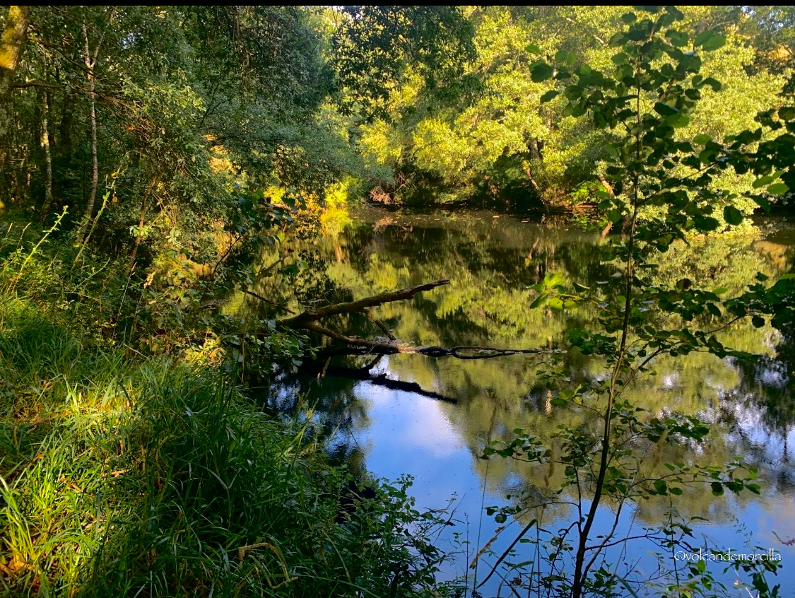
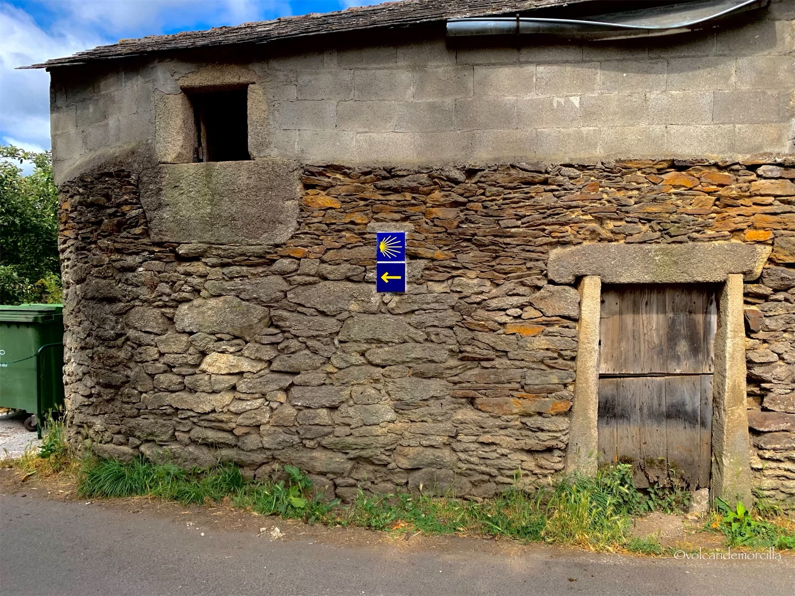
Hoy comenzamos donde lo dejamos ayer, en Baamonde. Según las guías oficiales del Camino de Santiago, los primeros kilómetros discurren junto a la carretera, sin embargo he visto en Wikiloc que hay una ruta paralela por el otro lado del río Parga. Me parece mucho más apetecible porque será mucho fresquita y en un entorno muy natural.
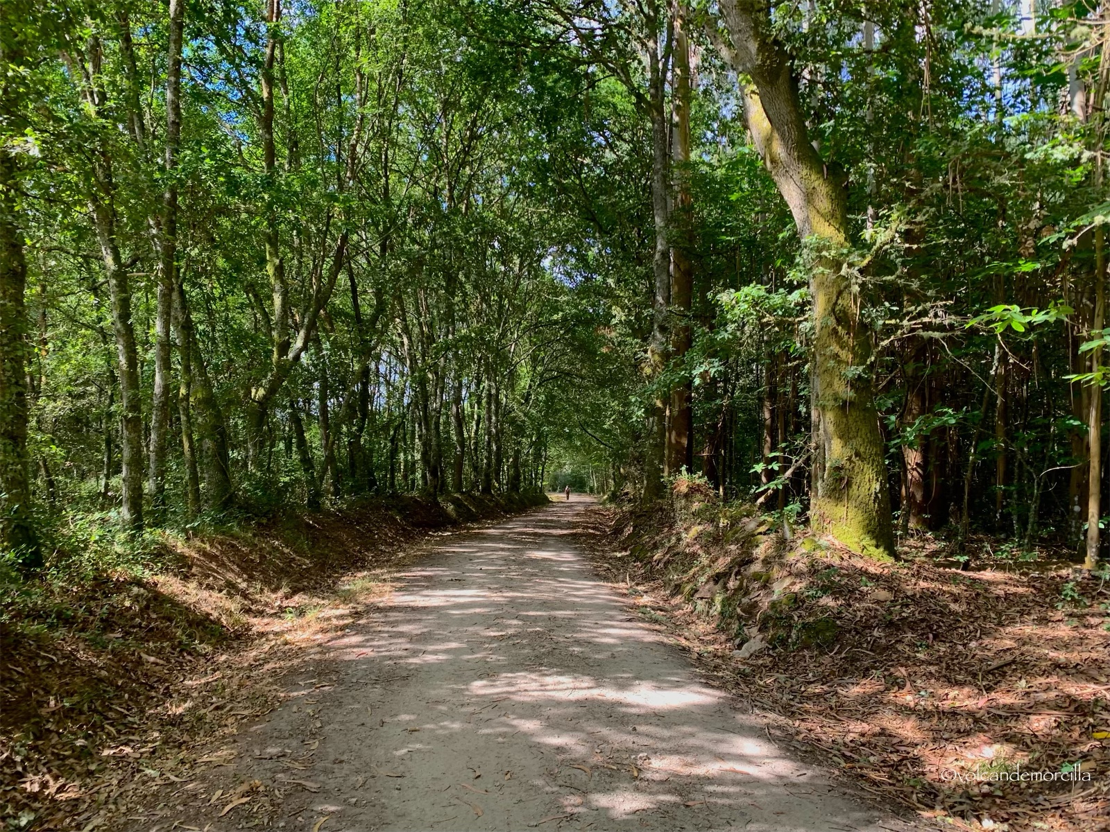
Decidimos coger esta ruta y cruzamos al otro lado del rio. Encontramos un campamento de boy scout y seguimos caminando junto al río. Advertimos que, progresivamente, se va haciendo la senda más estrecha pero imaginamos que será porque ha sido poco transitada últimamente.
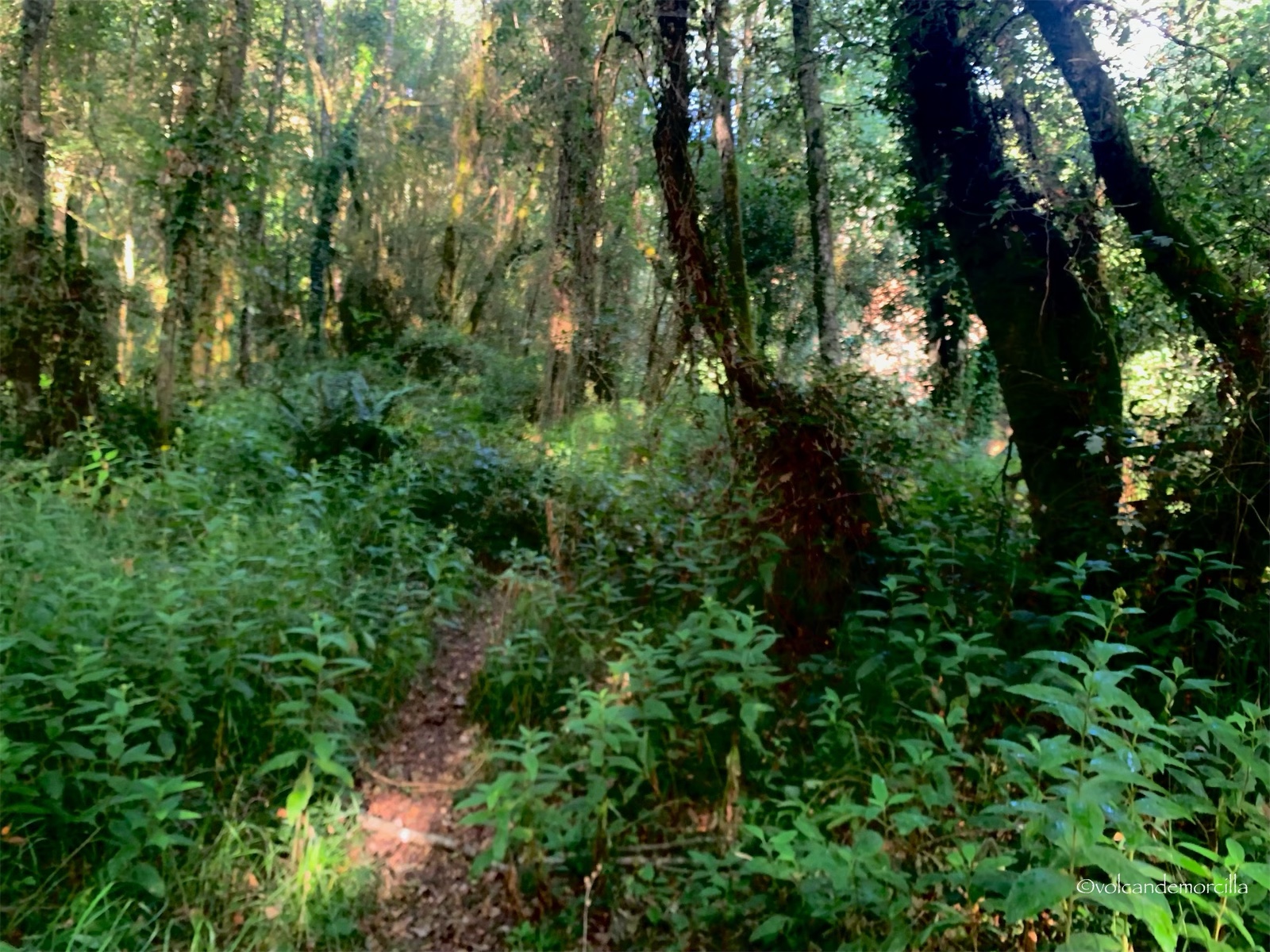
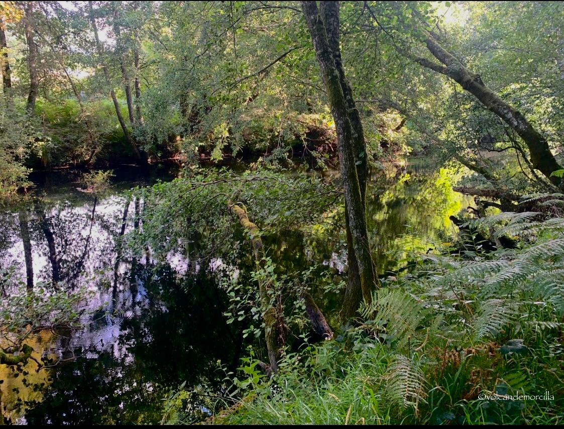
Seguimos por esta ruta varios kilómetros. Nos preocupamos porque la vegetación, a cada paso, se hace más intensa y alta.
Nuestro paso, cada vez, es más lento y dificultoso. Como hemos caminado varios kilómetros no queremos volver atrás, por lo que seguimos adelante con la esperanza de llegar a la ermita de San Albert, pero el camino se está complicando mucho.
Después de tropezarme y caer, decido guardar la cámara y no hacer fotos, para prestar toda la atención en dónde pongo los pies.
Debemos caminar muy atentos y abriendo la maleza, un accidente aquí podría ocasionar una tragedia. No creo que haya cobertura para el móvil y sería difícil encontrar a alguien que nos ayudara por estos lares donde no pasa nadie. Sinceramente, siento el peligro pues caminamos por una auténtica selva que en algunos con puntos nos cubre, incluso, por encima de la cabeza.
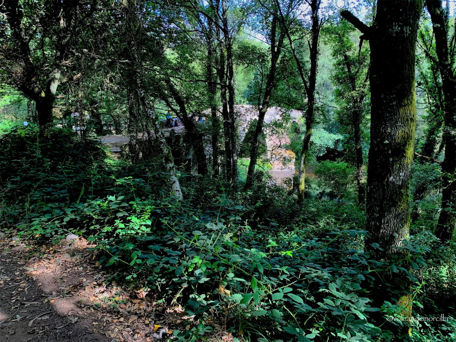
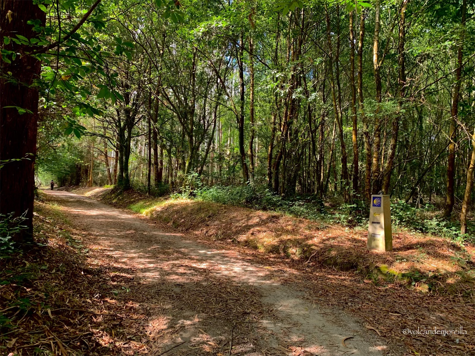
Finalmente, encontramos una vía forestal por la que avanzamos mucho más rápidamente. Hacemos una parada y nos tranquilizamos. Estamos empapados y asustados.
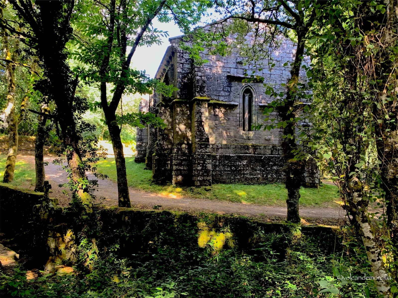
Finalmente, encontramos la capilla de San Albert que aparece ante nosotros de repente, en medio del bosque, oculta por mucha vegetación.
Después de haberlo pasado tan mal, se aparece ante nosotros esta ermita del siglo XIII. La situación me recordó a la de aquellos exploradores del Amazonas que encuentran, de repente, unas ruinas prehispánicas en el interior de una selva intrincada.
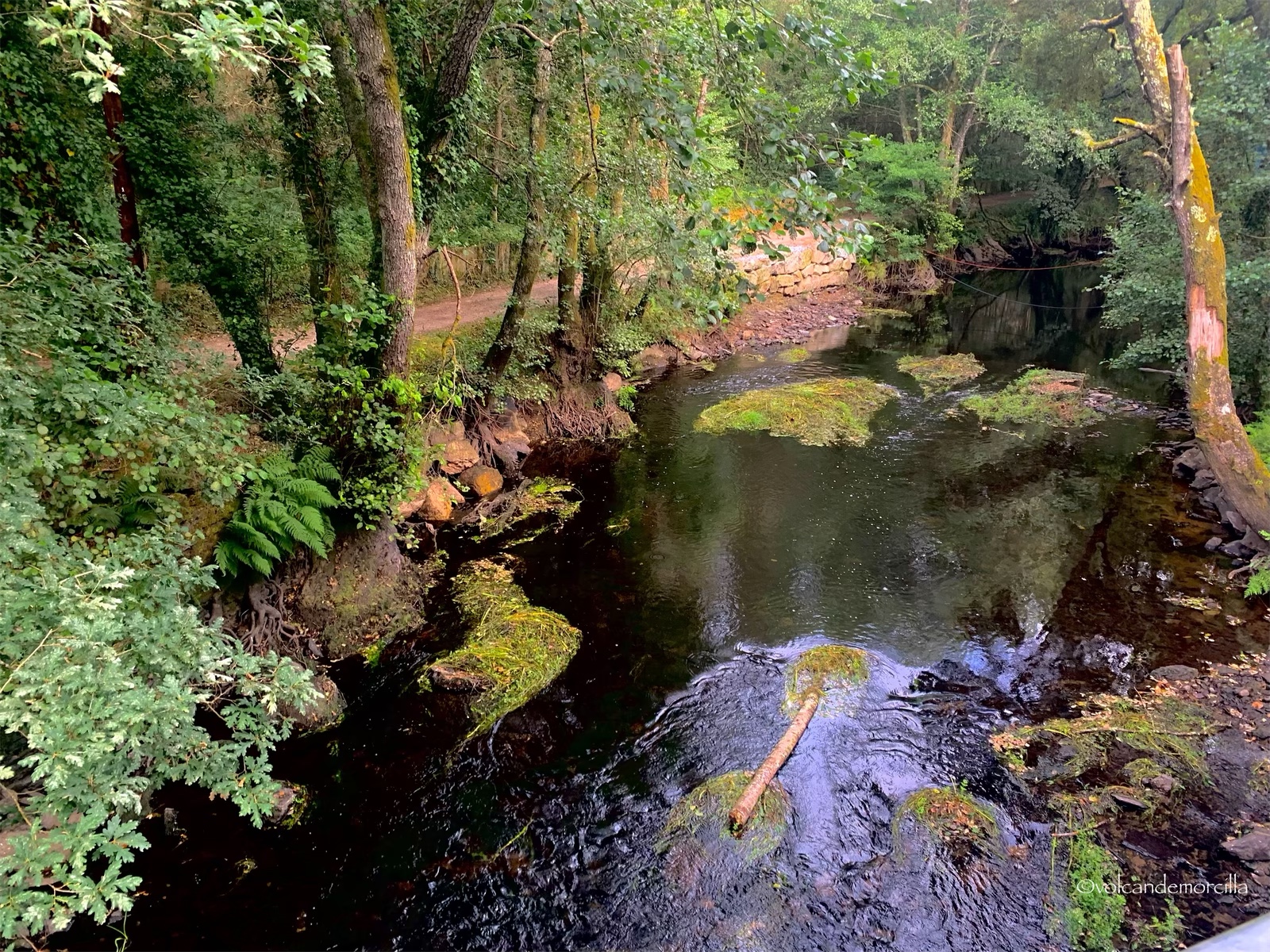
Junto a la ermita hay un puente que cruza el río y data del siglo XIV. Se cree que se construyó sobre uno anterior construido por los romanos.
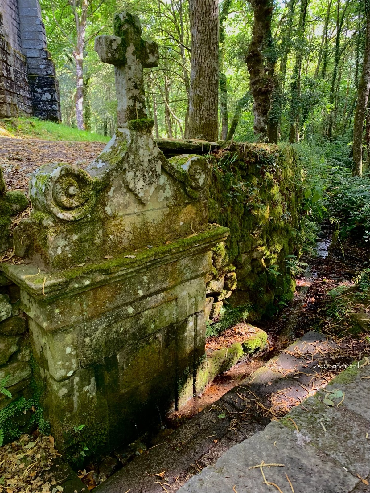
En el exterior, hay una fuente renacentista que proporciona agua potable. Paramos a refrescarnos y coincidimos con un peregrino vasco al que contamos nuestra penosa experiencia. Él carga una gran mochila y nos cuenta que piensa caminar hoy 50 km. Nos informa que va retrasado porque ha descargado su mochila de 10 kilogramos. Portaba, al parecer, muchos regalos que le habían hecho durante su desplazamiento desde Bilbao. Aún así, la mochila tenía pinta de pesar bastante. Me divierte ver asomar una gran barra de pan por la parte alta de su mochila.
Hay algunos peregrinos, los que nosotros llamanos “olímpicos” que sólo te cuentan la cantidad de kilómetros que recorren cada día. Se plantean retos enormes. Estos “peregrinos olímpicos”, si además son vascos, hacen auténticas proezas.
Hay “olímpicos” también gallegos. En Abadín nos contaron de un vecino que recorrió los 120 kilómetros que le separaban de Santiago de Compostela en un sólo día. Al parecer, esta proeza la ha hecho varias veces. Me quedó totalmente asombrado.
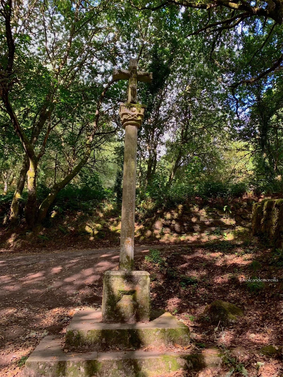
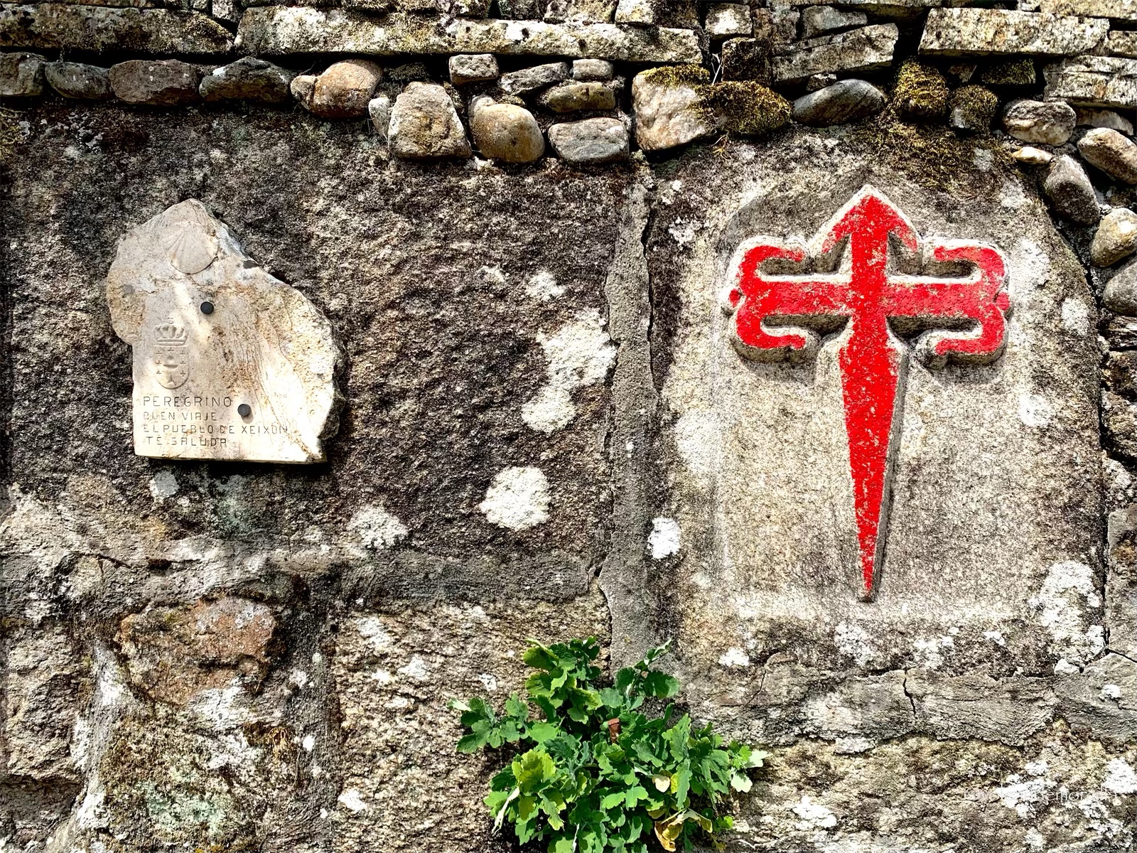
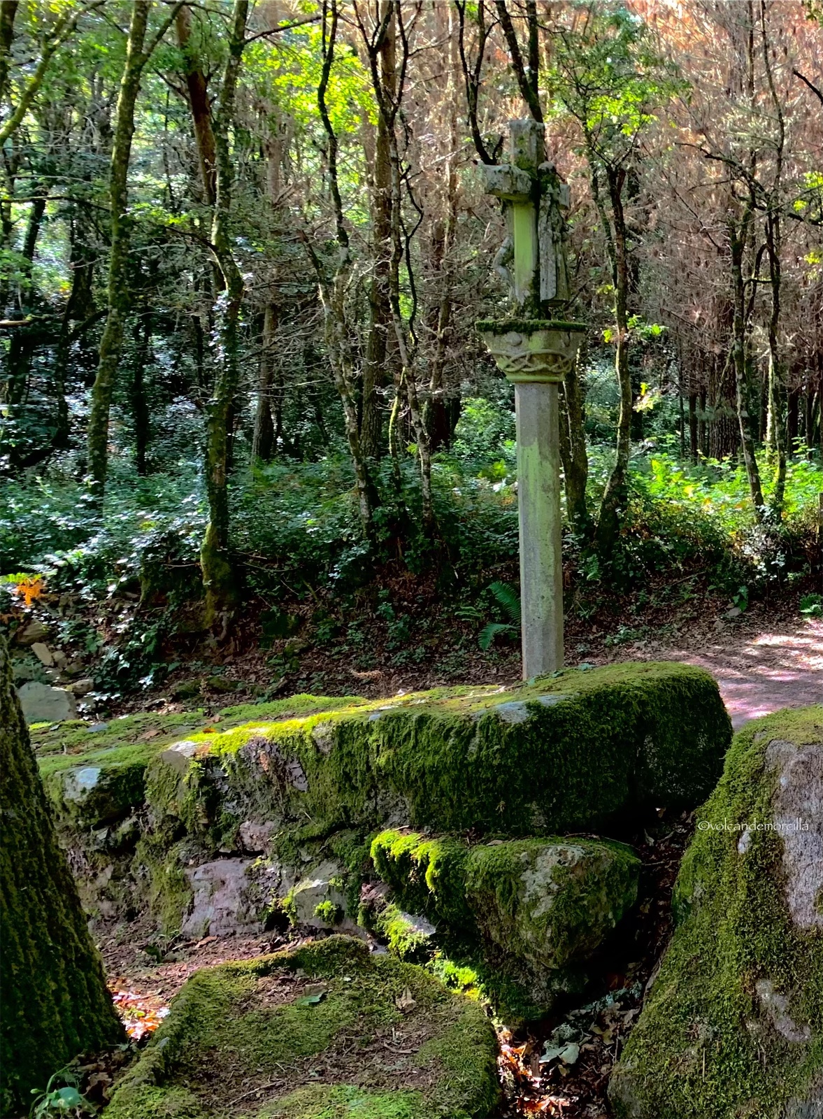
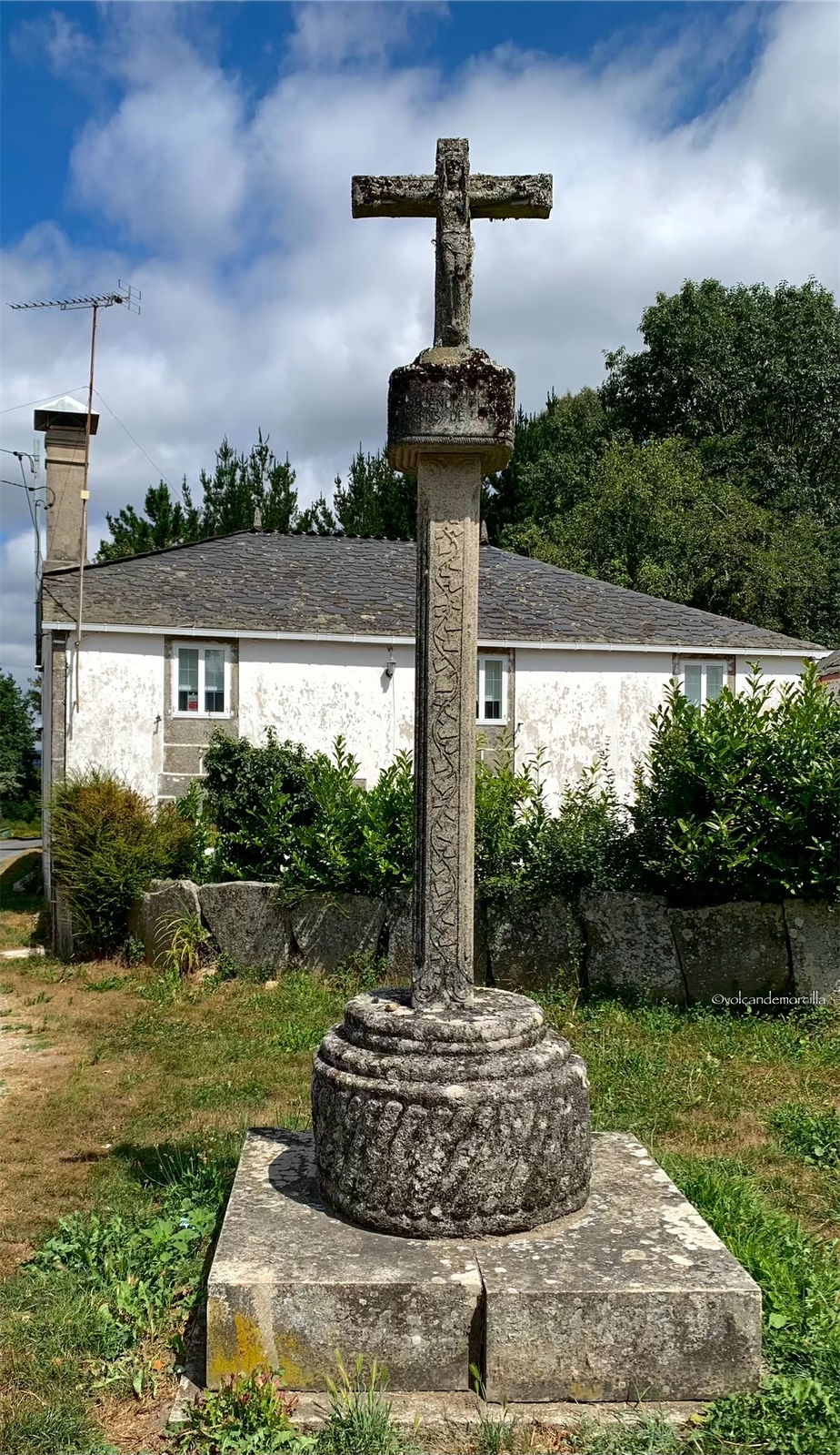
Junto a la ermita hay un cruceiro. Los cruceiros son monumentos religiosos que tienen una cruz sobre un pilar. Muchas veces los encontramos en el Camino. Generalmente están junto a ermitas o capillas. Tienen dos caras. En la anterior está Jesucristo crucificado y en la de atrás está la Virgen María con el niño. Este cruceiro, junto a la ermita de San Albert es muy antiguo y está cubierto de líquenes y musgo.
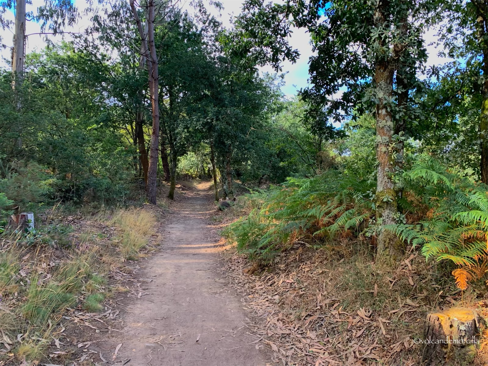
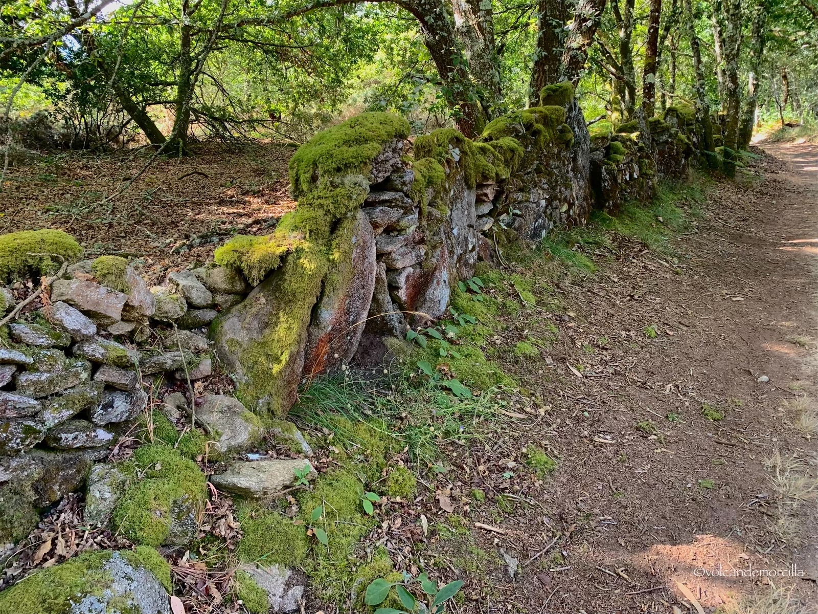
Seguimos el camino entre un bosque espeso de robles, encinas y pinos. Hay mucha humedad por lo que el musgo ha cubierto las piedras que delimitan las fincas junto a las que discurrimos.
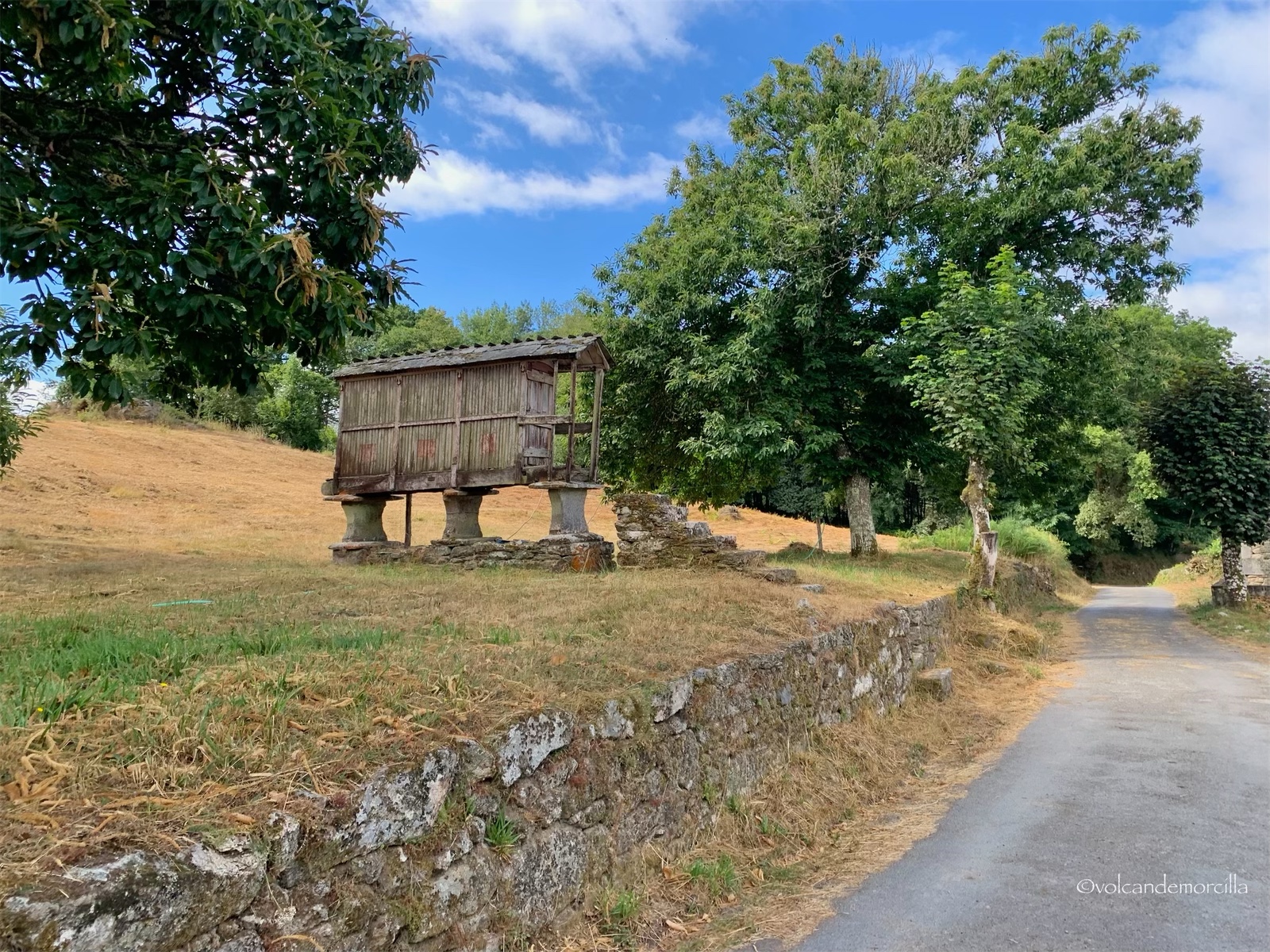
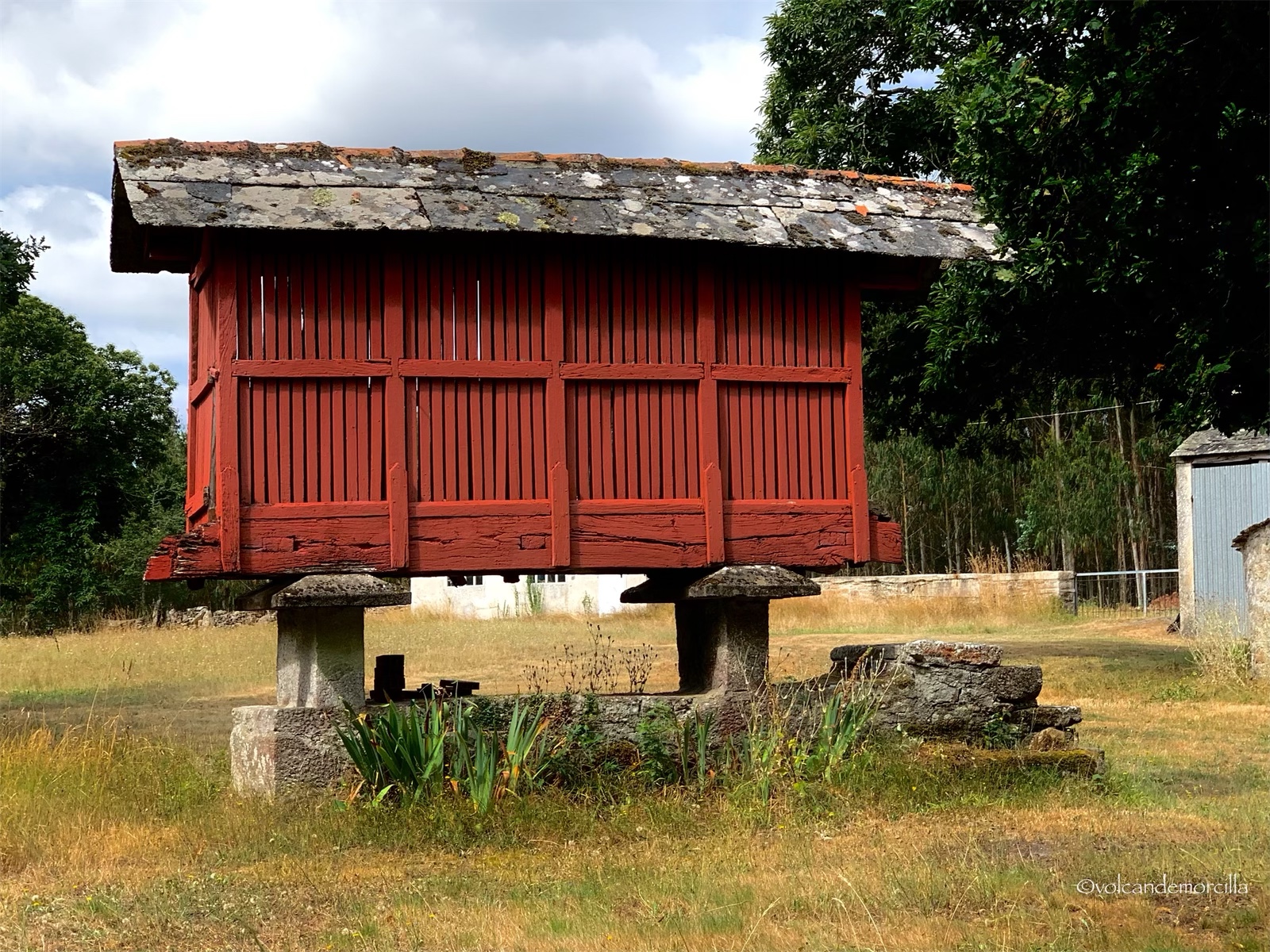
Observamos un viejo hórreo que está muy destartalado. En estas construcciones los aldeanos conservan la comida alejada de los animales y de la humedad. Otros años, he visto muchos más.
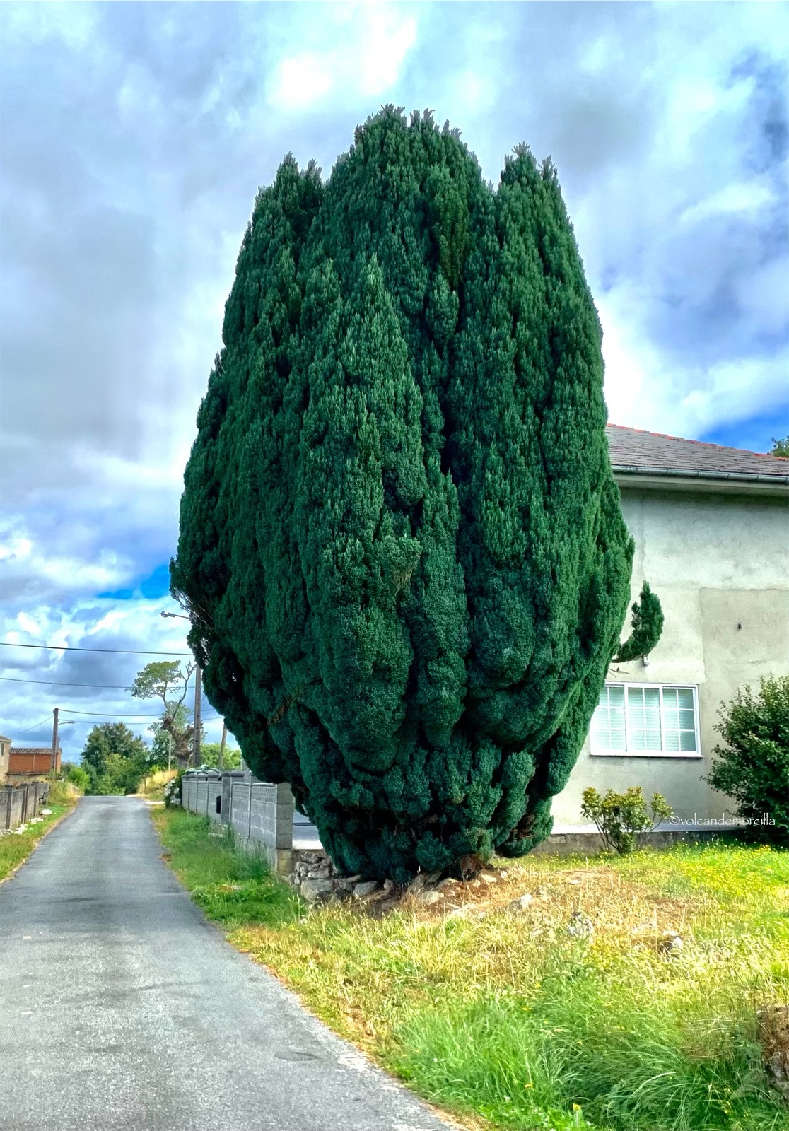
Tras una casa, encontramos un gran ciprés. No tiene mucha altura pero tiene un grosor impresionante. Es de un color azulado.
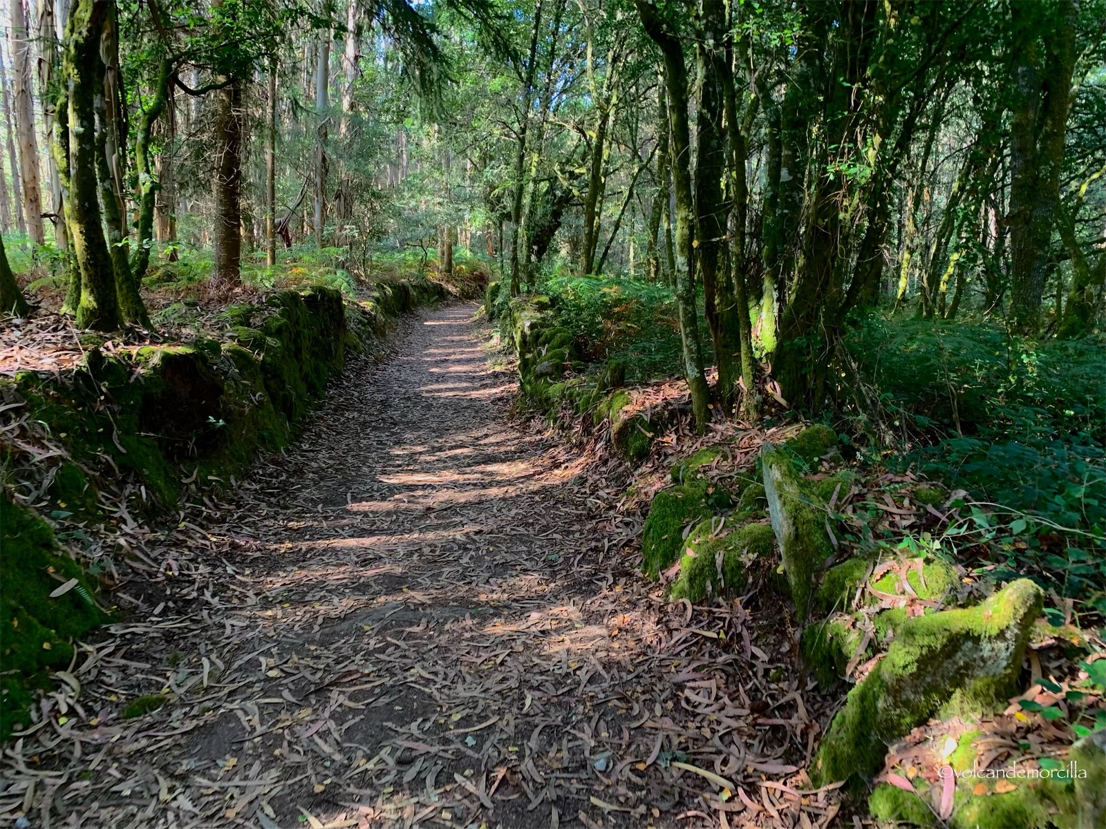
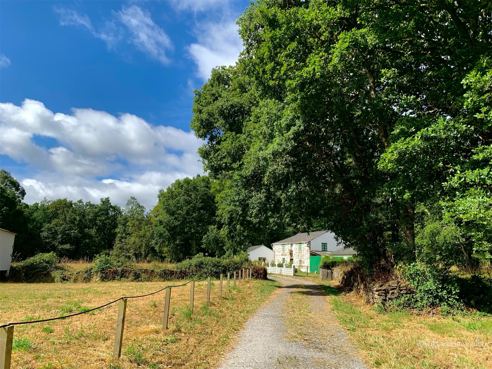
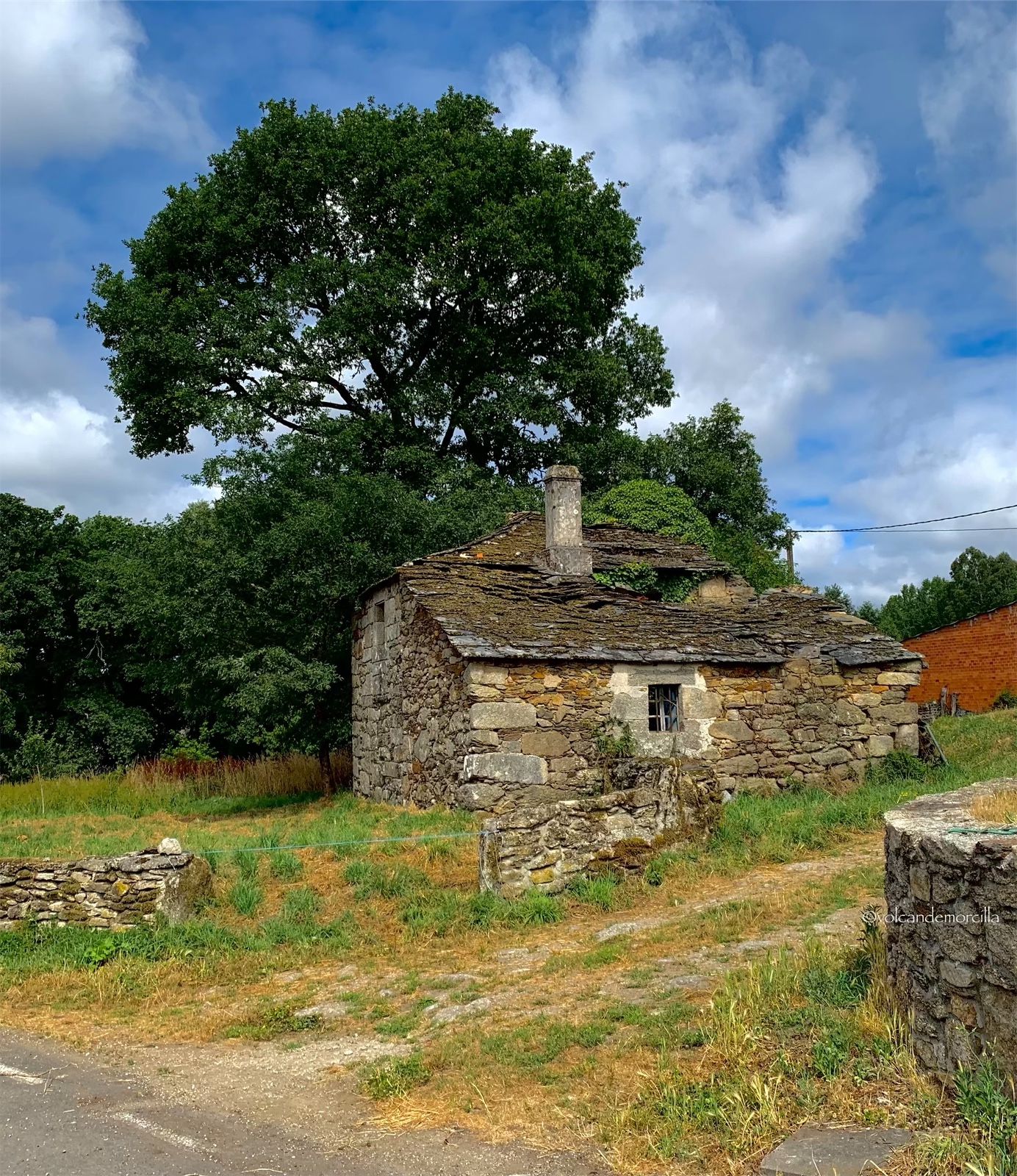
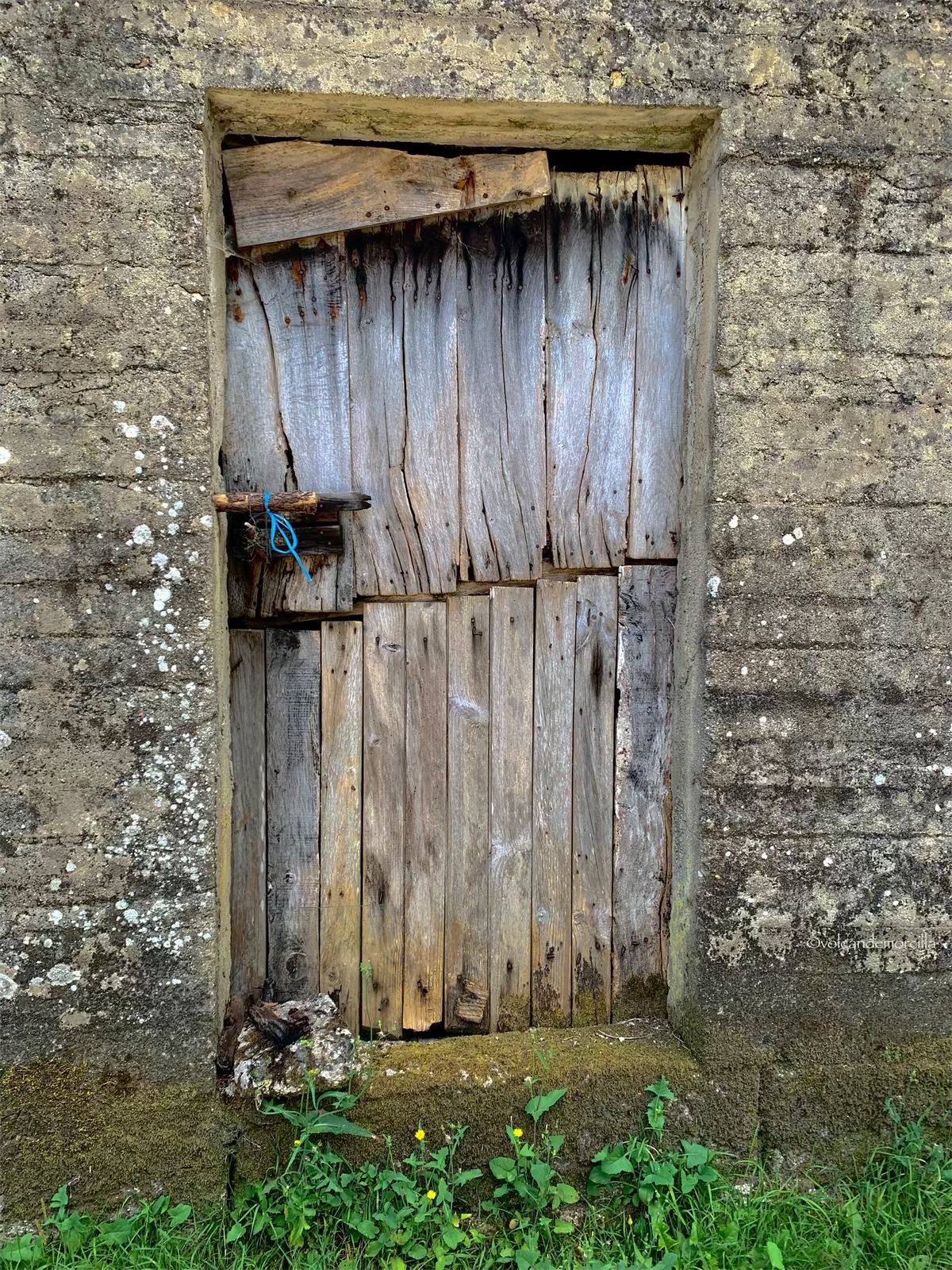
La etapa que estamos caminando es muy entretenida. No nos cansamos. Hay lugares donde el camino discurre bajo los árboles, mientras que en otros el espacio es abierto. De vez en cuando, se ven construcciones y casas. Me apena porque muchas de ellas están deshabitadas y pronto serán ruina.
Me encanta pensar que caminamos por lugares donde los europeos lo hicieron hace miles de años. Los celtas, en la península ibérica, se desplazaron por una red de caminos. Sobre ellos, construyeron los romanos sus calzadas.
En la España medieval, existían además otros caminos. Había, caminos reales que se utilizaban para las principales comunicaciones y, también, las cañadas reales que eran empleadas por los pastores para la trashumancia del ganado, buscando el mejor pasto en verano e invierno. Por todos ellos, los peregrinos medievales se desplazaron para llegar a Santiago de Compostela. El impulsor del Camino de Santiago fue, en el año 834, el rey asturiano Alfonso II “el Casto”. Desde su capital en Oviedo, partió hacia Compostela para confirmar el hallazgo del sepulcro del Apóstol Santiago. Para su desplazamiento de 320 kilómetros utilizó una antigua calzada romana.
El Camino que utilizó Alfonso II, se conserva todavía hoy y es el que se denomina “el Camino Primitivo”. Me gustaría hacerlo en alguna ocasión, aunque es un poco exigente porque tiene fuertes pendientes.
En el siglo X, se extendió por toda Europa la noticia del hallazgo de la tumba del apóstol y los peregrinos comenzaron a llegar a la península ibérica. En aquella época, sólo el norte no se encontraba ocupado por la invasión musulmana. Los peregrinos que cruzaban la cordillera de los Pirineos, para llegar a Compostela, seguían una ruta junto al mar Cantábrico. Esta vía hoy se ha recuperado y se denomina “el Camino del Norte”.
A partir del siglo XI, tras recuperar el río Duero los cristianos, en el año 910, los peregrinos comenzaron a utilizar un camino mas al sur, porque es mucho mas llano y con menores dificultades montañosas.
Así, los caminos que llegaban desde Francia y cruzaban los Pirineos por Aragón o por Navarra terminaban confluyendo en una población llamada Puente la Reina y seguían por una vía más accesible transcurriendo por la meseta castellana. Por ello, esta ruta cuyos peregrinos procedían fundamentalmente de Francia y del norte de Europa se denomina hoy en día “el Camino Francés”. Es la ruta de peregrinación más utilizada en la actualidad y también lo fue en la Edad Media.
Los peregrinos, al llegar a León, con frecuencia se desviaban hacia el norte para llegar a Oviedo por una ruta llamaba “el Camino de San Salvador” porque allí podían adorar “El Santo sudario” que es una reliquia importantísima de la cristiandad pues se trata de la sabana que envolvió el cadaver de Cristo. Luego, los peregrinos continuaban su marcha, bien por el Camino Primitivo o por el Camino del Norte. Este último, es el que elegimos nosotros para hacer este año porque, al ser un año Xacobeo, es esperable que acuda mucha gente y, por ello, buscamos una ruta en la que hubiera menos multitud.
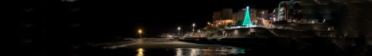
Este Camino nos está gustando especialmente. El primer día, nada más, coincidimos con tres peregrinos. Los días siguientes, vimos unos pocos más pero, únicamente hoy nos hemos cruzado con un grupo boy scouts. Dentro de unos días, cuando confluyamos en Arzúa con el Camino Francés, formaremos parte de la masa caminante. Hasta entonces, nuestro objetivo es disfrutar de la paz y de la naturaleza.
The risky river road
Today we start where we left off yesterday, in Baamonde. According to the official guides of the Camino de Santiago, the first kilometers run along the road, however I have seen on Wikiloc that there is a parallel route on the other side of the Parga River. It seems much more appetizing to me because it will be very cool and in a very natural environment.
We decided to take this route and crossed to the other side of the river. We found a boy scout camp and continued walking along the river. We warn that, progressively, the path becomes narrower but we imagine that it will be because it has been little traveled lately.
We continue along this route for several kilometres. We worry because the vegetation, at every step, becomes more intense and higher.
Our step, each time, is slower and more difficult. As we have walked several kilometres, we do not want to go back, so we continue forward with the hope of reaching the hermitage of San Albert, but the road is getting very complicated.
After tripping and falling, I decide to put the camera away and not take photos, to pay full attention to where I put my feet.
We must walk very carefully and open the brush, an accident here could cause a tragedy. I don't think there is mobile coverage and it would be difficult to find someone to help us in these parts where no one passes by. Honestly, I feel the danger because we walk through an authentic jungle that in some places covers us, even above our heads.
Finally, we find a forest road through which we advance much more quickly. We stop and calm down. We are soaked and scared.
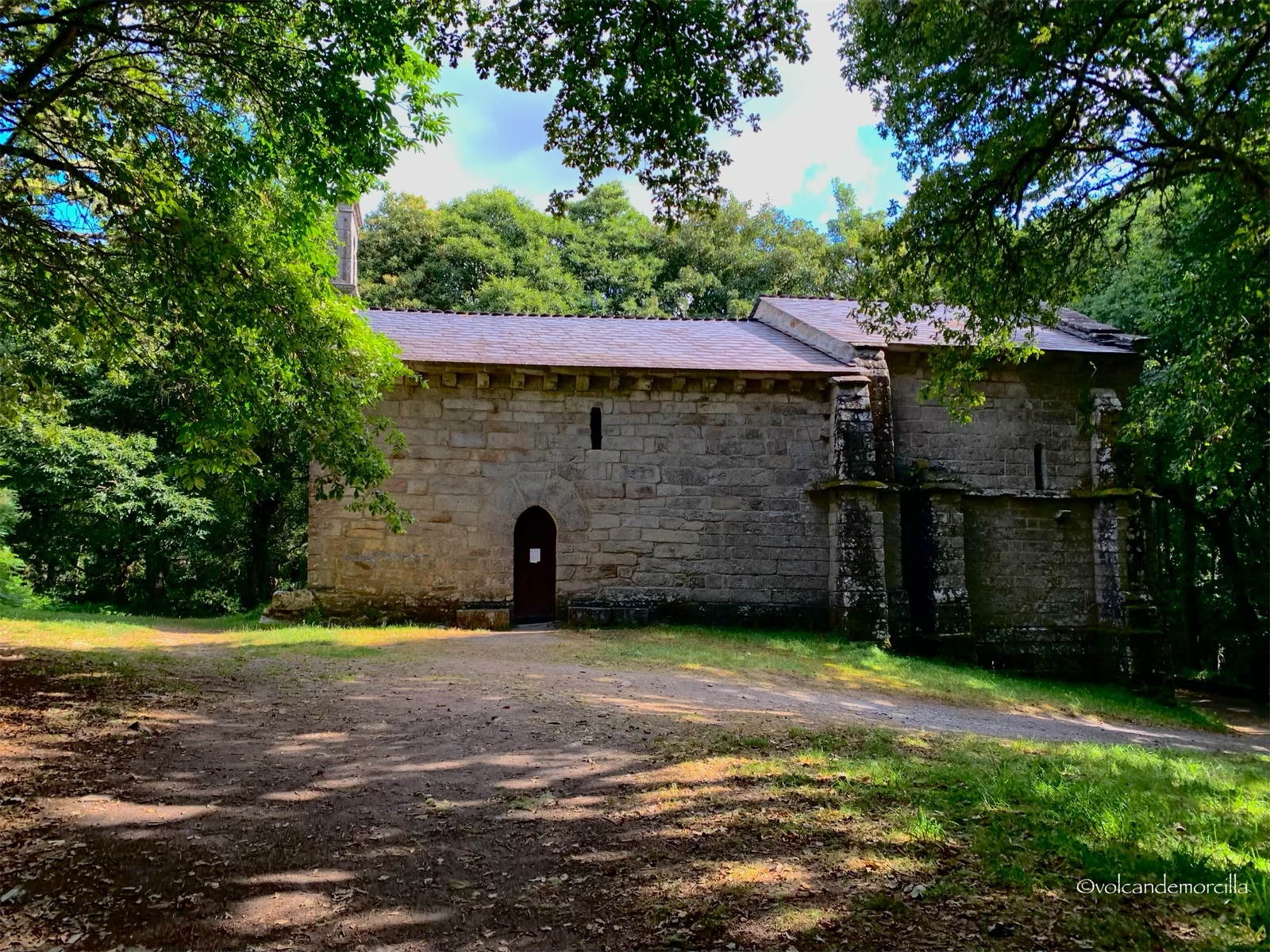
Finally, we find the chapel of Saint Albert that suddenly appears before us, in the middle of the forest, hidden by a lot of vegetation.
After having such a bad time, this 13th century hermitage appears before us. The situation reminded me of those explorers in the Amazon who suddenly found pre-Hispanic ruins inside an intricate jungle.
Next to the hermitage there is a bridge that crosses the river and dates from the 14th century. It is believed that it was built on top of an earlier one built by the Romans.
Outside, there is a Renaissance fountain that provides drinking water. We stop to freshen up and we meet a Basque pilgrim to whom we tell our painful experience. He carries a large backpack and tells us that he plans to walk 50 km today. He informs us that he is running late because he has unloaded his 10-kilogram backpack. He apparently carried many gifts that had been given to him during his displacement from Bilbao. Still, the backpack seemed to be quite heavy. It amuses me to see a large loaf of bread appear. There are some pilgrims, the ones we call “Olympians” who only tell you the number of kilometers they travel each day. Huge challenges are posed. These “Olympic pilgrims”, if they are also Basque, perform authentic feats.
There are also Galician "Olympians". In Abadín they told us about a neighbor who traveled the 120 kilometers that separated him from Santiago de Compostela in a single day. Apparently, this feat has been done several times. He totally amazed me.
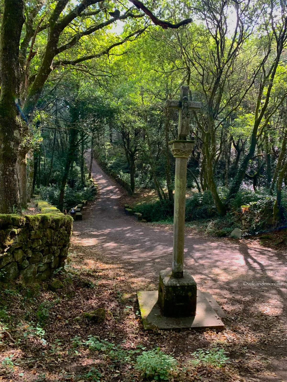
Next to the hermitage there is a stone cross. The crosses are religious monuments that have a cross on a pillar. Many times we find them on the Camino. They are usually next to hermitages or chapels. They have two faces. In the previous one is Jesus Christ crucified and in the back one is the Virgin Mary with the child. This stone cross, next to the hermitage of San Albert, is very old and covered with lichens and moss.
We follow the path through a thick forest of oaks, holm oaks and pines. There is a lot of humidity so the moss has covered the stones that delimit the farms next to which we run.
We see an old granary that is very dilapidated. In these constructions, the villagers keep food away from animals and moisture. Other years, I have seen many more.
Behind a house, we find a large cypress. It does not have much height but it has an impressive thickness. It is bluish in color.
The stage we are walking is very entertaining. We don't get tired. There are places where the path runs under the trees, while in others the space is open. From time to time, constructions and houses are seen. It saddens me because many of them are uninhabited and will soon be ruined.
I love to think that we walk in places where Europeans walked thousands of years ago. The Celts, in the Iberian Peninsula, moved through a network of roads. On them, the Romans built their roads.
In medieval Spain, there were also other paths. There were royal roads that were used for the main communications and, also, the royal ravines that were used by shepherds for the transhumance of cattle, looking for the best pasture in summer and winter. Through all of them, medieval pilgrims traveled to reach Santiago de Compostela. The promoter of the Camino de Santiago was in the year 834, the Asturian king Alfonso II "el Casto". From his capital in Oviedo, he left for Compostela to confirm the discovery of the tomb of the Apostle Santiago. For his 320 kilometer journey he used an ancient Roman road.
The Way used by Alfonso II is still preserved today and is called "the Primitive Way". I would like to do it on occasion, although it is a bit demanding because it has steep slopes.

In the 10th century, the news of the discovery of the apostle's tomb spread throughout Europe and pilgrims began to arrive in the Iberian Peninsula. At that time, only the north was not occupied by the Muslim invasion. The pilgrims who crossed the Pyrenees mountain range to reach Compostela followed a route along the Cantabrian Sea. Today this route has been recovered and is called “El Camino del Norte”.
From the 11th century, after recovering the Duero river, the Christians, in the year 910, the pilgrims began to use a path further south, much flatter and with fewer mountainous difficulties.
Thus, the paths that came from France and crossed the Pyrenees through Aragon or Navarre ended up converging in a town called Puente la Reina and followed a more accessible route through the Castilian plateau. For this reason, this route whose pilgrims came mainly from France and northern Europe is today called "the French Way". It is the most used pilgrimage route today and it was also in the Middle Ages.
Pilgrims, arriving in León, often deviated north to reach Oviedo along a route called "the Camino de San Salvador" because there they could worship "El Santo sudario" which is a very important relic of Christianity because it is of the savannah that wrapped the corpse of Christ. Then, the pilgrims continued their march, either along the Primitive Way or along the Northern Way. The latter is the one we chose to do this year because, being a Xacobeo year, it is expected that many people will attend and, therefore, we look for a route with less crowds.
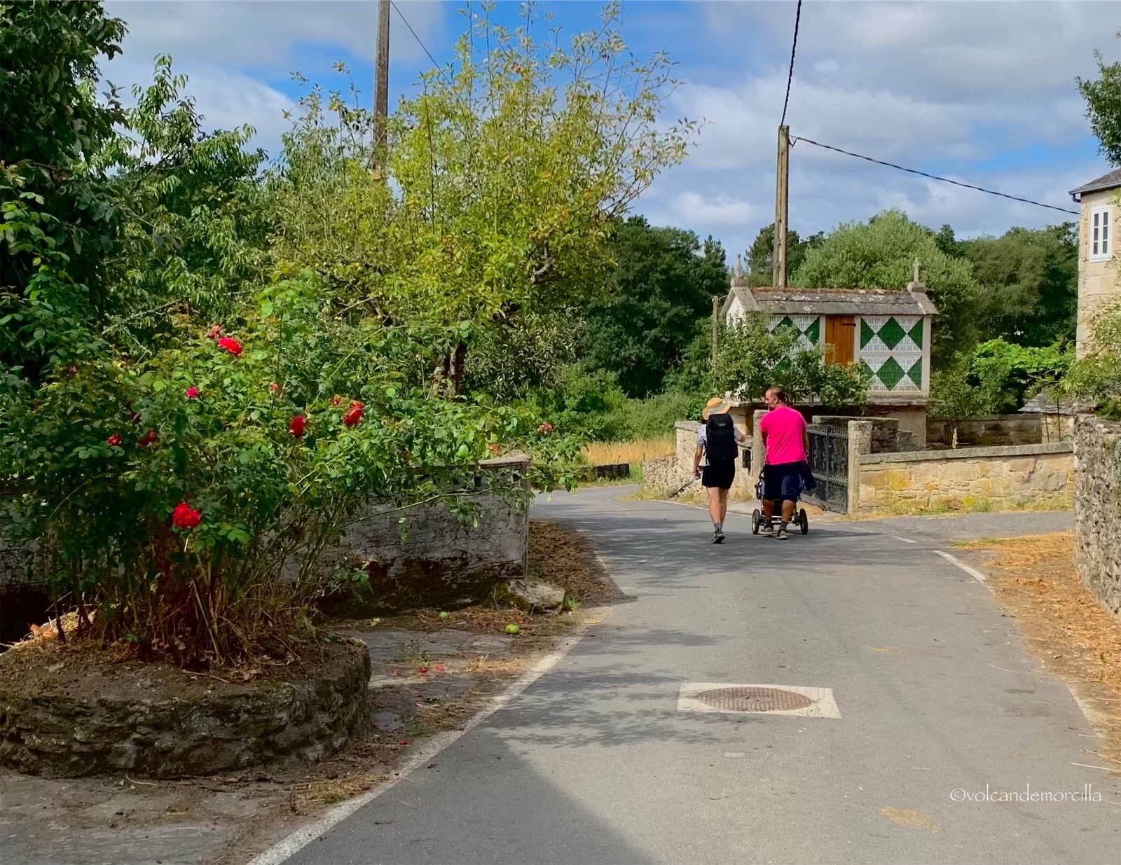
We are particularly enjoying this Camino. The first day, nothing else, we met three pilgrims. The following days, we saw a few more but, only today we have come across a group of boy scouts. In a few days, when we converge in Arzúa with the Camino Frances, we will be part of the walking mass. Until then, our goal is to enjoy peace and nature.
Cómo lo hago
Hice las fotografías con mi iPhone X. Para la edición utilicé la aplicación Snapseed y para la firma digital usé la App Watermark.
Los dibujos los hice en el iPad con el programa Sketches.
For the photography I use my iPhone X. For edition I use the Snapseed application and for the digital signature the Watermark app.
Everything I did on my mobile phone, I did not use the computer at all.
For the drawings, I use the Sketches program and paint them on the tablet.
Si quieres ver como lo hago, visualiza estos tres enlaces de publicaciones previas.
If you want to see how I do it, visualize these three links from previous publications.
Las fotos son mías y originales. También, soy el autor del dibujo separador.
¡Espero tus comentarios!
The photos are originals and mine. Also, I am the author of the separator drawing.
I await your comments.
Buen Camino!
Muchas Gracias amigos 😉
Dear @volcandemorcilla, we need your help!
The Hivebuzz proposal already got important support from the community. However, it lost its funding a few days ago and only needs a few more HP to get funded again.
May we ask you to support it so our team can continue its work this year?
You can do it on Peakd, ecency,
https://peakd.com/me/proposals/199
Your support would be really appreciated.
Thank you!