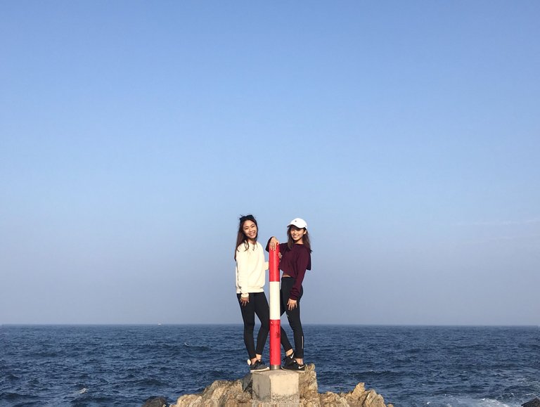
Travel with @nicolemoker & @krischy ❤️
Last weekend, @nicolemoker and I traveled to the southeastern Hong Kong Island, Hok Tsui, which is also known as Cape D'Aguilar. Cape D’Aguilar is named after Major-General Sir George Charles D'Aguilar (1784–1855), who served as Hong Kong Governor of Hong Kong from 1843 to 1848.
Cape D’Aguilar was not easily accessible by public transport, making it a secret gem that not yet to be found a few years ago. Recently, the locals and tourists are getting familiar with this place after it became a popular location for star photography enthusiasts. Although it’s not as secret as it used to be, the beautiful scenery is still here for you to explore.
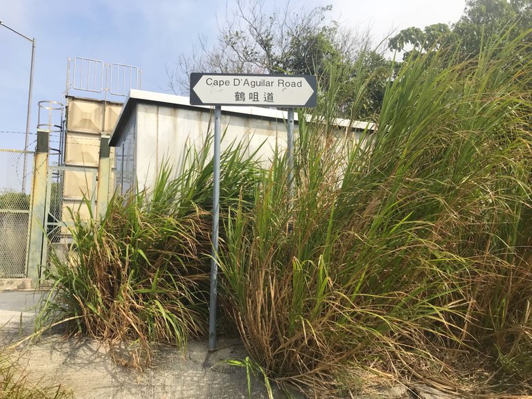
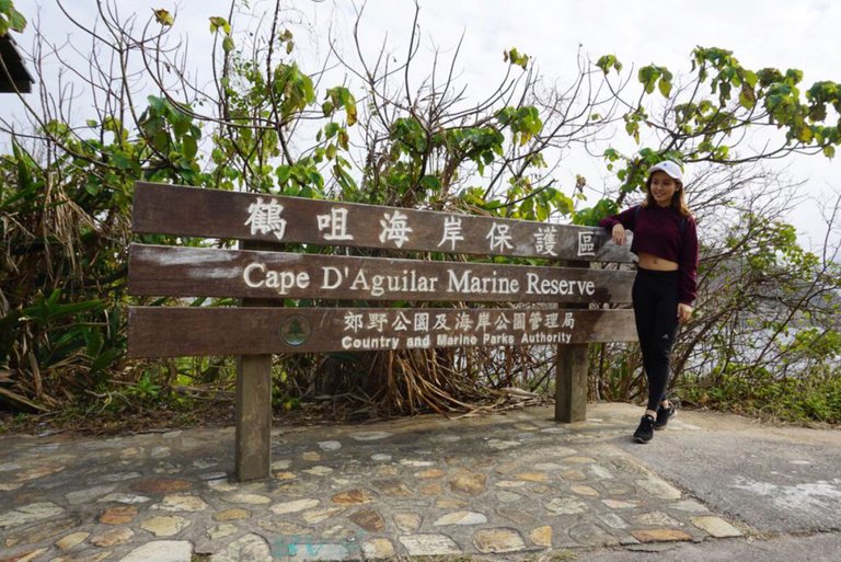
We took bus No.9 at Shau Kei Wan Bus Terminus and get off at Cape D’Aguilar road. After getting off from the bus, you will see the starting point with a road sign "Cape D’Aguilar ".
上個週末,@nicolemoker和我一起去了位於香港島東南部的鶴咀半島,鶴咀有還有一個充滿歐陸風情的英文名字:Cape D' Aguilar,取自於一位香港總督的爵士。
很多人以為鶴咀是禁區而不可內進,加上不是太多公共交通工具可以到達,所以被稱為「港島南區秘景」。這次興起是因為朋友在IG分享了一張鶴咀的照片,就拉著妮可說一起去:P
我們在筲箕灣巴士總站乘坐9號巴士,在鶴咀道下車。從巴士下車後,就會看到鶴咀道的入口。
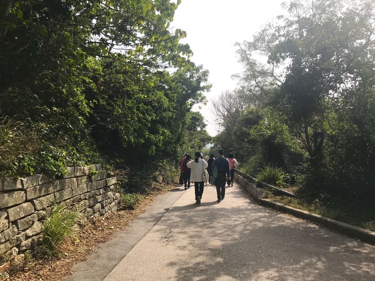
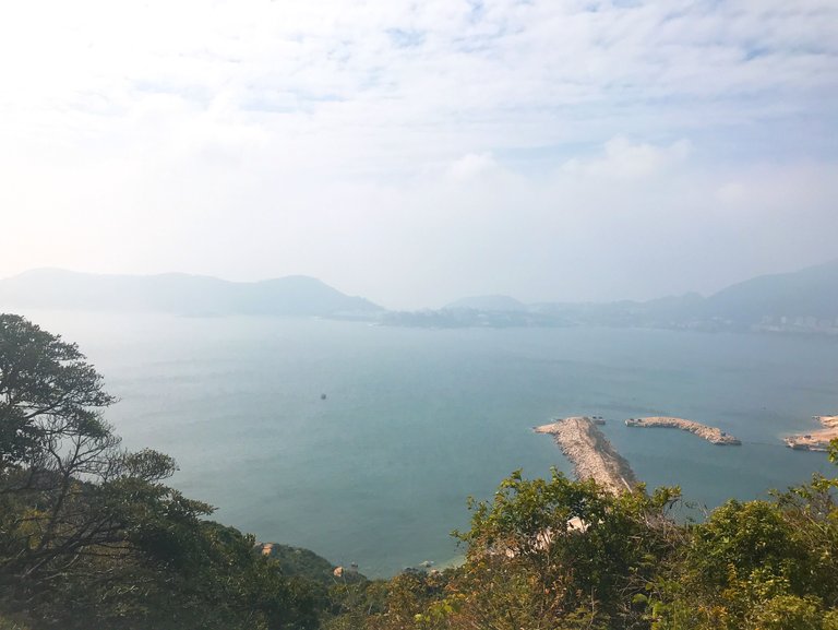
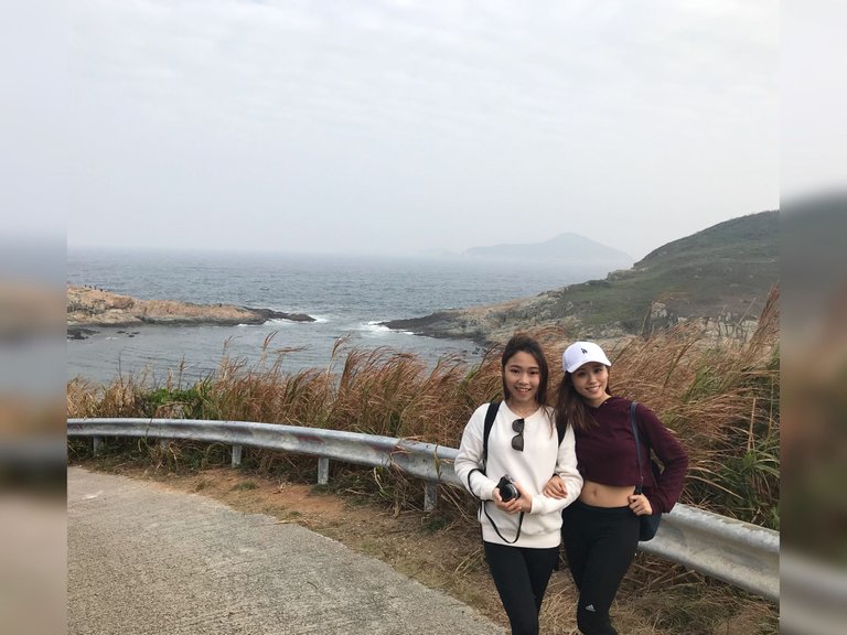
Go along the main traffic road and enjoy the panoramic view of the sky and sea from the coastal cliff.
海岸保護區前,都是水泥路,沿途可以欣賞令人心曠神宜的海岸風光。

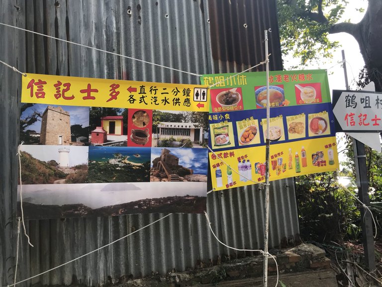
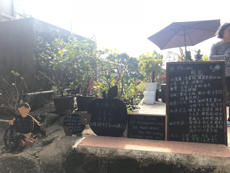
There are different food stores provide drinks and food for visitors while we are walking to our destination, sea caves by the shore.
路過芽菜坑村和鶴咀村,沿途有幾間小店,為遊客提供飲料和食物。
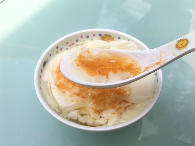
We ordered a tofu pudding (HKD$15) :P
我們每人點了一碗豆花($HKD 15)
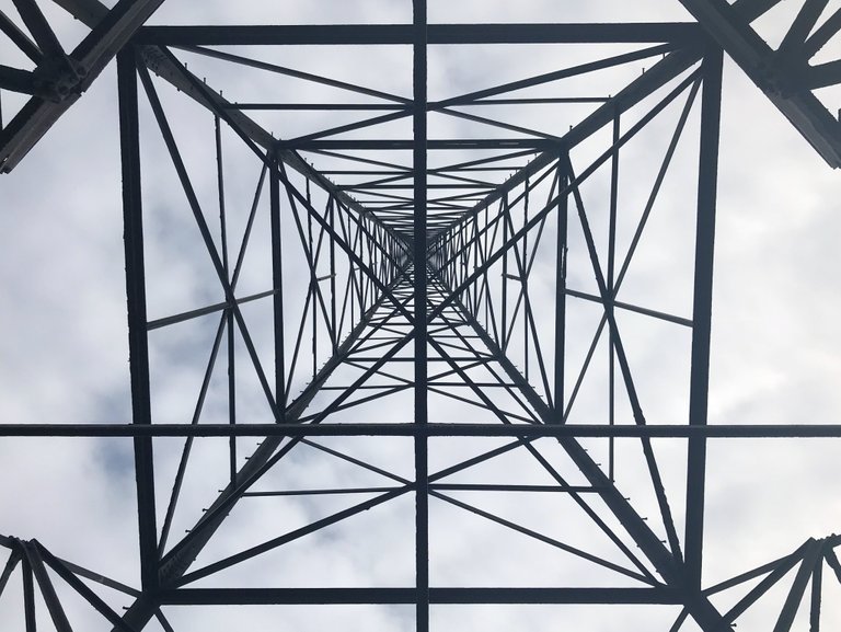
After finish the refreshing and tasty tofu pudding, we continue our trip. Follow the concrete path, there are many electric tower.
吃過豆花後,我們再繼續旅程,沿路看到好幾個電塔。
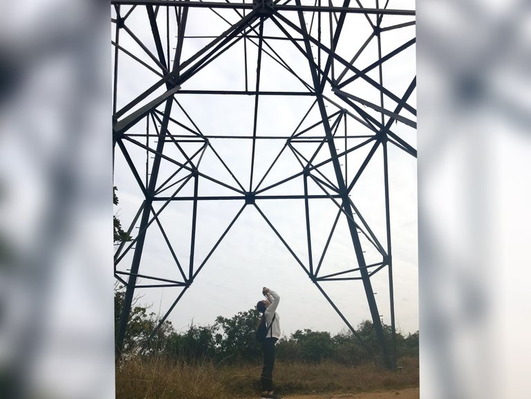
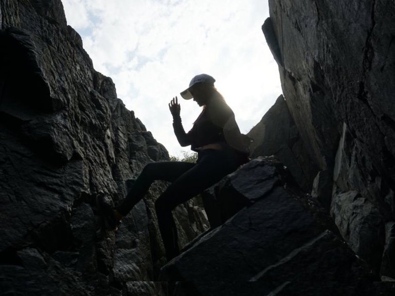
If you take photos directly below the tower, you will have some very cool abstract photo like this one~
我們又停下來拍照,從電塔的正下方拍會拍到由線條造成的照片,像下圖那樣:P
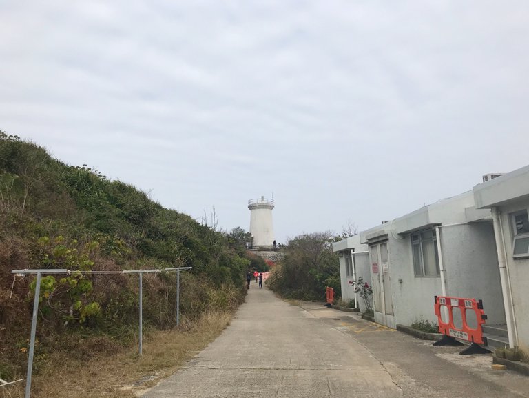
After around 30-minute walk and passing through a few villages, you will reach the Cape D’Aguilar radio station.
經過約30分鐘的步行路程,經過幾個村莊,我們終於到達了鶴咀電台。
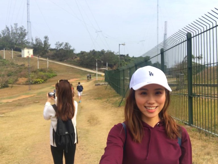
Visitors are prohibited from entering the radio station which is a restricted area. You can take another path, walk on the lawn to the other side of the radio station.
當看到無線電台範圍及「私人地方,不可擅進」的路牌,繞過它,只需繞過就走旁邊的草地就可以了。
You will see another junction after returning to the cement road. Take the path on the left and continue walking, follow the sign. You will see the oldest surviving lighthouse in Hong Kong is right in front of you.
穿過電台後就繼續走。會見到分叉路,有路牌寫著向上是燈塔,走大概5分鐘便會看到燈塔
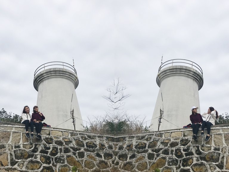
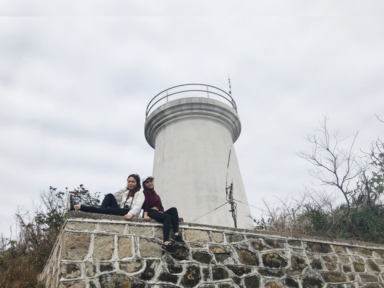
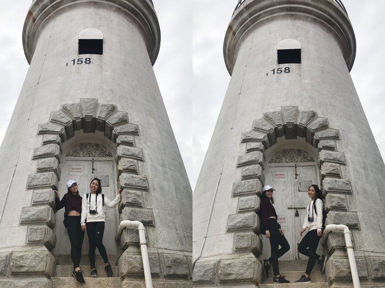
1. Light House/鶴咀燈塔
Nicole and I was super excited to see the first tourist spot in this trip. We took many photos with the lighthouse :P
鶴咀燈塔是香港現存最古老的燈塔,在1875年開始啟用,在2006年被列為法定古蹟。妮可和我看到燈塔後都非常興奮,和燈塔拍了很多照片。這宏偉的白色燈塔配襯著藍天,真的令人有在異國的感覺。
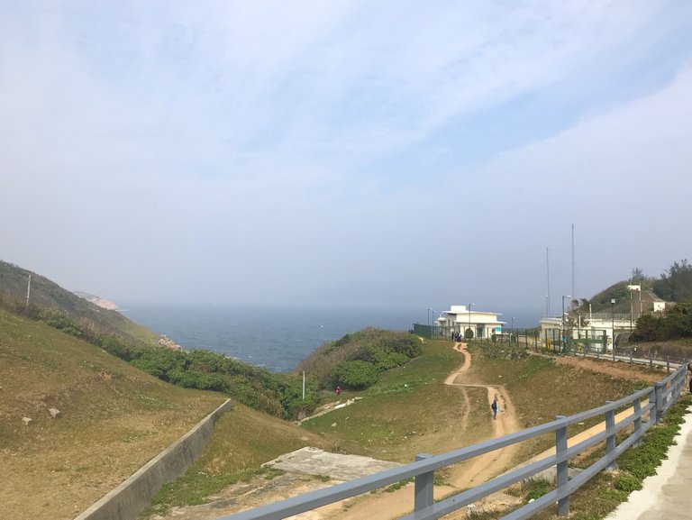
Marine Reserve and other tourist spots are on the other side of the junction, so we walked back to the junction after visiting the lighthouse. We took the right path this time, after 10 minutes walk, we saw the sign "Cape D'Aguilar Marine Reserve".
燈塔在分岔口的一端,而海岸保護區和蟹洞則在另一端,因此,我们先返回分岔口。這次我們往下走,走了大概十分鐘就看到寫著「鶴咀海岸保護區」的牌子。
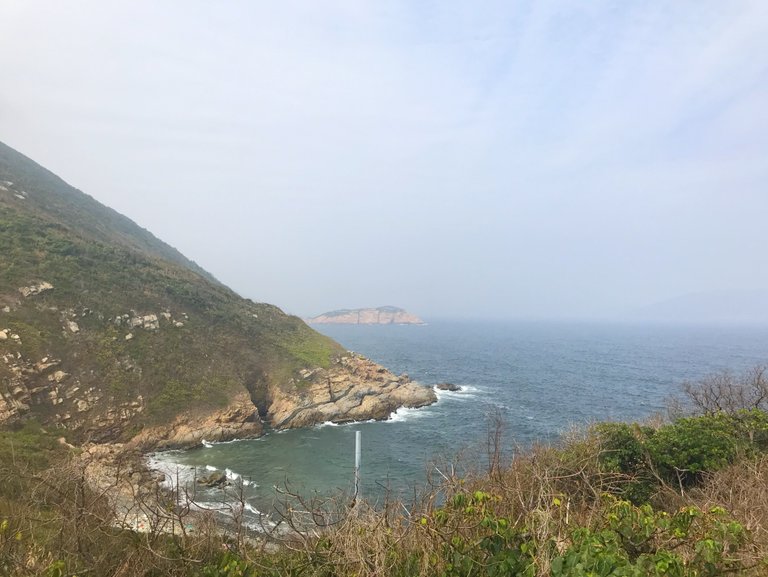
From the photo below, you can see two island are barely joint to each other. On the left, we have Cape D'Aguilar and on the right is Kau Pei Chau.
我和妮可的身後是兩個快連到一起的小島,左邊是鶴咀,而右邊則是牛髀洲,大家覺得鶴咀的地形像一個鶴咀嗎?
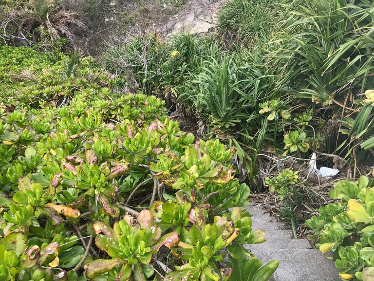
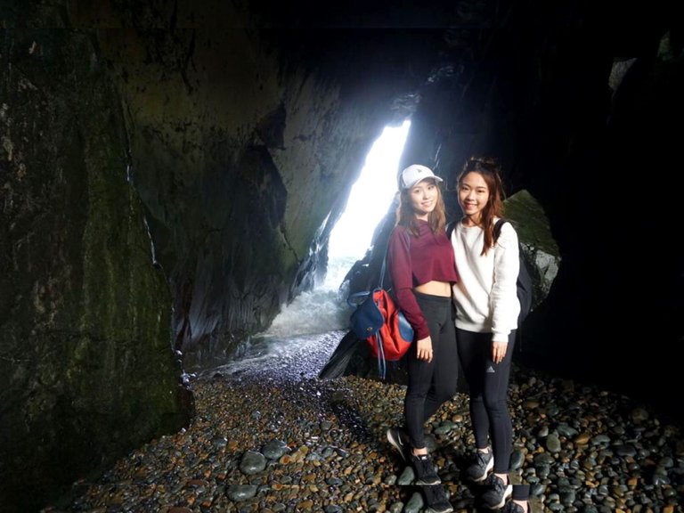
Down to the place walking for around 5 minutes before the institute of marine science ahead, there is a hidden pathway on the left leading down to Thunder Sound Cave.
往海岸保護區途中,記得細心聽聽周圍的聲音,因為當你聽到浪濤聲時,意味雷音洞就在附近,電音洞的入口是在到達研究中心前,在左側的一條隠閉小路。
2. Thunder Sound Cave/ 雷音洞
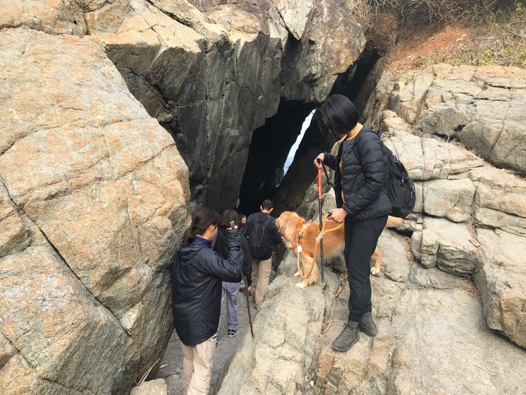
The exterior of the cave.
雷音洞的外部
A photo taken by Nicole while I am climbing down to the cave. What a cool shot taken by Nicole lol.
妮可從洞的內部拍攝我爬進洞內的照片,很酷吧,哈哈。
In the cave, there are many oval stones scoured by surf, so they produce sound of collision. You will hear thundering sound when sea waves splash against the cave wall
每當巨浪衝過收窄的洞口,加上洞內的回音,會聽到雷鳴般的聲音,如雷貫耳。
I will continue this trip in my next coming post :P Thanks for reading and I hope you enjoy 💓 If you would like to watch the vlog of this trip, please press here :P
https://steemit.com/travel/@nicolemoker/u39yevpo
我將在下一篇文章中繼續分享這次的旅程:P感謝你花時間看這篇文章,希望你喜歡💓 另外,想看這次旅程短片的可以看看妮可的分享喔 :)
!steemitworldmap 22.2166654 lat 114.2491571 long d3scr


Wow!Excellent photography.You are really creative photographer. Please stay with photography. how the beautiful natural view is! Very color full also. this see world good to traveler.
Thank you :)
You are welcome my friend, I have a new post, do not forget to visit ya, let me add the spirit in steemit.
You are looking so cool and beautiful in all the photos. And the views that you have captured are also really amazing and attractive.
Thanks for a wonderful photography and sharing your travel with us.
Thank you my friend :)
Glad that you enjoy this post ~
Congratulations, Your Post Has Been Added To The Steemit Worldmap!
Author link: http://steemitworldmap.com?author=krischy
Post link: http://steemitworldmap.com?post=explore-hong-kong-with-me-15-cape-d-aguilar-part-1
Want to have your post on the map too?
very good
Thank you :)
Wow, looks like a really nice place to visit. I've been to HK few times but have never been Hok Tsui island. Next time when I go to HK I will definitely follow your instructions:) Thanks for an interesting post!
haha, there's actually no Hok Tsui island in Hong Kong. Hok Tsui is located in the southeastern Hong Kong Island.
oops...now I'm feeling awkward haha. anyway, you got my point:)
Woooo, these girls are pretties :PPPPP
I wanna show that photo again XD
haha lol
I would love to visit Hong Kong!
You will like it :)
awesome photogreaphy dear keep it up i follow you hope you will share more thanks
Thank you :)
Sure. I will continue sharing different places and restaurants here.
another very exciting trip you have discovered, my friend. Good for you!
Thank you :)
Amazing place ! Hope you guys enjoyed there !! Beautiful Hongkong !!!
You both are looking awesome there !
Thank you :)
你们都穿好少啊,我还在穿羽绒服
剛好去的那天不太冷 :P
Healthy activities!😃😃
Yes :P sometimes it's good to do something different ~