Finding 'out of the way' roads and tracks that led to the unknown were always high on our Google Map searches. The more remote and the more 'out of the way', the better! We were seeking adventure and enjoyed exploring and while many roads offered just that, some just turned out to be 'normal'.
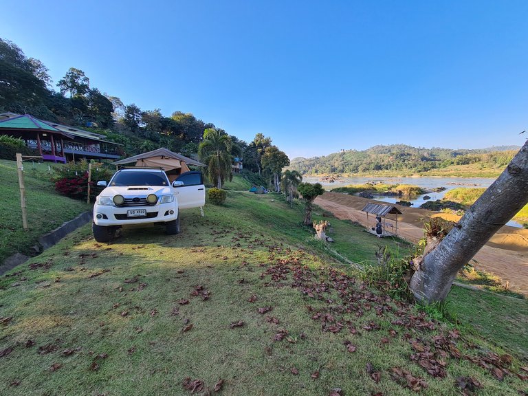
Old photos tagged to Google Map locations created the expectation that a 4x4 dirt track would lead us to Thailand's forgotten corner, Kaeng Pha Dai and open out onto a rocky river beach. It was Thailand's corner that was wedged in by Laos on 2 sides and next to the Mekong River.
We expected it to be quiet, full of nature and offer the perfect spot to set up camp on a riverside beach - something we had yet to try.
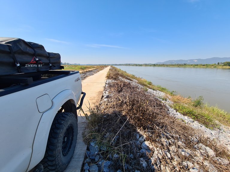
As we got closer and drove along the last 30km stretch of single lane road leading to the northern corner, we still found ourselves on hardtop and that there might not be a dirt track after all. We also passed endless dumper trucks. The ones heading in the same direction were full of sandy soil and the trucks leaving were empty. We started to think that maybe our destination might not be so quiet after all.
We did however have plenty of views of the Mekong River and Laos on the other side. The water seemed relatively low and could be easily crossed without a boat. Although there were not physical barriers stopping you from crossing, there were a few army checkpoints and camps along the road.
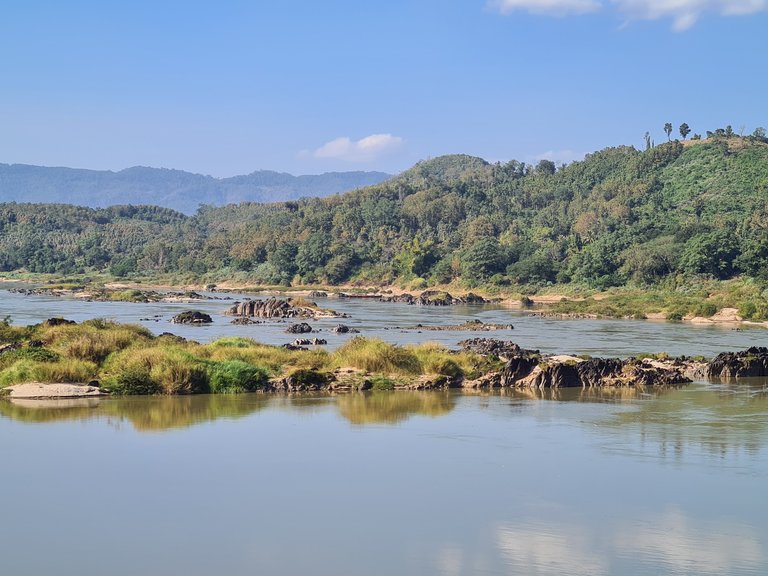
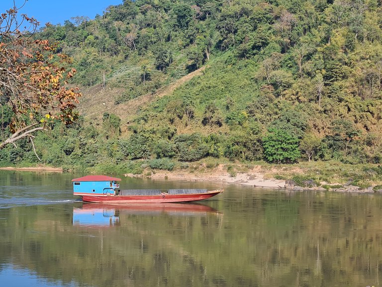
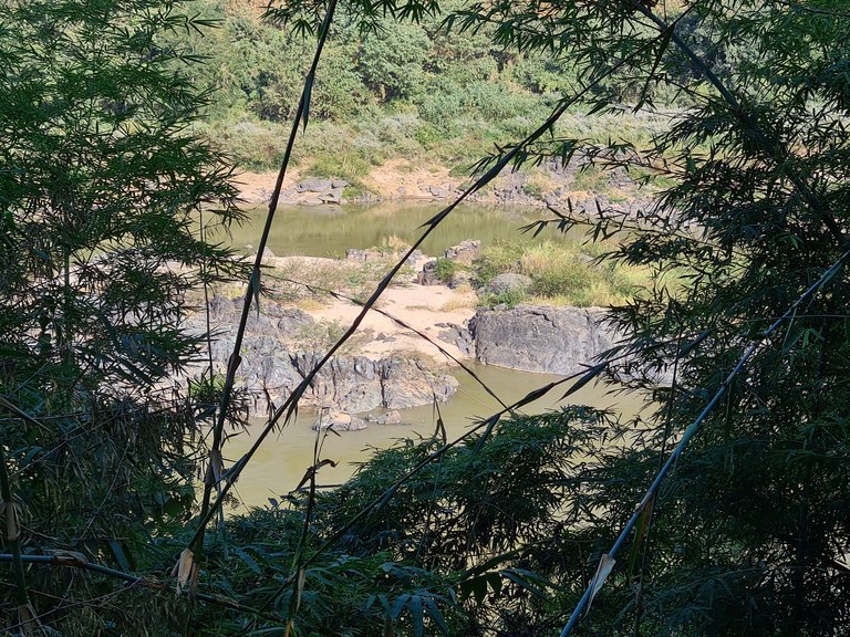
From the Thai side of the river it was only possible to see the river banks on the Laos side because of how the road was set back and how the hillside dropped away. The opposite banks were full of sandy beaches and rocky islands. We assumed that the Thai river bank would be the same.
We kept driving but there was never a need to engage 4WD, the hard top continued all the way until it simply ended with a Thai sign stating 'End of the Road'!
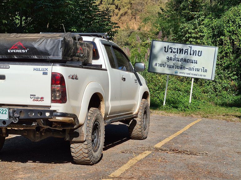
The end of the road and sign wasn't really what we were expecting! Where were the rocks, the river beaches and the 4x4 access down to them! We got out and had a look around but after a slow drive in following so many big trucks we had kind of worked what was happening.
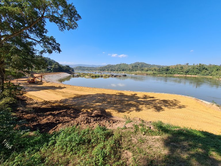
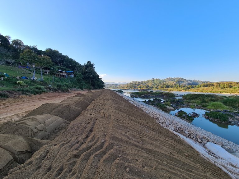
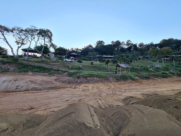
We had seen it before further up the river some 100+ kilometers away. A huge and what seemed, endless river erosion protection wall. A massive project was underway to line the entire Thai river bank along the northern Mekong River. The soil was being trucked in to dump on top of the rocks that had already been placed. There were no longer any beaches or riverside access! This was the new river bank!
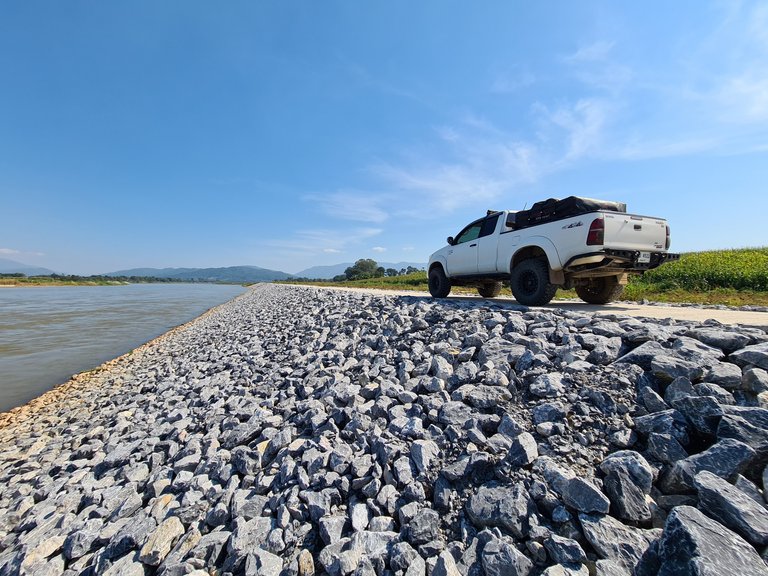
Photos Above: The finished section of the river bank protection project some 100km earlier.
Slightly disappointed that the natural river bank had now changed so dramatically and with views across to Loas of how it should look we were left wondering what to do, where to camp and where to go.
Sat on a grassy bank while we were meant to be scouring the map for alternative riverside spots, we instead spent more time telling each other how 'that spot' and 'that spot' would make for an ideal campground to park up, open the roof top tent, make a fire and jump in the river for a wash, but no, we were not on the Laos side!
We asked a local what was happening to the area and why such a large scale project was needed. He turned out to be a low level developer who was overseeing one part of the project in the area. He told us that the the erosion protection wall was to enforce Thailand's border and to ensure land was never lost to the river. He said is also acted as an easy access point to any section of the river and could be controlled quickly and safely.
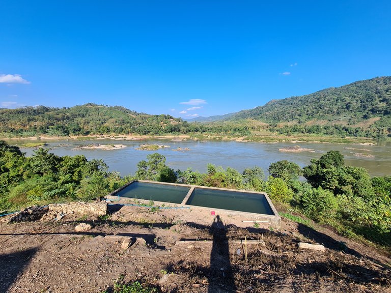
He also told us that the park ground was being developed as a picnic and campground and that it was free of charge. We were told that we could use the toilet block, set up anywhere but that we might be woken up early when the morning shift start delivering more soil and the dumper trucks and diggers start work.
In hindsight I suppose it was better to be on the Thai side and look out across the more natural Laos side than to look back onto a huge concrete wall and scarred landscape.
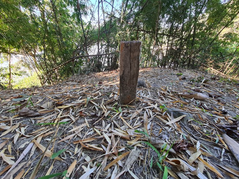
We took a walk along the river passed the end of the road and found a footpath leading up into the forest behind us. We found another marker, similar to what we had at another location along the border. This was marker 001 and marked the first official land divide between Laos and Thailand. The rest followed the mountain ridge up and along. Strangely there were not soldiers or checkpoints and you could have kept walking into Laos if you wanted to.
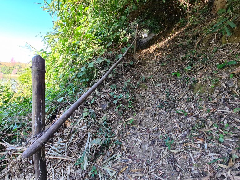
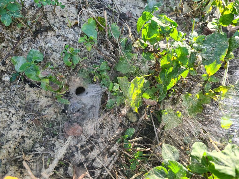
We started to watch our footing because we started to notice more and more spider webs, we seemed to think it was some kind of funnel web spider and not the sort you want to get bitten by.
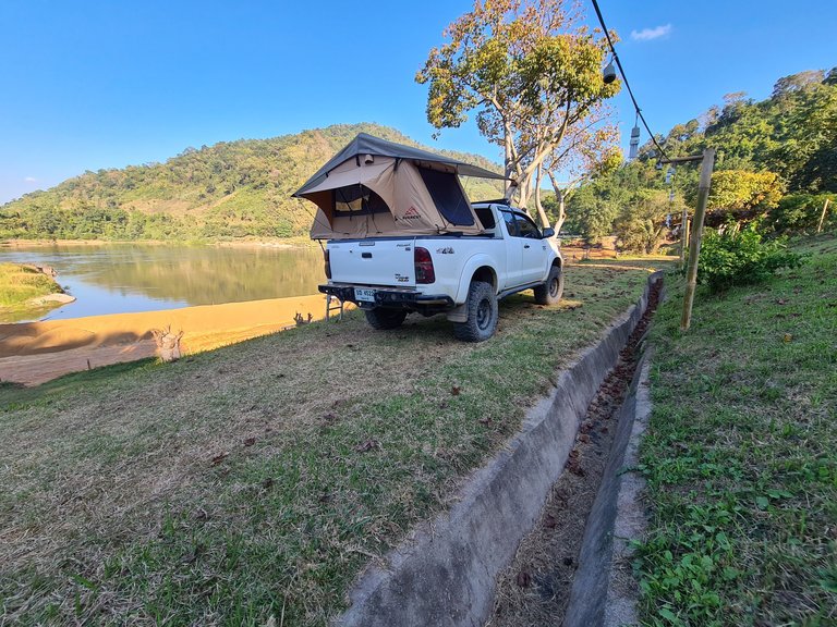
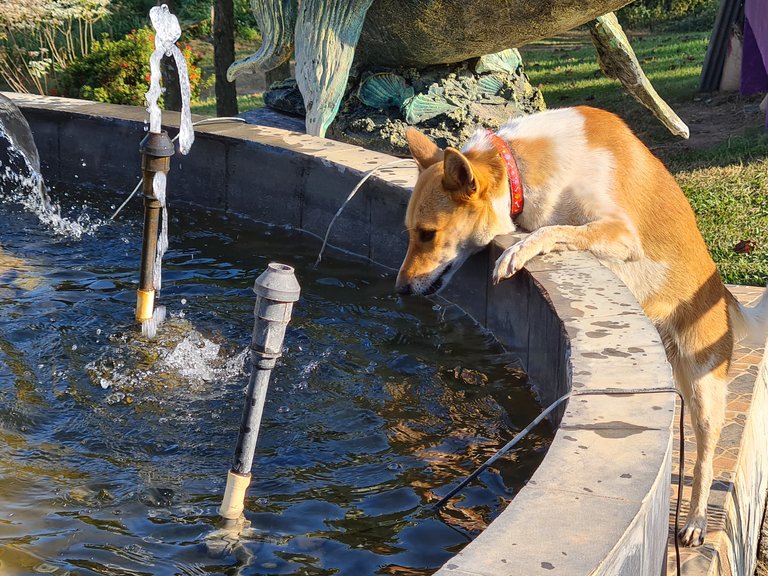
Even with such a huge river flowing by, our dog had found an even more convenient waterhole to drink from.
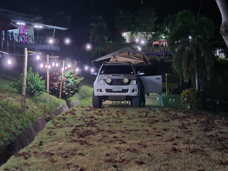
The campsite lights turned on and made for a very pleasant evening. The Mekong could be heard down below and reflections across the water glistened.
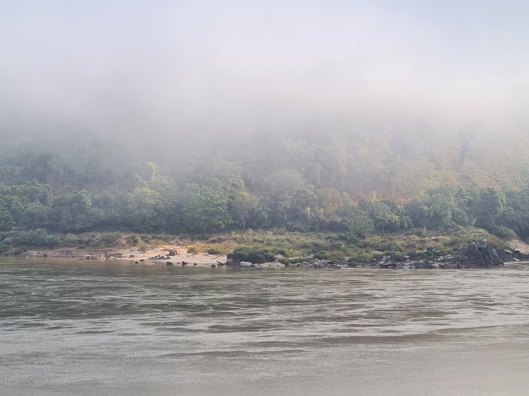
We woke up to heavy morning fog. Afterall we were in a valley, with cooler temperatures and a large river. We could barely see the otherside of the river but it did look really nice and something rarely seen in Thailand.
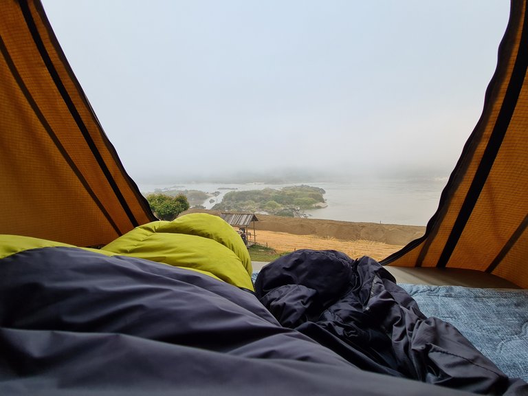
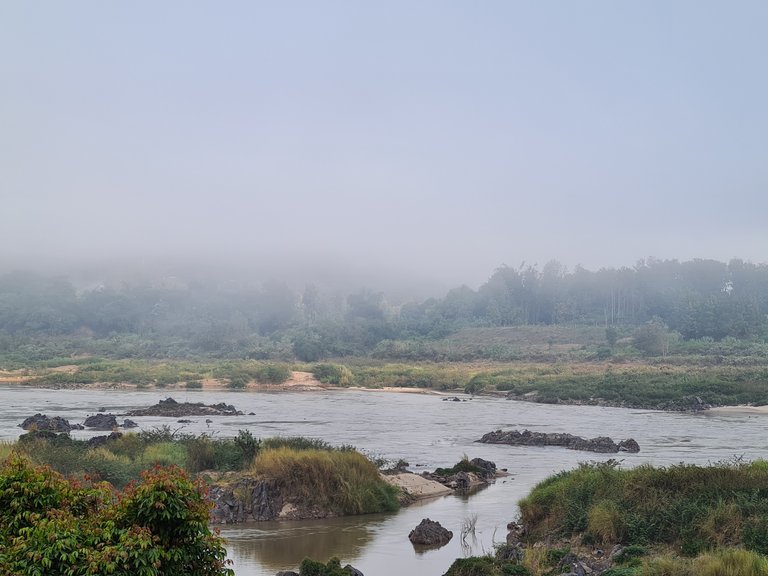
As the fog started to lift it hung like a blanket just above us hiding the tops of the mountains and hillsides but revealed the Mekong and its banks.
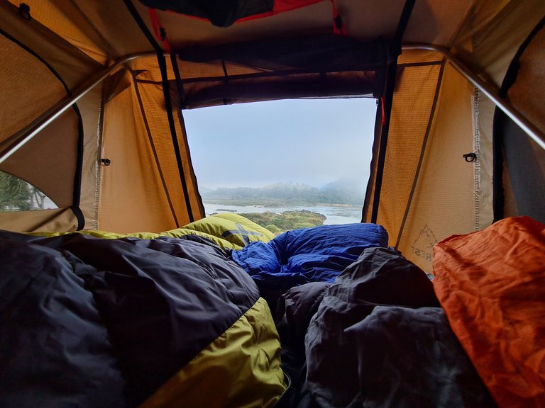
We stayed in the tent for longer than we normally do as there was no rush to get packed up. We needed to wait for the sun to break through and dry the condensation on the tent so just lay back and watched the river flow by.
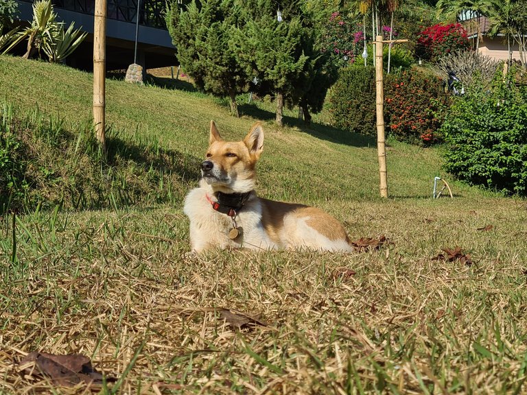
When the sun finally did break through the fog, it wasn't only the tent that was trying to catch the rays, but our dog as well! Without fail, every morning if given the chance she will find the sunniest spot and go out to sunbathe - no matter how hot it is!
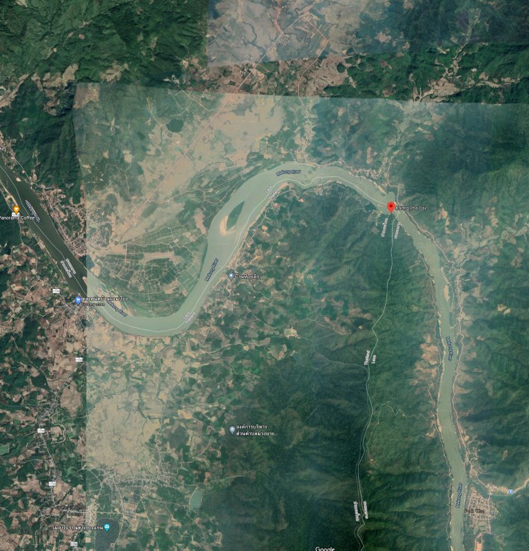
Source: Google Maps
I hope you enjoyed this post and please follow for more like it in the future.
All content is original: the photos (unless stated), the writing and the adventure!
Hiya, @LivingUKTaiwan here, just swinging by to let you know that this post made it into our Honorable Mentions in Daily Travel Digest #1119.
Your post has been manually curated by the @pinmapple team. If you like what we're doing, please drop by to check out all the rest of today's great posts and consider supporting other authors like yourself and us so we can keep the project going!
Become part of our travel community:
Congratulations, your post has been added to Pinmapple! 🎉🥳🍍
Did you know you have your own profile map?
And every post has their own map too!
Want to have your post on the map too?