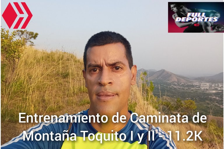
Greetings friends of Hive and @fulldeportes, today I'm going to share with you my mountain hiking training today Saturday on the route of El Toquito I and II hill, in the community of Villa de Cura, Aragua state, Venezuela.
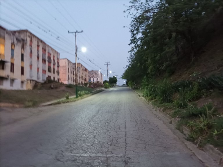
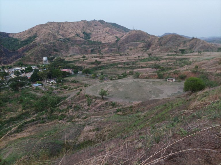
Cabe destacar que me levanté bien temprano para estar listo, y sali a las 5:43 am, ya estaba aclarando y el clima estaba fresco, activando la aplicación Strava para registrar este entrenamiento. En esta oportunidad subí sólo porque los otros compañeros no podían hoy. Los primeros kilometros mantuve un buen ritmo de caminata, al pasar al final de la urbanización del Toquito, llevaba un tiempo de 19 minutos con 45 segundos.
It should be noted that I got up very early to be ready, and left at 5:43 am, it was already clearing and the weather was cool, activating the Strava application to record this training. This time I went up only because the other teammates couldn't today. The first kilometers I kept a good walking pace, passing the end of the Toquito urbanization, I had a time of 19 minutes and 45 seconds.
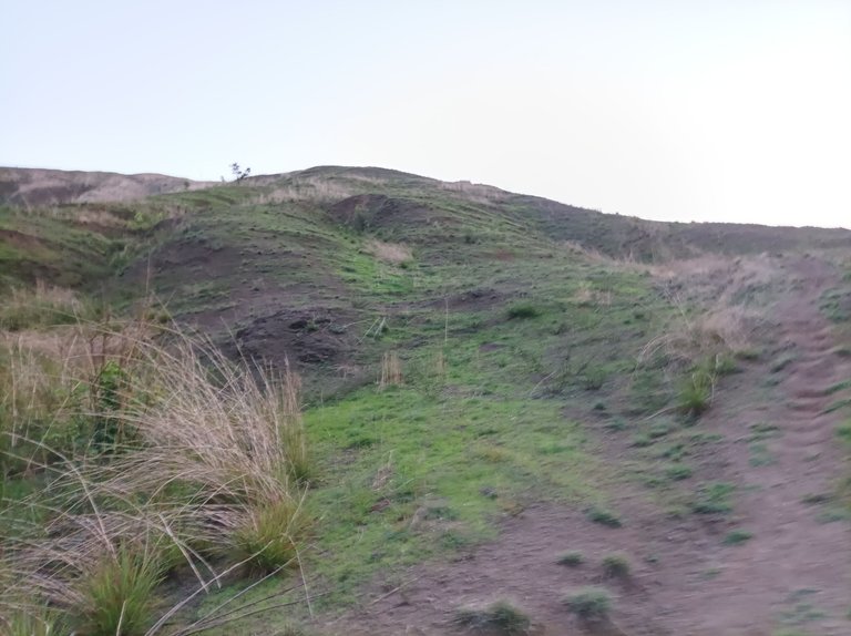
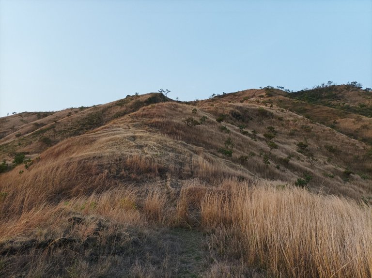
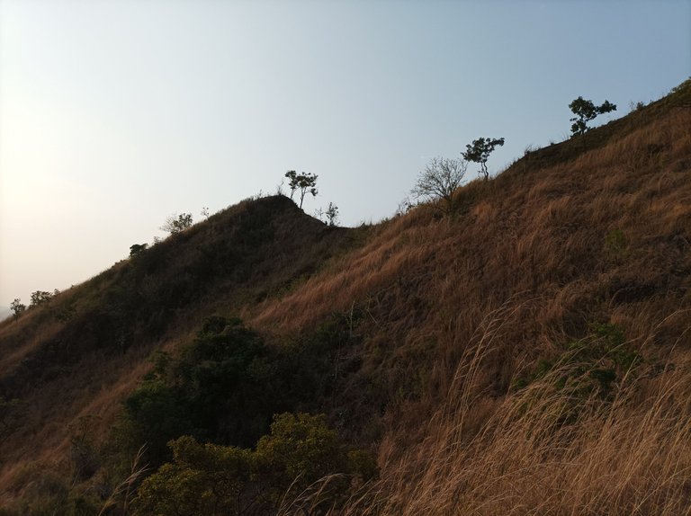
Después comenzó el ascenso a la montaña, ya llevaba una distancia de 2.15K, sintiendo algo de calor, a esta hora, me imagino que en la tarde va estar muy fuerte, en la primera pendiente ya llevaba un buen paso, marcando un tiempo de 26 minutos, y una distancia de 2.5K, en una parte de la montaña me detuve unos segundos para tomar unas fotografías y continuar subiendo, en el recorrido pude ver que hicieron unas escaleras en el terreno con el fin de evitar una caída, en ese instante venía un amigo caminante que entrena diariamente en esta ruta.
Then began the ascent to the mountain, already had a distance of 2.15K, feeling some heat, at this time, I imagine that in the afternoon will be very strong, in the first slope and had a good pace, marking a time of 26 minutes, and a distance of 2.5K, in a part of the mountain I stopped a few seconds to take some pictures and continue climbing, in the tour I could see that they made some stairs on the ground in order to avoid a fall, at that moment came a friend walker who trains daily on this route.
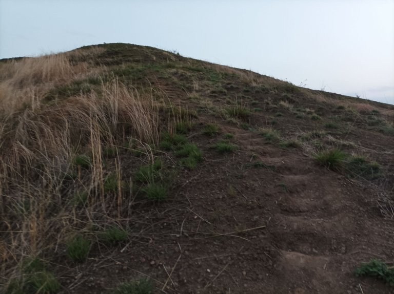
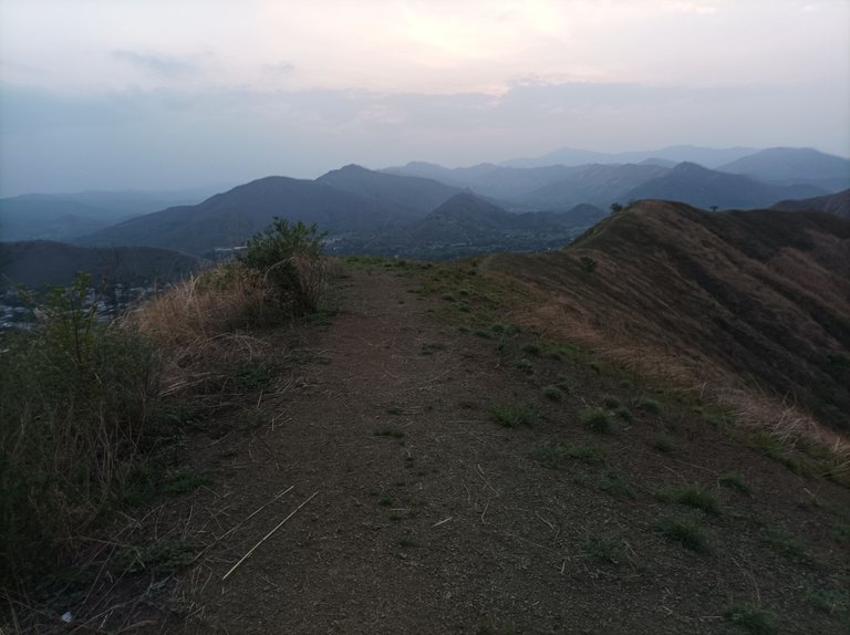
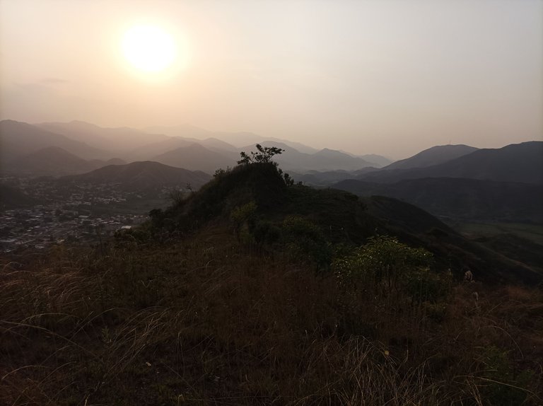
Asimismo, aumente el paso en la segunda subida, para luego continuar escalando la tercera pendiente y llegar a la cima con un tiempo de 32 minutos y una distancia de 2.84K, continúe avanzando al lado derecho de la montaña, donde podemos ver todo el centro de Villa de Cura y el sector El Toquito, me desplaze y complete la distancia de 3.3K con un tiempo de 37 minutos.
Likewise, I increased the pace on the second ascent, to then continue climbing the third slope and reach the top with a time of 32 minutes and a distance of 2.84K, continue advancing to the right side of the mountain, where we can see all the center of Villa de Cura and the sector El Toquito, I moved and completed the distance of 3.3K with a time of 37 minutes.
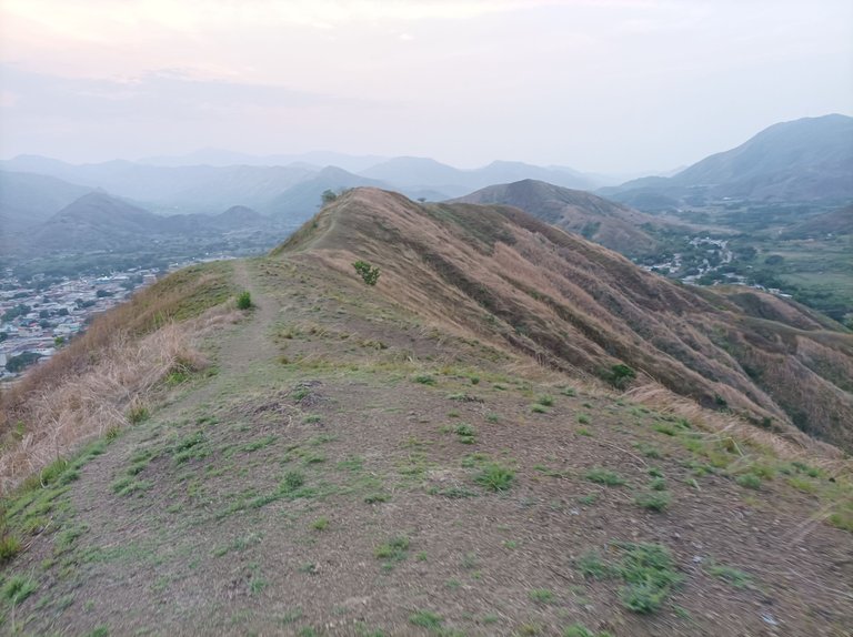
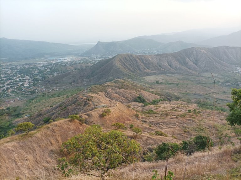
Ahora continúe caminando para bajar por la parte posterior de la pista de atletismo, esto sirve de recuperación del esfuerzo físico, y terminar de bajar complete la distancia de 5K en tiempo de 57 minutos en la pista. Después busque el camino para subir el Toquito II, que comienza con una pendiente que se siente fuerte y después una parte plana para continuar con el ascenso a esta ruta.
When I reached the top of this mountain, I made a time of 1 hour 20 minutes, and a distance of 6.38K, from the bottom of the track is 1.38K, then I started to descend, I needed a cane because it was a little slippery the route, when I reached the bottom, I took the new route to make more distance, and go out in front of the land that is at the entrance of the hill.
Al llegar a la cima de esta montaña, hice un tiempo de 1 hora 20 minutos, y una distancia de 6.38K, desde la parte de abajo en la pista son 1.38K, después comencé a descender, me hizo falta un bastón porque estaba un poco resbaloso el recorrido, al llegar a la parte baja, tomé la nueva ruta para hacer más distancia, y salir frente al terreno que está en la entrada del cerro.
When I reached the top of this mountain, I made a time of 1 hour 20 minutes, and a distance of 6.38K, from the bottom of the track is 1.38K, then I started to descend, I needed a cane because it was a little slippery the route, when I reached the bottom, I took the new route to make more distance, and go out in front of the land that is at the entrance of the hill.
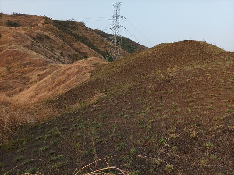
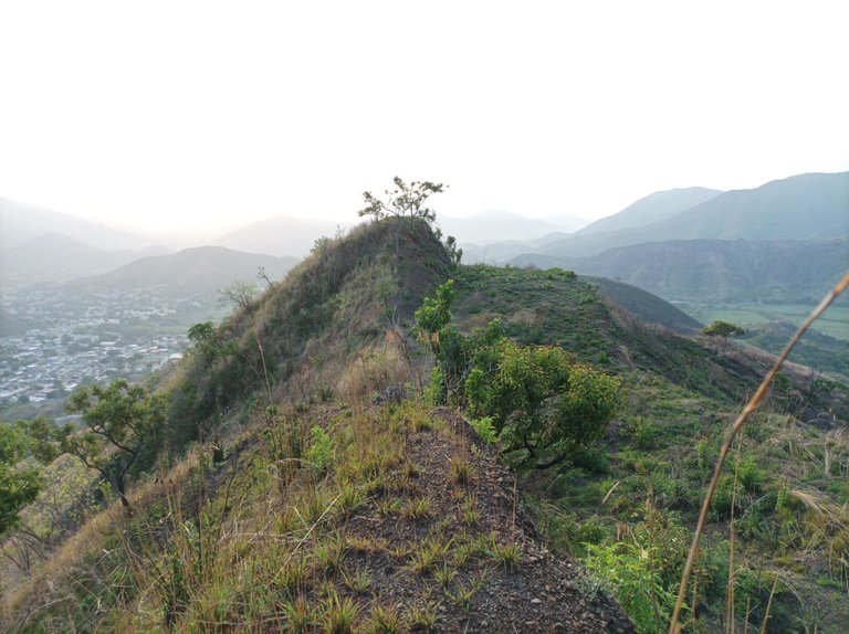
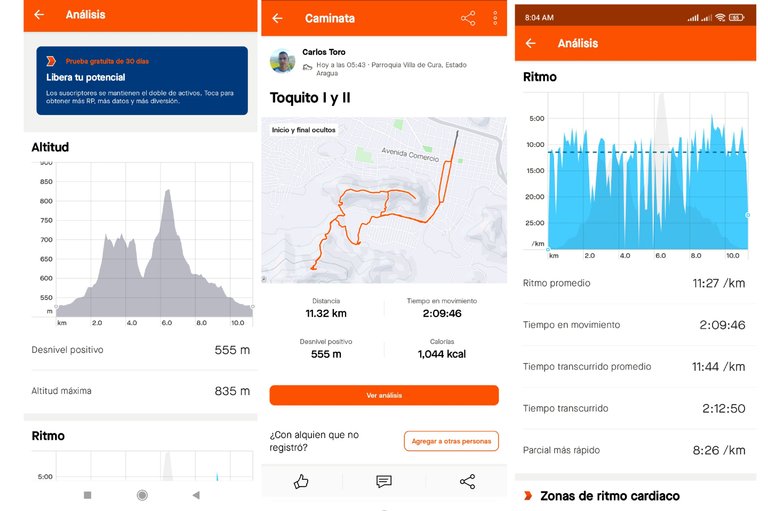
Luego continúe caminando, para pasar por la urbanización del Toquito y llegar al centro de la comunidad de Villa de Cura, terminando el recorrido con una distancia de 11.32K y un tiempo de 2 horas 12 con 50 segundos, con una altura de 835 m y un desnivel positivo de 555 metros.
Then continue walking, to pass through the urbanization of Toquito and reach the center of the community of Villa de Cura, finishing the route with a distance of 11.32K and a time of 2 hours 12 with 50 seconds, with an altitude of 835 m and a positive difference in altitude of 555 meters
Espero que les haya gustado, nos vemos en una próxima publicación.
I hope you liked it, see you in a future post.
Fotografías: Teléfono Redmi Note 10
Portada realizada en APP GridArt
Logos utilizados de Hive y de fulldeportes
Traductor utilizado: Traductor de Google
Photos: Redmi Note 10 Phone
Cover made in The APP GridArte
Used logos of Hive and fulldeportes
Translator used: Translator used: Google Translate

Vote la-colmena for witness By @ylich

Excelente recorrido, me familiarizo mucho con estas imágenes ya que por casi 24 años de servicio he trabajado frente al mismo en el liceo Manuel Morales Carabaño, saludos cordiales y sigamos haciendo deportes estimado @cetb2008 .
Que bueno amigo, gracias por comentar saludos.
Bonitas imágenes de nuestras majestuosas montanas, tu entrenamiento con salida del sol incluida, simplemente un deleite...saludos
Hola, que bueno te guste las fotografías, gracias por tu comentario.
Hola amigo, escogite un excelente horario para realizar la caminata. Sin dudas el clima y el horario hacen de la caminata algo más ameno.
Hiciste un buen tiempo 🤗
Hola, si el clima es más fresco, gracias por tu comentario.