A couple of years ago, I stayed at an Airbnb that would have excellent sea views if it wasn't for rock in the way. The remains of an ancient volcano rim, the Maunganui Bluff, is a prominent landmark in the area, and many historical events have happened here. One famous story involves a crossing by my sixteen-great-grandfather Tōhe. He named the bluff because it resembled a mountain from his far-northern homeland. Tōhe's name is part of the Maori name for Ninety Mile Beach - Te-Oneroa-a-Tōhe - which means Tōhe's Long Beach. So, I had to walk the track across the bluff.
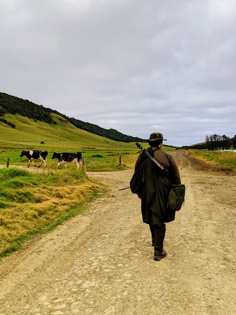
On my way with kilt, haversack, leg wraps and walking poles. The kilt and wraps are a 70/30 cheap wool blend. I want to see how the kilt performs in this type of environment. I carry three litres of water and sufficient gear for basic first aid and an emergency overnight. A full post on my loadout is here: Day walk gear including great kilt and leg wraps
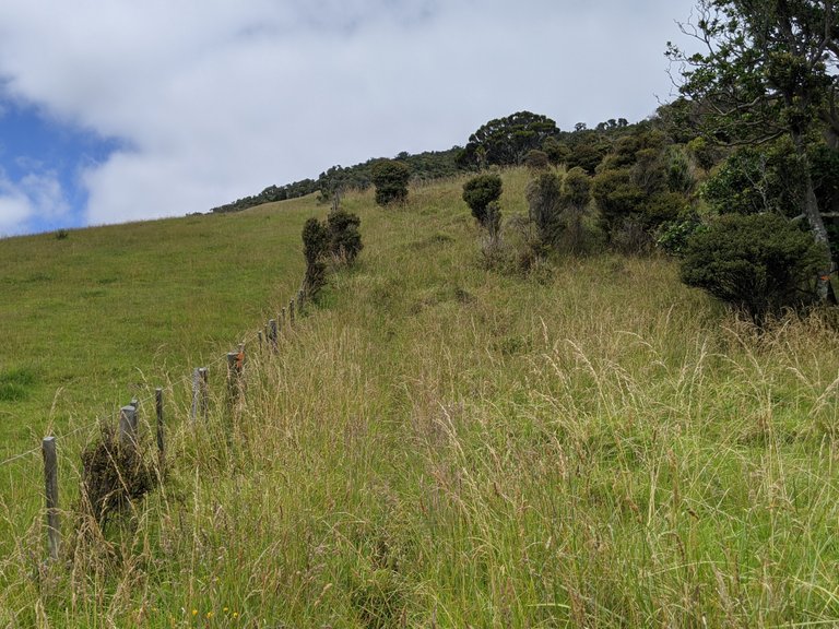
I start walking at the end of a road, and the first part is along farmland. Note the electric fence wire across the farm race (service track).
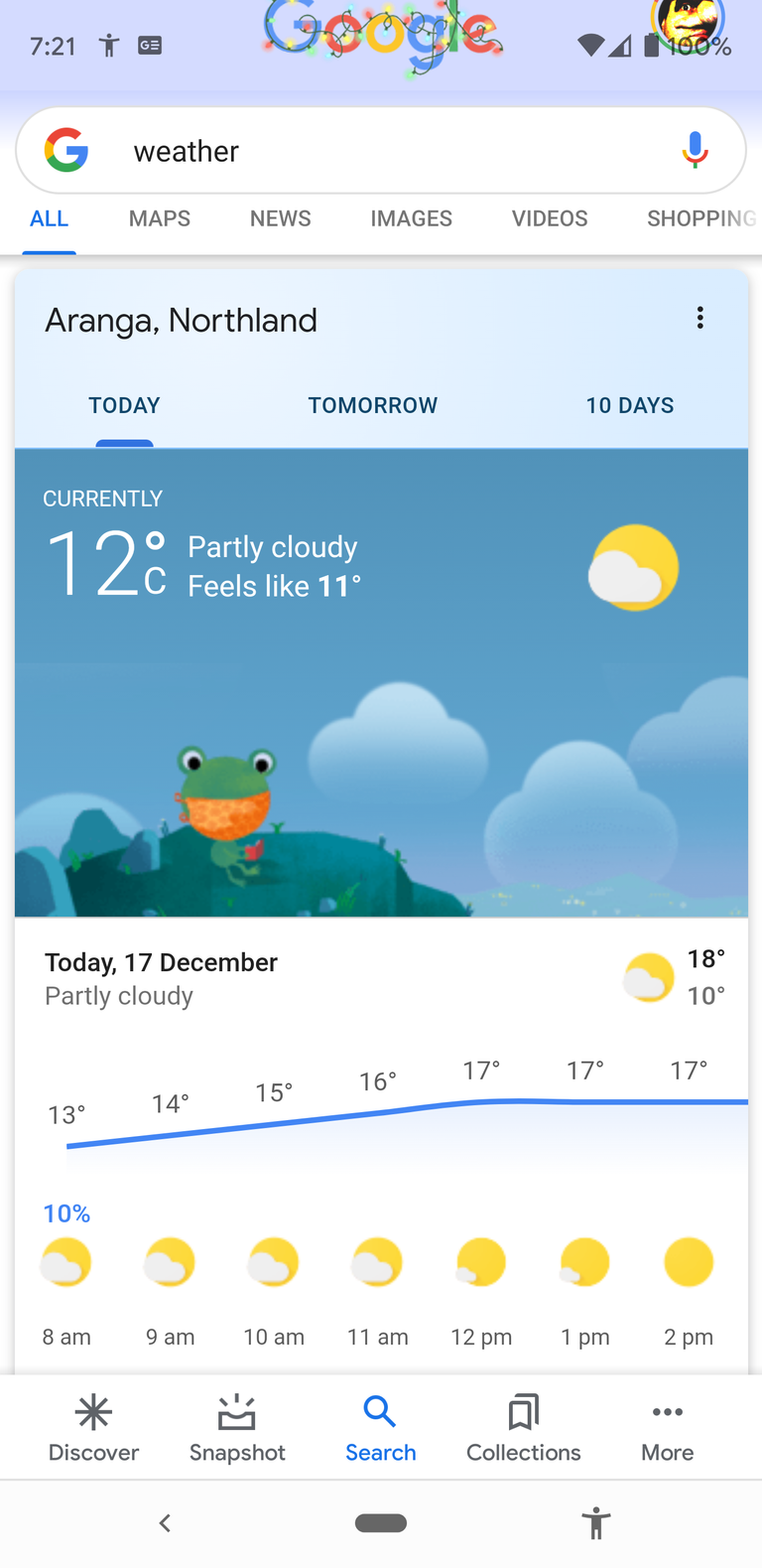
Weather forecast for the day - it is pretty cool for summer. Perfect kilt weather. Always check the weather.
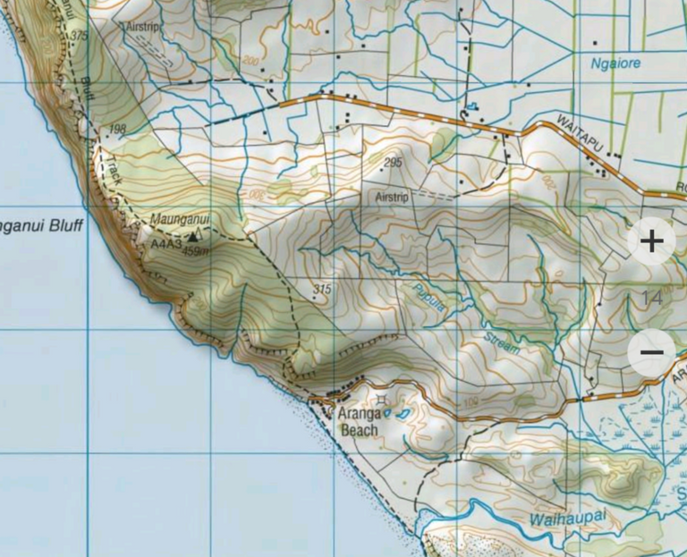
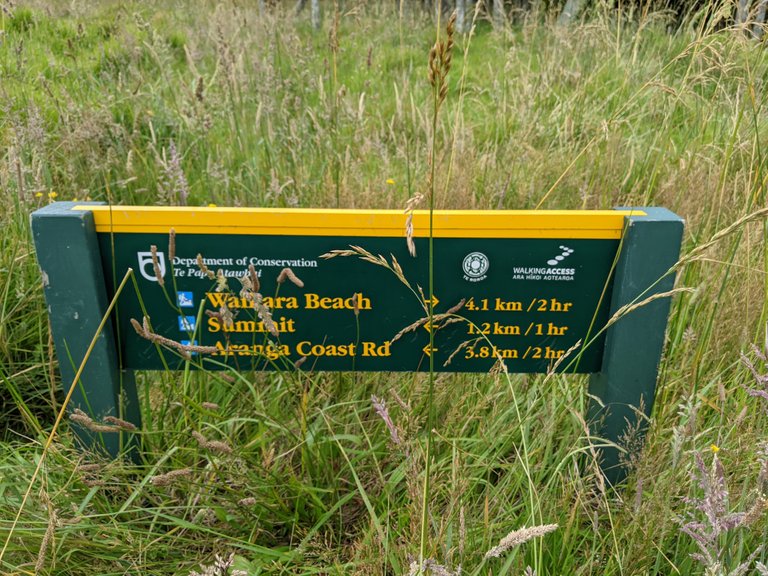
Here is the map I used. At the end of Waitapu road, walk along a farm race, across farmland, over a fence and then navigate off trail for a few hundred metres before joining the path in the Waitapu saddle near the cliff face. Excellent.
A note on Maori names: although names can be broken down, be careful. We Maori can be protective of our history, and you might get the answer you want to hear rather than the real story. Maunga = mountain, nui = big. Big mountain. Wai = water, tapu = taboo/sacred. Though, there are people also named Waitapu, at least one who died not far from here.
End of the road, time to walk.
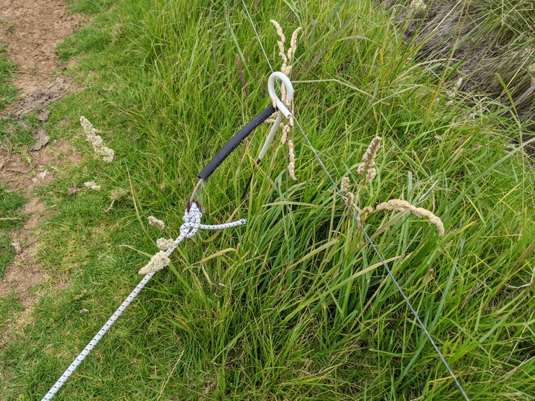
Electric wire gate. Either go under or grip the insulated black pipe, open the gate and then close it after yourself. I was once caught out when the insulated handle had perished, exposing the zappy wire where I couldn't see it.
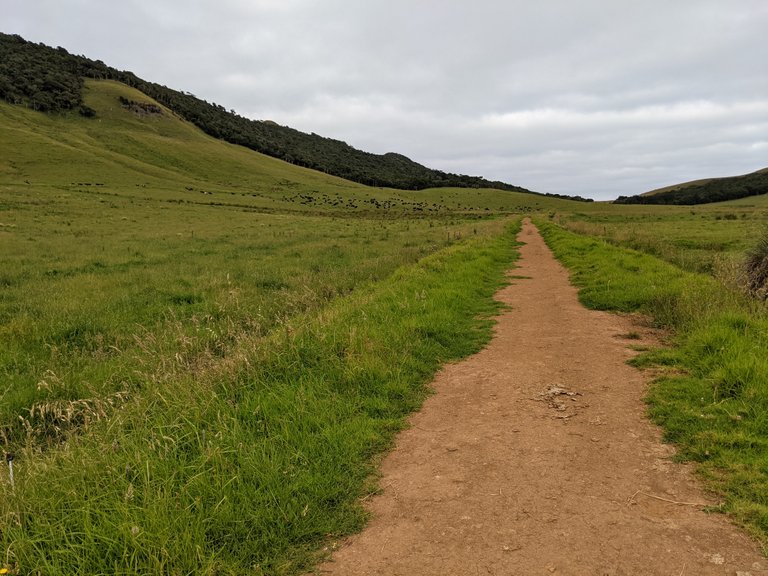
The start of the walk is across a farm. Maunganui bluff is on my right. The Waitapu saddle in the distance is where I'm going.
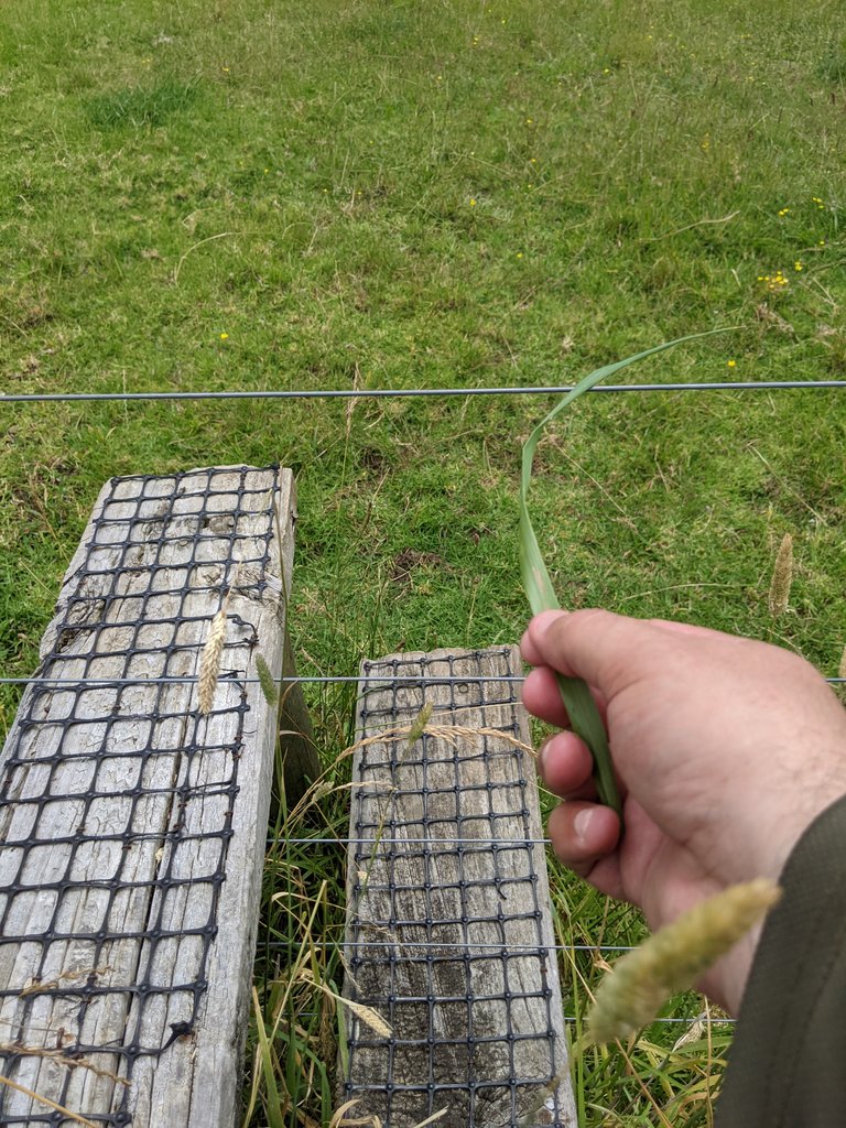
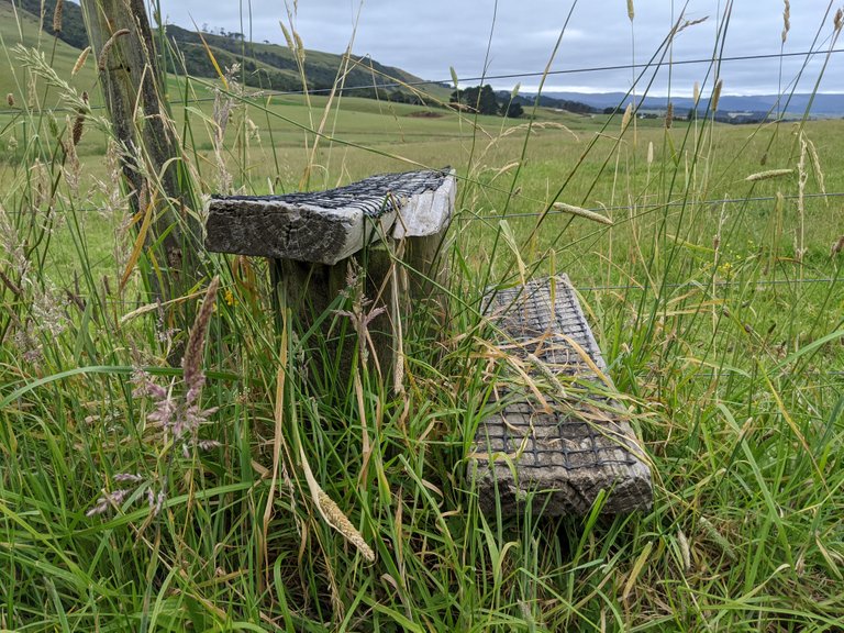
At the end of the farmland is a stile. These are steps that allow you to go over the fence. But, the fence is electric - which you can tell because it either makes a "tick" noise, you can use a green piece of grass to test, or you can see insulators on the posts. On my way over, the electric fence was not on. Also, the stile had a loose top step.
Over the stile and looking back. My AirBnB is up on those hills to the left, and the bluff is to my right.
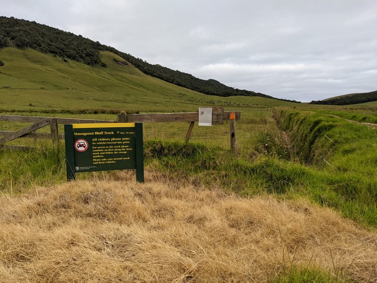
Just over the stile and buried in the grass is this sign. I had to walk past this towards the saddle where I thought I'd join the Maunganui bluff track. For whatever reason, I misinterpreted the arrow. I walked to the left of the sign rather than turning 90 degrees to my left. There were no other visible track markers from this point.
The new track goes up to the left of the stile, not where I went! But duh, if I'd turned left just over the stile, I would've been on this lovely new track. I wasn't expecting a trail here, especially not one that looks like this. COVID has meant many tracks were less used and not maintained.
I go across grassland towards the Waitapu saddle. I have no photographs of this because I mainly was swearing. When I say grassland, I mean horrible tangles of Kukuia grass, some taller than I. You had to walk with high/short steps, wait to sink and hope you didn't get stuck. Crossing that 400 metres or so took nearly an hour or constant struggle—all the joy of slogging through mud, none of the beauty benefits. The leg wraps, while a little warm, did a great job of protecting my legs from the myriad micro-abrasions that wading through vegetation brings.
At the saddle, I couldn't see any trail markers. So I took a short rest and headed towards the bluff in the correct direction according to my map. At least the grass at the saddle was more meadowlike. And the view ... well, 198m drop to the ocean, and I'm not too fond of heights. So yeah, great.
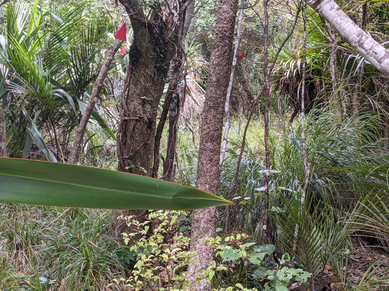
Not far inside the treeline, I see pink markers. Well, they are markers, but DOC track markers are orange! Maybe they weathered funny - but they are going in the right direction, and they're the only markers I can see.
Something feeding. Probably possums. They'll nibble at me if I don't make it back. I made it a few hundred metres into the treeline before the track markers stopped at the bottom of a cliff face. I look around, and the terrain is rough and overgrown, and there are no more markers.
I have to make a decision, so I take a rest break. I'm now high enough that I get a cellphone signal. So, I checked the maps on the Department of Conservation website and...
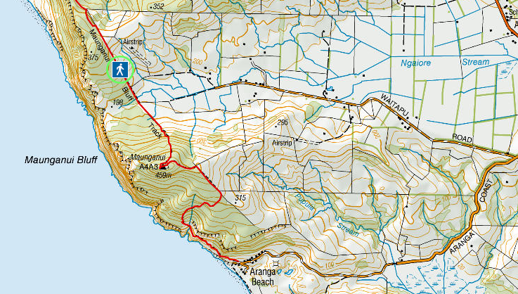
... the track has been moved inland! You can still join the track off Waitapu road, but you don't walk to the saddle along the cliffs. I should've checked this map sooner!
Great. So, my options are:
- Continue on towards the bluff summit and meet the track there. Off-trail navigating in steep/rough terrain, the estimated speed is about 1-400m per hour. Unfortunately, I'd need more water and time.
- Navigate through the bush and try to meet the new trail at the nearest/most convenient point. Again, I'd need to be faster to make it with the supplies and time I have. Damn. Also, risk of injury and I'm by myself. Let's not do that.
- Head back down the way I came, rejoin the track at the most accessible point - likely the stile - and then reevaluate for time and supplies. Who am I kidding? I'm going to need more time and supplies. So, abort the mission.
Well, the bluff was there when my sixteen-great-grandfather Tōhe crossed it in a legendary journey from the north, and it'll be there if I come again sometime. Also, my ancestor died after completing the bluff crossing. So yeah, an ancestral warning not to push it. So, I do the sensible thing and head back the way I came out of the tree line and down the saddle.
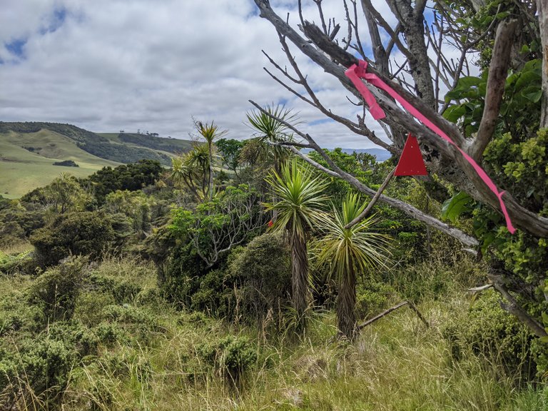
As I break the treeline and head down the saddle, I see more of these markers. Finally, they lead back into the bush over a promontory on the south side of the saddle. This track may get me where I need to be sooner. Well, I only want to wade through the kukuia grass if I have to, and I have enough supplies to backtrack if the trail is incorrect, so let's go. This off-map trail may join up with the proper track soon enough that I can carry on! Here's hoping.
I meander downhill and across dried streams but generally in the right direction—the trail alternates between bush and gorse. Surprisingly, the kilt doesn't get noticeably caught on anything. Perfect!

And finally, this off-map trail rejoins the mapped route earlier than the stile. Just about 2-300m metres earlier. I don't have time to make the Bluff this year - so I'll have to come again. Oh well.
Even though the fence at the stile wasn't electrified when I crossed, a sixth sense told me to test again, and this time it was live. So I covered the top wire in all my spare clothes and a doubled-up poncho, then crossed. Despite all those layers, I could still feel a slight zap near the family jewels.
Then a power walk/wobble across the farm back to the road head. This is just one of those things in the outdoors. It's enjoyable even when things don't go according to plan. I haven't been back yet—one day.
Until next time.
The rewards earned on this comment will go directly to the people sharing the post on Twitter as long as they are registered with @poshtoken. Sign up at https://hiveposh.com.
I love nature and reading the story of your itinerary I liked it as much as the photos you shared.
You are right that things do not always go according to plan, but a destination not reached is always a destination that is possible to reach in the future ;)
!discovery 30
Yes, safety first always. People get into a lot of trouble by focusing on the destination at all costs. It's not easy psychologically. I kinda knew I was going to abort mission, but I think sitting down and going through the options helps convince myself that I'm making the right decision and I'm not prematurely turning back.
😊😎🤙 Nice trekking..
Beautiful land!
how strong is the juice in those electric wired? bet u got a nice jolt that time! :P
Thanks. Northland bush is very different to the bush near me, but yes beautiful. I'm not sure how strong those hot wires are - but if I can feel it through all those layers of clothing then I think it's going to hurt.
True. 😣😣😣
Thank you for the story and photos. You'll make it next time in no time :)
How many kilometers did you hike that day?
@tipu curate
Upvoted 👌 (Mana: 45/55) Liquid rewards.
KMs? Not sure. No much as the crow flies - maybe about 6km. The off track parts were a real effort.
Very beautiful.. many green trees... Life must be very comfortable.
thank you for sharing
Thank you, there are certainly worse places one could live.
12 °C is a pleasant autumn/fall weather to walk in the nature. The weather in my country (in Hungary) is similar nowadays. It is between 10 °C and 13 °C in the daylight. Currently it is 10 °C, but currently we are in the evening (2022.11.09, 19:02 CET).
It was 12degC in the morning. I took that screenshot so I had a weather forecast photo on my phone when I lost signal. I think we got up to 17degC and that was still a cool day for summer.
this one was a unexpected adventure! i'm glad you took the correct decision and went back to your car... is better to not put yourself in risk...
i loved the photo and i think that sword is awesome!
Always. I'm no stranger to turning around if the risks get too high. Always another day to try again.
!PIZZA🤑
This post was shared and voted inside the discord by the curators team of discovery-it
Join our community! hive-193212
Discovery-it is also a Witness, vote for us here
Delegate to us for passive income. Check our 80% fee-back Program
Yay! 🤗
Your content has been boosted with Ecency Points, by @eturnerx.
Use Ecency daily to boost your growth on platform!
Support Ecency
Vote for new Proposal
Delegate HP and earn more
Congratulations @eturnerx! You have completed the following achievement on the Hive blockchain and have been rewarded with new badge(s):
Your next payout target is 29000 HP.
The unit is Hive Power equivalent because post and comment rewards can be split into HP and HBD
You can view your badges on your board and compare yourself to others in the Ranking
If you no longer want to receive notifications, reply to this comment with the word
STOPCheck out the last post from @hivebuzz:
Congratulations @eturnerx! You received a personal badge!
You can view your badges on your board and compare yourself to others in the Ranking
Check out the last post from @hivebuzz: