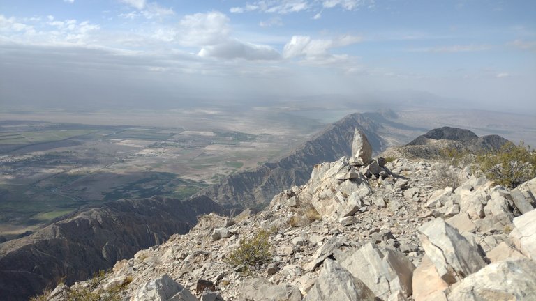
After the almost two months I had spent in the province of San Juan, the day came when I decided the date to return home. It took me a while to decide what day it would be because I was having such a good time that I didn't want to go back, but at the same time I had some important events I wanted to attend. Once the date was set, I knew I had to take one last walk to say goodbye to this province and all the beautiful landscapes I had seen. I had a hard time deciding where I would end this trip, but luckily, my friends from San Juan recommended me an amazing place: Parkinson Hill, from which I would take one of the most beautiful postcards of this place ❤️.
Después de los casi dos meses que había pasado en la provincia de San Juan, llegó el día en el que decidí la fecha de vuelta a mi casa. Me costó un poco decidir qué día sería porque la estaba pasando tan bien que no quería regresar, pero al mismo tiempo tenía algunos eventos importantes a los cuáles quería asistir. Una vez que estuvo fijada la fecha, supe que tenía que hacer una última caminata para despedirme de esta provincia y de todos los paisajes hermosos que había visto. Me costó decidir en qué lugar le daría un fin a este viaje, pero por suerte, mis amigos sanjuaninos me recomendaron un lugar asombroso: el Cerro Parkinson, desde el cuál me llevaría una de las postales más hermosas de este lugar ❤️.
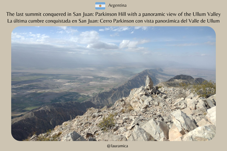
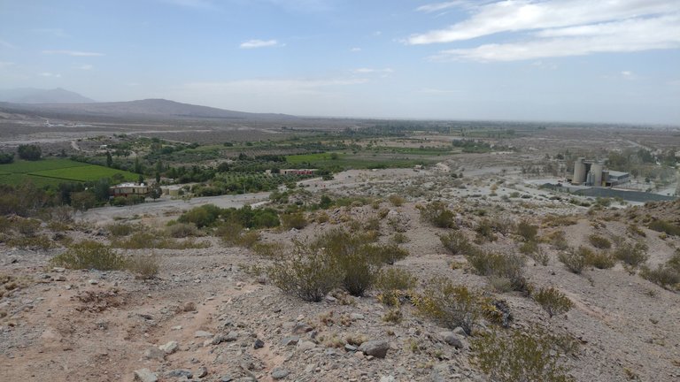
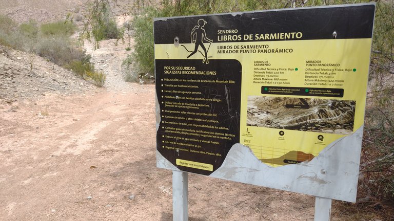
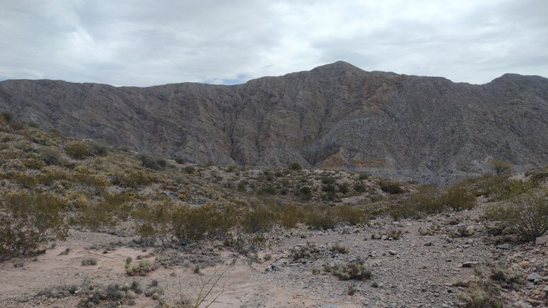
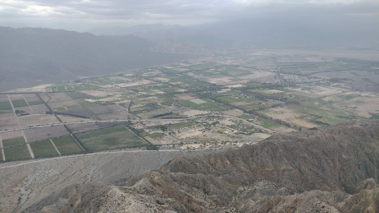
What nobody could explain to me was why this hill has that name. I couldn't find it online either, but I was left with the unofficial explanation that its path was rocky and you had to be careful not to wobble when walking. Hill Parkinson is located in the Zonda valley area, but from its summit you can see Ullum and even the dam. The view I was promised from up there was very promising, so after telling a friend to come with me, we set off on our hike 😃.
Lo que nadie supo explicarme era por qué este cerro tiene ese nombre. Tampoco lo encontré online, pero me quedé con la explicación no-oficial de que su sendero era pedregoso y había que tener cuidado de no tambalearse al caminar. El Cerro Parkinson se ubica en la zona del valle de Zonda, pero desde su cima puede apreciarse el de Ullum e incluso el dique. La vista que me prometieron desde ahí arriba era muy prometedora, así que después de decirle a un amigo que me acompañara, emprendimos nuestra caminata 😃.
According to what we had been told, this trail is about 9 km long and would take about 4 hours to hike to the top. In all my time in San Juan I had done lots and lots of trekking, so I felt more than prepared to do this one. Besides, I had been to this area several times before and had the opportunity to visit it from above and from below, from one side and from the other, so its mountains were somehow familiar to me ❣️.
De acuerdo a lo que nos habían dicho, este sendero es de unos 9 km y tardaríamos unas 4 horas en recorrerlo hasta la cima. En todo mi tiempo en San Juan hice mucho, muchísimo trekking, así que me sentía más que preparada para hacer este. Además, ya había estado en esta zona varias veces y tuve la oportunidad de visitarla por arriba y por abajo, de un lado y del otro, así que sus montañas eran de alguna forma, familiares para mí ❣️.
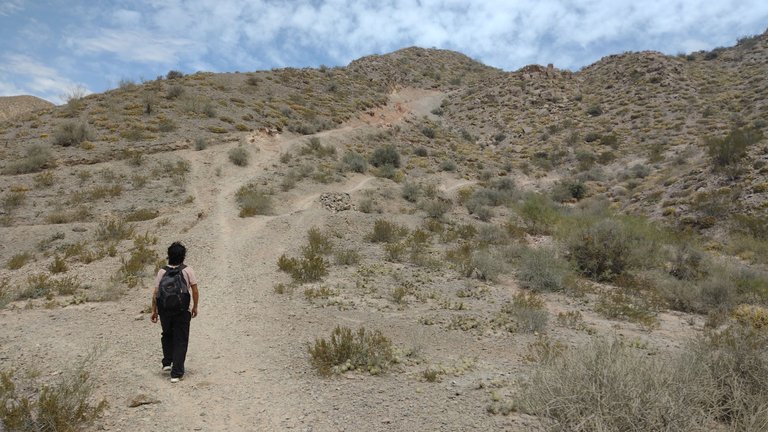
Although we had a hard time finding the bus stop that would take us there, once we started the trail we could easily identify it. There was no one else but us in that area when we arrived, and so it was until the end. San Juan is not such a touristy province, so if trekking in quiet and uncrowded places is your thing, you might like this place a lot 😄.
A pesar de que nos costó encontrar la parada del colectivo que nos acercaba hasta ahí, una vez que iniciamos el sendero pudimos identificarlo fácilmente. No había nadie más que nosotros en esa zona cuando llegamos, y así fue hasta el final. San Juan no es una provincia tan turística, así que si lo tuyo son los trekkings en lugares tranquilos y sin gente, este lugar podría gustarte bastante 😄.
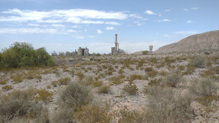
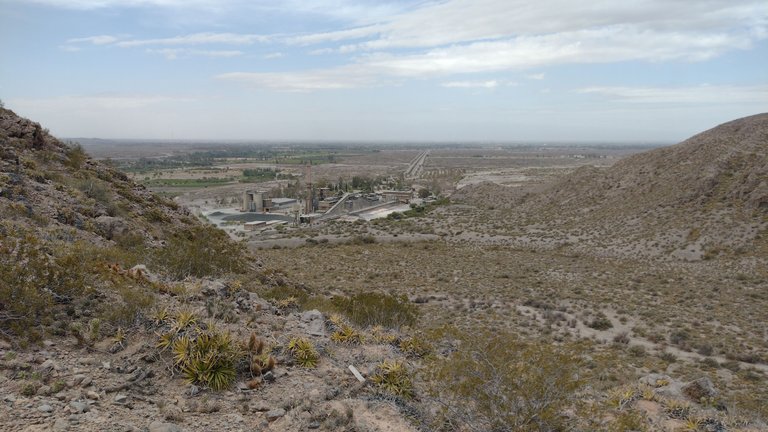
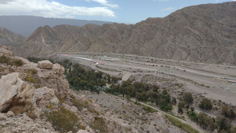
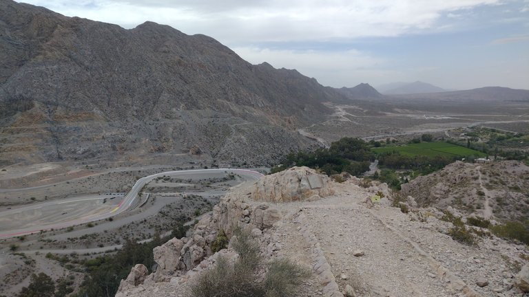
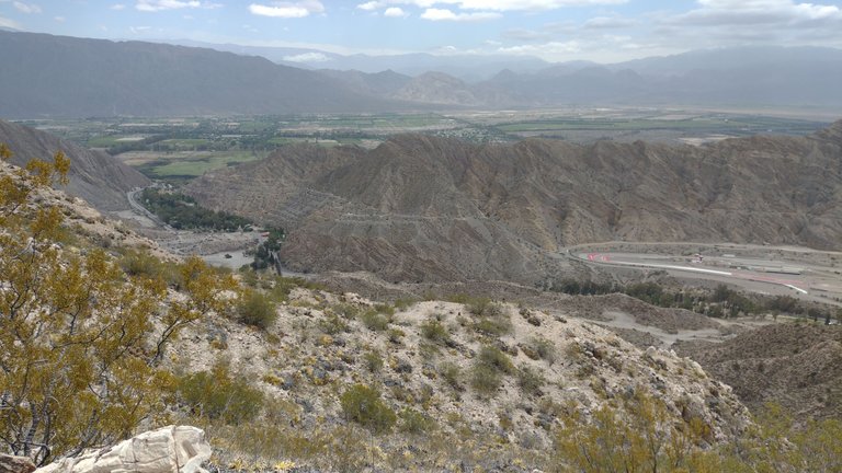
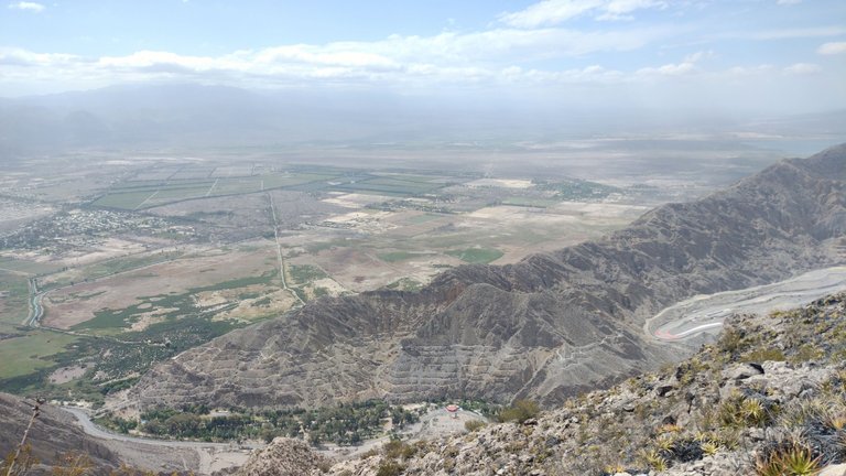
One of the first things we saw during our ascent was the Calera San Juan, a facility that almost seems to blend in with the landscape. In this place part of the clayey mountains are exploited to extract materials for construction. In fact, when we came in the bus we saw that part of the mountains are quite worked to take advantage of these resources. However, the parts where the trails are located and the places that visitors want to see are not being affected 😶.
Una de las primeras cosas que vimos durante nuestro ascenso fue la Calera San Juan, una instalación que casi diría que esta mimetizada con el paisaje. En este lugar se explota parte de las montañas arcillosas para extraer materiales para la construcción. De hecho, cuando veníamos en el colectivo vimos que parte de las montañas estan bastante trabajadas para aprovechar estos recursos. Sin embargo, las partes en donde se encuentran estos senderos y los lugares que los visitantes queremos ver no están siendo afectados 😶.
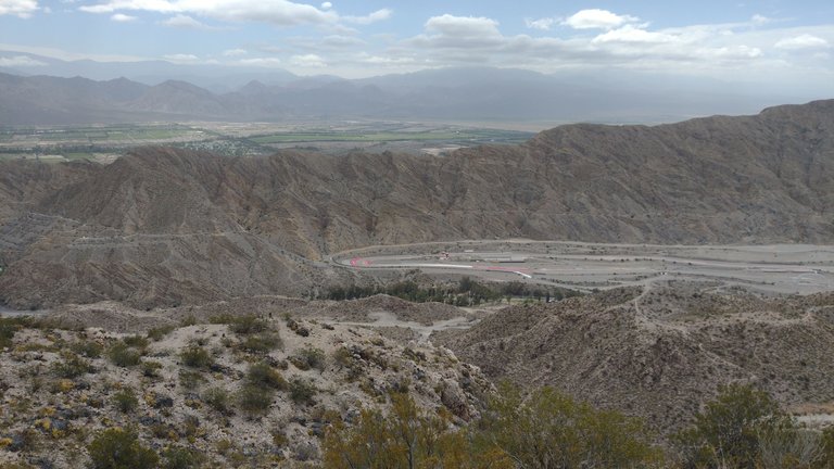
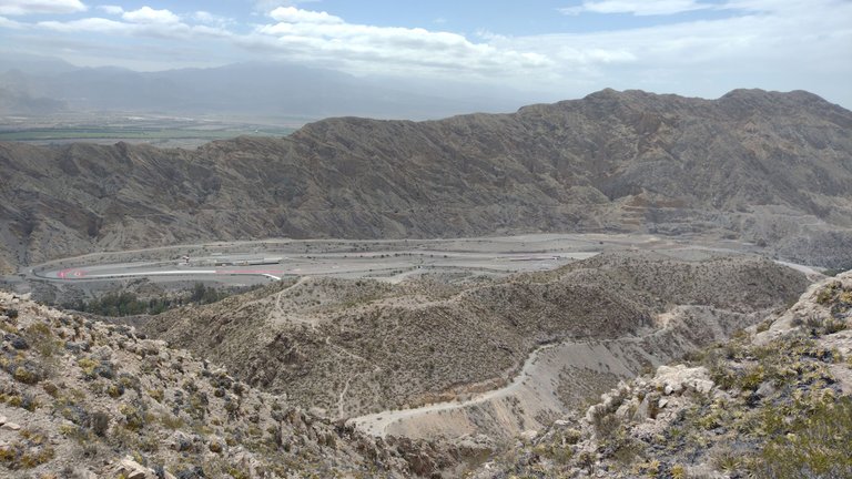
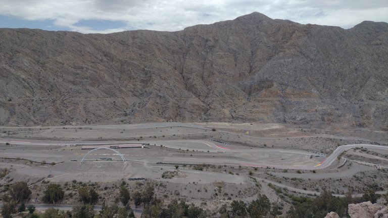
A few minutes later, to our left, we could see the large abandoned racetrack from above. This racetrack surprised us the first time we saw it, and the last time as well. Currently, this facility is in disuse because of some accidents that occurred there and because another much bigger one was built later in another part of the province 🙃.
A los pocos minutos, a nuestra izquierda pudimos ver desde arriba el gran autódromo abandonado. Este autódromo nos sorprendió la primera vez que lo vimos, y la última también. Actualmente, esta instalación está en desuso debido a que ocurrieron algunos accidentes en él y a que posteriormente se construyó otro mucho más grande en otra parte de la provincia 🙃.
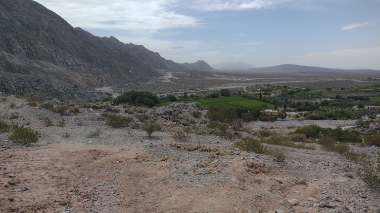
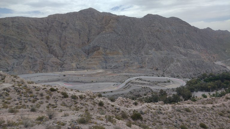
This racetrack can also be appreciated from other points on the mountain, such as the Head of Indian Monument and from the Garden of the Poets Viewpoint. Several things there are to do in this place, and as I had enough time I did them all. I could say that I had seen the abandoned racetrack from the top left and right, and now I was seeing it completely from the front 😃.
Este autódromo también puede ser apreciado desde otros puntos de la montaña, como el Monumento Cabeza del Indio y desde el Mirador del Jardín de los Poetas. Varias cosas hay para hacer en este lugar, y como tuve tiempo suficiente las hice todas. Podría decir que había visto el autódromo abandonado desde arriba a la izquierda y a la derecha, y ahora lo estaba viendo completamente desde el frente 😃.
Our day was quite cold and cloudy, but ideal for walking in this usually hot area. I was glad to have found a companion to do this trek and to be able to comment on everything we saw: although I also like to spend my time alone, sharing moments with friends who also love the mountains is something very special 💞.
El día que nos tocó estaba bastante frío y nublado, pero ideal para caminar por esa zona usualmente calurosa. Me gustó haber conseguido un acompañante para hacer este trayecto y poder comentar todo lo que veíamos: si bien también me gusta pasar mi tiempo a solas, compartir momentos con amigos que también aman las montañas es algo muy especial 💞.
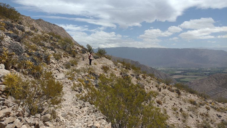
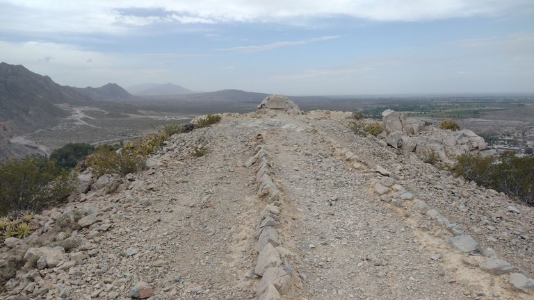
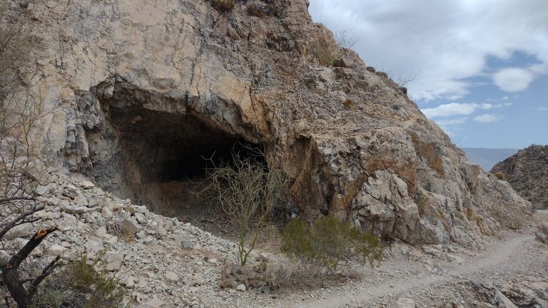
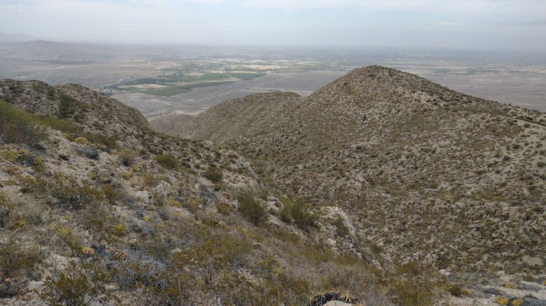
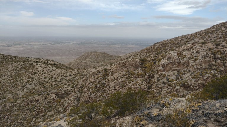
Something that we had also read is that this road is prepared for mountain biking. I don't know if it goes all the way to the top of the hill, but a large part of it is. That is why the trail was easily identifiable and there was not much chance of getting lost. Besides, it was quite entertaining, because in addition to the fact that it was beautiful all around, we could see things like natural caves and wind shelters 😀.
Algo que también habíamos leído es que este camino esta preparado para hacerse en mountain bike. No sé si precisamente hasta la cumbre del cerro, pero gran parte del él sí. Es por eso que el sendero estaba fácilmente identificable y no había mucha chance de perderse. Además, era bastante entretenido, ya que además de que todo el alrededor era hermoso, dentro de él pudimos ver cosas como cuevas naturales y refugios para el viento 😀.
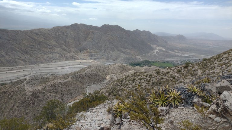
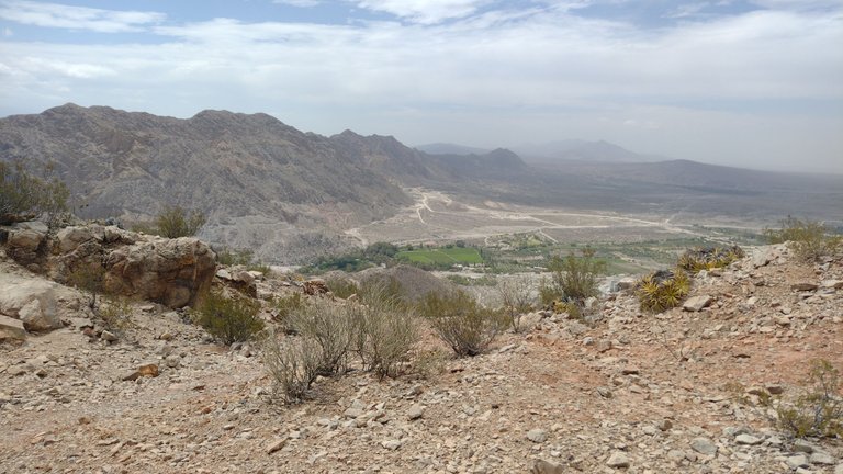
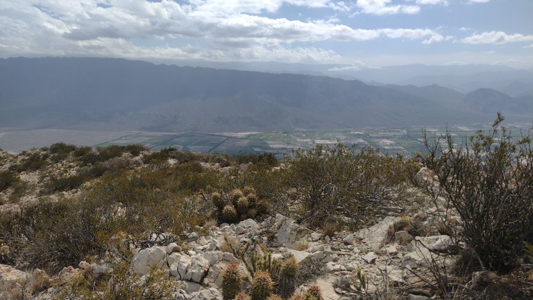
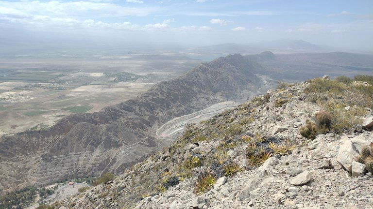
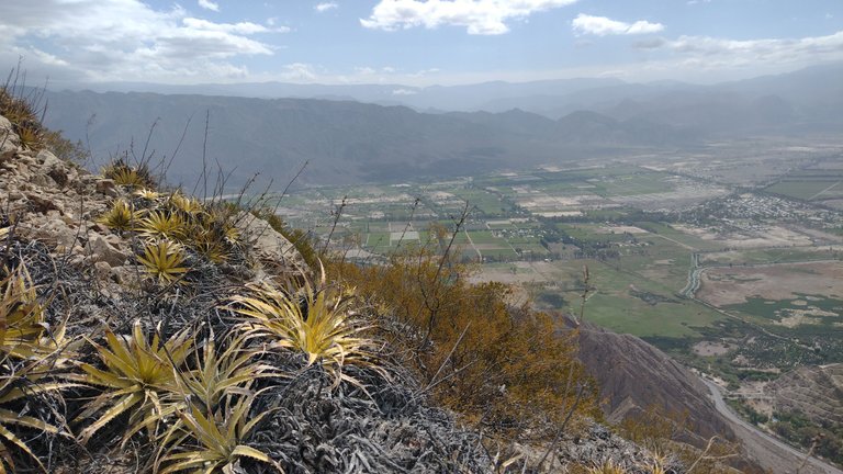
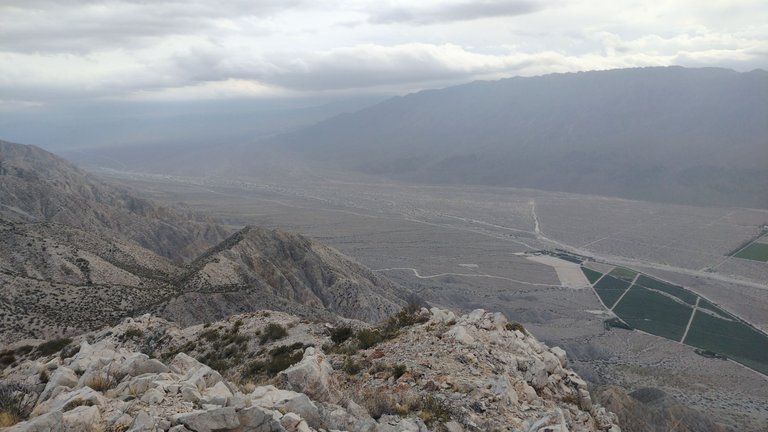
As we climbed higher and higher, we began to have a superior view of the Sierras Chicas mountain range. On it are the old Siete Caminos, used in the time when this mountain was also exploited for commercial purposes. Of course I also did this walk on the top step, but seeing it like this from afar was another level. The stepped mountain was incredibly pretty from where we were 💖.
A medida que íbamos ascendiendo más y más, empezamos a tener una vista superior del cordón montañoso Sierras Chicas. En él se encuentran los antiguos Siete Caminos, usados en la época en la que esta montaña también se explotaba con fines comerciales. Por supuesto también hice este paseo por el escalón superior, pero verlo así desde lejos era otro nivel. La montaña escalonada era increíblemente linda desde donde estábamos 💖.
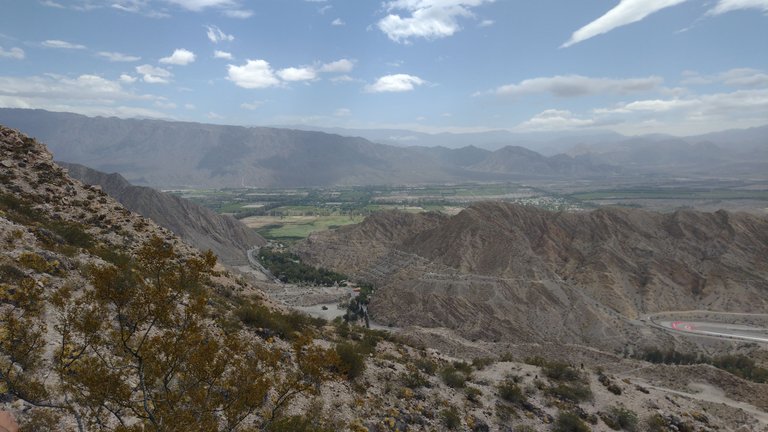
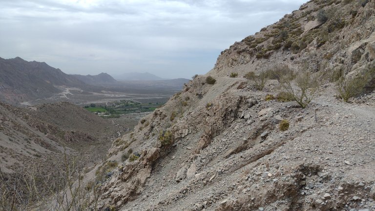
And that very mountain is the one we hiked during my longest trek in the province of San Juan. It took us about 20 km to cross the Sierras Chicas Mountains from left to right until we reached its other end. Definitely, that was my great feat in San Juan: going up at one end of the mountain range and coming down at the other is something incredible. The day I did it I knew it was incredible, but having a panoramic view from the front was another level. I got so excited about how nice it was that I had to sit for a few minutes just taking in the scenery. "Did I walk all the way up there?" I thought, and of course I did 💕.
Y esa mismisima montaña es la que caminamos durante mi trekking más largo en la provincia de San Juan. Nos tomó unos 20 km atravesar las Sierras Chicas desde izquierda a derecha hasta desembocar en su otro extremo. Definitivamente, esa fue mi gran hazaña en San Juan: subir en una punta de la cordillera y bajar en la otra es algo increíble. El día que lo hice supe que fue increíble, pero tener una vista panorámica desde el frente fue otro nivel. Me emocioné tanto por lo lindo que era que tuve que sentarme unos minutos a contemplar el paisaje. "¿Yo caminé todo por ahí arriba?" pensaba, y pues claro que sí 💕.
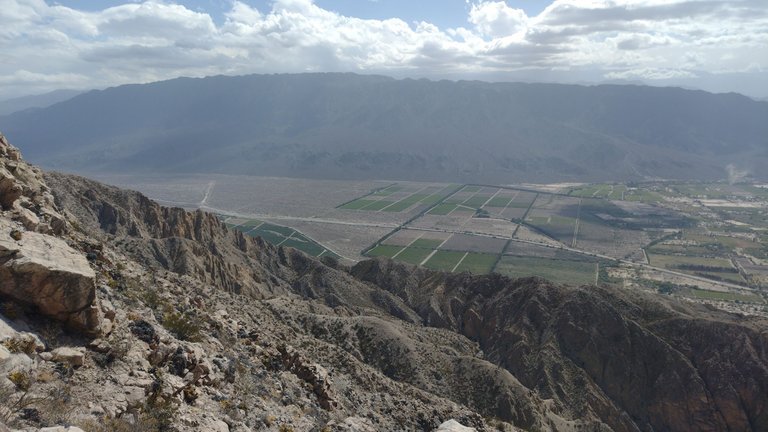
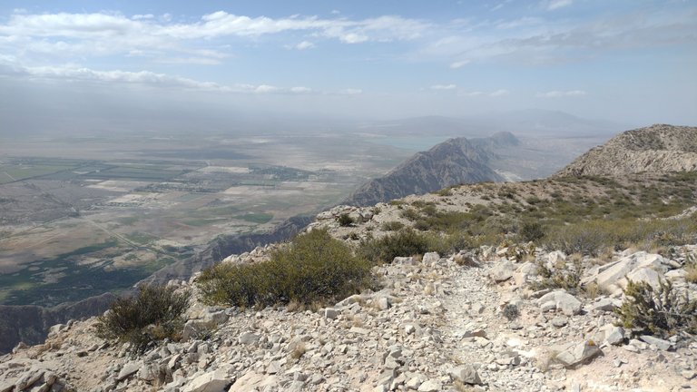
The hike was progressing and we were getting closer and closer to our goal. But we kept surprising ourselves by identifying from above all the places we had visited down there. From there we could also see the characteristic mountain peaks of the Juan Pobre Ravine, one of the short but beautiful treks I did in one morning before work. I was fascinated that this area contains so many things to do, and I'm glad I did most of them 😘.
La caminata avanzaba y nosotros estábamos cada vez más cerca de lograr nuestro objetivo. Pero no dejábamos de sorprendernos identificando desde arriba todos los lugares que habíamos visitado ahí abajo. Desde ahí también pudimos ver los característicos picos montañosos de la Quebrada Juan Pobre, uno de los trekkings cortos pero lindos que hice en una mañana antes de trabajar. Me fascinó que en esta área estén contenidas tantas cosas para hacer, y me alegra haber hecho la mayoría de ellas 😘.
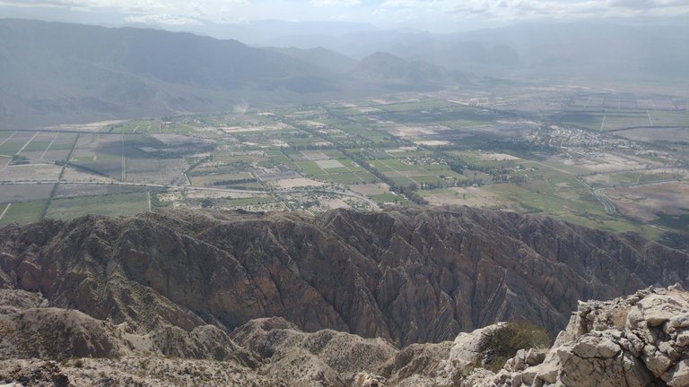
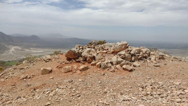
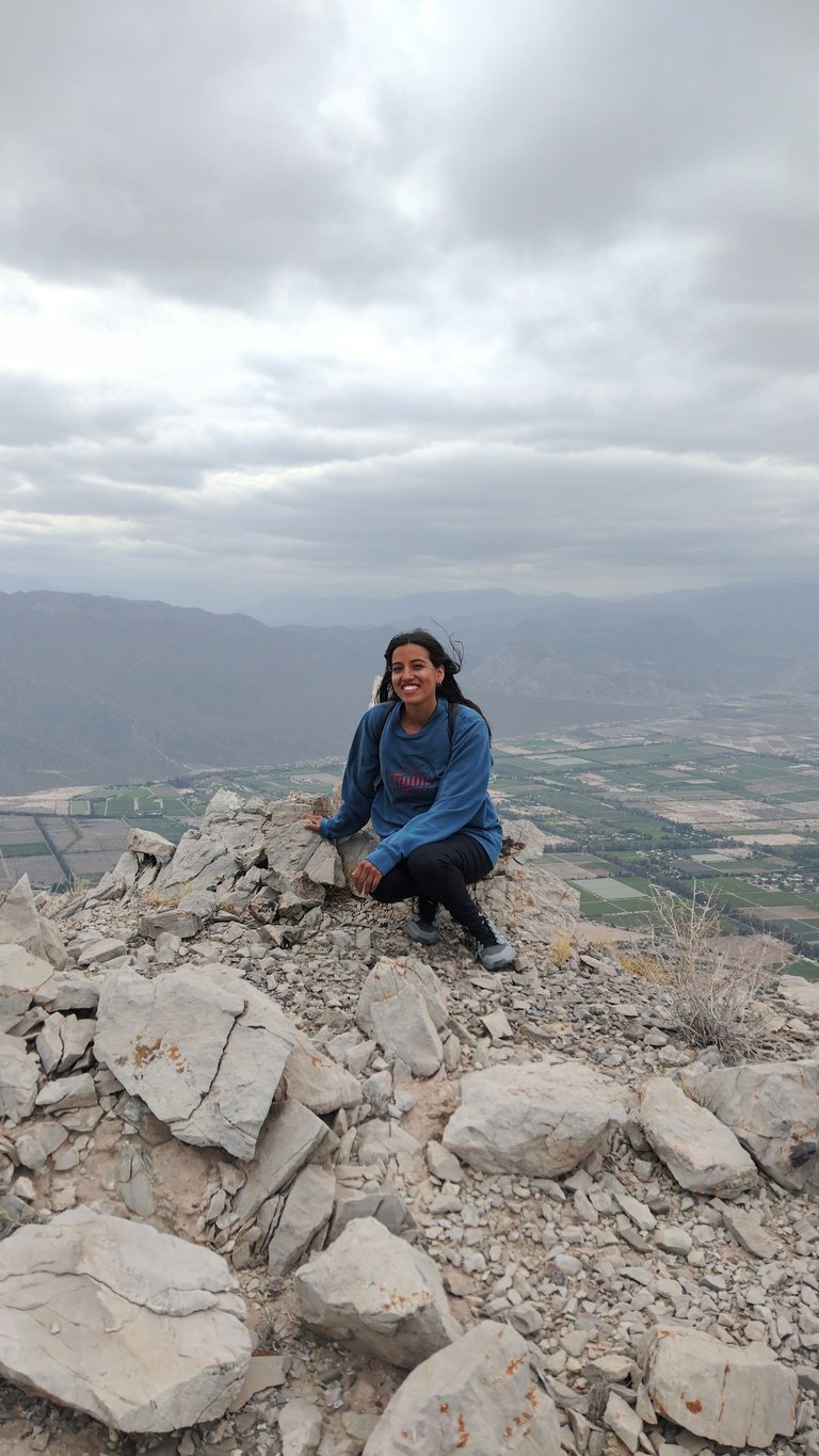
And almost without realizing it, the typical strong wind that warns you when you are about to reach the summit began to blow, and so it did. We had already seen much more than we expected, but as always, being at the summit of the hill you visit is like finishing the crowning of the walk. This mountain has more than 1600 meters above sea level, perhaps a little smaller than others I visited before, but undoubtedly the one that gathered more beautiful landscapes in one place ❤️.
Y casi sin darnos cuenta, empezó a soplar el típico viento fuerte que te avisa cuando estas a punto de llegar a la cumbre y así fue. Ya habíamos visto mucho más de lo que esperábamos, pero como siempre, estar en la cumbre del cerro que visitas es como terminar de coronar el paseo. Más de 1600 msnm tiene esta montaña, quizás un poco más pequeña que otras que visité antes, pero sin duda la que más paisajes hermosos reunió en un solo lugar ❤️.
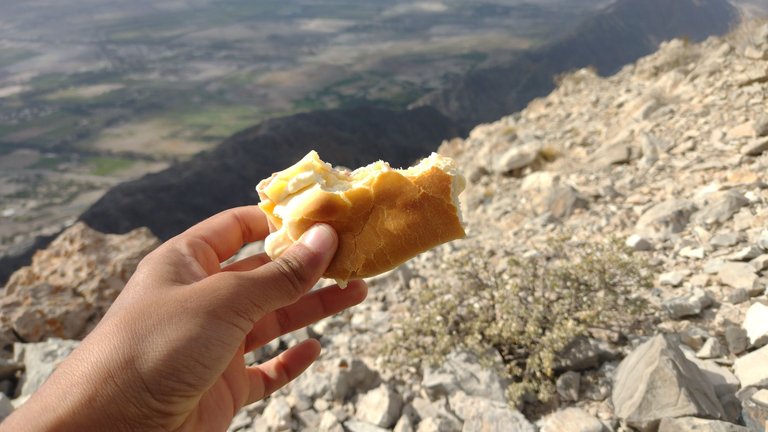
I think that this recommendation as a trekking to close this trip could not have been more accurate. I loved everything I saw, I could not have been more pleased with this trek. And as it is customary since I do these walks, I took a moment to eat the sanguche I had brought. This bread had to wait 9 km and more than 4 hours to be eaten, but it was worth it to be in that great place 💕.
Creo que esta recomendación como trekking para darle cierre a este viaje no pudo haber estado más acertado. Me encantó todo lo que ví, no pude haber estado más conforme con esta caminata. Y como es costumbre desde que hago estos paseos, me tomé un momento para comer el sanguche que había llevado. Este pan tuvo que esperar 9 km y más de 4 horas para ser comido, pero valió la pena que sea en ese gran lugar 💕.
Looking at these photos and reminding myself that all of this was achieved thanks to the decision to travel alone for the first time is something that excites me so much. Before that I had to convince myself for a long time that this was something I could achieve, and I definitely did. Being there, I was infinitely grateful to all the causes that made me be on that mountain at that moment, on that walk, at that moment in my life and with that clarity of mind of doing what I like. I am very lucky and I will never get tired of thinking and saying it, and every time I see a beautiful landscape like this, I confirm that I'm making the best use of my time ❤️.
Mirar estas fotos y recordarme que todo eso fue logrado gracias a la decisión de viajar sola por primera vez es algo que me emociona demasiado. Antes de eso tuve que convencerme durante mucho tiempo de que esto era algo que podría lograr, y así fue definitivamente. Estando ahí agradecí infinitamente a todas las causas que hicieron que yo estuviera en esa montaña en ese momento, en ese paseo, en ese momento de mi vida y con esa claridad mentar de estar haciendo lo que me gusta. Soy muy afortunada y nunca me voy a cansar de pensarlo y decirlo, y cada vez que veo algún paisaje hermoso como este, confirmo que estoy aprovechando mi tiempo de la mejor manera ❤️.
❤️ Hope you liked this post! Thanks for reading. ❤️
❤️¡Espero que les haya gustado este post! Gracias por leer. ❤️
Lau 💕.
📸 Portada creada en Canva. Todas las imágenes son de mi propiedad 💕.
Congratulations, your post has been added to Pinmapple! 🎉🥳🍍
Did you know you have your own profile map?
And every post has their own map too!
Want to have your post on the map too?
Climbing the barren mountains is very enjoyable, the views there are truly spectacular and very impressive
Yes! It was fun and not that hard really, and the view was amazing ❣️.
It's a rocky place, sure is challenging to get through it..
Not so much, it could have been difficult but it was quite friendly 😅.
What a beautiful hill and what a beautiful view there is from there, I had heard about the Allum Valley.
I think that this is a failure of the province, there is a need to promote more the beautiful places in San Juan, I have rarely heard or seen official advertising for San Juan
What a beautiful way to close your trip through the province, getting to know another beautiful place there, the landscapes are really beautiful
Congratulations on another excellent adventure and the good shots you have taken dear friend @lauramica
Have a wonderful day
I also think that they would have many other visitors if tourism in these provinces were a little more widespread. Everything was very beautiful there, a pity that it is not known. Wish you a great Sunday with your family ❤️.
We all must plan such trips and explore such beautiful places and here we get to learn a lot and our knowledge also increases a lot by visiting such scenic places.
Yes! And we do a lot of excercise in the meantime :)
Yeah.
It's a pity that it's too far away with me, if it's close maybe I'll come with you, the cobblestone road makes me very interested, because such mountains are rare in my country, and one of them I have already climbed
Mountains are great, sure the one in you're place is beautiful too 💕