With a new day dawning on my very memorable Fall Colors tour of central Colorado, I left Meeker after the previous day's adventures excited to experience new roads I had never before now traveled.
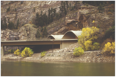
Lead Photo: View from Triangle Park on the New Castle - Buford Road in Colorado
(Click on any image in this post, in PeakD, for anGoing through Buford yesterday, I did not miss the beautiful bridge across the White River and wonder what lay beyond, as it wound up into the mountains to the south.
So ...
The night before, in my stay in Meeker, I checked into it online and knew the next day, I would be experiencing the New Castle - Buford Road for the first time!
Before taking a closer look, this is a map of the area traveled:
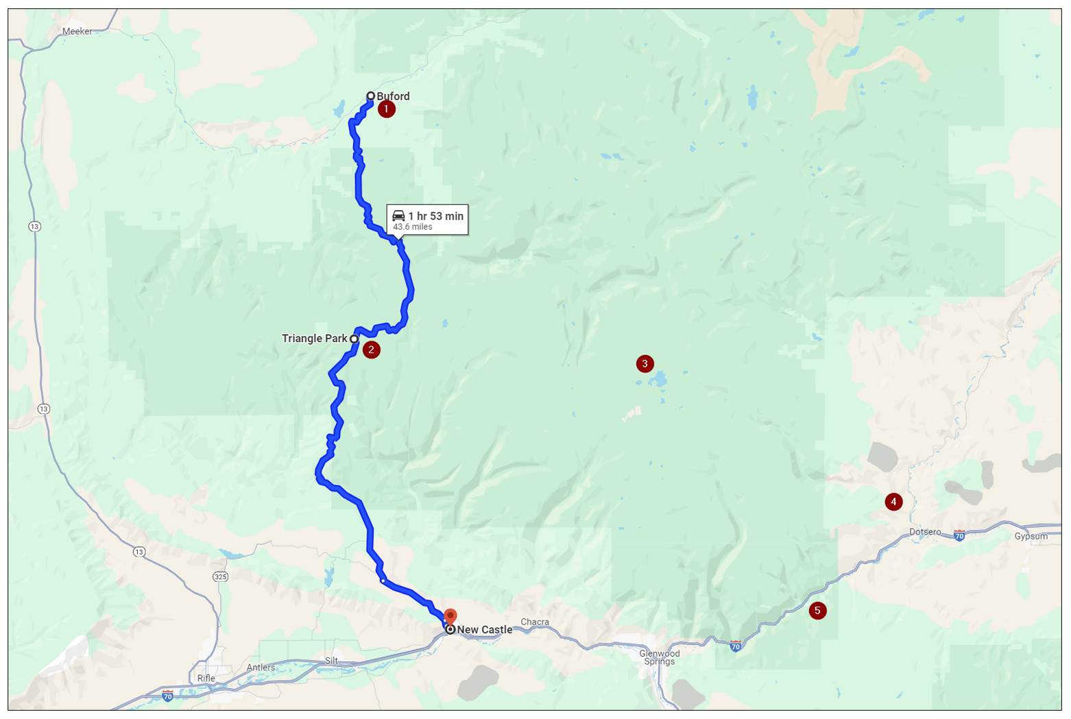
Source: Highlighted Google map of area covered in this post
Here is a brief look at each of the highlight points illustrated above, with links to more information, if you are interested in learning more about it:
- Buford - Established in 1889. Serves as the entrance to White River canyon. And, crossing the White River on a pretty little bridge, where the New Castle - Buford Road begins heading south and climbing fast!
- Triangle Park - Elevation 10,118 ft (3,084 m), then descending steepily down into New Castle.
- Deep Lake - Located in the Flat Tops Wilderness, on the eastern slope of the Flat Top Mountains.
- Dotsero - Located at the confluence of the Eagle River with the Colorado River.
- Glenwood Canyon - Traveling through this rugged canyon, carved by the Colorado River and bypassed by the Ute Indians altogether, you are on the very last piece of America's Interstate Highway System built!
Let's be on our way! 😎

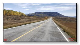
New Castle - Buford Road
Once crossing the White River at Buford, the paved road becomes gravel, but well maintained. If you don't mind subjecting your passenger vehicle to some wash boarding in the road, it is otherwise easily traveled in one.
This road climbs over 10,000 ft (+3,000 m) to cross the western end of the Flat Tops and then drops down into the Colorado River canyon, in the area of the little town of New Castle.
Ascent to Triangle Park
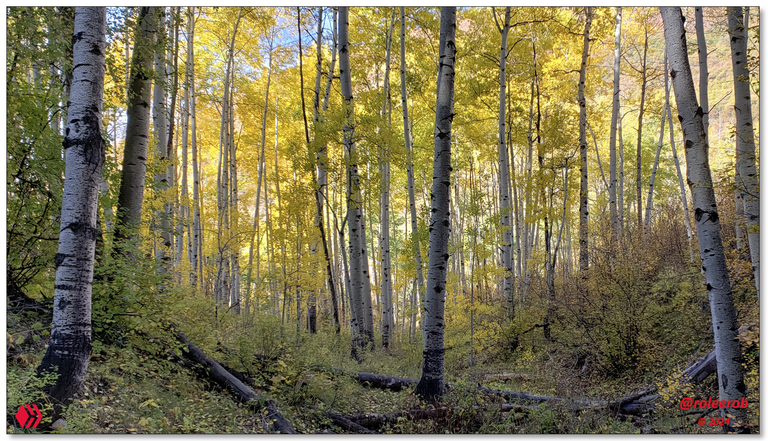
The climb up is steep, through many switchbacks. The highlight, as usual in much of the Rocky Mountains, is passing through the "Aspen Belt." That is why we are here on this trip.
Let'd do it!
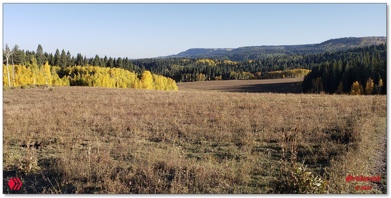
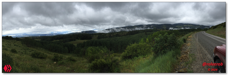
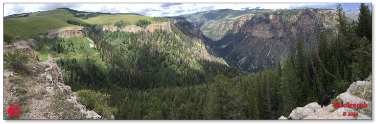
View looking back northeast, at the beginning of Triangle Park, to the entrance to the White River canyon.
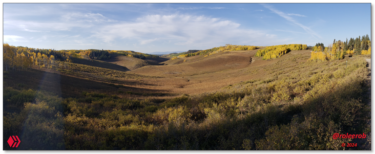
Panoramic view looking back northwest, to the White River valley.
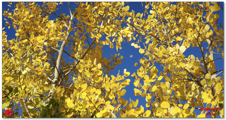
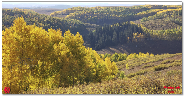
Brilliant fall colors of aspen trees, with moon in the background.
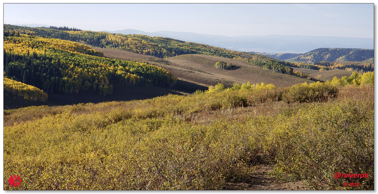
View of the beautiful "Aspen Belt" down below Triangle Park
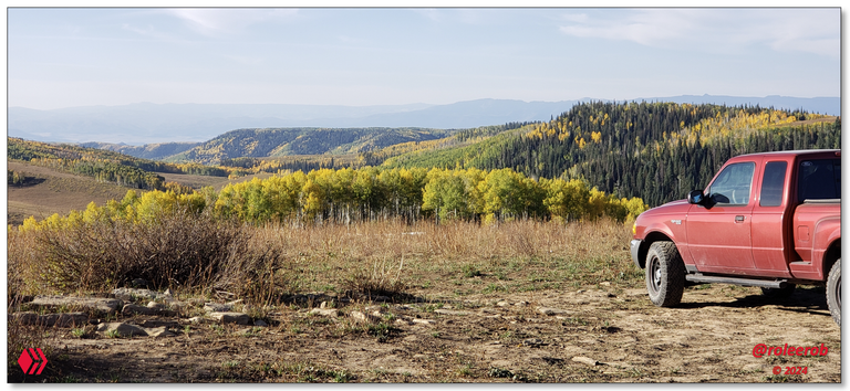
Old hunter's campsite, with a view northeast of the canyon down into New Castle, in the distance.
Photos: Views from Triangle Park
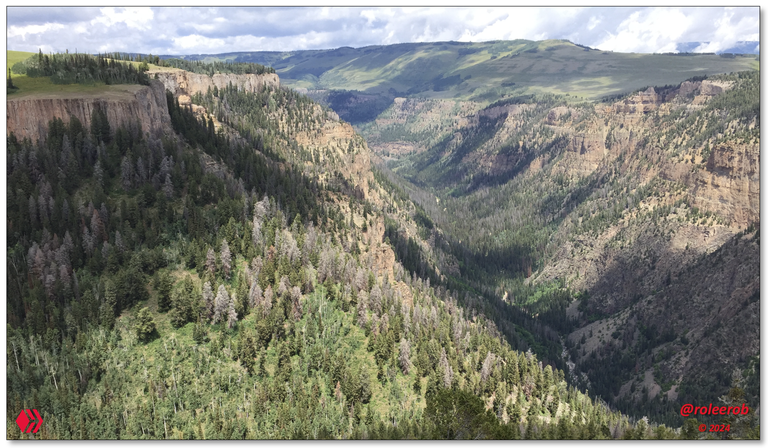
Dropping down into New Castle
Well, I could've stayed up in the high country all day and explored the 4-WD roads going off in just about every direction. Probably for days and days ... But ... Had to "move on down the highway" given how far I had planned to travel on this particular day.
- "You're booking yourself too tight!" as my favorite comedian Brian Regan would say ... 🙄
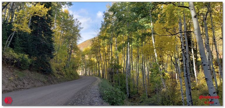
Down through the glorious "Aspen Belt" and ...
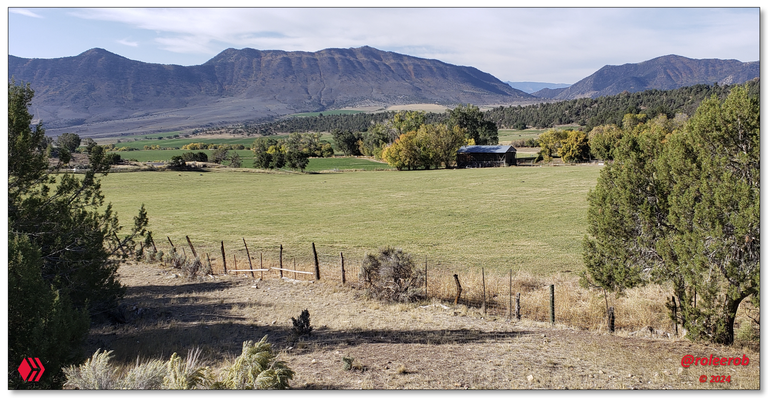
... out into the high ranch country above New Castle, sitting just above the Colorado River.
Photos: Views from descent into New Castle
Like so many of these favorite RLT road trips, this one was over way too fast. And looking at the pictures leaves me wondering, as is often the case, whether I will ever experience it again.
Upon arriving in New Castle, with my mind on other matters, my attention was drawn back to this quaint little town. While only a relatively short distance away, on the other side of the Colorado River from Interstate 70, from steady traffic, it was just enough.
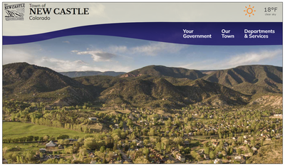
Source: Website for the Town of New Castle in Colorado
Much more popular and well-known vacation destination, Glenwood Springs, is nearby. So ... I would imagine this little town gets overlooked. I think I would enjoy staying here, at least for a day or so, should I ever come through here again.
Deep Lake and the eastern slope of the Flat Top Mountains
It is never fun to arrive at a long-anticipated destination and find ... You are not welcome! That is how I view arriving "under a cloud." Amongst other things (like rain!), the sun is not out, so lighting for the hoped for pictures just aren't what they might have been. Oh well ... 🤷♂️
We make the best of it!
Climbing up to Deep Lake
We left the main road at Dotsero, with an elevation of 6,145 ft (1,873 m), to climb up through the southeastern corner of the Flat Top Mountains, to reach Deep Lake, at an elevation of 10,466 ft (3,190 m).
Quite the trip and view on the way up!
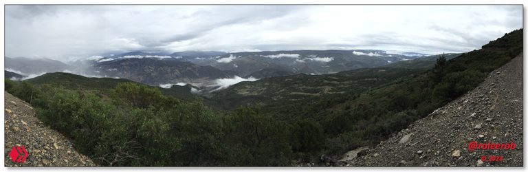
Panoramic view of the climb up from Dotsero, under the clouds in the center below.
Panoramic view of finally reaching the high country of the White River National Forest.
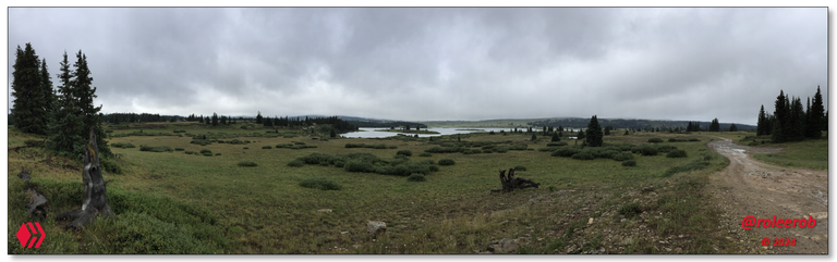
Panoramic view of Heart Lake.
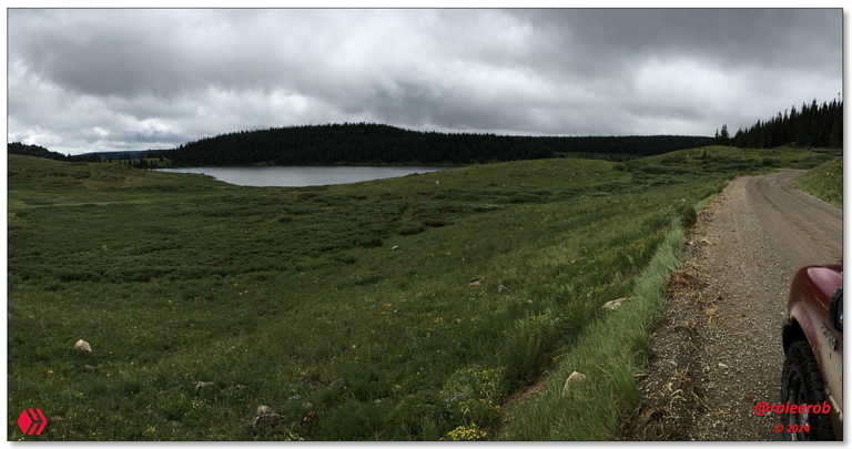
View of finally reaching Deep Lake, in the rain ...
Approaching the aptly named Deep Creek Overlook, with the sun belatedly coming out!?
Panoramic view of the incredible Deep Creek Overlook.
View of Deep Creek drainage and no trail to it. Incredible fishing, for sure! Just have to get down there. And back!
Photos: Views going to Deep Lake in the Flat Top Mountains
While far from ideal, this day was still better than a day in the office! Hahaha ... 😉 I sure hope to be able to return someday and see this area again, under better conditions.
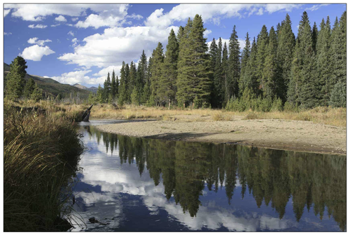
Dotsero and the Colorado River
Dotsero is located at the confluence of the Eagle River with the Colorado River, which comes down from its headwaters in Rocky Mountain National Park. There is a lot to like and do, in the surrounding countryside.
Headwaters of the famous American river, the Colorado River!
Source: Website for goColorado.com
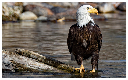
An eagle on the ... wait for it! ... Eagle River!
Source: Website for the Town of Eagle in Colorado
All of the streams draining out of the east side of the Flat Top Mountains flow down into the Colorado River. Converging at Dotsero with those coming down from the Vail area, via the Eagle River.
Before flowing down into the rugged Glenwood Canyon ...
Glenwood Canyon
If you get anywhere near the area covered in this post, you do not want to miss traveling down through this canyon. Yes, it involves traveling down part of America's Interstate Highway System, but ...
It is unlike almost any other stretch of it.
Source: Website on Glenwood Canyon's construction.
This stretch of highway is an engineering marvel - with a number of tunnels and bridges carrying one lane of traffic above bridges below carrying traffic in the opposite direction. Upon traveling it, compared to any other section of Interstate Highway, it is not hard to see why this approximately ~12 mile (~ 19 km) section of it was the last built and the most expensive.
As the gateway to Glenwood Springs, which has many attractions and is a worthy travel destination in its own right, one "bucket list" destination in Glenwood Canyon is Hanging Lakes.
Just watching this video will tell you all you need to know, if interested. Now want to see Hanging Lake, for yourself?
Well, then, make sure you have
advance reservations!
advance reservations!
Yes, I am serious, as it is one of the most popular hikes in the whole state of Colorado!
While these last sections are more travelogue than showcasing original pictures of my own, I have traveled through them all and they are highly recommended, if you come this far!
I wanted to ensure you had the "big picture" in view, before packing your bags! 😉
Closing
While this portion of my trip was marred by both smoke from forest fires and rain, you have to make the best of every day. You never know, if you will ever pass that way again!
I hope you enjoyed "seeing through my eyes" this remote part of the American West. If so, I’d love to hear any feedback you may be inspired to provide.
Until "next time," all the best to you for a better tomorrow, as we all work together to build up our Hive Communities and add increasing value to our Hive blockchain! 👍 😊
Respectfully,
Blogger @roleerob
Hive "Dolphin" 🐬 & Man Cave "Dragon" 🐉
P.S. Unless otherwise noted, all images are pictures taken by my smartphone - a Samsung Galaxy S9+.
🌲 No trees were harmed in the publishing of this post! 🌲


Interested in reading more of my travel-related posts?
 |
RLT #1: Battle Pass Scenic Byway
The first of my RLT ("Road Less Traveled") series, as I began writing again on Hive in 2024. An open road. With no one on it. Out in remote portions of the great American West. Hmmm. I wonder what it all means? |
 |
Fond Memories: Return to Spirit West River Lodge
A remarkable place. Built by remarkable people. Writing about it resulted in some of my highest rewarded posts, including "Daily Top Payout" on Hive. Please don't miss my tribute to Lynn Finney, in the top comment.
|
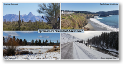 |
R2R Travelogue: Recap of "@roleerob's excellent adventure!" In winter ... My R2R series - "Road to Recovery" trip of a lifetime. In 31 days, I drove 4,984 miles through a part of 8 states - Colorado, Arizona, California, Oregon, Washington, Idaho, Montana, and Wyoming. Unforgettable memories relived and new ones made! |
Map of roleerob's
Check out HaveYouBeenHere's:
App •
Map •
Hive Travel Community
• Discord


I'm here, traveling along with you after missing out on far too many adventures! Those aspen trees in the fall are breathtaking!.
Yes, @melinda010100, it really was a magical time of year in the high country of the Rocky Mountains. I have 3 more coming, on this same trip, then it will be over.
And back to my ... "comfy chair!" Hahaha ...
I've been in the mountains several times over the years when the everything was golden. Beautiful memories!
Dear @roleerob !
I was amazed by Colorado's vast forests, rivers, and valleys!
I'm even more surprised that such a vast territory is completely uninhabited!
By the way, I wonder how you solved the problem of food and lodging in a forest without people!😃
These views are divine, thanks for sharing.
Glad you liked them. Thank you for stopping by and letting me know!
You're welcome.