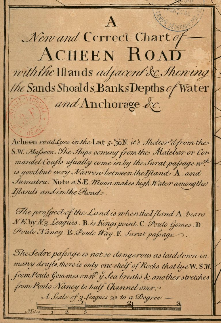
A new and correct chart of Acheen road with ths islands adjacent. An ancient map of Aceh in upaload http://gallica.bnf.fr/, made in 1700-1799.
Acheen is another term for Aceh in bygone ages.
A description in this map is written in French.
In the visible map
Poulo Rodondo (Rondo island)
Poulo Way (Weh island)
Poulo Brafse (Breueh island)
Poulo Nancy (Nasi island)
Coast of Sumatra (The northern tip of Sumatra island, now Banda Aceh)
Detailed information, please visit Gallica

Please refer to the book:
Acheen, and the ports on the north and east coasts of Sumatra : with incidental notices of the trade in the eastern seas, and the aggressions of the Dutch
Author: Anderson, John
Print Source: London: W.H. Allen and Co, 1840
Publication Info: Ithaca, New York: Cornell University Library
nice post