Hey everyone!
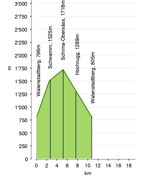
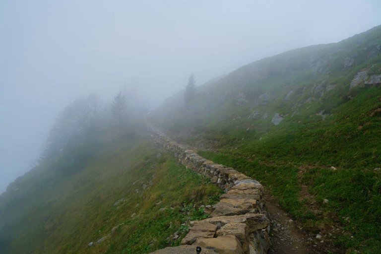
This fall I was lucky enough to be in the clouds. It was actually in the foggy mountains, but it's more romantic to think that it was a hike in the clouds. At that time it was still almost summer-like warm and it was a real pleasure to walk. The road itself was 11 kilometers with an ascent of 1000 meters for the entire route. It wasn't always easy.
Этой осенью мне посчастливилось побывать в облаках. На самом деле в туманных горах, но романтичнее думать, что это был поход в облака. Тогда еще было почти по-летнему тепло и идти было сплошное наслаждение. Сама дорога была 11 километров с подъемом в 1000 метров за весь маршрут. Не всегда это было просто.
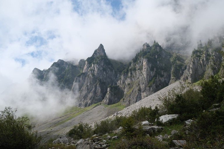
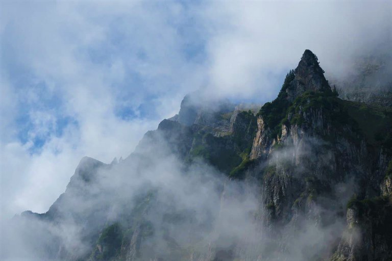
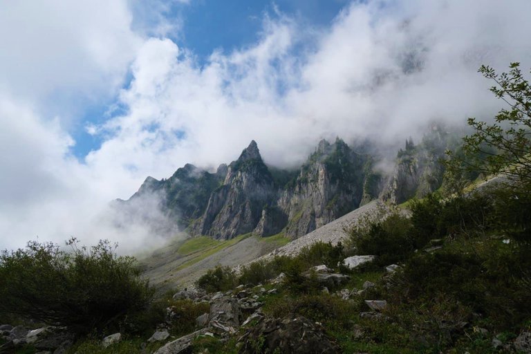
Churfirsten-Felswände cliffs
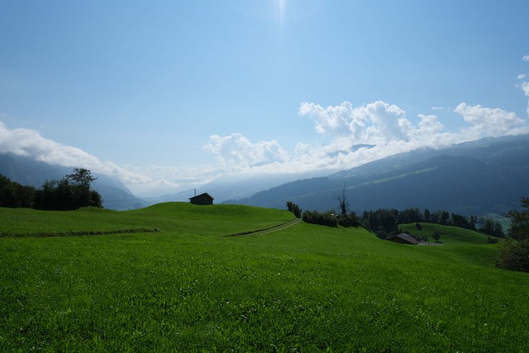
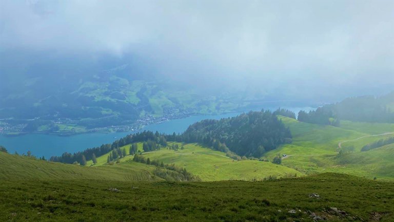
This circular tour at the foot of the Churfirsten with a unique view of Lake Walensee is sure to charm every hiking enthusiast. Part of the route follows the "Alp- und Kulturweg Schrina" with interesting information about nature and culture
Этот круговой тур у подножия Churfirsten с уникальными видами на озеро Walensee обязательно очарует каждого любителя пеших прогулок. Часть маршрута проходит по "Alp- und Kulturweg Schrina" с интересной информацией о природе и культуре.
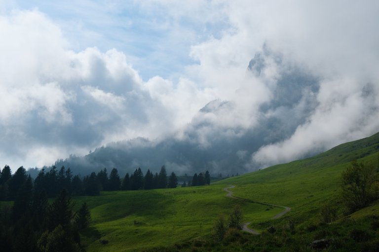
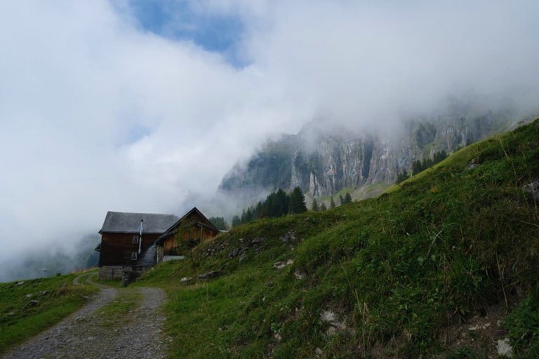
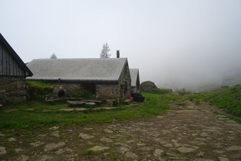
The starting point of this hike is the small village of Valenstadtberg. It belongs to the municipality of Walenstadt and enjoys a privileged location on a southern slope with a panoramic view of Lake Walensee. The ascent up "Berger Laui" is quite steep through a gorge-like cut in the forest. Then the trail becomes more gentle, and after another wooded area you reach Alp Tschingla with its guesthouse.
Отправной точкой этого похода является небольшая деревня Валенштадтберг. Она относится к коммуне Валенштадт и выгодно отличается своим расположением на южном склоне с панорамным видом на озеро Walensee. Подъем по "Berger Laui " довольно крутой через лесной разрез, напоминающий ущелье. Затем тропа становится более пологой, и после еще одной лесной зоны вы достигаете Alp Tschingla с его гостевым домом.
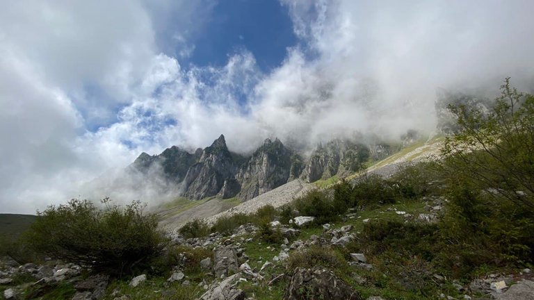
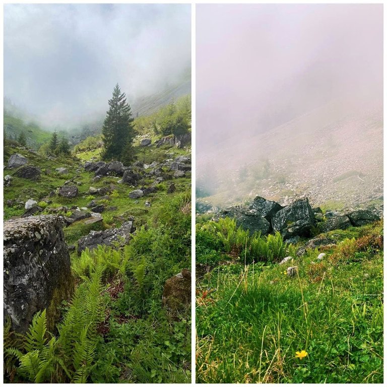
The effort involved in the climb is worth it: from Alp Tschingla, the trail runs as a high-altitude and panoramic route with breathtaking views of the Churfirsten-Felswände cliffs up close and deep views of the Walensee, which looks like a fjord. The alpine area at the foot of the south side of Mount Churfirsten is largely a cultural landscape that has been used, cultivated and changed over the centuries.
Усилия, затраченные на подъем, стоят того: от Alp Tschingla тропа идет как высотный и панорамный маршрут с захватывающими видами на скалы Churfirsten-Felswände вблизи и глубокими видами на Walensee, похожий на фьорд. Альпийская зона у подножия южной стороны горы Churfirsten — это в значительной степени культурный ландшафт, который использовался, возделывался и менялся на протяжении веков.
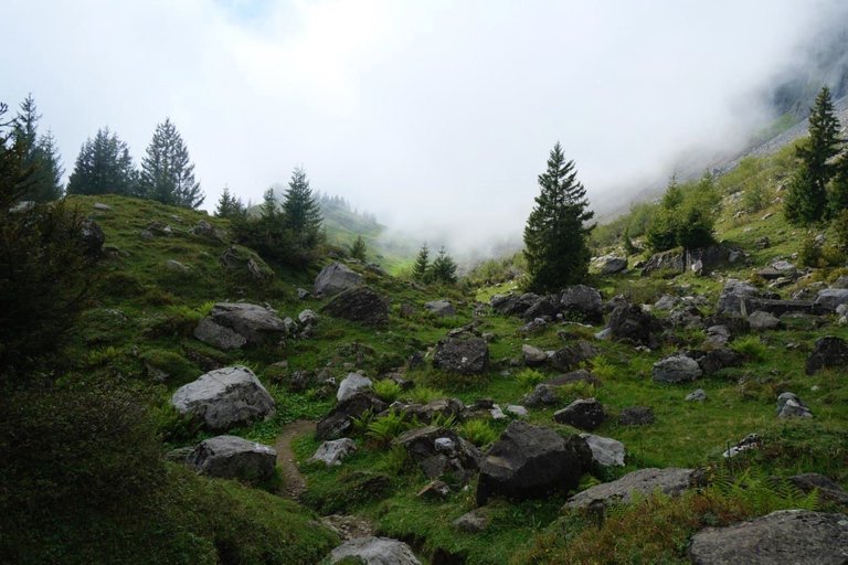
The descent begins at Schrina Obersäss. The descent continues first along a narrow mountain road, then leads back into the forest and finally back to the starting point.
Спуск начинается у Schrina Obersäss (Шрина Оберзасс). Сначала он идет по узкой горной дороге, затем ведет обратно в лес и, наконец, возвращается к исходной точке.
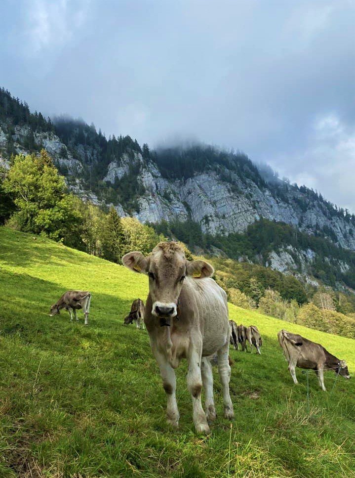
At the end of the route we were greeted by a curious, cute calf 🥰
В конце маршрута нас встречал вот такой любопытный милый теленок 😊