Hello Steemians, today I would like to share a conceptual but practical city planning idea that could be adopt into the real-world situation and hopefully it could be realized. In this article, I will share about Rejuvenate or revitalization project. The content incorporated some case studies and how we could achieve it with a local city as a subject for this experiment.
Original and edited image by Author
A. Rejuvenate or revitalization project
In a city context, this project is meant to revive; restore, or reorganized certain or multiple element to make the city built environment more sustainable and livable. In detail, project mostly focus on:
- Reroute motorized traffic for better improvement of pedestrian friendly infrastructure across the city.
Example of rerouting traffic project:
Barcelona, Spain
Issues: Unhealthy air quality
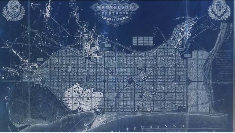
image capture from a youtube link source
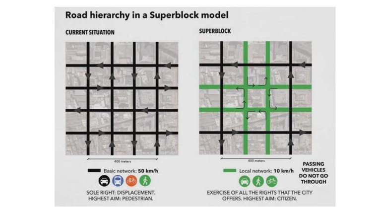
image capture from a youtube link source
Solution Concept: Super Block planning
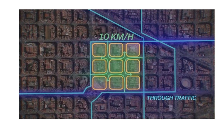
image capture from a youtube link source
9 blocks of building form a superblock with slower traffic speed and smaller vehicle to access it. While bigger vehicles such as lorry and buses only can operate outside the super block.
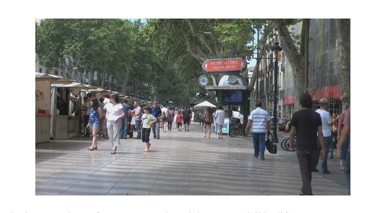
image capture from a youtube link source
Internal road become open air market, pedestrian friendly street, and larger open space for public event (musical performance, dancing, cultural activities and more).
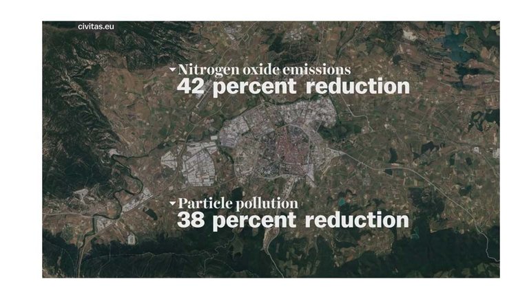
image capture from a youtube link source
Because of the street had been transform into pedestrian friendly streets, it form a network that increase a walkable distant and reduce the need of use of cars. Hence, reduce air pollution.
- Revitalize city infrastructures; alley, streets, river to achieve healthy environment and improve local economy.
Kuala Lumpur, Malaysia
River of Life (ROL) is Kuala lumpur City initiative to revitalize the historic Klang River.
Issues: Polluted river and unhealthy environment
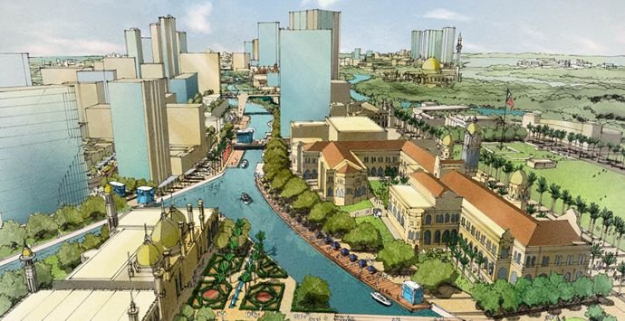
The project contains three major components:
- River cleaning
- River beautification
- Commercialization and tourism
A total of RM3.4bil has been allocated to clean up the 110km rivers.
By 2020, the initiative hope to transform current river quality which is Class III-Class IV(not suitable for body contact) to Class IIB (suitable for recreational usage).
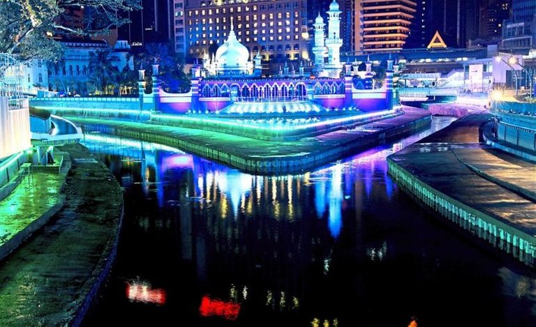
Image source
Reader can access the link here for more information.
B. Proposed Rejuvenate Street in Kota Kinabalu City, Sabah.
In this section, I would like to contribute my thought and ideas to any rejuvenation project/proposal out there especially in Kota Kinabalu. Therefore, in this section, reader will expose to author conceptual idea that will be fully illustrated in Computer generated graphics. If you have any comments or suggestion, you are welcome to drop some comment for further discussion.
This Proposal contain 3 parts
Part 1: Site Introduction
Part 2: Site Issues
Part 3: Implementation and discussion
Let’s begin
Part 1: Site Introduction
Kota Kinabalu is the capital of Malaysia’s Sabah state and located at the northwest coast of Borneo. Formerly known as Jesselton during colonial period, therefore, you could find some of the remnant of the past that integrated into today city architecture. Furthermore, the city architecture also mainly shaped by the state’s multi-racial culture, practice and beliefs.
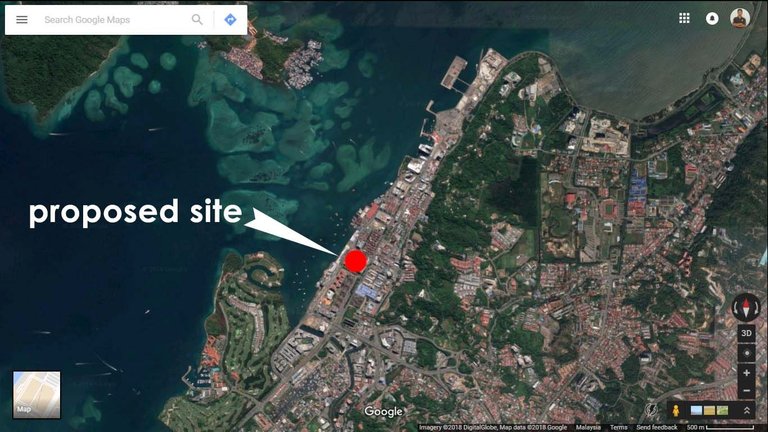
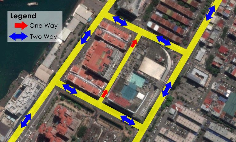
Image source: Google Map
The Proposed Rejuvenate Street project is in the center of the city.
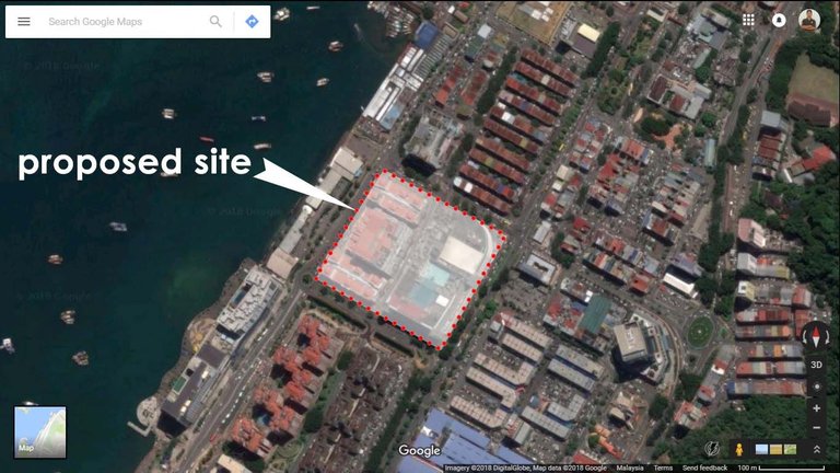
Image source: Google Map
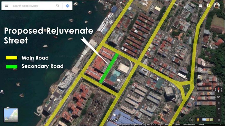
Image source: Google Map
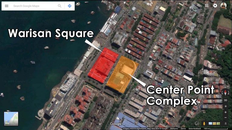
Image source: Google Map
The proposed site is a secondary one-way road that sandwich between two commercial building (Shopping complex and shop/office)
Why this street was selected?
The proposed is a street, located in the center of the city and sandwich between two buildings. The selection is based on author insight on site study and the feasibility of higher success rate as a City Rejuvenation Project. Besides that, it also a public street that meant for public usage which could be transform into a park or garden for local community.
Weather Information
Climate: Average 32OC, Wind speed 14 KM/h, 67% Humidity
Daylight Duration: 12 – 13 hours
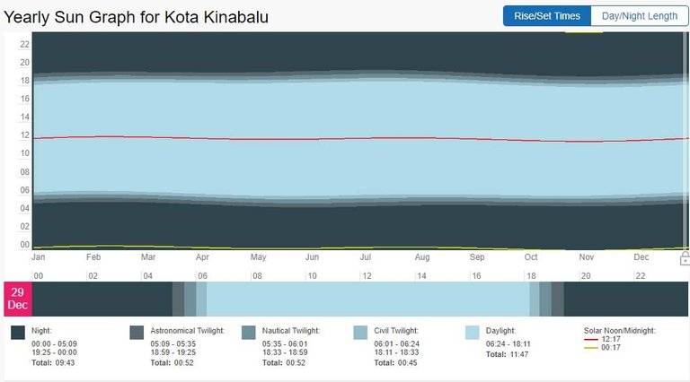
Source
Site Dimension:
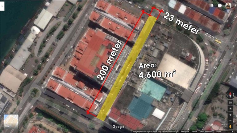
Image source: Google Map
Macro Neighborhood Context
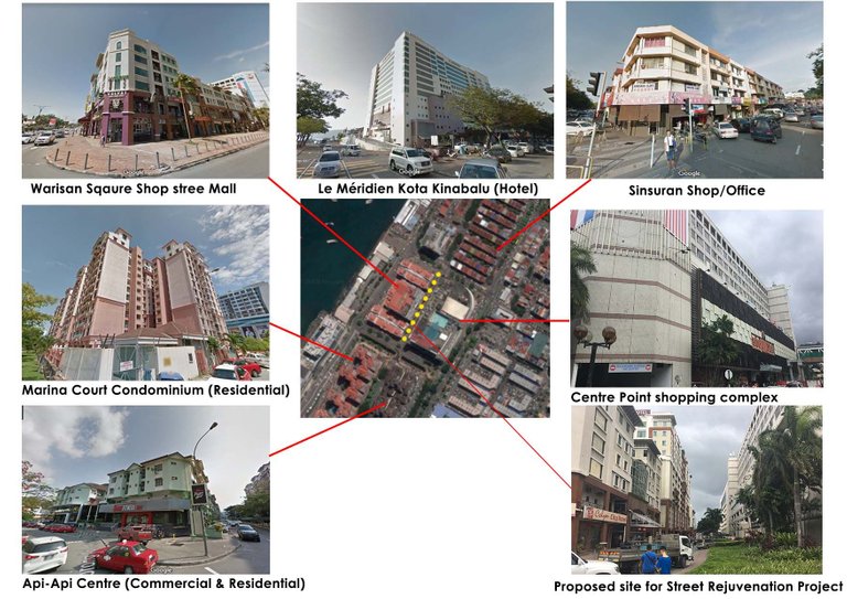
The street is located within a rich commercial and residential vicinity. Tourist and locals flock to this location to enjoy local goods and services such as shopping, restaurants, night bar and club, and even enjoying city lifestyle alongside waterfront promenade.
**Micro Neighborhood Context **
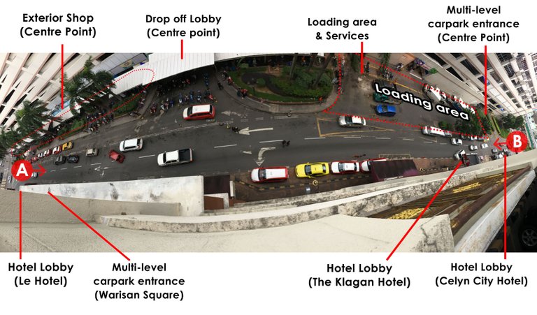
Image 1 Original Photo by Author
Based on the image above taken from Warisan Square building, it shows that the entire street are cars orientated. Users mostly using this street for drop off and pick up passenger; it is a loading area and services for the shopping mall, and route to multi-level carpark above.
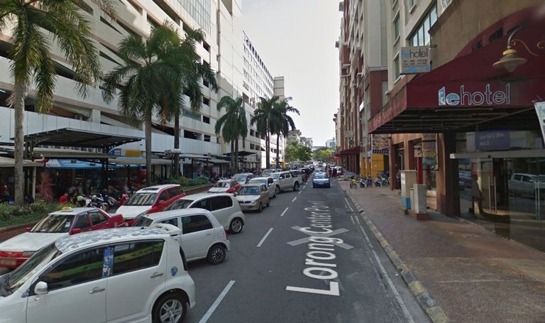
Image source: Google map
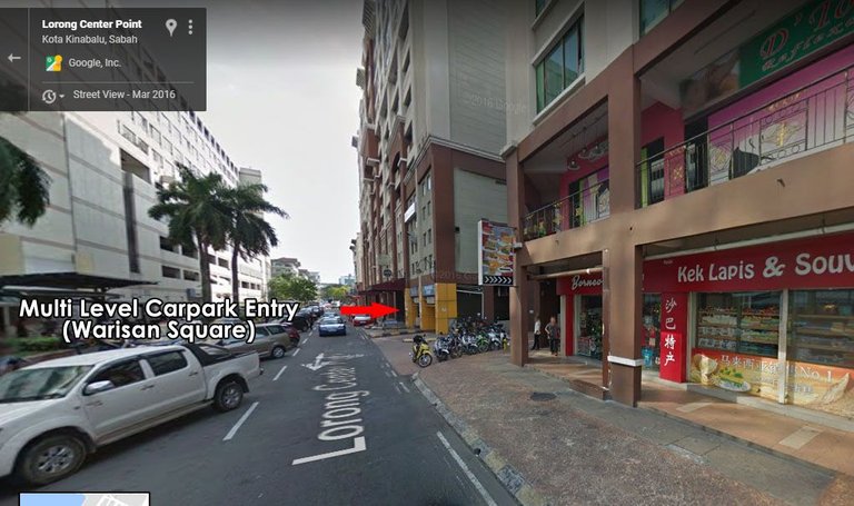
Image source: Google map
Both images above are from the view point A in the Image 1. It shows the exterior shop (Left side of the road) at the ground floor of Centre Point are crowded with parked cars and while the other side (Warisan Square) are mostly occupied by hotels.
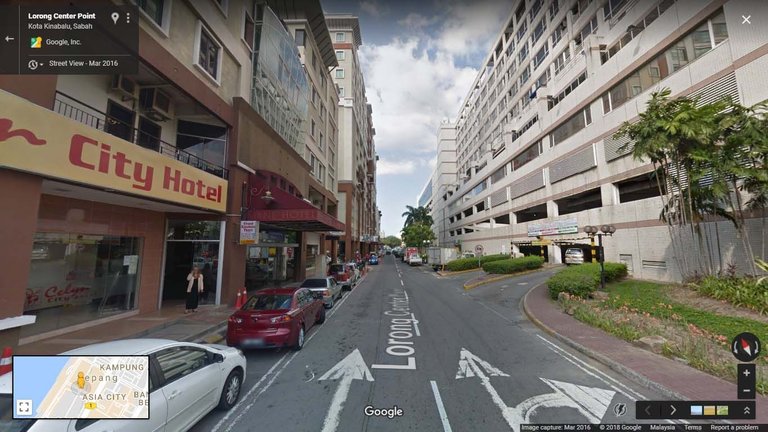
Image source: Google map
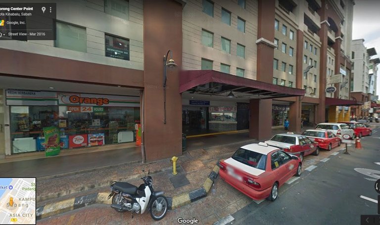
Both images above are from the view point B in the Image 1. It shows the entrance of multi level carpark (Centre Point Shopping Complex) and its loading bay entry way (Right side of the road). On the other side, (Warisan Square) are mostly occupied by hotels and convenient stalls.
Part 2: Site Issues
** 3 Issues**
- Impractical/redundant landscape design
- Air quality heavily polluted in this small alley.
- Under development & Pedestrian Hazard
1. Impractical/redundant landscape design
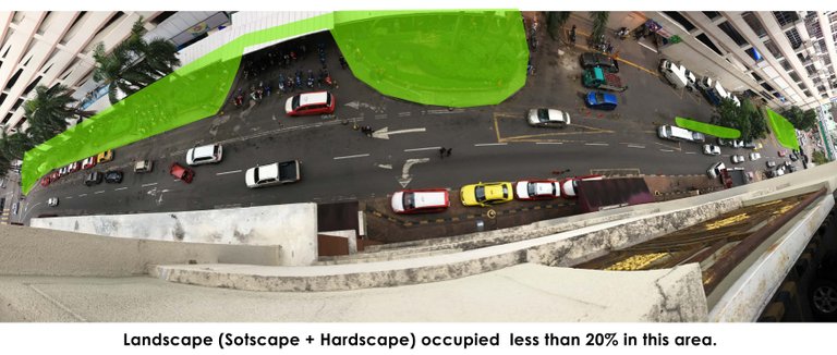
In this area, the landscape only occupied less than 20% of the total area, and most of the available landscape are merely for ornamentation, instead of designing it for human comfort such as (reduce heat island effect, garden for social activities, and wider walkway for pedestrian.
Even though the street is only about 190 meters in length, cars owner often utilizes this road as a diversion (U-turn). In addition, double sided parking further increases road congestion and interrupting those who only trying to get around city traffic or entering complex multi-level parking. This further increase the air pollutant emitted by cars in this region, hence making this narrow alley even more suffocate. Besides that, particulate emitted by vehicles will be inhale by pedestrian. Thus could generate health problem like asthma, premature death and develop lung cancer.
3. Under development & Pedestrian Hazard
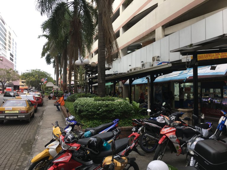
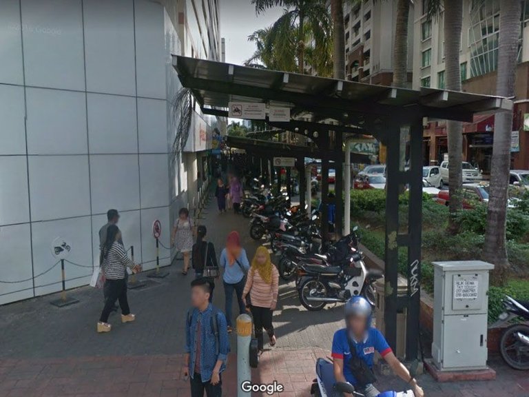
Image source: Google map
Because of just to fulfil a requirement of providing greenery space, designer have no idea that their design does not benefit the truth end users.
Therefore, the garden and covered walkway are parked with motorcycle.
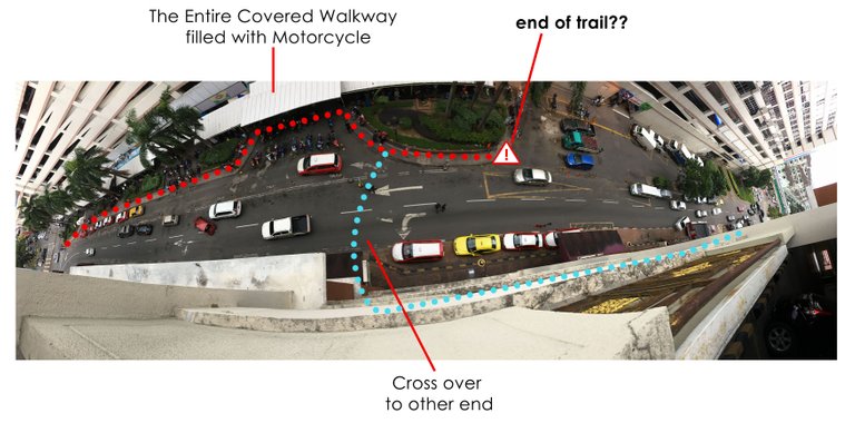
As a pedestrian user, how would you rate your experience based on above path way.
For me, I’m frequently walk in this city and I would rate it disappointed as it was design for machine instead the person behind the machine. It exposed me to the danger of traffic, weather and social security (I would not walk in this alley alone in the night even though there are 24hrs convenient store and hotels open opposite it.)
Part 3: Implementation and discussion
The outcome of the project should be able to promote more positive outdoor activities for social networks, promote pedestrian and bicycle friendly environment and benefits ground floor retails.
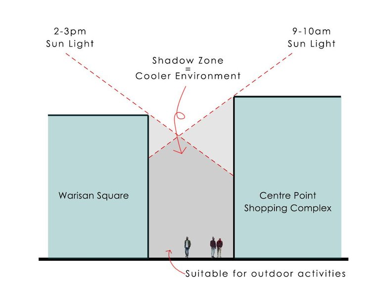
Since the entire street is sandwich between two buildings, it is protected from strong wind and shielded certain period of sun light. To enable sun shade at any time, trees could be planted in this area, or sun shade devices could hang above ground.
Please rotate your screen to visual the plan below.
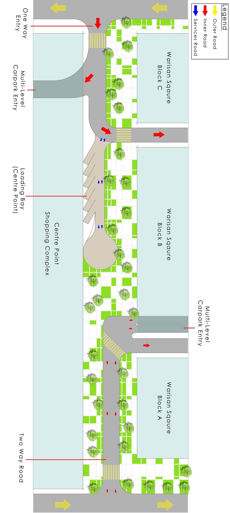
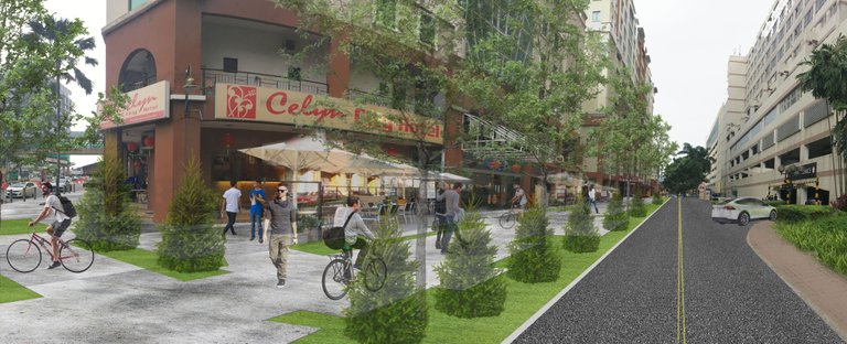
Above is a schematic plan for the revitalize project of the street, it illustrated the appearance of the park, garden that will be replacing current asphalt road. Based on the image above, the idea will reclaim 2,431 sq.meter (which could be rented out) of the street for commercial purposes, exercises activities, and even social activities.
Image above is an computer generated graphic illustrated one of the scenery of the alley. It shows how a widen corridor could be turn into a park/ human oreintated street and to be use for pedestrian activities and commerical activities where hotels or shops could fully utilize their frontage for outdoor café and more.
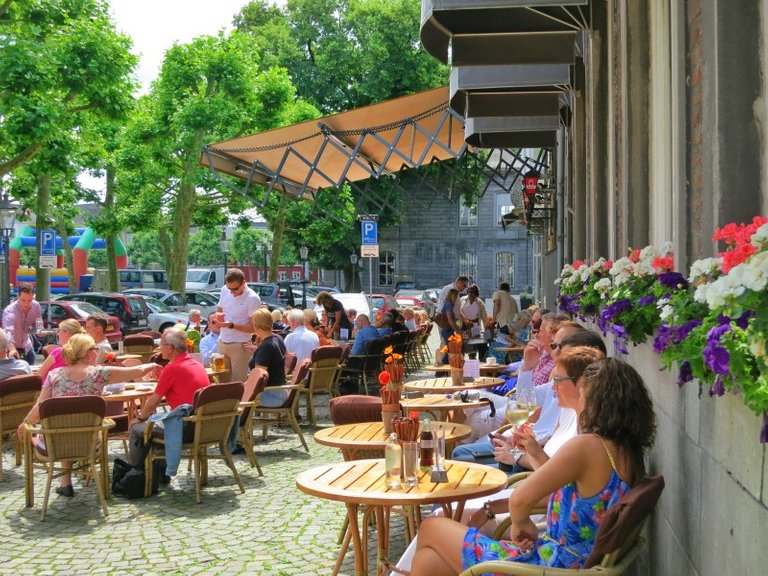
Example of outdoor café/stall theme

Conclusion
In a nutshell, cars only able to deliver any human to a macro destination. Once in micro scale, it is the people who are walking, cycling, or jogging that will visit a shops; or it is slow pace movement of people that make a location lively, vibrant, safe and secure. In future, I am looking forward for support from anyone and especially local Sabahan who would like to make our first initiative to actually propose such project to local authority and to make our city a better space to live in. Thank you.
Hope you guys enjoying it and please do drop us comments and resteem to spread the word to your fellow friends. We look forward for the contents that will use the tag #archisteem :)
Like the idea of how you wanna revitalize the street. The idea is great but implementation will need to work on persuasion with all the stakeholders as well as the cost sharing.
Since it is a public street own by the local authority, the only cost sharing would be Local authourity themselves. Howeve, it is the interest of public And other stakeholders that could make a stronger persuasion to local authority.
Indeed, infrastructure cost usually will be bear by the government (for most of the cost). Nonetheless, the government can also amend policies to welcome private sector to join in as a consortium to build it. It really depends on the suitability of the execution to the context and scale.
I like your proposal, it is very interesting. Need to study on the traffic flow too, there are times when traffic can be very heavy. Maybe you should show it to the mayor or the CM, and let them decide.
Thanks for the heads up, the intention of public is to remove any present of cars. So any vehicles entering is either going to multi level carpark or loading bay.
Love this idea so much, gives of a vibe like the street between Mid-Valley and the Gardens, although I'd very much still prefer it being a fully pedestrianized street like your idea. Good analysis!

source
thanks, but I'm looking forward to push ideas like this to public and local authority. So that anyone can enjoy what a city truly is. I see you also an architecture enthusiast too, would you like to share some of thoughts?
Our city lacks walkability with it's historical five foot walkways. Singapore does it very well with their wide pedestrian walks and trees that offer a very nice shaded cool walk within the city. All at the same time preserving their shophouse heritage (i think at least they try to). For KK, it seems more vehicles are constantly increasing and that comes with it's own shares of problems. A more walkable city with good transportation connections would really elevate the look and public perception of the city. All the more, it starts with initiatives like this. Hope to see more of it :)
agree, but sabah have to build more public transport infrastructure besides roads to makes city more walk able and makes people mobility more dependent on public transport .