
Mapping huge sites like this isn't easy because it involves a ridiculous number of high res images which must be processed online to create larger maps.... which must be edited in After Effects or Photoshop. Depending on your end goal. Mine is film, so I use After Effects.
How big is this solar site?
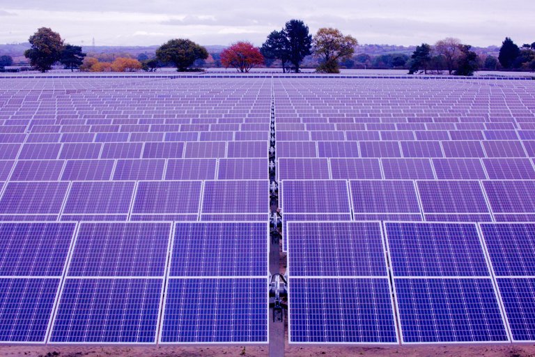
It is 200 acres.
When I walk the perimeter it is 2.74 miles.

It is an enjoyable walk but there has been much animal death in the name of 'progress'.
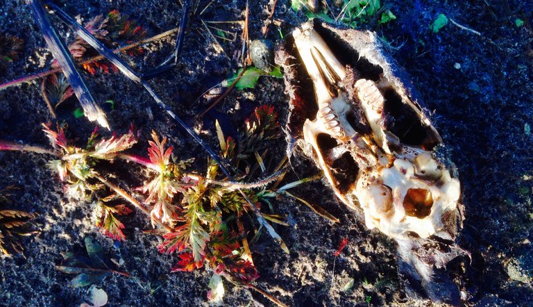
But let's not talk about that hey. I know I am a hypocrite taking their money when I've seen the truth. Yet at the same time I can appreciate the beautiful perfection in the inevitable cycle of death. And photograph it to pay it the respect it deserves.
I remember with clarity the moment the site manager told me the badgers had been served their eviction notice. Unlike the other animals which were just blitzed with chemicals from day 1, the badgers were given one month to vacate due to some old English law.
Sounds ridiculous I know but I'm telling you the truth.
I could show you pictures of dead badgers but instead I will show you this.

Better to focus on the good stuff.
How does drone mapping work?
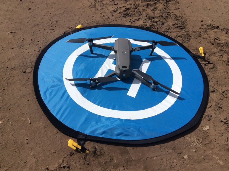
The drone flies on a pre-set path and takes a shit load of pictures.
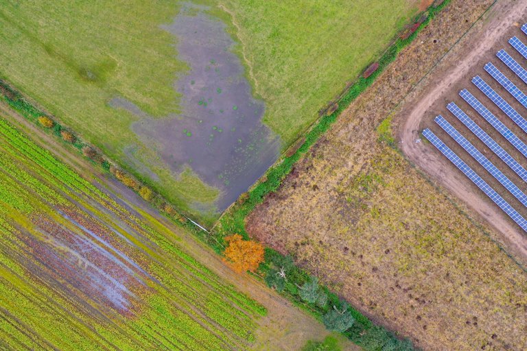
A single image looks like this at the maximum height of 400ft.
I use an overlap of 80% which may sound like a lot but when taking 'satellite' inconsistencies and sudden gusts of wind into account it is needed.
What this means is that it takes a LONG TIME to map even just a small section of the site.
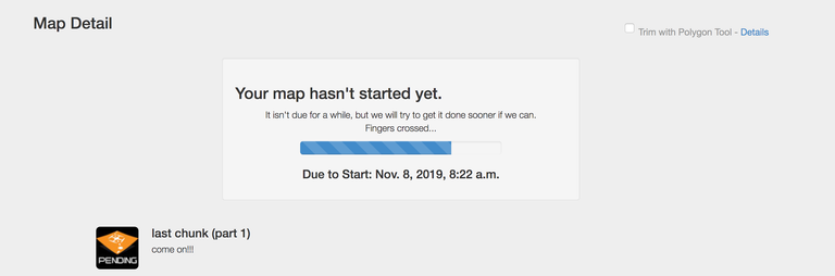
Here was my final mapping sequence from yesterday. 20min flight time, 45 images. 3h online processing. Even just for this 'tiny' last part of the field, seen top left.
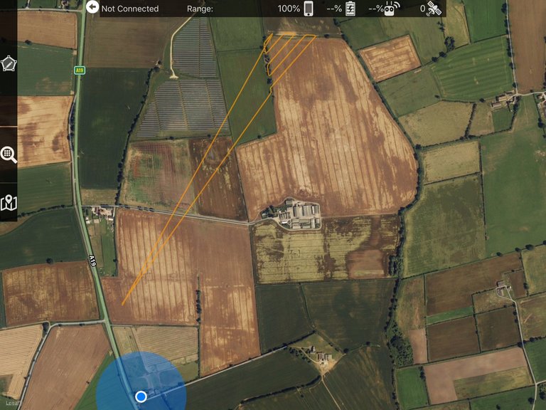
The blue dot is where I am now. Where I've been living. The yellow line was my flight path.
This 'little' map for example took just under an hour to photograph, requiring two batteries and 300 images. And let's not forget the 24h of online processing.

Add to this the problem that only for one hour each day (midday to 1pm) the modules horizontal, in the ideal position for mapping. Making this time of day the ONLY time of day to create this map. I was totally at the mercy of the weather and for sure had to break a few safety rules flyinging in light rain to get this done.
My heart was beating like motherfu..er I can tell you! But the drone is still in one piece and was not affected by the light rain. God Bless you my Mavic Pro 2.
It is a long old process & cold too! Especially when the light is low and the drone must fly super slow to account for this and maintain a crisp image.
The resolution is MEGA.

What when the mapping is done?
So, when I get home I feed the images into MapsMadeEasy (before backing them up of course) and then I wait...

...and then wait some more
And finally, I wait some more...
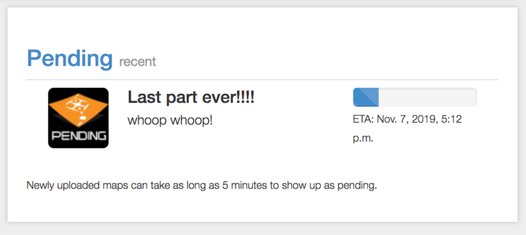
In this moment I am waiting for the last part to be processed so that I may send a finished map to the boss, hopefully tonight.
For those of you who missed it, here's me in the early days of learning to do drone mapping.
No doubt you will hear from me again when this google earth shot is finished!
See how beautiful it looks?
Remember to focus on the good stuff.
Who is @samstonehill?
Sam supports @naturalmedicine because they are seeking to help us in ways which go far beyond money. Please come and join us on Discord
All content created for this account is 100% original (unless otherwise stated), produced by @samstonehill who invites you to use & share freely as you wish.

Congrats. Your perseverance has won out in the end.
You've also given a good reminder about the wildlife that is affected by "development".
Posted using Partiko Android
It is done.
Soooooo happy!
Do the solar cells change angle during the day?
When I map, things that are long, tall, and moving are the hardest to get a good photo frame on. Trains, tall buildings, cliffs, and long storage units. It's easy to notice the change of perspective. I bet the sun glare on the solar cells is a challenge too based on where the drone is in relation to the sun angle.
We use mostly plane photos for maps.
Yep, the cells change angle during the day giving me only a one hour window each day when they are horizontal.
A plane would have been much more fun!
@tipu curate
@giphy curate 100
A huge hug from @amico! 🤗
#sbi-skip !trdo
Congratulations @amico, you successfuly trended the post shared by @samstonehill!
@samstonehill will receive 0.30265650 TRDO & @amico will get 0.20177100 TRDO curation in 3 Days from Post Created Date!
"Call TRDO, Your Comment Worth Something!"
To view or trade TRDO go to steem-engine.com
Join TRDO Discord Channel or Join TRDO Web Site
Upvoted 👌
Powered by witness untersatz!
Upvoted 👌 (Mana: 15/20)
Thank you!
yeah so excited for you, you made it to the end. Can't help feeling for all the badgers and animals that were harmed or worse in the making of that solar farm though. But we need to know all the sides that come with renewable energy. Have a great trip back and looking forward to seeing how the garden has been coming along xx Bon Voyage xxxx
Merci! Yeah, the badgers had to get a mention. Poor dudes. They were HUGE!
Guess the company won't be using those photos.
Anyway... my cab arrives 2 hours!!!
:)
Hi Sam,
Wow fantastically done! - highly interesting too - thanks for being, doing and sharing!
Upvoted and resteemed :D
A pleasure as always to pass on what I know :)
Looking very good been off Steem for a few weeks; moving so back now! Will have to catch up 💯🐒
Good to see you back! Catch up we shall ;)
For sure. Shame you have gone home i'm only an hour ish away from here 💯🐒
No way!
I was so desperate for company, it would have been great to meet up.
Never mind. I will likely be back next summer when they persuade me to film it with beautiful summer flowers around ;)
Perhaps there will yet be an opportunity to meet. I would really like that.
Yer did realise you were so close. Next time for sure 💯🐒
Rather more to it than I imagined!
Man, if I was going to list all the things that could go wrong with a mapping system like this it would be a very long list!
Very happy it is done now and the film is on its way to the boss for review :)
I will look out for the film when it goes public.
Congratulations @samstonehill! You have completed the following achievement on the Steem blockchain and have been rewarded with new badge(s) :
You can view your badges on your Steem Board and compare to others on the Steem Ranking
If you no longer want to receive notifications, reply to this comment with the word
STOPTo support your work, I also upvoted your post!
Do not miss the last post from @steemitboard:
thanks :)
Congratulations @samstonehill, your post successfully recieved 0.3026565 TRDO from below listed TRENDO callers:
To view or trade TRDO go to steem-engine.com
Join TRDO Discord Channel or Join TRDO Web Site