It's time for me to go for a bit of walk; explore the local area, see what's around. I'm at the point now in my recovery where I could undertake a longer trek — which is something I've enjoyed doing for most of my life. Long walks through scrub, bushland, forests, coastal trails, farming country... just about anywhere really except maybe the harsh northern deserts of the outback.
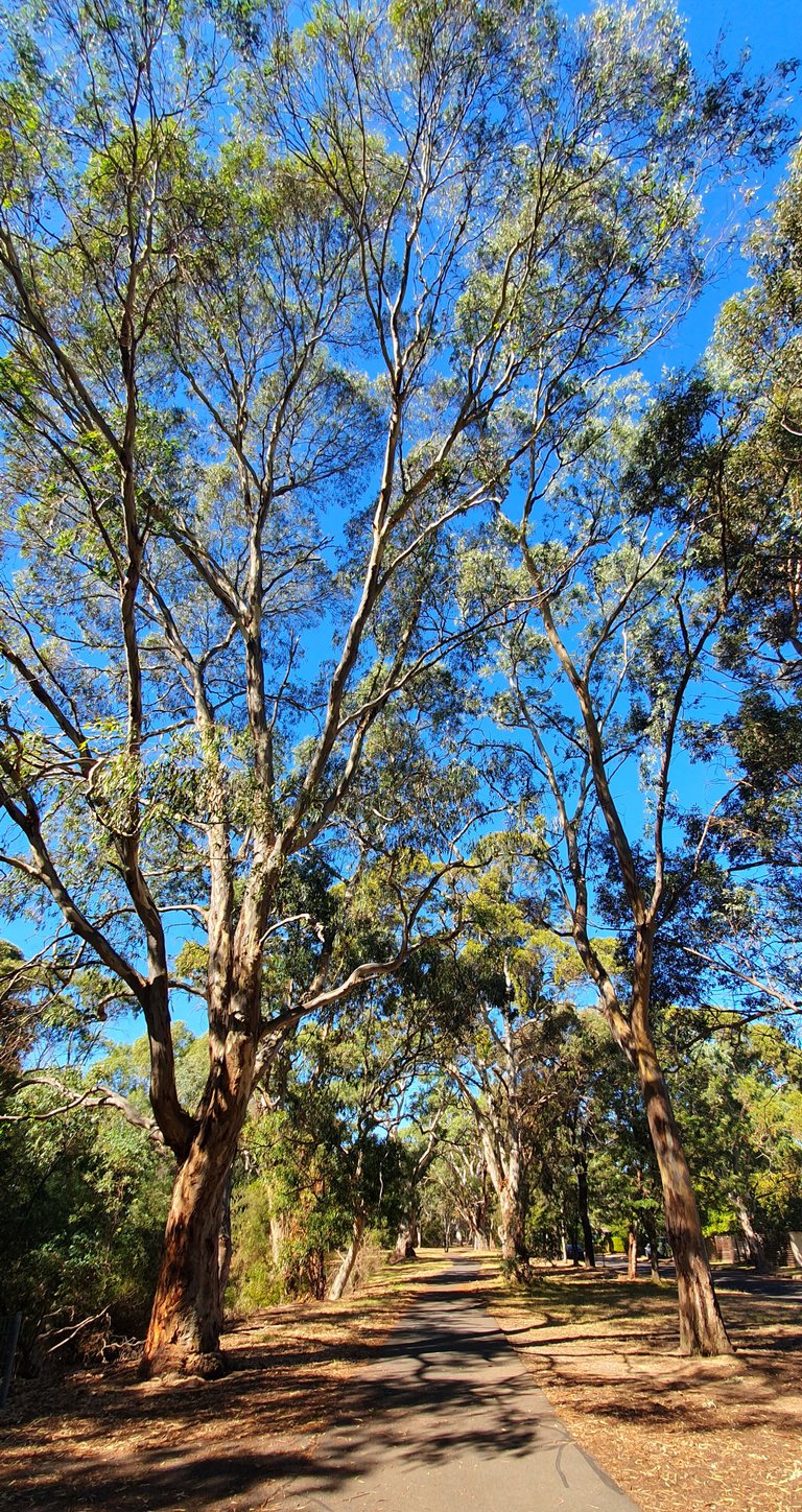
To get to the supermarket from where I am, I cross a creek by bridge and pass a footpath running parallel to said creek. Have a look at it, in the photo above — the path that is. Quite enticing, right? Positively begging for exploration! The creek is to the left in this picture and the market is a way onward to the right.
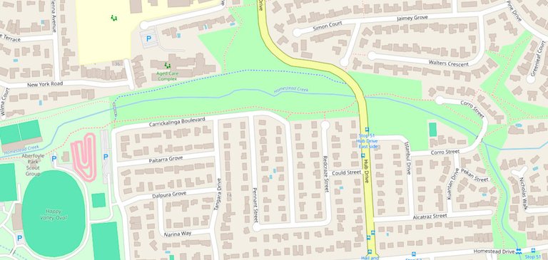
Having a look on OpenStreetMap, apparently the waterway is called Homestead Creek. It's the solid blue line running roughly through the middle then splitting into two toward the bottom right corner of the image.
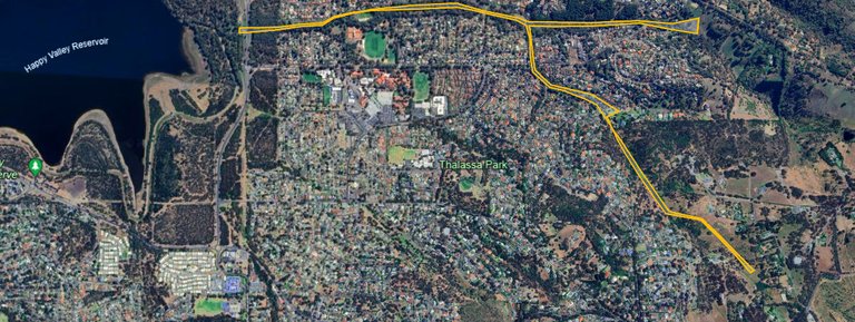
I've spent some time drawing up a trail to follow using Google Earth, which I'll stick on my phone and refer to when in doubt. Here it is above in yellow. It was hard to tell at times where the creek was going from the satellite imagery alone. I had a rough idea but also had to just follow the trees and hope for the best sometimes. Should be alright though. Can't get too lost. Right? We'll see about that!
I am in doubt as to how far I'll get on the rightmost branches of my planned route. From the air it looks like open fields beyond the trees but I'll more than likely encounter some fences on the ground before I get to the end of the yellow lines.
Haven't seen any water in Homestead Creek, not in the small part I've been walking past lately, anyway. Maybe there'll be some elsewhere along it's length? I hope so. Always nice to see a bit of running water in these dry parts.
'Thalassa Park' is labelled quite prominently in that image above too. That's somewhere I haven't been yet and would like to explore. There's a tunnel that leads to it with murals on both sides of the entrance. It's near a local coffeeshop. One for another day.
That's about it for now. If the weather is sunny tomorrow I'll take the time and set off on this walk. I want to do the whole Y-shaped loop so will probably need 3 hours. I'll share the experience in a Part 2.
I considered, at length, posting this in a community but I've decided against it. Outdoors and More was my pick, but after reading the posting rules, I think this walk might not be outdoors enough. Linear park following a creek surrounded by suburbia is what I expect — though I'm really hoping there'll be something like proper bushland to walk through at those easternmost ends. A taste of wilderness? We'll see.
@galenkp, as it's your community, do you think I've made the right decision here?
-Sing
I am glad that you are on track for full recovery as you can now take on long walks which is a great sign.
Yeah it really is, thanks mate! Legs and knees can get a bit sore but if I take it slow and steady it's okay. Any waterways or trails near you that could be good for an explore?
Not really my friend. My place is Peshawar city and we do not have such waterways or trails near us what so ever.
Am so happy that you are taking your recovery so positively and getting back into full groove.
Congratulations @singularity.zero! You have completed the following achievement on the Hive blockchain And have been rewarded with New badge(s)
Your next target is to reach 20 posts.
You can view your badges on your board and compare yourself to others in the Ranking
If you no longer want to receive notifications, reply to this comment with the word
STOPCheck out our last posts: