Nothing is impossible when you compare the largest of something try to defy what most consider beauty breathing from more than just design in efficiency. Found only on Vancouver Island, history presents to us:
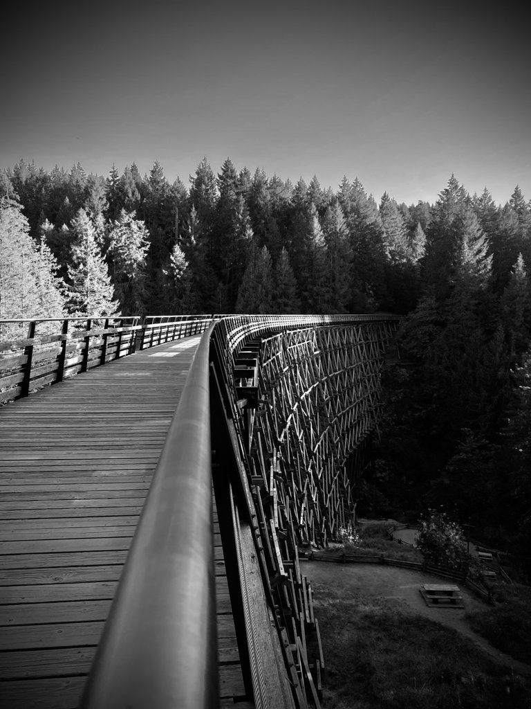
144-foot-high Kinsol Trestle!!!
Features of Design
187 meters long
44 meters high
It is 1 of 8 Trestles on the Cowichan Valley Trail. Considered by far the biggest and most impressive of the other 87.5%
Built on it’s 7-degree curve makes it unusual and represents an amazing feat of engineering. The beams were initially numbered and put together like a jigsaw puzzle.
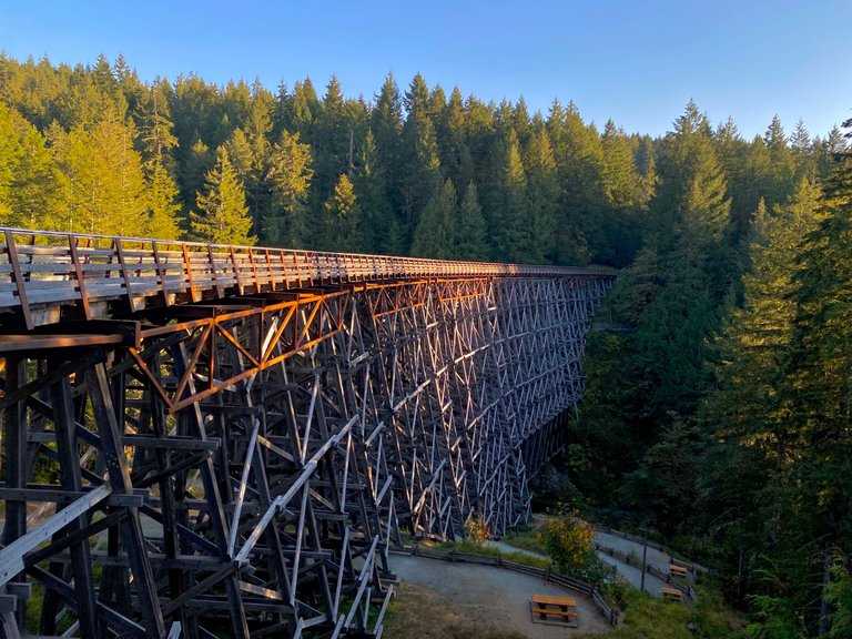
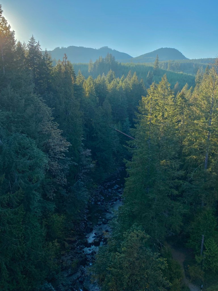
It lives comfortably spanning the Koksilah River located just north of Shawnigan Lake. Originally completed in 1920, it was named for the nearby mine that inevitably never met its destiny to produce the minerals wanted like silver and copper.
It was built as part of a plan to connect Victoria to Nootka Sound, passing through Cowichan Lake and Port Alberni, when forestry had gained profile with momentum on Vancouver Island and suggesting more efficient ways to transport the region’s massive, old-growth logs was needed. It was not built, to be part of any nearby mines. It was named after Kinsol Station which, (irony), took the name from a nearby mining venture named “King Solomon Mines”, a small mining group that had trouble producing material to fill even 3 rail cars total between 1904-1907 .
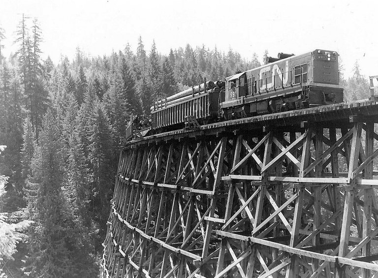
The line was started in 1911 by the Canadian Northern Pacific Railway (CNoPR) and while engineers designed it all, courageously was built by the locals that needed it like farmers and loggers. Helped with investment funding from the Canadian Western Lumber Company, which was the largest lumber company in the world at that time.
The trestle was never completed by the CNoPR, and the line only reached Youbou before construction was terminated. The CNoPR was taken over by Canadian National Railways in 1918, and its line and the trestle were completed in 1920 as part of the “Galloping Goose” rail line. The last train to cross the Kinsol was in 1979, and the trestle was abandoned 1 year later.
After 1979, trains ended up never crossing the trestle. So it gradually fell into disrepair into the shadows with heartfelt secrets of times upholding itself & others who needed it. An amazing accomplishment for something that doesn’t essentially feel anything, but from an idea.
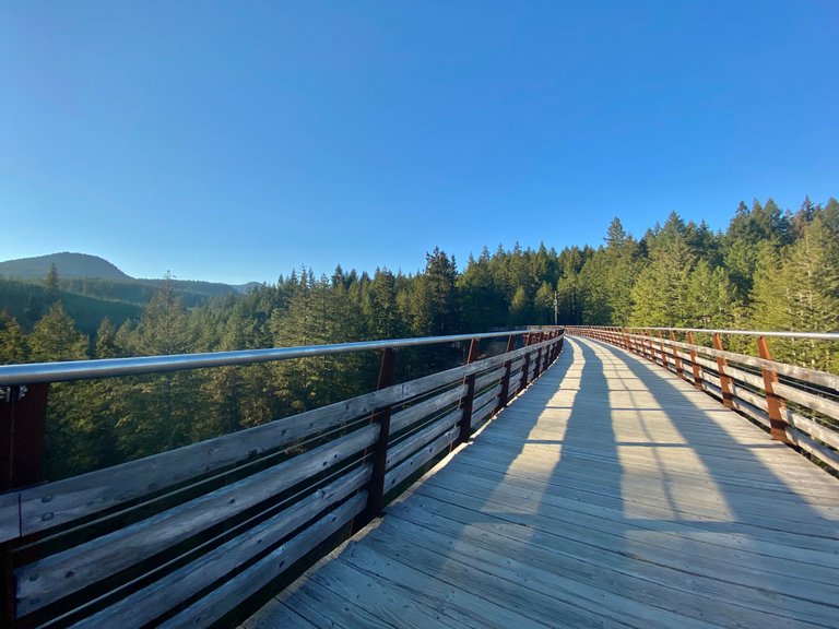
Finally, after years of campaigns to save the trestle, rehabilitation work began in 2010. The official reopening of the trestle was July 28, 2011.
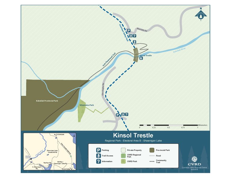
There are some access points to reach the Trestle:
From the south (Glen Eagles Road in Shawnigan Lake: 48.666766º -123.698657º)
From the north (Riverside Drive in Cobble Hill: 48.728548º -123.672391º)
Also a neat feat
Middle of the trestle: 48.668869º -123.693950º
The Kinsol Trestle Trail represents just a small part of the much larger Cowichan Valley Trail, which runs for 120 kilometres between the Malahat and the Nanaimo area.
This outstanding multi-use trail is part of The Great Trail (formerly known as the Trans Canada Trail), passes through a variety of incredible landscapes and features 7 additional trestles, including Holt Creek, McGee Creek and Marie Canyon.
Do not click that other link in the comments.
Thanks for the heads up!
DO NOT FOLLOW any instruction and DO NOT CLICK on any link in the comment!
I downvoted it, is there a way for the author to get rid of it? How does downvoting work on the blockchain?
The best way to get rid of it is to mute the author.
I loved reading the history on this trestle 👍