Heeeyho Readers! How's the Altair shipwreck after three years?
After posting edit: I forgot to change the community on Peakd and ended up posting on EcoTrain instead of Haveyoubeenhere. What a dumb f@#k.
Fuuuuuuuuh. How frustrating can it be when you have fresh photos, a tingling anxiety to post, but discover you've shared the story three years ago?
Shall we call this post a remember? Or a follow-up? A remember-up or a follomber?
I have never had the urge to bring back a story unless there's something to add that completely changes the narrative or enhances the story somehow. It's the case with the Altair shipwreck.
Altair | A Shipwreck Story | Photography – posted on Oct 21, 2018.
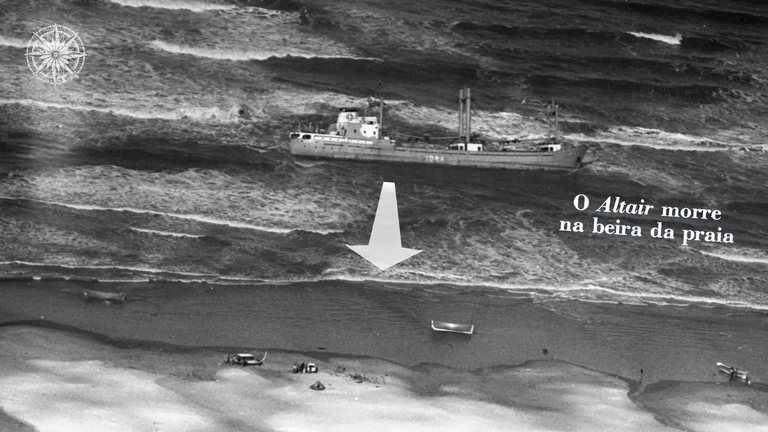
The story itself hasn't changed. It'll remain engraved in photos, old newspapers, and in this blockchain. What has changed, however, is the remain of a disaster occured on the southern Brazilian shore in 1976. I won't repeat the story nor the photos – you can check my older post for that. What I want to explore in this post is the passage of time and share how Altair looks like after three years.
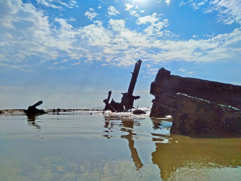
Altair rests on coordinates 32º 38' S 052º 17' W; some 20 kilometers from where I live. One can drive on the shore southward to reach the shipwreck since the 240-kilometer shoreline is mostly drivable. From the shipwreck onwards, towards the south, the beach becomes considerably wilder.
If this post goes over 100 usd in payout I'll cycle the whole 240 kilometers of shoreline to showcase the numerous lighthouses and fauna.
February 06, 2022. Beautiful Saturday morning. The howling winds calmed down, giving us the opportunity to cycle to Altair. A friend of mine awaited with warm bolinhos de queijo for breakfast at the meeting point, at a gas station. We'd calculated to spend an hour and a half to go and come back, meaning an average speed of 25km/h on mountain bikes. Doable, considering we are trained.
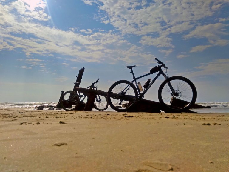
Didn't work as planned. The hard-packed sand wasn't as solid as it usually is, dragging us down. We kept a good pace though. There's a mountain biking competition coming next week in this area so recognizing the conditions gives us the upper hand.
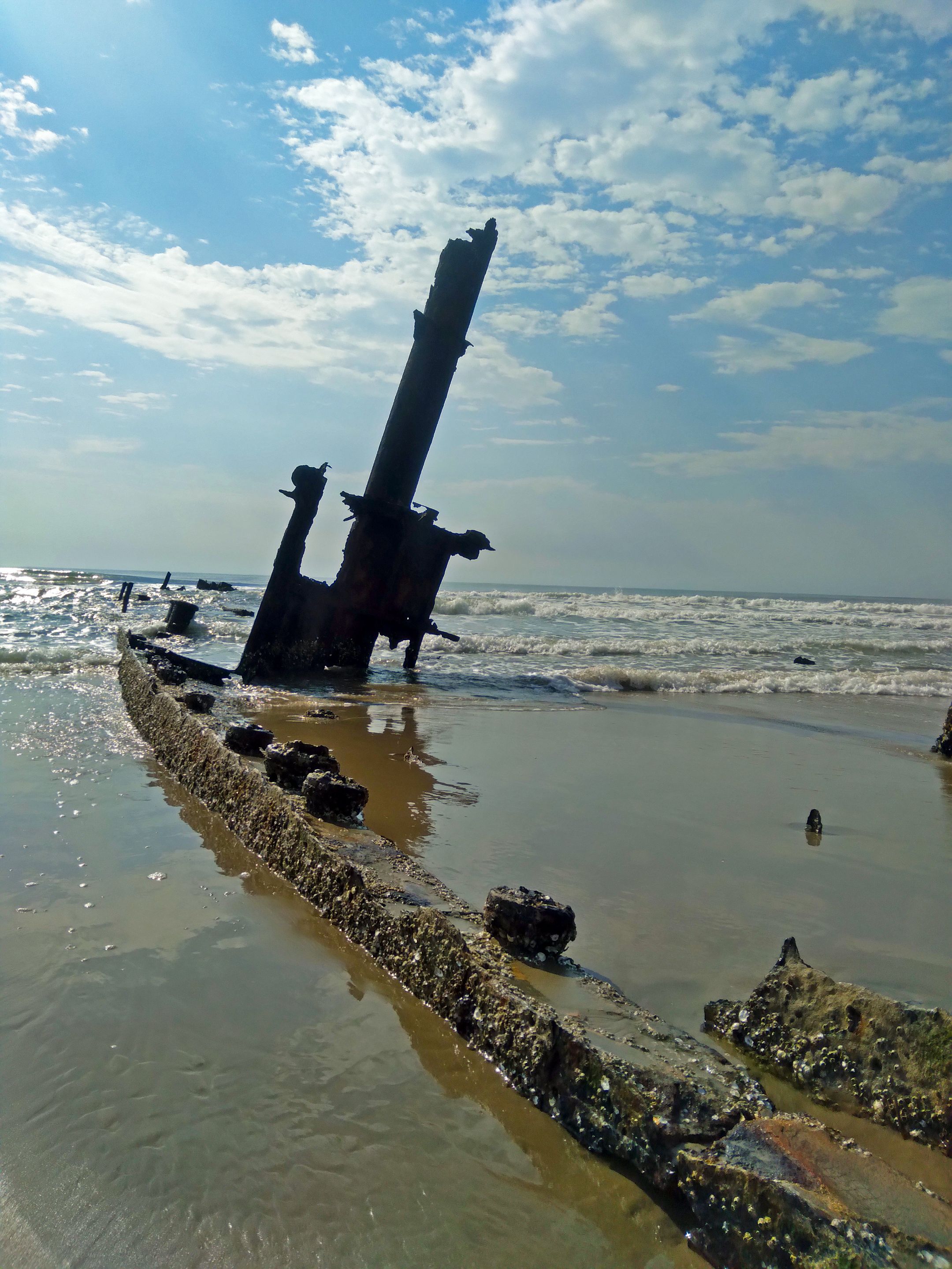
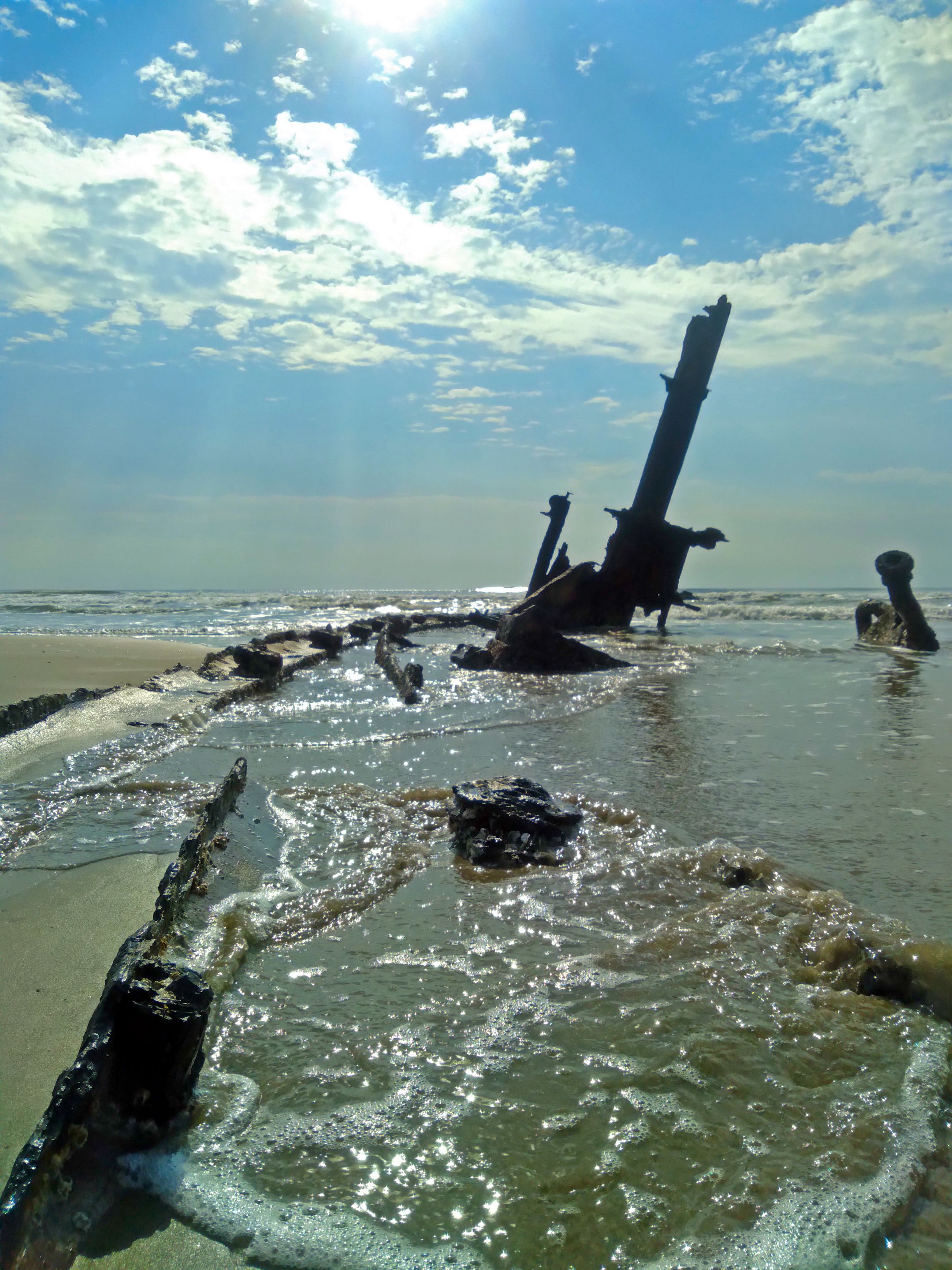
Good ole Altair is slowly disappearing. Compared to 2018, the top half portion of the last remaining mast has gone. The ship had six mast-like structures when new. I also noticed that most of the hull has completely rotten away or sank into the sand and the bridge shrunk even more.
When I was a kid, during the 90's, we used to hop on deck to collect mussels. Parts of the bridge still existed, allowing us to enter amid years of rusty steel. It's shocking to see how Altair has degraded over the last decade.
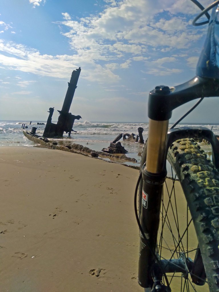
The sun was glowing hot at the time, which greatly destroyed most of the photos. (Self note: never trust the cellphone.) I believe that in five to ten years the ship will completely disappear, erasing from the shore a once well-known landmark.
Altair
I'd like to share some extra information not included in the 2018 post. The photos presented below are from various sources.
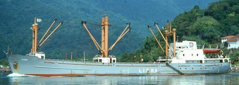
The ship got stuck parallel to the shore, but shifted the aft 'till its resting position with the aft facing the beach. One can only imagine the sheer force of waves against the hull to shift tons of metal around.
I'd love to add a series of old photos to make a chonology, but the sourcers are uncertain. If you google navio Altair on google you should be able to see some amazing shoots from the 70's.
I'll end this post with the same question asked in 2018: How many years until it's completely gone?
Until next time.
Peace.
Did you know that I have a book out? Check this!
Access Link: https://www.amazon.com/dp/6500272773?

If you enjoyed this post consider leaving your upvote for a hot coffee.
Find me on Twitter: https://twitter.com/mrprofessor_
~Love ya all,

Disclaimer: The author of this post is a convict broke backpacker, who has travelled more than 10.000 km hitchhiking and more than 5.000 km cycling. Following him may cause severe problems of wanderlust and inquietud. You've been warned.

Reminds me of the famous shipwreck on the Navagio Beach on the Greek island of Zakynthos that I got to see back in 2012. I am sure this one will be gone soon too. It´s ok, it´s just nature taking over but I can imagine some people will miss these once iconic beach landmarks...
It all goes back to the earth! With today's meteorological and sailing technology it's very unlikely that a ship this size is gona ran aground around here again. Wooden fishing boats do end up on the shore from time to time. I joke saying that they should strand another ship in there so we don't lose the touristic point.
Wowser! I am surprised no one cleared it from the shore. What's going on here?!
Yeeeey! From what I read the cost and risk, in 1976, to remove the ship was greater than the insurance would pay. Plus there was some fire shortly after it ran aground. So they decided to scrap the important parts and leave it there. So it's became a touristic spot.
Our coast has more than 300 reported shipwrecks \o\
has this practice changed over the years?
Well, no other big ship ran aground along the coast since then. I've heard of a ship running aground on the other side of the channel, but they pulled it out fine. We do see wooden fishing boats stranded sometimes though.
Congratulations, your post has been added to Pinmapple! 🎉🥳🍍
Did you know you have your own profile map?
And every post has their own map too!
Want to have your post on the map too?
The rewards earned on this comment will go directly to the person sharing the post on Twitter as long as they are registered with @poshtoken. Sign up at https://hiveposh.com.