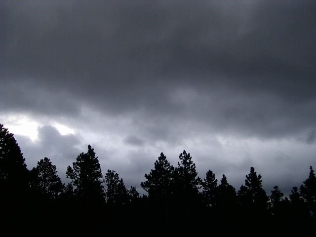
Hello HIVE LEARNERS, how are you today ? I hope you feel a good day and happy Wednesday.
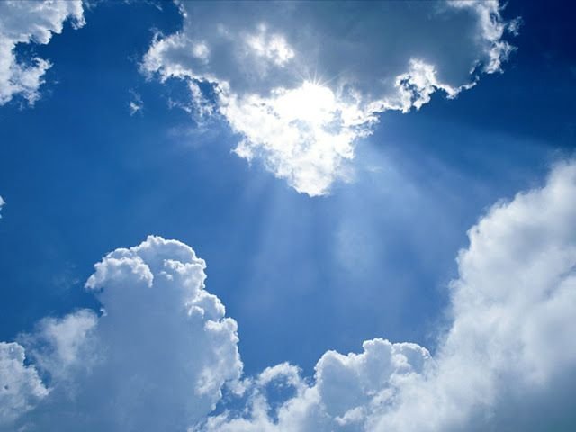
On this occasion I will try to discuss about clouds, of course you must know this one object and you always see it flying in the sky. But they have an irregular shape and you think they are the same kind?, you are very wrong if you think so. Different cloud shapes actually indicate the level of altitude, humidity, and so on. For more details, let's see some of my explanations below.
First, Hight cloud types
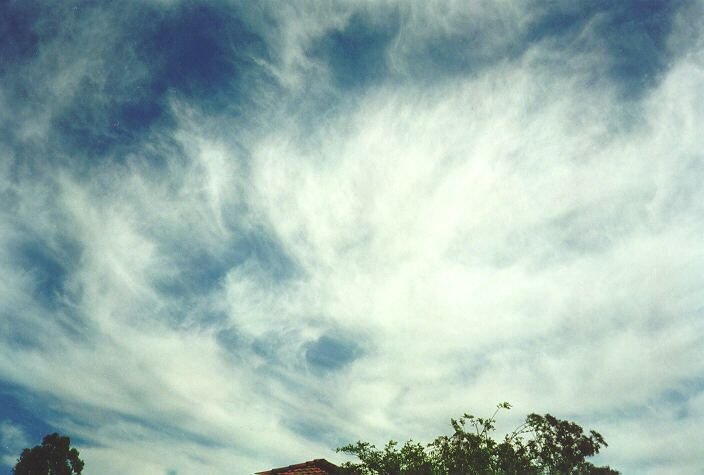
- Cirrus
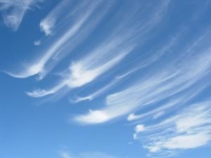
This one cloud is a thin cloud and usually appears when the weather is sunny in the afternoon or evening. This cloud is in a very high position from the other clouds, this cloud is at an altitude of 8000 meters. In this cloud there are also many ice crystals because of its position. Of course, these clouds are thin, and sometimes some are a little thicker than the others. When this thick Cirrus cloud blocks the sun's light, the sunlight will be refracted by the many ice crystals in this cloud and a Hallo occurs. Hallo is a large thin circle in the sky due to the refraction of sunlight
Not much can be discussed about this cloud, because this cloud is an ordinary cloud which only indicates that the weather is sunny and hot.
- Cirrocumulus ( Cc )
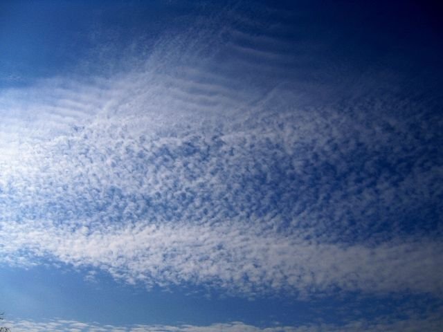
These clouds can be recognized by their shape like blotches, or like small spheres neatly arranged along their path, the color is pure white but the shape is slightly thicker than Cirrus clouds. This cloud is at an altitude of 6000 meters. It can be said, that this type of cloud is a Cirrus cloud that clumps up into small, irregular spheres. This cloud is still a sign that the weather is sunny and is a good cloud for flight other than Cirrus clouds.
These clouds usually appear on the eastern horizon at sunrise or on the western horizon at sunset.
- Cirrostratus
This cloud is also a thin cloud and is a cloud that is at an altitude of 6000 meters or more. This cloud is a development or merger between Cirrus and Cirrocumulus clouds. The shape of these clouds is like a soft cotton that sometimes covers the entire sky with its smooth edges. The two clouds that I mentioned earlier are not clouds that have the potential to rain, but these Cirrostratus clouds can cause light rain if these clouds become denser and thicker.
Second, Medium-height cloud types
- Altocumulus
Source
Altocumulus clouds are clouds that are lower than the previous clouds, are at moderate altitude and these clouds appear when the air becomes humid. These clouds have the potential for light rain at night if these clouds appear in the afternoon. This cloud has a shape like solid white patches that cover the sky, sometimes on one side it has a gray color and this is a characteristic of this cloud.
- Altostratus
Source
This cloud is a thick cloud and is a cloud that will cause drizzle. This cloud is slightly lower than the previous cloud and thicker, you can mark it with the characteristics of this cloud which is like a large sheet that sometimes covers the sky. This cloud has a dark gray color, and if the cloud is too thick it will be able to cover the sun's rays, the sunlight will be visible when it penetrates the thin part of this cloud.
Third, Low-height cloud types
- Stratocumulus
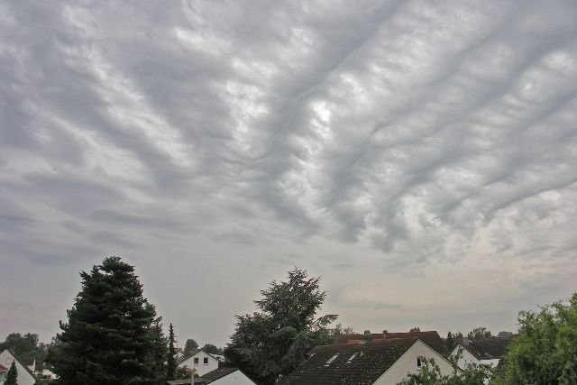
Source
This cloud is also a cloud that will cause drizzle. These clouds are clouds that originate from Altostratus clouds that accumulate so as to form layers like waves. The characteristics and characteristics of this cloud are also the same as the Altostratus cloud which has gray characteristics and has a white color in a thin section. These clouds are easy to spot because of their stacked and multi-layered shape.
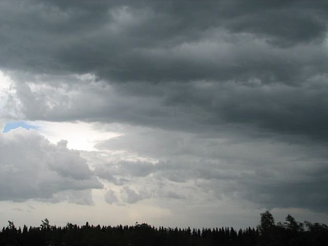
- Nimbostratus
Source
These clouds are thick clouds and can interfere with flight. This cloud is the forerunner of heavy rain, but when it appears it is sometimes accompanied by drizzle. The color of these clouds is usually dark gray and sometimes white with gray on the sides. The shape of this cloud is irregular with messy edges, this cloud is very similar to a large fog or smoke above the sky.
- Comulonimbus
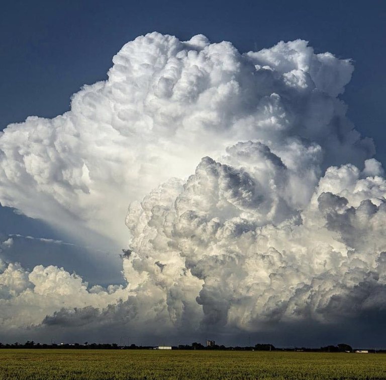
Source
This cloud is the most terrifying cloud of all clouds. This cloud has a very high towering shape like a tower, this cloud is very dense with water vapor and is one of the clouds that causes storms. A lot of lightning that strikes from inside this cloud, this cloud also signals that a big storm will occur and if this cloud touches the ground, there will be a hurricane and even a tornado. This cloud can be characterized as thick acid billowing above the sky, usually the color of this cloud is bluish gray but this cloud is also white because the water content in it is not too much, and this cloud is something that is feared by many airlines, even those who willing to delay flights if they know there is this cloud formation in their flight path.
Maybe this is a little explanation from me about the types of clouds. Hopefully add knowledge and hope you like it. Thank you and see you in another post.


Congratulations @deimage! You have completed the following achievement on the Hive blockchain and have been rewarded with new badge(s):
Your next target is to reach 1000 replies.
You can view your badges on your board and compare yourself to others in the Ranking
If you no longer want to receive notifications, reply to this comment with the word
STOPCheck out the last post from @hivebuzz:
Support the HiveBuzz project. Vote for our proposal!
Wow wow wow MY DEAR
You describe very nicely and thank for your good writing
Thanks a lot buddy, very appreciate it
Saran long ne edit judul bang. mehan siattek trok tim jih ijak komen.han ibi pakek,ibi teguran,salam sukses. 🤝🤝
Edit kiban maksud jih...?
lage nyan ka ok, han ibi tulis bak judul ata nyan, na long kalen di tegur👍
Ok. Terimakasih...
Nyan keuh rencana lon neuk tes boh ata nyan, biasa menye ta boh ata nyan na ta boh bak judul keu penanda.
Berarti han ji bi boh bak judul eu, berarti jeut ta kheun peraturan nyan hanya main-main belaka. 😂