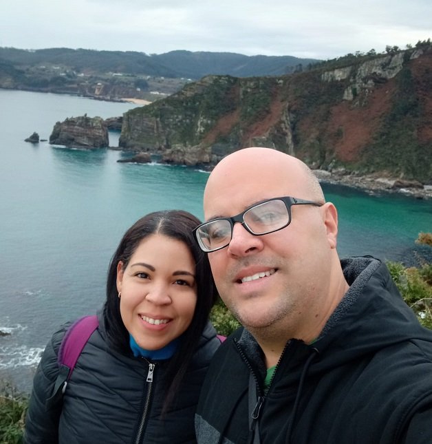
Cuando el clima es más frío y con cielo gris, el mar y sus encantos embellecen el paisaje. Observar el mar para mí, es una sesión de relajación, el sonido de las olas que vienen y van, las aves y las tonalidades de azules en el agua, son un espectáculo.
When the weather is colder and with gray skies, the sea and its charms embellish the landscape. Watching the sea for me, is a relaxation session, the sound of the waves coming and going, the birds and the shades of blue in the water, are a spectacle.
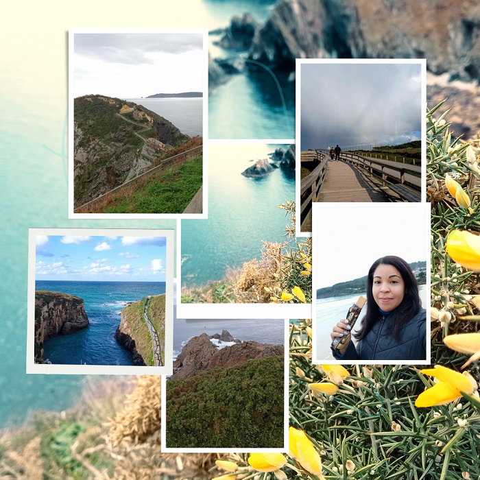
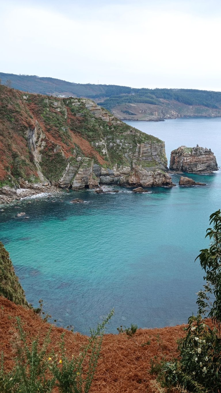
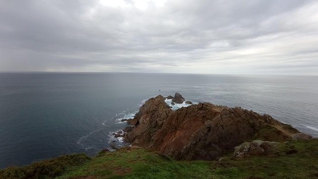
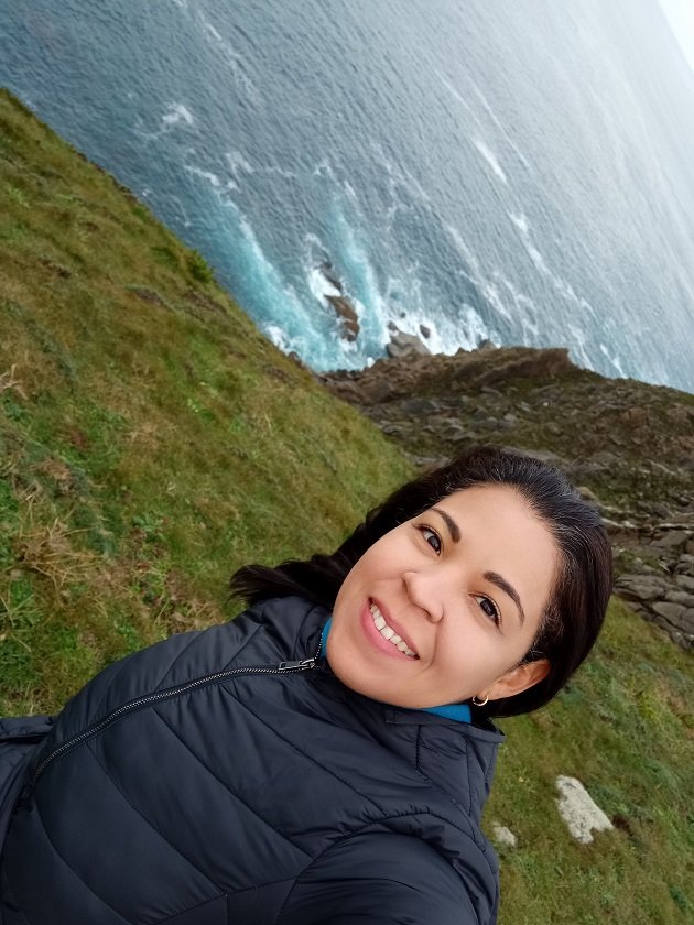
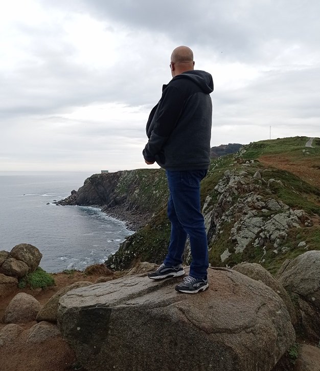
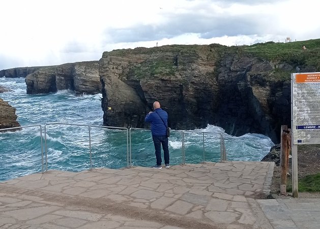
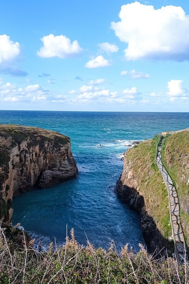
A principios de este año, nos fuimos a "O Fuciño do Porco", en gallego, que significa hocico de cerdo en castellano, su nombre oficial es Punta Socastro y esconde el cabo donde se localiza una ruta impresionante. Su nombre se debe a que desde visto desde el mar tiene esa forma.
Está ubicado en el municipio de O Vicedo en Lugo.
Earlier this year, we went to "O Fuciño do Porco", in Galician, which means pig snout in Spanish, its official name is Punta Socastro and hides the cape where an impressive route is located. Its name is due to the fact that from the sea it has that shape.
It is located in the municipality of O Vicedo in Lugo.
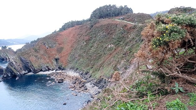
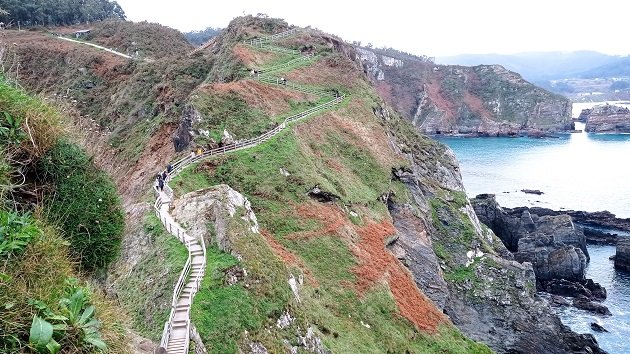
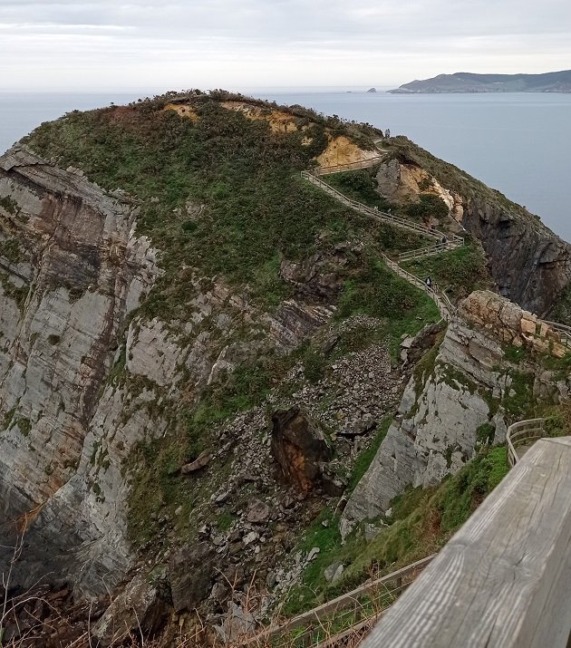
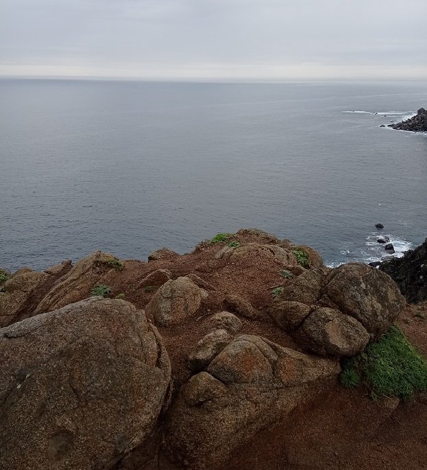
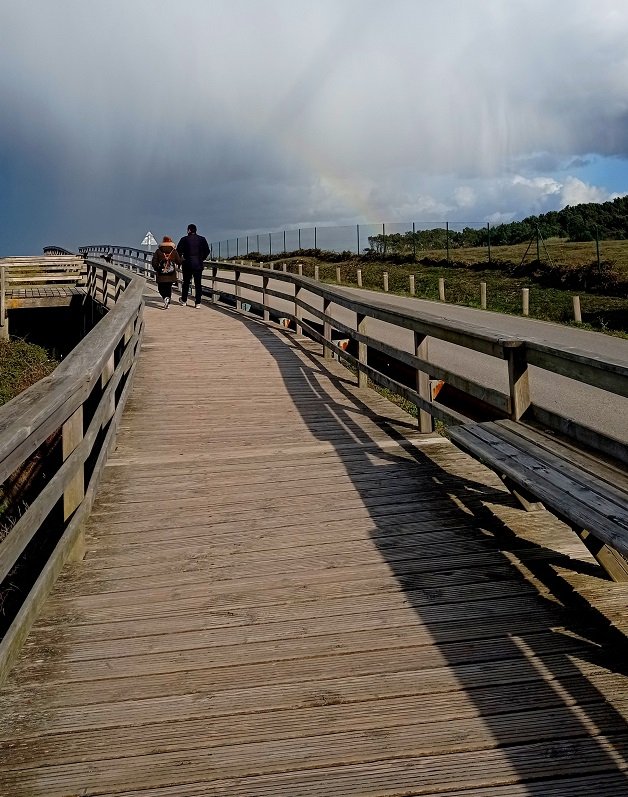
Transcurre por una pasarela peatonal de madera de unos 400 metros, con algunas escaleras y acantilados que miran al mar Cantábrico. Un mirador sobre lal final del recorrido se observa la Ría de Viveiro y otros lugares de O Vicedo.
It runs along a wooden footbridge of about 400 meters, with some stairs and cliffs overlooking the Cantabrian Sea. A viewpoint at the end of the route you can see the Ria de Viveiro and other places of O Vicedo.
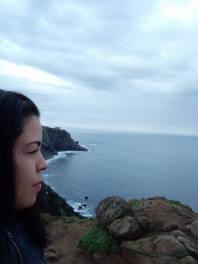
Al principio hay un camino de tierra de unos 3 km, luego se empiezan a ver del lado izquierdo las bellas aguas de las Punta Lodelas, Punta Ventosa y La isla Coelleira. Seguimos avanzando y ya se ve la hermosa pasarela.
At the beginning there is a dirt road of about 3 km, then you begin to see on the left side the beautiful waters of Punta Lodelas, Punta Ventosa and Coelleira Island. We keep going and you can already see the beautiful walkway.
En temporada baja, como fue nuestro caso, puedes ir sin cita previa y tardar lo que desees. En los meses de julio y agosto, es necesario pedir cita por internet antes de ir, y recorrerlo de ida y vuelta en 45 minutos, por la cantidad de gente que lo visita.
In low season, as was our case, you can go without an appointment and take as long as you want. In the months of July and August, it is necessary to make an appointment online before going, and to go there and back in 45 minutes, because of the number of people who visit it.
Al quedar cerquita la playa, es un buen destino sobretodo en época de sol. Nosotros fuimos a ver Playa Abrela, cerquita de la entrada principal.
Being close to the beach, it is a good destination especially during the sunny season. We went to see Abrela Beach, near the main entrance.
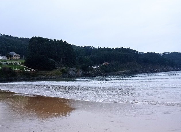
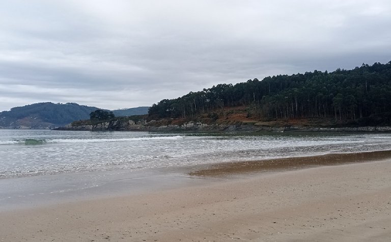
Playa Abrela/Abrela Beach
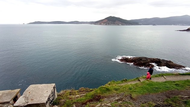
Luego de terminar el recorrido, almorzamos sándwiches y bebidas que llevamos de casa porque un domingo de invierno no hay nada abierto para comer. Después seguimos a Estaca de Bares, que es un cabo situado en el municipio Mañón, provincia de La Coruña, en la comunidad autónoma de Galicia.
After finishing the tour, we had sandwiches and drinks for lunch that we brought from home because on a winter Sunday there is nothing open. Then we continued to Estaca de Bares, which is a cape located in the municipality of Mañón, province of La Coruña, in the autonomous community of Galicia.
Estaca de Bares, en La Coruña/Estaca de Bares, in La Coruña
Sus coordenadas la delatan como el punto más al norte de la Península, además de ser la divisoria entre el océano Atlántico al norte y al oeste y el mar Cantábrico al este. Con una posición estratégica, el cabo de Estaca de Bares fue declarado Sitio Natural de Interés Nacional durante la II República, en el año 1933.
Its coordinates make it the northernmost point of the Peninsula, as well as being the dividing line between the Atlantic Ocean to the north and west and the Cantabrian Sea to the east. With a strategic position, the cape of Estaca de Bares was declared a Natural Site of National Interest during the II Republic, in 1933.
Tiene fama internacional como paso obligado para cientos de miles de aves. A este punto, conducen varias rutas migratorias de especies marinas y terrestres procedentes del Atlántico, el Mediterráneo y el Ártico. Algunas valoraciones alcanzan cifras que exceden los dos millones y medio de ejemplares volando hacia el oeste los que pasan por este punto.
It has an international reputation as an obligatory passage for hundreds of thousands of birds. Several migratory routes of marine and terrestrial species from the Atlantic, the Mediterranean and the Arctic lead to this point. Some estimates reach figures that exceed two and a half million birds flying westward that pass through this point.
Praia As Catedrais/As Catedrais Beach
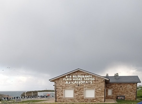
Su nombre es Playa de Aguas Santas, ubicada en la provincia de Lugo, municipio de Ribadeo. Internacionalmente conocida como Playa de las Catedrales. Declarada monumento natural en el año 2005, por su riqueza, formaciones rocosas, impresionantes acantilados, gran cantidad de cuevas, islotes, túneles y arcos, estos últimos, son como los arbotantes de las catedrales.
Its name is Playa de Aguas Santas, located in the province of Lugo, municipality of Ribadeo, internationally known as Playa de las Catedrales. Declared a natural monument in 2005, for its richness, rock formations, impressive cliffs, lots of caves, islets, tunnels and arches, the latter are like the flying buttresses of the cathedrals.
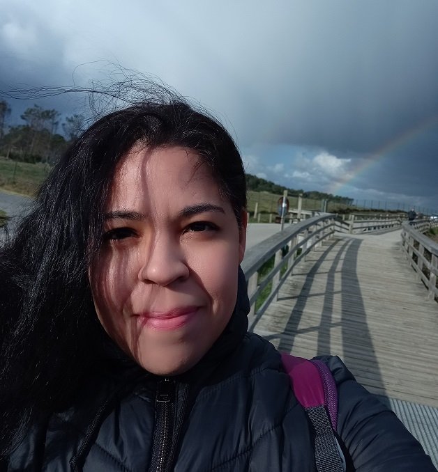
En el mes de Abril, con cielo más soleado caminamos por la pasarela de madera comenzando por Praia As Catedrais, en gallego, Playa de Las Catedrales, donde no pudimos bajar por el intenso oleaje de aquel día. Fue un paseo corto porque la lluvia fue intensa y regresamos a casa.
In April, with sunnier skies we walked along the wooden walkway starting at Praia As Catedrais, in Galician, Playa de Las Catedrales, where we could not go down because of the intense swell that day. It was a short walk because the rain was intense and we returned home.
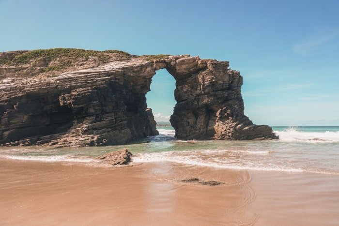
La acción del viento y salinidad del agua han provocado la erosión de las rocas calizas, creando columnas naturales en medio de la arena.
The action of the wind and salinity of the water have caused the erosion of the limestone rocks, creating natural columns in the middle of the sand.
Entrada a la playa/Entrance to the beach
En Semana Santa y los meses de julio, agosto y septiembre, es necesario hacer reserva por Internet para recorrerla.
During Holy Week and the months of July, August and September, it is necessary to make a reservation online to visit it.
Vista desde la pasarela/View from the footbridge
No hay excusas para no salir a dar una caminata sin importar el clima.
There are no excuses for not going for a walk regardless of the weather.
Hasta la próxima publicación!
Until next publication!
Beautiful pics
Hello Alex, thanks!
oh, what a nice ride. those landscapes look great!
That's right Nelson incredible views, thank you!
Congratulations, your post has been added to Pinmapple! 🎉🥳🍍
Did you know you have your own profile map?
And every post has their own map too!
Want to have your post on the map too?
Thanks!
Congratulations, your post has been added to Pinmapple! 🎉🥳🍍
Did you know you have your own profile map?
And every post has their own map too!
Want to have your post on the map too?
Thanks!
Congratulations @betzaidag! You have completed the following achievement on the Hive blockchain and have been rewarded with new badge(s):
Your next target is to reach 500 upvotes.
Your next target is to reach 50 replies.
You can view your badges on your board and compare yourself to others in the Ranking
If you no longer want to receive notifications, reply to this comment with the word
STOPCheck out the last post from @hivebuzz:
Support the HiveBuzz project. Vote for our proposal!
The rewards earned on this comment will go directly to the people sharing the post on Twitter as long as they are registered with @poshtoken. Sign up at https://hiveposh.com.