Hello friends, welcome to my blog
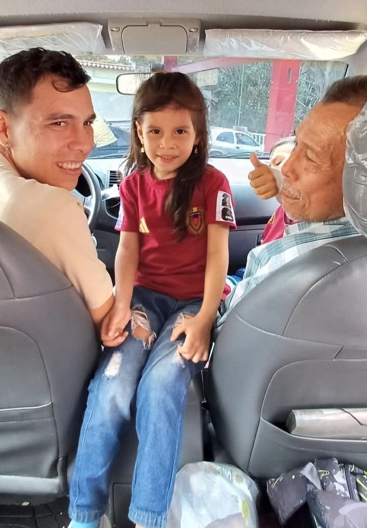
I would like to share with you a road trip I made with my family (mom, dad and siblings) during the last vacations when we went to visit the Sanctuary of the Holy Christ of La Grita in La Grita, Táchira state – Venezuela.
After the visit and being in the church of the patron saint of Tachira, when it was time to return my dad proposed to make the trip by another route that took us through the tras-Andean highway that connects La Grita with the state of Merida but also communicates to the north of Tachira state which is where my parents live.
At first we were a little nervous about gasoline, it is no secret that in Venezuela there is a shortage of fuel and more in the border states such as Táchira, but leaving La Grita we found a gas station that was working dispensing dollarized gasoline and there was little queue, so we made the small queue and then continue our journey.
Hola amigos, bienvenidos a mi blog
Me gustaría compartir con ustedes un viaje por carretera que hice con mi familia (mamá, papá y hermanos) durante las vacaciones pasadas cuando fuimos a visitar el Santuario del Santo Cristo de La Grita en La Grita, estado Táchira - Venezuela.
Luego de la visita y estar en la iglesia del Santo patrono del Táchira, a la hora de regresarnos mi papá propuso hacer el viaje por otra ruta que nos llevaba por la carretera Trasandina que comunica a La Grita con el estado Mérida pero también comunica hacia la zona norte del estado Táchira que es por donde viven mis padres.
En un primer momento teníamos un poco de nervios por la gasolina, para nadie es un secreto que en Venezuela hay escasez de combustible y más en los estados fronterizos como lo es el Táchira, pero saliendo de La Grita encontramos una estación de servicio que estaba trabajando despachando gasolina dolarizada y había poco cola, así que hicimos la pequeña cola para luego seguir con nuestro viaje.
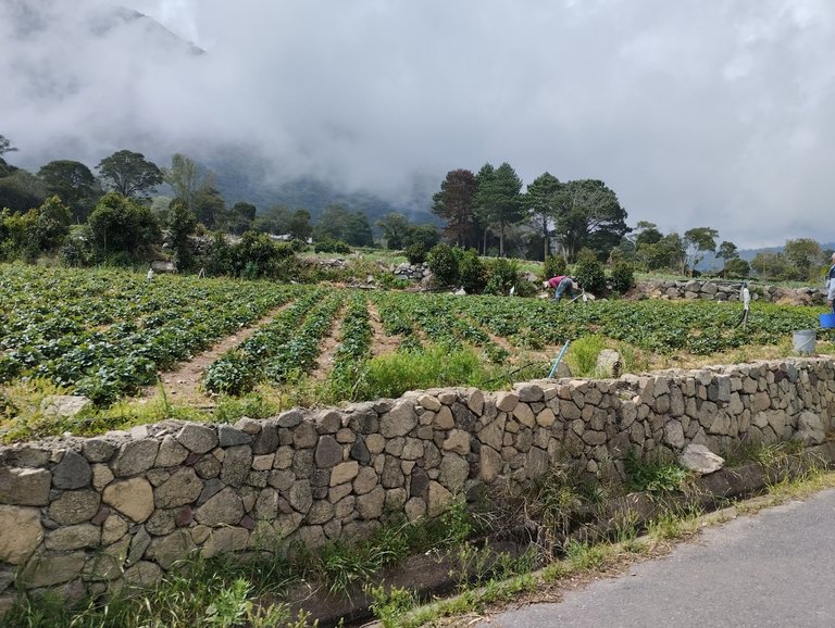

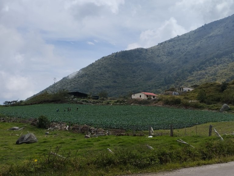
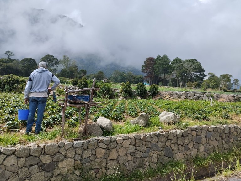
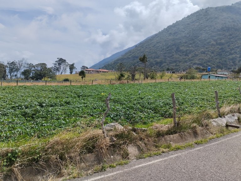
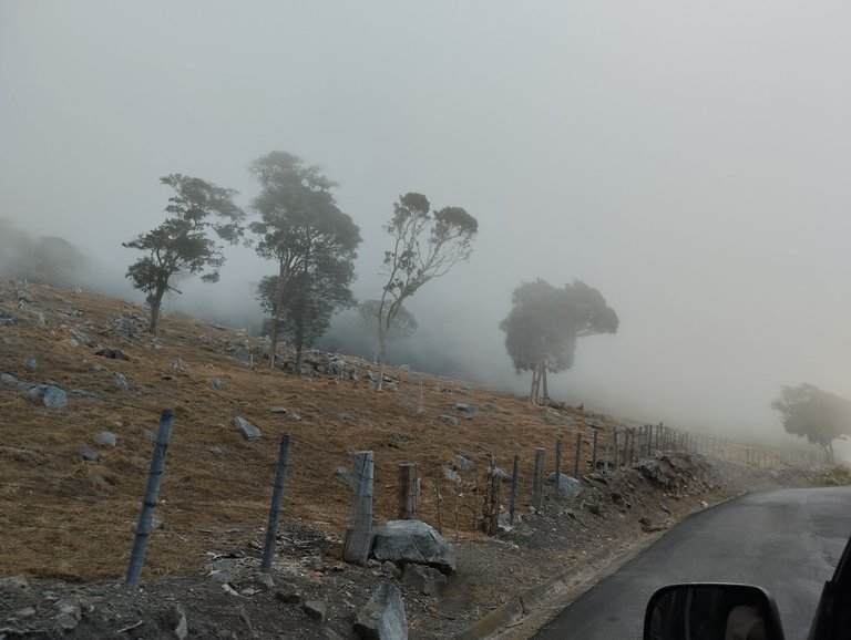
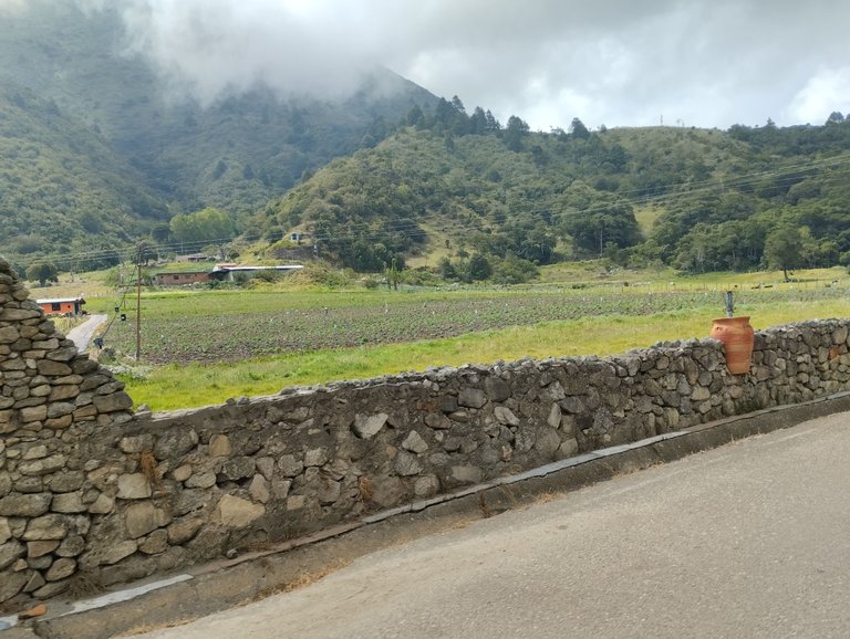
As it is a mountain road it has a very rich climate between 15°C, from this area of the country comes most of the vegetables that are distributed in the center of the country, as well as fruits such as strawberries and blackberries. On the way what we could see the most was carrots, broccoli, potatoes, lettuce, cabbage and other crops that we could not distinguish and farmers in their daily operations. I could not stop taking pictures of how the crops merged with the mountains and the clouds. They were beautiful landscapes with different shades of green.
Cómo es una vía por montaña tiene un clima muy rico entre los 15°C, de esta zona del país proviene la mayoría de las verduras y hortalizas que se distribuyen en el centro del país, además de frutas como las fresas y moras. En el camino, lo que más se podían observar era cultivos de zanahorias, brócoli, papa, lechuga, repollo y otros que no podíamos distinguir, así como agricultores en sus operaciones diarias. No podía dejar de tomar fotografías de como los cultivos de unían con las montañas y las nubes. Eran paisajes muy hermosos con diferentes tonos de verde.


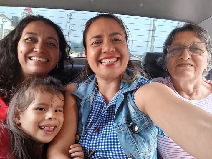
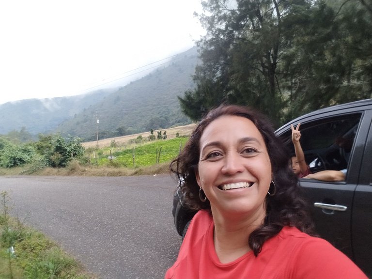
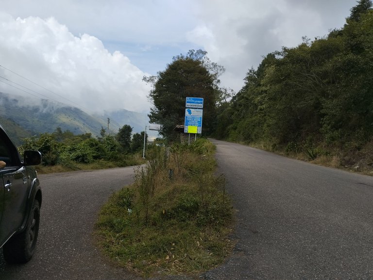
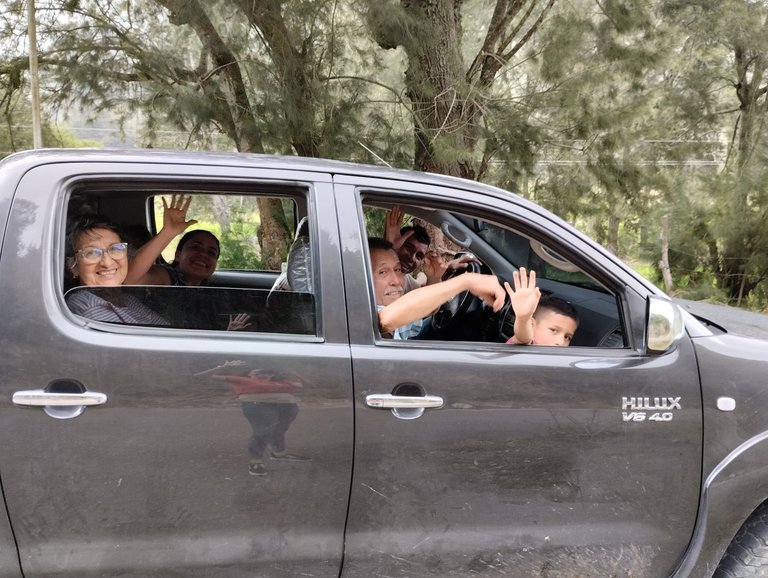
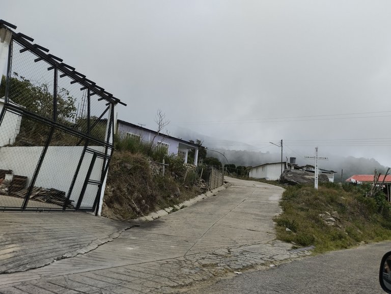
Following the signs we arrived at Pueblo Hondo in the municipality of Jáuregui, it turns out that there are two, Pueblo Hondo Encima and Pueblo Hondo Abajo, to continue on our way we had to take the road to Pueblo Hondo Abajo, otherwise we would continue up the mountain. Here we did stop and I was able to take some pictures of us (although the only one who got off was me).
Siguiendo las señalizaciones llegamos a Pueblo Hondo en el municipio Jáuregui, resulta que existen dos, Pueblo Hondo Encima y Pueblo Hondo Abajo, para continuar con nuestro caminos teníamos que tomar la carretera hacia Pueblo Hondo Abajo, de lo contrario, seguiríamos subiendo la montaña. Aquí si nos detuvimos y pude tomar unas fotografías de nosotros (aunque la única que se bajo fui yo).

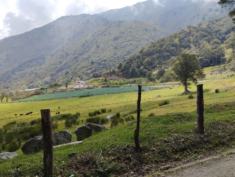
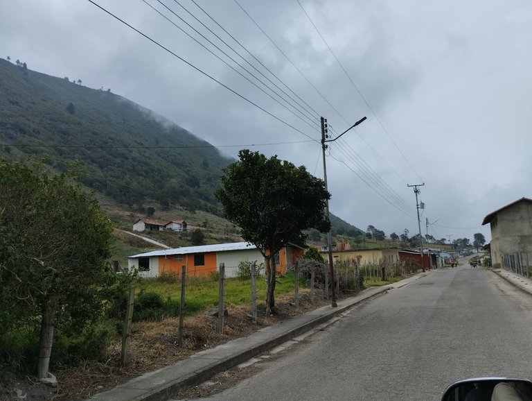
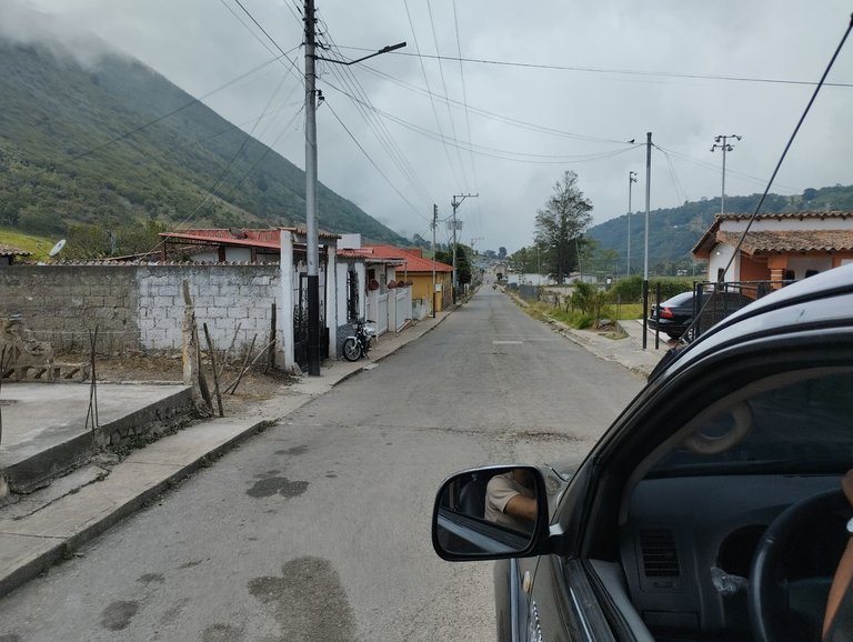
We started to go down and we found the small town that has only one street and it is the main street where the cars go up and down, in the same way we can see that agriculture is the economic activity of the population. Here there is only one street which we followed and it took us to San Simon, a town that I shared with you in a post a few months ago. Leaving San Simón is where the turnoff is that leads to towns in the state of Mérida such as Bailadores, Tovar and Zea. But we continued on our way to La Tendida on the Panamerican Highway.
Comenzamos a bajar y nos encontramos con el pueblito que solo tiene una calle y es la principal por donde suben y bajan los carros, de igual manera podemos ver qué la agricultura es la actividad económica de la población. Aquí no hay perdida solo existe una calle el cual seguimos y nos llevo a San Simón, pueblo que les compartí en una publicación hace algunos meses. Saliendo de San Simón es donde está la desviación que lleva a poblaciones del estado Mérida como Bailadores, Tovar y Zea. Pero nosotros seguimos nuestro camino hasta La Tendida en la carretera panamericana.


This is a trip that lasted about three hours and although we did not get out of the car I liked it very much because of the cold weather and the landscape. I liked it better this way than the way we arrived at La Grita, which was through La fría, in the municipality of García de Hevia (which is not cold at all because it is very hot). The only thing is that the way we arrived was faster and the important thing was to be at our destination early.
Este es un viaje que duró como tres horas y aunque no nos bajamos del carro me gustó mucho por el frío del clima y el paisaje. Me gustó más por esta vía que por donde llegamos a La Grita, que fue pasando por La fría, municipio García de Hevia (que de fría no tiene nada, porque hace mucho calor). Solo que por donde llegamos es más rápido y lo importante era estar temprano en nuestro destino.

You can check out this post and your own profile on the map. Be part of the Worldmappin Community and join our Discord Channel to get in touch with other travelers, ask questions or just be updated on our latest features.
Thank you very much.
Hey @beysyd you are welcome.
Thanks for using @worldmappin 😘
Thank you very much.
This is really a very pleasant trip, you and your family are smiling happily.
and you also managed to capture every beauty of this trip, it's really amazing, have a nice day my friend ♥️
Well yes, we were very happy, the trip was a great success, we had not gone out together for many years and we got together to visit the Shrine and this great day came out. My parents were very happy to have their three children together. It was a great day.
Hola! nunca he estado allí , pero se ve un clima muy agradable me recuerda cuando trabaje un tiempo en la Colonia Tovar en Aragua, recogiendo durazno, fresa, mora y hortalizas. como zanahoria brócolis calabacínes y tomate de árbol . Fue muy hermosa ver tu paseo.😘
Son zonas agrícolas las dos, solo que en esta parte del Táchira la altura es mayor que en la Colonia así que es más frío el clima. Yo fui una vez a la Colonia, es muy bonito.
Wow, these are some really interesting pictures my friend. I am really interested in seeing them 😘
I'm glad you liked them. The scenery is very nice.
YOU got a very wonderful road trip because the view is so beautiful and and i love mountain places for its fresh air and nice views.
Very nice, the scenery is amazing, the mountains and the greenery, the photos were really nice even though I took them in motion.
Congratulations @beysyd! You have completed the following achievement on the Hive blockchain And have been rewarded with New badge(s)
Your next target is to reach 5250 replies.
You can view your badges on your board and compare yourself to others in the Ranking
If you no longer want to receive notifications, reply to this comment with the word
STOPCheck out our last posts:
Me gustaron mucho las fotografías! Se ve que en la zona donde están los cultivos el ambiente es muy bonito. Además, la temperatura estaba baja y me imagino que el clima se sentía divino.
Que bueno que realizaron ese viaje y disfrutaron de la experiencia de agarrar otra ruta para llegar a su destino.
Si, allá hace frío, ese día más bien estaba despejado, generalmente por esa zona hay mucha neblina, solo la encontramos cuando íbamos bajando.
Gracias por tu visita.
Very nice trip seeing very high mountains I am very interested to see it 🤗🤗❤️❤️
How nice, it is a beautiful landscape.
Que rico se ve ese lugar 😍 falta un chinchorrito y listo! 😄
Jajaja me imagino que muchos usan Chinchorro, pero con ese frío que debe hacer de noche no creo que se aguante. Es mejor un montón de cobijas para dormir.