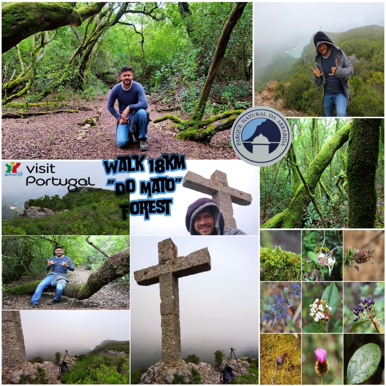
Within the deepest part of the Mediterranean Forest of the "Serra da Arrabida" is a place that seems to come out of a fantasy movie, there are few lucky ones who manage to get here and set foot in a place that is thousands of years old. Traveler friends, I stopped by here again to bring you a fantastic post where we will visit the "Do Mato" Forest. For this you must climb about 300 meters high and look for the secret path that takes you to it, it does not exist on any map so getting lost is quite a lot. easy, join my adventure and discover why Portugal is the most beautiful country in Europe!🧭🌎
Dentro de lo mas pronfundo del Bosque mediterranico de la "Serra da Arrabida" se encuentra un lugar que parece salido de una pelicula de fantasia, son pocos los afortunados que logran llegar aqui y poner un pie en un lugar con miles de anos. Amigos viajeros paso nuevamente por aqui para traerte un fantastico post donde visitaremos el Bosque "Do Mato" para ello debes subir unos 300 metros de altura y buscar el camino secreto que te lleva a el, no existe en ningun mapa por lo que perdernos es bastante facil, unete a mi aventura y descubre porque Portugal es el pais mas bonito de Europa!🌄🌲🗺️
Planning the route🧭 / Planeando la ruta🌍🚩
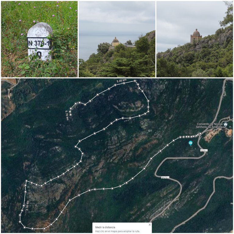
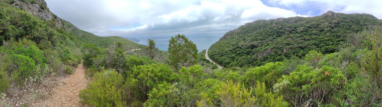
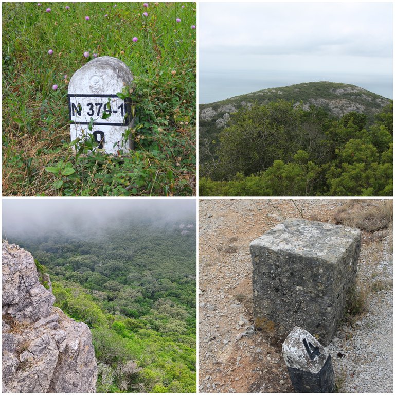
From the beginning of the trail to the end there are 5.5km which we have to do again, adding 12km, then until we reach the camp where we left the car, complete about 18km, it doesn't have to be completely like that, you can leave the car further ahead and save 6km of walking, you decide! My goal is to exercise, so the more I walk the better, in Gmaps you get the entrance at the point where I mark it, which would be here: (38.473068, -8.996701) It will be an average walk with a duration of 1.5 hours and you must come prepared with plenty of time. water, cool summer clothing, hat, boots and hiking poles.🌍🦎
Desde que inicia el sendero hasta el final son 5.5km los cuales tenemos que hacer nuevamente de vuelta sumando 12km, luego hasta llegar al campamento donde dejamos el carro complete unos 18km, no tiene que ser del todo asi, puedes dejar el carro mas adelante y ahorrar 6km de caminata tu decides! mi objetivo es ejercitarme por tanto mientras mas camine sera mejor, en Gmaps consigues la entrada en el punto donde yo te marco que seria aqui: (38.473068, -8.996701) sera una caminata media con una duracion de 1.5horas y debes venir preparado con mucha agua, ropa fresca para verano, sombrero, botas y bastones de excursion.🧭🚩

Start of the route🧭 / Inicio de la ruta🌍🚩
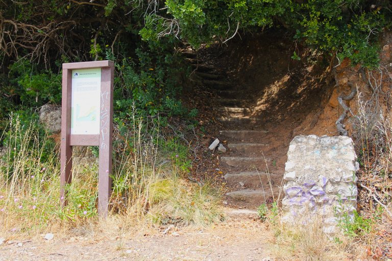
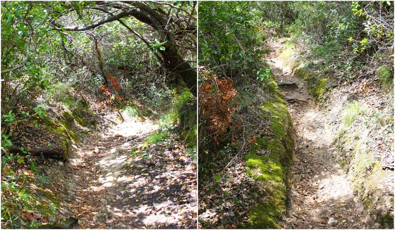
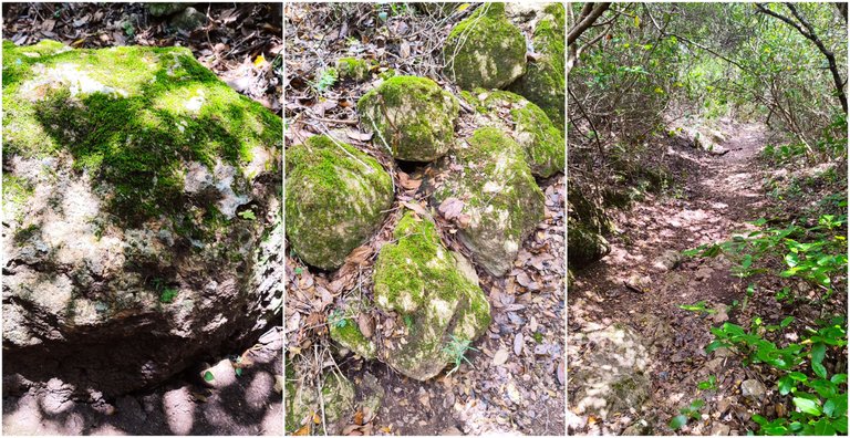
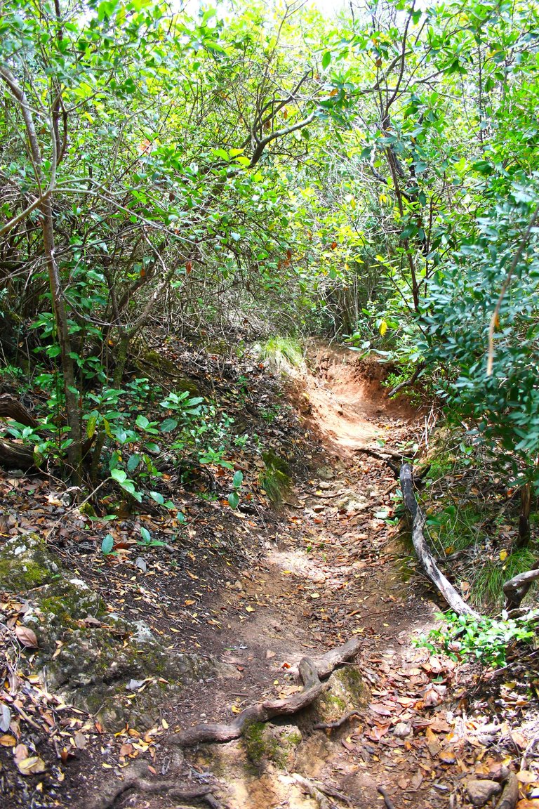
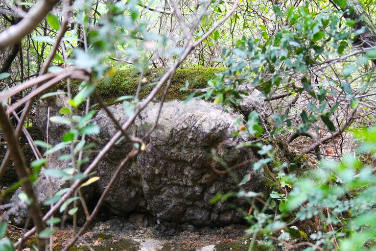
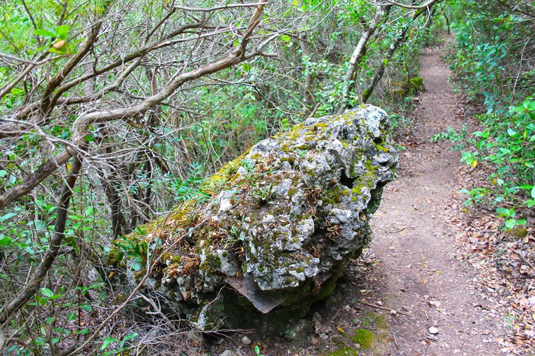
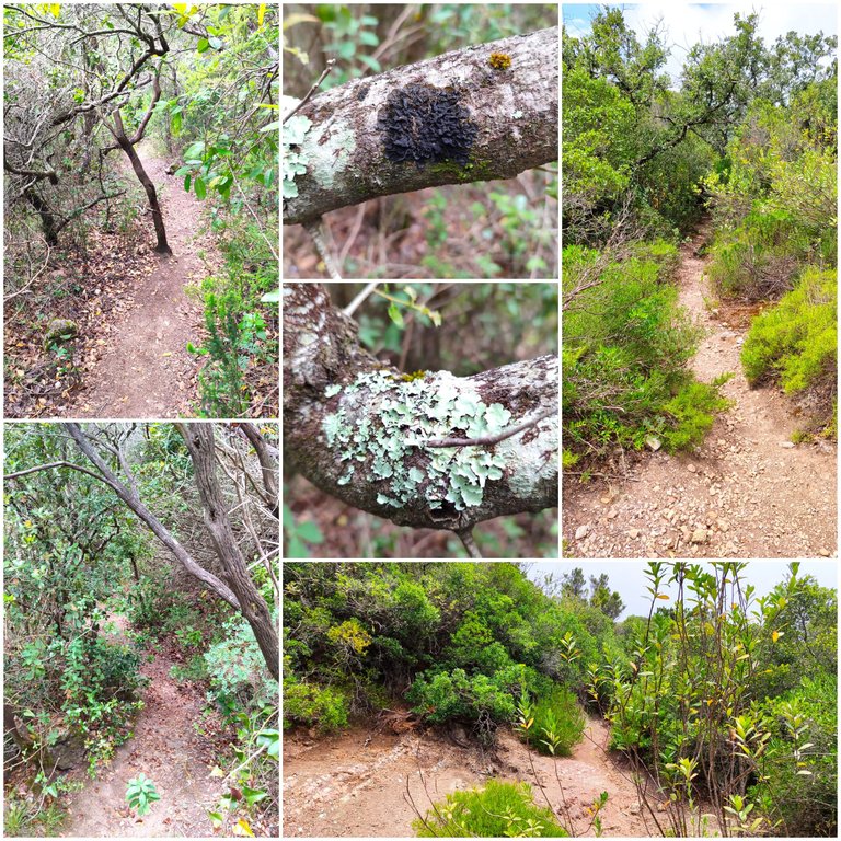
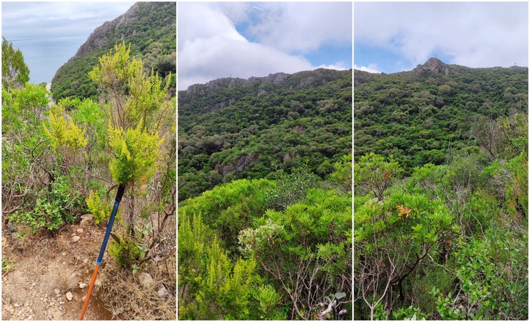
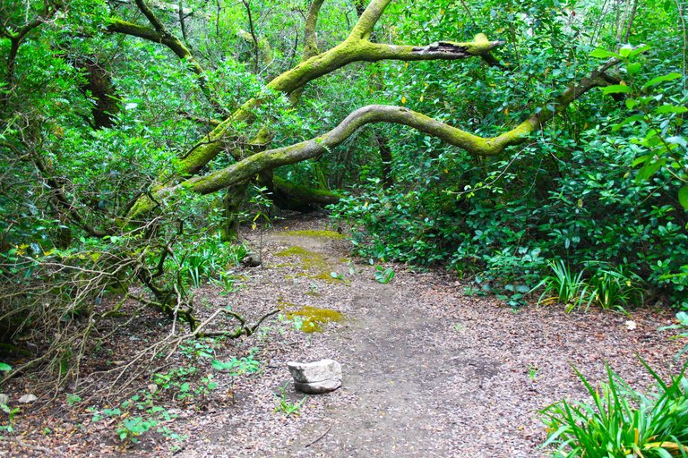
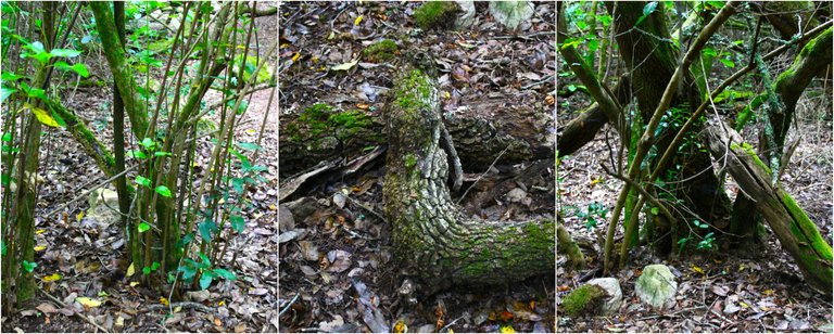
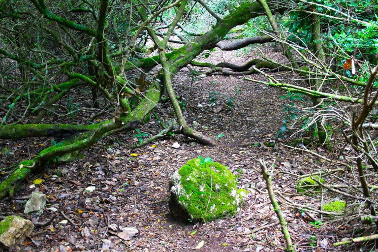
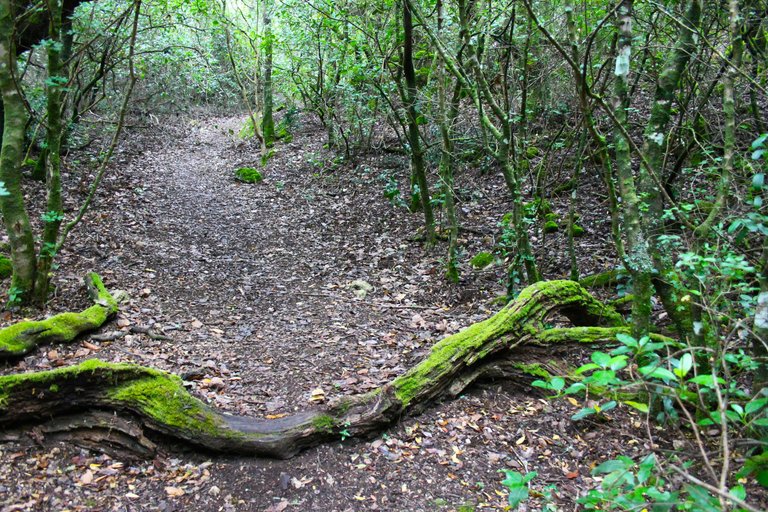
This is the entrance to the Path or at least one of the alternatives, as I told you there is no route that shows us to get to the top of the mountain, it is my second time that I make the path to the crosses but on this occasion I traced a second alternative route and as you can see the weather is also different in this case it was very cold and cloudy, I think the only disadvantage of the trail is that there are too many bushes with thorns and you tend to scratch yourself and cut yourself if you are not all covered, just look some stone stairs on the left side of the road to know that we are going well.🌍🌲
Esta es la entrada del Sendero o al menos una de las alternativas, como te dije no hay una ruta que nos muestre para llegar a la cima de la montana, es mi segunda vez que hago el camino hacia las cruces pero en esta ocasion trace una segunda ruta alternativa y como puedes ver el clima tambien es diferente en este caso estaba muy frio y nublado, creo que la unica desventaja del sendero es que hay demasiados arbustos con espinas y tiendes a rasparte y cortarte si no estas todo cubierto, basta con ver unas escaleras de piedras al lado izquierdo de la carretera para saber que vamos bien.🏔️🌎
Biodiversity🧭🌷 / Biodiversidad🌍🚩
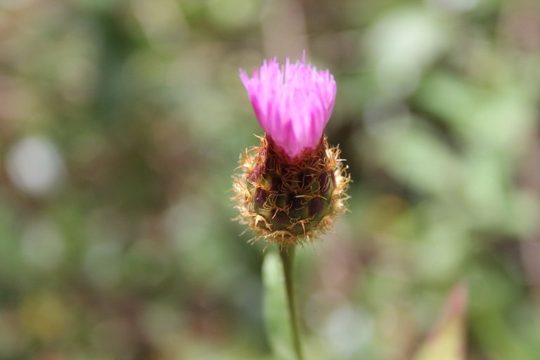
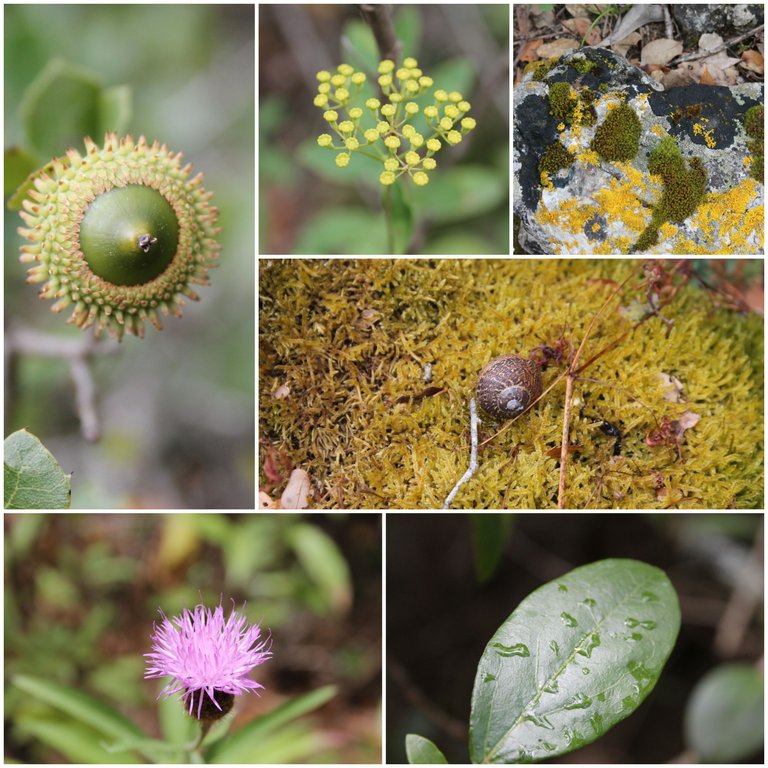
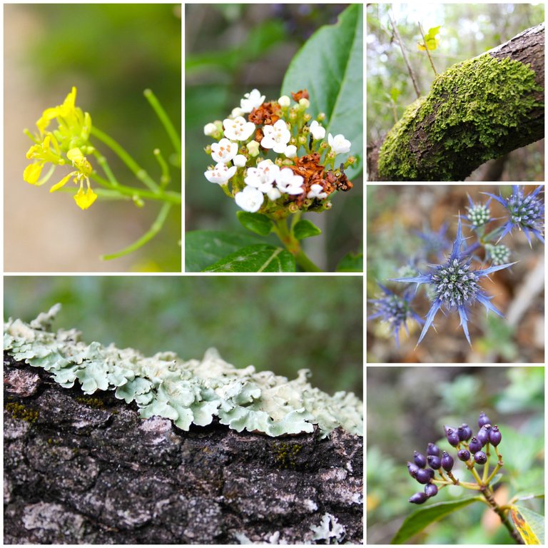
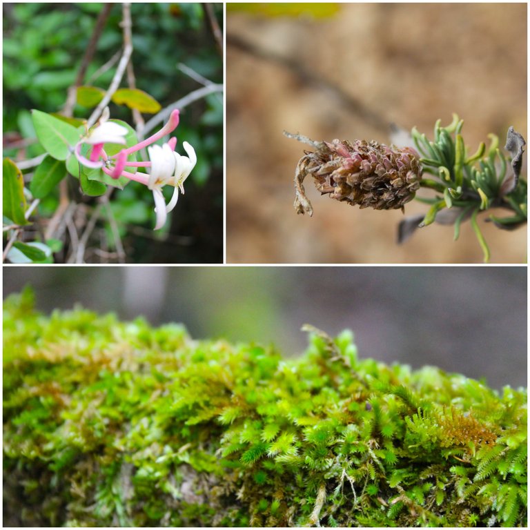
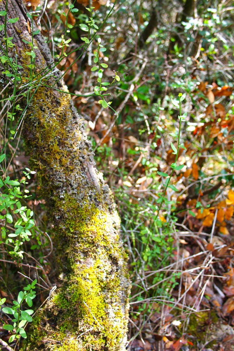
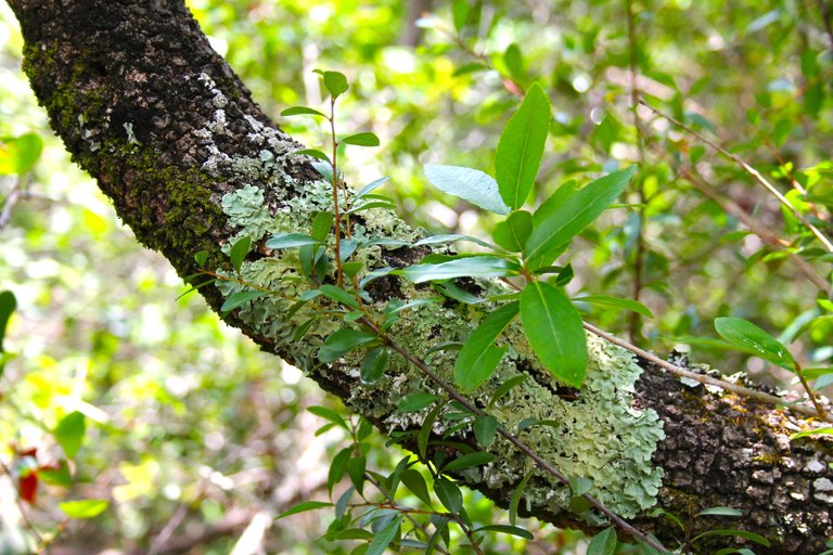
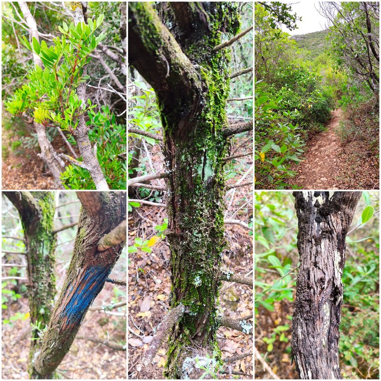
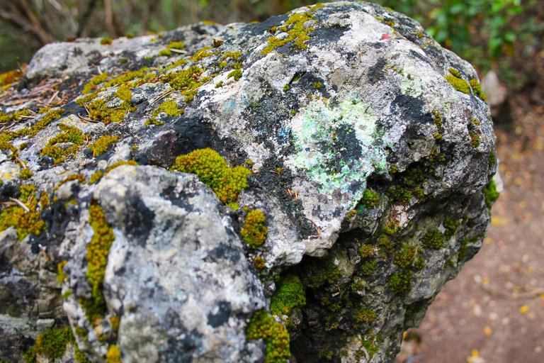
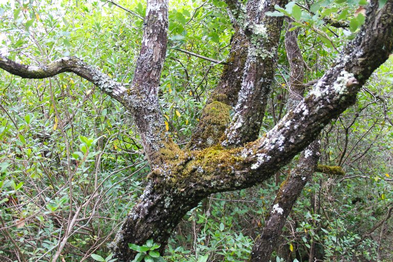
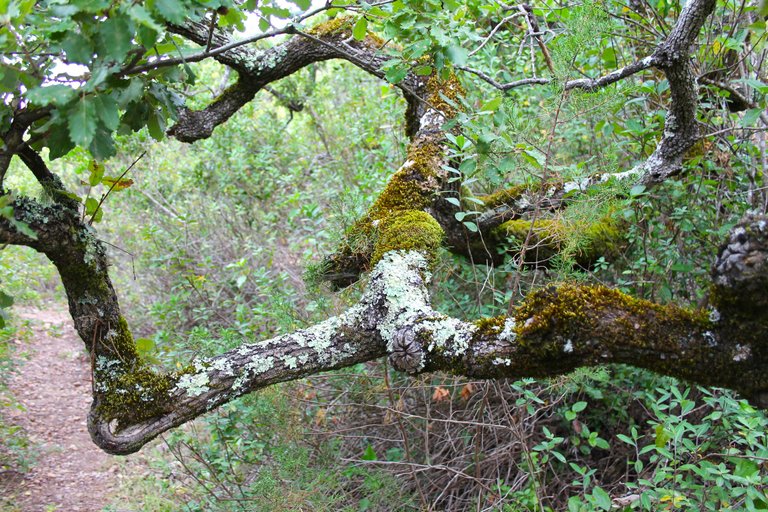
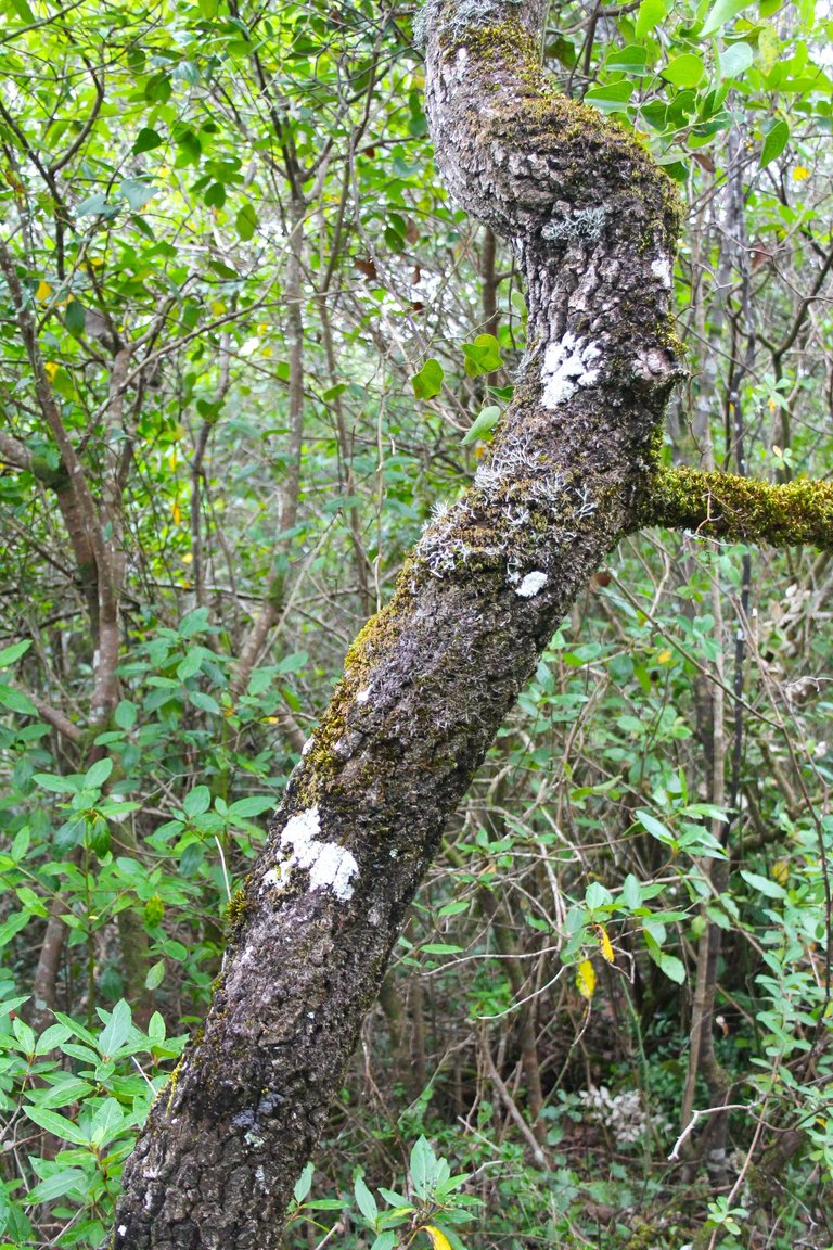
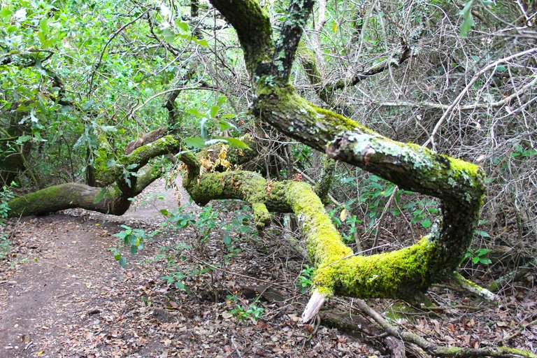
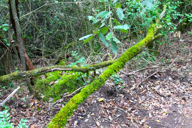
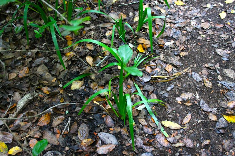
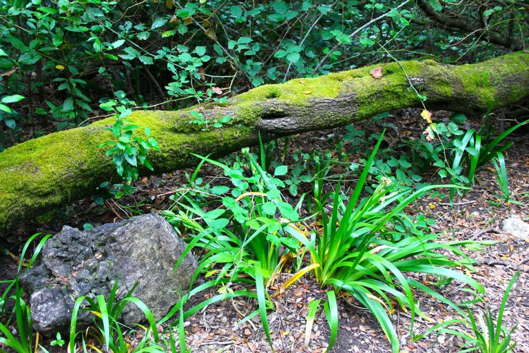
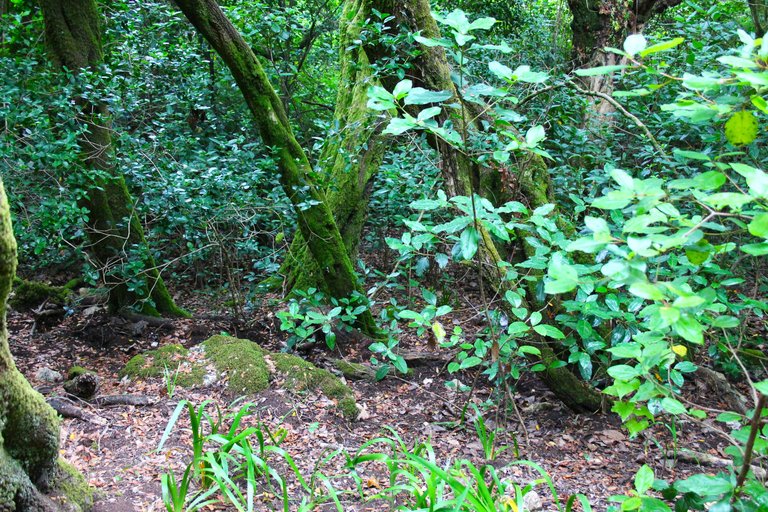
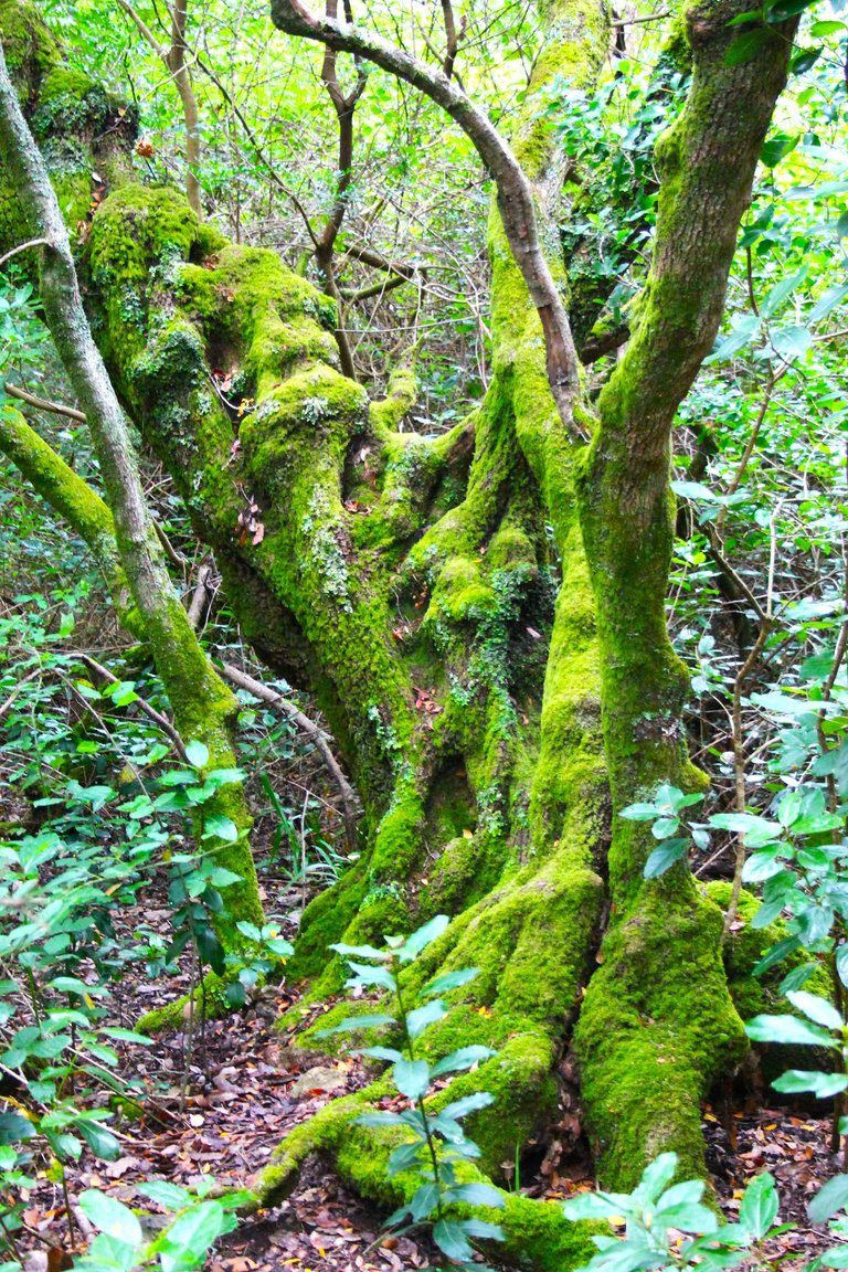
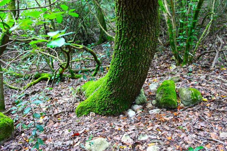
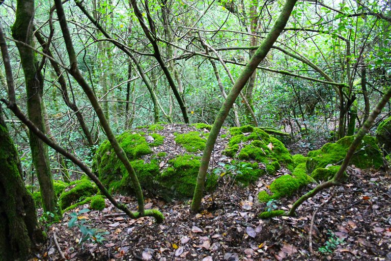
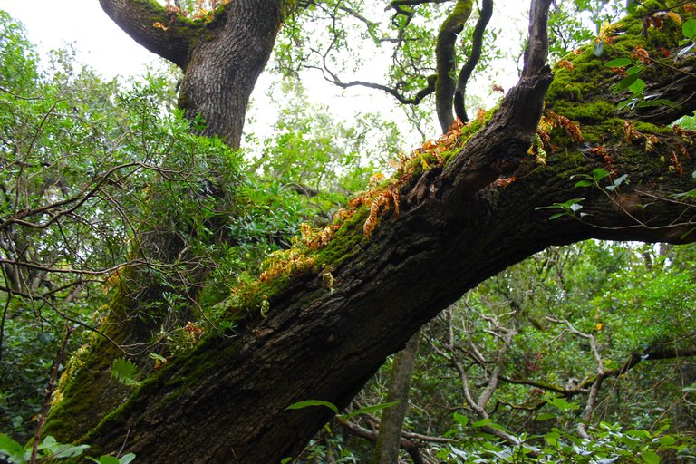
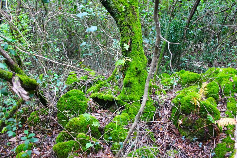
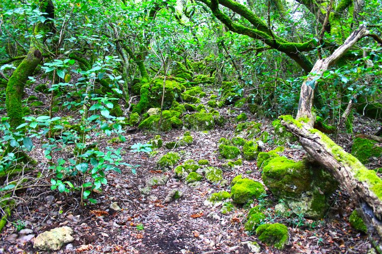
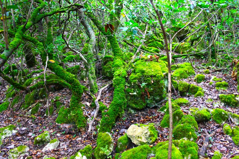
It is common to see in this type of landscapes plants adapted to various types of climate, the winter in Portugal can be somewhat cold with temperatures between 6-10 degrees in this area, then the summer has very high temperatures reaching 40 degrees or more, Obviously, in order to survive this environment, a plant must present adaptations in its leaves, stem and root. So plants like the oak are quite abundant, then we have shrubs like Smilax aspera that are climbers with thorns, we could also see aromatic plants like thyme, rosemary. Something that is also common in humid and cold forests are lichens and mosses, there are several species here.🌎🏔️
Es comun ver en este tipo de paisajes plantas adaptadas a diversos tipos de clima, el invierno de Portugal puede ser algo frio con temperaturas de entre 6-10 grados en esta zona, luego el verano tiene temperaturas muy altas alcanzando los 40 grados o mas, evidentemente una planta para poder sobrevivir este ambiente debe presentar adaptaciones en sus hojas, tallo y raiz. Por lo que las plantas como la encina es bastante abundante, luego tenemos arbustos como Smilax aspera que son trepadoras con espinas, tambien podriamos ver plantas aromaticas como tomillo, romero. Algo que tambien es comun de bosques humedos y frios son los liquenes y los musgos, aqui hay varias especies.🌷🦎🦨
https://concepto.de/bosque-mediterraneo/#:~:text=Flora%20del%20bosque%20mediterr%C3%A1neo,-Abundan%20%C3%A1rboles%20adaptados&text=En%20estos%20bosques%20predominan%20las,el%20romero%20y%20el%20tomillo.
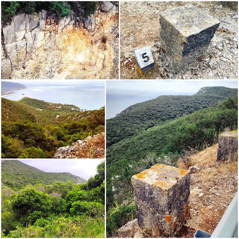
Climbing to 325 meters🧭🌷 / Subiendo a 325 metros🌍🚩
convent territory🚩🌍
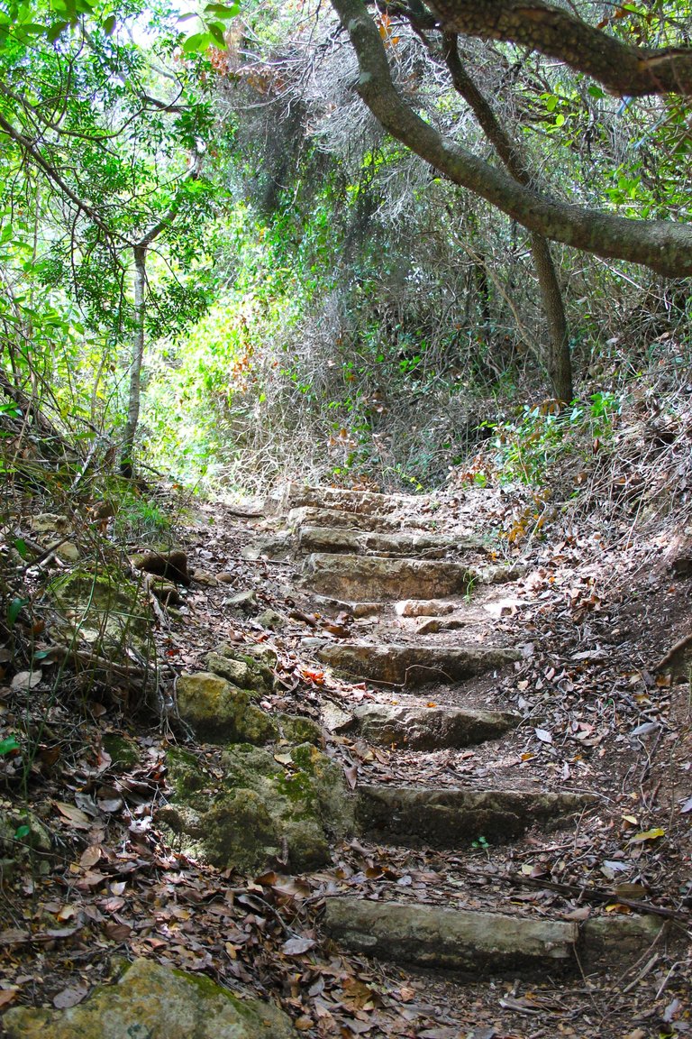
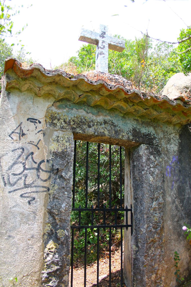
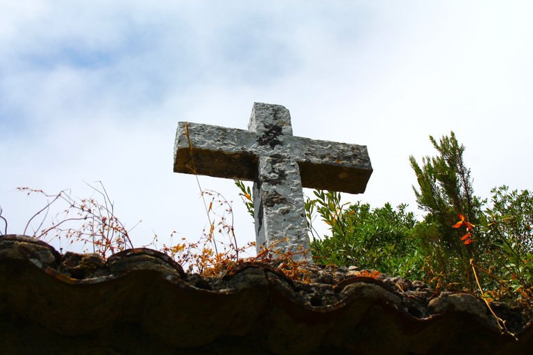
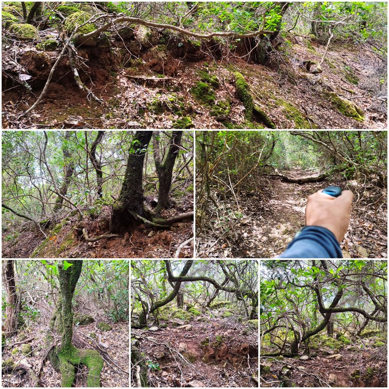
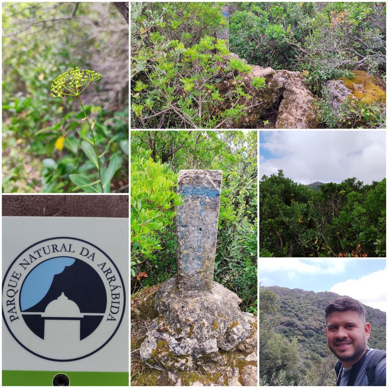
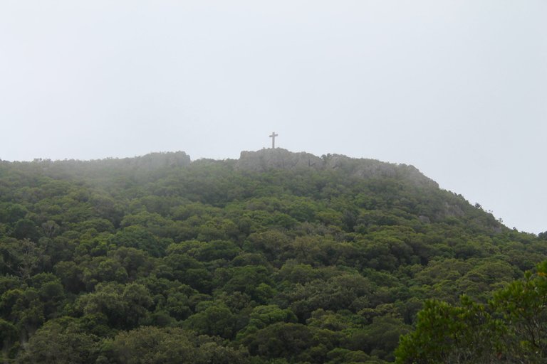
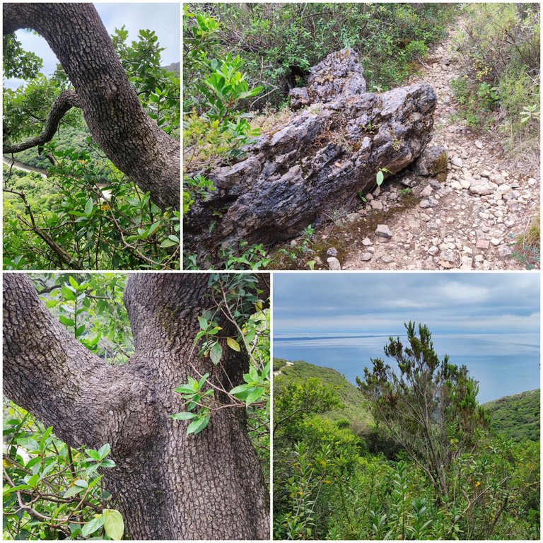
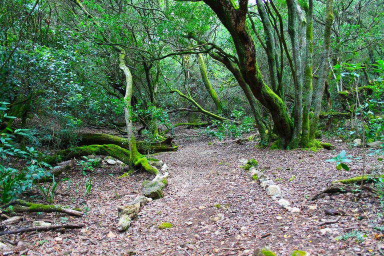
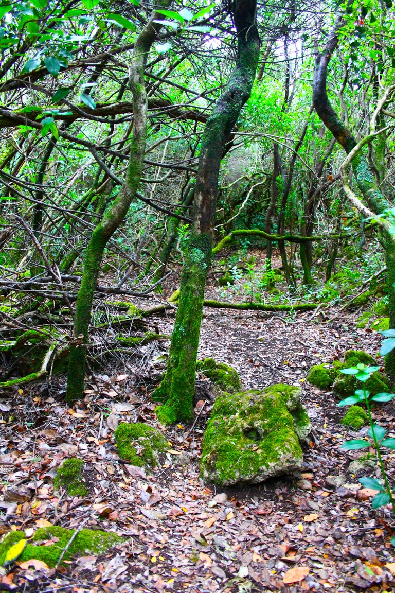
The entire path will be on fairly dry sand roads and in winter slippery, it will be very difficult to orient yourself because there are too many intersections that there will come a time where we will not know if we are lost or not, as a recommendation follow a blue and a pink dot at the beginning, they are marks made by people who have already completed the trail, when we pass the main path in a straight line we can take advantage of photographing the entrance to the convent, this convent is 500 years old and as you can see the stone crosses denote that Catholic denomination, we cannot enter but the convent We can visit it by making an appointment online.🧭🌏
Todo el sendero sera en caminos de arena bastante secos y en invierno resbaladizos, sera muy dificil orientarse porque hay demasiados cruces que llegara un momento donde no sabremos si estamos o no perdidos, como recomendacion sigue al inicio un punto azul y otro rosado, son marcas realizada por personas que ya completaron el sendero, cuando pasemos en linea recta el camino principal podemos aprovechar en fotografiar la entrada al convento, este convento tiene 500 anos y como puedes ver las cruces de piedra denotan esa denominacion catolica, no podemos entrar pero al convento lo podemos visitar marcando una cita por internet.🌻🌳
When I told you about a forest that is thousands of years old, I actually fell short, very short! For these forests to be formed and more than 7 million years had to pass, we have to go back to when the collision occurred between the "African and Eurasian" plates, that was when the Mediterranean Sea originated. The Arabs were the first to discover this area because the name: "Arrabida" in Arabic means place of prayer and meditation. It was only in the 1980s that these roads began to be created to access the different places in the mountain.🏔️🌄
Cuando te comentaba sobre un bosque que tiene miles de anos en realidad me quede corto muy corto! para que se formara estos bosques y tuvieron que pasar mas de 7millones de anos, tenemos que retornar cuando ocurrio la colision entre las placas "africanas y euro-asiaticas", alli fue cuando se origino el mar mediterraneo. Fueron los arabes los primeros en descubrir esta zona debido a que el nombre: "Arrabida" en arabe significa lugar de oracion y recogimiento. Apenas en la decada de los 80 es que se comenzaron a crear estos caminos para acceder a los diferentes lugares de la montana.🌎🦉👨🏻🏫
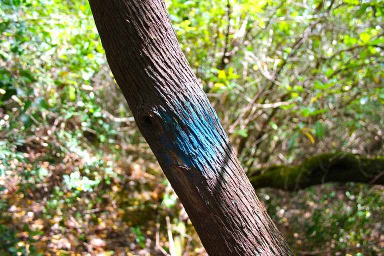
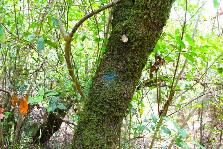
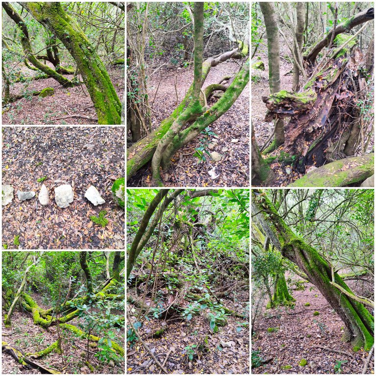
The previous time I did the trail I had some doubts that I managed to resolve today, for example the blue spots are our guide to the mountain, I thought they were another path but they are correct, they will take you into the forest I would say about 3kg and then open a moment where they change to another pink color, if you follow that order you will reach the crosses.🌎🌄
La vez anterior que hice el sendero quede con algunas dudas que consigue resolver hoy, por ejemplo las manchas azules son nuestra guia hacia la montana, pense que eran otro sendero pero estan correctas, te llevaran dentro del bosque diria que unos 3kg y luego abra un momento donde cambian a otro color rosado, si sigues ese orden llegaras a las cruces.🌷🏔️
200 meters high🧭🌷 / 200 metros de altura🌍🚩
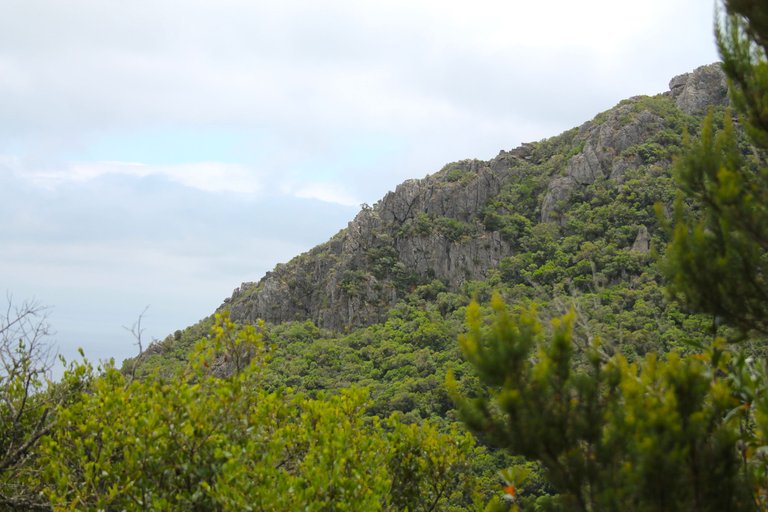
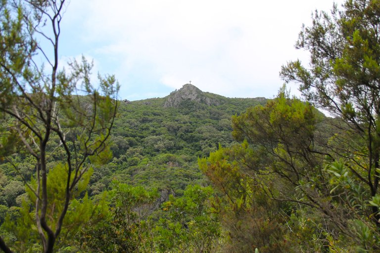
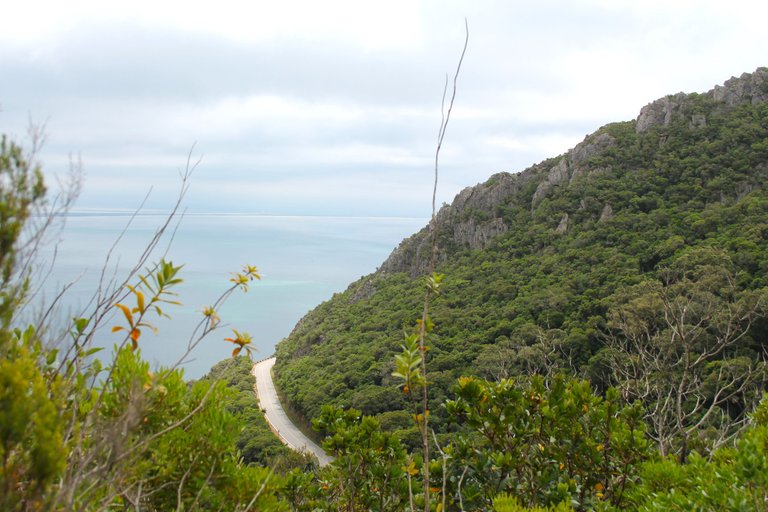
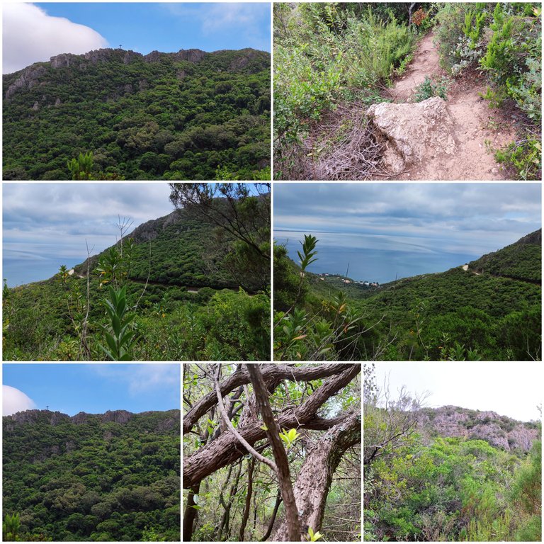
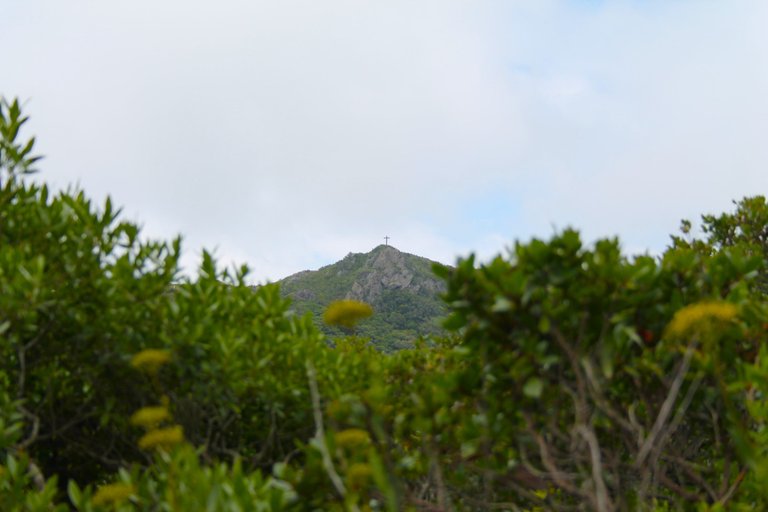
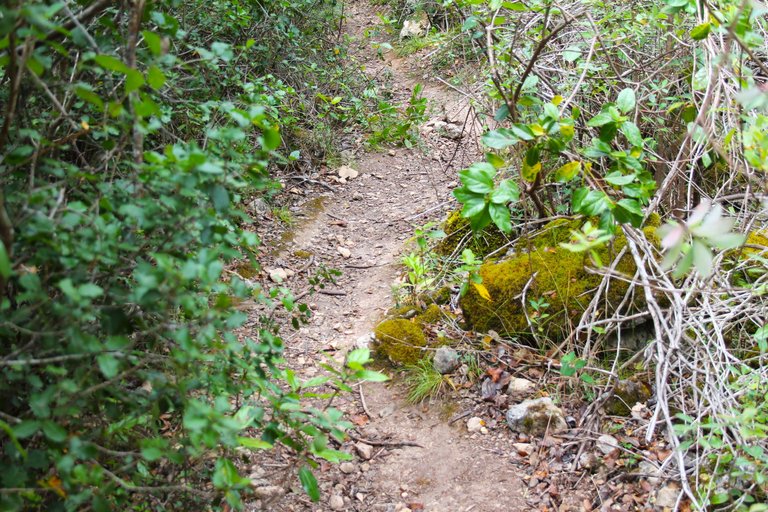
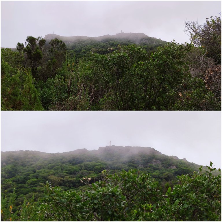
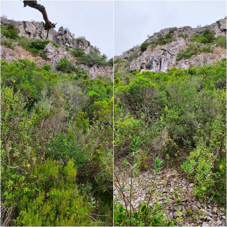
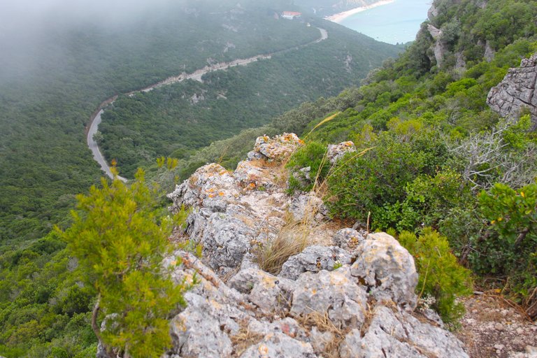
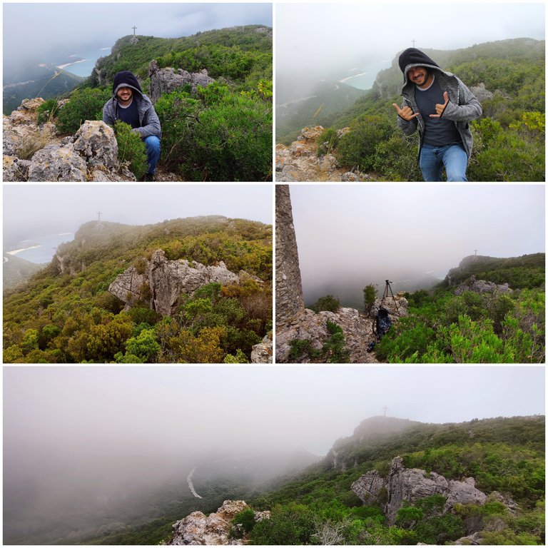
Here the forest clears a little and has a beautiful view of almost 180 degrees, we have in front of the mountain range with those crosses which is where we are going, once the drone flew here so if you want better images you can look for that post! But that day the weather was sunny and very hot, today it is the opposite, too much fog and cold. I had never climbed the mountain in fog and it was a wonderful experience.🌎🦉🌍
Aqui el bosque se despeja un poco y tiene una hermosa vista de casi 180grados, tenemos al frente la sierra con aquellas cruces que es para donde vamos, una vez vole el drone por aqui asi que si quieres mejores imagenes puedes buscar ese post! pero estaba ese dia el clima soleado y hacia mucho calor, hoy es lo contrario demasiada neblina y frio nunca habia subido la montana con neblina y fue una experiencia maravillosa.🦨🦎🌲
The fog arrived🧭🌷 / Llego la neblina🌍🚩
Back to the forest🌷🌍
You have no idea how windy it was today, along with the fog it was quite cold and pleasant! As I mentioned, it is the first time that I have done the trail in these conditions and of course since it is not so hot we do not consume much water and we do not get as exhausted. In these conditions you could do the trail with children but of course always supervising there are many loose stones and we tend to slip .🧭🌏
No tienen idea del viento que habia hoy, junto con la neblina estaba bastante frio y agradable! como mencione es primera vez que hago el sendero en estas condiciones y claro al no haber tanto calor no consumimos mucha agua y no nos agotamos tanto, en estas condiciones podrias hacer el sendero con ninos pero claro siempre supervisando hay muchas piedras sueltas y tendemos a resbalarnos.🌻🌳
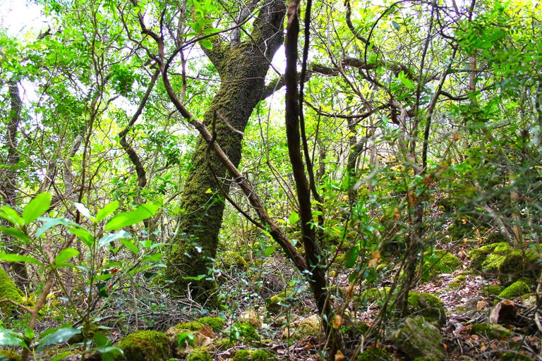
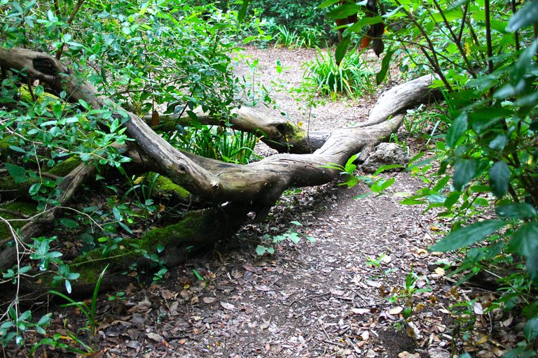
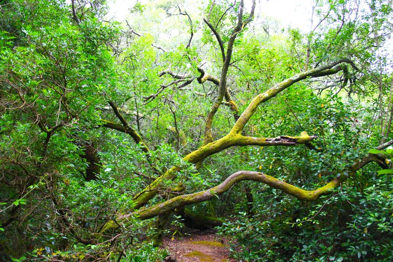
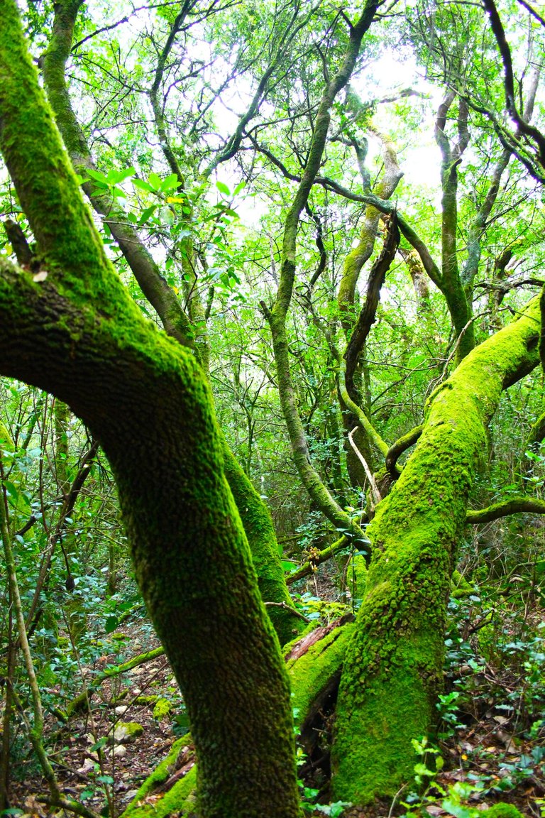
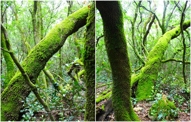
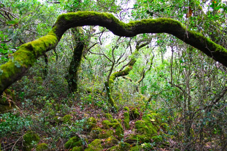
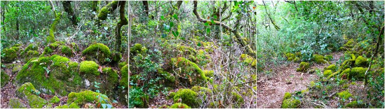
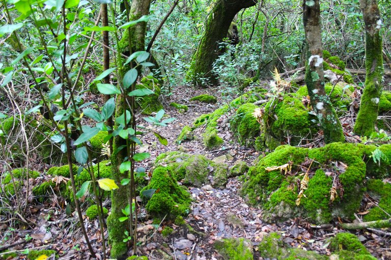
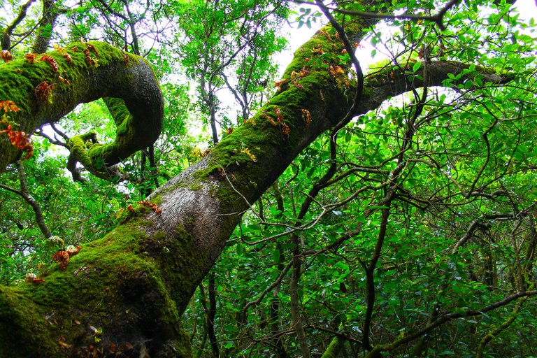
The Secret Forest "Do mato"🧭🌷 / El bosque Secreto "Do mato"🌍🚩
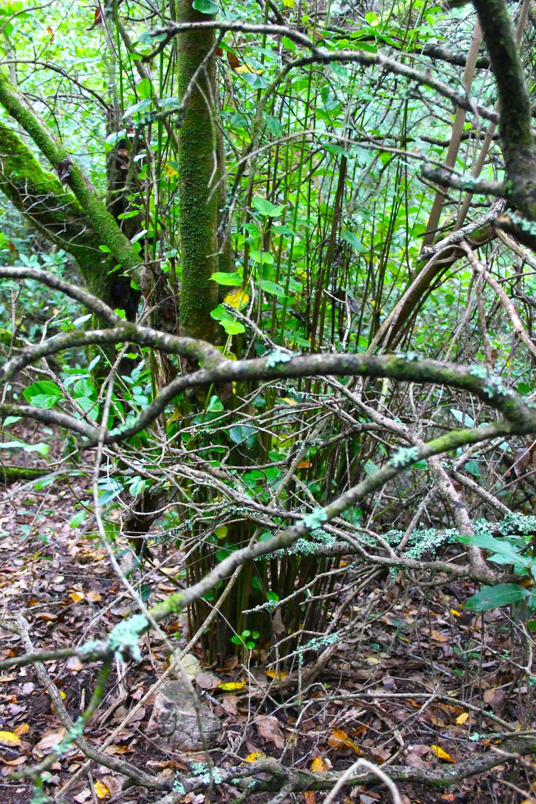
Here begins the forest "Do mato" has a single entrance that is the one that the blue spots take you to, and here everything changes, the atmosphere is mysterious, silent, humid, too colorful!🌎🌲
Aqui comienza el bosque "Do mato" tiene una unica entrada que es la que te llevan las manchas azules, y aqui todo cambia, la atmosfera es misteriosa, silenciosa, humeda, demasiado colorida!🚩
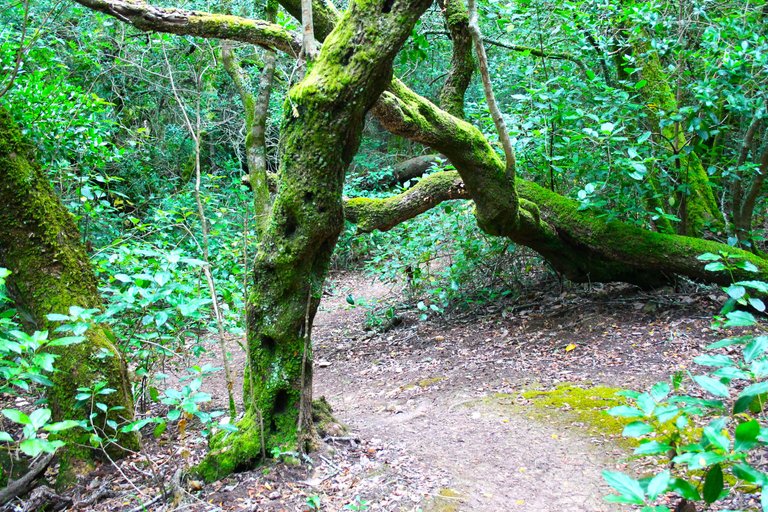
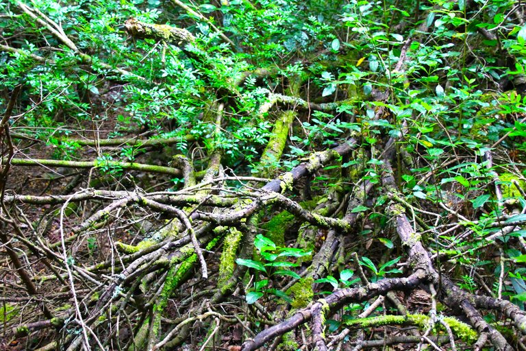
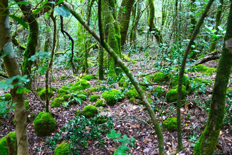
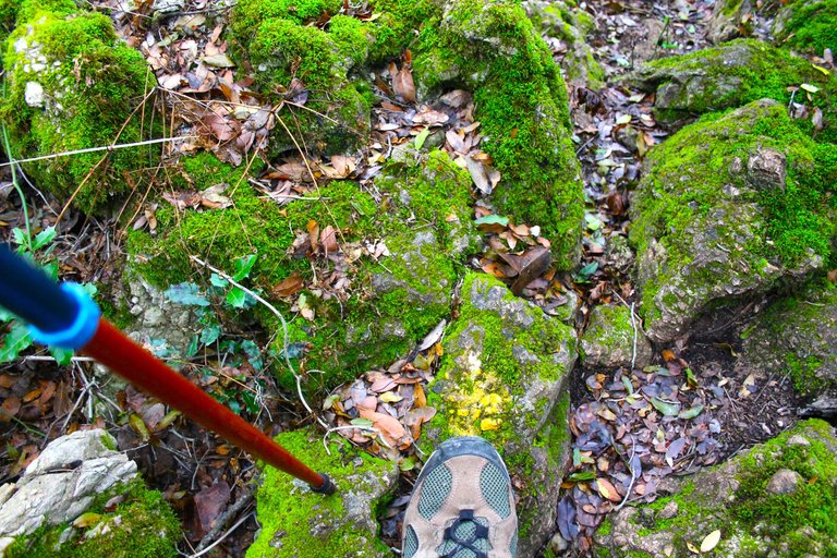
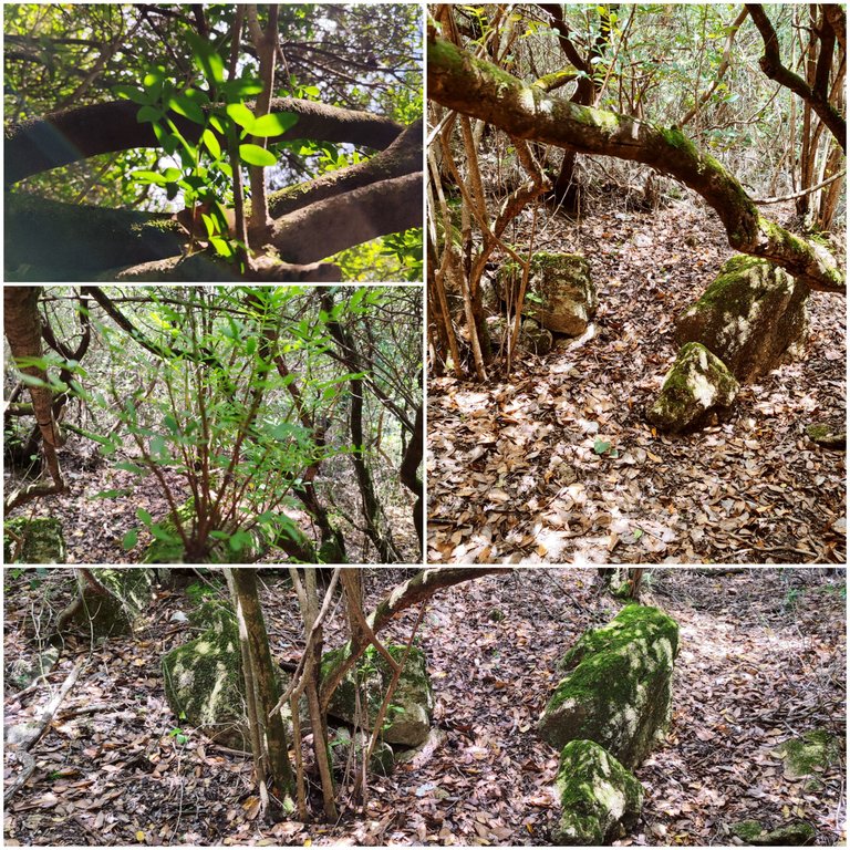
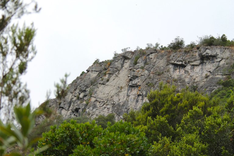
Be careful in this part, it is the most dangerous because there are many loose and sharp stones. Also, as you can see, we leave the blue guide and enter the yellow lines, you must follow them to continue towards the mountain! This area is sensitive, it is an ecological term to denote a protected area with great importance in the ecosystem, IT IS PROHIBITED TO LEAVE GARBAGE OR BREAK THE VEGETATION.🌍🌲
Atencion en esta parte es la mas peligrosa porque hay muchas piedras sueltas y filosas, tambien como puedes observar dejamos la guia azul y entramos en las lineas amarillas debes seguirlas para continuar hacia la montana! esta area es sensible es un termino ecologico para denotar un area protegida y con mucha importancia en el ecosistema, PROHIBIDO DEJAR BASURA O ROMPER LA VEGETACION.👨🏻🏫🏔️


We are just under 3kg to reach the final stretch of our adventure and pay attention once again the color changes from yellow to pink, now we must follow these instructions, and well we leave the "Do Mato" forest behind, what did you think of the landscape there?🦎🌷🏔️
Estamos a poco menos de 3kg para llegar a la recta final de nuestra aventura y atentos nuevamente cambia el color de amarillo a rosado, ahora debemos seguir estas indicaciones, y bueno dejamos atras al bosque "Do Mato" que te parecio el paisaje alli?🌲🌍🌄

6km descent🧭🌷 / 6km de descenso🌍🚩

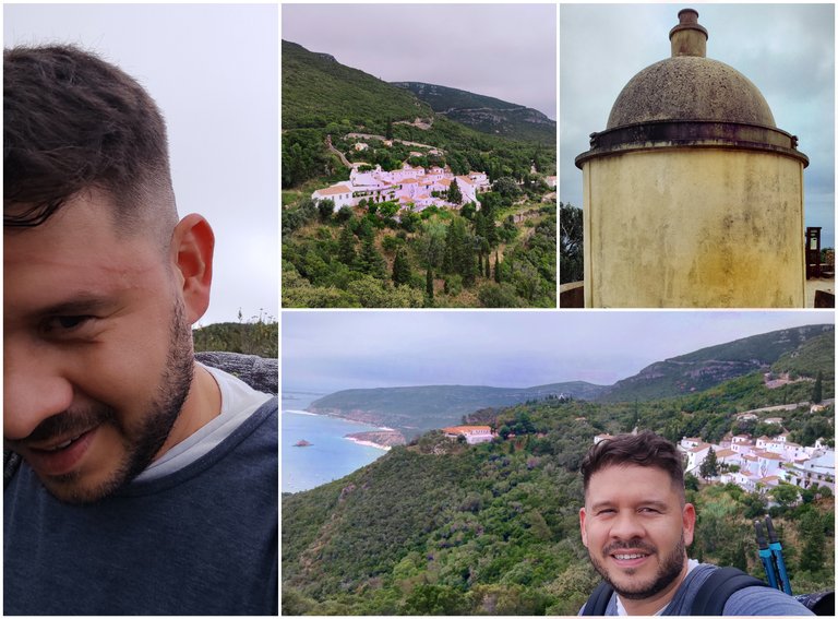
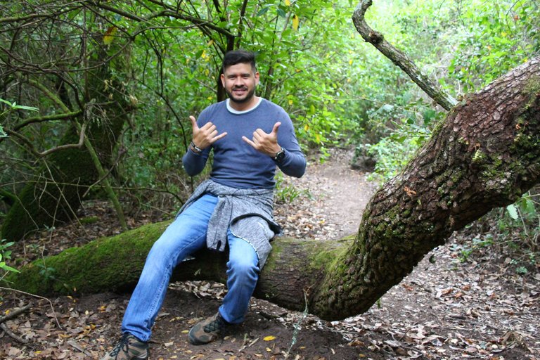
After a fairly hard descent full of accidents haha I managed to reach the road and took the opportunity to take some photos in the convent.🌍🚩
Luego de una bajada bastante dura y llena de accidentes jaja logre alcanzar la carretera y aproveche en tomarme unas fotos en el convento.🌲

DNA is an organization to foster and DENSIFY NATURE-APPRECIATION which aims to establish REPORTS OF BIODIVERSITY DATA that is contributed by all of us Hiveans and subsequently cataloged.
Therefore DNA searches for HIGH-QUALITY posts that aim to DESCRIBE and determine the BIODIVERSITY AROUND YOU with added EXPLANATIONS and INFORMATION. For these informative posts they offer a CURATION SERVICE using the @dna.org account. It is also a CURATION TRAIL. Just add the #dna TAG if you think that any of your posts is what they are looking for.
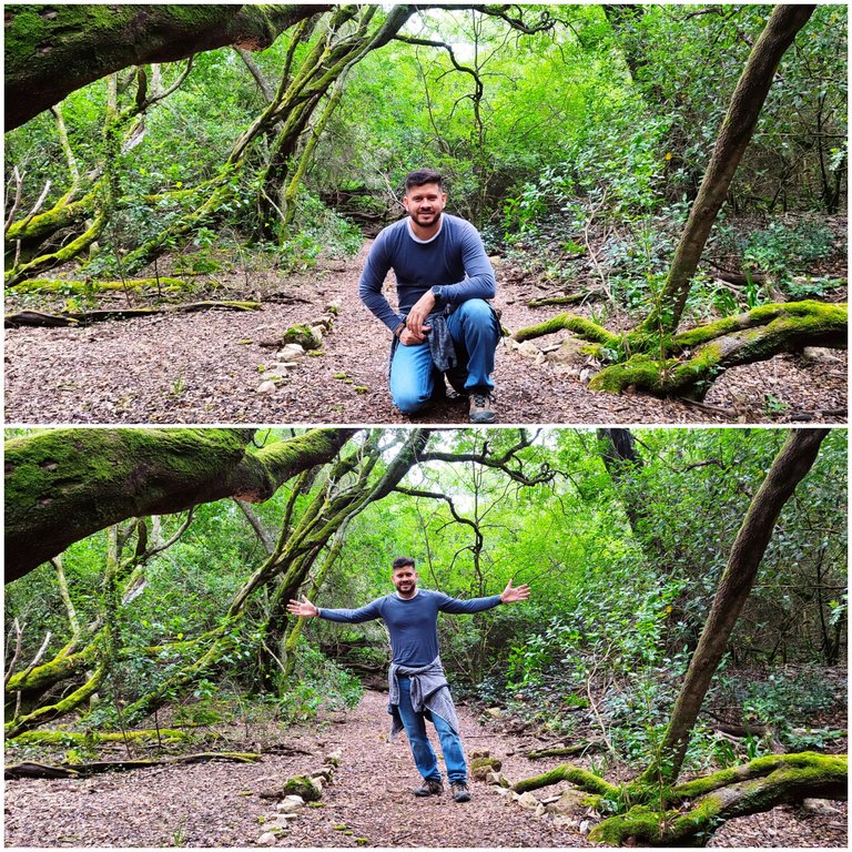
THANKS FOR READING ME (PHOTOS AND VIDEOS OF MY PROPERTY) / GRACIAS POR LEERME FOTOS Y VIDEOS DE MI PROPIEDAD🙂🧠🦾👍
Congratulations, your post has been added to WorldMapPin! 🎉
Did you know you have your own profile map?
And every post has their own map too!
Want to have your post on the map too?
Hiya, @ybanezkim26 here, just swinging by to let you know that this post made it into our Honorable Mentions in Travel Digest #2242.
Your post has been manually curated by the @worldmappin team. If you like what we're doing, please drop by to check out all the rest of today's great posts and consider supporting other authors like yourself and us so we can keep the project going!
Become part of our travel community:
18 km.... 🫣
Sending you an Ecency vote