Makalidurga Trek is one of the famous trek from Bangalore which is at a distance of just 60 kms. It is also close to dadaballapur at a distance of just 15 kilometers. The best part is, it is easily accessible by road and railways, as the trek starts from the railway station itself. Also the best part is that it is all season trek for both beginners and experienced once. It is also considered as the quick weekend gateway from Bangalore.
Before you start the trek, you should book the trek. The price is Rs 250 in weekdays and Rs 400 in weekends. As this comes under forest department, there is limited number of tickets will be issue per day. So we have booked our tickets and started in the morning 6 from our home. While going we have packed our breakfast so that we will be eating that on top of the hill.
To start the trek we have to cross the railway line and then there were forest officials who will be checking our tickets. Occasionally they can ask for the ID proof, so keep it handy. You have to book online because there is no provision of booking on spot.
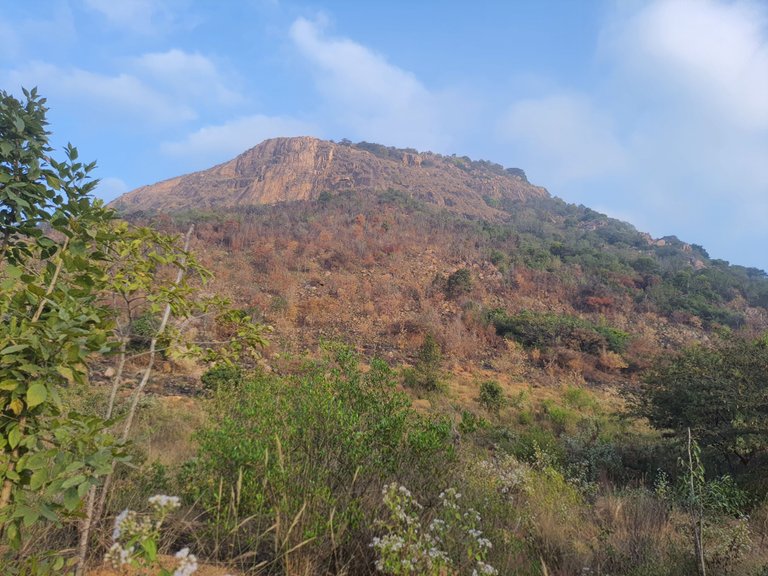
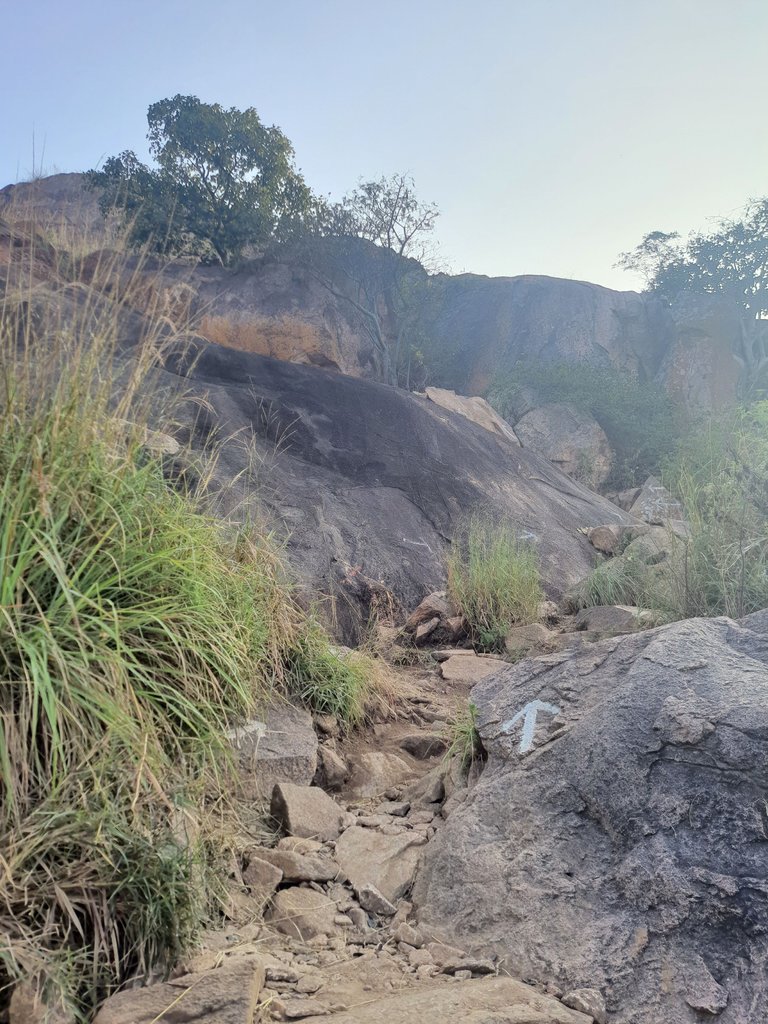
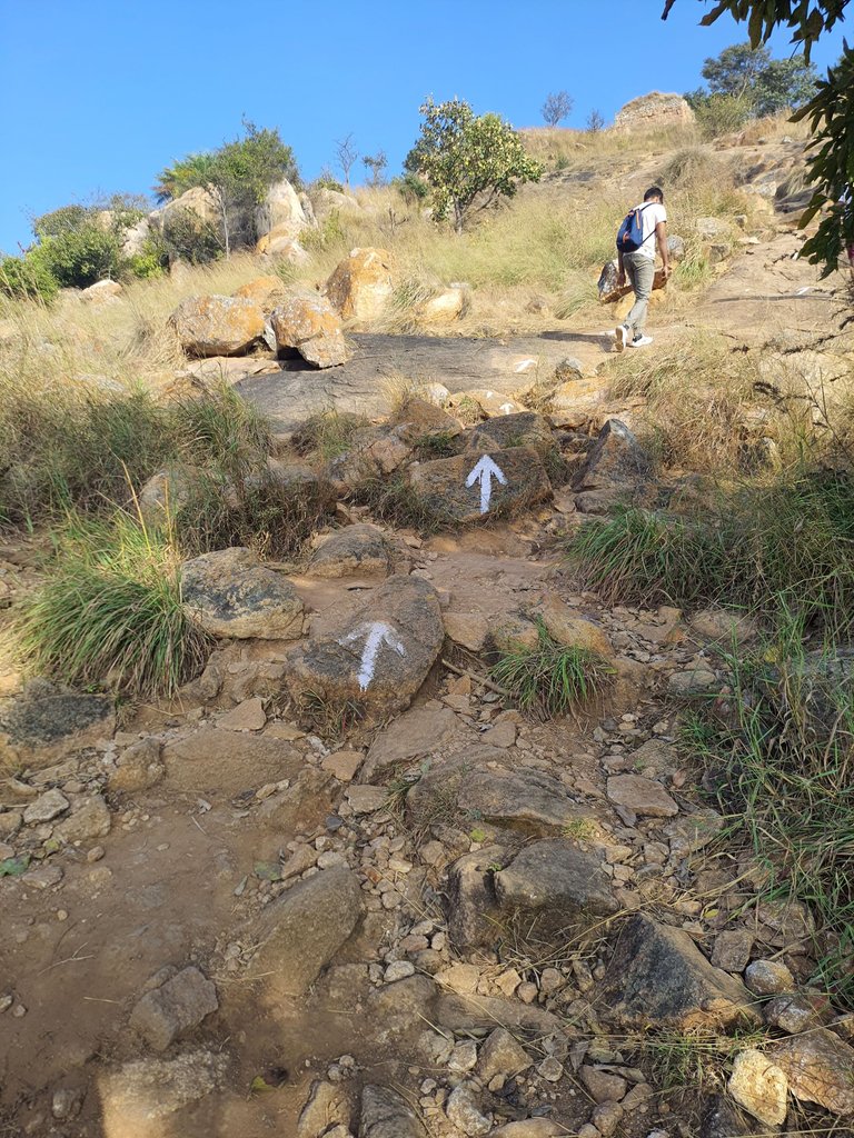
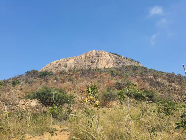
After we have shown our ticket we have started our trekking journey. The hill looked like a monolithic one but it was not.
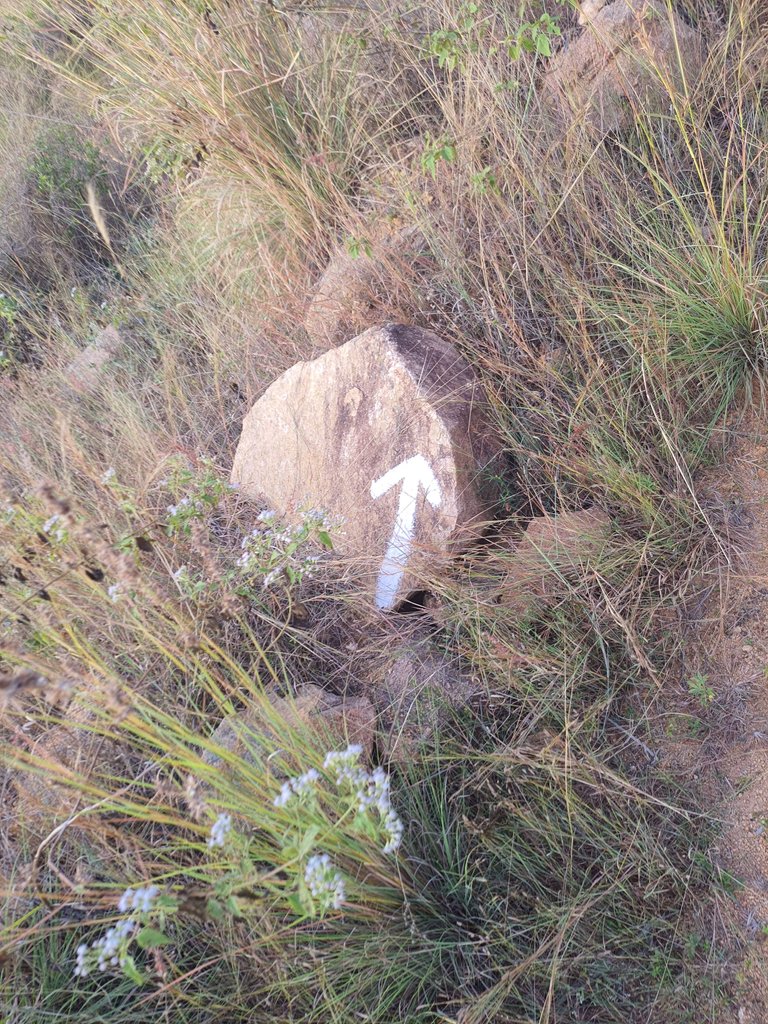
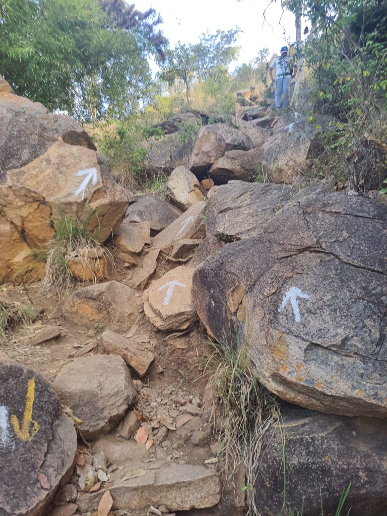
For the fist few hundred meters it was a plain surface. We were getting the arrow mark to show us the path forward. To be honest, that is actually good to know of we were following the right path.
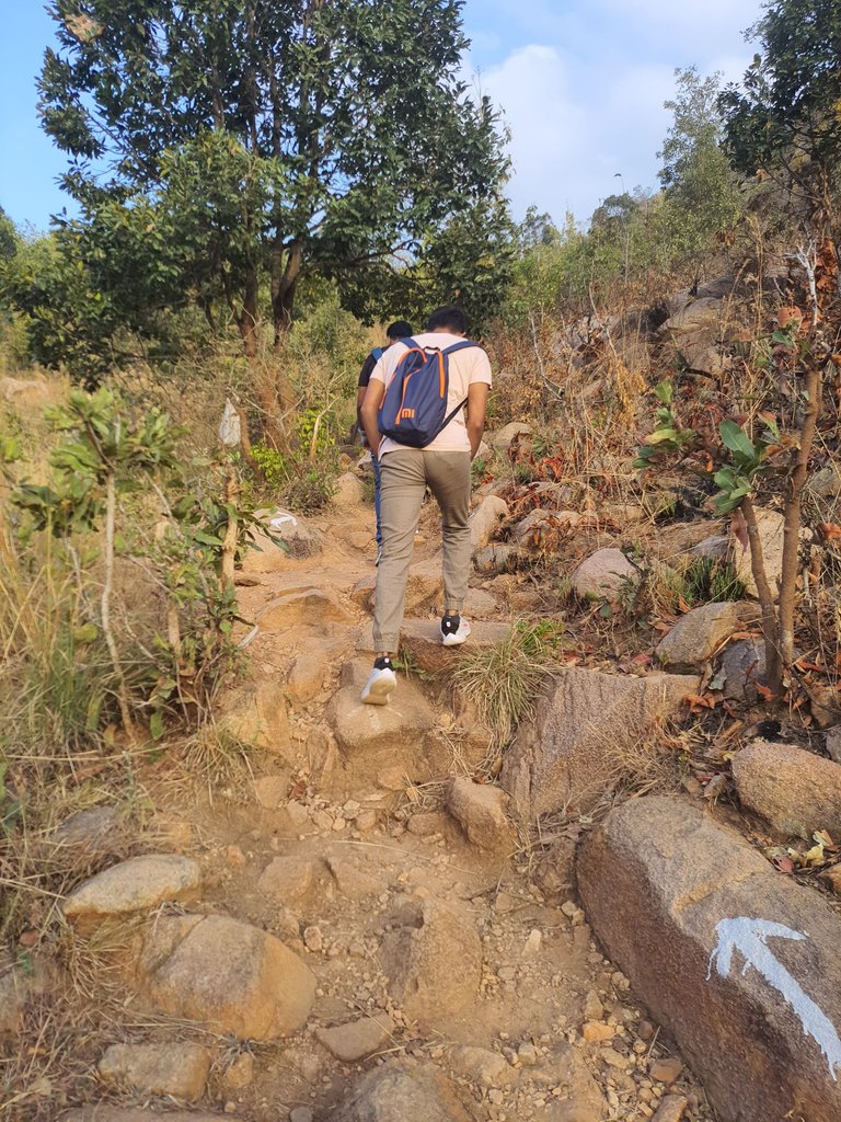
The grass and trees were not fully green at the base, mainly because it didn't rain for some time. Once we have crossed the plains, we have to climb the uneven boulders. This is were our strength gets tested. We have to use our hands to strengthen the grip. It's not that it is not for beginners but it needs some strength because we have to continously climb the boulders and that too uneven ones.
Since the climb became little challenging, we were taking our time to climb. We have taken little breaks in between and also enjoying the beauty. Then came a point were the views started gettinb beautiful.
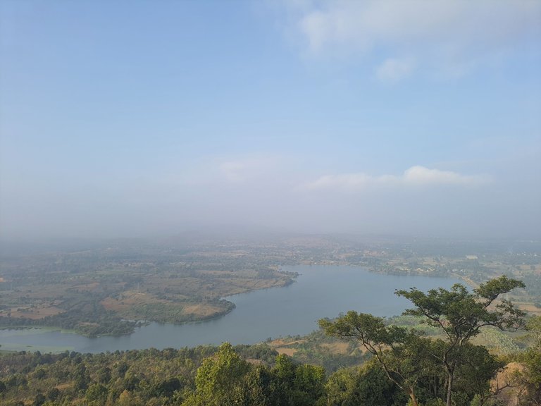
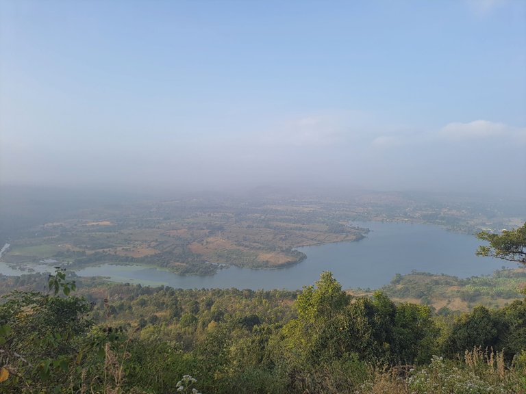
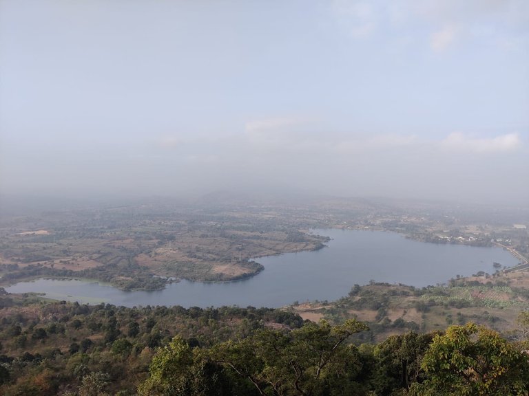
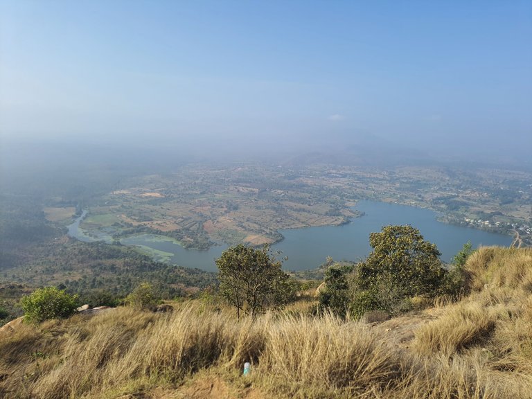
As you can see there is a nice looking lake which is visible from half way of the trek. A cool breeze was flowinv there so we were not that tired. It is just that our breathing has increased a little bit and our blood pressure was little high. We got that information with the smart watch we had.
It took us close to 1 hour to reach at the first stop which had a great looking views.
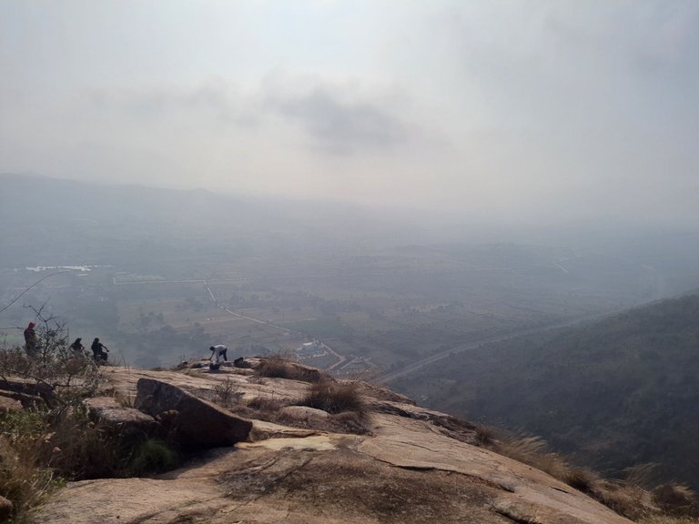
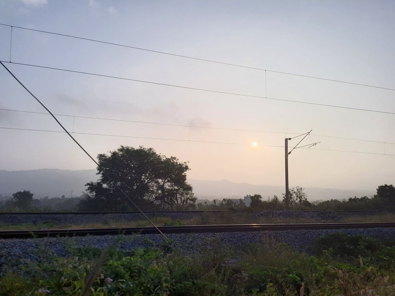
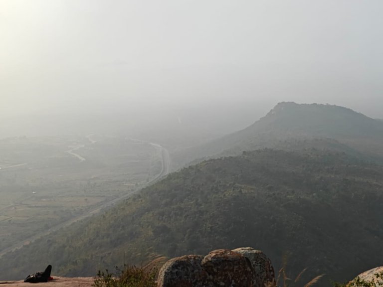
The railway track was visible along with railway station. A adjacent hill was visible. It was little foggy when we reached there. We were hungry, so we had our breakfast at that location and refreshed.
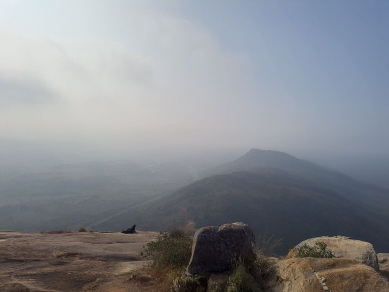
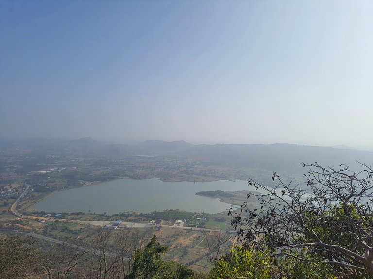
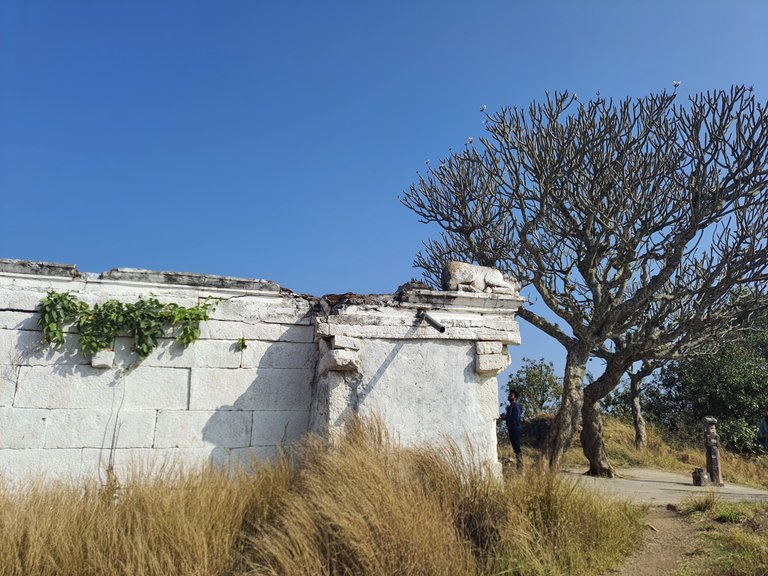
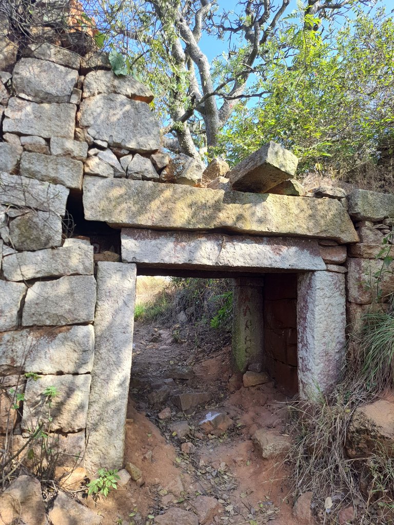
After that we have started again to the next stop which was a little above were we were standing. At the top there was a ruined fort. The trek was relatively easy than before.
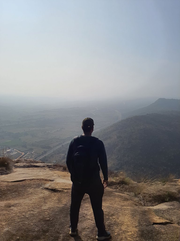
The views started getting better as we reached the top.
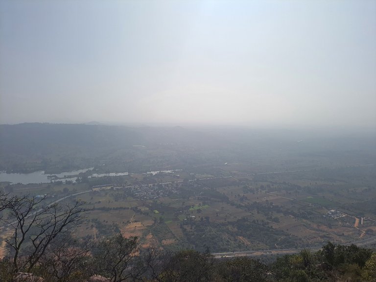
There were basically two lakes visible onbothsideof the hill. As well as some plains.
There was a temple at the top and some ruins of the fort.
We sat at the hill for overall and hour and then started climbing down. Again the first stretch from the top was not that difficult.
But after that it was little difficult because now we have to climb down the boulders and thus we have to be extra careful on the feet because it was little slippery at some point. It took another 1 hour to reach down. It took totally 3 hours including going up, coming down, and staying on the top.
We had coconut water at the base. Note, you do not get anything on top so you should carry water preferably 2 litres because you need a lot of water if you sweat. And then we have started our journey towards Bangalore and reached in another 1 hour. So yeah it was basically a half a day outing where we have done our breakfast on the hill with some breathtaking views.
This post has been manually curated by @steemflow from Indiaunited community. Join us on our Discord Server.
Do you know that you can earn a passive income by delegating to @indiaunited. We share more than 100 % of the curation rewards with the delegators in the form of IUC tokens. HP delegators and IUC token holders also get upto 20% additional vote weight.
Here are some handy links for delegations: 100HP, 250HP, 500HP, 1000HP.
100% of the rewards from this comment goes to the curator for their manual curation efforts. Please encourage the curator @steemflow by upvoting this comment and support the community by voting the posts made by @indiaunited..
This post received an extra 15.96% vote for delegating HP / holding IUC tokens.
Congratulations, your post has been added to Pinmapple! 🎉🥳🍍
Did you know you have your own profile map?
And every post has their own map too!
Want to have your post on the map too?
It is amazing to have breakfast on the hill with an amazing view 🤩
Yeah, it was my second time. First time was having Maggie in Munnar
Thanks
Hiya, @ybanezkim26 here, just swinging by to let you know that this post made it into our Honorable Mentions in Travel Digest #2114.
Your post has been manually curated by the @pinmapple team. If you like what we're doing, please drop by to check out all the rest of today's great posts and consider supporting other authors like yourself and us so we can keep the project going!
Become part of our travel community: