Back in Louisville and I'm already missing the gorge, flipping through photos and trying to figure out how to get back there. For having grown up in the area I sure don't get back there nearly as often as I should.
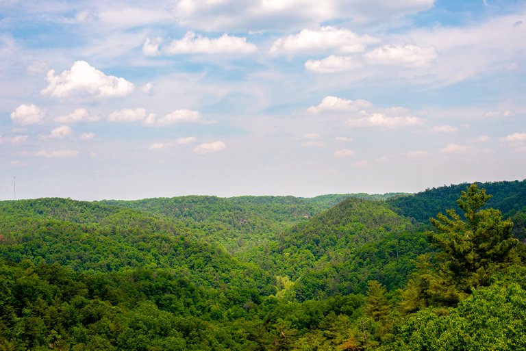
On the way down we could tell we were getting closer and closer as the hills got taller and taller. Rolling down the Mountain Parkway we noticed the highway was lined by amputated trees, as if some giant with a chainsaw had strolled down the shoulder cutting off any limb or tree that looked at the highway wrong.
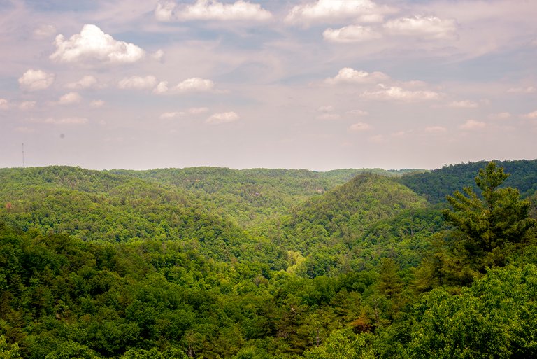
This area is part of the Cumberland Plateau, the hills all level off at about 1250 feet above sea level. If you head a little further down the highway they start getting taller and more uneven but we had more to do in the Gorge than we had time for so we never made it past there.
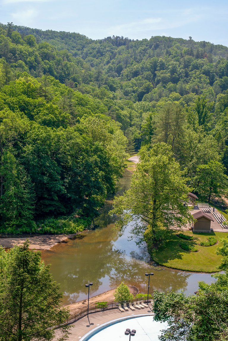
We were overdue for some R&R so after we arrived at our yurt we just relaxed and read and poked around exploring our immediate environs. I grew up about 25 miles from where we were staying, it was a bit different wandering around as a tourist instead of a local.
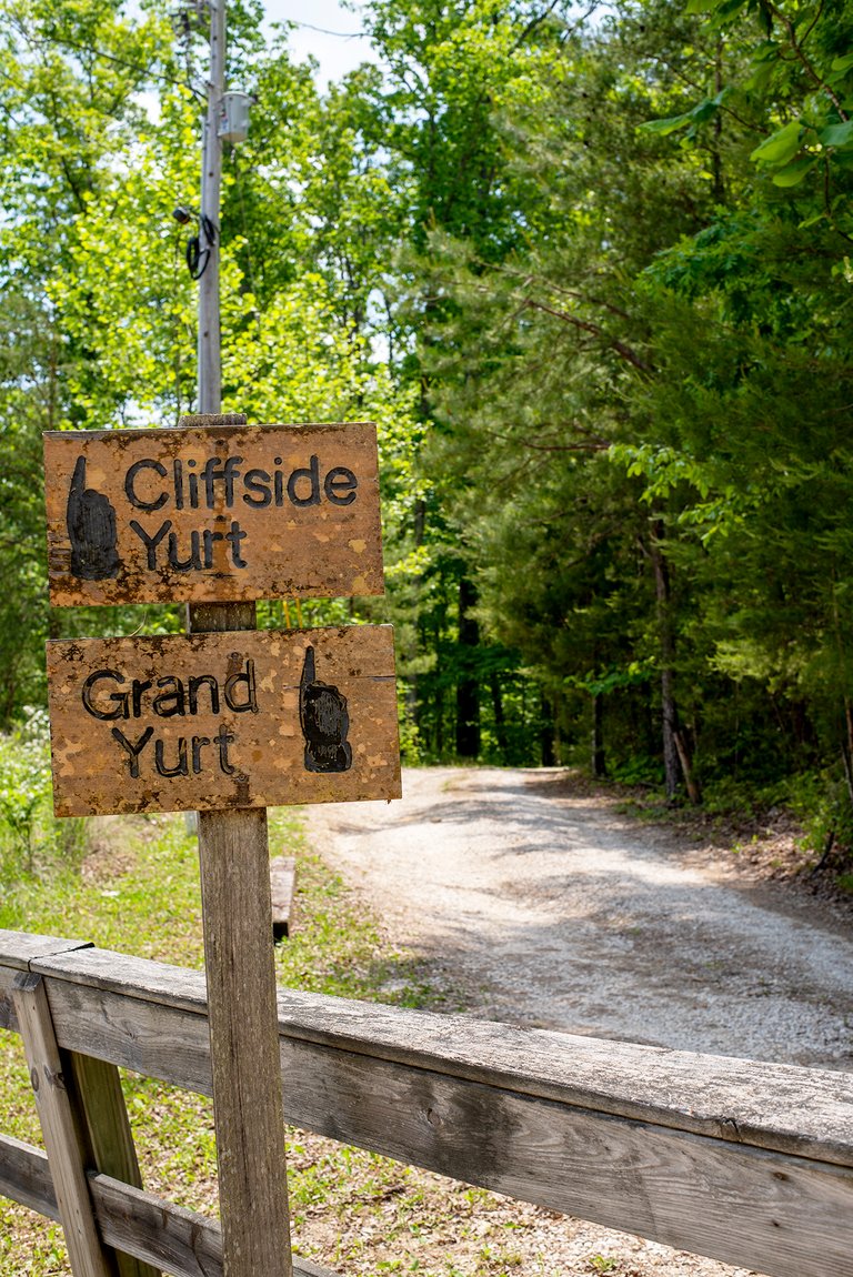
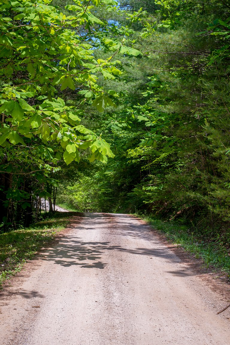
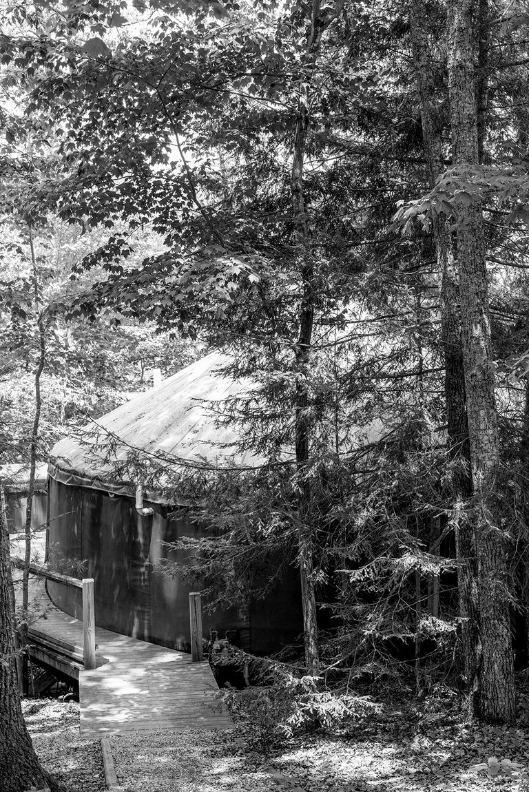
We stayed at the Cliffside Yurt, part of what the map called the Yurt Village. If three yurts make a village then I suppose we were one... To get there we had to pass through a gate with no gate (we had the code for it though!) and then were quickly greeted by a cabin festooned with a Trump 2020 flag just in case we forgot the area had voted 2 to 1 for the former guy. From there we had to turn onto a gravel (I use this term loosely) road that was more dirt, ruts, and potholes than anything else. After about a mile of this we were supposed to turn at the 'black' fence (see photo above) and then we were at our yurt.
Right before we got to the yurt we passed the trailhead for Suzanna Arch, between the state of the road, the arch, and all the flora and fauna to see and shoot around the yurt we didn't move the car again until it was time to check out.
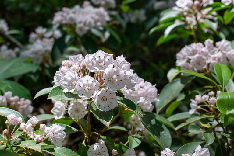
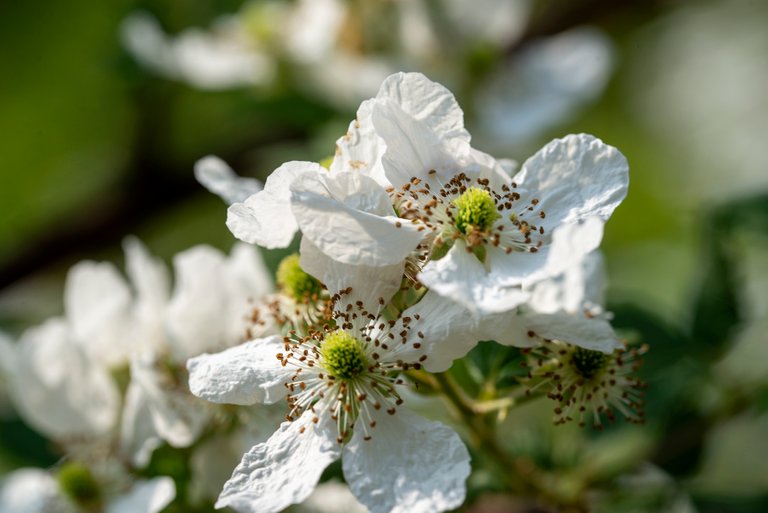
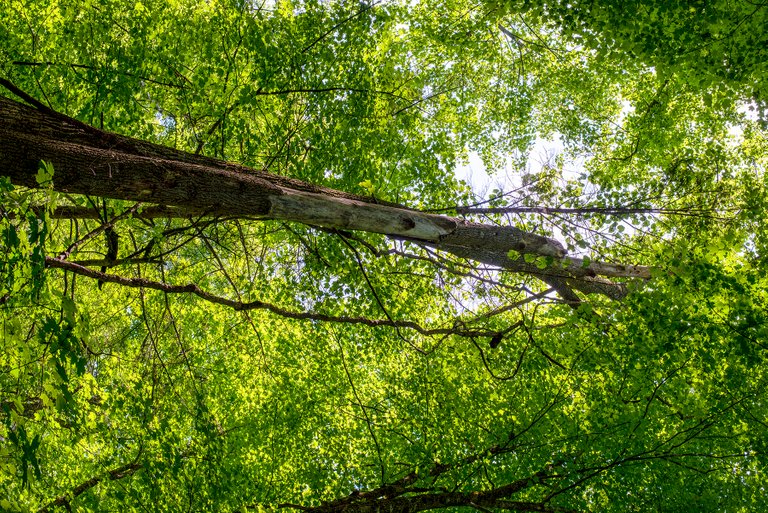
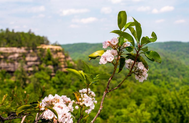
The mountain laurel was blooming (above) all around the yurt and lent the air a lovely smell. There were also lots of blackberry briars in bloom around us (below), hinting at the tasty snacks that July will bring.
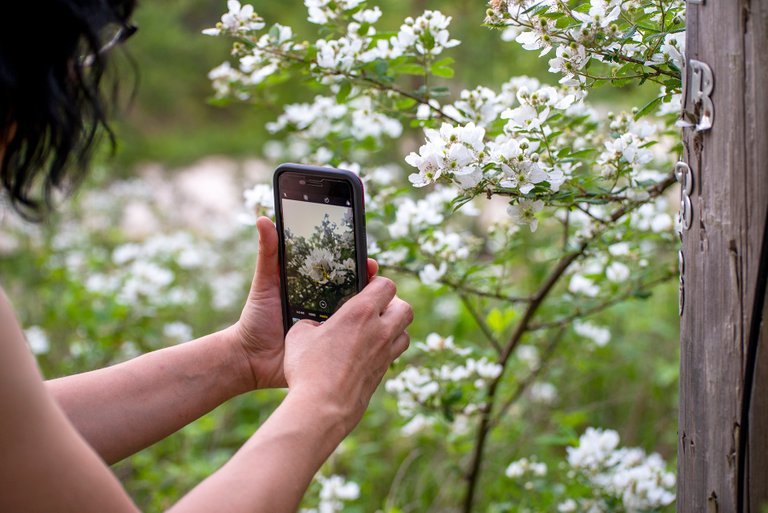
Naturally we had to take lots of photos and the sun had slid below the hills before we knew it.
The next day we were up and raring to go at the crack of noon (that's what this vacation thing is about right?) and set out to see the Suzanna Arch. I'd been reading about it before we left and had discovered that it was a private trail only open to the people staying right around where we were so we couldn't pass that up.
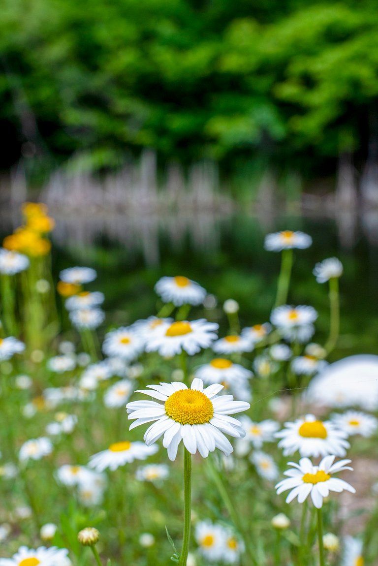
Naturally we got distracted by the wildflowers and the nearby pond and spent an hour taking photos before we even made it to the trailhead (it wasn't a five minute stroll from our yurt).
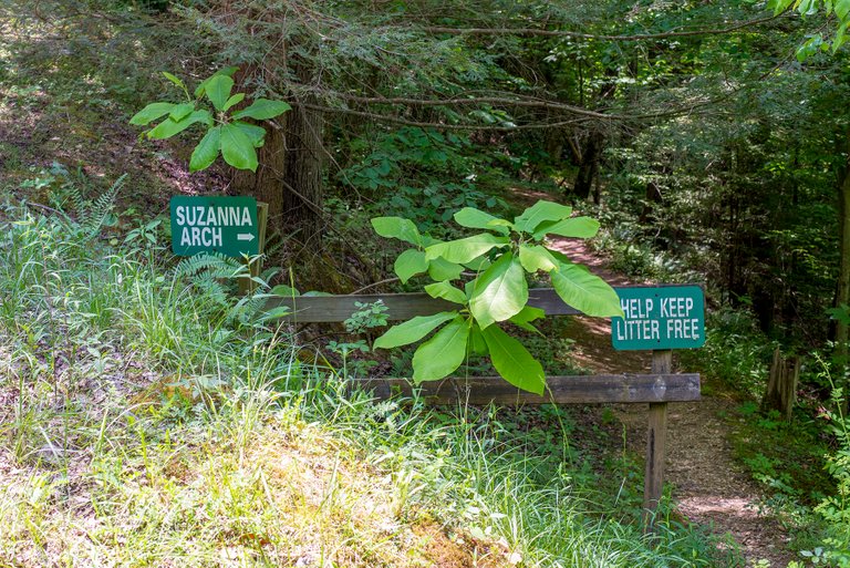
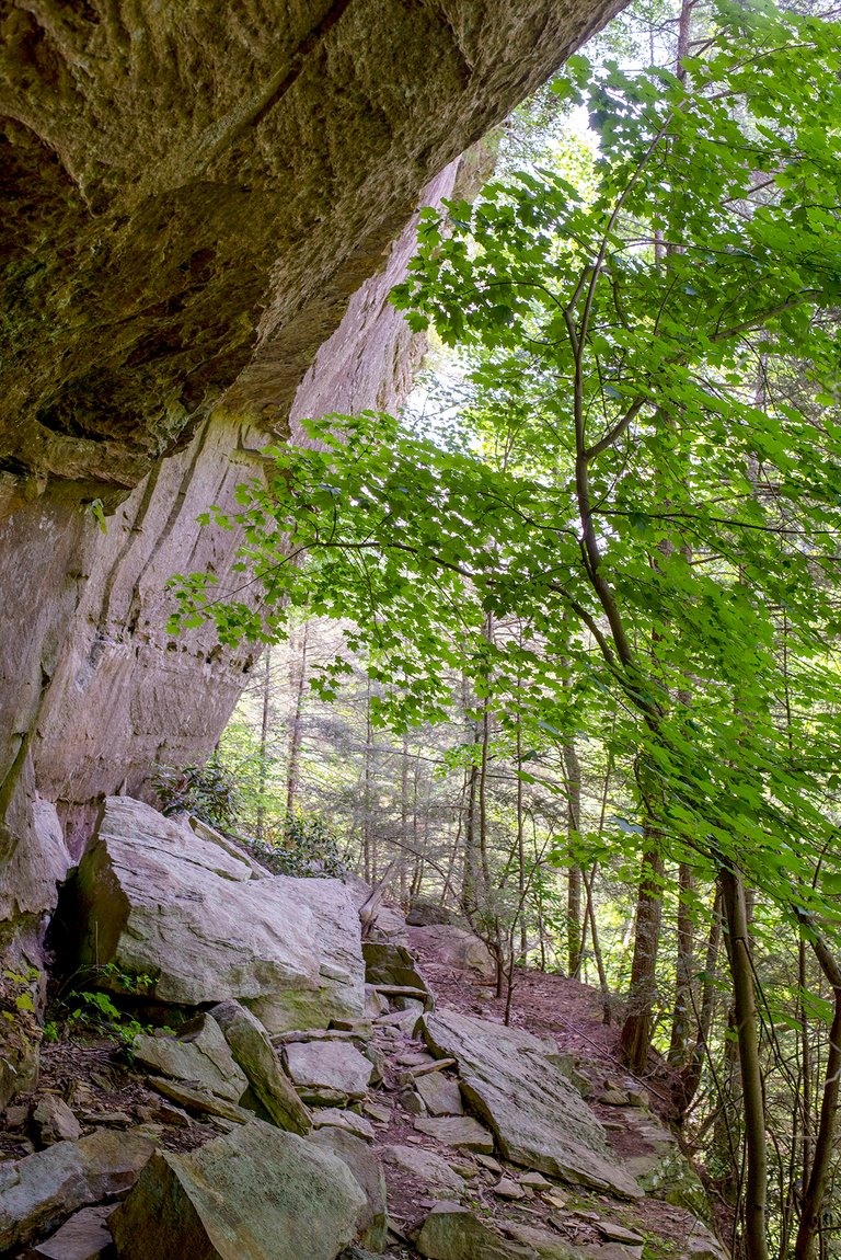
The trailhead was of the understated variety and the trail was of a similar sort. It was a mile and a half out and back that was described as 'moderate to strenuous'. We haven't done much hiking recently so it definitely came in on the upper end of that scale.
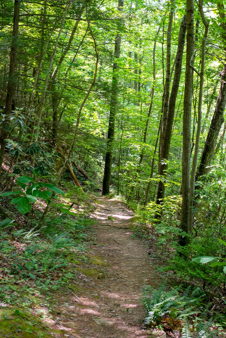
One minute the trail would be headed steeply downhill, the next you were going uphill on a similarly steep grade. I had a blast, it was much like hiking along the creek that runs through my homeplace, following it down to the Kentucky River we would traverse very similar terrain. There was so much to see from and along the trail even without the arch at the end it'd be worth the hike.
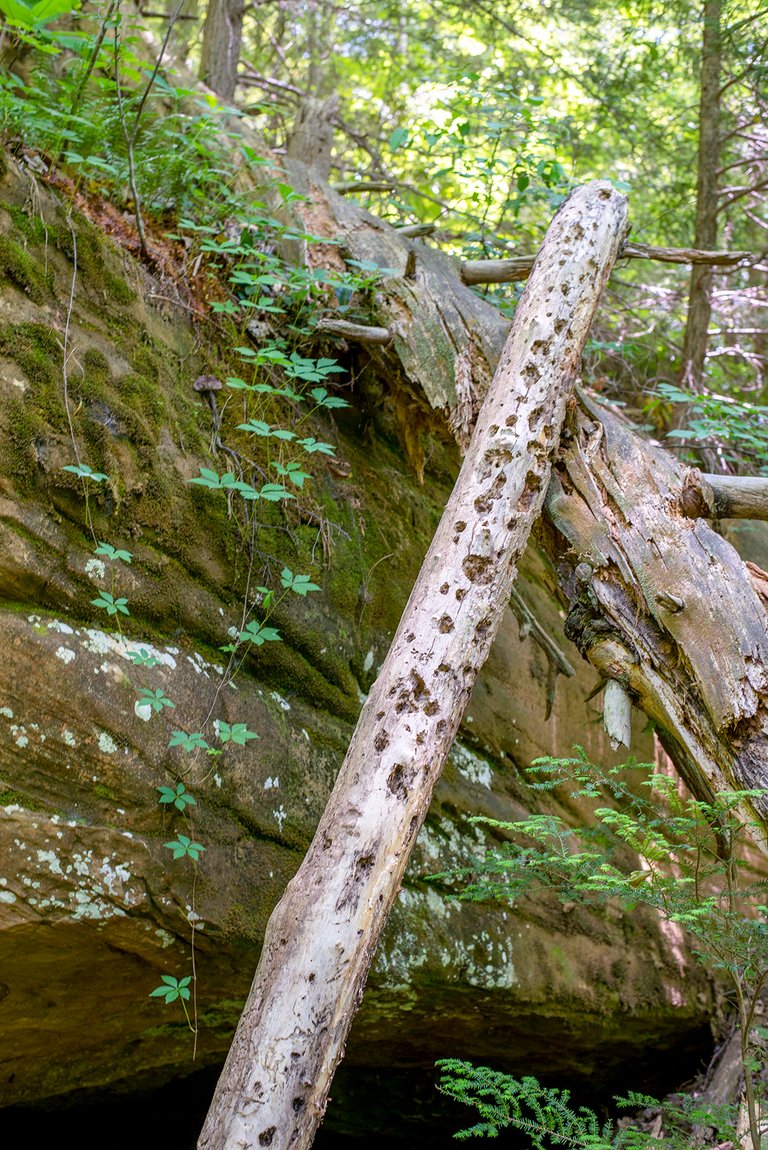
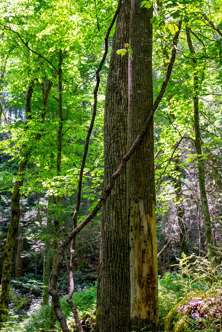
We passed this on the trail, when you see a log looking like the one leaning against the rock it usually means a red-headed woodpecker has been dining there. The night before we'd spotted one while sitting on the deck at the yurt, with how little distance we were from there it's quite possible we had sighted the destructive diner.
There and back took us a bit more than three hours but we were always stopping to take more photos. With the heat and humidity we probably didn't take enough water but we made it back alright. The whole time we were hiking we never saw another person, only the occasional barking of a dog intruded upon the sights, sounds, and smells of the woods.
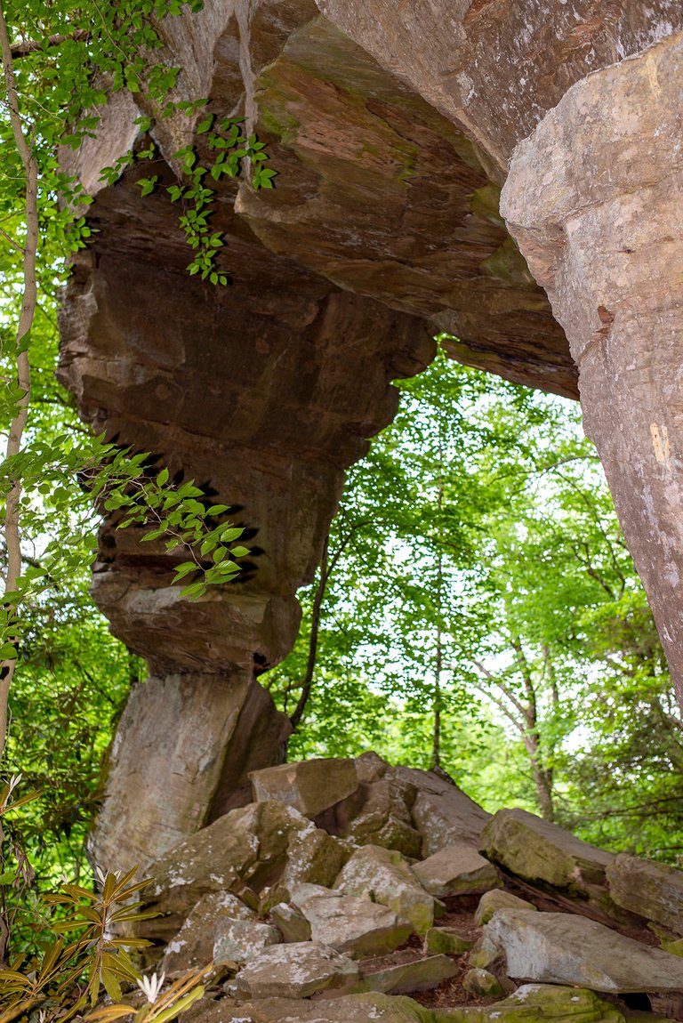
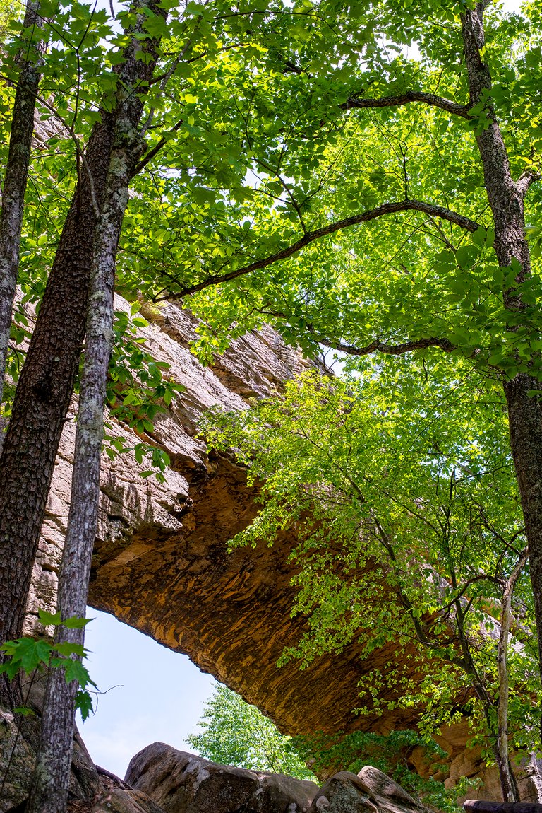
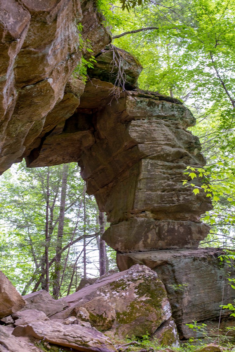
Suzanna Arch was definitely worth the hike, above is the far side of it and below is the near side of it, from the trail.
After getting our fill of taking photos we hiked back to the yurt and grilled us some vittles. We were cooking by flashlight so there's no photos to make you jealous. Some unsolicited advice for y'all: If you're planning on grilling corn on the cob, try soaking them in some sugar water for a while before wrapping it in foil and tossing it on the grill. It's never done wrong by me and sure was tasty that night.
The next morning we had to check out and head back to Louisville but we couldn't bring ourselves to leave just yet. We decided we couldn't leave without paying Natural Bridge State 'Resort' Park and Miguel's Pizza Restaurant a visit, especially since they were on the way back to the highway.
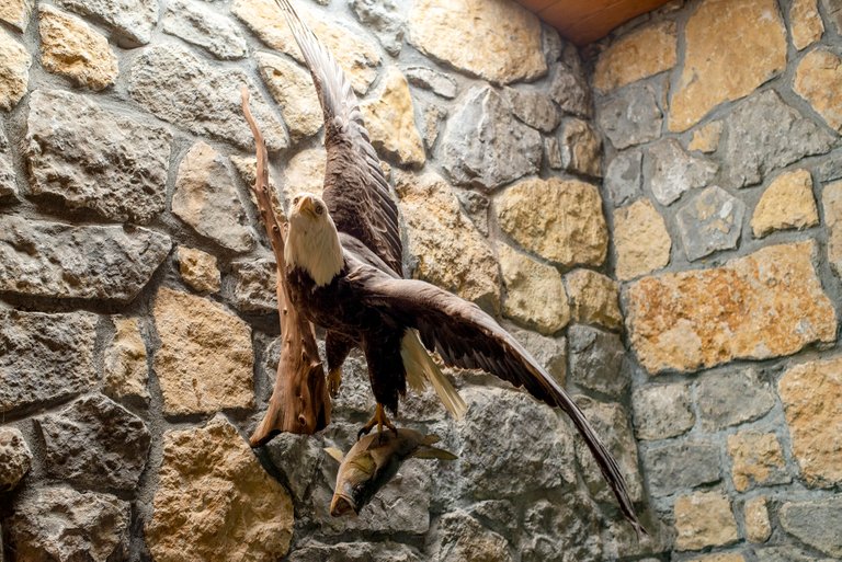
I'm not sure how Natural Bridge earned the resort part of it's name, maybe the bald eagle clutching a bass mounted on the wall? The word resort just calls to mind enclaves full of rich drunk people carved out of the poor areas of Mexico, while they've gentrified the hell out of the area and legalized the sale of alcohol, something is still lacking. The park did get it's start as an excursion destination for one of the local railroads, so it kinda tracks. The L&N Railroad bought it from the railroad that built it but in the 1920s gave it to the state of Kentucky to be a park.
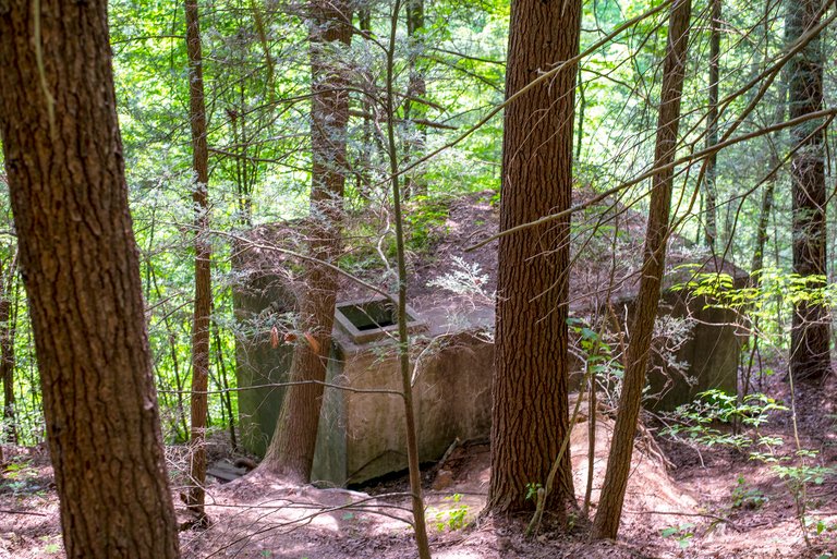
The Civilian Conservation Corps built a good bit of stuff at the park and the general area as well, I suspect the structure in the photo above is a remnant from that. While I'm not particularly impressed with Hemlock Lodge (I may be a bit jaded, I've been there countless times), the main attractions of the park are natural and they're much more impressive. The park is a nature preserve meant for passive enjoyment (you can't even have pets on the trail), those seeking more active pursuits are directed to the nearby Red River Gorge.
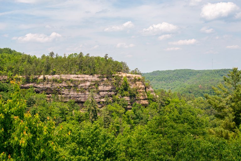
The park has over twenty miles of trails, all of which (I think) have at least one terminus at the Natural Bridge that gives the park its name. We hiked the 1.75 mile Rock Garden Trail up to the bridge.
Even though the temperature was climbing towards the 90s (it ultimately hit 92F), much of the trail was in the comfortable cool cover of the woods.
We passed a couple of trees with what we always called grapevine hanging down (the skinnier vine/tree looking thing next to the two trees in the center of the photo above). As kids we'd swing on it, it often grows near water and usually we were using it to swing out over a creek or the Kentucky River.
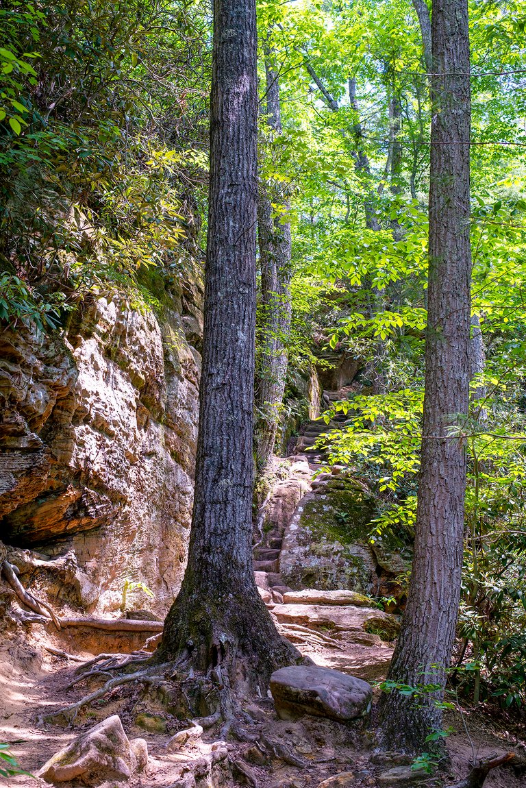
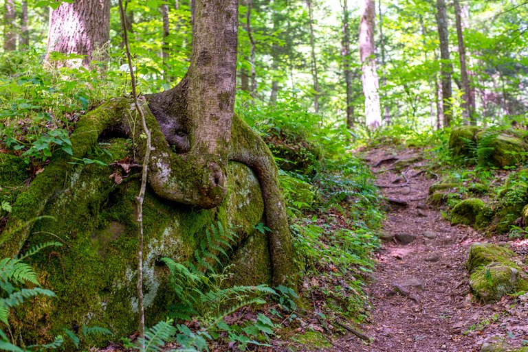
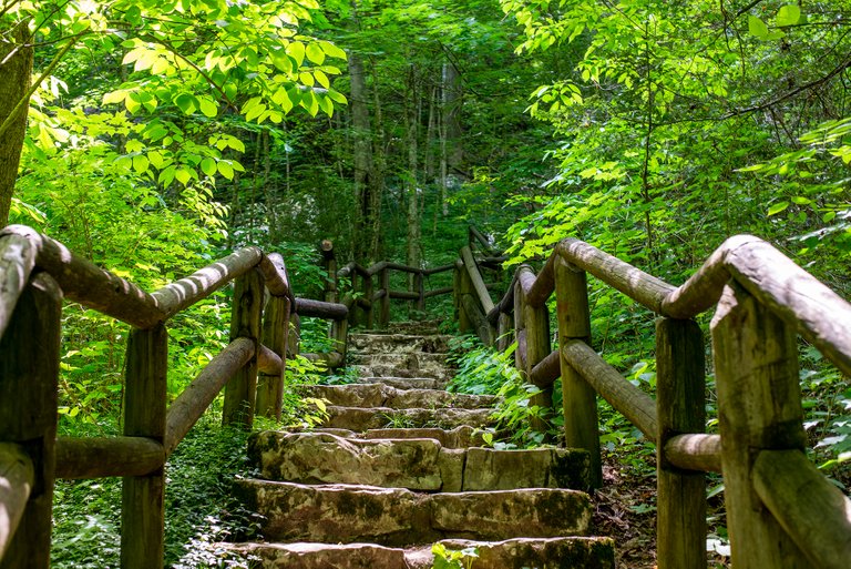
The trail passed through woods, along the foot of cliffs, and even had some fun stone steps. Don't know how fun they'd be after a little rain though...
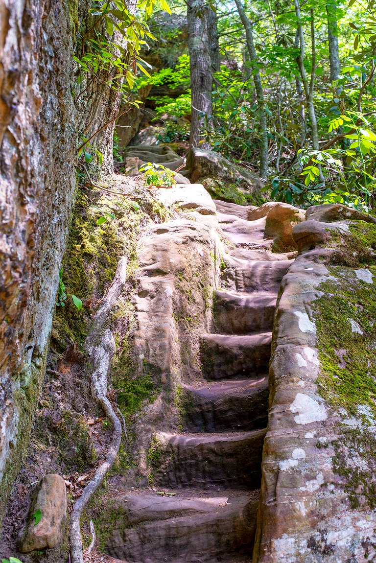
They just kept going...
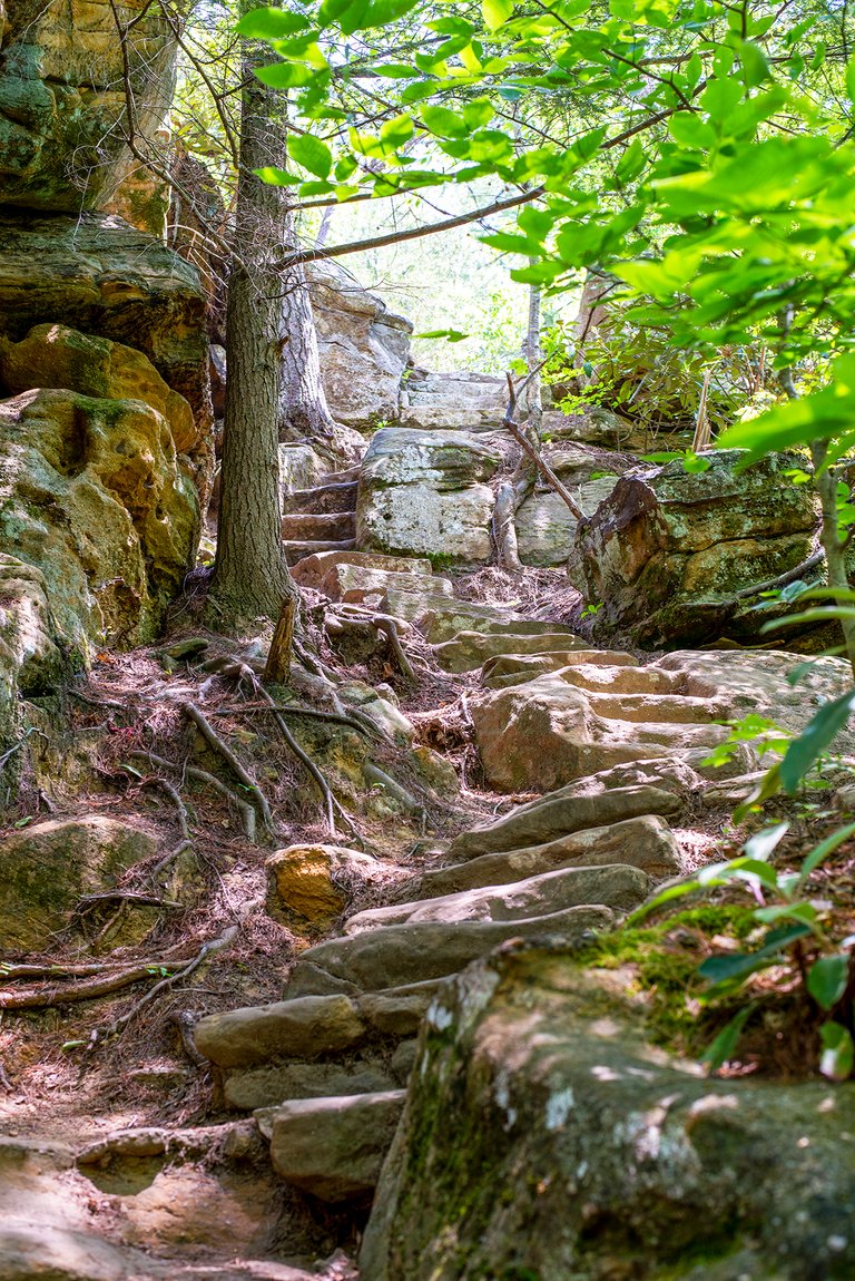
Once past the stone steps we could tell we were starting to get close to the bridge, with the temperature and the wind both increasing.
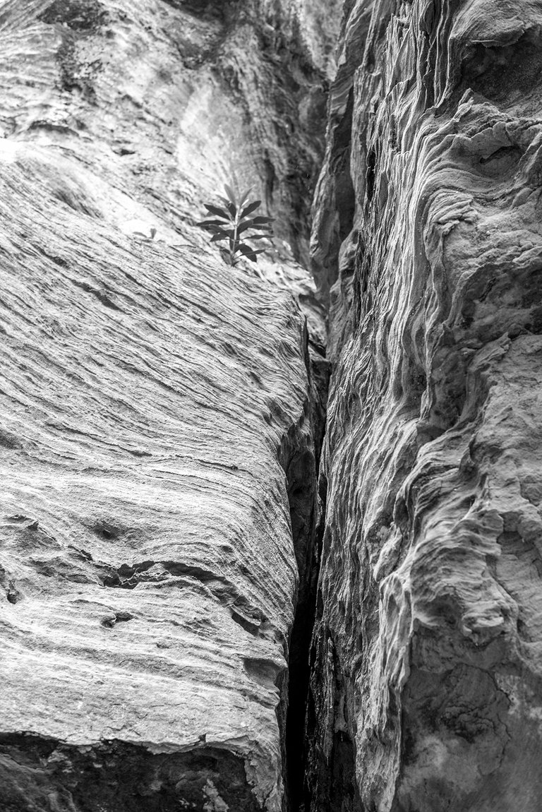
Some of the rock formations cracked me up.
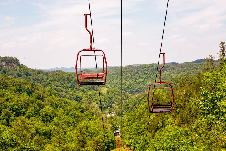
When we wandered out under the chair lift we knew we were getting close.
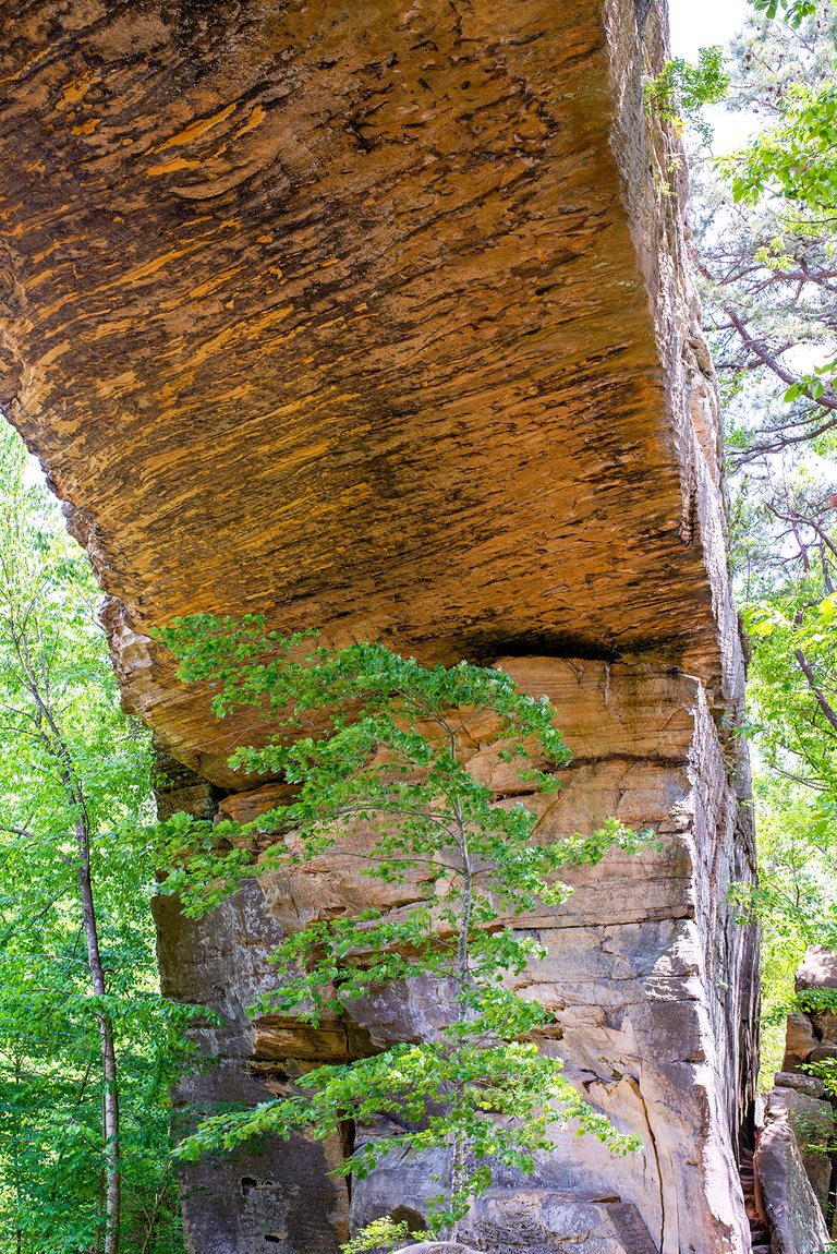
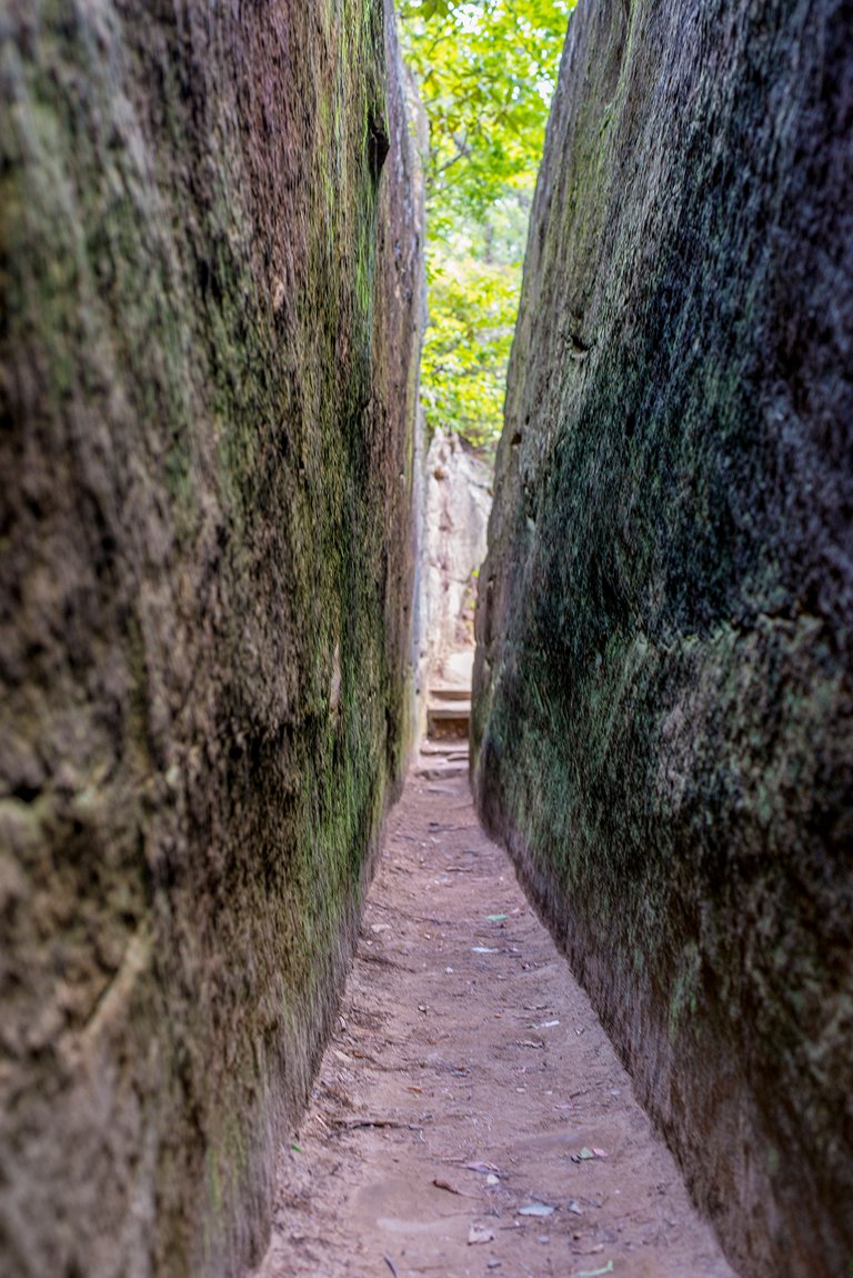
Finally the trail come out under the Natural Bridge. The bridge is 78ft (24m) long and 65 feet (20m) high and was well worth the hike. After polishing off most of our somewhat scant water supplies and catching our breath we headed through Fat Man's Squeeze (below) and on up to the top of the bridge.
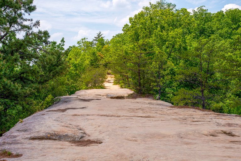
I'll let you judge the view from the bridge for yourself, there was a nice breeze blowing on top that made it all the more pleasant.
By this point we were a bit thirsty and more than a bit hungry so we headed back down the 0.75 mile Balanced Rock trail back to Hemlock Lodge. We'd saved it for the hike back down because it was steeper, made for a nice easy decent, albeit with lots of steps.
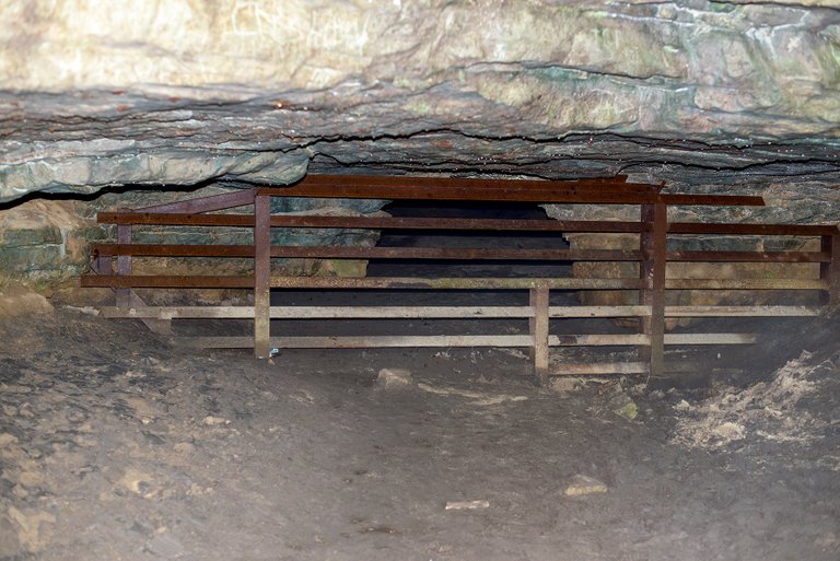
We accidentally blew right on passed the balanced rock without noticing, but we did stop and take a peek at the cave. The metal barrier over the entrance was new to me, I'd been in there with my dad when I was younger. That time our flashlight died and the only source of light we had was the matches in my pocket that I wasn't supposed to have. Talk about a conundrum...
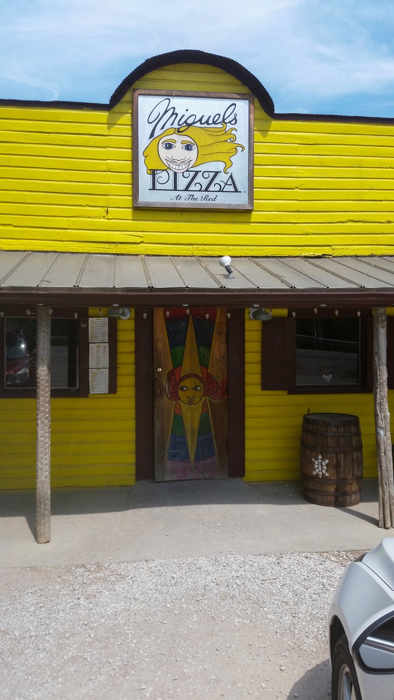
We had one last stop before hopping on the highway and heading back to Louisville and that was Miguel's Pizza Restaurant. I've driven past it countless times over the years and had never once had their food. They sell bumper stickers of that odd looking logo and I've happened across it in the most unexpected of places. We may have just been hungry but that pizza tasted mighty good and I got to wash it down with an Ale-8 in a returnable bottle (the good heavy glass ones with a deposit when you bring it back) which made it a double treat. With our bellies full we headed back to Louisville, thoroughly vacationed and ready to plot further mischief.
Now, you made me miss hiking more! 😭
Sorry about that! We were long overdue for some, hopefully you can get some hiking in soon!
Great post Colonel! I used to visit relatives in your fine state when I was growing up, but this was a place we never visited. Looks beautiful!
Thanks! Whereabouts did you use to visit?
It is! I've been more times than I can count but it keeps luring me back.
My family was from Ohio and Muhlenberg counties in western Kentucky. We used to spend time at Lake Malone. Great memories!
Ah, nice! I grew up listening to John Prine sing about Muhlenberg County but have only passed through on my way to Land Between the Lakes. Somehow I'd managed to have never heard of Lake Malone until you mentioned it, gonna have to add that to my list of places to visit, thanks!
Congratulations, your post has been added to Pinmapple! 🎉🥳🍍
Did you know you have your own profile map?
And every post has their own map too!
Want to have your post on the map too?
Your content has been voted as a part of Encouragement program. Keep up the good work!
Use Ecency daily to boost your growth on platform!
Support Ecency
Vote for Proposal
Delegate HP and earn more
!PIZZA
It really is, I'm already regretting leaving!