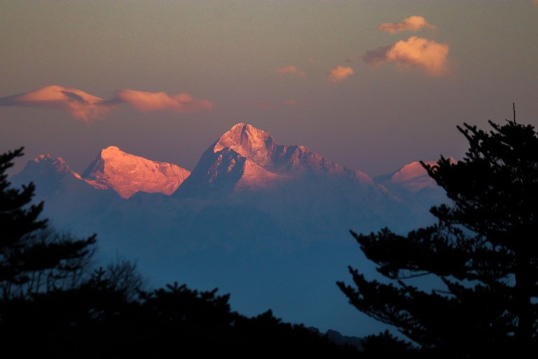
I can't believe it but it is true, I was standing at a place from where the world's highest peak 'Mount Everest' was visible and on the other side India's highest peak named 'Kanchenjunga' was shining. After the rain at night, I started feeling that we would not be able to see Everest in the morning. Let's go and find out which place I went to from where this view was visible.
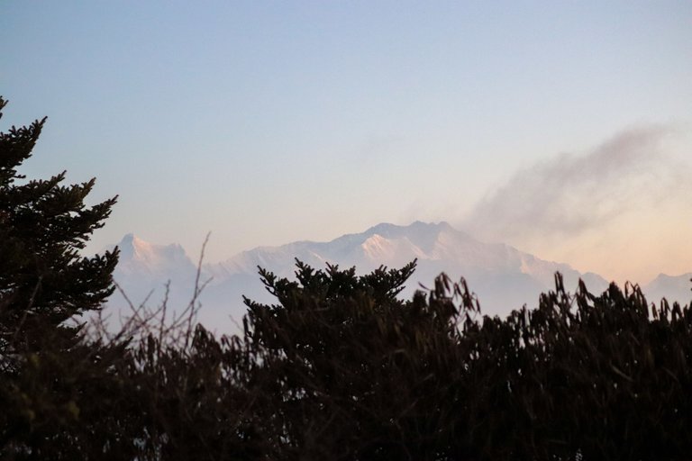
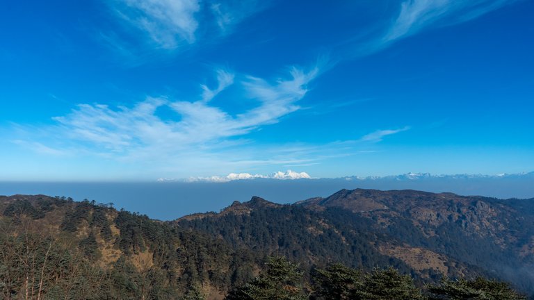
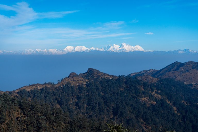
 The world's highest peak Everest and two other 8 thousand meter high peaks in one frame
Best Bengal state is situated in the east of India, this state and the country of India share its borders with the country of Nepal. Rimbik is a small village in West Bengal which comes under Darjeeling Hill Station. Now if we talk about National Park, this place comes under Shingalila National Park. Nearest airport is Bagdogra from where Darjeeling is at a distance of 60 km and it takes about two and a half hours to cover this distance because the entire route is hilly.
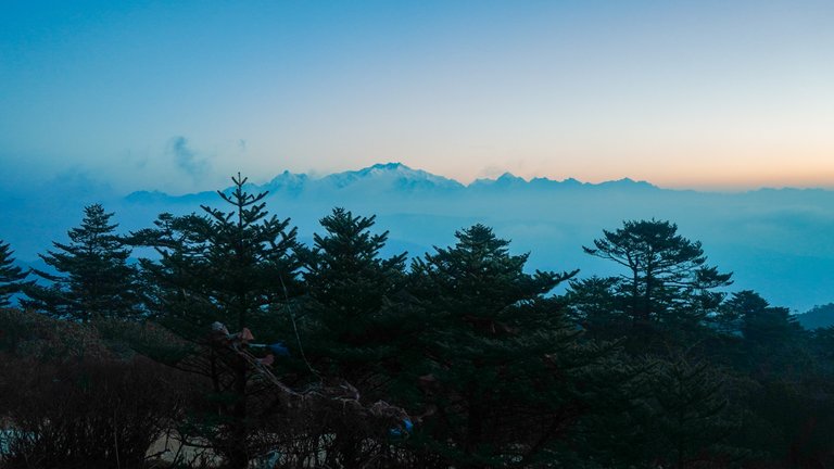
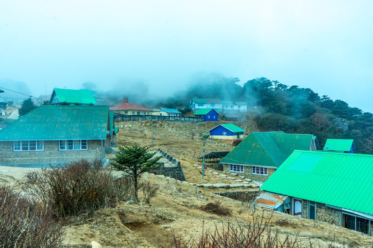
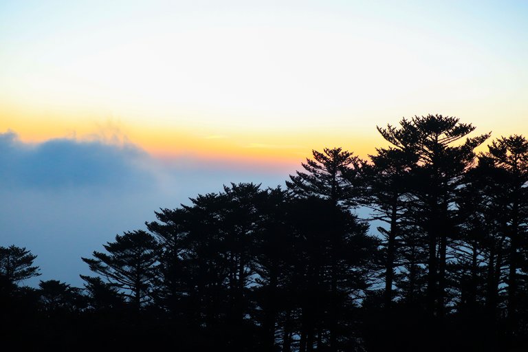 The morning vibes
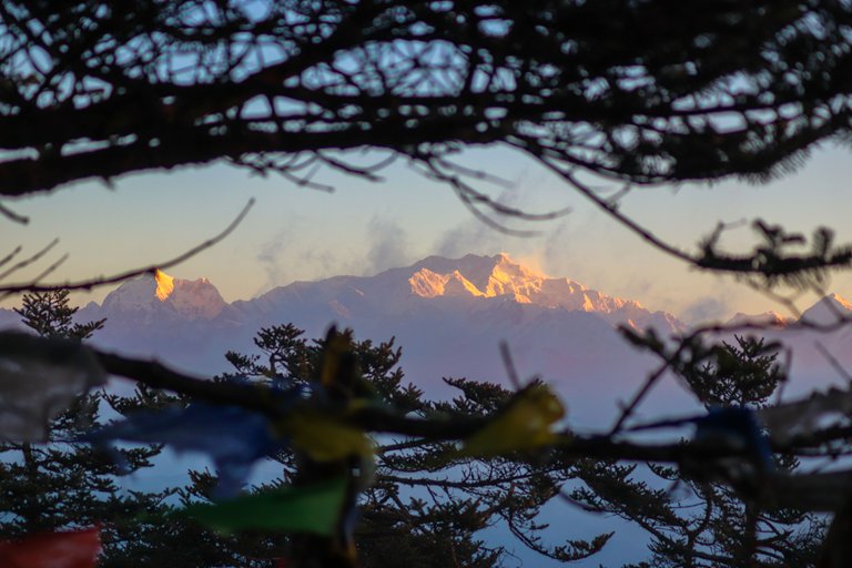
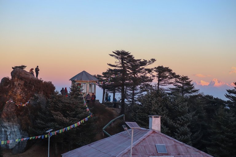 Tourists rejoice with the first rays and the sight of Everest
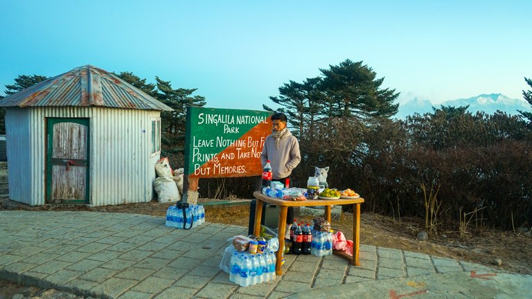
The distance by road from Darjeeling to Manebhanjan is 25 km and it takes about 40 minutes to cover. This is a matter of breaking opinions, now let me tell you why I have come here. For the last 4-5 years, a 'Trail Run' is being organized in Shingalila National Park and I have come here to volunteer in this event. One category of this event is 65 km long which will start from Rimbik village and go to Sandakphu from where it will reach Phalut and then straight to Rimbik and finish.
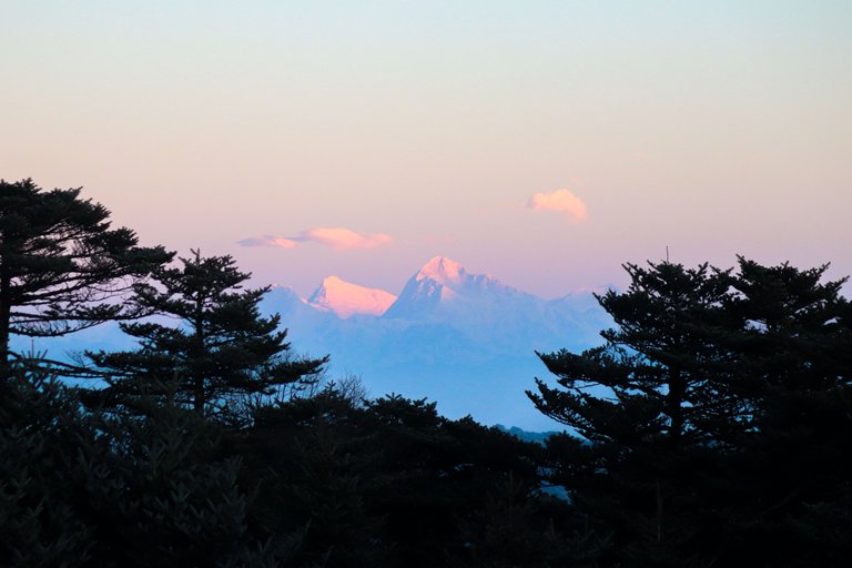
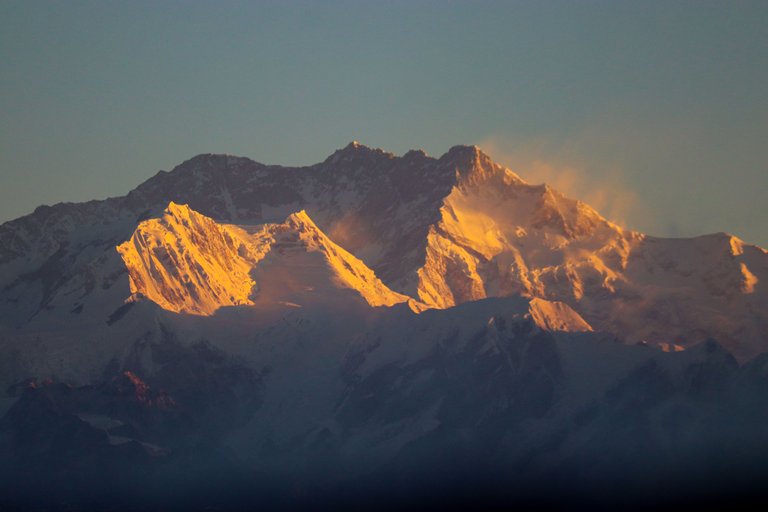
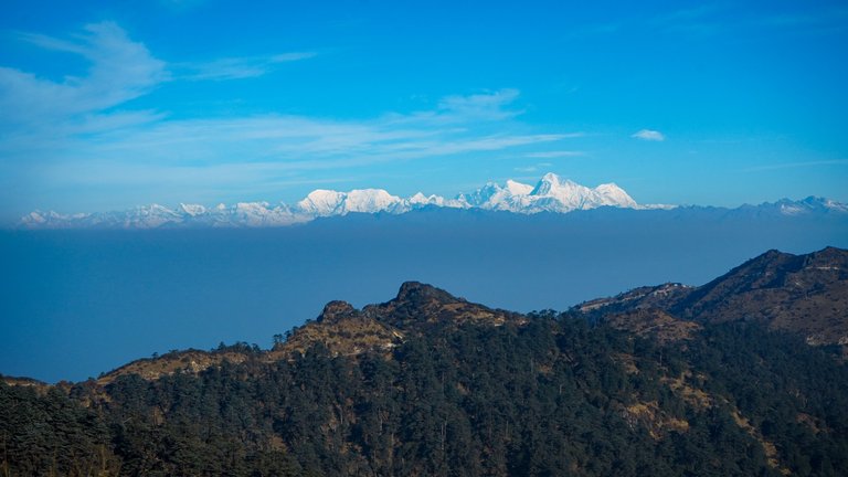
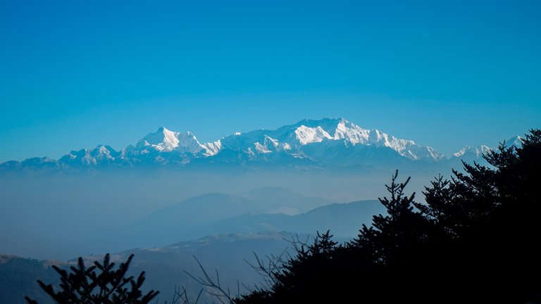
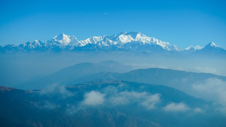
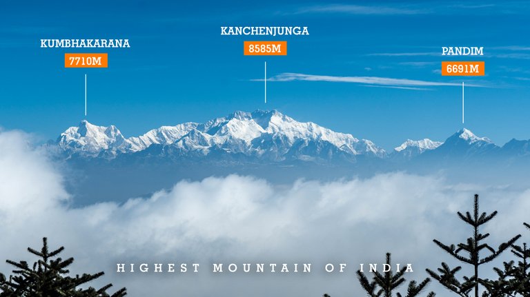
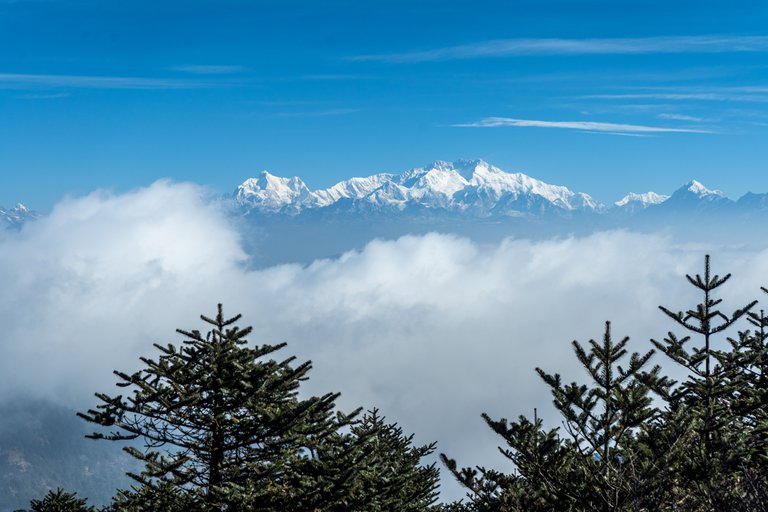
 India's highest peak Kanchenjunga
 India's highest peak Kanchenjunga, 8585 meters
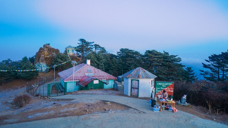
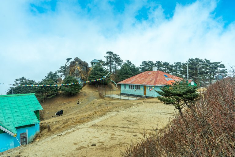
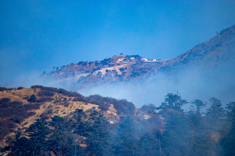
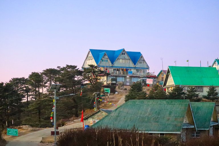 The blue roof hotel in Nepal and the green roof buildings are in India
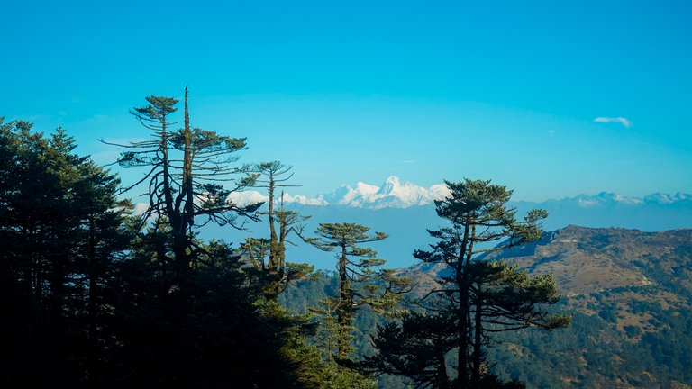
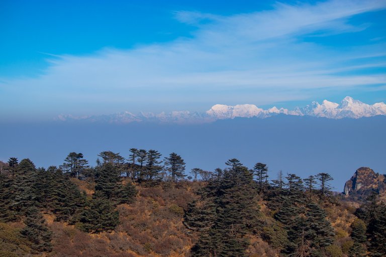
In this event, I have to go to Sandakphu and get 4 hydration points set up, after which I have to do photography of the runners. Well, let me tell you that Sandakphu, whose height is 3636 meters above sea level, this peak is the highest peak of West Bengal and because of getting this title, many tourists come to Sandakphu to spot Everest and Kanchenjunga. It is a very funny thing that after reaching Sandakphu, the eyes remain less on the earth and more towards the mountains.
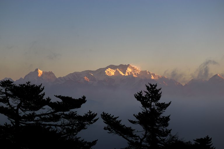
 People eagerly waiting to see Everest and Kanchenjunga after sunrise
The ridge extending from Sandakphu to Phalut which is 21 km. I buy hydration for the long ride and hop into the car with my 3 other friends. A 32 km long road has been built from Manebhanjan (1928 m) which is located on the India-Nepal border to Sandakphu. But at this height of the mountains, it feels less like a road and more like a roller coaster ride. If you have the problem of motion sickness, you will throw out the eaten food from your mouth very quickly. Neither did I eat food nor did I feel the problem of motion sickness, hence I reach Sandakphu safely.
 Our hydration point with Everest shining in the sunlight behind it
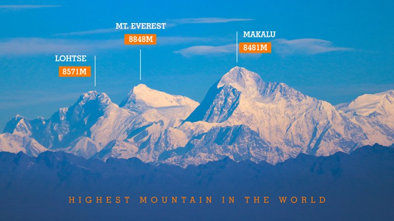
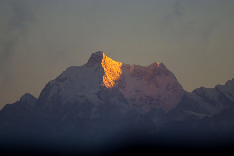
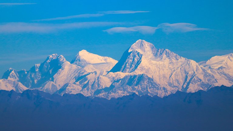
 Mount Everest, 8848 meters in middle and right one is Makalu 8481 meters
 Right to left: Lohtse (8571 m), Mount Everest (8848 m) and right one is Makalu (8481 m)
After reaching Sandakphu, I along with my friends take down the stuff from the car at the hydration point set up here and keep it in our room. We have to set up station at 05:30 am and the race will start at 4 am from Rimbic. This place is only 18 km away from the start point but in this 18 km one has to fight an elevation gain of 1950 meters. According to me the first runner will arrive here between 05:30 and 05:45. After dinner, we do all the planning and go to sleep so that we can wake up early in the morning.
 The Kumbhakaran peak 7710 meter
 India's highest peak 'Kanchenjungha 8585 meters'
 This view famous as 'Sleeping Buddha'
As soon as my eyes opened, it started raining. I woke up at 11 o'clock in the night and looked outside and saw that it was raining heavily. I think positively and get into my quilt again thinking that the rain will stop and tomorrow I will see Everest along with Kanchenjunga. The temperature here is in minus. I sleep when it stops raining, it stops around 3 o'clock. In the morning, I get up before the alarm rings and start my work by saying good morning to my colleagues.
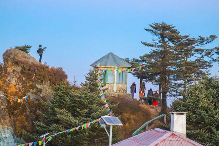
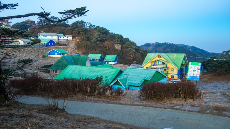
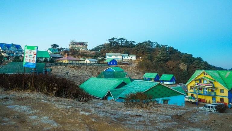 This area called Sandakhphu which is west bengal highest peak 3636 meters)
 Race hydration point at Sandakhphu with our volunteer
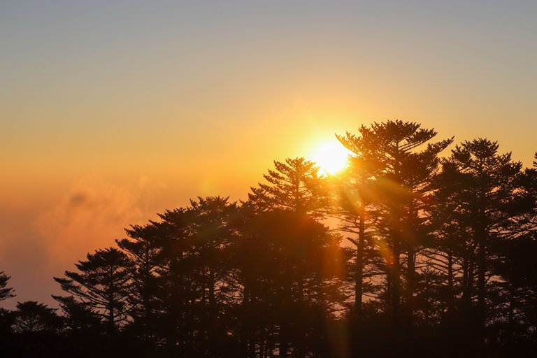
We set our hydration point at 05:20 minutes and it was as expected. The first runner reaches here at 05:35. It was very dark at 5:30 but within the next 10 minutes the place was caught by the sunrise. The sunrise came from behind us, by now even the clouds in the sky had gone. Now the hope of seeing Everest and Kanchenjunga had increased even more. It is believed that the best time to see the view from here is from November to February. After February, light rains start, due to which there is dense fog almost all the time in which leave alone Everest, one cannot see even 10 feet away.
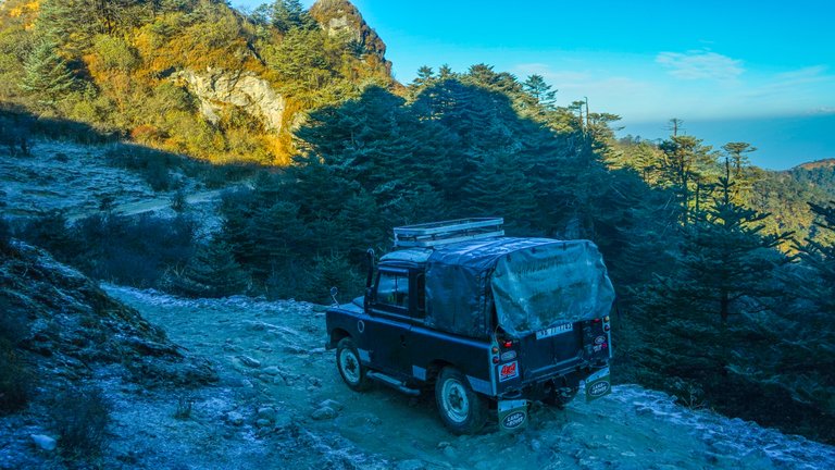 The 70 year old Land Rover which still runs here
 The Everest massive
As soon as I see the sun on the horizon, my happiness knows no bounds because in my north I can see Kanchenjunga covered in yellow light, while in my west I can see the world's highest peak Everest. The first rays of the sun have made this view golden. I feel as if the entire mountain is made of gold. Of course, I made some amazing clicks with the camera, but to stand in front of this huge view with naked eyes was a great and honorable thing.
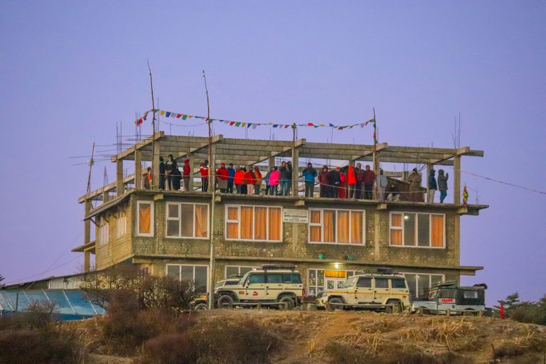
The tourists present here get up and stand on the roof of the hotel to watch the sunset, admire Kanchenjunga and shake hands with Everest. Our team is working faithfully in their hydration points, so I tell them and move a little further on the route from where a clear view of the mountains can be seen. After going about 2 km further, I found a spot where I could click photos of the runners along with Kanchenjunga and Everest. Here the wind is cold and the temperature is very low, so I am wearing gloves on my hands because the body of the camera has become so cold as if I am holding ice. I am afraid that the camera's battery may get drained in this cold.
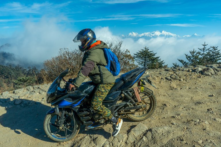 Nepalees drive here two wheelers
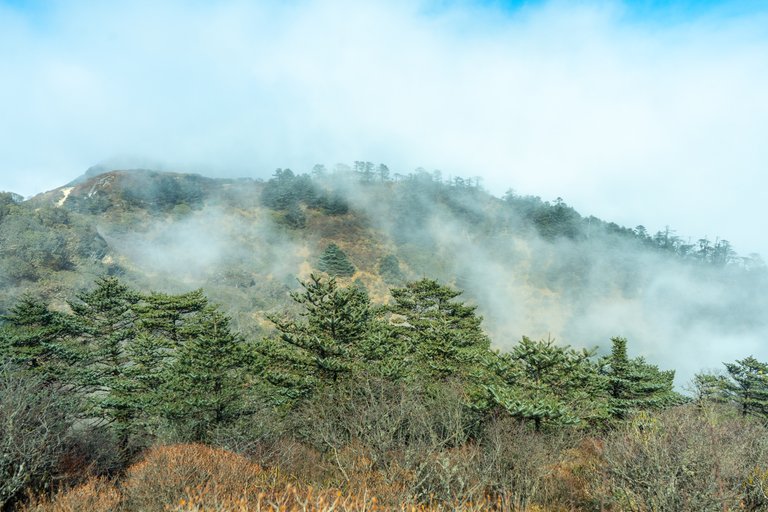
Clouds are dancing on the ridge extending from Sandakphu to Phalut, sometimes everything gets lost in the clouds and sometimes everything is visible very clearly due to the strong wind. This game of hide and seek continued until my work here was completed. For this reason, photos of some runners could neither be taken with Everest nor with Kanchenjunga. Some runners even waited for the clouds to go away but it did not happen. Overall I manage to click photos of 61 runners. Now it remains to be seen how many runners will reach the finish line and wear the finisher's medal around their neck.
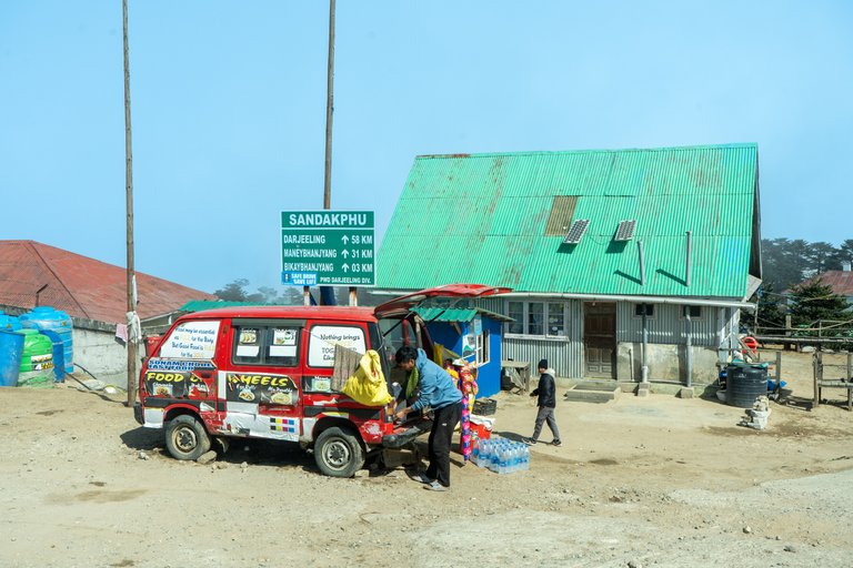 Food van at Sandakhphu
Runners have to reach Sandakphu within 7 hours as per the cutoff time of the race and if the runners do not reach here within 6 hours of the start of the race, they will be disqualified. By 10 am, when all the runners cross from here, I start walking back from here towards Sandakphu. On my way back I meet a motorcyclist who is from Nepal and is going towards his shop. According to the Government of India and the Forest Department, only 4x4 vehicles can drive here, these vehicles have a permit to drive in Shingalila National Park. Two wheelers are prohibited from running on Indian soil.
 Mount Everest
Let me tell you one thing, Land Rover cars of British era still run on the road built in this National Park. It has been more than 70 years since these trains have been running here. That is a different matter, now these old vehicles have been fitted with the engine of Mahindra Bolero, which is an Indian car manufacturing company. And this was done because it was impossible to get parts for such an old vehicle. Most tourists use these cars to reach Sandakphu and Phalut. Some enthusiasts also cover this difficult route on foot and by bicycle. Actually, I also enjoy walking a lot and if I did not have this responsibility today, I would have liked to do this trek on foot.
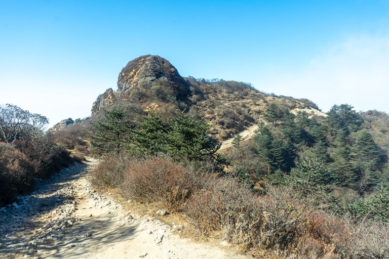
I see a high rock on the way on which people stood in the morning to witness Everest. In main Sandakphu, someone has converted a van into a food truck. I felt like eating something but now is not the right time, so I start walking back towards the hydration point. Our companions have packed the hydration and now the car will come again to collect this luggage which had dropped us here yesterday and gone to Phalut. From here I and a videographer will start descending towards Rimbik on foot while the remaining two volunteers will stay here and go to Manebhanjan with the car.
 The Kanchenjungha massive
Now let me tell you some facts here. 226 mountain peaks are visible from Sandakphu, the highest peak in West Bengal. Mainly Everest, Kanchenjunga, Lohtse, Makalu and Nuptse are visible from here, meaning a total of 4 mountains are visible from here which are higher than 800 meters. Peaks of India, Nepal, Bhutan and China are visible from Sandakphu. The road distance from Sandakphu to Phalut is 21 km and all these hill peaks are clearly visible throughout the way. From here the smallest peak named Devithan Dada is also visible whose height is only 385 meters.
That's all for today's post, in the next post I will write about the journey on foot from Sandakphu back to Rimbik. I hope you liked this post.
I am constantly thinking about an announcement made two days ago. Our favorite travel community @pinmapple is going to close by the end of May. Whatever Pinmapple team has thought about this decision, believe me it will have a deep impact on hive users. Pinmapple inspires me to write every day. Whenever I go anywhere, I click photos only with the thought that I will post them in Pinmapple. To be honest, I have become used to posting in pinmapple. And to tell you the truth, I don't want this community to close after 7 years. I am not able to understand in which community I will post my future travel posts. Well I hope this break will be beneficial for pinmapple.
Disclaimer: This post is originally written in Hindi and I have used Google Translator to tranlate the Hindi text in English. All the photos have been clicked by me from Sony A7iii & Canon 77D and edited in Lightroom/photoshop.
Congratulations, your post has been added to Pinmapple! 🎉🥳🍍
Did you know you have your own profile map?
And every post has their own map too!
Want to have your post on the map too?
Beautiful Mt. Everest.
Indeed it is a great mountain
Yes.
वाह अद्भुत नज़ारा बड़े भाई😍😍
भाई जी इस नज़ारे को स्वर्ग की फोटो कहना गलत न होगा
This post has been manually curated by @bhattg from Indiaunited community. Join us on our Discord Server.
Do you know that you can earn a passive income by delegating to @indiaunited. We share more than 100 % of the curation rewards with the delegators in the form of IUC tokens. HP delegators and IUC token holders also get upto 20% additional vote weight.
Here are some handy links for delegations: 100HP, 250HP, 500HP, 1000HP.
100% of the rewards from this comment goes to the curator for their manual curation efforts. Please encourage the curator @bhattg by upvoting this comment and support the community by voting the posts made by @indiaunited.
The most beautiful mountain. No wonder she attracts people there.
Apart from the height, this mountain attracts sometimes with the rising sun and sometimes with the setting day. There is something about this mountain
Hiya, @ybanezkim26 here, just swinging by to let you know that this post made it into our Top 3 in Travel Digest #2208.
Your post has been manually curated by the @pinmapple team. If you like what we're doing, please drop by to check out all the rest of today's great posts and consider supporting other authors like yourself and us so we can keep the project going!
Become part of our travel community:
I will miss such messages from you very much, I will remember the pinmapple community as long as I am on hive.
The views are amazing, Mount Everest with the sun rising behind it is absolutely beautiful.
You are absolutely right, I had become an effigy after seeing this scene. Everything became magical when the sun's rays fell on Everest.
Magnificient Baba ❤️❤️❤️
Dhanyawad guruji
Wao, beautiful and amazing place. Thanks for sharing. Best regard
Thanks for stopping by to see Everest
thank you
Rich post. Fabulous