May 11, 2022
Our journey in the enchanting Shing Mun Reservoir was great and we discovered another beautiful paradise in Hong Kong. While wandering around the reservoir, we found routes going to different trails. One of them is Needle Hill's and its name hooked us and so we opted to visit the hill since we still have enough time.
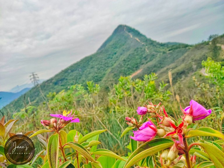
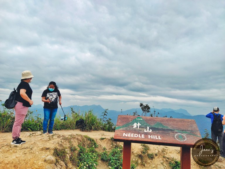
Curious about its name so I looked it up on the internet. Upon knowing its information, we found out that Needle Hill, also called Cham San, is the third among the sharpest peaks in Hong Kong. It got its name from its sharp peak that resembles the tip of a needle as you can see in the photo below.
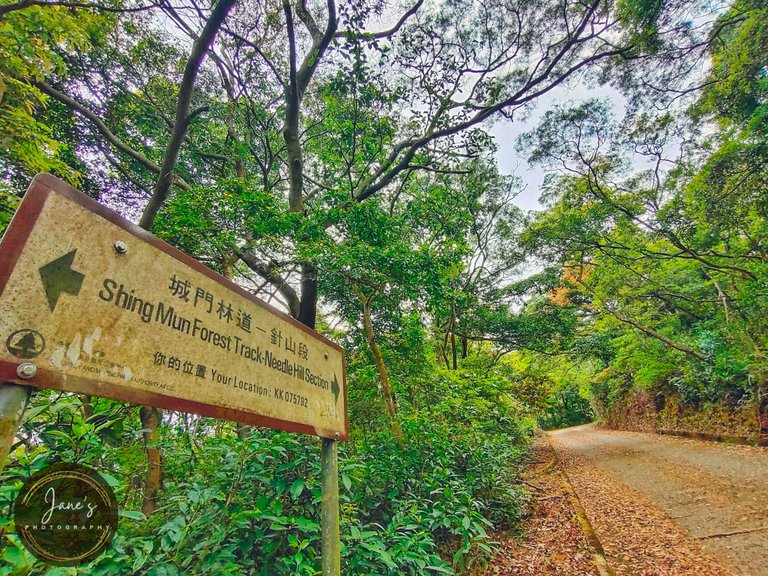
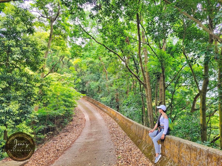
To get to this hill, you have to start at Shing Mun Reservoir and look for the sign heading to this hill. You can also start at the stairway to MacLehose Trail Section Seven near the main dam. The paved path seems easy to hike but it's all windy, steep slopes that you might want to bring more water, or perhaps, discontinue climbing.
We walked on a seemingly never-ending windy path up to the hill. It's exhausting, but a good exercise in the afternoon. There's also a point going down to Shatin Town.
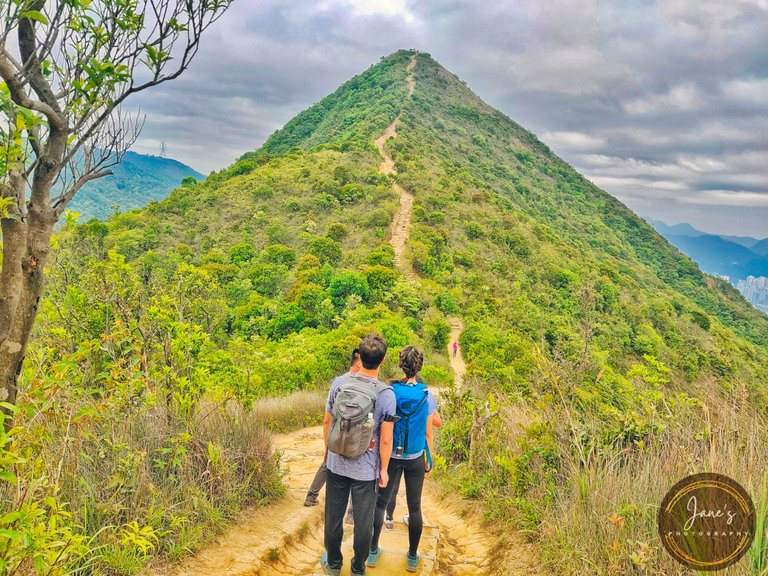
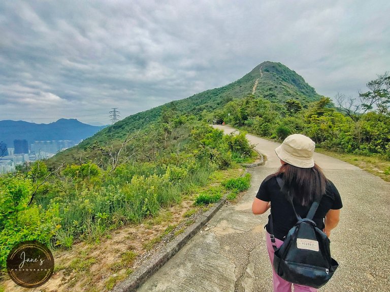
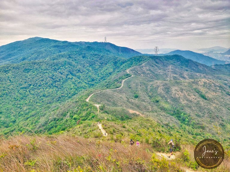
After about an hour of walking from our starting trail, we finally see Needle Hill from the distance. It seems near, yet still far and so we continued walking.
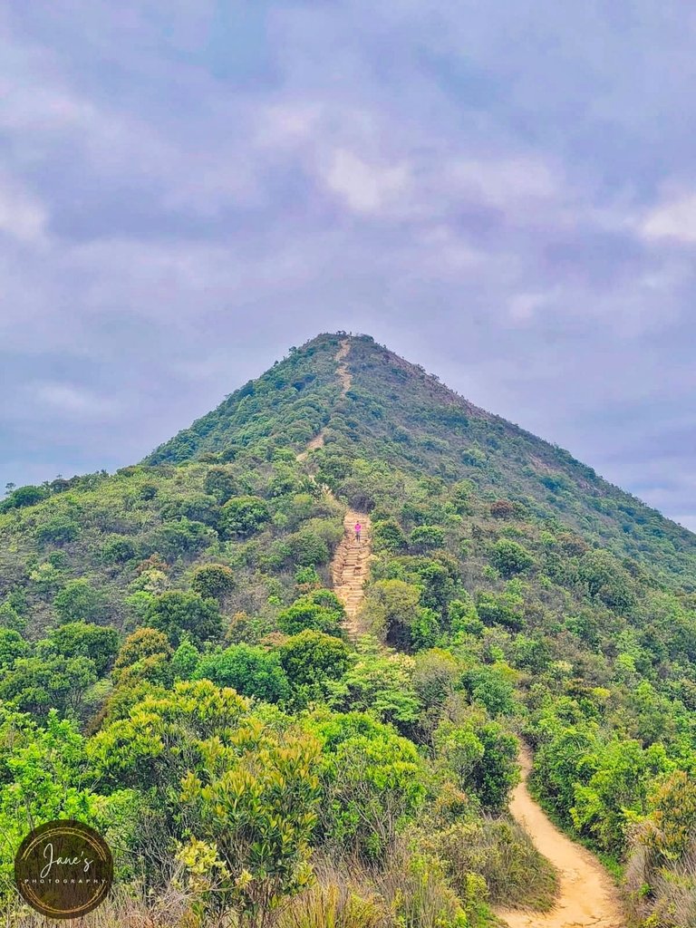
Look how steep the hill is that has an altitude of 532 meters. It may look easy to venture out to this hill in the photo, but try to climb it, and you might say it's hellish.
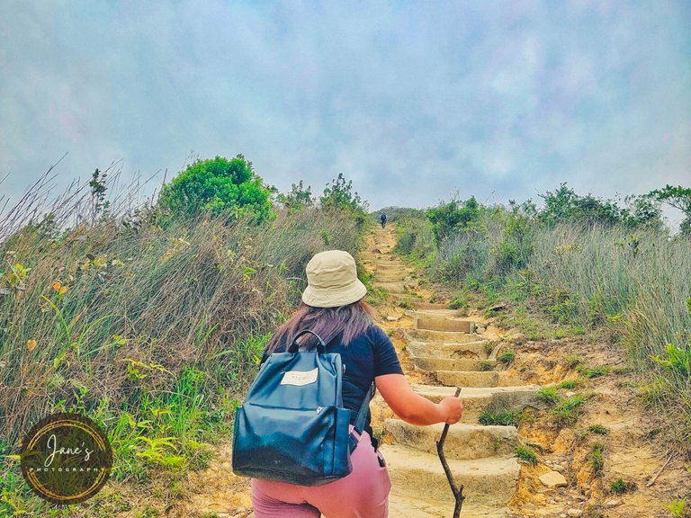
Suitable non-slip shoes should be worn if you hike this trail as stairs can be slippery and you might look for a walking stick, just like what my friend did. Stairs are partly concrete but some parts are ruined and have been covered by sands over time which makes them slippery. I admired those who dared to jog on these stairs. Just one wrong step and they will fall nonstop. But they managed to do so.
Look how clever she is. Someone afraid of heights found ways to support her probably trembling legs, lol. She even wanted to discontinue when we were halfway there, but of course, we can't just stop and go back.
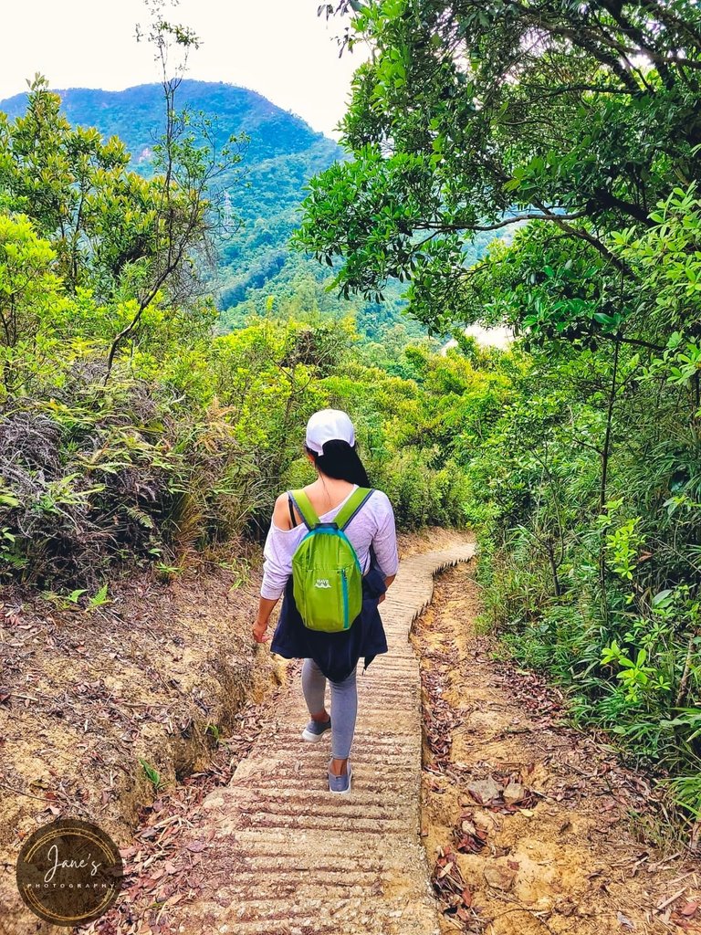
And here's the view of the undulating ridges we climbed before reaching the steep part of the hill. The slightly flattened ridges formed like roads that beautifully snakes atop hills.
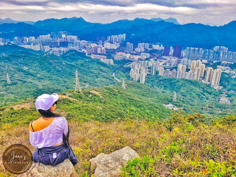
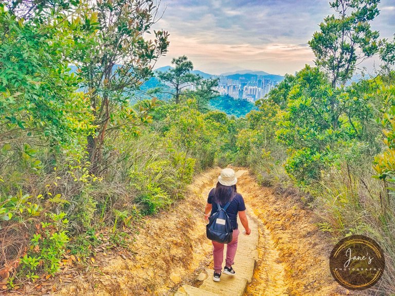
From the higher part of the hill before reaching the summit, is a stunning view of Shatin and Tsun Wan on the left. Those cities with skyscrapers don't look bustling though. They seem peaceful from above the mountain, yet bustling once you visit them.
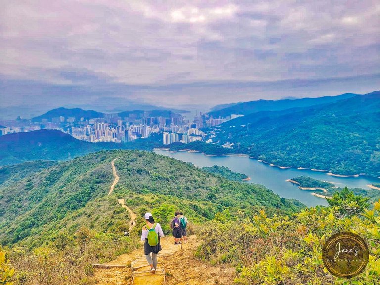
Meanwhile, on the right is the beautiful Pineapple Dam snaking through the Shing Mun Reservoir. Looks like this reservoir is an incredible creation.

You might wonder why it is called Pineapple Dam, but it doesn't look like a pineapple? I actually asked my friend about that matter, lol. But based on the little history I shared in my previous travel blog about the reservoir, the old settlers in this area have planted pineapples, and there were a lot of pineapple fields before this dam was created. And that's where it got its name.
After almost a couple of hours of walking on windy inclining slopes and climbing steep stairs, we finally reached the summit at almost five in the afternoon. That was exhausting, yet a great exercise.
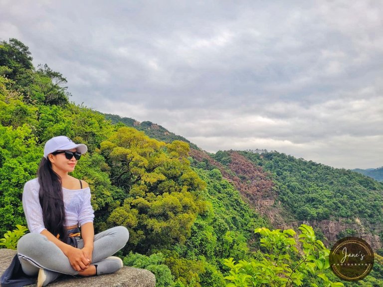
Given its sharp peak, there isn't much flat space on the summit but offers a scenic view. Those smiles are precious after an arduous climb. Another achievement to be added to our list.

We didn't stay long on the top due to limited time and opted to continue our journey. We chose to go down on the opposite side to see what beauty lies down the hill. The incredible view from above was perfection alone and we looked forward to seeing more.
If going up is challenging, the more it is going down. But compared to the other side, this part isn't too steep and easier to climb down. However, our knees are bearing down on us, putting strains and pain on them. My friend often asked me if my knees were hurting. I guess it was hers that were hurting, lol.
Gladly, it was all paved paths and stairs that made our walk going down easier. A group of young hikers was amazed by the steep view of the hill.
Stairs seem to be never-ending the same as on the other side. Oftentimes, we would ask ourselves, "are we there yet?" All we saw were bushes, trees, and long stairs.
After more than half an hour of walking, we finally see the dam from the distance which gave us hope that we were near the base already.
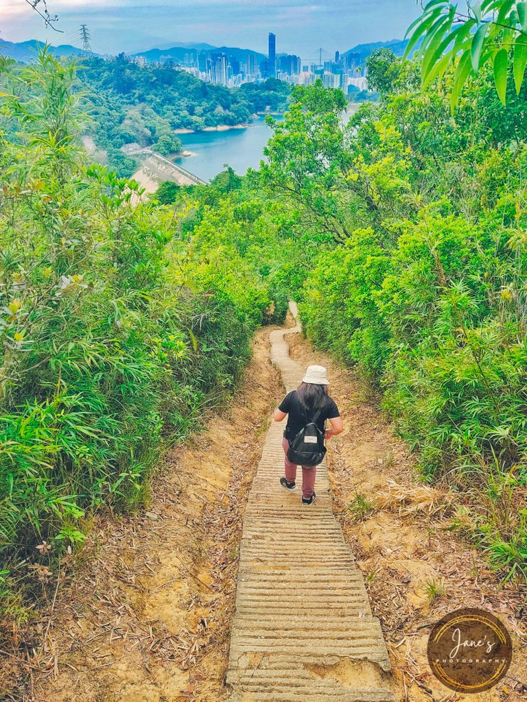
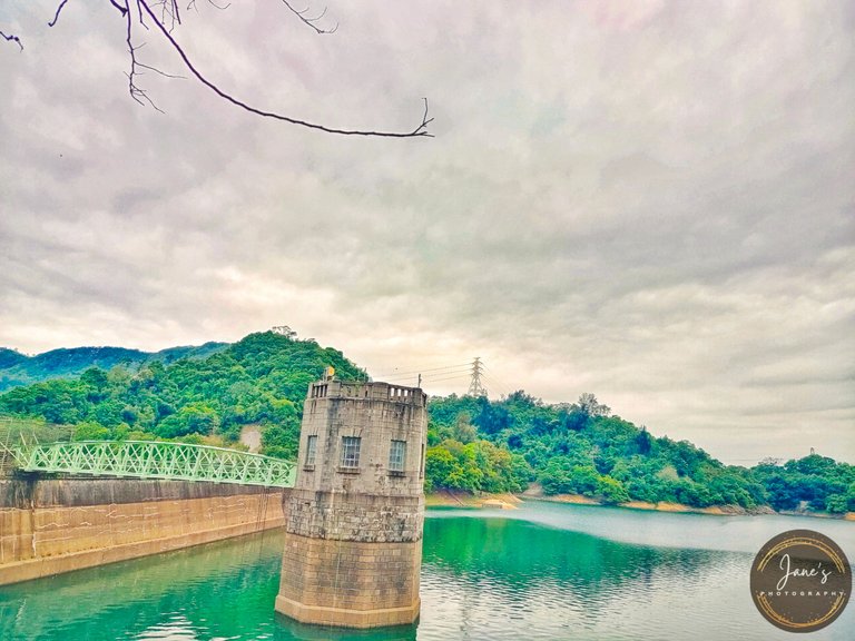
The stunning view of the main dam and Tsuen Wan HK. We reached the base at five-thirty in the afternoon. That was faster than we thought.

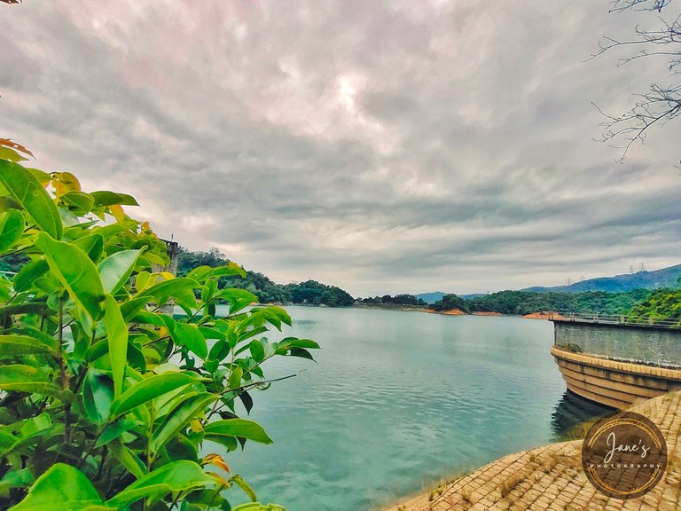
The main dam is also called Gorge Dam with a capacity of three thousand million gallons of water and 280 feet in height. It consists of a reinforced diaphragm wall, a concrete thrust block, and absorbent sand wedge and rock fill on the downstream aide.
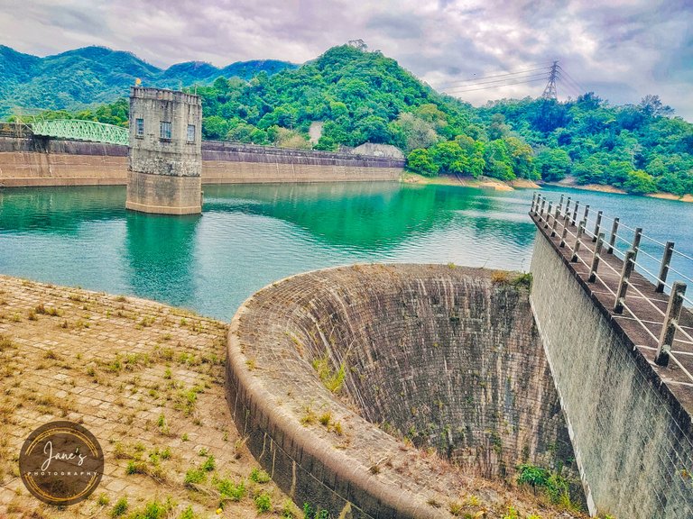
Another attraction in the area is a Steel Bridge that spans across the water to the Valve Tower with cross-braced lattices. The Valve Tower is an octagonal masonry tower that was inspired by the architectural style of towers in Europe.
On the right side going to another trail is Bellmouth Overflow. A circular masonry overtops by a masonry footbridge connecting it to the shore. This helps control the flow of the water into the downstream area, especially during strong typhoons as water often rises.
It was a great decision to go down this part of the reservoir as the view was relaxing. A perfect place to rest for a while after an arduous hike before heading back home.
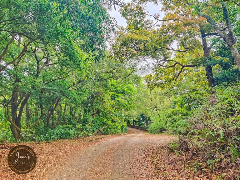
While looking at different trees of different colors, we thought that Autumn and Spring are probably the best season to visit this area as colors are more vibrant. I would truly recommend this reservoir to visit, especially for family and day-trippers. Easy trail with scenic views.
You can visit this article to know how to get to this reservoir.
The Enchanting Shing Mun Reservoir
Thanks for stopping by. See you in my next travel blog.
#qurator
#pinmapple
#amazingnature
#ecotrain
#photography

Follow me on:
The rewards earned on this comment will go directly to the person sharing the post on Twitter as long as they are registered with @poshtoken. Sign up at https://hiveposh.com.
Hiya, @ybanezkim26 here, just swinging by to let you know that this post made it into our Honorable Mentions in Daily Travel Digest #1553.
Your post has been manually curated by the @pinmapple team. If you like what we're doing, please drop by to check out all the rest of today's great posts and consider supporting other authors like yourself and us so we can keep the project going!
Become part of our travel community:
Thank you
I enjoyed reading your adventure so much! Thank you for sharing 💕
Thank you
That place is so relaxing!
The hike looks challenging but fulfilling!
But I can’t dare, taba2 ko eh hahahaha
but I would want to go 😂
Haha..mganda nga yun exercise mo 🤣
@jane1289 HAHA! nu ka ba, I don't always go out esp weekdays 😅
Mas nice talaga mag hiking, pero kapos always sa hangin
Haha..lalo na sa steep stairs 🤣
Mahirap basta stairs even if not steep 😅
The hike looks very tiring and challenging but the view from up there and going is definitely so worth it!
Yup...it was really worth it 🥰
WOW! The view is awesome! I love mountains and posts about nature. Thanks for sharing such a beautiful place.
Welcome .i love nature too 🙂
Great work and beautiful view!
Indeed
Congratulations, your post has been added to Pinmapple! 🎉🥳🍍
Did you know you have your own profile map?
And every post has their own map too!
Want to have your post on the map too?
Your content has been voted as a part of Encouragement program. Keep up the good work!
Use Ecency daily to boost your growth on platform!
Support Ecency
Vote for new Proposal
Delegate HP and earn more
Congratulations @jane1289! You have completed the following achievement on the Hive blockchain and have been rewarded with new badge(s):
Your next target is to reach 10000 upvotes.
You can view your badges on your board and compare yourself to others in the Ranking
If you no longer want to receive notifications, reply to this comment with the word
STOPCheck out the last post from @hivebuzz:
Support the HiveBuzz project. Vote for our proposal!
Great climb up, to show us such an amazing views. Beautiful!
Love the photographs.