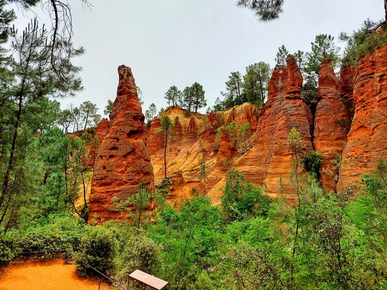
Le Sentiers des Ocres
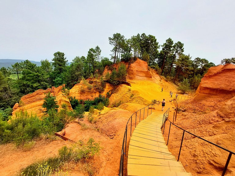
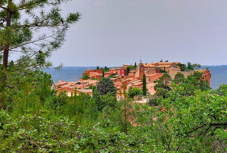
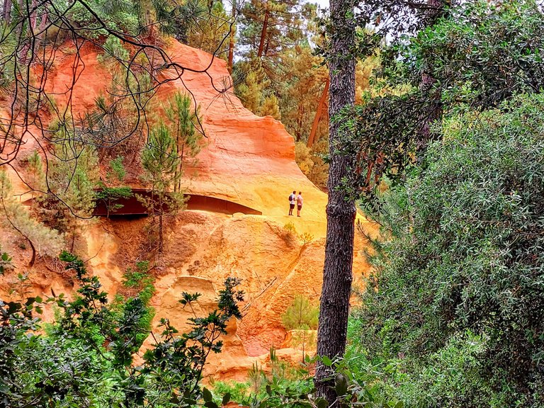
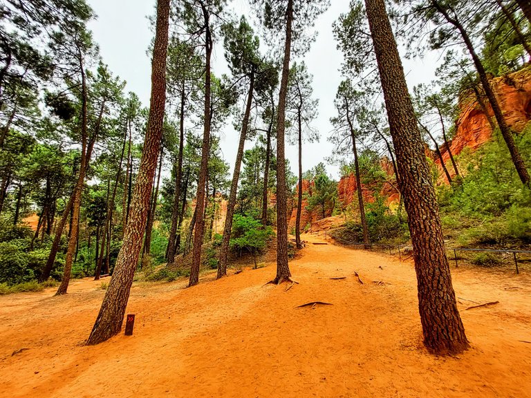
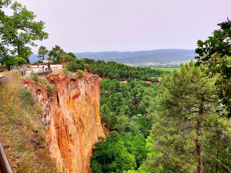
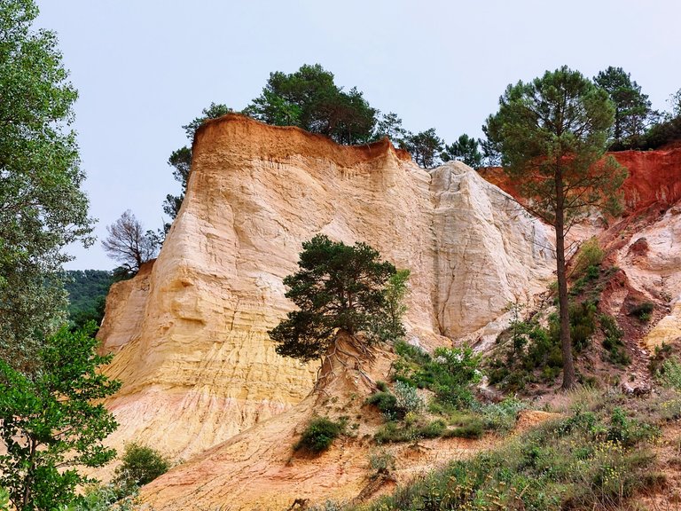
Continuing our journey in the Provence region of France brought us to "Le Sentiers des Ocres," a large natural ocre deposite located just a short walk from the town of Rousillion. You can actually see Rousillion peaking through the trees from within the site.
We paid a small fee of 3 euros per person to enter and hike along the 50 meter trail within. It took about an hour but you could spend more time in there if you wanted. I personally felt that an hour was plenty of time to get a feel for the area.
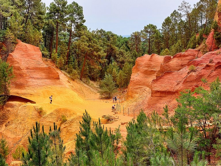
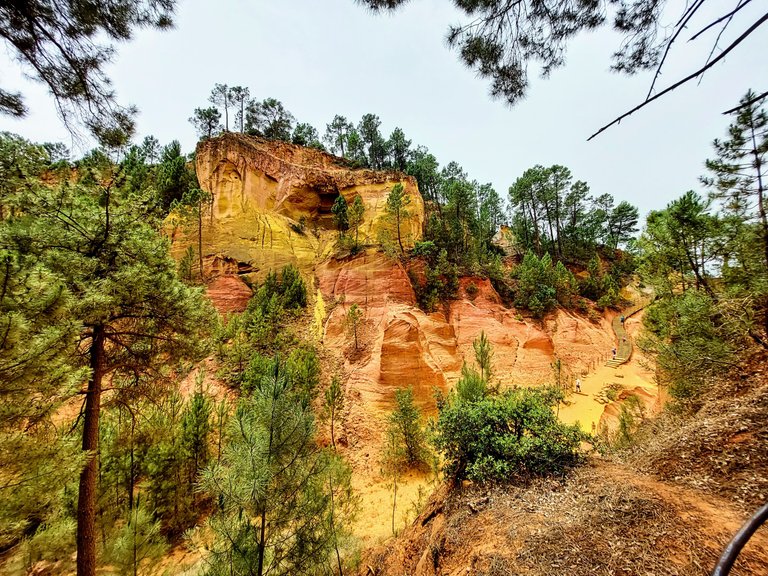
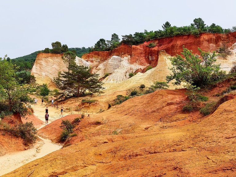
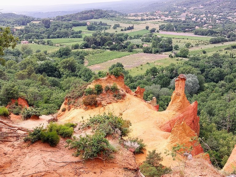
The hike begins in a large bowl like landscape that according to the sites brochure, was modeled by a sea that had once covered the area.
Around 100 - 200 million years ago this part of Southern France had been under water and when the seas receded they left behind a mixture of sand and clay called glauconite.
Several different factors played a roll in creating the variety of colors left behind.
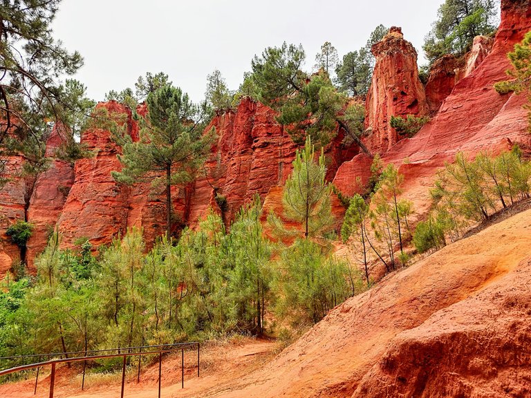
For instance, waves continuously washing over the cliffs eventually decayed the granite stone of the area turning it into kaolin, a soft white clay that is used to make porcelain. It's also used as a filler in paper and as a medicinal absorbant.
The deep red colors of the site came from shellfish living in the area at the time. They left excretions behind that became concentrated iron deposites within the glauconite.
Within the colorful cliffs are holes that were apparently made by sea worms. You can't actually see the holes along the hike, but supposedly they provide evidence of the process described above.
Humic acid, produced by decaying mangrove leaves on the surface of the iron deposites, oxidized the iron and turned it into geothite (a dark yellowish-brown mineral) and hematite (a redish-black mineral).
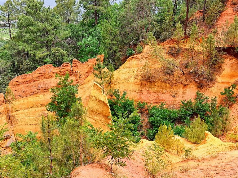
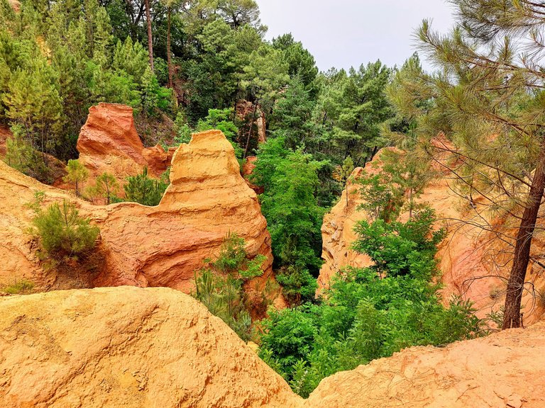
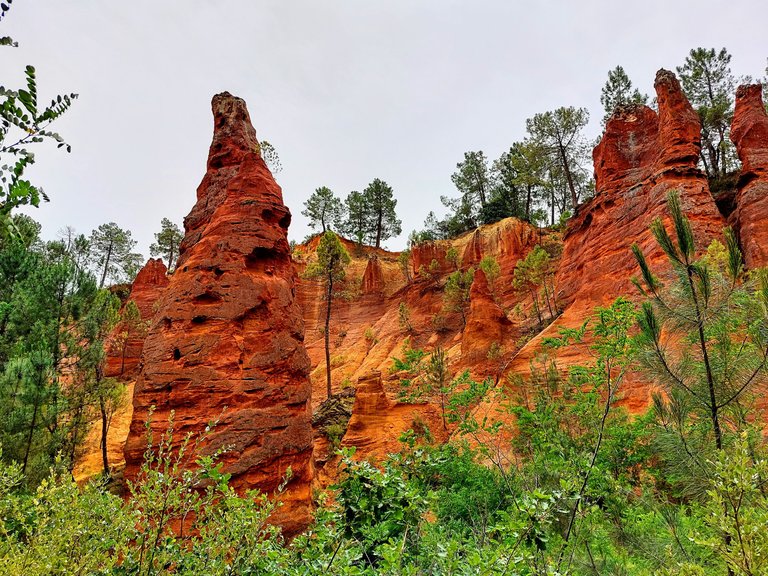
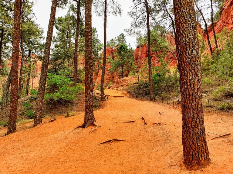
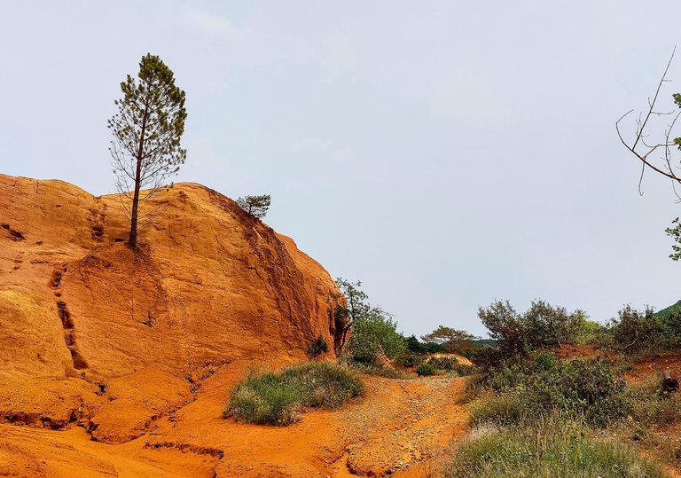
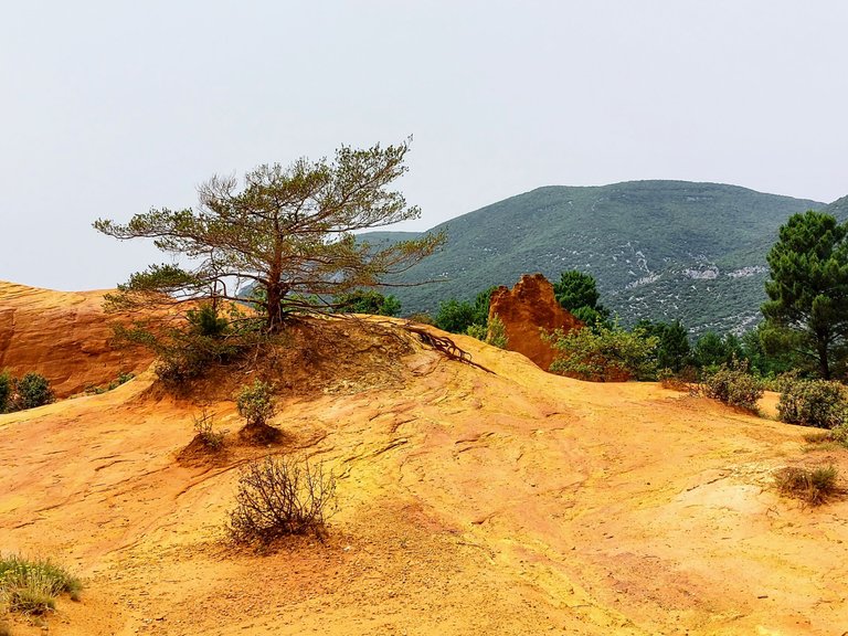
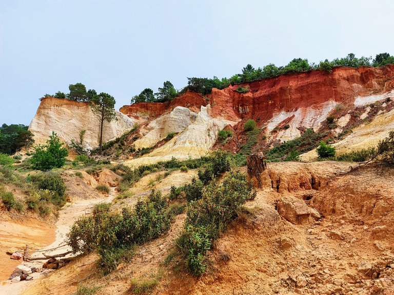
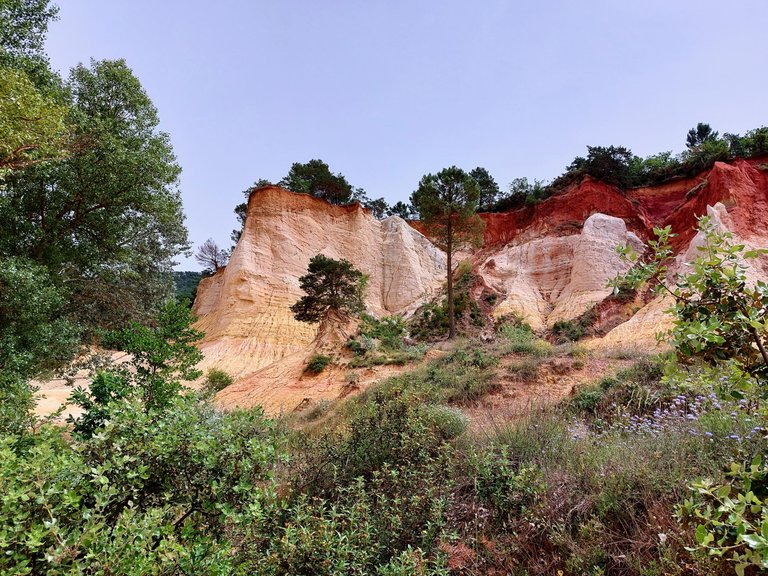
The natural process produced a landscape that is bright and colorful and changes quite a bit as you walk along. Some places contain bright orange and yellow colors while others contain deeper shades of brown and red.
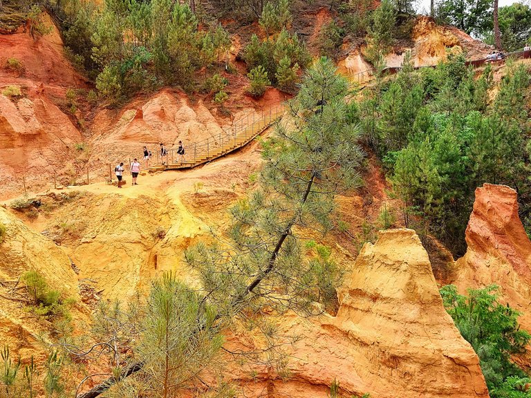
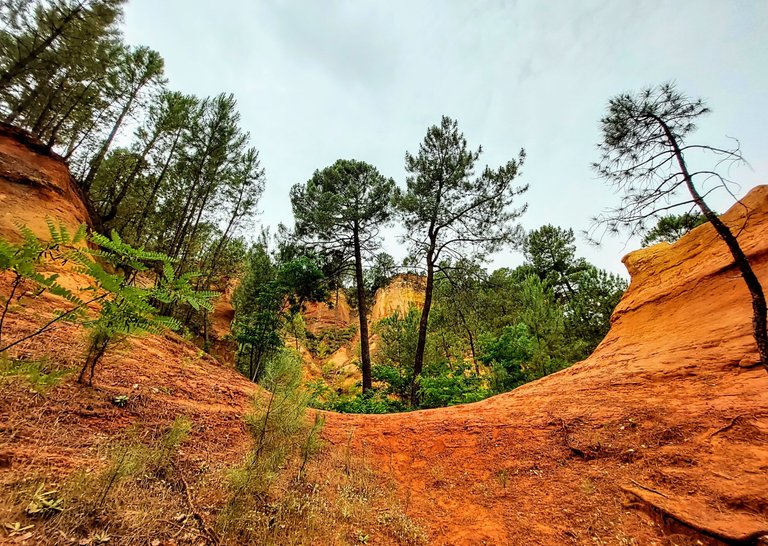
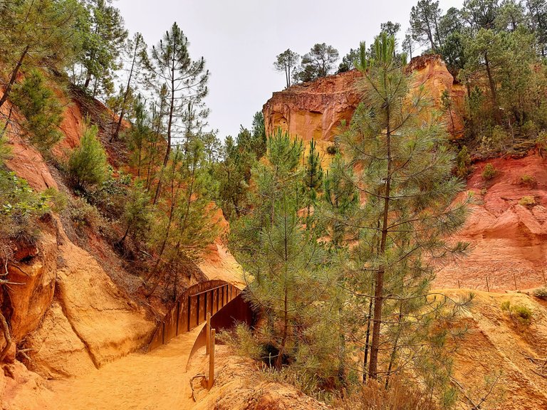
A walk through the forest eventually brings you to a platform that allows you to view the site from a higher elevation. It's a good spot to take selfies! We probably should have done that ourselves.
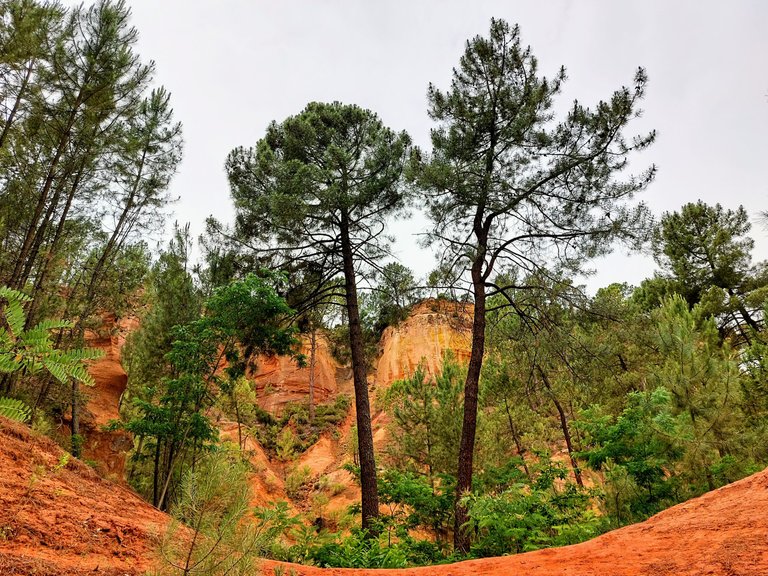
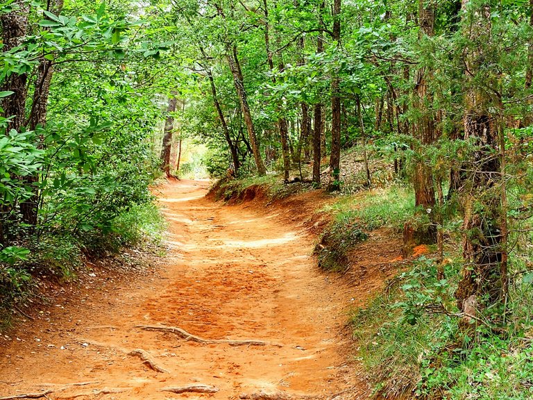
In order to protect the landscape the hike follows a dedicated path that winds its way through the forest and stops at several unique view points along the way.
The path is set up in a circuit and eventually brings you back to where you started.
Overall I found the site to be very unique, like nothing I had ever seen before, that was until we headed to our next destination for the day. Nonetheless, I think that the Sentiers des Ocres was well worth the price of admission. You really can't go wrong at 3 euro a person and it's super convenient being so close to the town of Rousillion.
Le Colorado de Provencal de Rustrel
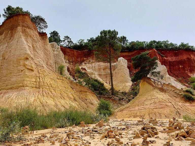
Le Colorado de Provencal is located a short drive from Rousillion and is another large natural deposite of the ocre pigment. We went there right after finishing up at "Sentiers," and the drive took us only about 30 minutes. This site is quite a bit larger than the previous one but at 5 euros to park your vehicle, it's still very reasonably priced. It's basically free if you walk to the location but it's sort of in the middle of nowhere so I don't know how you would get there without driving.
The hike begins from the parking lot where you have the option of following one of two pathways, blue or orange. The blue path is about 2km long and takes around 40 minutes to complete whereas the orange is 4km long and take roughly an hour and 40 minutes. We chose the orange path.
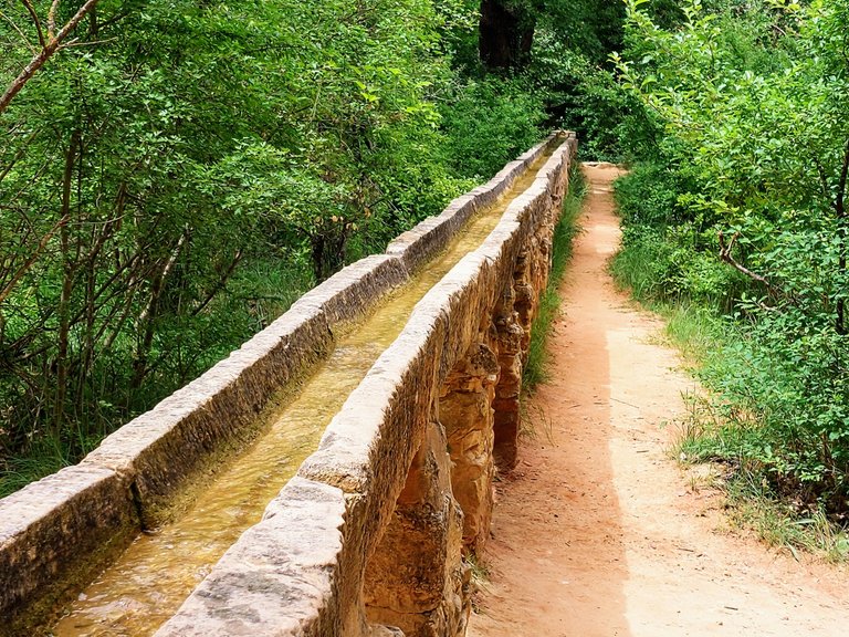
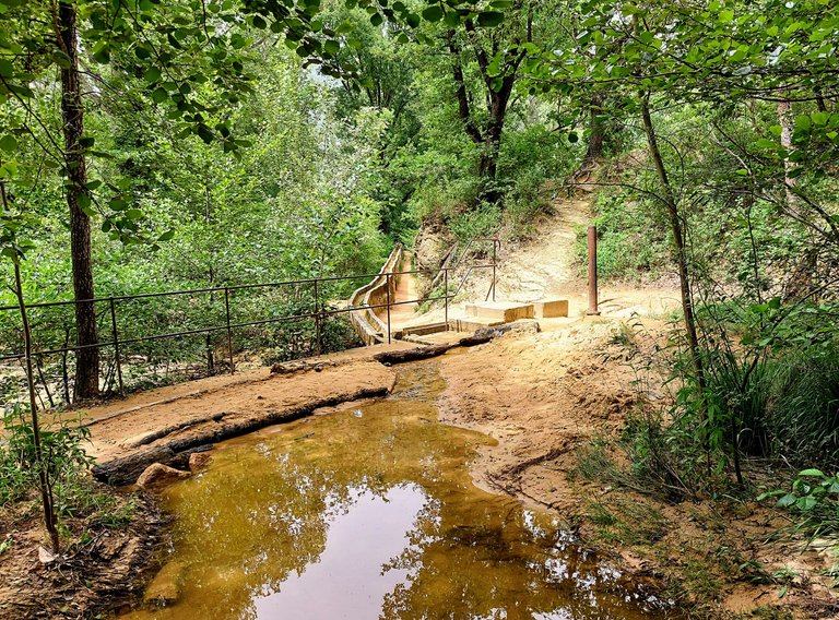
Along the way we passed this old aqueduct that was used to transport water from a small stream to someplace beyond the walking trail.
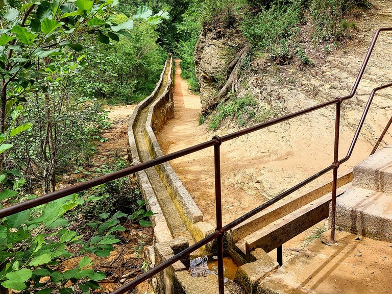
The site was an old quarry back in 1876 - 1930 and remnants of the industry can be seen throughout the landscape. Along with the aqueduct there are old iron pipes located within the quarry itself. Miners would use dynamite to unearth the ocre and then they would spray the cliffs with water from the pipes in order to separate and extract the ocre from the other minerals found in the sand and clay.
The ocre would then settle in ponds which would dry up in the hot months of summer. Once dried, the ocre could be cut into bricks before being transported to factories to be turned into dust.
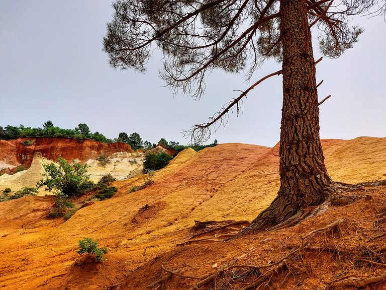
The name of the location is quite fitting given that it derives from the sites color. "Colorado" means "colored" in the local dialect. It is a very colored location indeed.
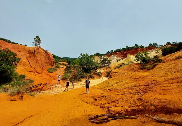
A short distance from the aqueduct brings you to the main quarry.
In the photo below you can see two of the iron pipes that I was referring to previously. They are just off to the left of the people in the photograph.
Though very similar to the previous location this site did have its differences. For one thing the site was much larger and much less concentrated in one location. The hike was quite a bit longer, a little more intense and definitely felt more like a natural environment.
There were also a lot more white clay deposites in the cliffs which gave it a different and more layered look about it.
There was one main ocre quarry along the hike and it is at this location where most of my photographs were taken. Sticks and logs were laid out to create a make-shift walking path for people to follow and a volunteer or worker standing just outside the quarry kindly asked everyone to respect the area and stay within the barrier. The barrier was meant as a means to protect the site from people climbing the pigmented cliffs and destroying them over time which really felt reasonable given how many people visit the area each year.
The barrier didn't detract from the site at all though nor did being relegated to a set path.
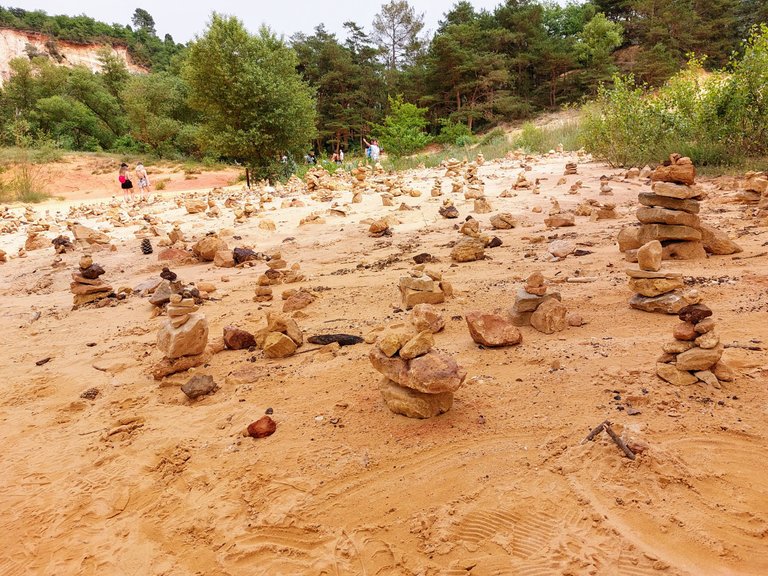
We often see these stone figures during our hikes. People leaving their mark on the terrain and subtly telling others that they were here. Sometimes I make one myself but I wasn't in the mood that day so I just took a picture and moved on.
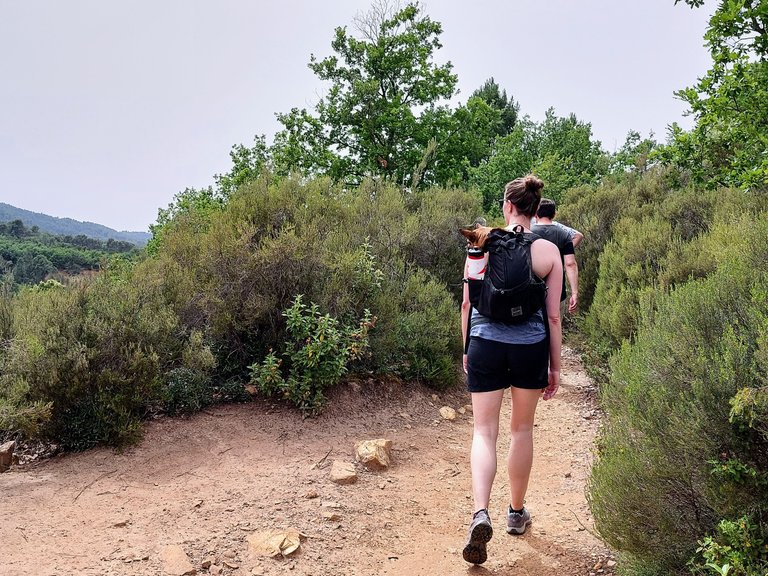
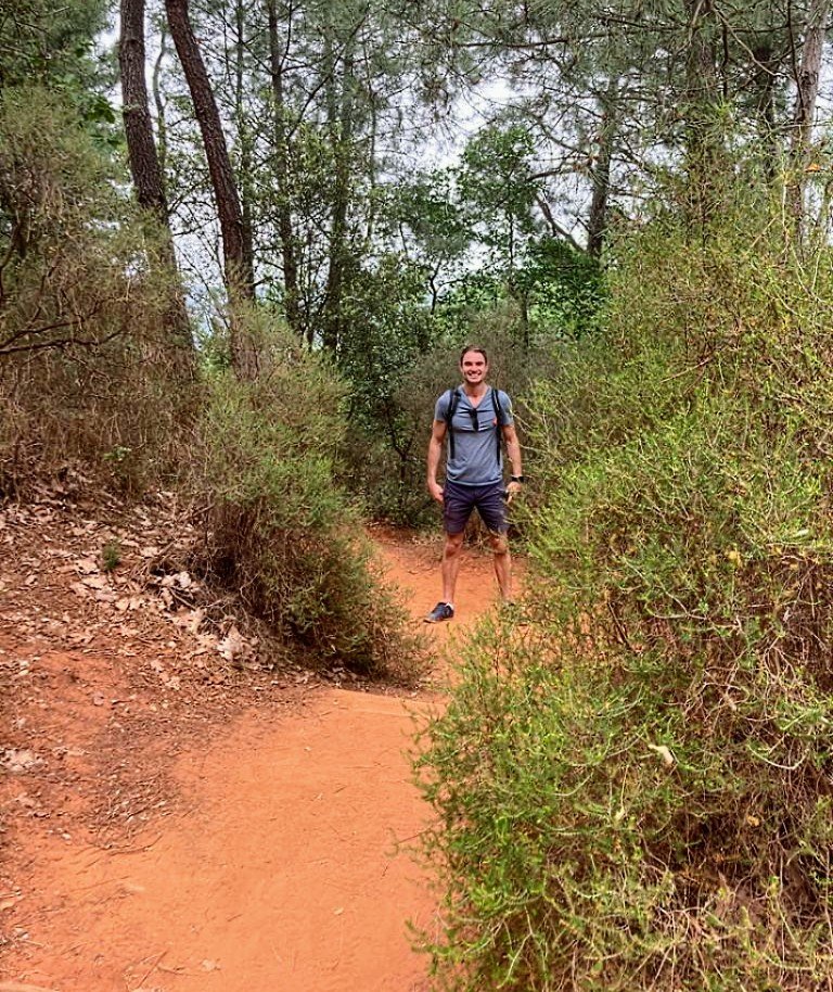
After leaving the quarry the hike continues into the forest and up through the hills.
The path is pretty narrow and we got caught behind a group of people on more than one occasion. We are fast walkers and it was getting late in the day and we were tired and wanting to head back to our hotel in Avignon. After walking on the heels of one group for several minutes they eventually moved to the side and allowed my wife and I to pass.
In the hills there were a few locations that provided panoramic views of the landscape below, including the large quarry that we had just come from. These areas were quite busy though and the path remained quite narrow so we didn't spend a lot of time here.
Overall I really enjoyed both hikes in the ocre mines and would certainly recommend either of them to anyone traveling in the area. Both are quite similar overall but "Colorado" was a bit more natural and had a longer and slightly more intense hike if that is your preference. There is no real need to do both locations and I think either of them provides a good experience of the natural ocre deposites.
i ´ve visited this place a few years ago and this is a magnificent place that your post makes a beautiful tribute to… 😉
I love how you find the best spots to visit in my country, and I enjoy noticing that I.ve also visited them, which makes me appreciate that I also always try to find the places of beauty here 😄
It is a really beautiful spot. Very unique. The whole area is amazing but the color at the Ocre quarries is something special. I'm glad that you had a chance to experience it as well :)
Excellent post! Congratulations on catching so many big fish; well deserved.
Thanks. I appreciate it :)
Whoa... Those are some amazing spots. I've been learning more about geology recently so I have an extra appreciation for such. Some excellent photography as well, nice work. Oh and... That spot with the two trees is super cool!
Thanks man. I'm glad you liked it. Yeah nature is super cool and it's really interesting how these spots come together and are created. It's seems like everything cool is either created by heat, pressure and gas, or decaying organic matter lol.
I enjoyed reading. Very informative. Between the two sites, I would probably choose Le Sentiers des Ocres to visit. I love how contrasting the colors are of the trees and the soil.
Thanks for reading. Yeah, that is a good choice between the two. You get deeper reds at that location rather than whites and oranges, so the contrast is much more dramatic.
I have been to both spots a few years ago, it’s amazingly beautiful, especially Le sentier in Roussillon. Great region, with great wine! 😉
That's awesome. I'm glad you got to experience them. The region is amazing, one of my favorite spots in France - though I have many favorite spots in France lol. Great wine indeed!
a truly wonderful experience. I find the geology here quite interesting. If we build more areas for animals to live here, that would be great
Do you mean like zoos?
There is a beautifull place! nice photos from your travel hiking by the way 👍
Thanks I'm glad you liked them.
Congratulations, your post has been added to Pinmapple! 🎉🥳🍍
Did you know you have your own profile map?
And every post has their own map too!
Want to have your post on the map too?
Amazing place 🥰
Thanks!
Hiya, @LivingUKTaiwan here, just swinging by to let you know that this post made it into our Top 3 in Daily Travel Digest #1273.
Your post has been manually curated by the @pinmapple team. If you like what we're doing, please drop by to check out all the rest of today's great posts and consider supporting other authors like yourself and us so we can keep the project going!
Become part of our travel community:
Thanks!