[ENG]
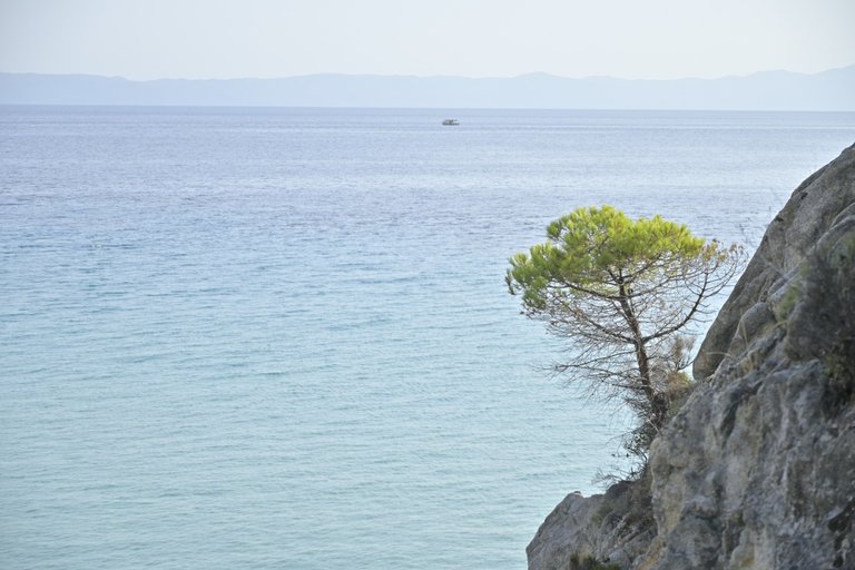
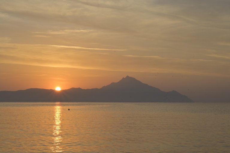
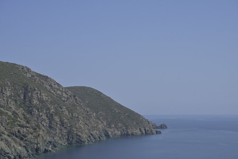
The beginning of the holiday in Greece started terribly! Saturday was a very hot, sunny day. There was literally not a cloud in the sky. A simple calculation of the current time and the number of kilometers left to travel allowed us to assume that we would eat dinner in Greece and swim in the Aegean Sea that day. Unfortunately, all plans were put into question the moment we reached the Macedonian-Greek border. A huge traffic jam announced at least an hour, maybe even two hours of waiting. Nothing could be further from the truth. It quickly turned out that dozens, hundreds, and finally probably even thousands of drivers did not feel like standing on two lanes of the motorway and patiently waiting for their turn, but rudely bypassed the 2-kilometer queue of waiting cars on the emergency lane, which made the main queue move even slower. Our tiny car did not cope well with the Greek heat, so sitting in a traffic jam in an air-conditioned interior was only our pious dream. In total, we spent almost 4 hours on the Macedonian-Greek border, and the consequences were that we reached Thessaloniki during the afternoon rush hour in heavy traffic. This also delayed our drive. Finally, we reached the Aegean coast only an hour and a half before sunset. The advantage was that from the beach we could admire the faint outline of the peak of Mount Olympus rising from the sea on the western side, and we had the next few days of vacation for real beach time.
[PL]
Początek wakacji w Grecji rozpoczął się okropnie! Sobota była bardzo gorącym, słonecznym dniem. Na niebie nie było dosłownie żadnej chmurki. Proste przeliczenie aktualnej godziny i ilości pozostałych do przejechania kilometrów pozwalało nam przypuszczać, że jeszcze tego dnia zjemy obiad w Grecji i popływamy w Morzu Egejskim. Niestety wszystkie plany stanęły pod wielkim znakiem zapytania w momencie gdy dojechaliśmy do granicy Macedońsko – Greckiej. Potężny korek zwiastował nam przynajmniej godzinę, może nawet dwie godziny czekania. Nic bardziej mylnego. Szybko okazało się, że dziesiątki, setki, a finalnie pewnie nawet tysiące kierowców wcale nie miało ochoty stać na dwóch pasach autostrady i cierpliwe czekać na swoją kolejkę., tylko chamsko pasem awaryjnym omijali 2 kilometrową kolejkę czekających samochodów, przez co zasadnicza kolejka jeszcze wolniej się przemieszczała. Masz malutki samochodzik nie radził sobie dobrze z greckimi upałami, dlatego siedzenie w korku w klimatyzowanym wnętrzu było tylko naszym pobożnym marzeniem. Sumarycznie wyszło na to że na granicy Macedońsko - Greckiej spędziliśmy niemal 4 godziny, a konsekwencje tego były takie, że do Salonik dojechaliśmy w godzinach popołudniowego szczytu w natężeniu ruchu drogowego. Co również opóźniło naszą jazdę. Finalnie do brzegu morza Egejskiego dojechaliśmy dopiero na półtorej godziny przed zachodem słońca. Plus był taki, że z plaży mogliśmy podziwiać niewyraźny zarys szczytu góry Olimp wyrastający z morza pod zachodniej strony, a na prawdziwe plażowanie mieliśmy kolejne dni urlopu.
[ENG]
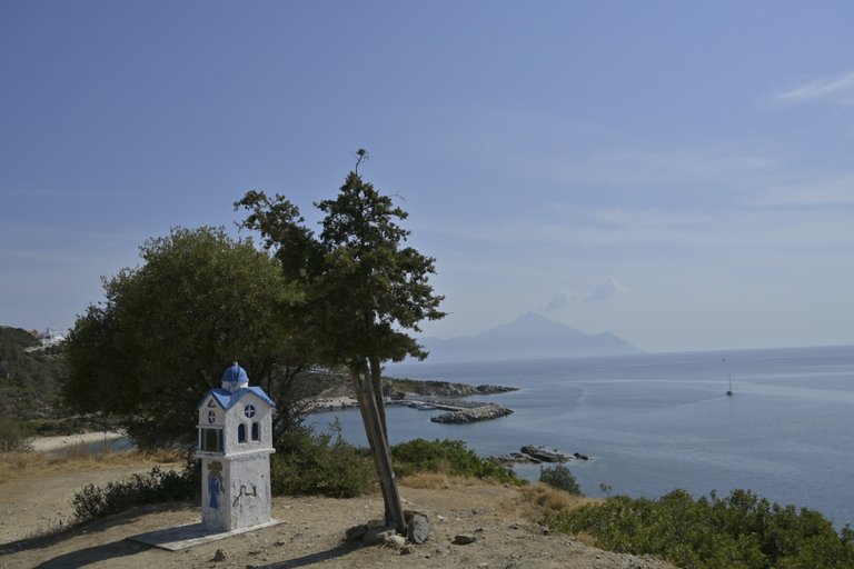
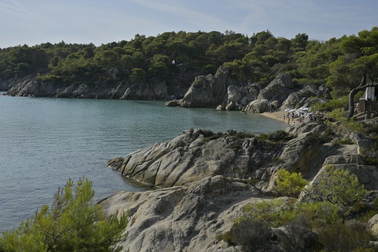
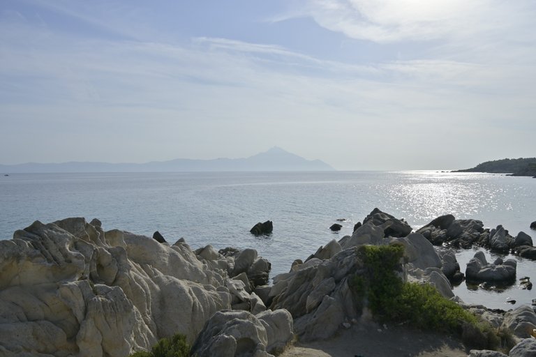
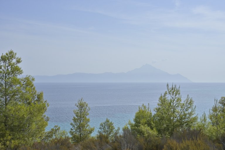
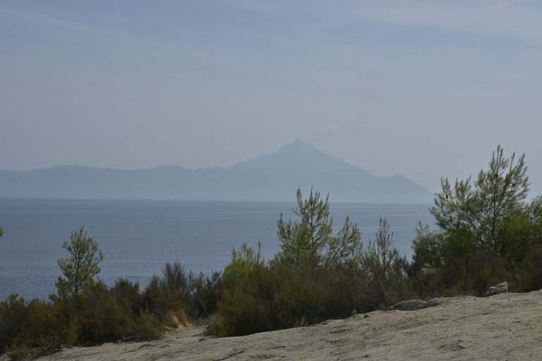
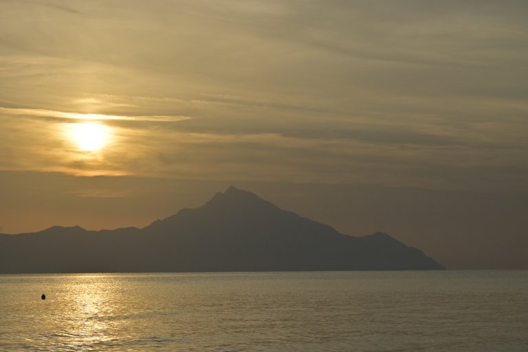
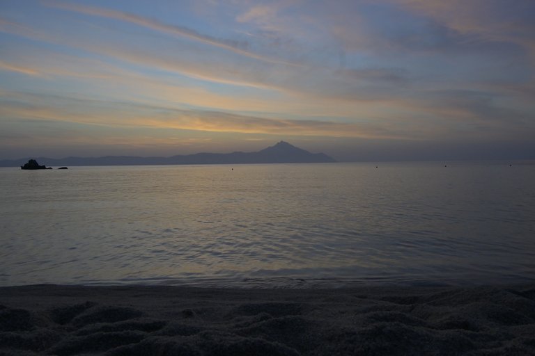
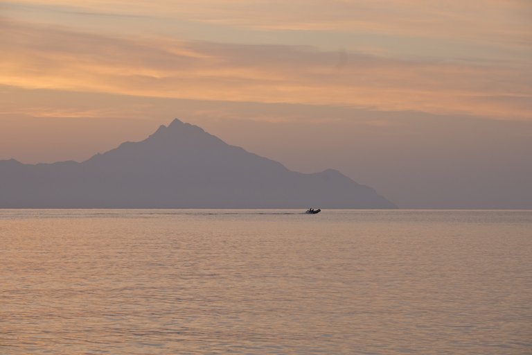
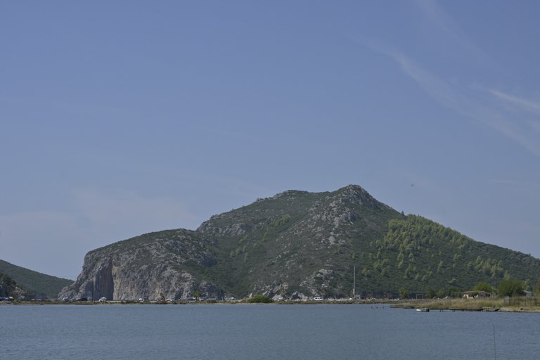
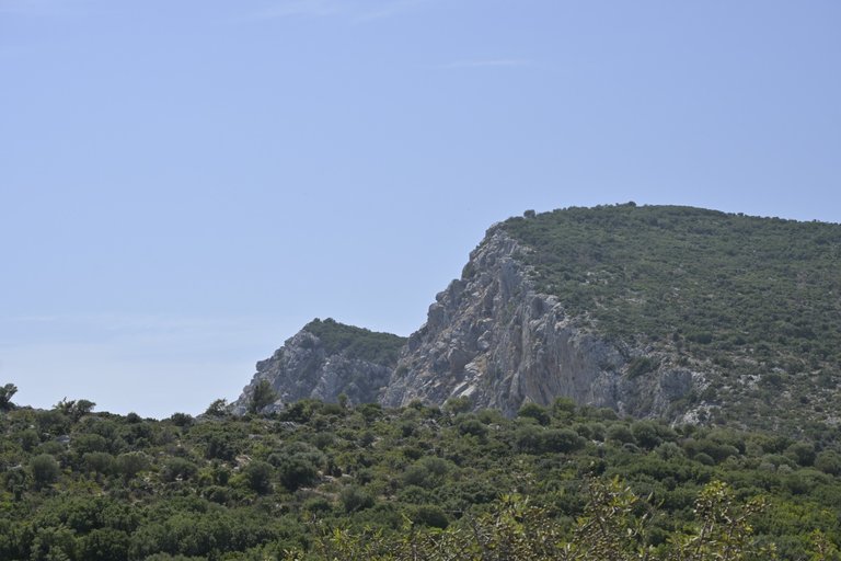
Our base camp was the tourist settlement of Flogita, located on the southwestern coast of the Halkidiki Peninsula. Flogita was not a very interesting place, so every morning we left it to relax on the most interesting beaches in the region. The situation is that the Halkidiki Peninsula, commonly called Chalkidiki, resembles a hand with three fingers in its shape, and each finger is a separate peninsula on the peninsula, called Kassandra, Sithonia and Athos from the west. The latter cannot be visited, because the entire last finger is occupied by a community of Orthodox monks. And that's a pity, because Athos is probably the most interesting of all three peninsulas, and that's because at its very end there is a huge peak, Athos, 2,033 meters above sea level, and literally above sea level, because the distance from the beach to the peak is less than 4 kilometers, so this mountain literally grows out of the sea. You can only go to the peninsula inhabited by 1,811 Orthodox monks for pilgrimage purposes, but only if you are a man, because a woman, even the most pious, is not allowed to go to Athos, because her presence could disturb the thoughts of the monks. Therefore, the only thing we could do was admire this monumental mountain from the neighboring Sithonia peninsula.
[PL]
Naszą bazą wypadową była położona na południowo zachodnim wybrzeżu Półwyspu Chalcydyckiego turystyczna osada Flogita. Owa Flogita nie była zbyt ciekawym miejscem, dlatego każdego dnia rano wyjeżdżaliśmy z niej po to aby wypoczywać na najciekawszych plażach regionu. Sprawa wygląda tak, że Półwysep Chalcydycki zwany potocznie Chalkidiki swoim kształtem przypomina dłoń z trzema palcami, a każdy palec to osobny półwysep na półwyspie, zwane są kolejno od zachodu Kasandra, Sitonia i Atos. Tego ostatniego nie da się zwiedzić, bo cały ostatni palec zajmowany jest przez wspólnotę mnichów prawosławnych. A szkoda, bo Atos jest chyba najciekawszym z wszystkich trzech półwyspów, a to dlatego, że na jego samym końcu znajduje się ogromny szczyt Atos liczący sobie 2033 metrów nad poziomem morza i to dosłownie nad poziomem morza, bo od plaży do szczytu jest niecałe 4 kilometry odległości, więc ta góra wręcz wyrasta z morza. Na półwysep zamieszkały przez 1811 prawosławnych mnichów można udać się wyłącznie w celach pielgrzymkowych ale pod warunkiem, że jesteś mężczyzną, bo kobieta, choćby była najpobożniejsza to i tak nie ma prawa udać się na Atos, bo swoją obecnością mogłaby zaburzyć myśli mnichów. Dlatego jedyne co mogliśmy zrobić, to podziwiać tą monumentalną górę z sąsiedniego półwyspu Sithonia.
[ENG]
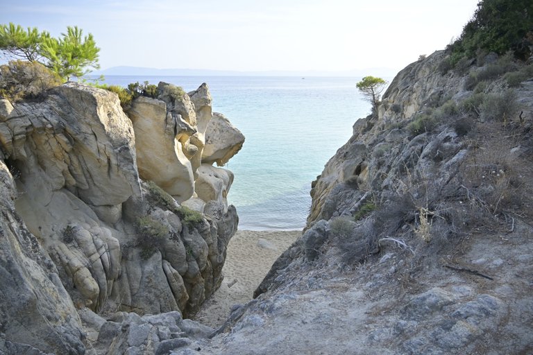
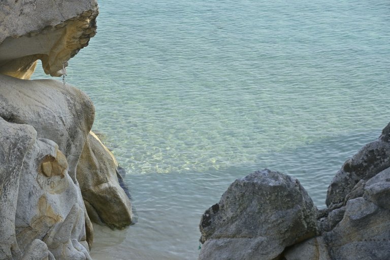
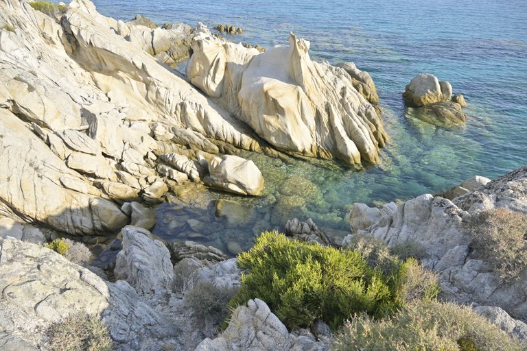
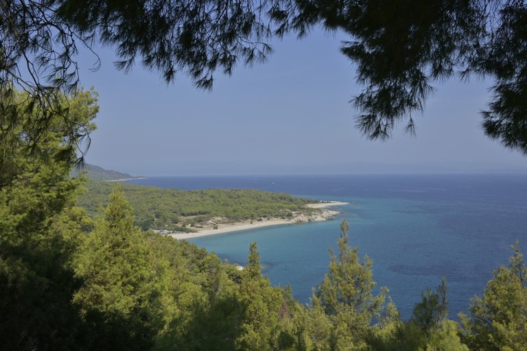
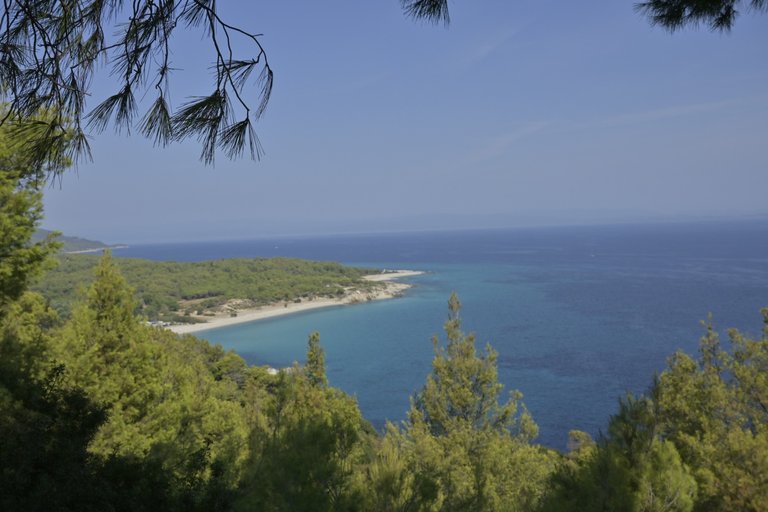
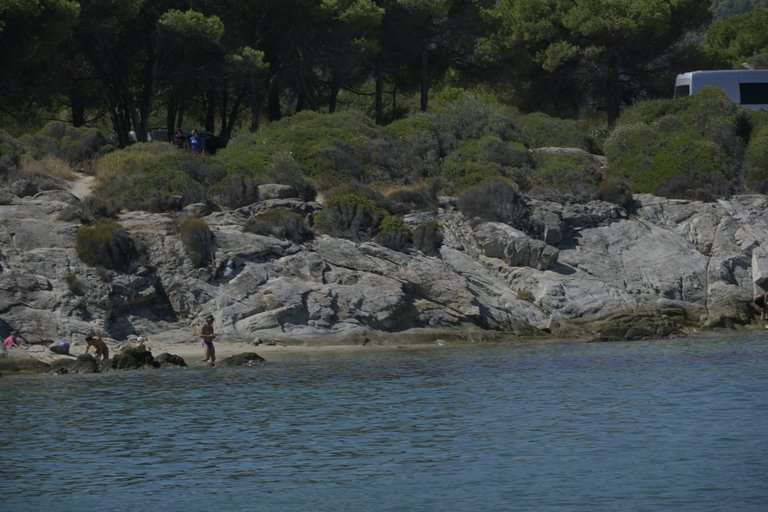
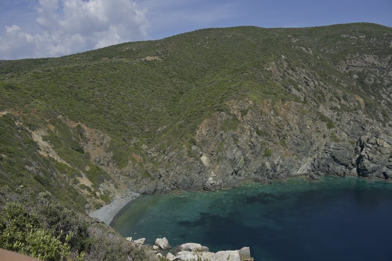
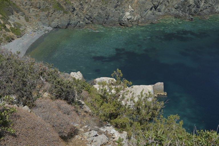
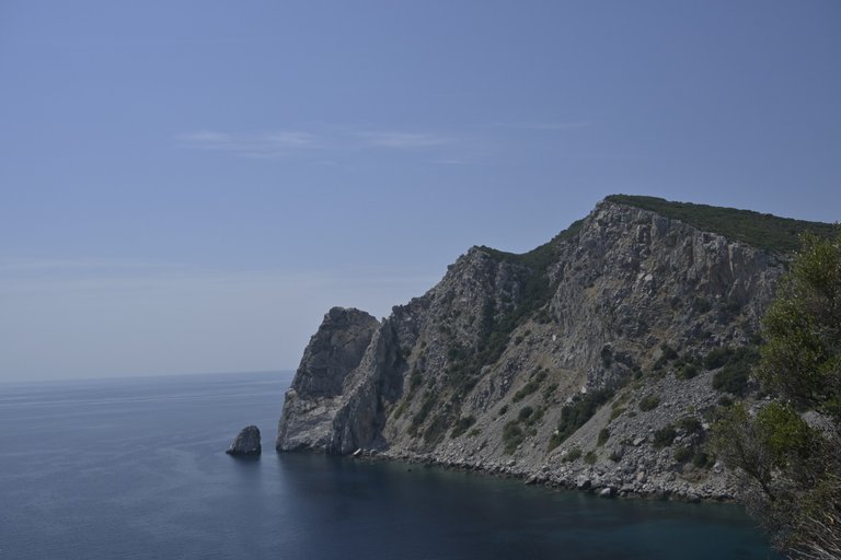
The extreme finger called Kassandra somehow didn't catch our attention enough to decide to dedicate one of the three days to visit it, which is why every time we went to the beach we chose Sithonia, or the middle finger. And we have to admit that the beaches there are fabulous. The first beach we visited was Karydi Beach, where rounded stones cut deep into the sea, and in the shallow bays created in this way, there were swarming with all kinds of colorful fish. Unfortunately, this beach was very crowded. We went to the furthest stone thinking that we would find some peace there, but it didn't help, because after a while some women came up to us doing almost erotic photo sessions. The next beach we visited was Paradaise bay, which was not so crowded, especially since we went there only a few minutes after sunrise. Maybe it was because of this, the lack of people, and the completely calm sea, the visibility under the water was amazing. Whenever I dived in seas like the Baltic Sea I was happy when I saw something a meter or two in front of me, in the Mediterranean Sea or other clear seas the visibility was probably 10 meters, but here at Paradaise Bay I had the impression that I was able to see underwater places 100 meters away from me. Thanks to this, it seemed to me that the number of fish swimming in this bay was particularly large. Without a doubt, Paradaise Bay can be hailed as the best beach we visited during our entire vacation. Unfortunately, it is not very easy to get there. It is located halfway between two towns, where you have to turn off the main road and drive a few hundred meters into the forest, and then go on a fairly long walk down the slope leading to the beach. The last place we visited on Sithonia that deserves to be described is a rock called Σπηλιά της Έρικας. I don't know how to translate it from Greek, but it is a rock that protrudes the most into the sea from which a fabulous view stretches. Unfortunately, our stay there was made unpleasant by Greek military planes, which organized military exercises right above our heads. The roar of the planes flying over, the sounds of missiles being fired, filled us with shivers and provided unforgettable emotions, because truly your legs become weak when you stand on a narrow rock protruding 100 meters above sea level in the midst of the fighting planes making the air and the earth tremble.
[PL]
Skrajny palec zwany Kasandra jakoś nie przyciągną naszej uwagi na tyle mocno abyśmy zdecydowali się na poświęcenie jednego z trzech dni celem odwiedzenia go, dlatego za każdym razem jadąc na plaże wybieraliśmy właśnie Sitonię czyli środkowy palec. No i trzeba przyznać, że tamtejsze plaże są bajeczne. Pierwsza odwiedzona przez nas plaża to była Karydi Beach gdzie obłe kamienie wcinały się głęboko w morze, a w powstałych w ten sposób płytkich zatokach, aż roiło się od wszelkiego rodzaju kolorowych rybek. Niestety ta plaża była bardzo tłoczna. Poszliśmy na najodleglejszy kamień z myślą, że na nim znajdziemy trochę spokoju, ale nic to nie dało, bo i tak po pewnej chwili przylazły do nas jakieś babki robiące sobie niemal erotyczne sesje zdjęciowe. Kolejną odwiedzoną plaża była Paradaise bay która nie była już aż tak tłoczna, tym bardziej że pojechaliśmy na nią zaledwie kilka naście minut po wschodzie słońca. Może to właśnie z tego powodu czyli braku ludzi, oraz kompletnie spokojnego morza widoczność pod wodą była niesamowita. Zawsze gdy nurkowałem w morzy typu Bałtyk cieszyłem się gdy widziałem cokolwiek na metr, dwa metry przed siebie, w morzu śródziemnym albo innych czystych morzach widzialność sięgała pewnie z 10 metrów, ale tutaj na Paradaise bay miałem wrażenie że jestem w stanie zobaczyć pod wodą miejsca odległe o 100 metrów ode mnie. Dzięki temu zdawało mi się, że liczba rybek pływających tej zatoce jest szczególnie duża. Bez wątpienia Paradaise bay można okrzyknąć mianem najlepszej plaży jaka odwiedziliśmy podczas naszego całego urlopu. Niestety nie da się tam dotrzeć zbyt łatwo. Znajduje się ona w połowie drogi między dwoma miastami, gdzie trzeba skręcić z drogi głównej i przejechać kilkaset metrów wgłęb lasu, a koleinie udać się na dość długi spacer na dół zbocza ;prowadzącego nad plażę. Ostatnie miejsce które odwiedziliśmy na Sitoni, a zasługuje na opisanie to skała o nazwie Σπηλιά της Έρικας. Nie wiem jak to przetłumaczyć z języka greckiego, ale jest to skała wysunięta najbardziej w głąb morza z którego rozpościera się bajeczny widok. Niestety nasz pobyt tam został uprzykrzony, przez Greckie samoloty wojskowe, które urządziły sobie tuż nad naszymi głowami ćwiczenia wojskowe. Huk przelatujących samolotów, odgłosy wystrzeliwanych rakiet, napawały nas dreszczem i dostarczały niezapomnianych emocji, bo zaprawdę nogi robią się miękkie, gdy stoi się na wąskiej skale wystającej 100 metrów ponad poziom morza w walczące w powietrzu samoloty sprawiają, że powietrze i ziemia aż drżą.
Ci co wyprzedzali bokiem kolejkę na przejściu granicznym, to na pewno byli Grecy. Robią to nagminnie, nawet na światłach 🤣
Σπηλιά της Ερικας to w tłumaczeniu z greckiego grota (jaskinia) Eryki (Eryka - imię żeńskie).
Na greckim wybrzeżu można znaleźć mnóstwo grot, najczęściej dostępnych od strony morza.
Fajnie wiedzieć że byliście gdzieś w pobliżu 🙂
Congratulations, your post has been added to the TravelFeed Map! 🎉🥳🌴
Did you know you have your own profile map?
And every post has their own map too!
Want to have your post on the map too?
- Go to TravelFeed Map
- Click the create pin button
- Drag the marker to where your post should be. Zoom in if needed or use the search bar (top right).
- Copy and paste the generated code in your post (any Hive frontend)
- Or login with Hive Keychain or Hivesigner and click "create post" to post to Hive directly from TravelFeed
- Congrats, your post is now on the map!
PS: You can import your previous Pinmapple posts to the TravelFeed map.Opt Out
Congratulations, your post has been added to WorldMapPin! 🎉
Did you know you have your own profile map?
And every post has their own map too!
Want to have your post on the map too?
Hiya, @lizanomadsoul here, just swinging by to let you know that this post made it into our Honorable Mentions in Travel Digest #2348.
Your post has been manually curated by the @worldmappin team. If you like what we're doing, please drop by to check out all the rest of today's great posts and consider supporting other authors like yourself and us so we can keep the project going!
Become part of our travel community:
Congratulations @olusiu! You received the biggest smile and some love from TravelFeed! Keep up the amazing blog. 😍 Your post was also chosen as top pick of the day and is now featured on the TravelFeed front page.
Thanks for using TravelFeed!
@for91days (TravelFeed team)
PS: Have you joined our Discord yet? This is where over 1000 members of the TravelFeed come together to chat. Join us!
Feels so sad not to visit Greece already! So much to see!
Watching the sunset or sunrise is the most important thing on the beach or sea.
I enjoyed reading your post. It was very interesting to me as I am currently in North Macedonia, in the Sharr mountain near Kosovo. We plan to drive through Greece next week, so we may take your tips and find that Paradise Beach… sounds really nice!
Hello olusiu!
It's nice to let you know that your article won 🥇 place.
Your post is among the best articles voted 7 days ago by the @hive-lu | King Lucoin Curator by szejq
You and your curator receive 0.0549 Lu (Lucoin) investment token and a 13.63% share of the reward from Daily Report 452. Additionally, you can also receive a unique LUGOLD token for taking 1st place. All you need to do is reblog this report of the day with your winnings.
Buy Lu on the Hive-Engine exchange | World of Lu created by @szejq
STOPor to resume write a wordSTART