[ENG]
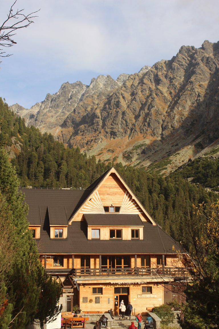
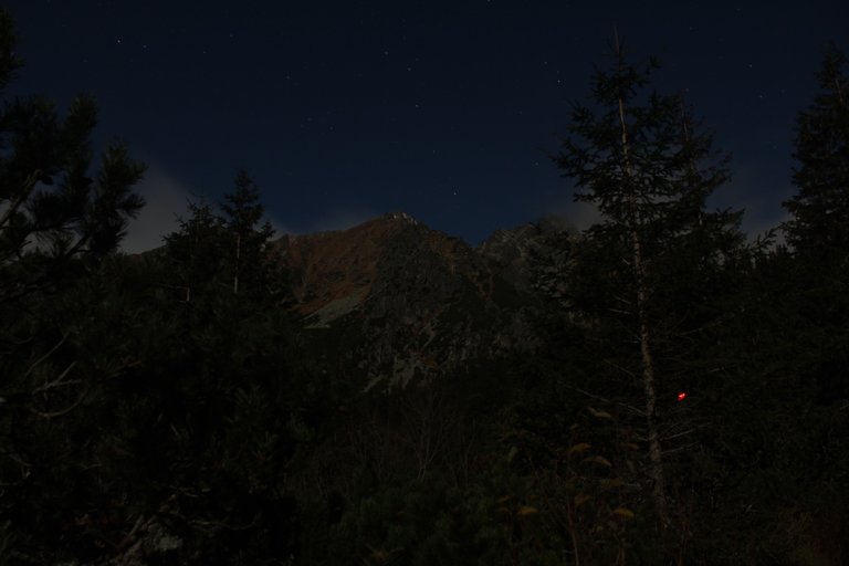
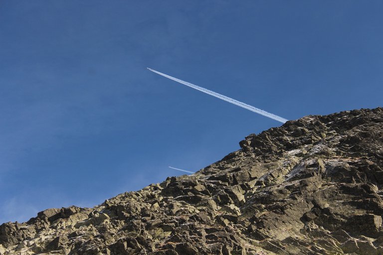
A few years ago I decided to decorate the 28 highest mountain peaks in individual ranges of the Crown of Polish Mountains. Out of 28 peaks, I have already conquered 26 and to finish I am missing one of the lowest mountains, Ślęża, and the highest mountain, Rys in the Tatra Mountains. Last fall, a few days before the official closure of the trails on the Slovak side of the Tatra Mountains, we decided to try to conquer the highest mountain from the side of our southern neighbors. . Since it was already late autumn and the days were quite short, we decided to plan the ascent of Rysy with an overnight stay along the way. So, on the first day, we arrived in Slovakia, in the town of Štrbské Pleso, and in about an hour, maybe a little longer, we reached the mountain shelter called "Horský hotel Popradské pleso". The advantage was that we could leave our luggage in the hostel and get games easily, and besides, in the morning we saved almost three hours needed to get from Krakow to Štrbské Pleso. Located at an altitude of 1,500 meters above sea level, a very nicely renovated shelter with a very attractive canteen provided us with a pleasant dinner and a good overnight stay.
[PL]
Kilka lat temu podjąłem decyzje o tym, aby zdobić 28 najwyższych szczytów górskich w poszczególnych pasmach wchodzących w skład Korony Gór Polski. Z 28 szczytów zdobyłem już 26 i do zakończenia brakuje mi jednej z najniższych gór czyli Ślęży, oraz najwyższej góry czyli tatrzańskich Rys. Jesienią poprzedniego roku na kilka dni przed oficjalnym zamknięciem szlaków po Słowackiej stronie tatr postanowiliśmy spróbować zdobyć tą najwyższa górę od strony naszych południowych sąsiadów. Ponieważ była już późna jesień, a dzień przez to był już dość krótki postanowiliśmy zdobywanie Rys zaplanować z noclegiem po drodze. Tak wiec pierwszego dnia dojechaliśmy sobie na Słowację do miasteczka Štrbské Pleso i w około godzinę, może trochę dłużej doszliśmy do schroniska górskiego zwanego „Horský hotel Popradské pleso”. Plus był taki, że mogliśmy w schronisku zostawić nasze bagaże i zdobywać gry na lekko, poza tym nie rano mieliśmy zaoszczędzone niemal trzy godziny potrzebne na dojechanie z Krakowa do Štrbské Pleso. Położone na wysokości 1500 metrów nad poziomem morza bardzo ładnie wyremontowane schronisko z bardzo atrakcyjną stołówką zapewniło nam przyjemną kolacje o dobry nocleg.

[ENG]
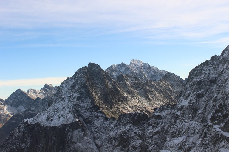
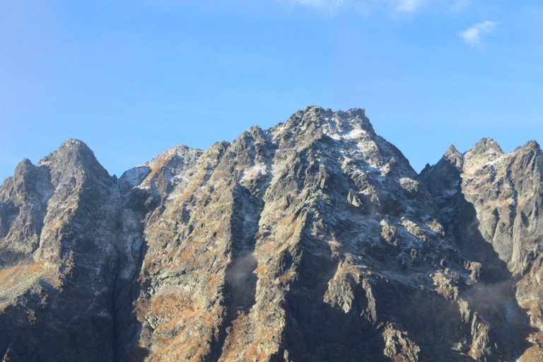
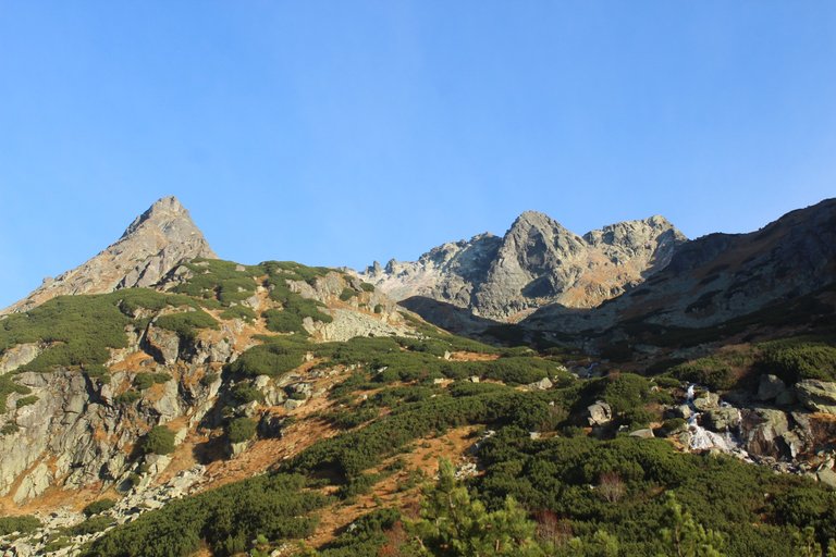
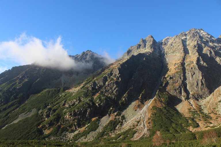
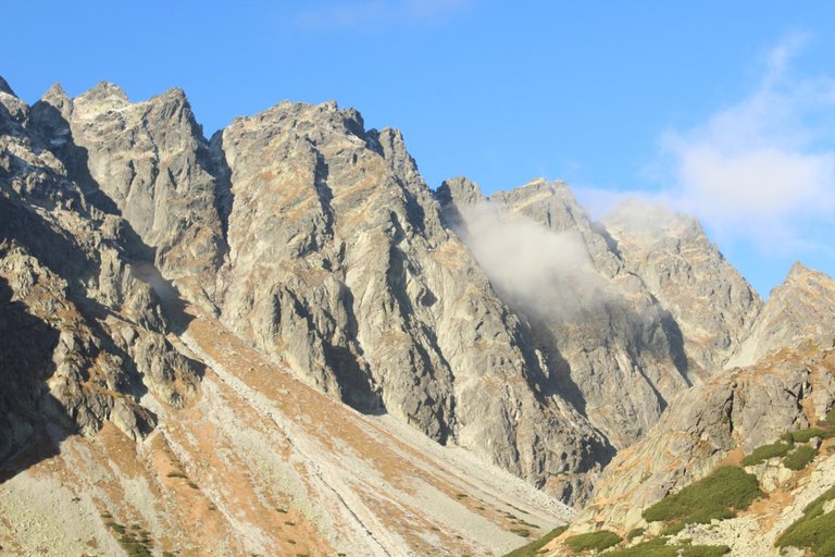
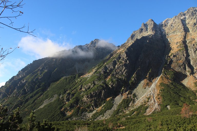
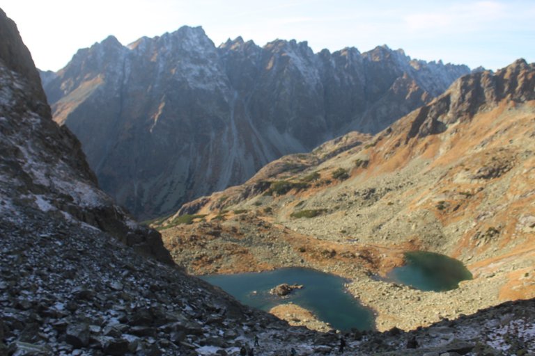
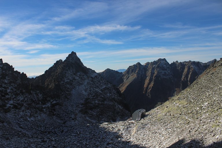
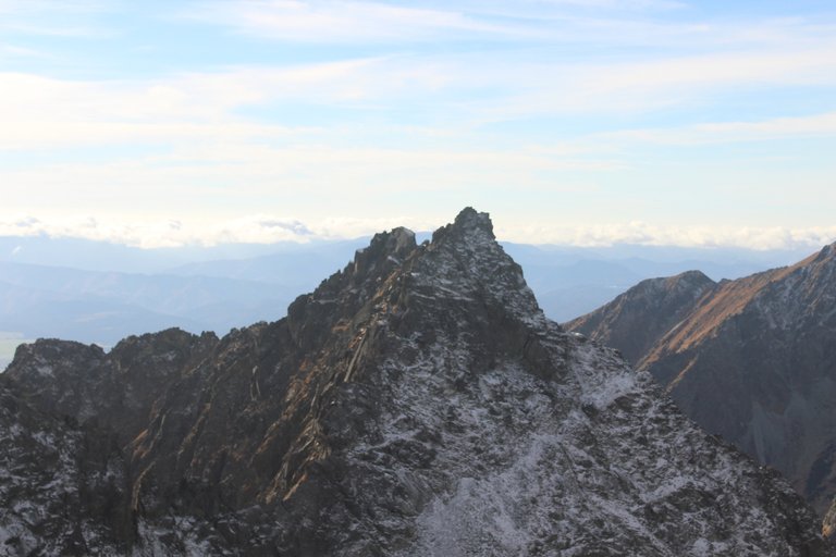
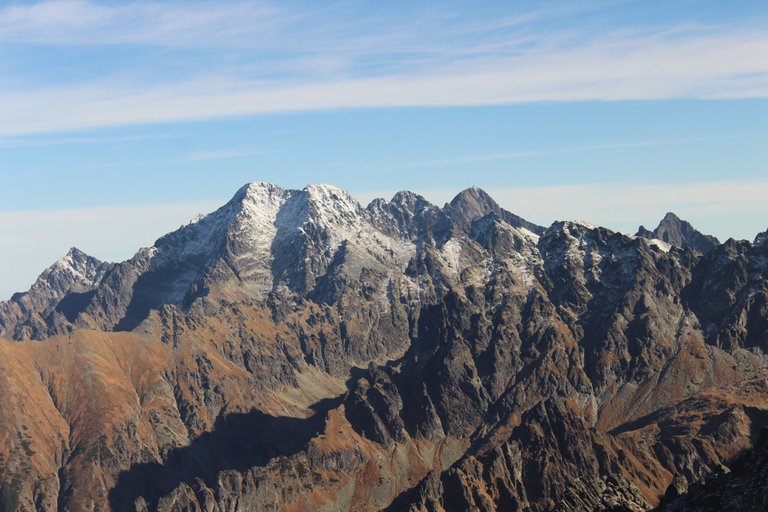
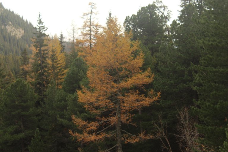
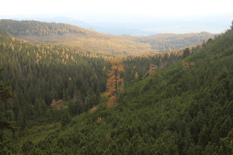
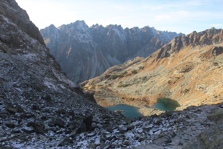
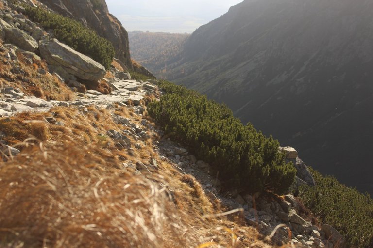
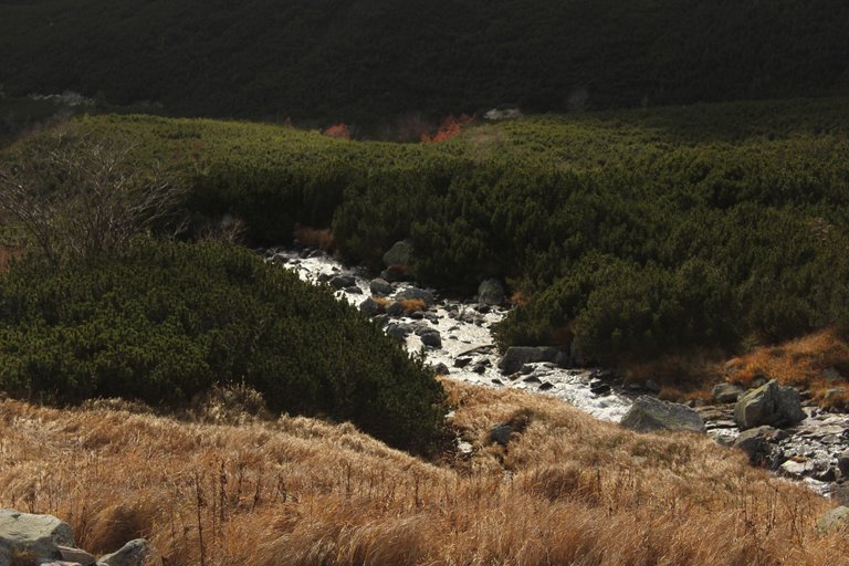
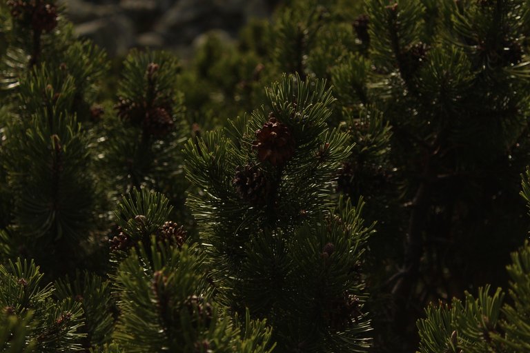
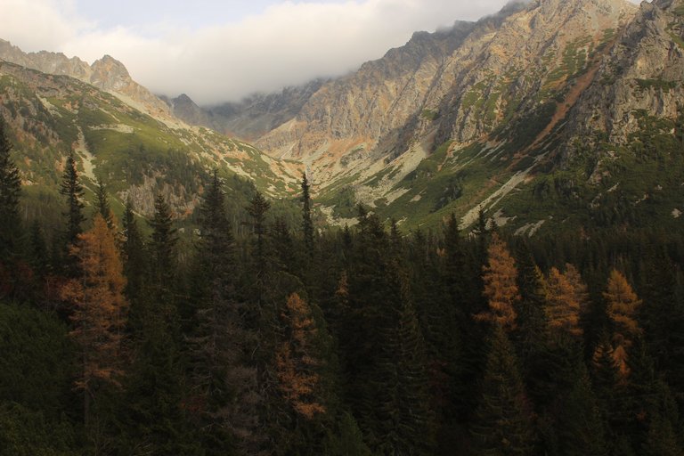
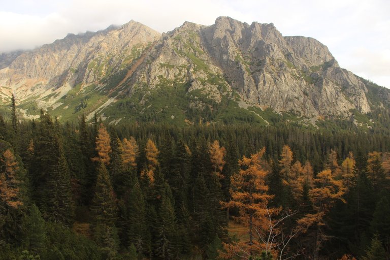
On the second day, at dawn, we set off towards Rysy. The first kilometers led us through the forest, and only when we reached the crossroads of the trails above the Žabí streams did we see picturesque mountains. At the same time, anxiety entered our hearts because we saw that the highest mountain peaks, such as Rysy which appeared on our right, were slightly snow-covered and we did not have crampons! It's okay, we decided to move on and wait to see what the next road will bring. When we reached an altitude of about 2,000 meters above sea level and the section with ladders began, the first icy stones appeared on our way, but fortunately, as it was already around noon, the ice melted and revealed non-iced fragments of stone on which we could safely and confidently climb. put your feet down. We were encouraged by Tatra porters who, with huge luggage on their backs, carried all the necessary things to the shelter called Chata pod Rysami, i.e. gas cylinders, pallets for the fireplace, Kofole and beer. After overcoming the steep section with ladders, the route looked much better because the trail was covered with well-trodden, not too slippery snow. This is how we reached the Chata pod Rysmi shelter located at an altitude of 2,250 meters above sea level. There it turned out that there was not much space in the shelter and it was almost completely filled with tourists. Fortunately, the weather was good so we sat on a bench behind the shelter and ate our second breakfast there. While eating, we decided that even though we didn't have crampons and the trail was covered with snow, we would try to continue because the next 100 meters of the climb looked very safe, and we'll see what happens next. This way we reached a very picturesque pass with a view of the eastern part of the High Tatras. Optimism filled our hearts, because it seemed that the remaining 100 meters of the climb to the top were very flat, or at least it looked that way at the beginning. We also noticed that many people coming down from the summit were also without crampons or crampons, so if they could do it, why shouldn't we? Unfortunately, after reaching an altitude of 2,385 meters, the trail took an unpleasant turn from a wide, gently sloping ridge to the west of the main ridge and led along a narrow, highly exposed path that I simply had no desire to walk on in winter conditions. I was very surprised, because standing at the beginning of this narrow path, a dozen or so people passed us and continued their journey to the top without hesitation, and yet this path belonged to the "once you make a mistake" type of trails. Well, we lowered our ears and started descending into the valley. The advantage was that, thanks to our departure about half an hour earlier, we managed to reach the car when it was still light, and there would still be a chance to climb Rys, but this time definitely not in late autumn or early spring.
[PL]
Drugiego dnia skoro świt ruszyliśmy w kierunku Rys. Pierwsze kilometry wiodły nas przez las i dopiero gdy dotarliśmy do rozstaju szlaków Nad Žabím potokom naszym oczom ukazały się malownicze góry. Jednocześnie w nasze serca zajrzał niepokój, ponieważ zobaczyliśmy, że najwyższe szczyty górskie, takie jak np. Rysy które pojawiały się po naszej prawej stronie są lekko ośnieżone, a my nie mamy raków! Nic trudno postanowiliśmy iść dalej i czekać co przyniesie dalsza droga. Gdy dotarliśmy na wysokość około 2000 metrów nad poziomem morza i zaczął się odcinek z drabinkami pojawiły się na naszej drodze pierwsze oblodzone kamienie, ale na szczęście ponieważ była już godzina około południowa lód wytapiał się i odsłaniał nie oblodzone fragmenty kamienia na których śmiało i bezpiecznie można było stawiać stopy. Otuchy dodali nam tatrzańscy tragarze, który z ogromnymi bagażami na plecach wnosili do schroniska nazywanego Chata pod Rysami wszystkie potrzebne tam rzeczy, czyli butle z gazem, palet do kominka, czy Kofole i piwo. Po pokonaniu stromego odcinka z drabinkami trasa wyglądała już znacznie lepiej, ponieważ szlak pokryty był dobrze wydeptanym niezbyt śliskim śniegiem. W taki sposób dotarliśmy do położonego na wysokości 2250 metrów nad poziomem morza schroniska Chata pod Rysmi. Tam okazało się, że w schronisku nie ma za wiele miejsca i jest całe niemal po brzegi wypełnione turystami. Całe szczęście pogoda była dobra więc usiedliśmy na ławce za schroniskiem i tam zjedliśmy sobie nasze drugie śniadanie. W trakcie jedzenia ustaliliśmy, że mimo iż nie mamy raków, a szlak jest obsypany śniegiem to spróbujemy iść dalej bo najbliższe 100 metrów podejścia wyglądało bardzo bezpiecznie, a co będzie dalej to się zobaczy. W ten sposób doszliśmy na bardzo malowniczą przełęcz, z której rozpościerał się widok na wschodnią część Tatr Wysokich. W nasze serca wlał się optymizm, bo zdawało się, że pozostałe do szczytu 100 metrów podejścia jest bardzo płaskie, a przynajmniej tak wyglądało na początku. Zauważyliśmy również, że wiele osób schodząca ze szczytu również szła bez raków czy raczków, wiec skoro oni dali sobie radę to dlaczego my mielibyśmy sobie nie poradzić. Niestety po dotarciu do wysokości 2385 metrów szlak w nieprzyjemny sposób skręcił z szerokiej o delikatnie pochylonej grani skręcił na zachód od głównej grani i prowadził po wąskiej mocno wyeksponowanej ścieżce, po której po prostu nie miałem najmniejszej ochoty iść w zimowych warunkach. Moje dziwienie było ogromne, bo stojąc na początku tej wąskiej ścieżki minęło nas kilkanaście osób, które bez wahania ruszyło w dalszą drogę na szczyt, a przecież ta ścieżka należała do szlaków kategorii „raz się mylisz”. Cóż spuściliśmy uszy po sobie, i zaczęliśmy schodzić do doliny. Plus był taki, że dzięki wcześniejszemu o jakieś pół godziny odwrotowi udało nam się dotrzeć do samochodu w momencie gdy jeszcze było widno, a na zdobycie Rys jeszcze będzie okazja, ale tym razem na pewno nie późna jesienią ni wczesną wiosną.
Congratulations @olusiu! You received the biggest smile and some love from TravelFeed! Keep up the amazing blog. 😍 Your post was also chosen as top pick of the day and is now featured on the TravelFeed front page.
Thanks for using TravelFeed!
@for91days (TravelFeed team)
PS: Have you joined our Discord yet? This is where over 1000 members of the TravelFeed come together to chat. Join us!
Congratulations, your post has been added to Pinmapple! 🎉🥳🍍
Did you know you have your own profile map?
And every post has their own map too!
Want to have your post on the map too?
what a beautiful view of the mountains, it looks amazing
Hello olusiu!
It's nice to let you know that your article will take 12th place.
Your post is among 15 Best articles voted 7 days ago by the @hive-lu | King Lucoin Curator by hallmann
You receive 🎖 1.0 unique LUBEST tokens as a reward. You can support Lu world and your curator, then he and you will receive 10x more of the winning token. There is a buyout offer waiting for him on the stock exchange. All you need to do is reblog Daily Report 181 with your winnings.
Buy Lu on the Hive-Engine exchange | World of Lu created by szejq
STOPor to resume write a wordSTART