
[ENG]
The measure has changed! It's been two weeks of our stay in Ecuador, one of the most volcanic countries in the world, and due to the French weather we have not yet seen any of the dozen volcanoes located here. When all around there are gray clouds hanging low above the ground, the horizon is flat as if it were drawn from a ruler, and yet, according to what we saw in the photos from postcards, it should be full of volcanic cones. We decided that it could not go on like this, and the only way to see the volcano in such weather is to climb one of them.
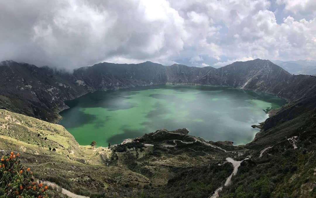
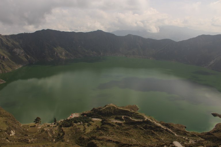
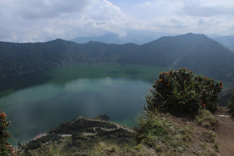
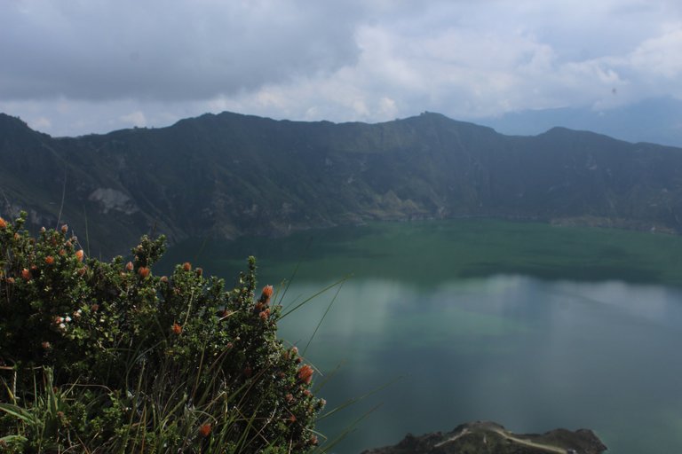
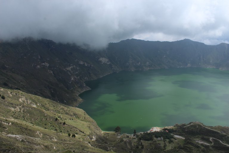
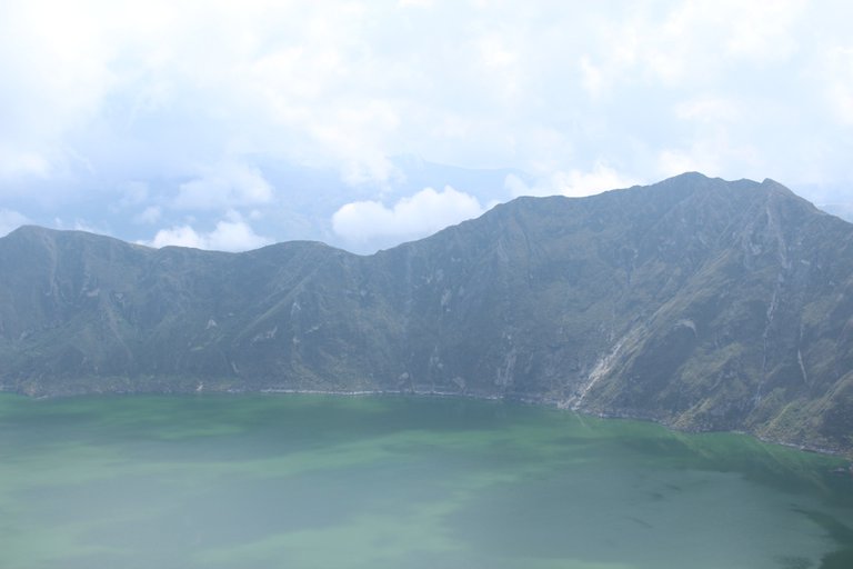
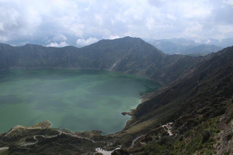
Quilotoa volcano 3,914 m above sea level is one of the lowest volcanoes in Ecuador. It seems so inconspicuous, but around 1280, that is when the Polish king Władysław Łokietek celebrated his eighteenth birthday, and in Poland there was a division of districts, here a real hell broke loose! An earthquake, a huge bang, a lot of lava and even more pyroclastic material. But when Quilotoa calmed down and stopped smoking, she must have been very ashamed, not only because of how much trouble she had done, but just imagine standing in the middle of nowhere, completely naked with scorched vegetation that once covered its slopes tropical, and even worse, with a bare crater. straight towards the sky. Fortunately, with the help of the bare Quilotoi, the rain came, which flooded the crater and created the picturesque Quilotoa Lagoon, and because there were many different kinds of minerals at the bottom of the crater, not so long residing in the interior of the earth, the rainwater was colored with intense green.
Honestly, I was a bit skeptical about going to this volcano, but avoiding it would turn out to be the biggest mistake made in South America. The crater has a diameter of 2 km, and there is a further 200 m difference in height from where we stood to the surface of the lake. If you think that 600 years ago lava was gushing from all this hole with unimaginable force, then you have respect for Mother Nature ... From today on, I am a VOLCANO FAN! I will climb as many volcanoes as possible!
[PL]
Miarka się przebrała! Minęły już dwa tygodnie naszego pobytu w Ekwadorze, jednego z najbardziej wulkanowych krajów świata, a przez tę francowatą pogodę nie widzieliśmy jeszcze żadnego z kilkudziesięciu znajdujących się tutaj wulkanów. Gdy wszędzie dookoła są szare, nisko zawieszone nad ziemią chmury, horyzont jest płaski jakby był rysowany od linijki, a przecież zgodnie z tym co widzieliśmy na fotografiach z pocztówek powinien być cały przepełniony stożkami wulkanicznymi. Stwierdziliśmy, że tak dalej być nie może, a jedyną możliwością zobaczenia wulkanu w taką pogodę jest wejście na jeden z nich.
Wulkan Quilotoa 3914 m n.p.m jest jednym z najniższych ekwadorskich wulkanów. Niby taki mały niepozorny, ale około 1280 roku, czyli wtedy kiedy król Polski Władysław Łokietek obchodził osiemnaste urodziny, a w Polsce trwało rozbicie dzielnicowe tutaj rozpętało się istne piekło! Trzęsienie ziemi, ogromny huk, dużo lawy i jeszcze więcej materiału piroklastycznego. Ale gdy Quilotoa się uspokoiła i przestała dymić musiała się bardzo zawstydzić, nie tylko z powodu tego jak bardzo narozrabiała, ale przecież wyobraźcie sobie stać tak w szczerym polu zupełnie gołym z wypaloną roślinnością, która kiedyś tropikalnie porastała jej zbocza, oraz co gorsza z gołym kraterem wystawionym prosto w kierunku nieba. Całe szczęście z pomocą gołej Quilotoi przyszedł deszcz, który zalał krater i utworzył w nim malowniczą Lagunę Quilotoa, a że na dnie krateru było dużo rożnego rodzaju minerałów nie tak dawno przebywających jeszcze we wnętrzu ziemi, deszczówka zabarwiła się intensywną zielenią.
Powiem szczerze, że byłem trochę sceptyczny co do wyjazdu na ten wulkan, ale ominięcie go okazałoby się największym błędem popełnionym w Ameryce Południowej. Krater ma średnicę 2 km, a od miejsca w którym staliśmy do tafli jeziora jest jeszcze jakieś 200 m różnicy wysokości. Jeśli pomyślisz, że 600 lat temu z całej tej dziury z niewyobrażalnym impetem tryskała lawa, to nabiera się respektu przed matką naturą... Od dzisiaj jestem WULKANOWYM FANEM! Wdrapię się na tak dużo wulkanów jak tylko się da!
Congratulations, your post has been added to Pinmapple! 🎉🥳🍍
Did you know you have your own profile map?
And every post has their own map too!
Want to have your post on the map too?
Your content has been voted as a part of Encouragement program. Keep up the good work!
Use Ecency daily to boost your growth on platform!
Support Ecency
Vote for new Proposal
Delegate HP and earn more
Congratulations @olusiu! You received the biggest smile and some love from TravelFeed! Keep up the amazing blog. 😍 Your post was also chosen as top pick of the day and is now featured on the TravelFeed.io front page.
Thanks for using TravelFeed!
@smeralda (TravelFeed team)
PS: Did you know that we recently launched the truvvl app? With truvvl, you can create travel stories on the go from your phone and swipe through nearby stories from other TravelFeed users. It is available on the Apple App Store and Google Play.
The rewards earned on this comment will go directly to the person sharing the post on Twitter as long as they are registered with @poshtoken. Sign up at https://hiveposh.com.