If you have been following my RLT travel series at all, you will not want to miss this one. In my view, it offers the most spectacular scenery of them all, as I cover one of the most impressive stretches of highway in America - the Silver Thread Scenic and History Byway, in the San Juan Mountains of southern Colorado!
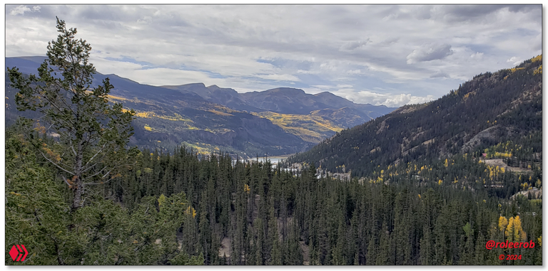
Overlooking Lake San Cristobal and the magnificent San Juan Mountains surrounding it
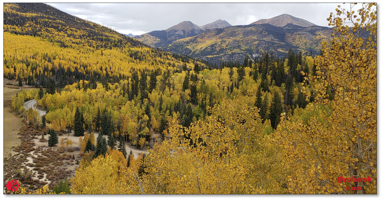
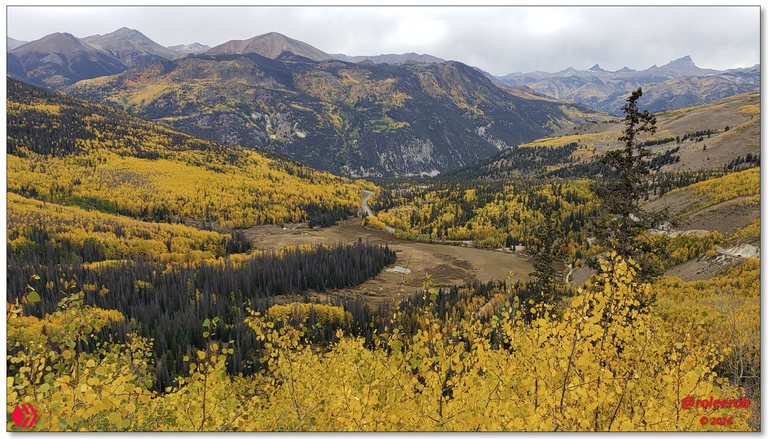
Lead Photo: The Silver Thread Scenic Byway up into the San Juan Mountains!
(Click on any image in this post, in PeakD, for anFor the next two posts, I will be writing one for each side of the Continental Divide split at the summit of Slumgullion Pass at 11,530 ft (3,514 m) - claiming "the steepest grade of any fully paved and maintained road in Colorado!"
Oh yeah!
Before taking a closer look, this is a map of the area covered in this post:
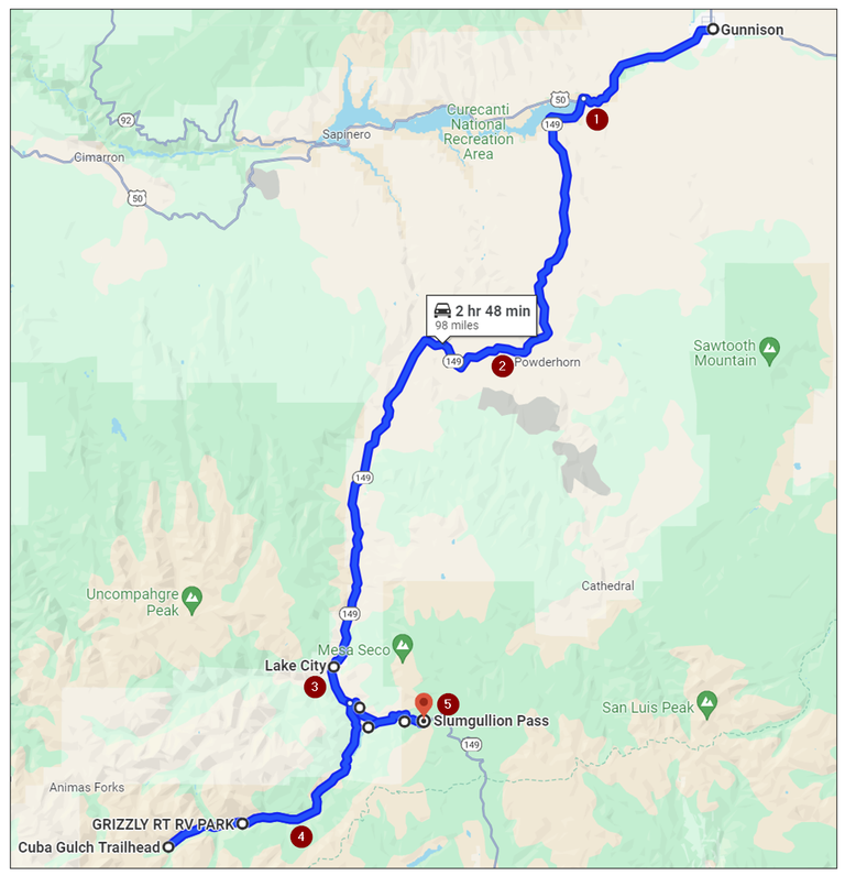
Source: Highlighted Google map of area covered in this post
Here is a brief look at each of the highlight points illustrated above, with links to more information, if you are interested in learning more about it:
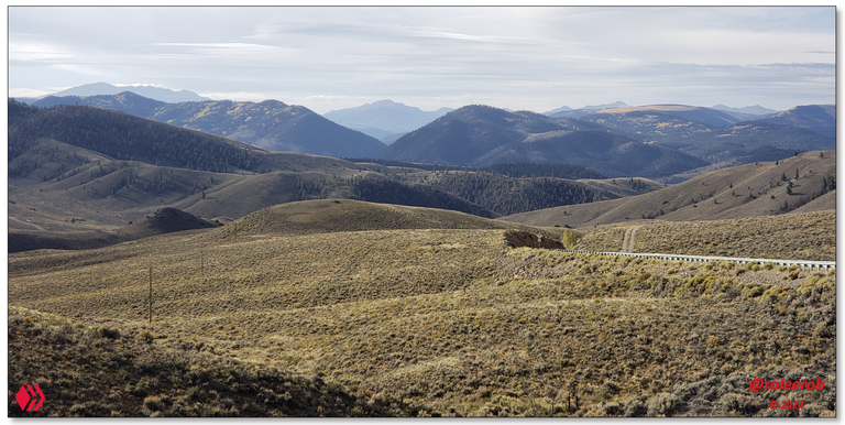
- Curecanti National Recreation Area - Elevation 7,523 ft (2,293 m). Left U. S. Highway 50, just as we were entering into this popular destination, and headed up into the high country of the San Juan Mountains on CO 149.
- On the Silver Thread Scenic Byway - Approximate location where the lower lead photo was taken.
- Lake City - Elevation 8,661 ft (2,640 m). A small town just downstream from Lake San Cristobal.
- Lake San Cristobal basin and gateway to the Alpine Loop - Elevation 9,003 feet (2,744 m). Drove up to the beginning of "... a network of four-wheel drive roads, is one of the most breathtakingly beautiful alpine drives in the world ..."
- Slumgullion Pass - Elevation 11,530 ft (3,514 m). Reached it driving up "the steepest grade of any fully paved and maintained road in Colorado!"
Let's be on our way! 😎

Climb up to Lake City
Leaving Gunnison early in the morning, the route along the Gunnison River was uneventful down to the upper end of the Blue Mesa Reservoir, the largest lake in Colorado.

Source: Webpage on Curecanti National Recreation Area.
This beautiful reservoir is backed up behind the dam on the Gunnison River, at the entrance to the spectacular Black Canyon of the Gunnison and all of its remarkable downstream dams, with their hydroelectric power generation and provision of vitally important water for agricultural needs. All enclosed inside the Curecanti National Recreation Area.
But ...
That is not why I am here ... 😉
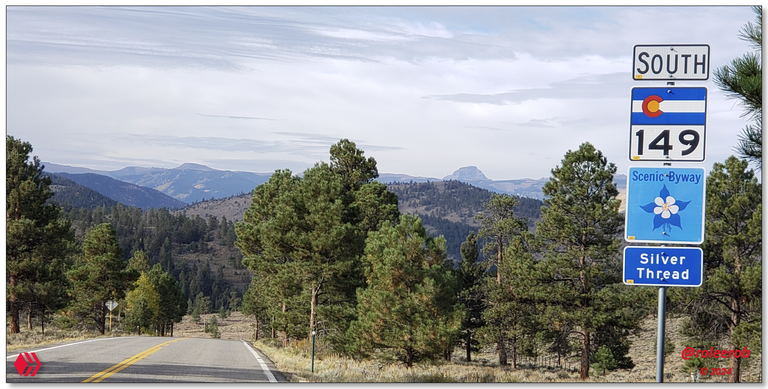
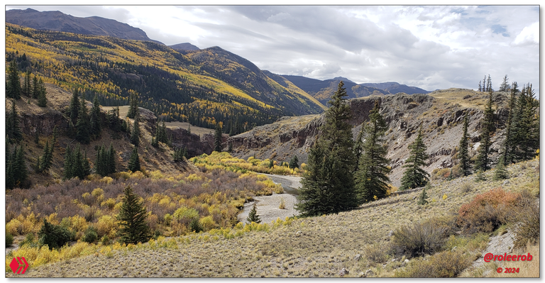
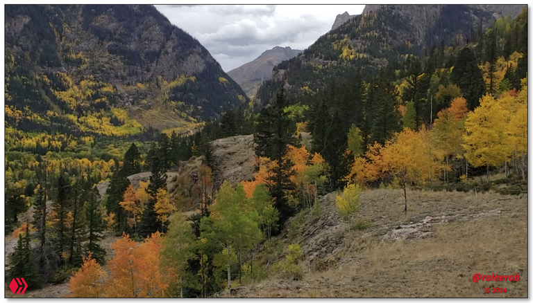
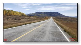
CO RT 149 along Lake Fork of the Gunnison
Once turning and crossing the bridge, at the junction of U. S. Highway 50 and CO RT 149, we were at the upper reaches of this lake (above). At an elevation of 7,523 ft (2,293 m), I immediately began to climb up to the first ridge presenting me with the following views, of what lay ahead:
After yesterday's adventures in the West Elk Mountains, today my little road warrior is going to 4-WD "heaven!"
One look and I knew it was going to be a very special day!
Beautiful view of the Lake Fork of the Gunnison River down below Lake City
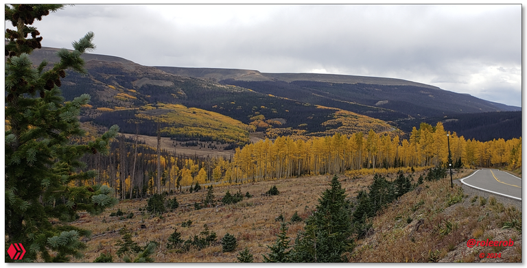
Photos: Views on climb up to Lake City
So many wonderful little "lures" to pull off the road, in either direction, to explore the vast San Juan Mountain range, but ... So, little time ... 😞
How many times on this trip did I think I will come back here some day and spend lots of time exploring? I have lost track ...
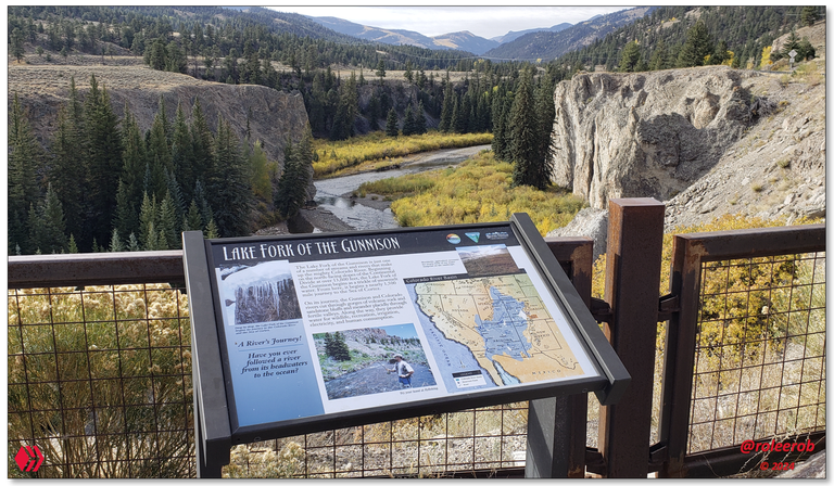
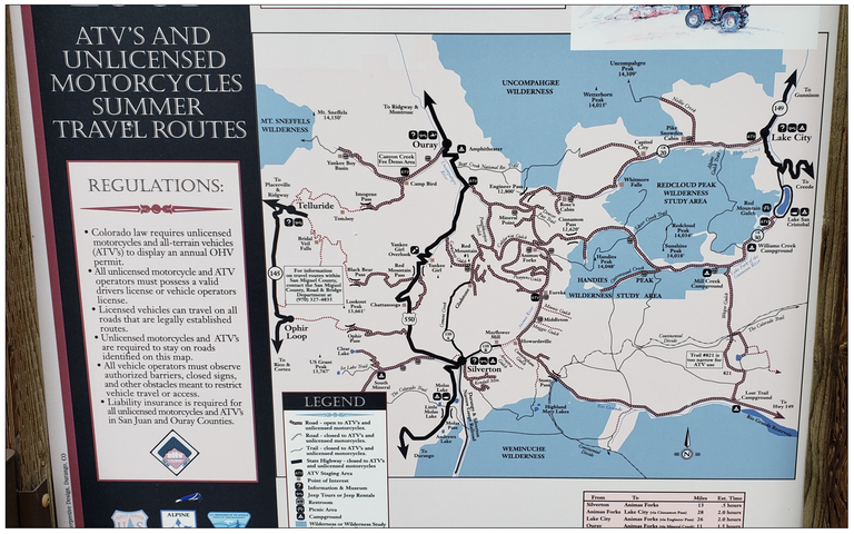
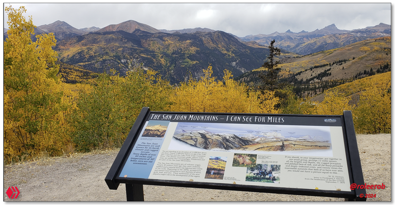
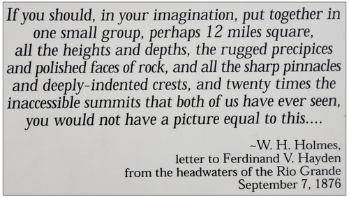
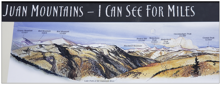
Informative Signs in Lake City
Lake City is a very peaceful small town high up, at 8,661 ft (2,640 m), in the San Juan Mountains. Once home to thousands, during a mining boom in the 1800s, the population was a mere 432 in the 2020 census.
Source: Webpage on Autumn in Lake City.
"Autumn is Perhaps the Most Beautiful Time to Visit Lake City. In One Word… GOLDEN."
Rather than "bury you," dear reader, with pictures of Lake City which did not impress me all that much, I chose instead to capture and present to you the following informative signs, as they were deemed more important.
Why?
For the detail provided to you about the remarkable country all around this little town. Which was the reason I was here:

The Lake Fork of the Gunnison drainage shown in a broader context

1874!? Unbelievable how early people were here in this rugged country ...
We are in "off roaders" Paradise here ...
Photos: Informative Signs in the area of Lake City
As I can imagine, it must be amusing to our Hivian friends from the ... "old world" ... to see references to 1874 as being "old." Well, you'll just have to accept that here in the ... "new world" ... that is very old ... 🤷♂️
The exodus from the East, after the tragedy and destruction of America's Civil War, was a major event in our country's history. The "point of the spear," in many cases? Men coming West to "seek their fortune," particularly linked to the discovery of deposits of gold and silver ...
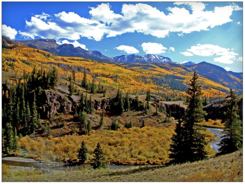
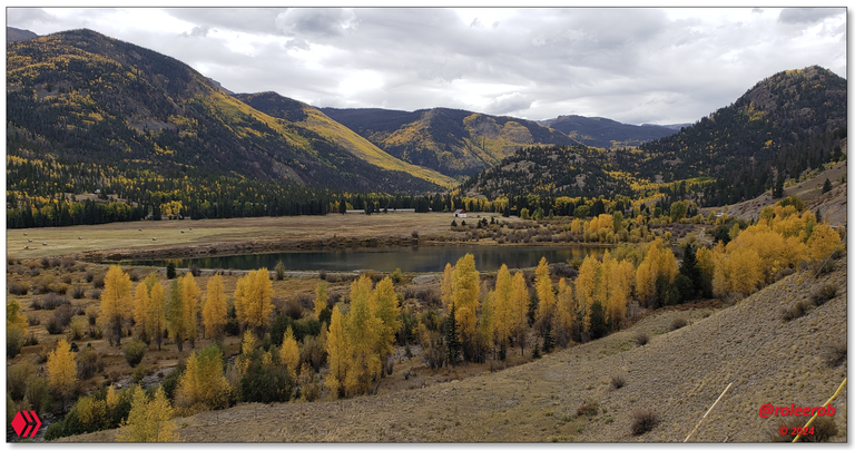
Lake San Cristobal Basin and Gateway to Alpine Loop
Leaving Lake City, I traveled a short distance up into the high mountain basin holding the "main event" of the day - Lake San Cristobal, the second largest natural lake in Colorado. It sits at 9,003 feet (2,744 m) in elevation.
First impressions? Wow! Mountain splendor in the San Juan Mountains of southern Colorado that is very difficult to match.
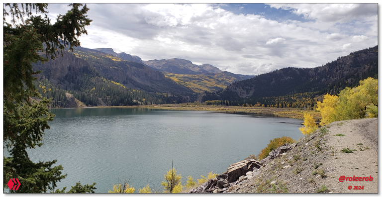
View looking west towards the end of Lake San Cristobal
Lake Fork coming down just before entering the lake
Entrance to Red Cloud Ranch


Your dream home? I hope you have a LOT of money then!
Finally! Some red leaves on the hillside, to the left.
End of the road! Off to the right, the Alpine Loop is a rugged 4-WD route up into much higher country ...
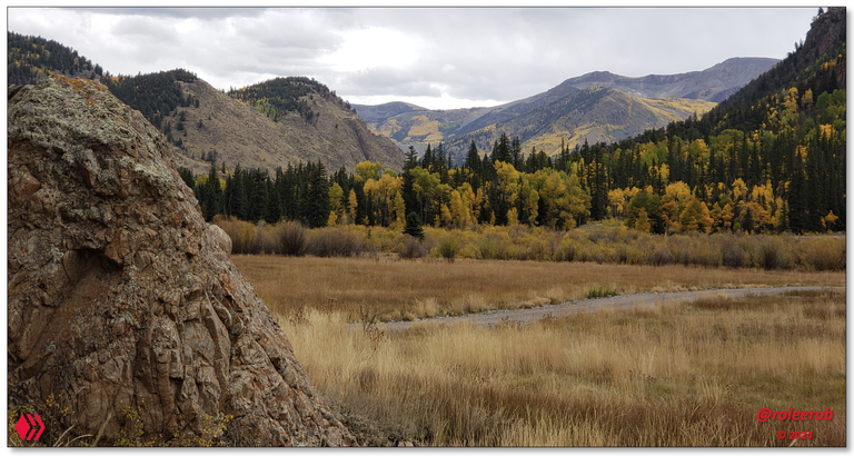
Photos: Views of Lake San Cristobal Basin and gateway to Alpine Loop
The urge to detour and redo my trip plans have been strong throughout this trip, but at no time greater than today.
Source: Webpage on Alpine Loop.
"... a network of four-wheel drive roads, is one of
the most breathtakingly beautiful alpine drives in the world ..."
Words and my pictures are not adequate to fully capture the experience of being there. Driving up through these mountains to Silverton would almost certainly be a life-time memory. One for which a dedicated trip would have to be planned ...
While nothing could be done about it, the only issue "dampening" an otherwise magnificent day was ... ? You guessed it! The overcast skies ...
While it did not rain, the brilliant sunlight at this high elevation would've significantly enhanced these wonderful pictures!
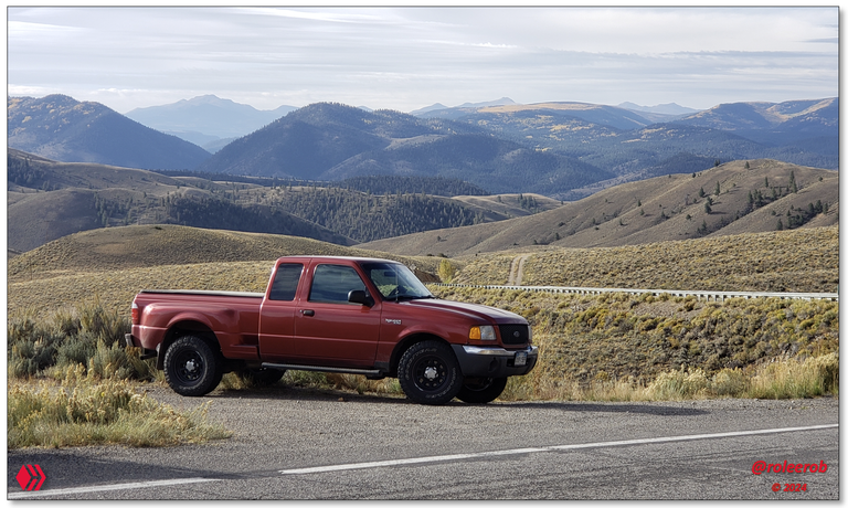
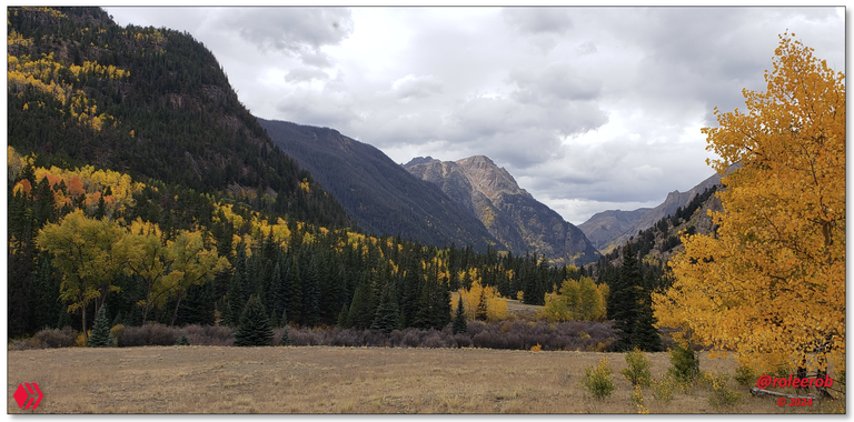
Climb to Slumgullion Pass
Driving back out to CO 149, I turned to head South and climb steeply up to the summit of Slumgullion Pass. Fun name? I thought so:
The term “slumgullion,” abbreviated simply as “slum,” refers to slumgullion stew, a watery meal composed mainly of root vegetables. Miners in the 1800’s referred to the leftover mud and yellow soils in gold-dense areas as “Slum.”
As one might expect, the views while climbing higher demanded a pullover, so ...
It was slow going! 🫡
Last view of Lake San Cristobal
Baldy Cinco Mountain - elevation 13,379 ft (4,078 m).
Climbing higher, fast ...
San Juans from Windy Point (yes!) Observation site. In the distance (rt), Uncompahgre Peak is 14,309 ft (4,361 m) in elevation.

Summit of Slumgullion Pass
Photos: Views of Climb to the Summit of Slumgullion Pass
While I have been higher in elevation than this, it has mostly been on foot. This is the 2nd highest elevation I had ever reached in a vehicle. I had my 4-WD little truck geared down into 3rd, to get up some of these final grades, the steepest in Colorado!
If you click to zoom in on the images above, you can better see the road threading its way up the mountainside!
Closing
RLT ("Road Less Traveled") post #7. Is the number 7 "lucky?" Is it "perfect?" Is it ?...? Well, I don't claim to know. I have just heard a lot of references to it being more than just another number most of my life ...
What I do know is this post covers what I considered to be the most attractive part of this trip. The place to which I would first return, given the opportunity. Especially knowing my next post is second behind this one, in its lure / appeal to come back, and that is right over the Divide ...
I hope you enjoyed "seeing through my eyes" this remote part of the American West. If so, I’d love to hear any feedback you may be inspired to provide.
Until "next time," all the best to you for a better tomorrow, as we all work together to build up our Hive Communities and add increasing value to our Hive blockchain! 👍 😊
Respectfully,
Blogger @roleerob
Hive "Dolphin" 🐬 & Man Cave "Dragon" 🐉
P.S. Unless otherwise noted, all images are pictures taken by my smartphone - a Samsung Galaxy S9+.
🌲 No trees were harmed in the publishing of this post! 🌲


Interested in reading more of my travel-related posts?
 |
RLT #1: Battle Pass Scenic Byway
The first of my RLT ("Road Less Traveled") series, as I began writing again on Hive in 2024. An open road. With no one on it. Out in remote portions of the great American West. Hmmm. I wonder what it all means? |
 |
Fond Memories: Return to Spirit West River Lodge
A remarkable place. Built by remarkable people. Writing about it resulted in some of my highest rewarded posts, including "Daily Top Payout" on Hive. Please don't miss my tribute to Lynn Finney, in the top comment.
|
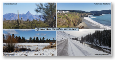 |
R2R Travelogue: Recap of "@roleerob's excellent adventure!" In winter ... My R2R series - "Road to Recovery" trip of a lifetime. In 31 days, I drove 4,984 miles through a part of 8 states - Colorado, Arizona, California, Oregon, Washington, Idaho, Montana, and Wyoming. Unforgettable memories relived and new ones made! |
Map of roleerob's
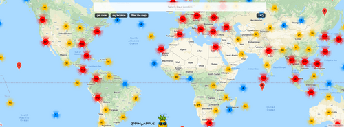
Check out HaveYouBeenHere's:
App •
Map •
Hive Travel Community
• Discord


Based on the map distance, the trip averages 30mph which is very slow. Given the roads looks wide and I'm guessing there's no traffic jam 😉 why does Google estimate it takes such a long time to cover 98 miles?
Of course, I'm sure this journey would make a lovely drive for the whole, and if I was there I'd probably be stopping every 5 miles to soak in the incredible views
Yes, 30 mph is slow. For a major highway ... Out in the "flat lands" ...
For winding up around all of the curves through the canyons, etc. it is pretty typical. That is if you keep moving. I stopped a LOT, to soak it all in ... 🙂
Sadly, even at that, it was over way too fast. This particular portion of my trip is at the top of where I would return, if I am ever given the opportunity.
Congratulations, your post has been added to Pinmapple! 🎉🥳🍍
Did you know you have your own profile map?
And every post has their own map too!
Want to have your post on the map too?
Dear @roleerob !
The historical fact is interesting that many Americans were wounded by the Civil War, left the devastated East, and went West in search of new hope!
I remember your writing about how your ancestors who settled in America settled in the West because of that!
Colorado's dense forests and mountains are beautiful, but when it snows, it really becomes a terrible place for humans to live!
I assumed Wyoming and Colorado would have similar natural environments!😃
Although Colorado's natural environment is very beautiful, I had a sad feeling that it would be difficult for me to live there!
I am not strong enough to work on ranches and farms as you claim!😂
Thank you for your good article!
In the modern era, @goldgrifin007, in which we both live (on opposite sides of the world) ...
... this is much less an issue than you apparently believe. Man has a great deal of ingenuity when it comes to solving problems. You also have winter there, right?
It can be more challenging in the rural locations which are highlighted in these posts, to be sure. Even then, men in powerful 4-WD trucks are far better equipped to deal with these challenges, than their predecessors mounted on horseback.
Lake city covers almost everything from beautiful mountains to lakes to beautiful flowers. If their are inhabitants they should definitely be lucky. Thanks to share these pictures to make us view through your eyes.
You can appreciate the beauty of the place through your photos 😍