Welcome back to the next installment of my travels along the long-distance European route E3. In today's episode, we will leave Nízký Jeseník and move to the Vítkovská pahorkatina (highlands).
Vítejte zpět u dalšího pokračování zápisků z mých cest po dálkové Evropské trase E3. Dnešním díle opustíme Nízký Jeseník a přesuneme se do Vítkovské pahorkatiny.
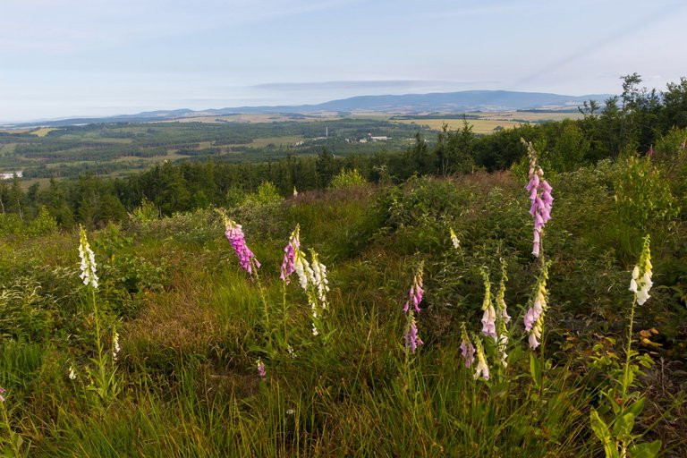
The night at the well was not exactly the most pleasant, because it was one of the few sources of water in the area, and so a large number of animals flocked there. Including annoying mosquitoes, so even though it was a warm night I had to be wrapped in a sleeping bag so they wouldn't get to me. That's why I packed up immediately after sunrise and set off towards the top of Slunečná (802m) from where the last view towards the already very distant Hrubý Jeseník was.
Noc u studánky, nebyla zrovna nejpříjemnější, protože to byl jeden z mála zdrojů vody okolí a tak se tam stahovalo velké množství zvěře. Včetně otravných komárů, takže i přes to že byla teplá noc musel jsem být zabalen do spacáku, aby se ke mě nedostali. Proto jsem se hned po východu slunce zabalil a vyrazil směr vrchol Slunečná (802m) odkud byl poslední výhled směrem již velmi vzdálený Hrubý Jeseník.
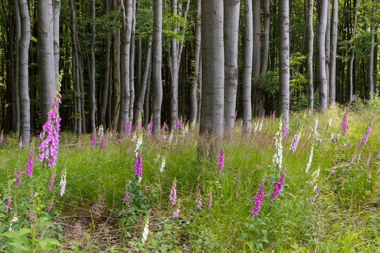
Slunečná ridge was very interesting, it's just a pity that roughly half of the ridge was without forest, because it was destroyed by a bark beetle.
Hřeben Slunečná byl velmi zajímavý, jen škoda že zhruba polovina hřebene byla bez lesa, protože ho zničil kůrovec.
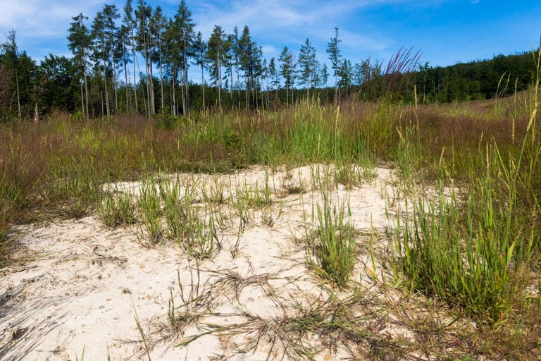
The same was true under the ridge, where a place was called Písečný svah (Sandy slope) and, according to the name, a small desert formed here.
Podobně tomu bylo i pod hřebenem, kde se jedno místo jmenovalo Písečný svah a podle jména zde vznikala malá poušť.
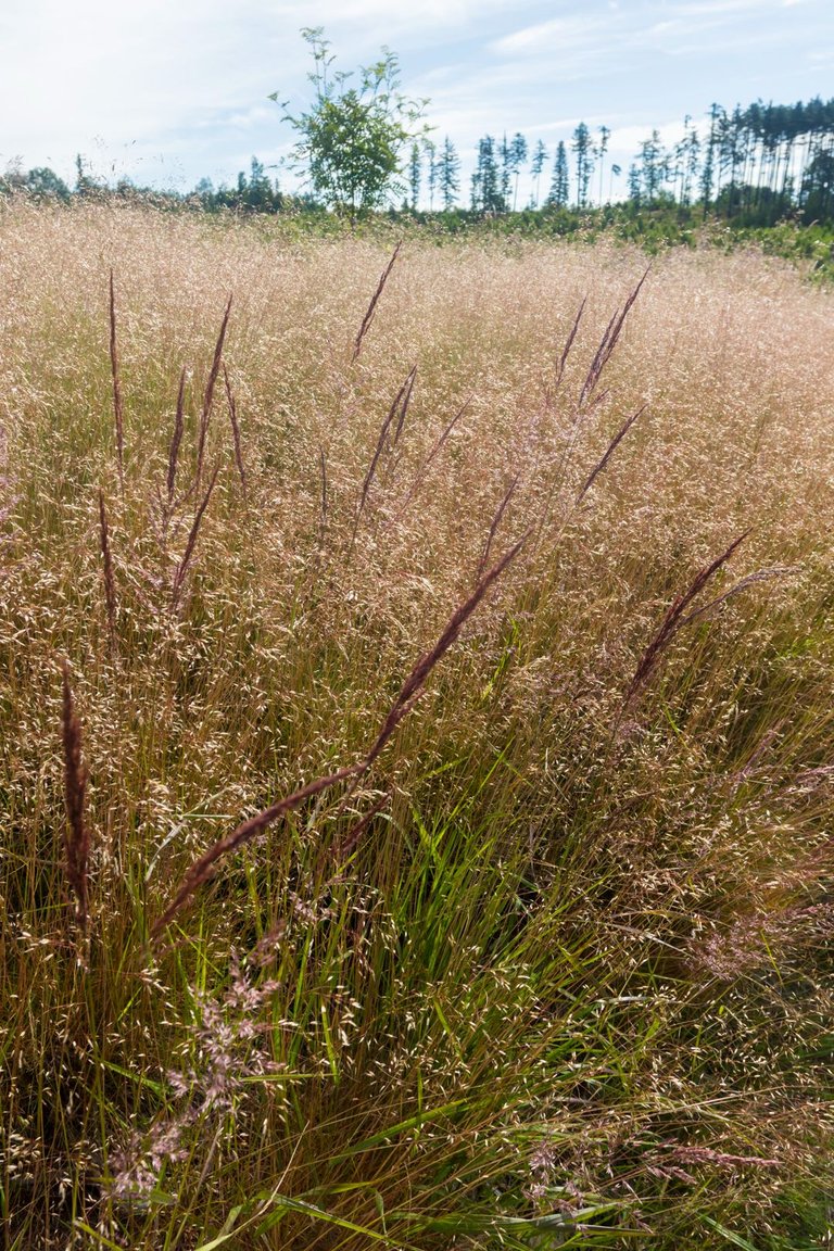
And basically the entire Lesní potok valley was without a mature forest, so instead of a forest, various types of grasses thrived here.
A v podstatě celé údolí Lesního potoka bylo bez vzrostlého lesa, a tak místo lesa zde prosperovaly různá druhy trav.
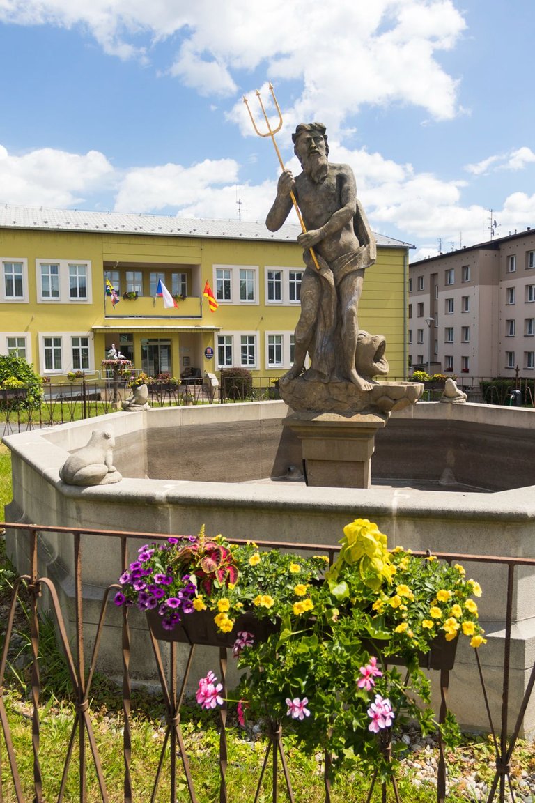
Through the small villages of Nová Valteřice and Křišťanovice, I reached the small town of Dvorce, where I bought a snack in a local shop. Again I was followed by a local crazy woman who wanted to chat. I exchanged a few words with a local grandmother at the bus stop where I had a snack. I took a picture of the Neptune Fountain and continued on.
Přes malé vesničky Nové Valteřice a Křišťanovice jsem došel do malého městečka Dvorce, kde jsem si koupil svačinu v místním obchodě. Opět jsem byl sledován místní bláznivou ženou, která si chtěla povídat. Prohodil pár slov s místní babičkou na zastávce autobusu kde jsem svačil. Vyfotil jsem Neptunovu kašnu a pokračoval dále.
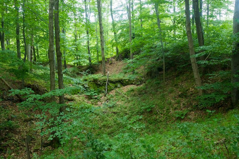
On the Budišovská silnice (road), I got through the forest to the ruins of the Vildštejn castle. I was surprised that it was a relatively large castle, but to this day, basically only the floor plan of the walls has survived.
Po Budišovské silnici jsem se dostal přes les až k zřícenině hradu Vildštejn. Překvapilo mě že se jednalo o poměrně velký hrad, ale do dnešních dnů se z něj dochoval v podstatě jen půdorys hradeb.
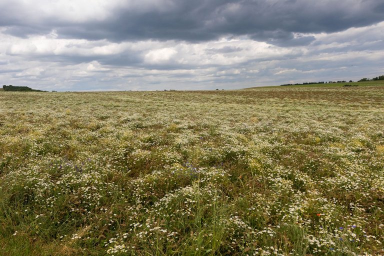
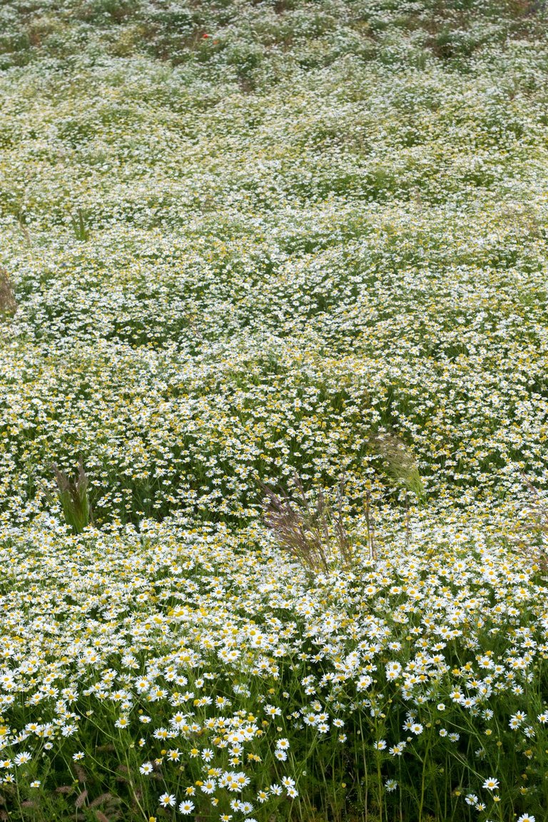
As soon as I left the forest, I was greeted by blooming meadows and a relatively large number of people heading to the nearby lookout tower. Unfortunately for me, it was out of my way and I didn't want to handle it too much, as it was quite warm, although it probably doesn't look like much from the photos.
Jakmile jsem opustil les byl jsem přivítán rozkvetlými loukami a poměrně velkým množstvím lidí, kteří směřovali na nedalekou rozhlednu. K mému neštěstí byla mimo mojí cestu a nechtělo se mi příliš zacházet, jelikož bylo docela teplo i když to podle fotek asi moc nevypadá.
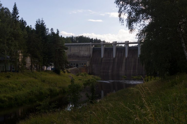
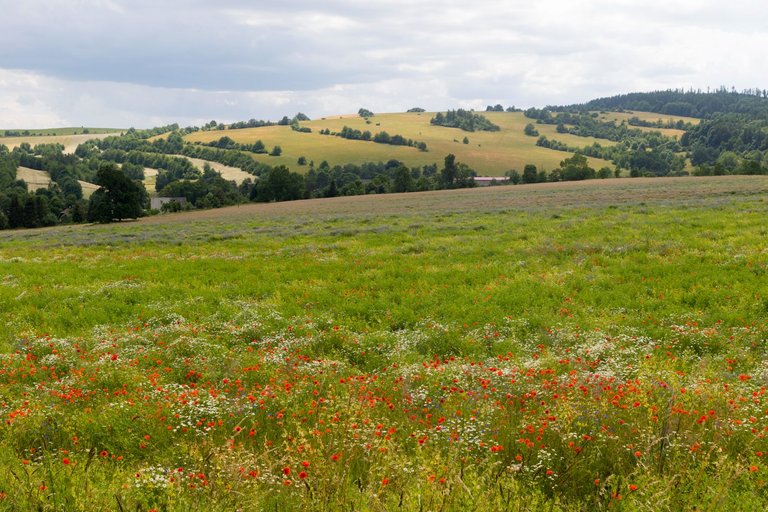
I planned to replenish supplies in the town of Budišov nad Budišovka. Buy insect repellant and then some shorts. I managed to do both in local shops and as a bonus I also bought outdoor socks for 59 CZK from local firm. The surroundings of the city are very beautiful. But the same cannot be said about the city, there is basically nothing of tourist interest here and one can meet quite interesting scenes on the streets. For example, like a drug addict sitting on the side of the road with some kind of 30-year-old VCR waiting for a dealer. So I left town pretty quickly and tried on the shorts I bought outside of town. I found that they were too small for me, so I angrily continued on. On the way to the nearby dam, in no time I found a brand new running cap worth about 1200 CZK in a ditch. So I wasn't too angry to buy shorts for 200 CZK. For the first time during the entire route, I disconnected from the E3 route, because it led through open terrain and a large part along the main road. So I chose the path through the forest around the reservoir to the Kružberk dam.
Ve městě Budišov nad Budišovkou jsem měl v plánu doplnit zásoby. Hlavně koupit repelent na hmyz a pak nějaké krátké trenýrky. Obojí se podařilo v místních obchodech a jako bonus jsem si koupil ještě outdoorové ponožky za 59 Kč od lokální firmy. Okolí města je velmi krásné. To samé se ale nedá říci o městě, není zde v podstatě nic turisticky zajímavého a člověk se zde může setkat s dosti zajímavými výjevy na ulicích. Třeba jako jeden drogově závislý sedící na kraji silnice s jakýmsi 30 let starým videorecordérem čekající asi na dealera. Takže jsem město dosti rychle opustil a za městem zkusil šortky co jsem koupil. Zjistil jsem že jsou mi malé a tak jsem naštvaně pokračoval dále. Cestou k nedaleké hrázi jsem v příkopu našel úplně novou běžeckou kšiltovku v ceně asi 1200 Kč. Takže mě ani tak nemrzel nákup kraťasů za 200 Kč. Poprvé za celou trasu jsem se odpojil od trasy E3 a to z důvodu, že vedla přes otevřený terén a velkou část i po hlavní silnici. Takže jsem zvolil cestu lesem kolem vodní nádrže až k přehradě Kružberk.
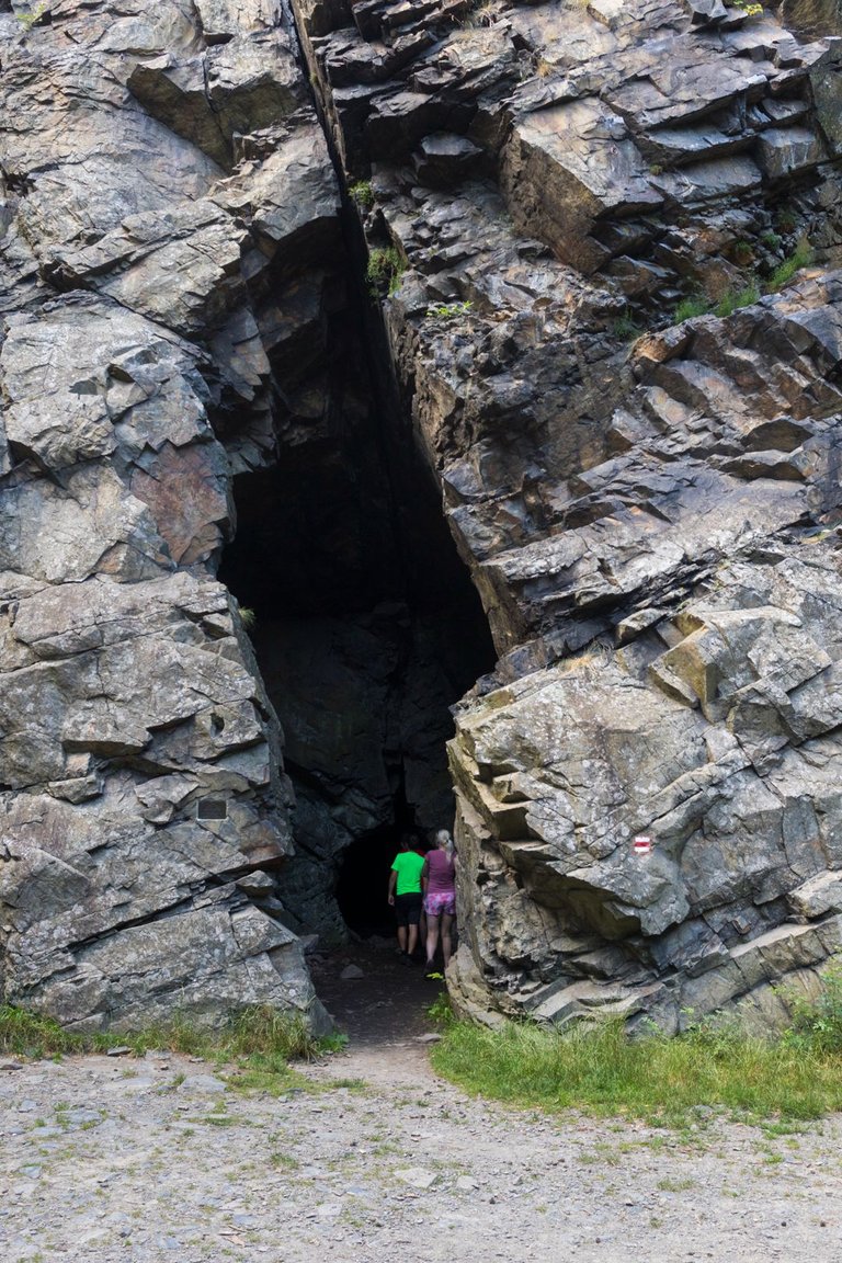
There was also an artificially created cave under the dam, which was originally supposed to serve as a tomb, but the local authorities did not support the construction, so only a hole in the rock remained. The surrounding rocks serve as a playground for climbers.
Pod přehradou byla i uměle vytvořená jeskyně, která měl původně sloužit jako hrobka, ale místní autority stavbu nepodpořili a tak zde zůstala jen díra v skále. Okolní skály slouží horolezcům jako hřiště.
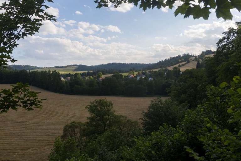
As evening was approaching, all that remained was to find a place to spend the night. Which appeared to be quite a problem in the deep valley of the Moravice River. In the end, according to the map, I chose a meadow that was further away from human habitation and seemed ideal. After I had bathed and washed things in the river, a man appeared here. He was also a traveler on his way from Beskydy to Jeseník. And he had the same idea as me with accommodation. So we exchanged a few words on various topics and since he was relatively local, he also described the situation in the so-called triangle of the Odra Vítkov Budišov, that it is the poorest area of Silesia and that is why I saw what I saw in Budišov. And since we both planned to leave around sunrise, we ended the conversation a little after dark and went to bed.
Jelikož se blížil večer, nezbývalo než najít nějaké místo k nocování. Což se jevilo jako docela problém v hlubokém údolí řeky Moravice. Nakonec jsem podle mapy zvolil louku, která byla dále o lidských obydlí a jevila se jako ideální. Po té co jsem se okoupal a vypral věci v řece se zde objevil muž. Byl to také cestovatel na své cestě z Beskyd do Jeseníku. A měl stejný nápad jako já s ubytováním. Takže jsme prohodili pár slov na různá témata a jelikož byl relativně místní tak mi popsal i situaci v takzvaném trojúhelníku Odry Vítkov Budišov, že se jedná o nejchudší oblast Slezka a proto jsem viděl co jsem viděl v Budišově. A protože jsme měli oba v plánu vyrazit kolem východu slunce tak jsme rozhovor ukončili chvíli po setmění a šli spát.

| Total distance traveled | Conquered peaks | Total altitude |
|---|---|---|
| 973,7 Km | 109 | 53471m |
Day four was more about the stories than the photos, but I was still able to cover the daily dose of kilometers and the distance stopped at the finish line of 33.4 Km. As I was still going down most of the day. As a result, I fell 826 meters, but climbed 528 meters. As a result, it was quite a relaxing day, except for the sweltering heat that prevailed at the time.
Čtvrtý den byl spíše o příbězích nežli o fotografiích, ale i tak jsem byl schopen urazit denní dávku kilometrů a vzdálenost se zastavila na metě 33.4 Km. Jelikož jsem většinu dne stále klesal. Ve výsledku jsem klesl o 826 metrů, ale tak jsem nastoupal 528 metrů. Talže to byl ve výsledku docela odpočinkový den, až na to úmorné vedro které tou dobou panovalo.
very beautiful landscapes
Now this was the best part of reading your post🥰🥰
The view is magical dear friend🤗🤗
I'm glad you liked it.
Very interesting and beautiful post. Photos of nature impress with their beauty. Thank you very much for your work and ability to love nature. I wish you success.
I absolutely do not understand how some people can exist without visiting nature at all or even destroy it.
After publishing such beautiful photos of nature, I think many will want to communicate with nature. Nature has given us a lot of beauty, we should be grateful to her for this. Once again I want to thank you for your positive and beautiful content.
tvl kšiltovka za dvanáct stovek? wtf? Moje kompletní oblečení co mám právě na sobě stálo asi třetinu 😂😂😂
Byla to New Balance ultra lehká běžecká. Holt si firmy nechávají kvalitní zboží zaplatit.
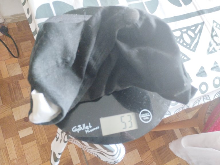
Schválně jsem si zvážil svoji ultra kšiltovku z pracovních oděvů za 50 Kč. 53 gramů. Nejsem běžec, ale to někdo řeší?
Congratulations, your post has been added to Pinmapple! 🎉🥳🍍
Did you know you have your own profile map?
And every post has their own map too!
Want to have your post on the map too?
Hiya, @LivingUKTaiwan here, just swinging by to let you know that this post made it into our Honorable Mentions in Daily Travel Digest #1977.
Your post has been manually curated by the @pinmapple team. If you like what we're doing, please drop by to check out all the rest of today's great posts and consider supporting other authors like yourself and us so we can keep the project going!
Become part of our travel community: