Welcome everyone to the second part of the Christmas travels around the island of Gran Canaria. Today we will see what the island prepared for me and my colleagues on my first full day on the island.
Vítejte všechny u druhého dílu vánočních cest po ostrově Gran Canaria. Dnes se podíváme, co pro mě a mé kolegy ostrov připravil, na můj první celý den na ostrově.
During the previous evening, we agreed where we would actually go on the island, which gave us direction to the following 12 days. As our first goal, we set ourselves to reach the beginning of the longest tourist sign that our map offered us. This meant walking to the south of the island and then across the mountains to the north to the city of Gáldar. This is a historical pilgrimage trail that led from the south of the island to the largest church on the Gran Canaria.
Během předchozího večera jsme se dohodli, kam vlastně na ostrově půjdeme, což dalo směr následujícím 12 dnům. Jako první cíl jsme si stanovili dojít na začátek nejdelší turistické značky co nám naše mapa nabídla. To znamenalo zamířit na jih ostrova a pak přes pohoří na sever do města Gáldar. Jedná se o historickou poutní stezku, která vedla z jihu ostrova k největšímu kostelu na Gran Canarii.
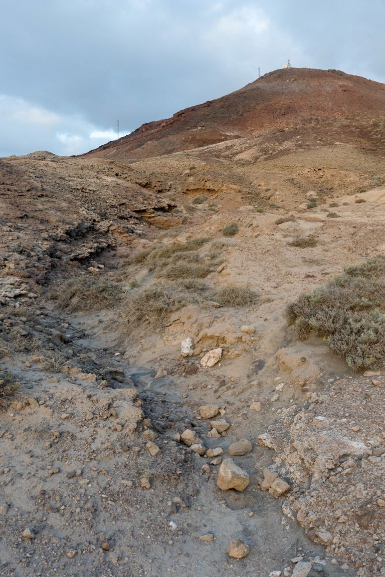
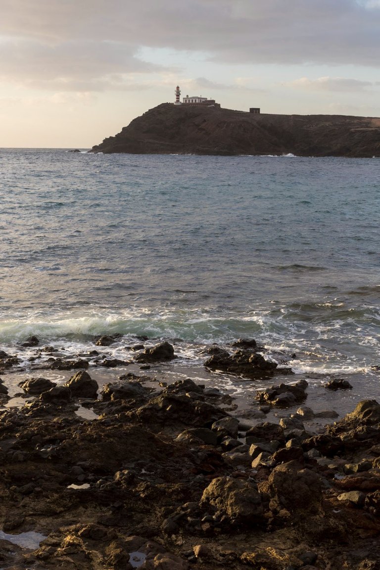
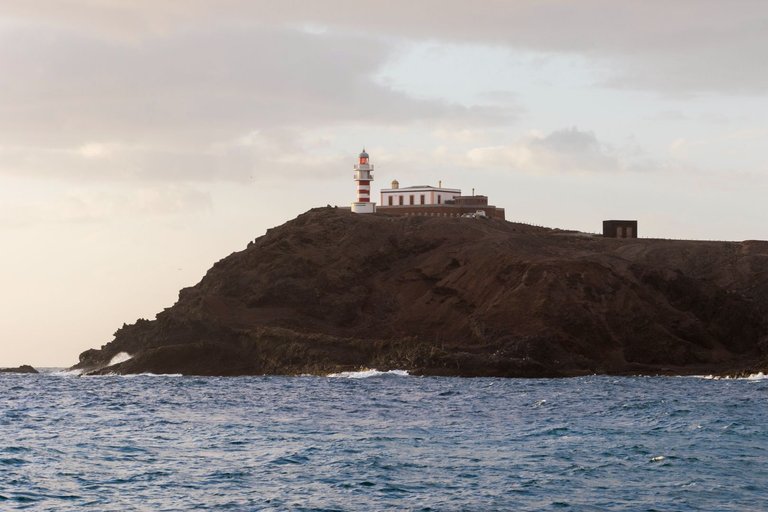
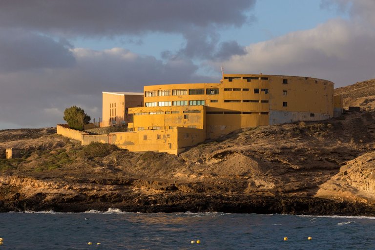
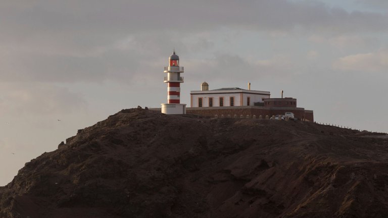
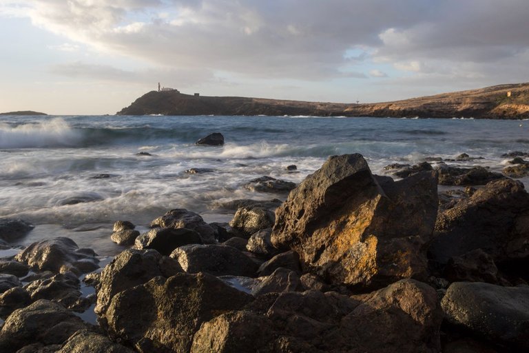
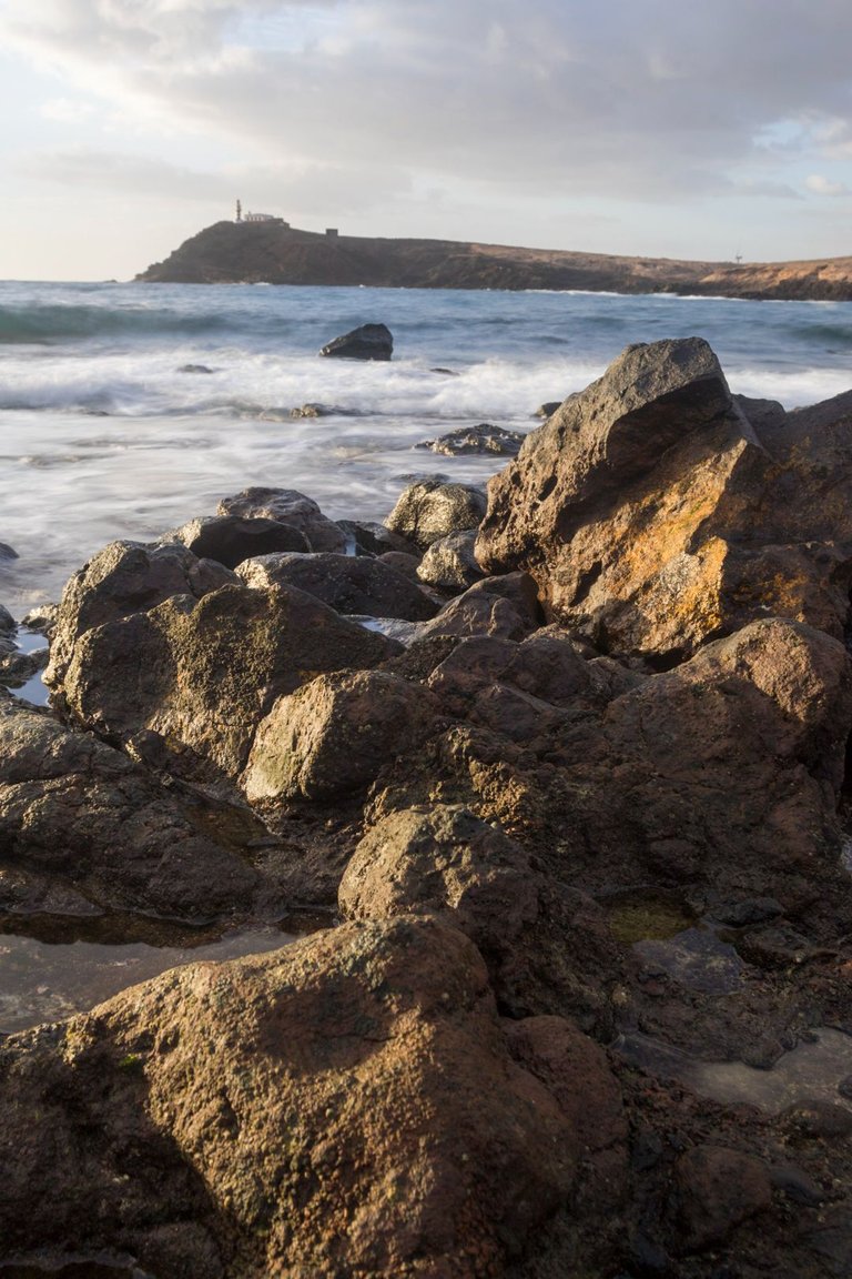
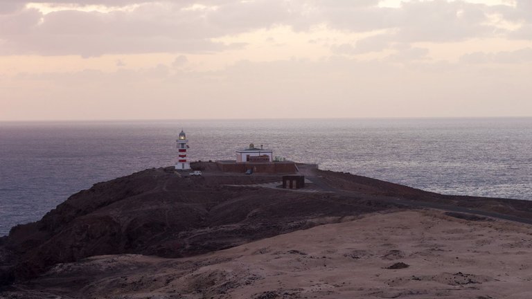
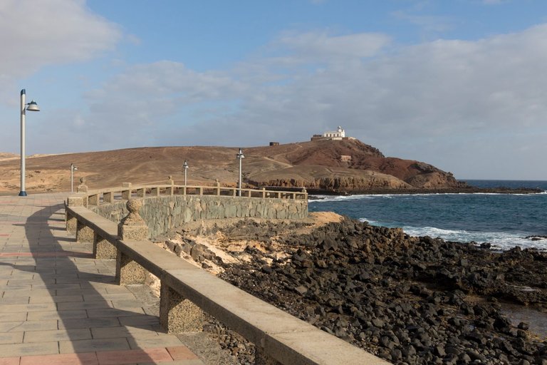
In the morning I set my alarm just before sunrise. With a plan to go to the sea to take pictures. On the way I had to pass through several ravines washed out by the water, past a building marked on the map as a hotel. It rather reminded me of a prison with a view of the sea. Until I finally reached the sea at a small fishing village that doesn't even have a name on the map.
Ráno jsem si nařídil budíka těsně před východ slunce. S plánem vyrazit fotit k moři. Cestou jsem musel projít několika roklemi vymletými vodou, kolem budovy označené v mapě jako hotel. Mě sobně to spíše připomínalo vězení s výhledem na moře. Až jsem nakonec došel k moři u malé rybářské vesničky, která nemá v mapě ani jméno.
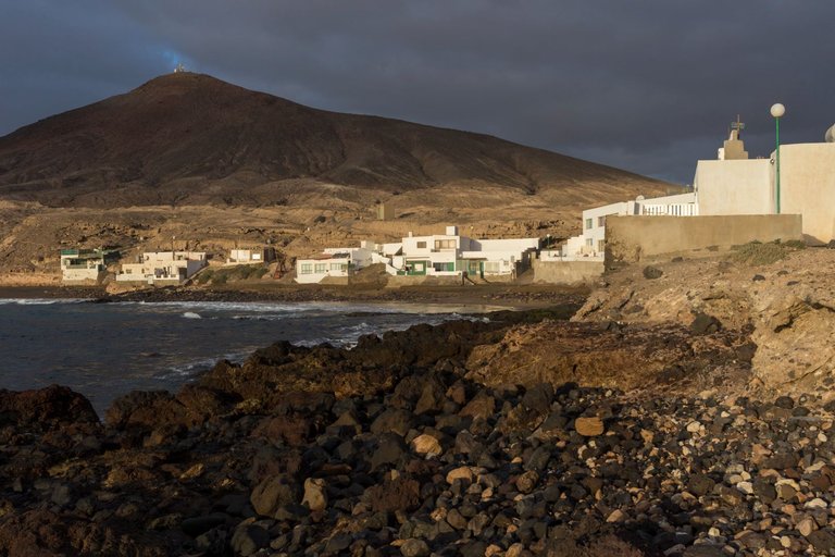
The sun rose above the horizon quite quickly and it started to get warm. That was the signal to head back to the place of our lodging. The friends were already awake, because they were woken up by the sun warming the semi-desert. We had a quick breakfast and set off south as we agreed the previous evening. In the first city we wanted to buy food, at least for two days. Because we didn't know how it would be with the possibility to eat and drink in a seaside restaurant.
Slunce se poměrně rychle vyhouplo nad horizont a začalo se dělat teplo. To bylo znamení vyrazit zpět na místo nocoviště. Kamarádi byli již vzhůru, protože je vzbudilo slunce ohřívající polopoušť. Rychle jsme posnídali a vydali se cestou směr jih, jak jsme se předchozí večer domluvili. V prvním městě jsme chtěli nakoupit jídlo, alespoň na dva dny. Jelikož jsme nevěděli jak to bude s možností najíst se a napít v nějaké přímořské restauraci.
We managed to buy supplies right away in Arinaga town, except for the most important thing we needed. And that was the gas bomb for the stove. Through my very little research, I found that hardware stores should have gas refills. There were quite a few of them in the city, but none of them had our system. So we set out again on them across our first river. Of course, it was dry, so invasive grass took over the bottom of the river.
Zásoby se nám podařilo nakoupit hned ve městě Arinaga, kromě nejdůležitější věci, kterou jsme potřebovali. A tou byla plynová bomba k vařiči. Díky mému velmi malému průzkumu jsem zjistil, že by plynové náplně měli mít v železářstvích. Ve městě jich bylo hned několik, ale ani v jednom neměli náš systém. Tak jsme se vydali opět dále na jich přes naši první řeku. Samozřejmě bylo sucho a tak dno řeky obsadila invazivní tráva.
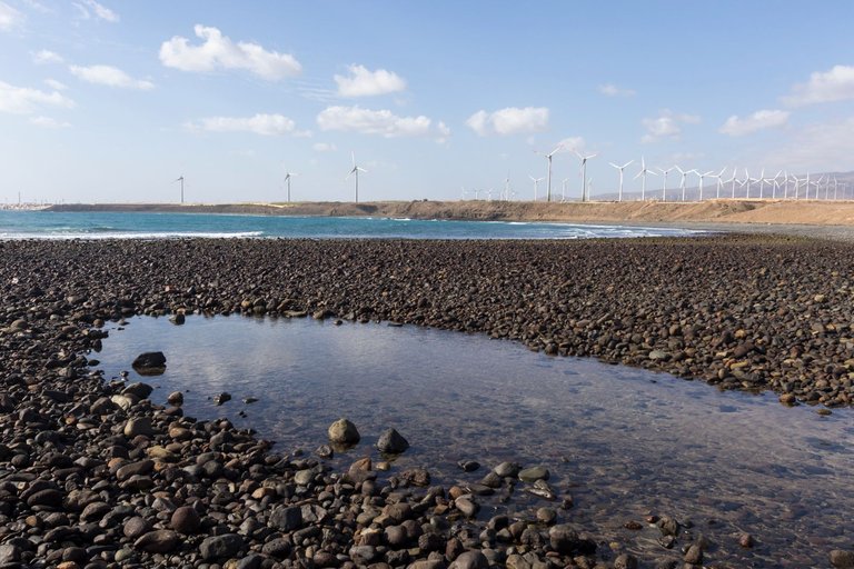
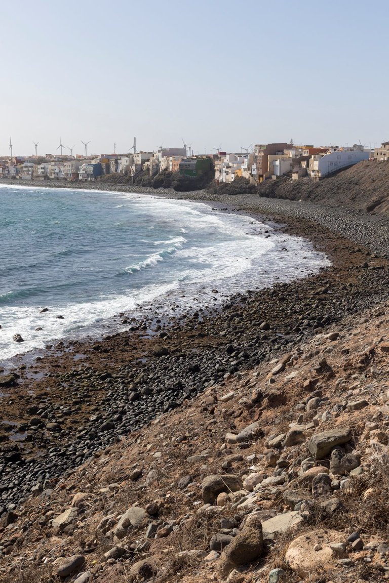
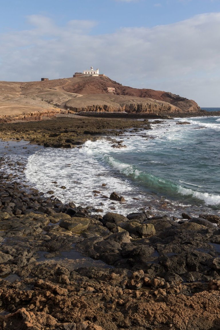
According to the map, we should have taken a longer route towards the highway, which the map shows. But I knew from the morning's photo shoot that was low tide and it was possible to shorten the journey around the sea along the rocky beaches. In the end, this event proved to be successful and greatly shortened our journey to the town of Pozo Izquierdo. The town was deserted, it seemed as if we would not be successful with an open restaurant. We were wrong. On the edge of the beach was Bar Pozo, where there were also a few local people and occasionally a few tourists appeared here. We spent several hours here because the service was not exactly the fastest. But on the other hand, the food was excellent and the beer cold enough.
Podle mapy jsme se měli vydat směrem k dálnici delší cestou, což zobrazuje přiložená mapa. Ale z ranního focení jsem věděl, že je odliv a je možné si cestu zkrátit kolem moře po kamanitých plážích. Nakonec se tato akce ukázala jako úspěšná a velmi nám zkrátila cestu do města Pozo Izquierdo. Městečko bylo liduprázdné, to působilo jakože nebudeme úspěšní s otevřenou restaurací. Mýlili jsme se. Na kraji pláže byl Bar Pozo, kde bylo i několik místních lidí a občas se zde objevil nějaký pár turistů. My jsme zde strávili několik hodin, protože obsluha nebyla zrovna nejrychlejší. Ale na druhou stranu jídlo bylo výborné a pivo dostatečně studené.
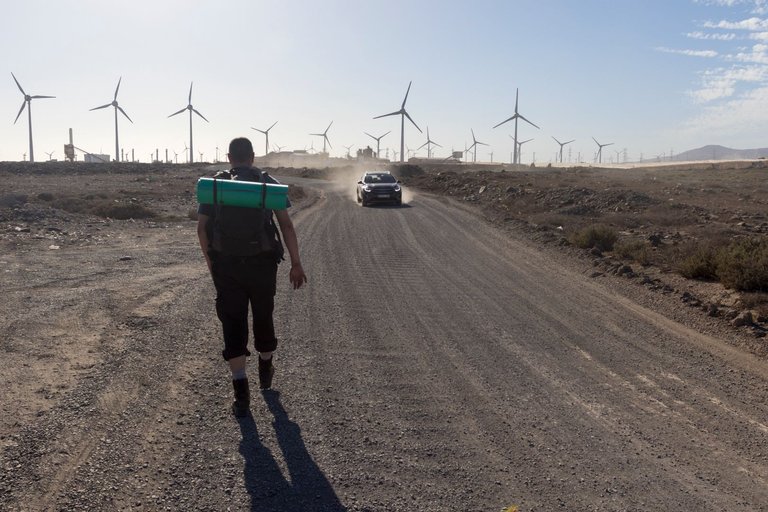
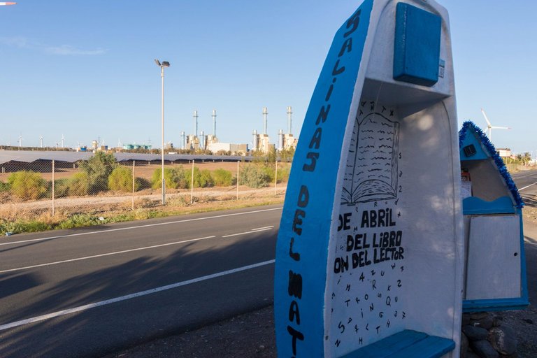
When we left the bar the sun was already quite low over the horizon. So we had about two hours of daylight left to find place to spend the night. Behind Pozo there were a large number of wind farms and what was supposed to be a river again. Based on previous experience, we chose the shortest possible route across the river and around the diesel power plant. As a place for a quick rest, we found an interesting patch on the edge of the village. Where was a bookcase made from old fishing boats. There were also several children's books in the booth, and so the hunt for pictures of pigs broke out. Neither of us was successful and so we continued further south around the sea to Castillo del Romeral. Where we replenished our water supply and some alcohol and snacks for the evening at the local convenience store. As a place to sleep, we chose a small oasis where were several mature date palms and Eucalyptus trees.
Když jsme bar opustili, slunce bylo již docela nízko nad horizontem. Takže nám zbývaly asi dvě hodiny světla, na to najít nějaké místo na noc. Za Pozo bylo velké množství větrných farem a něco co měla být opět řeka. Po předchozí zkušenosti jsme zvolili co nejkratší cestu přes řečiště a kolem dieslové elektrárny. Jako místo rychlého odpočinku jsme našli zajímavý plácek na okraji vesnice. Kde byla knihobudka udělaná ze starých rybářských lodiček. V budce bylo i několik dětských knih a tak se rozhořel lov obrázků prasat. Ani jeden z nás nebyl úspěšný a tak jsem pokračovali dále kolem moře na jih do Castillo del Romeral. Kde jsme v místní samoobsluze doplnili zásoby vody a nějaké ty zásoby alkoholu a pochutin na večer. Jako místo na spaní jsme zvolil malou oázu, kde bylo několik vzrostlých Datlových palem a Eukaliptů.
| Length of Trek | Meters Up | Meters Down |
|---|---|---|
| 28.8 Km | 315 meters | 334 meters |
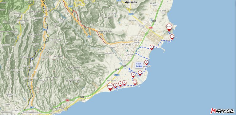
My first full day on the island was somewhat challenging. Because I was a little hungover from the night before. Plus it was warm enough for my taste. And from my friends, I got a taste of what traveling around the island will be like with them, when we meet civilization. The map shows that we have traveled 24 Km, but unfortunately it is not possible to make a custom route plan without having to manually click on each turn. That's why I recalculated all the places where I shortened our journey as directly as possible and I got to the figure of 15 Km.
Můj první celý den na ostrově byl poněkud náročný. Protože jsem měl malou kocovinu z předchozího večera. Navíc bylo na můj vkus dost teplo. A od kamarádů jsem dostal okusit jaké bude s nimi cestování po ostrově když potkáme civilizaci. Mapa ukazuje, že jsme ušli 24 Km, ale bohužel nejde udělat custom plán cesty aniž bych musel manuálně klikat na každou zatáčku. Proto jsem přepočítal všechny místa kde jsem si cestu zkrátili co nejpříměji a dostal jsem se k cifře 15 Km.
Amazing natural landscapes, unique travel experience for sure 😊
Congratulations, your post has been added to Pinmapple! 🎉🥳🍍
Did you know you have your own profile map?
And every post has their own map too!
Want to have your post on the map too?
Vážně se z vás stali Caminos?
Prošli jsme poutní stezku a spousta lidí co jsme potkávali si za našimi zády říkali. To jsou ty Caminos. V boha z nás samozřejmě nikdo nevěří :)
Camino je cesta, a je celkem jedno, jestli je to pouť do Santiaga nebo stezka mezi poli. Poutník je peregrino. Ale v titulku máš napsáno, že se z vás stali caminos, tedy cesty.
very beautiful view
This post has been selected for upvote from our token accounts by @watchlist! Based on your tags you received upvotes from the following account(s):
- @dhedge.bonus
@watchlist has 4 vote calls left today.
Hold 10 or more DHEDGE to unlock daily dividends. Hold 100 or more DHEDGE to unlock thread votes. Calling in our curation accounts currently has a minimum holding requirement of 100 DHEDGE. The more DHEDGE you hold, the higher upvote you can call in. Buy DHEDGE on Tribaldex or earn some daily by joining one of our many delegation pools at app.dhedge.cc.
Hiya, @ybanezkim26 here, just swinging by to let you know that this post made it into our Top 3 in Travel Digest #2112.
Your post has been manually curated by the @pinmapple team. If you like what we're doing, please drop by to check out all the rest of today's great posts and consider supporting other authors like yourself and us so we can keep the project going!
Become part of our travel community:
This is the advantage of such vacations, for a few days one goes to a place of one's choice and forgets the troubles of life and has a great time and this is the way we see that all these natural looking places. Which gives a lot of comfort to a person.