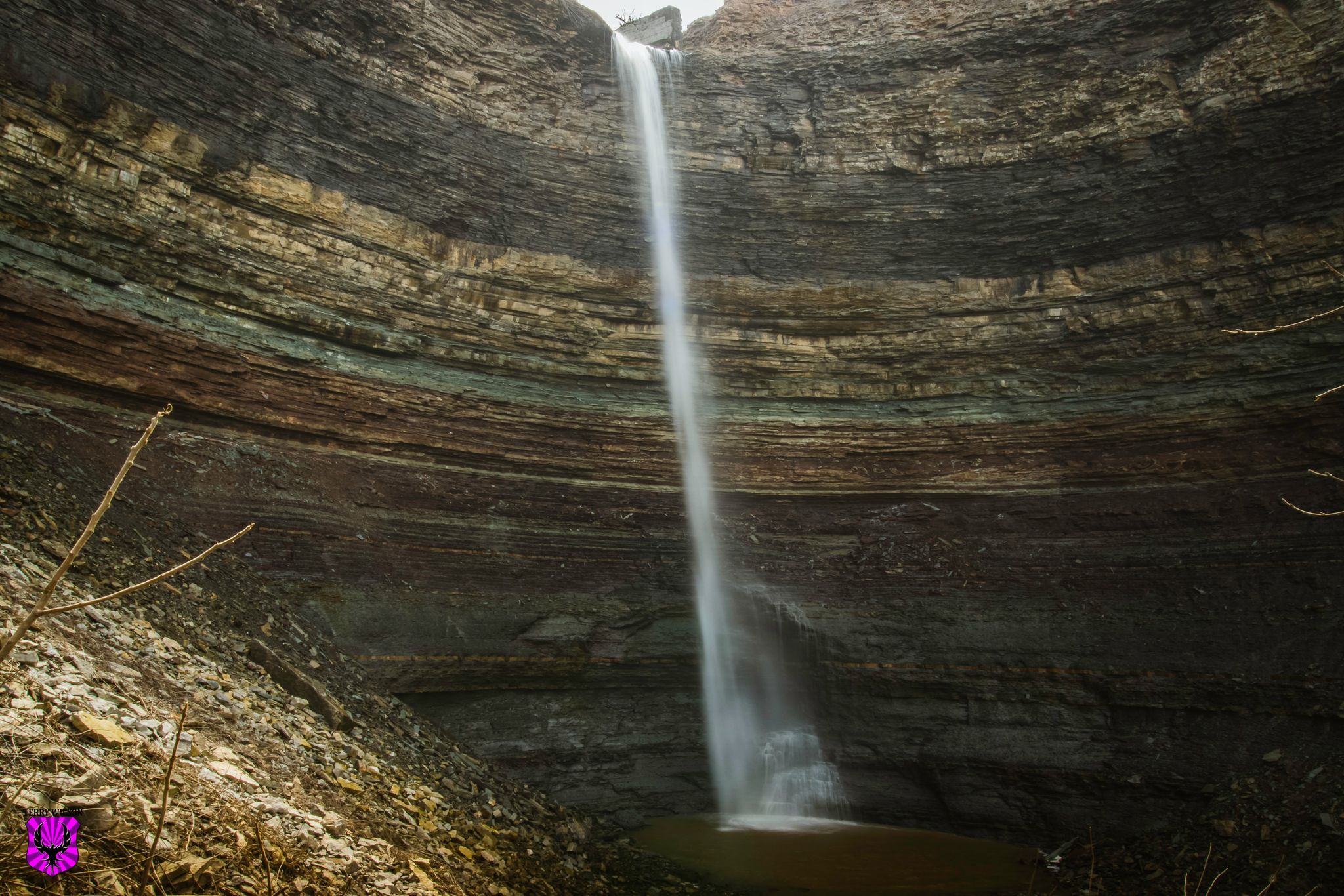
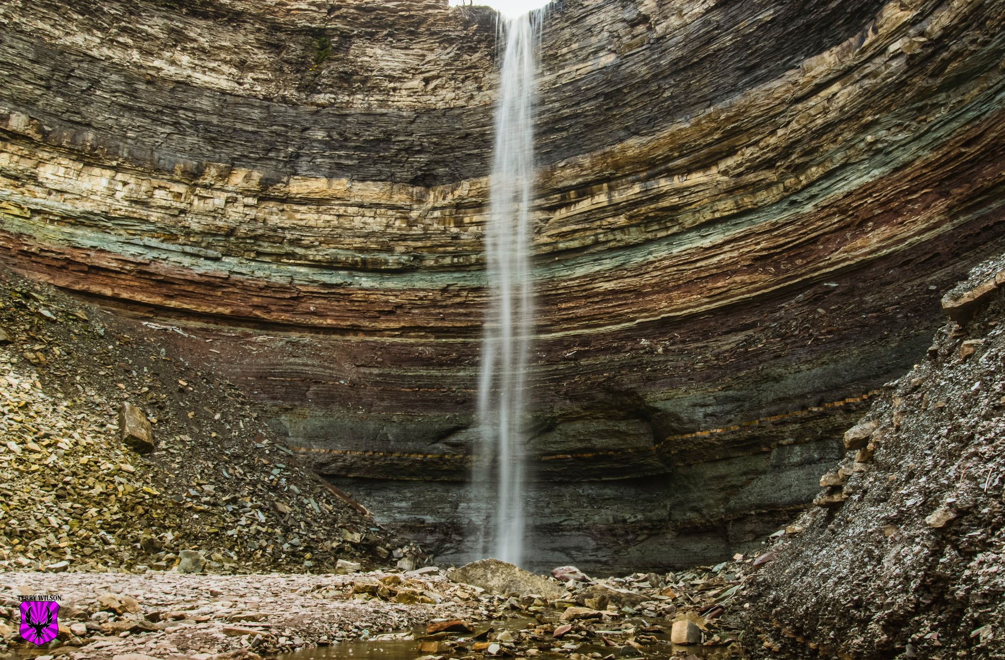
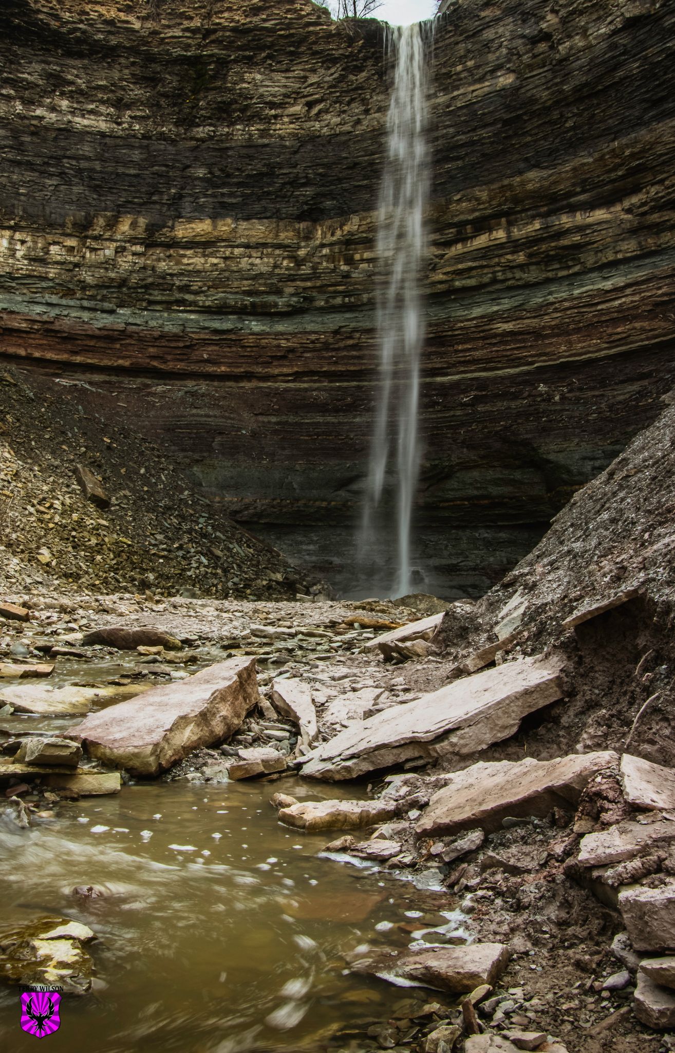
The Devils Punchbowl is a 130 foot tall waterfall that is in the middle shaped rock formation, in Stoney Creek Ontario. How it got it's name is unknown which is strange but there are several stories on where the name comes from. Some say that it was named for the pails of moonshine that was bootlegged in the surrounding woods, at one time. Others say that people who saw the beautiful sight as God’s work, knew that God would not want something named after himself, So they decided to name it after the devil instead.
Regardless of how it got it's name it is an incredible hike that starts with a small 12 foot tall waterfall.
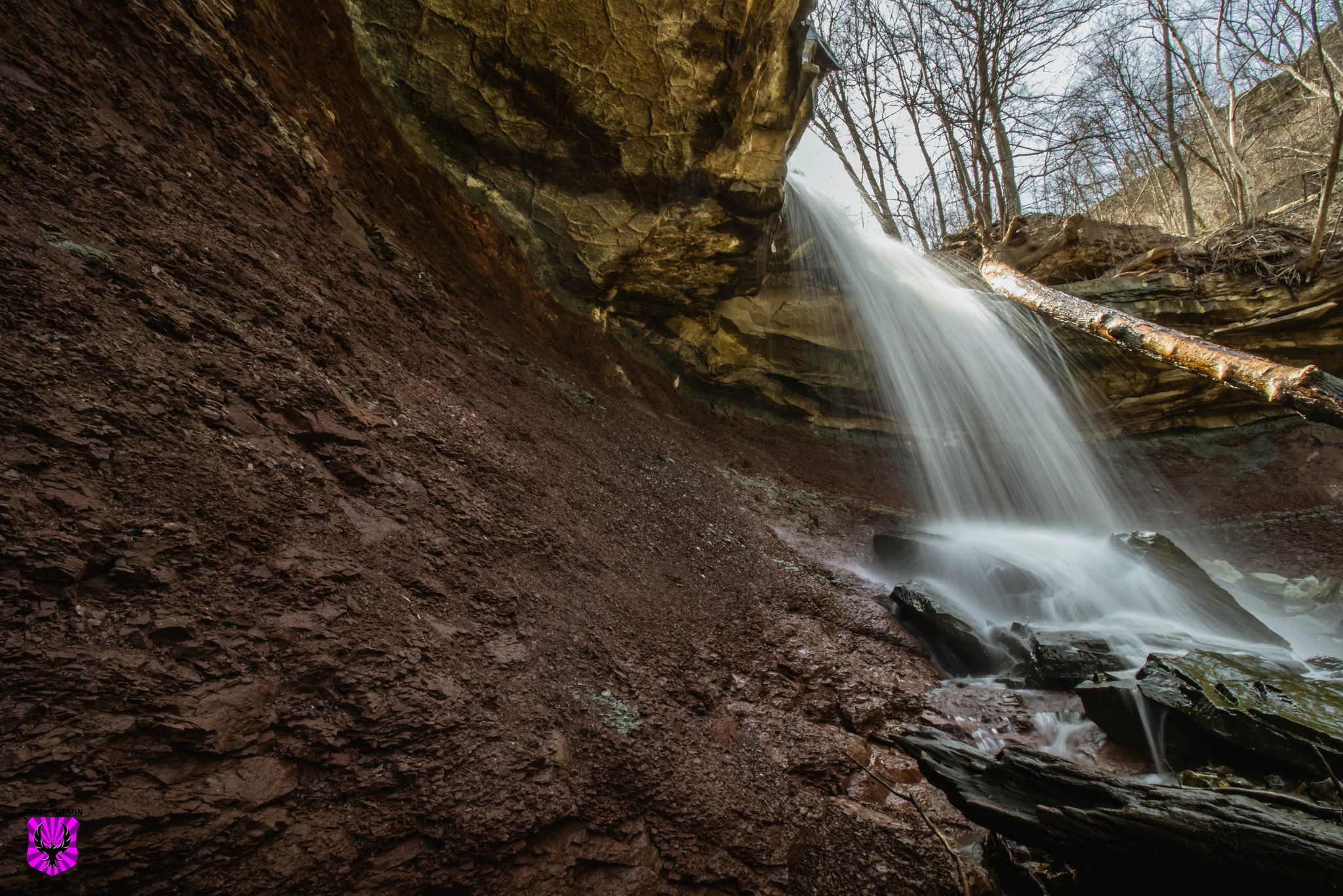
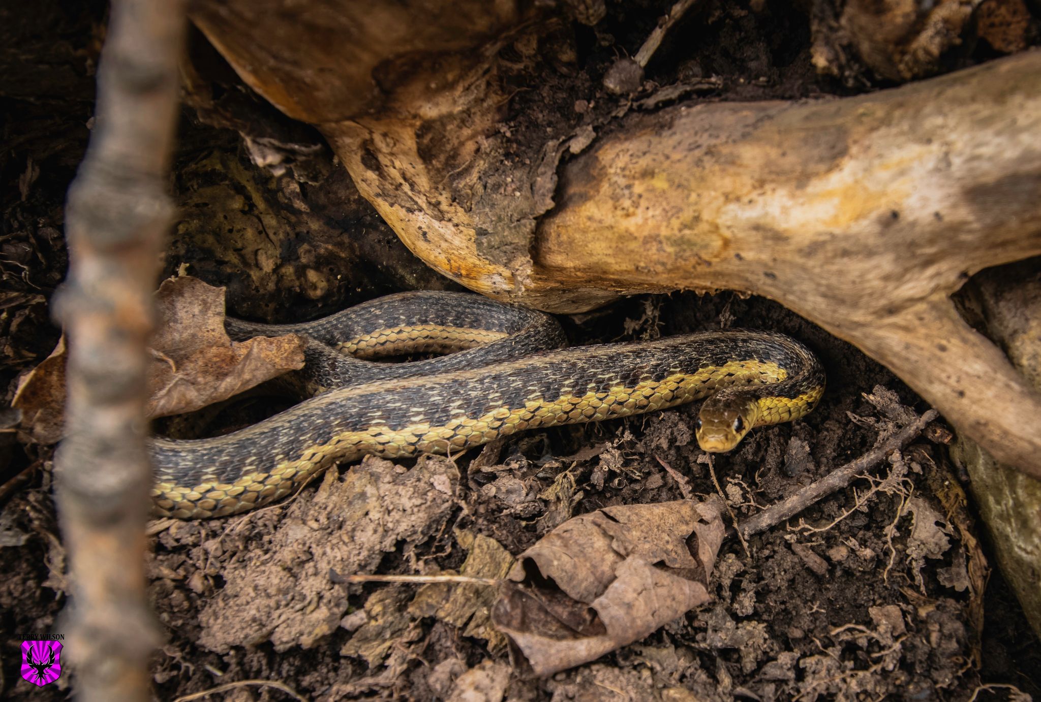
Then a trail that follows the creek with lots of plat and animal life.
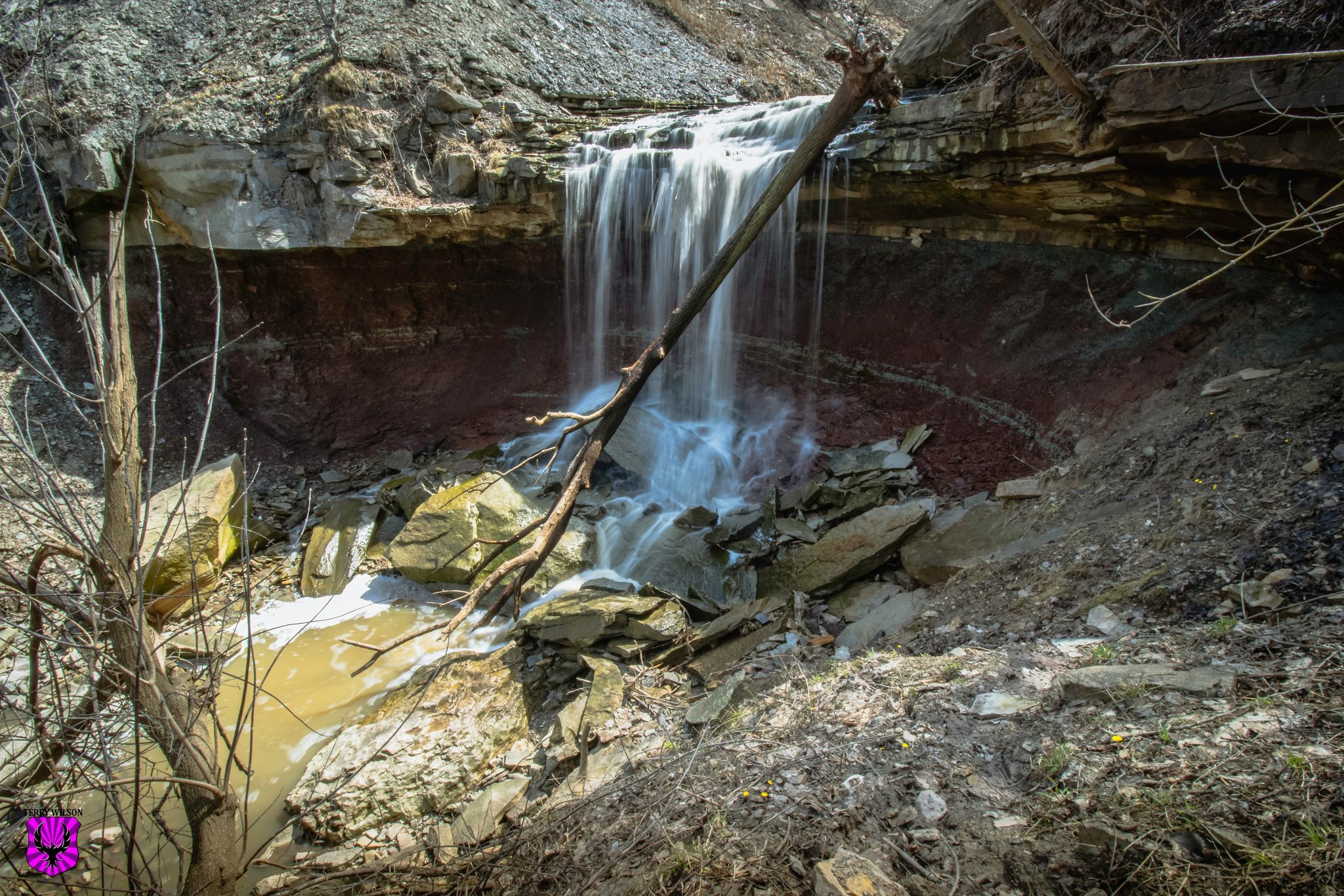
That quickly opens to the bowl formation and waterfall. In the summer waterflow is very low if there is any at all. So spring is the best time to hike to the falls, that way you don't only get the beautiful rock formations that were formed 10,000 years ago with the last ice age (In itself is more than worth the hike).
If you ever find yourself in the Hamilton/Stoney Creek area of Ontario I highly recommend a trip to this beautiful waterfall!
[//]:# (!pinmapple 43.21109 lat -79.75587 long Devils Punchbowl Waterfall d3scr)
Congratulations, your post has been added to Pinmapple! 🎉🥳🍍
Did you know you have your own profile map?
And every post has their own map too!
Want to have your post on the map too?