North Thailand is famous around the world for many things such as, elephant camps, hill tribe communities, bamboo rafting, mountains and a unique culture but locally, the north is starting to get a rather bad reputation for its slash and burn farming.
North Thailand has many rural communities which may struggle financially. Much of the population relies on produce they can farm, whether it's to sell or for personal use. Much of the farming is done by the people and not by machine making planting, harvesting and ploughing very hard - especially when you take into consideration the terrain.
Slash and burn farming is popular with most of these farming communities and makes a difficult job incredibly easy. It also allows the farmers to expand the usable land available to them and grow more crops once overgrown forested areas are cleared.
Unfortunately, all the burning in the north pollutes the air on a huge scale. Air quality in Chiang Mai and neighbouring regions have been known to reach 300 on the air quality index (AQI) and have affected other parts of Thailand and South East Asia to such an extent that provinces over 1000 kilometers away can still read 150-200 on the AQI!
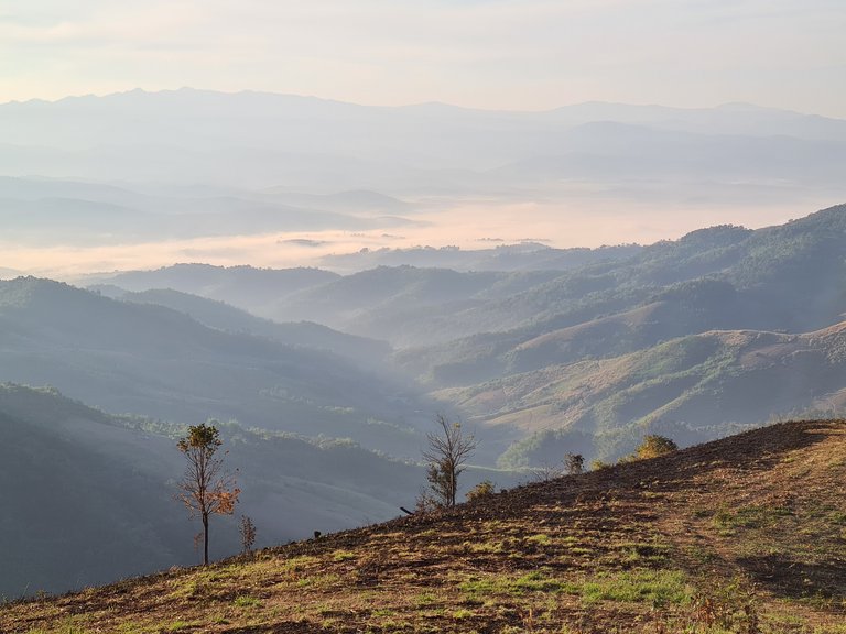
During a recent camping trip to Doi Chang, Chiang Rai, slightly further north than Chiang Mai, we saw the aftermath of this kind of farming. Entire mountainsides had been cleared to grow crops and many fields were totally black from recent fires.
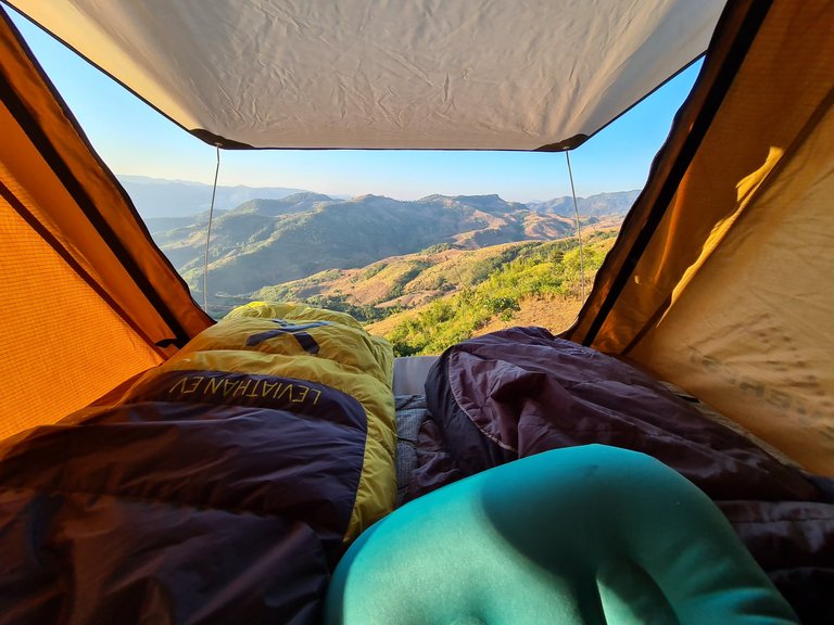
The view from our tent looked out across reclaimed hillsides where lush forests once grew. Our own camp spot was just the same.
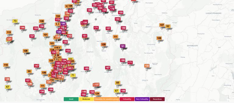
Source: https://aqicn.org/map/thailand/%C2%A0
At the time of writing this article the AQI in North Thailand sits at the 'unhealthy' level with some 'very unhealthy' regions. Also keep in mind that this is rural mountainous countryside with little traffic or industry!
In comparison, the screenshot below shows North America and Europe where most regions read a much lower AQI!
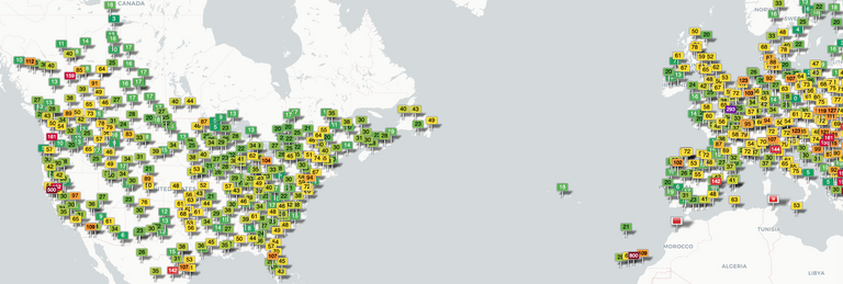
Source: https://aqicn.org/map/thailand/%C2%A0
Despite knowing about the air pollution, there's very little we can do to avoid or escape from it and people tend to go about their lives as normal, which is why we were out camping!
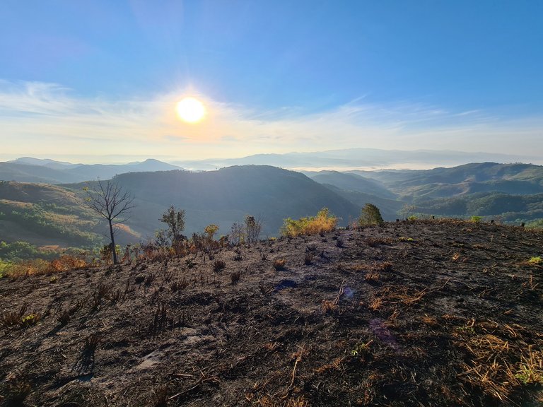
All of the views held a misty/foggy appearance but in actual fact, it was the pollution just hanging in the valleys.

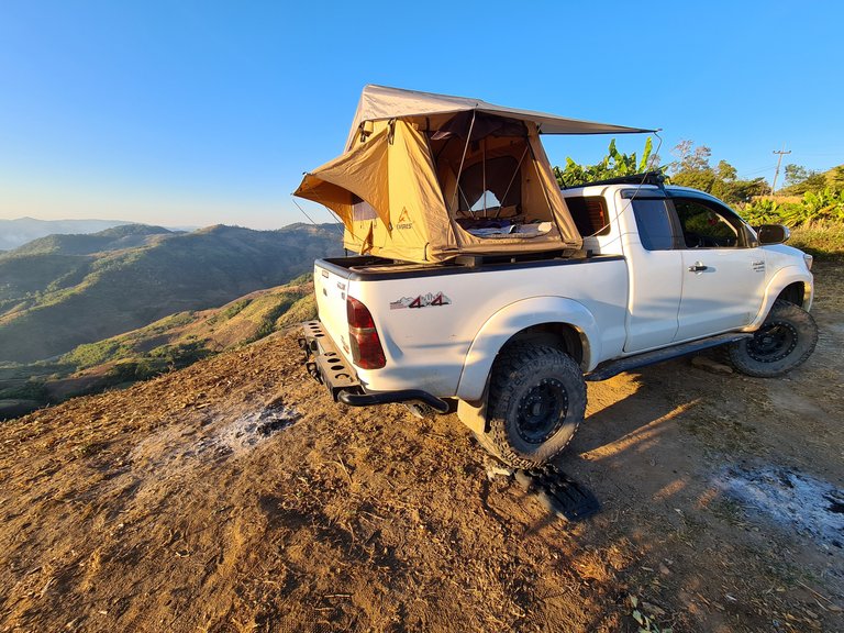
Once we had found a flat ridge that was suitable to camp, we levelled the truck and set up for the evening.
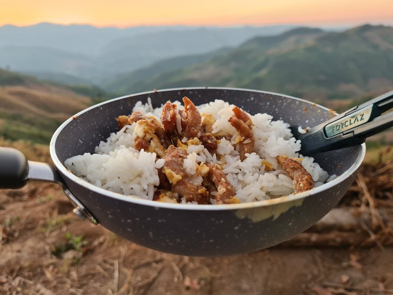
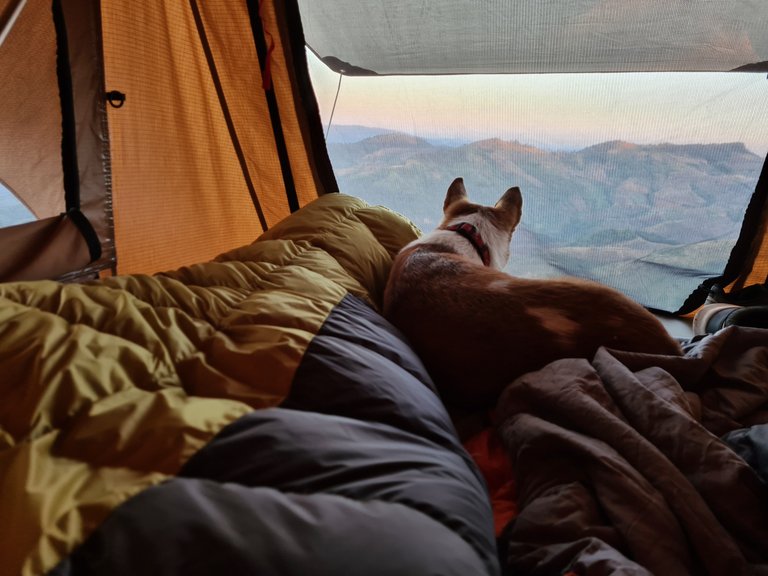
We had a few basic supplies but chose to cook over the gas stove instead of a fire. The fry up caught the attention of our dog, who we had put in the tent in an attempt to keep clean and not get covered in soot and ash from the burnt fields.
She conveniently lay as close to the door as possible looking down on us while we cooked. Luckily we noticed her hungry eyes before finishing and gave her a few bites.
The following day, we woke up early to find even more murky fog/pollution had settled in the valley behind us. It seemed ironic that after travelling so far, to a remote corner of the country which has a very low population, driving up mountains over 1500 meters and having much cooler temperatures, that the AQI can be so poor.
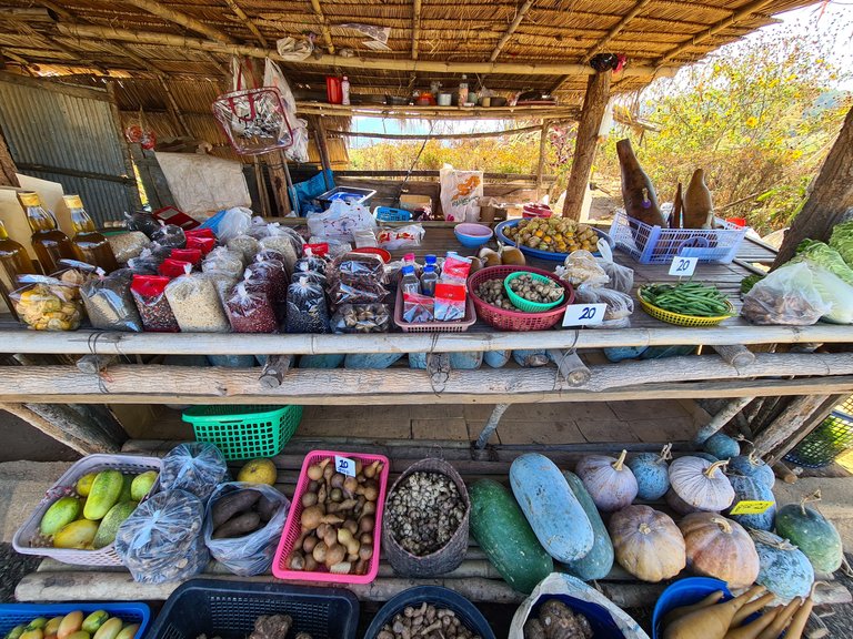
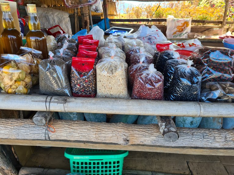
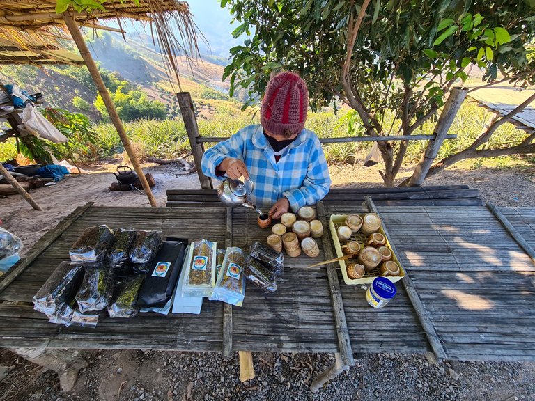
We drove further up the mountain road and stopped at a small roadside shop to see what they were selling.
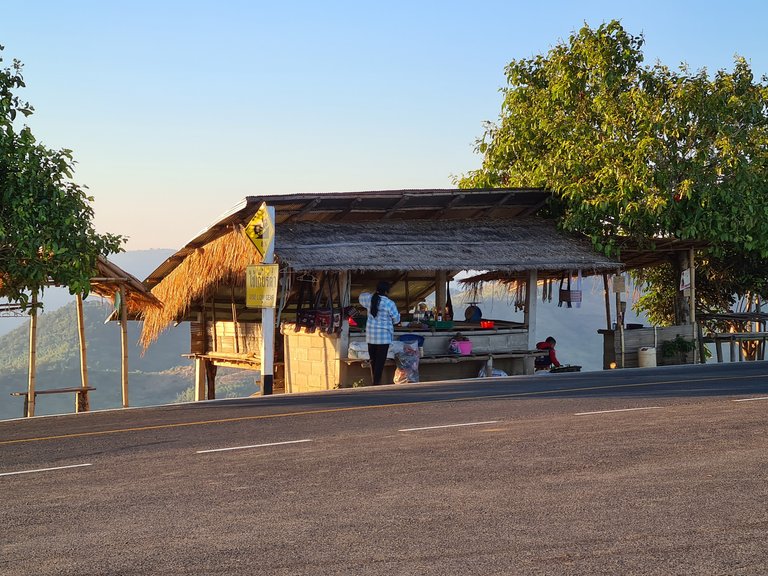
Strange bags of seeds and beans filled the table and herbal medicines covered just about every ailment. We curiously looked through what was for sale and discussed some of the medicines but only bought some tea after being poured a bamboo cup to try.
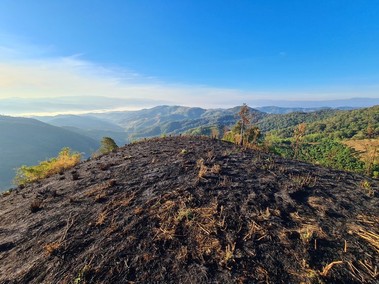
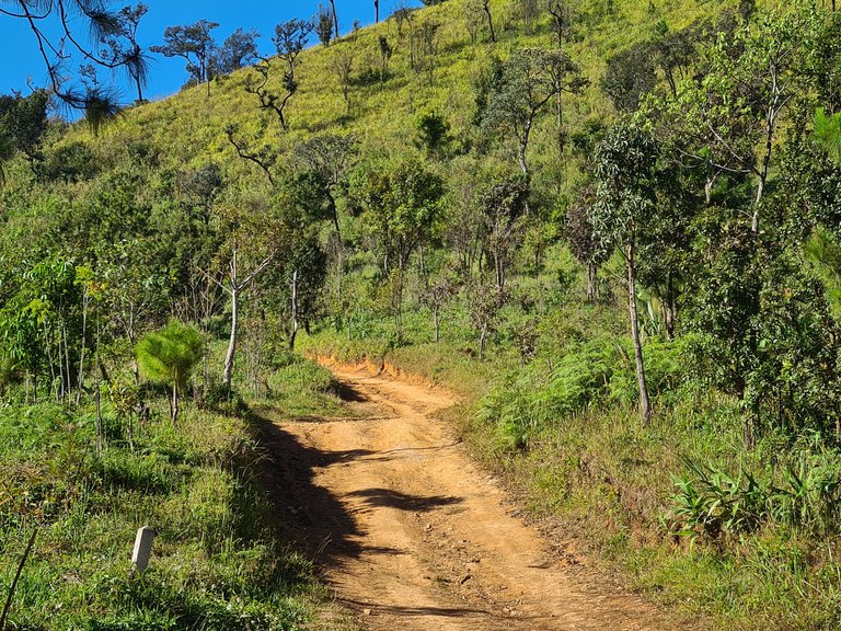
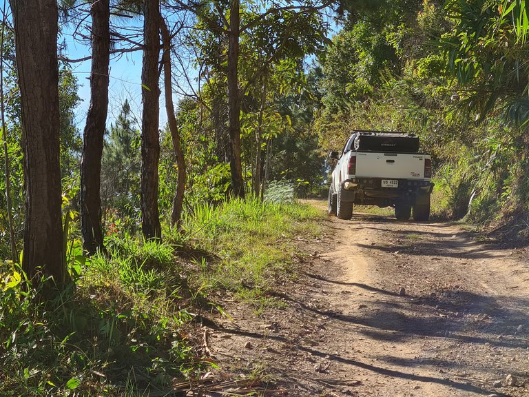
We drove further along the mountain road that started to deteriorate as it led up to the highest ridge. Hoping for a viewpoint we continued but just like all of the other views we had been seeing over the last couple of days, the mountainsides were again cut and burnt.
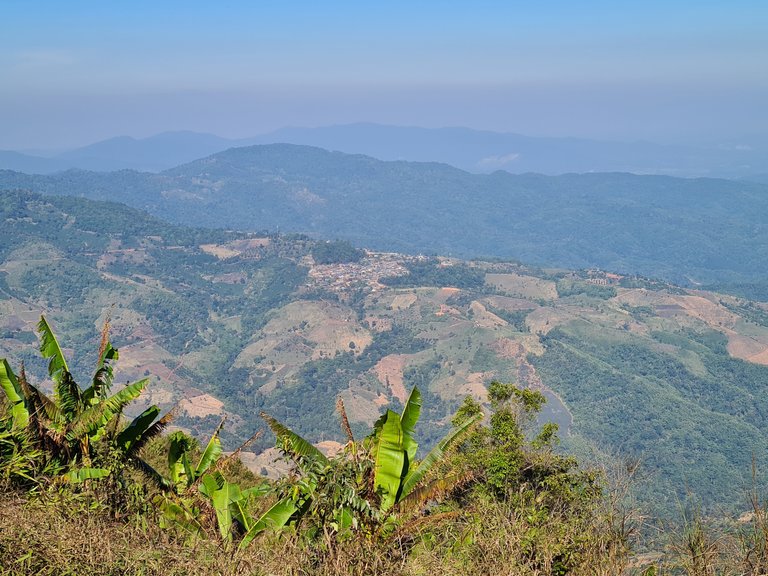
The highest part of the mountain looked as if it had been burnt at some point but had yet to be farmed. Small pine trees were dotted about and long grass filled the rest.
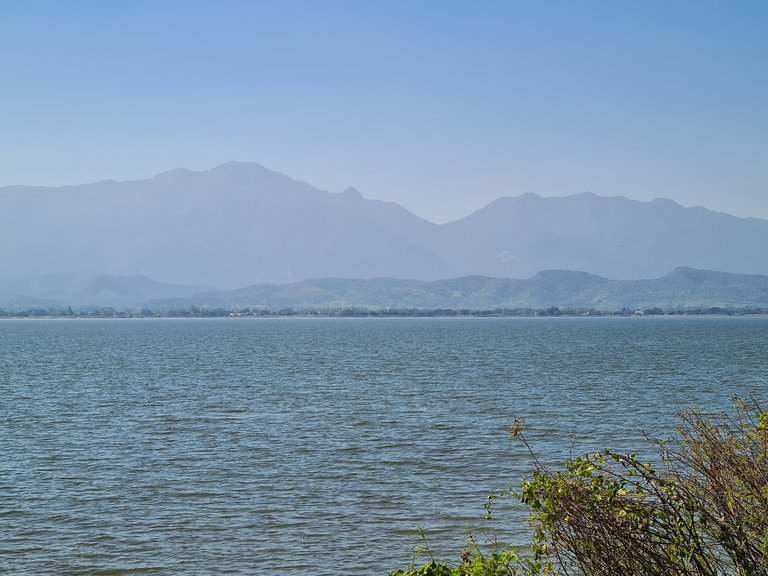
As we came down the mountain, we found a lake. It had direct views up to the mountain ridge we had camped the night before but the haze filtered out any colour definition or detail leaving just a hazy mountain outline.
I hope you enjoyed this post and please follow for more like it in the future.
All content is original: the photos (unless stated), the writing and the adventure!
So Beautiful Adventure Pictures! 🥰😊
Thank you, glad you liked them.
you welcome.
Hiya, @ybanezkim26 here, just swinging by to let you know that this post made it into our Honorable Mentions in Daily Travel Digest #1097.
Your post has been manually curated by the @pinmapple team. If you like what we're doing, please drop by to check out all the rest of today's great posts and consider supporting other authors like yourself and us so we can keep the project going!
Become part of our travel community:
वाह क्या बेहत खूबसूरत नज़ारा हैं 👌👌बहुत सुंदर खूब मज़े लिए होंगे सफ़र के शायद अपने 🤩🤩
Thanks buddy :)
Welcome sir ji🙏🙏
Congratulations, your post has been added to Pinmapple! 🎉🥳🍍
Did you know you have your own profile map?
And every post has their own map too!
Want to have your post on the map too?