Lamreh is a seaside village in Aceh Besar Regency with beautiful natural scenery, hilly natural contours, a large bay, and a rich history.
A quiet place away from the hustle and bustle of urban noise. The community there has to travel by motor vehicle to the nearest city, namely the city of Banda Aceh, which is 34 kilometers away and takes 45 minutes (according to Google Maps calculations). Not much different from the mileage we experienced when we visited there on April 12, 2023.
This is not my first visit. In 2014 and 2016, I was part of the history research team in the village. If you're interested, check out the documentary I directed while doing research. LINK
What's going on in Lamreh Village?
Based on the discovery of signs of civilization in the region, it can be assumed that at Lamreh Village, Aceh Besar was the center of the Lamuri Kingdom, which appeared in European and Arab travelers' narratives. Among the oldest narratives created by The Persian navigator Al-Ramhormuzi, in his 10th-century book Ajaib al-Hind (The Wonders of India), Marco Polo in his 13th-century book The Travels of Marco Polo, and the most accurate description of that position has been narrated by Tome Pires in the Suma Oriental, the following quote:
The islands which are called Gamispola are two or three and more, near the land of Achin and Lambry. There must be about ten or fifteen islands three or four leagues round and the sea between them is two, three or four leagues, and it is twenty or thirty fathoms near the land. ...
... Achin is the first country on the channel side of the island of Sumatra, and Lambry is right next to it, and stretches inland, and the land of Biar is between Achin and Pedir, and now these countries are subject to the king of Achin and he rules over them and he is the only king there.
Book: The Suma oriental of Tomé Pires: an account of the East, from the Red Sea to Japan, written in Malacca and India in 1512-1515; and, the book of Francisco Rodrigues, rutter of a voyage in the Red Sea, nautical rules, almanack and maps, written and drawn in the East before 1515.
Edited by Armando Cortesão.
Publication: 1944
Publisher: London: The Hakluyt Society
Collection: mcgilluniversity; mcgilluniversityrarebooks; toronto
Contributor: McGill University Library
Language: English
Digital Book Link (redirected to the excerpt page)
The Tome Pires' book refers to it as Lambry, but the local dialect refers to it as Lamuri, and Achin is now known as Aceh. During the research there, we only found epitaphs on tombstones until the 15th century. It's inevitable that the Lamuri Kingdom lost political power on the island of Sumatra after the 16th century.
It looks back at the history of the area. Okay, now I'm going to share my experience during my visit last week.
Let's go on trip
That afternoon, @AnzirPasai and I left the @Mapesa office with two other cultural activists to go to the official mansion of an Indonesian National Armed Forces officer, Colonel Jun Hisatur Mastra, to invite him to Lamreh village. He enthusiastically accepted our invitation. He is particularly passionate about cultural heritage preservation, and he currently serves as the Head of Transportation for the Iskandar Muda Military Region Command in Banda Aceh.
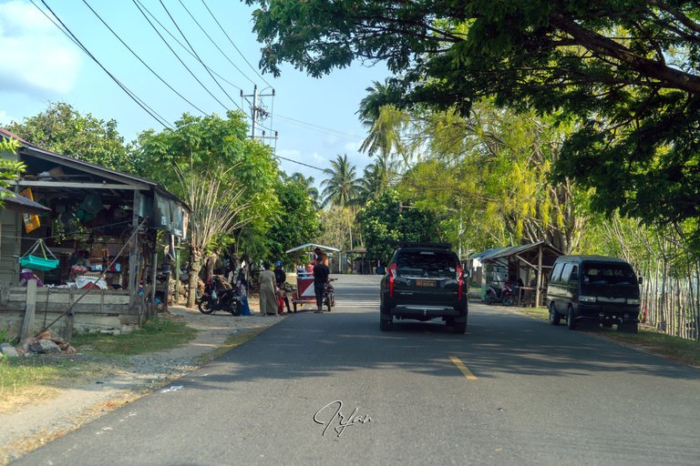
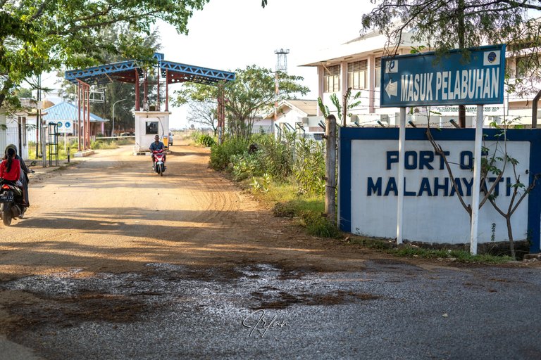
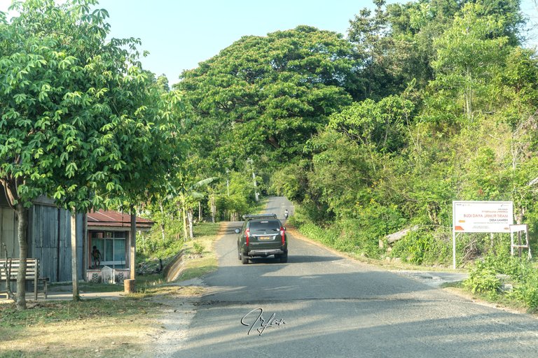
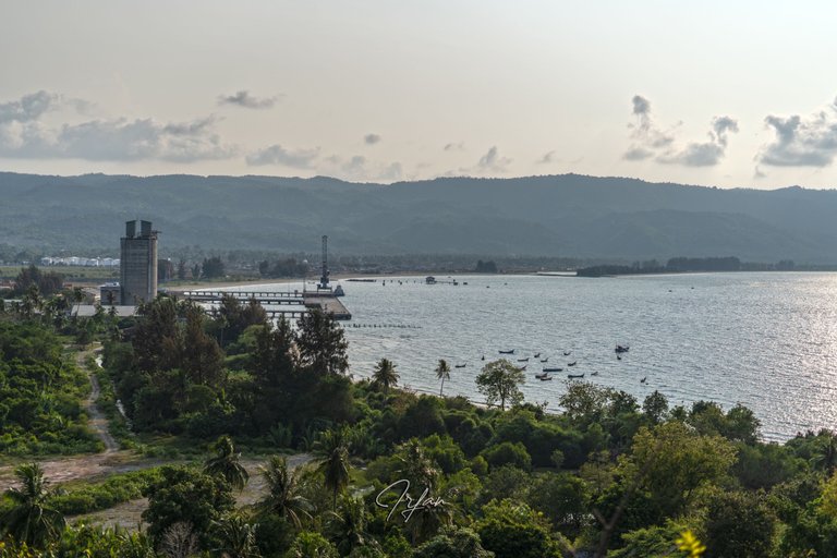
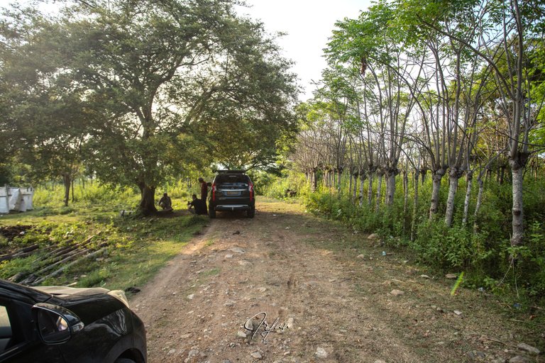
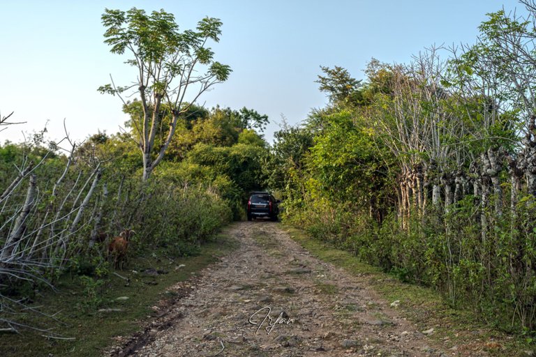
We drove leisurely in two cars. After traveling 31.5 kilometers, we arrived at the center of the congested Lamreh villagers' settlement. Came to a halt just at the entrance to the Malahayati port on the left, a quiet port for loading and unloading operations.
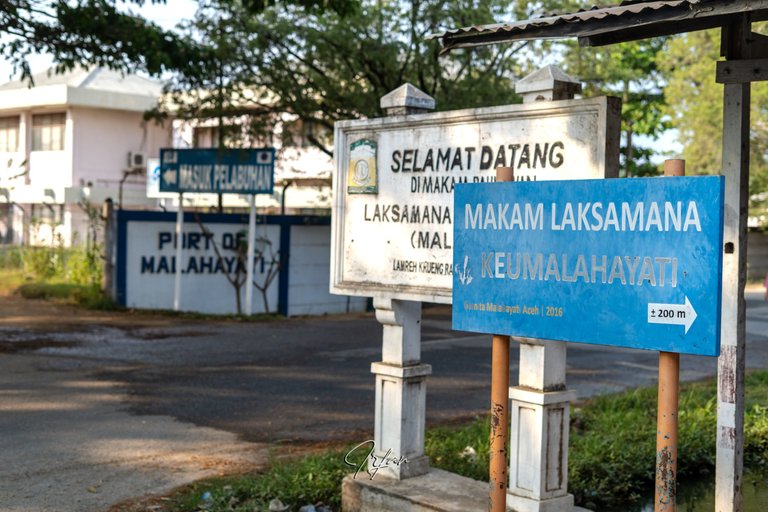
You can turn right to visit Admiral Keumalahayati's grave, a 16th-century heroine, but our goal is not there.
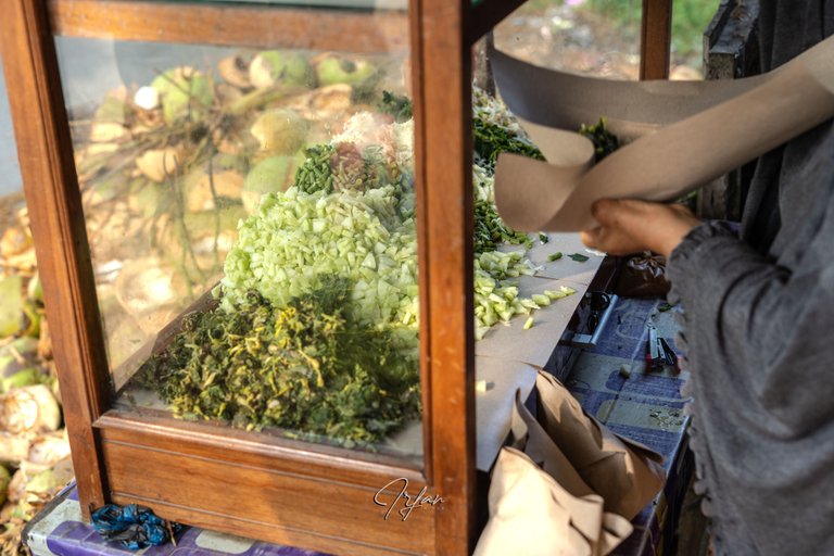
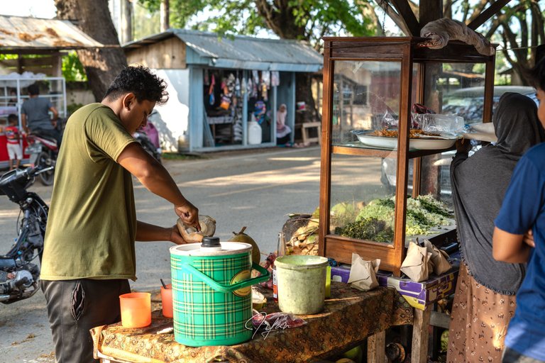
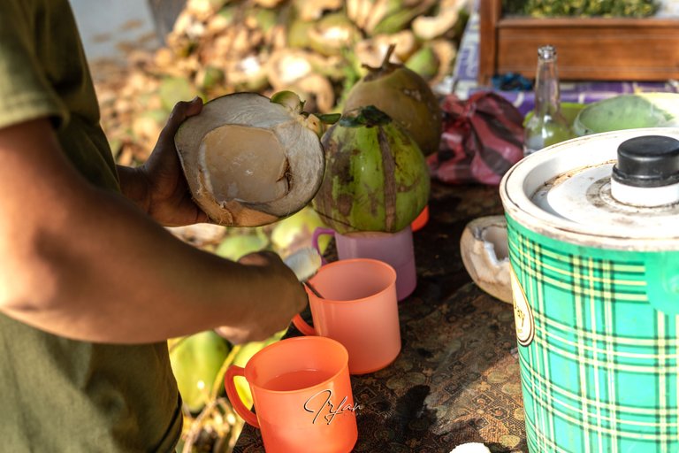
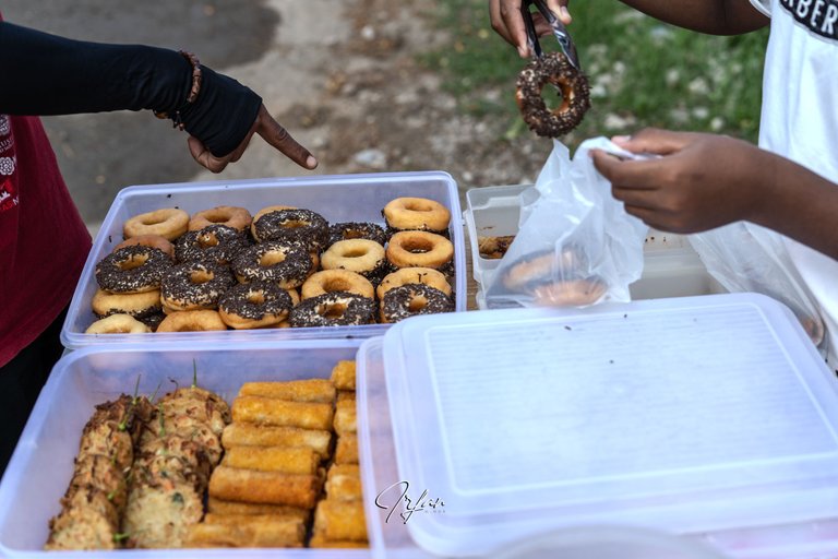
Currently, we are fasting in the month of Ramadan, so we will need to purchase food and beverages to break our fast when the time arrives, which will be around 18.42 at our destination.
Pecel, a traditional vegetable snack, as well as young coconut drinks and various cakes served on the side of the road, are our choices for later breaking the fast.
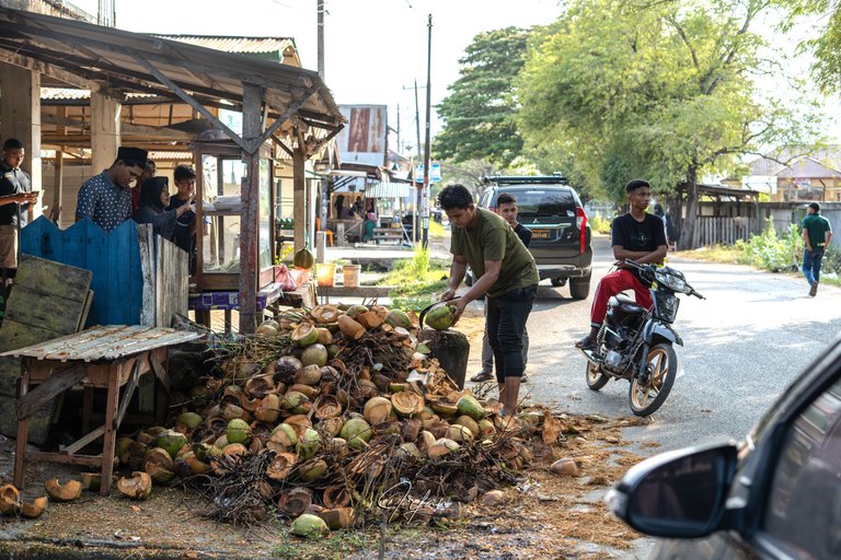
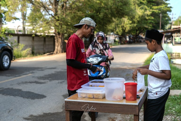
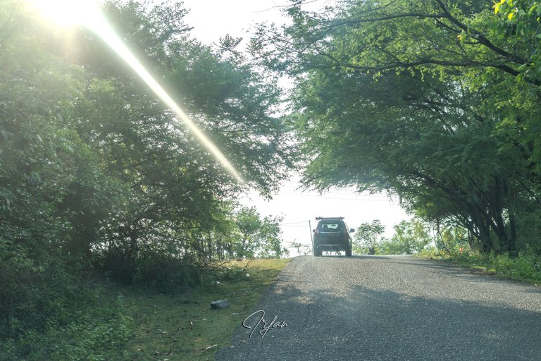
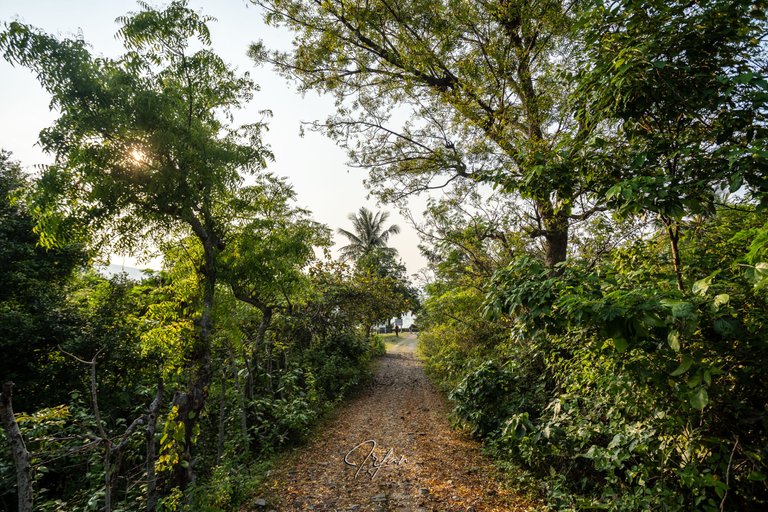
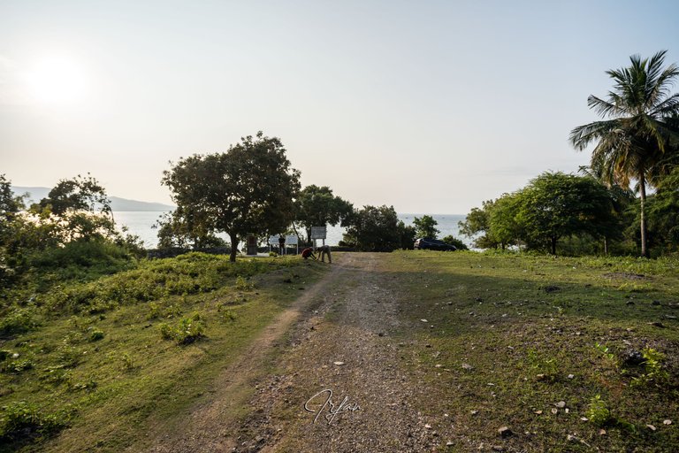
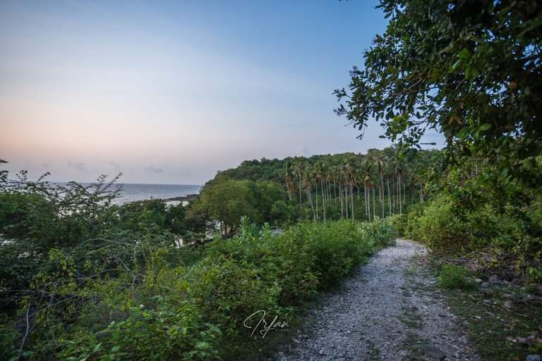
After purchasing food and drink supplies, we continue the trek with the route going uphill.
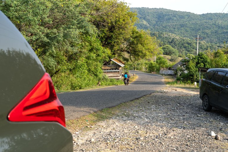
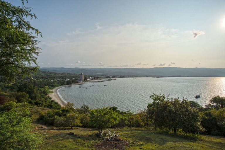
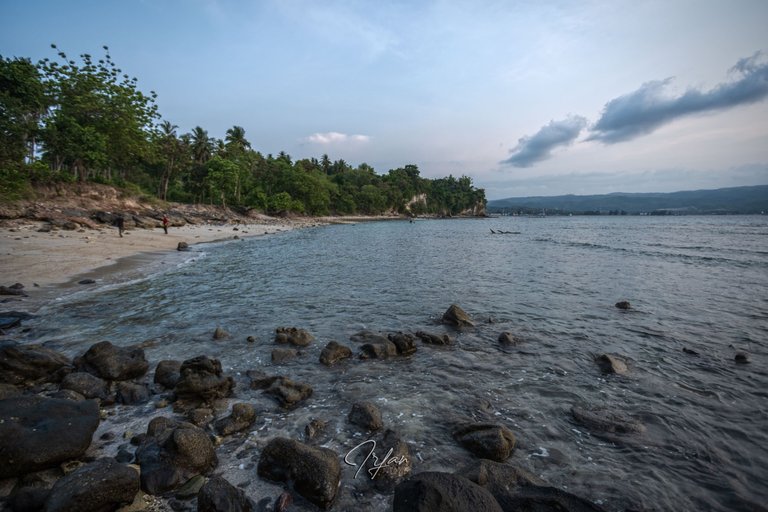
We stop for a moment about halfway up the climb to observe the bay, the locals call it Teluk Krueng Raya (Big River Bay). From that height, we can freely observe the activities at the Malahayati harbor pier.
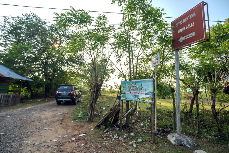
The highest point of the hill indicates that you have arrived at a junction, an information board on the left side of the road directs you to the Fort Inong Balee site (Situs Benteng Inong Balee) with an arrow 500 meters away, despite the fact that Google Maps shows it to be 850 meters away.
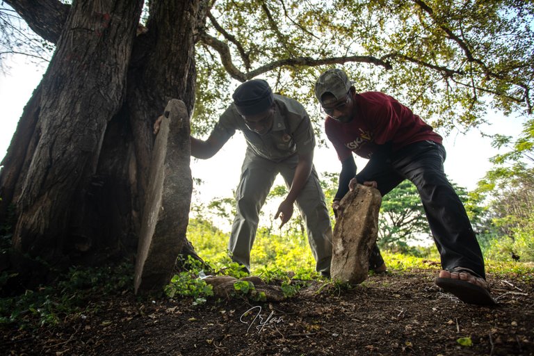
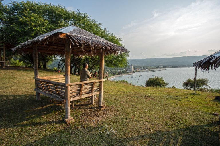
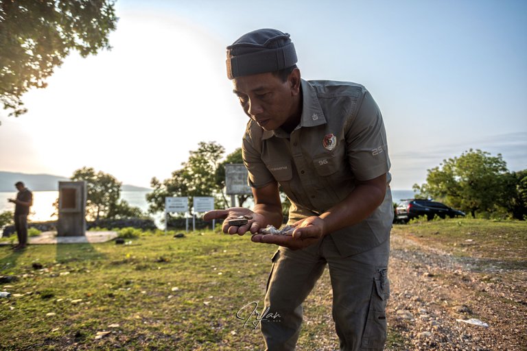
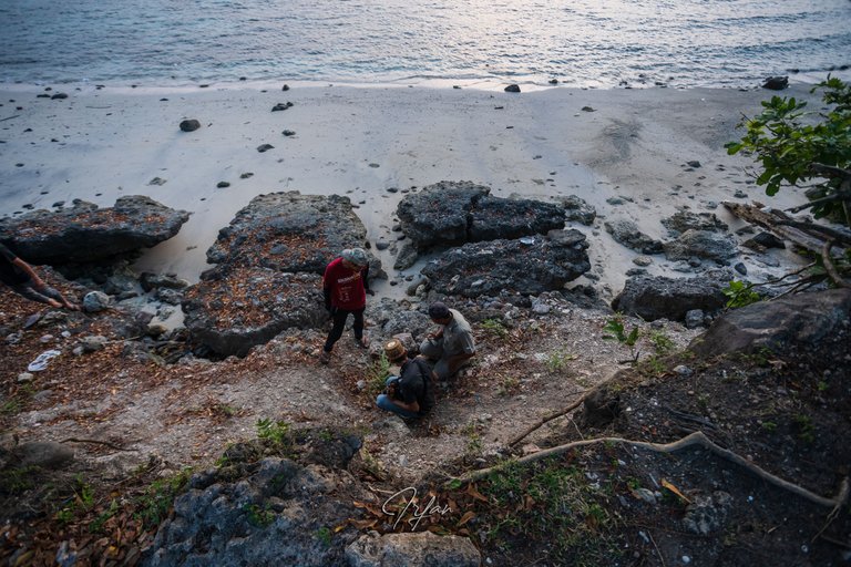
Before getting to the fort, we stopped again for a while to look at the rocks, assuming that these were ecofacts from the Lamuri Kingdom and that this location was a feature for viewing activity in the bay in ancient times.
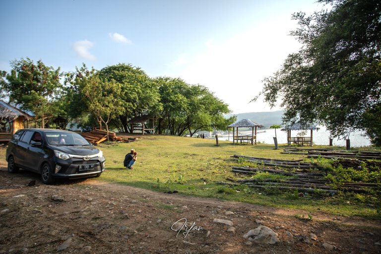
In that position, a relaxing area has been developed by local businessmen, you may enjoy views of the bay. During the month of Ramadan are not serving customers. However, you are allowed to relax even though the business is not operating.
Just another 700 meters to the fort site. Let's go!
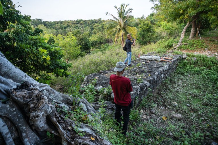
Fort Inong Balee Cultural Heritage Site
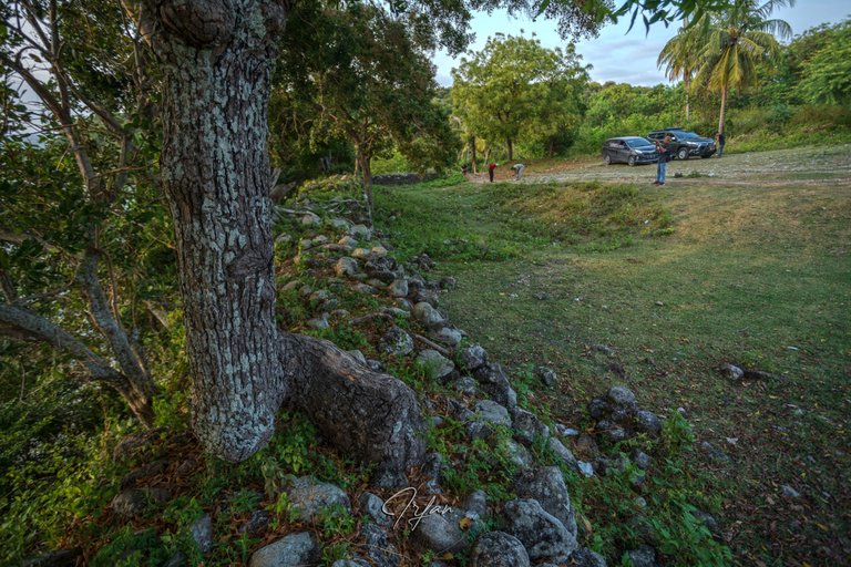
Return down the rocky path. Hooray! We've arrived at the Inong Balee Fort. There are no designated parking spaces, so don't worry, you can park your vehicle in a reasonable place.
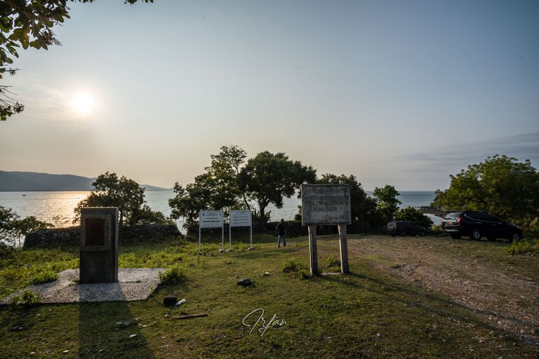
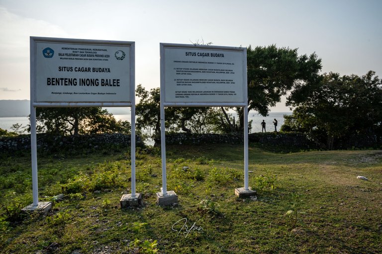
Within the area, there are four information boards, two of which are on behalf of the Ministry of Education, Culture, Research, and Technology and the Aceh Province Cultural Heritage Preservation Center, at the bottom of which reads the slogan:
"Kunjungi, Lindungi, Dan Lestarikan Cagar Budaya Indonesia"
(Visit, Protect, and Preserve Indonesia's Cultural Heritage)
In addition, brief historical information about the fort can be found on a monument carved on a copper plate in three languages: Acehnese, Indonesian, and English. Here's an excerpt from the English version:
This fort constructed by Sultan Ala ad-Din Ri'ayat Syah Sayyid al-Mukammil (1689-1604) is the center of defense for the seas of the Malacca Straits. Apart from that, this fort was used also as a dormitory for the Inong Balee militia (windows whose husbands were sacrificed through war).
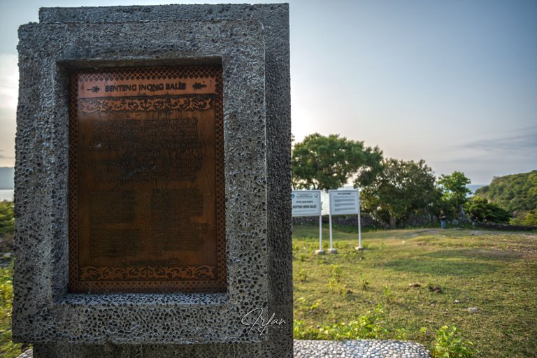
According to the narrative written there, the fort was built in the 16th century during the kingdom of Aceh Darussalam. In my opinion, I believe it existed prior to the 16th century during the Lamuri kingdom and was possibly used by the Aceh Darussalam kingdom when the Lamuri kingdom was defeated.
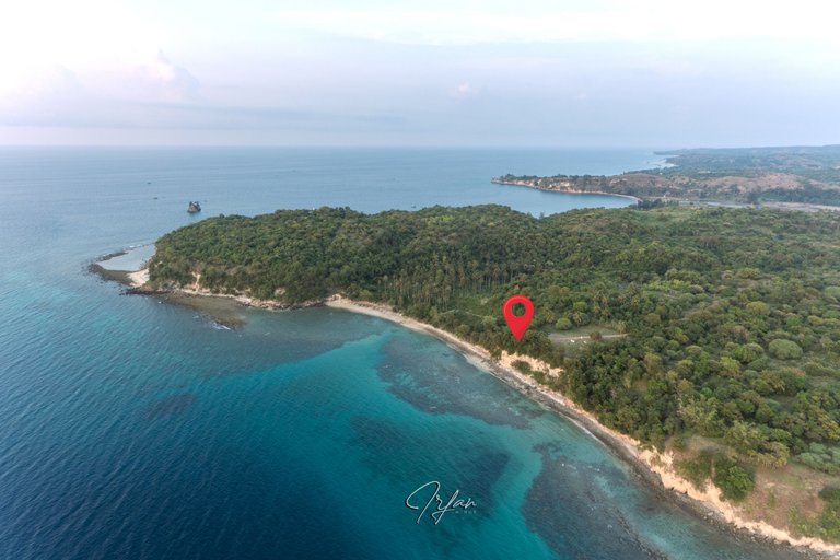
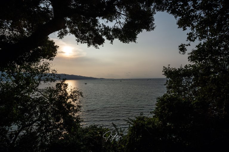
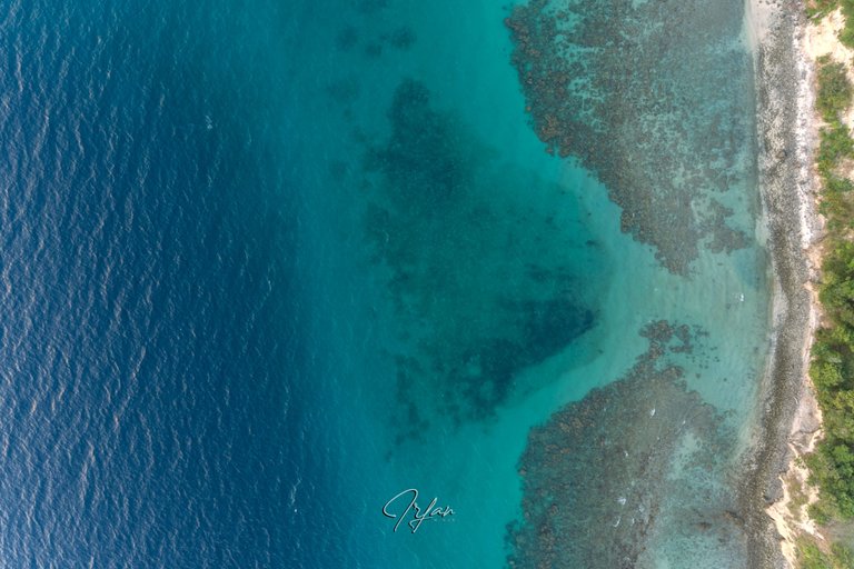
The aerial image below shows the two capes of Krueng Raya Bay.
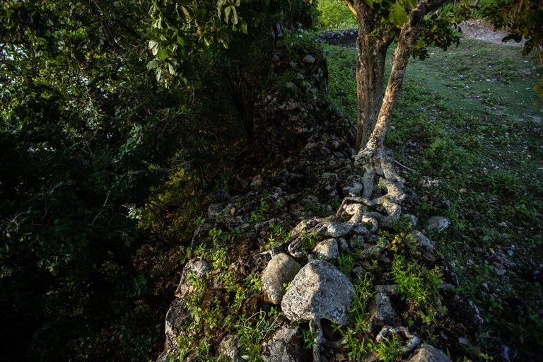
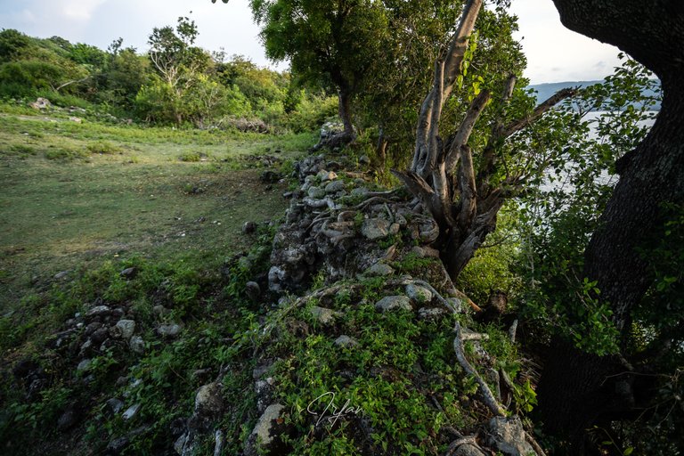
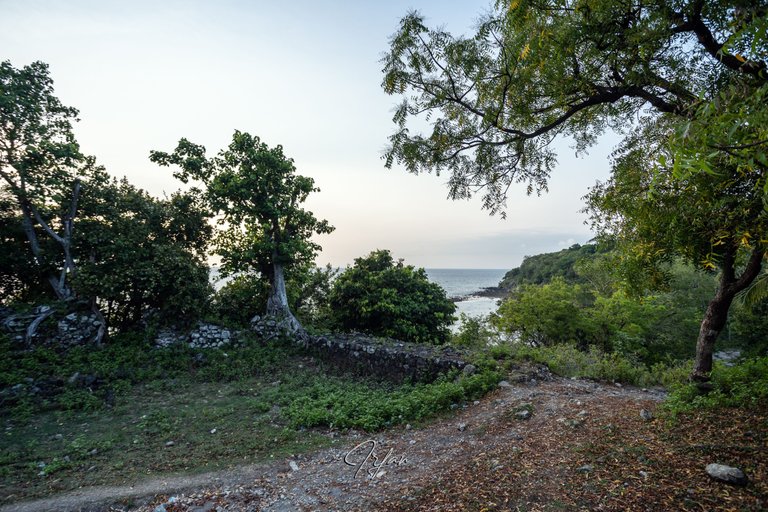
This fort is located on the Malacca Strait's shoreline, facing Krueng Raya Bay, at coordinates 5.608, 95.530. To the west, the section facing the sea has four semicircular portholes that can fit the cannon muzzle, some parts have been degraded, and wood roots have crept to the fort.
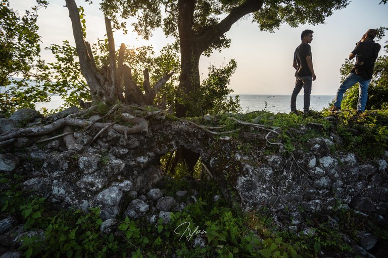
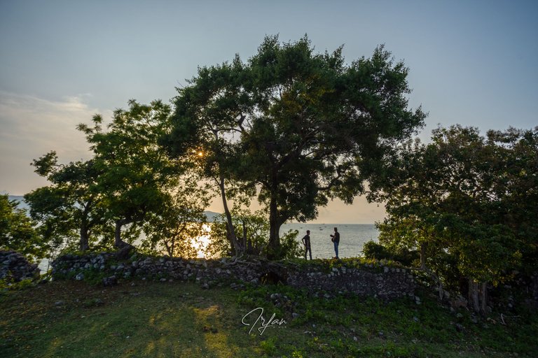
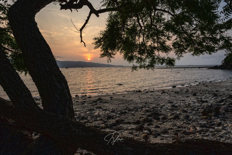
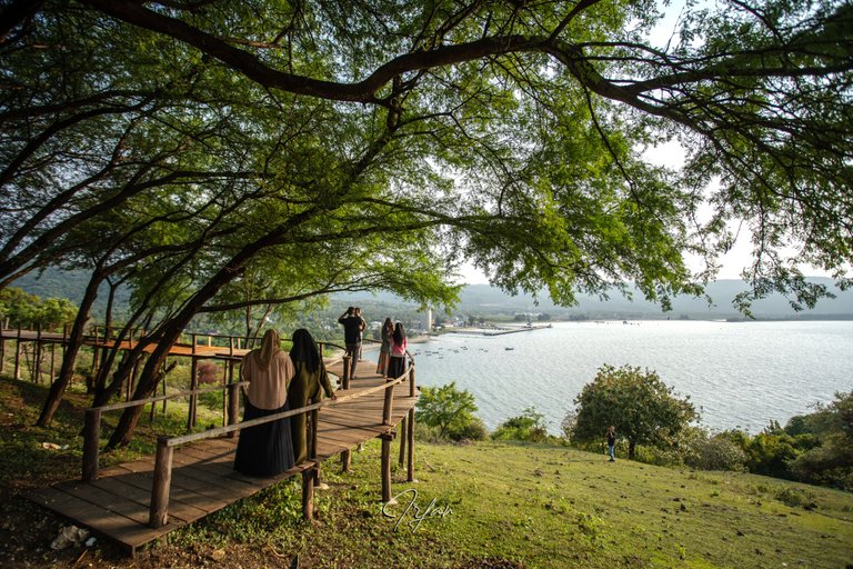
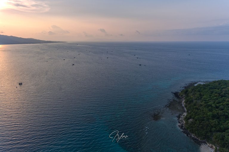
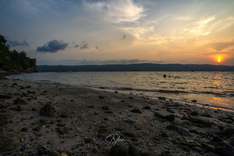
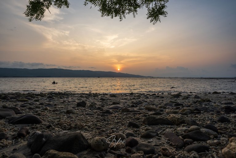
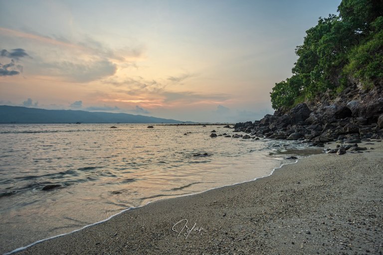
If you happen to be there, don't miss the sunset. It's a shame to miss out on the beauty of the soft twilight light breaking through the leaves. Scenic views of the seascape, in the distance, can be seen of the cape which was known as Pedir Point by maritime navigators in the past.
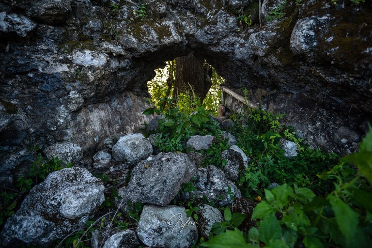
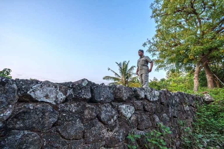
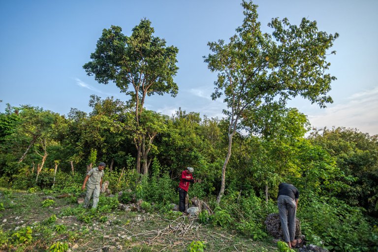
On the north side, you can observe the most intact part of the fort, Colonel Jun Hisatur Mastra measured the width with his body.
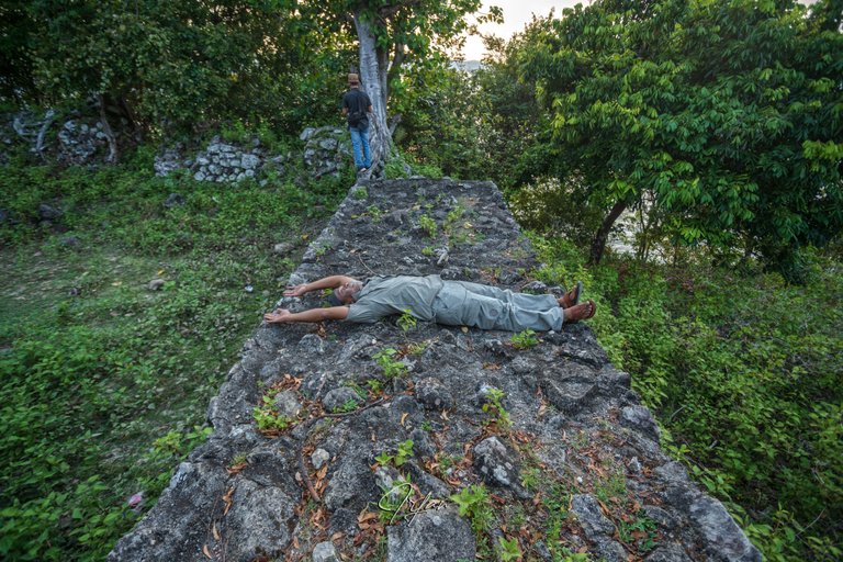
Part of the fort has been buried due to hill soil erosion, some researchers say it is 2.5 meters high and square in shape. While the eastern part has been completely buried.
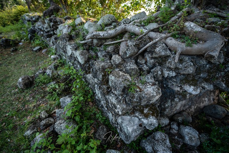
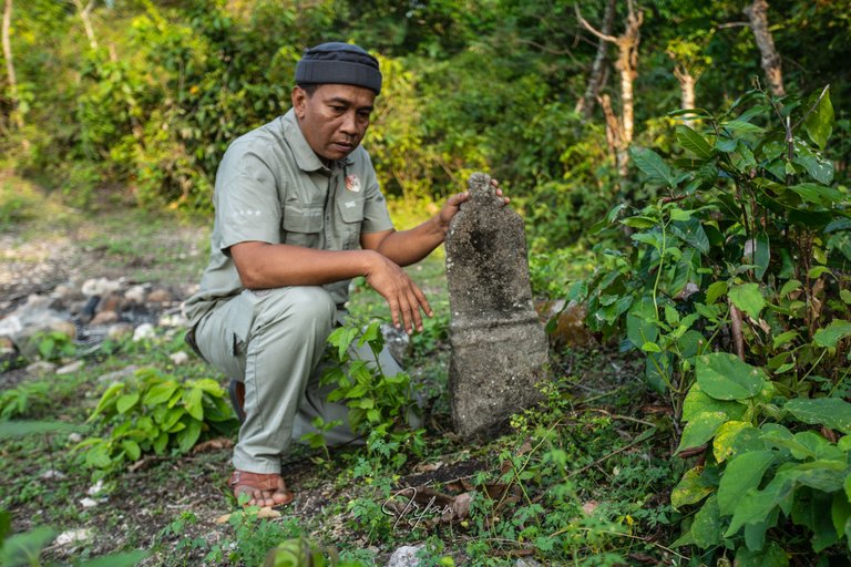
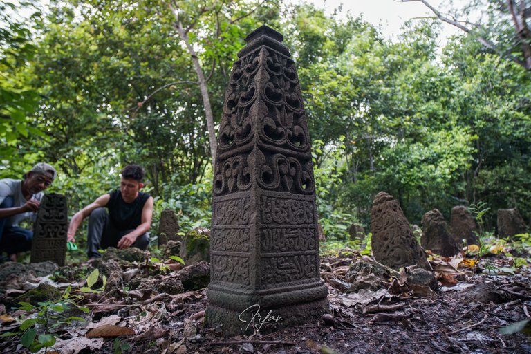
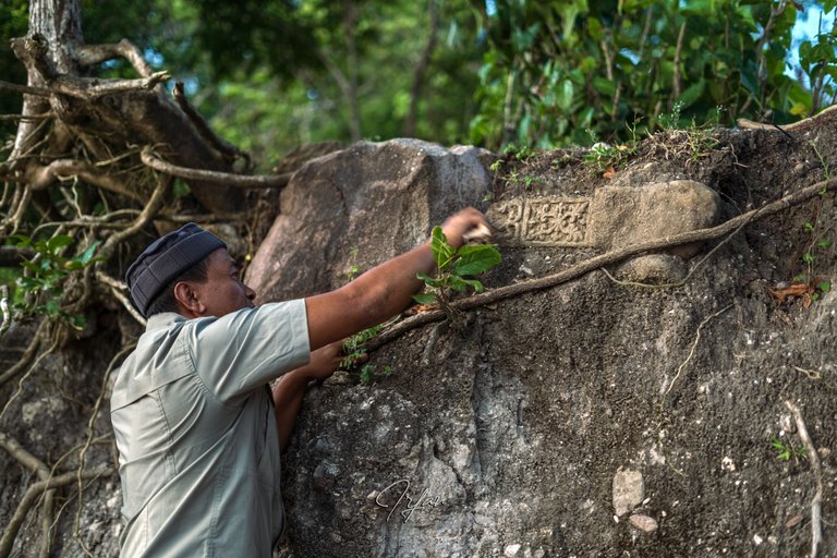
In and around the fort, several tombstones with Lamuri-period traits were discovered. These tombstones were discovered during a 2014 research. Ceramic and pottery fragments can also be found in the vicinity.
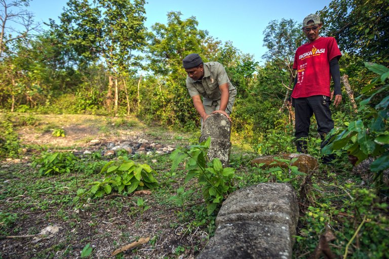
Take a look at the pic below.
The Lamuri kingdom is thought to be centered on the hill behind that coconut tree. 41 tombstones have been found in a study that took place from 27 September to 12 October 2014, all of which were read by the epigrapher Taqiyuddin Muhammad (@keuudeip). We don't have enough time to climb there because it's nearly dark. But I may post a photo I took during Ramadan last year on April 20, 2022.
Now let's go down from the fort to the beach, as the people call it:
Pantai Lhok Cut (Lhok Cut Beach)
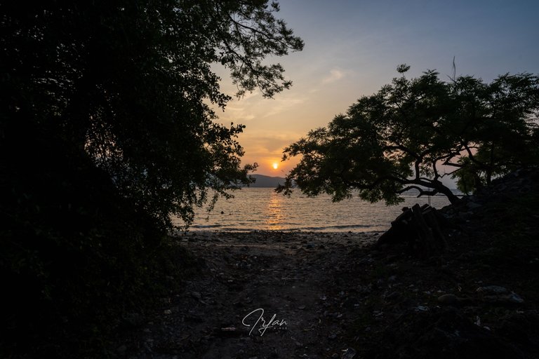
The gap resembles a gateway to the beach. I have to hurry to get the sunset pics.
When I was engrossed in capturing the sunset, a colleague called to inform me of a fresh discovery, a tombstone that was buried in the ground is now visible due to the cliff erosion.
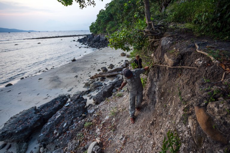
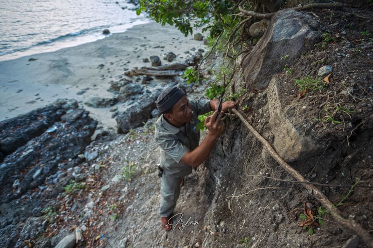
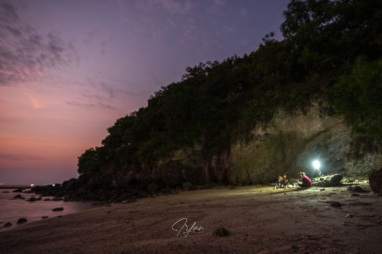
"Let's determine a suitable location for us to break our fast", said the Colonel.
We chose it near the rock ruins at the further end of the cliff.
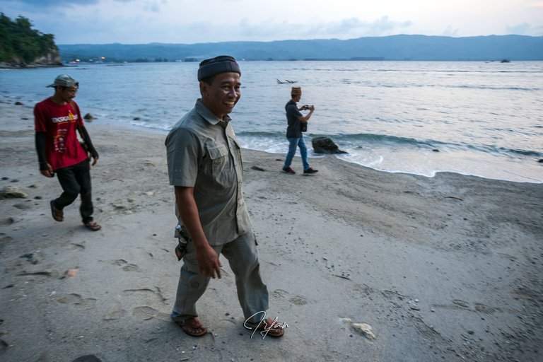
The sun has set, a sign that we are allowed to break our fast.
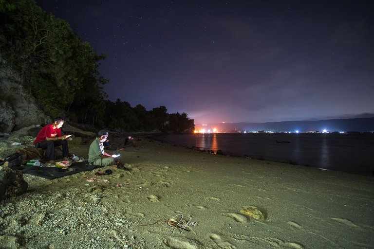
The most wonderful experience, thanks to my friends, Colonel Jun Mastra, Erik Miga, Yoesri Ramli, @AnzirPasai, and Rahmat Riski, who shared the joy of this visit.
Conclusion:
The area is ideal for tourists interested in natural beauty and cultural heritage tourism.
Eid Mubarak!!
Thank You
by Irfan M Nur (@vannour)
Amateur historian
Pictures taken with:
- Sony Alpha 7 III camera + Sony FE 50mm F1.8 lens and Canon EF 17-40mm f/4L USM lens + E-Mount Metabones adapter.
- Drone DJI PHANTOM 4
The rewards earned on this comment will go directly to the people( @anzirpasai ) sharing the post on Twitter as long as they are registered with @poshtoken. Sign up at https://hiveposh.com.
Thanks @anzirpasai
Hiya, @ybanezkim26 here, just swinging by to let you know that this post made it into our Honorable Mentions in Daily Travel Digest #1858.
Your post has been manually curated by the @pinmapple team. If you like what we're doing, please drop by to check out all the rest of today's great posts and consider supporting other authors like yourself and us so we can keep the project going!
Become part of our travel community:
Thank you very much for the good news.
That place should be developed for a tourist attraction om.
with the historical and also the scenery I guess it will attract lots of visitors.
beautiful sunset you have there om.
Happy Eid om. May God Bless you and your family always.
!PIZZA
cultural activists in Aceh have worked in that direction and continue to strive to make the area designated as a national cultural heritage area. Thank you for your kind words 🙏
Congratulations, your post has been added to Pinmapple! 🎉🥳🍍
Did you know you have your own profile map?
And every post has their own map too!
Want to have your post on the map too?
Congratulations @vannour! You have completed the following achievement on the Hive blockchain And have been rewarded with New badge(s)
Your next target is to reach 130000 upvotes.
You can view your badges on your board and compare yourself to others in the Ranking
If you no longer want to receive notifications, reply to this comment with the word
STOPTo support your work, I also upvoted your post!
Check out our last posts:
Support the HiveBuzz project. Vote for our proposal!
This post has been manually curated by @bhattg from Indiaunited community. Join us on our Discord Server.
Do you know that you can earn a passive income by delegating to @indiaunited. We share more than 100 % of the curation rewards with the delegators in the form of IUC tokens. HP delegators and IUC token holders also get upto 20% additional vote weight.
Here are some handy links for delegations: 100HP, 250HP, 500HP, 1000HP.
100% of the rewards from this comment goes to the curator for their manual curation efforts. Please encourage the curator @bhattg by upvoting this comment and support the community by voting the posts made by @indiaunited.
Thanks for taking me to a cool place. One day I returned to that place.
That's right, the beauty of the charm there cannot be denied
That's right, the beauty of nature there makes me want to go back there. 😉
Thanks for sharing this beautiful place. It brought back a glimpse of province life..
You're welcome
Many historical relics are stored in Aceh, one of which is the place you visit. I think this is something great, especially the evening view of the beach in Aceh Besar, there is no doubt about it.
I hope this post can guide you there one day with a different and unique story.
Gee hope I get lucky for that!
Nice
Such a wonderful place. Very nice.
I like how people there walking slowly with a smile on their face, sure that it was fun to explore new place I like the region that own with a rich history like this .
Have a great weekend dear!
These photos show a wonderful place where you can live in close contact with nature.