Yesterday we did something really tough!!! I’m not afraid of doing hard things. I spent my teenage years crewing for my dad on Hobie Cats racing in gale force South Easters. I’ve had gymnastics injuries, bruises, aching muscles and arms that couldn’t pull another rope because they were shaking from fatigue. And for the last few years I’ve loved hiking, but lately trail running has peaked my enthusiasm.
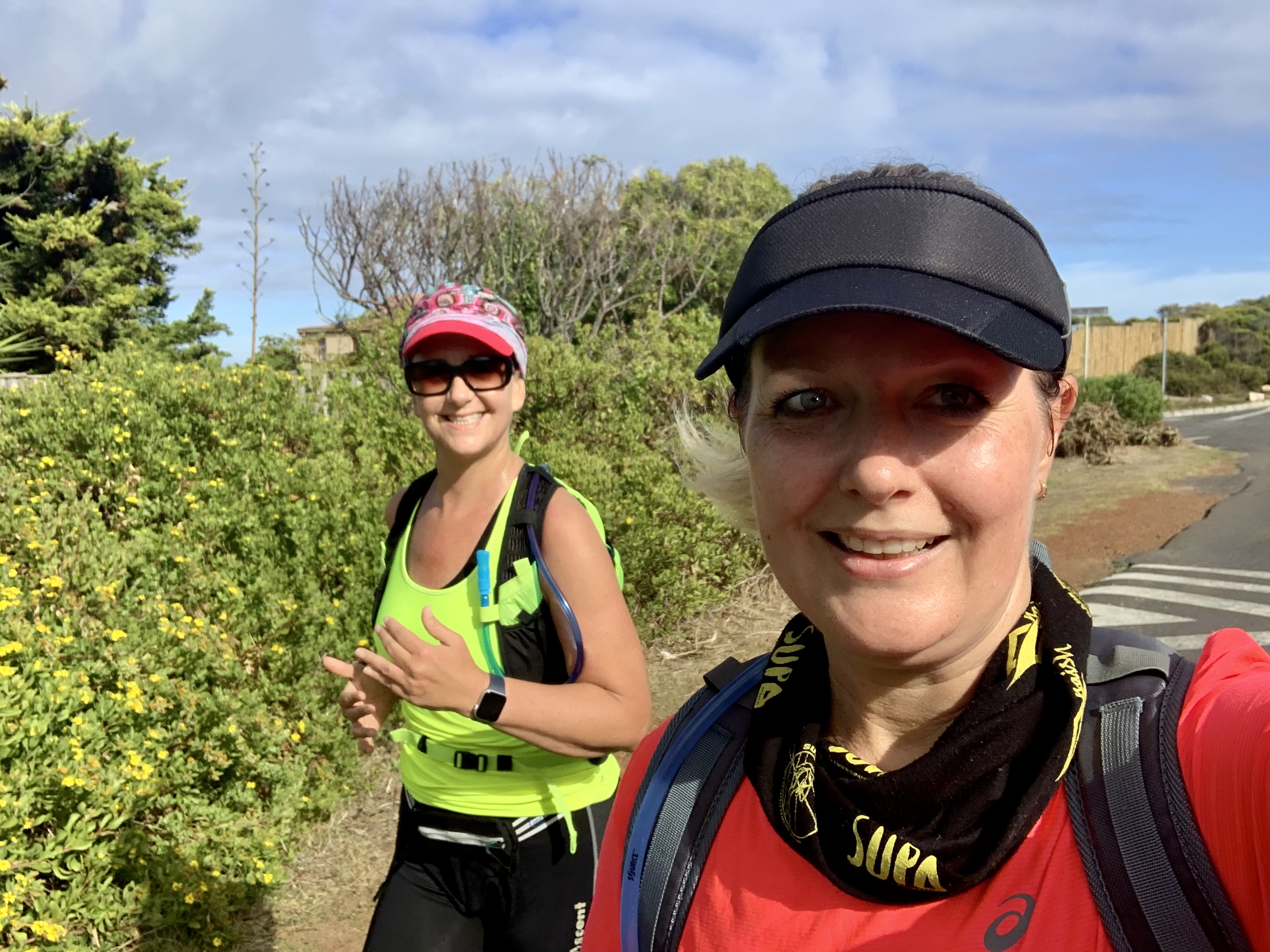
A couple weeks ago my trail buddy messaged me to say she had signed us up for the “Chicks Who Trail Run for Beer”. I didn’t know what it meant but it didn’t matter I was up for it. Maybe my husband could drink my beer?
Anyway at her birthday party on Wednesday evening she happened to mention that the “run” was up Chapmans Peak! WHAT??????? I had thought the trail “run” part would be somewhat achievable, but clearly for the two of us it was meant to be a hike!
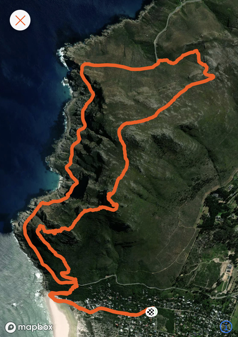
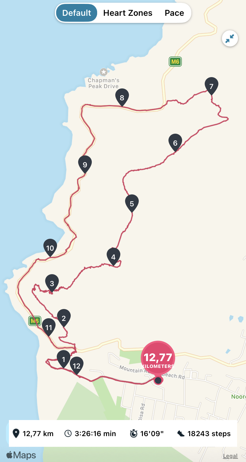
Now, Chapmans Peak is 593 meters of elevation from sea level. (We started at sea level.... on the beach) It’s steep and rocky and just a bit dangerous if you don’t watch your footing. I had never done this route from the back of Chapmans Peak before but from everyone I talked to, it was a steep, narrow path that was highly overgrown with a few Boulder climbing sections. Not my idea of running.
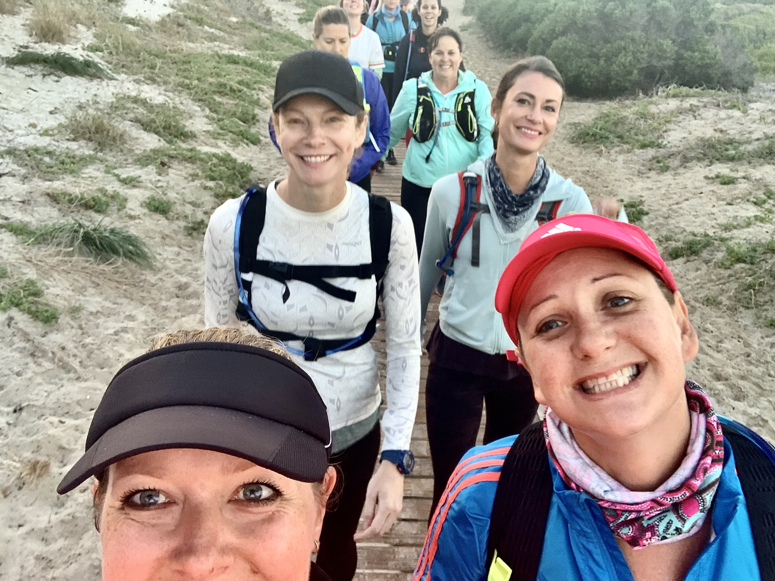
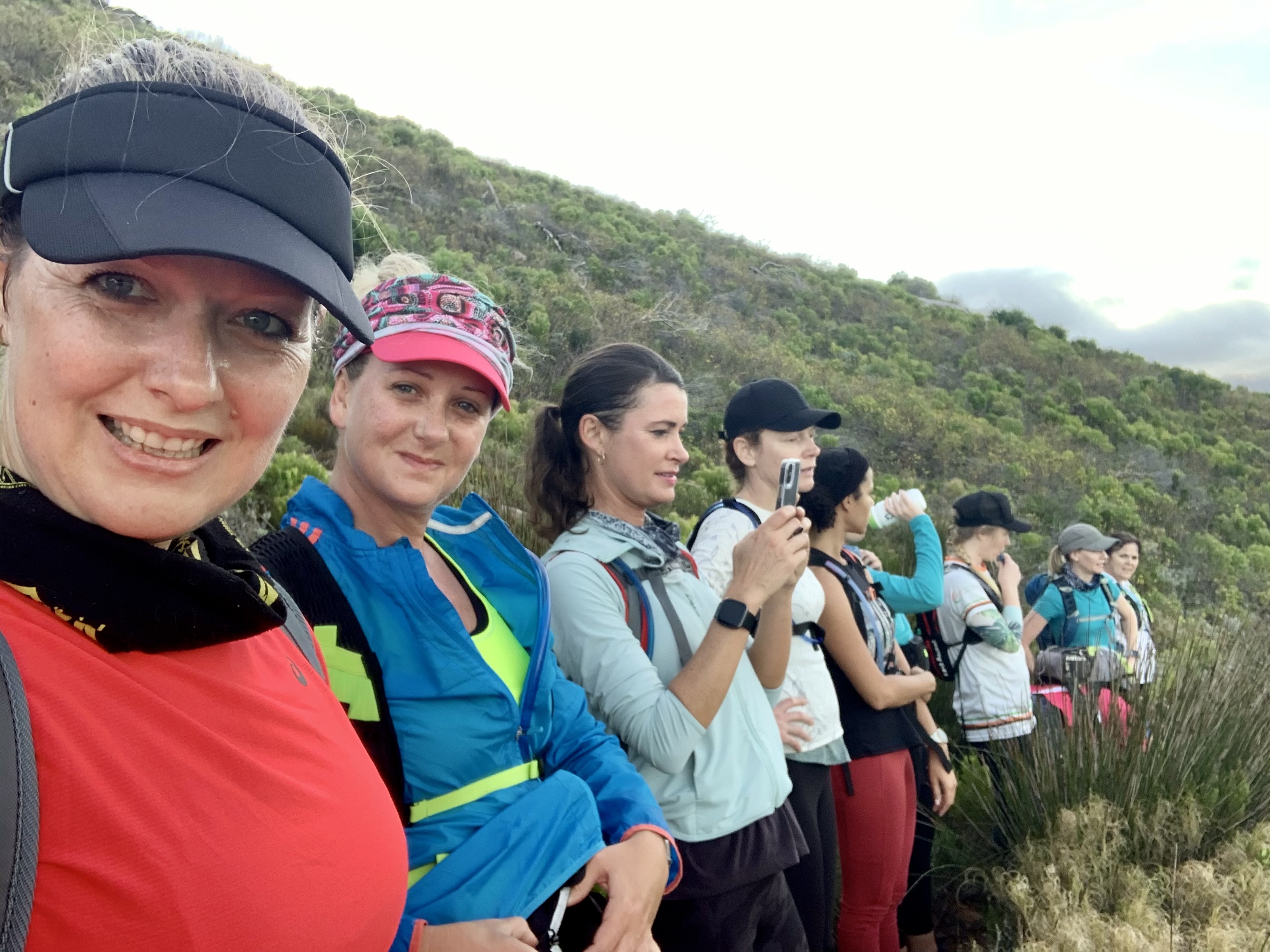
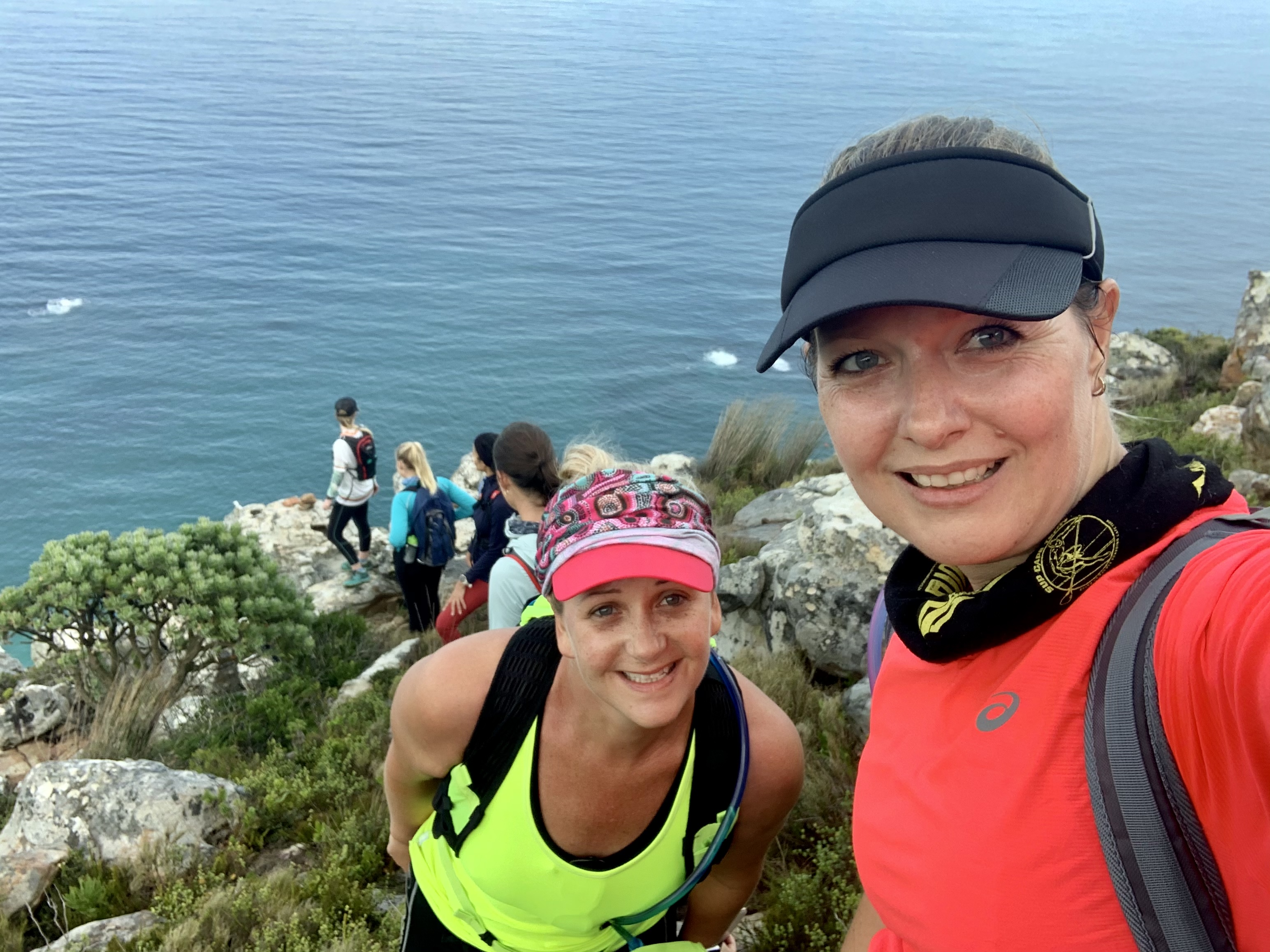
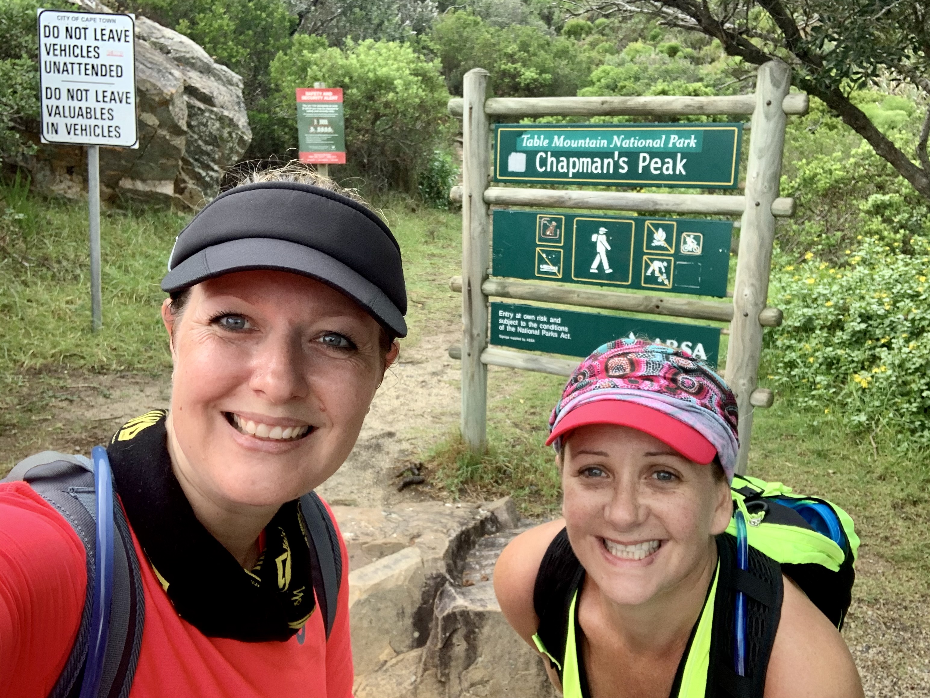
We met at our local craft brew spot called Aegir, also the sponsor of the run for the day. And this was also our starting point. We had joined as beginners to be with the slowest group and also got the chance to start first at 7.30am.
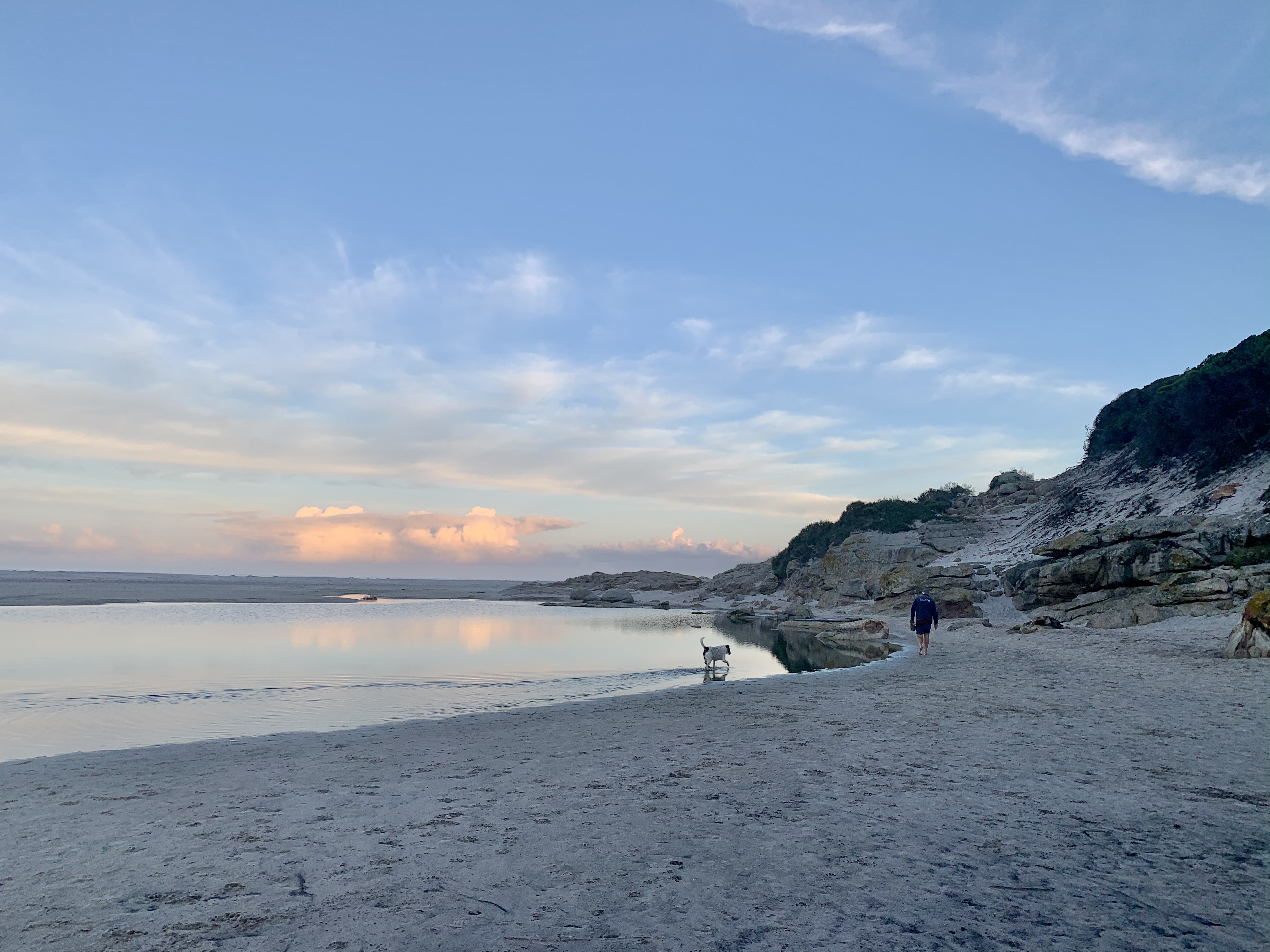
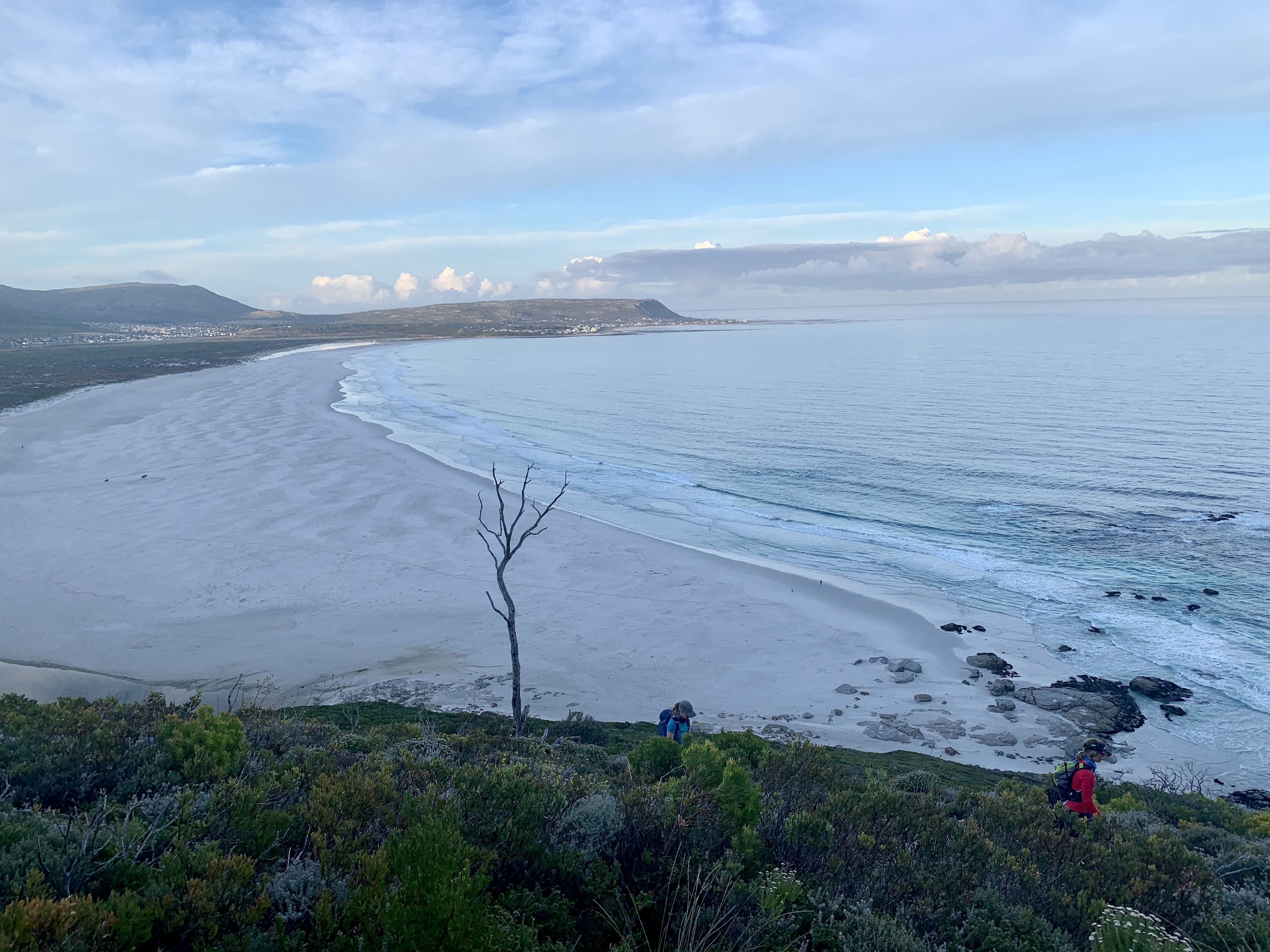
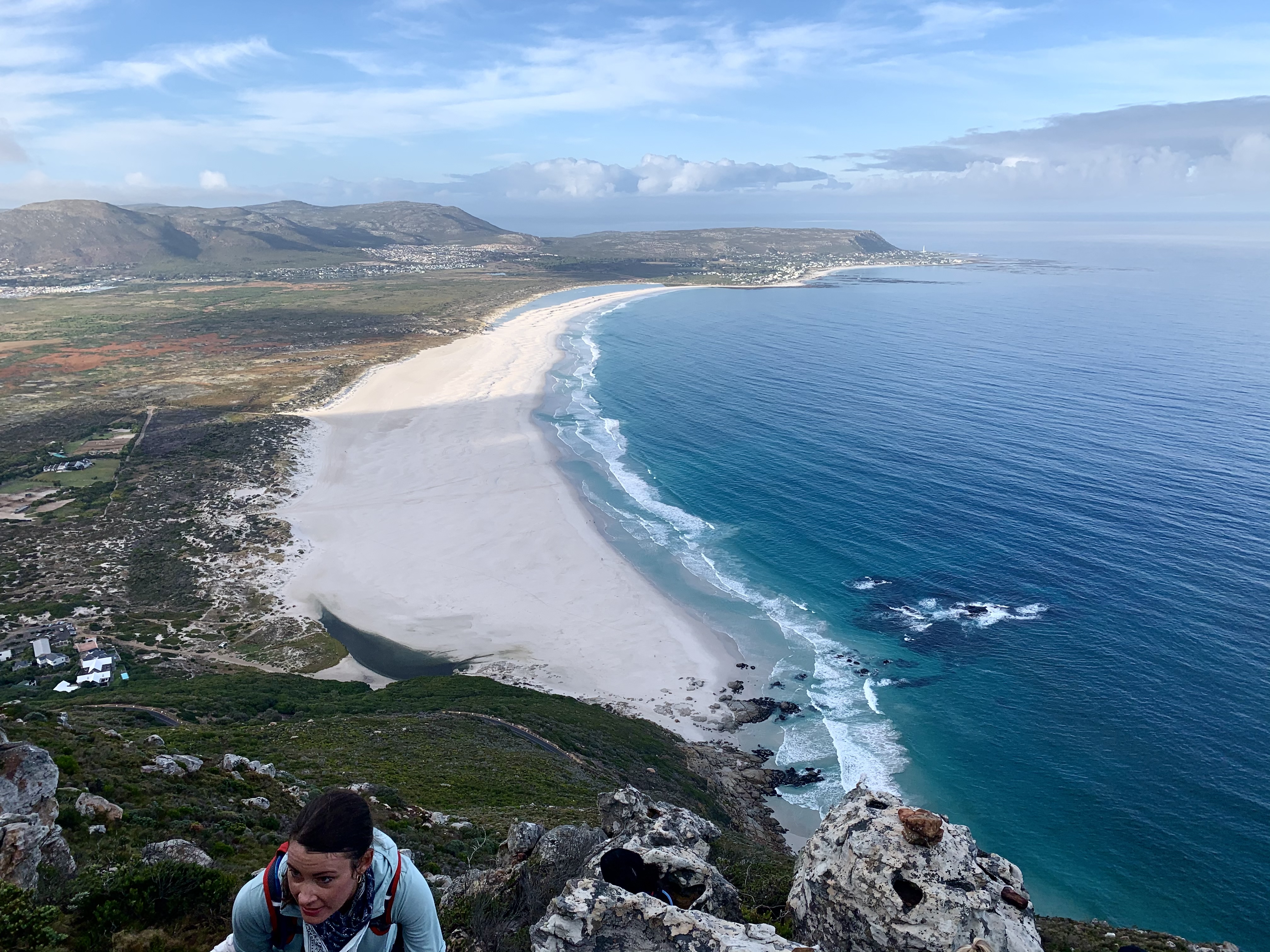
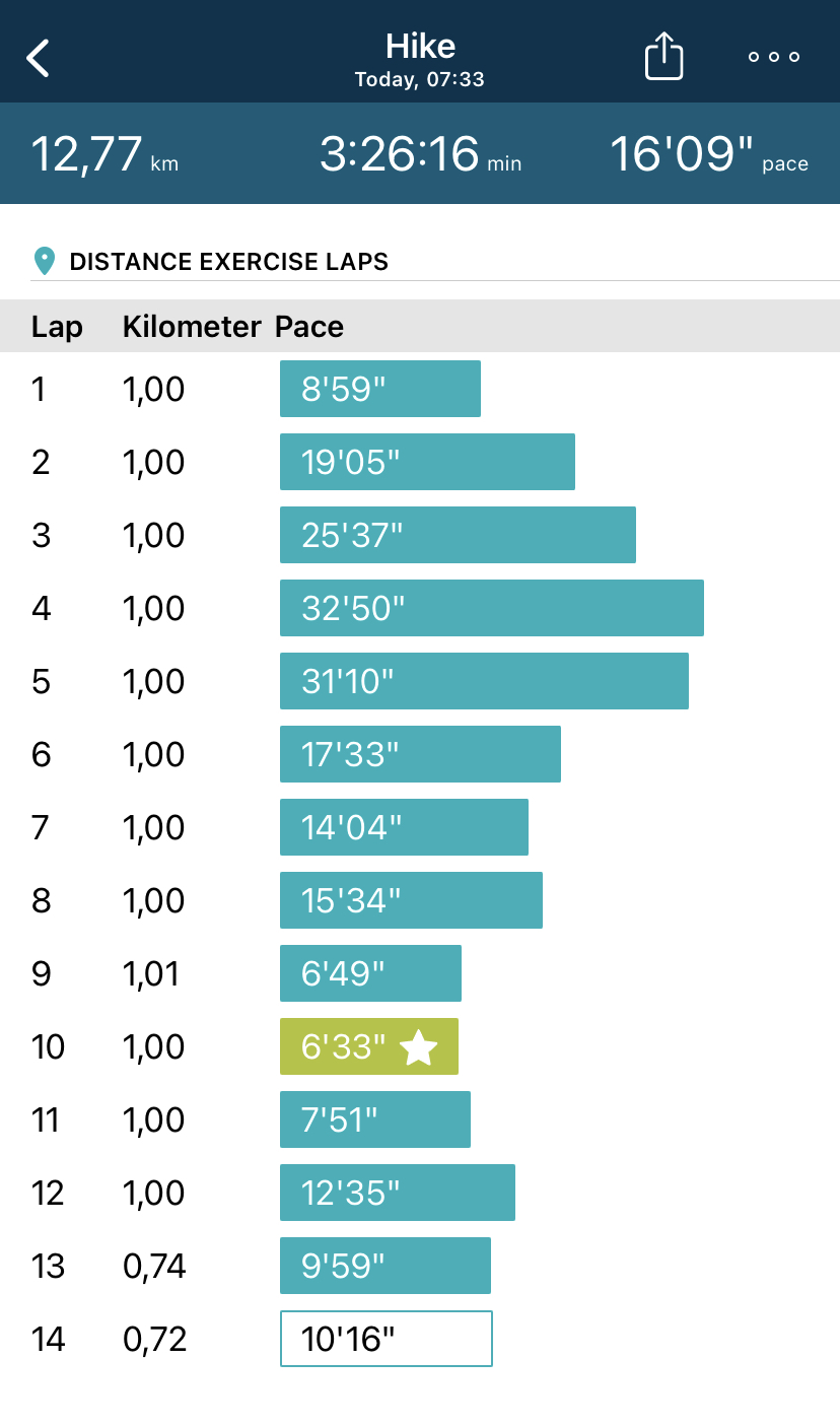
At 7.33am we hit the road at a slow jog with water sloshing in my camel pack. This took us our first kilometre to the Noordhoek beach. The last time I ran on sand I picked up a calf strain so this wasn’t a fun idea. Luckily everyone dropped to a walk at this point. The morning was perfect for the mountain.
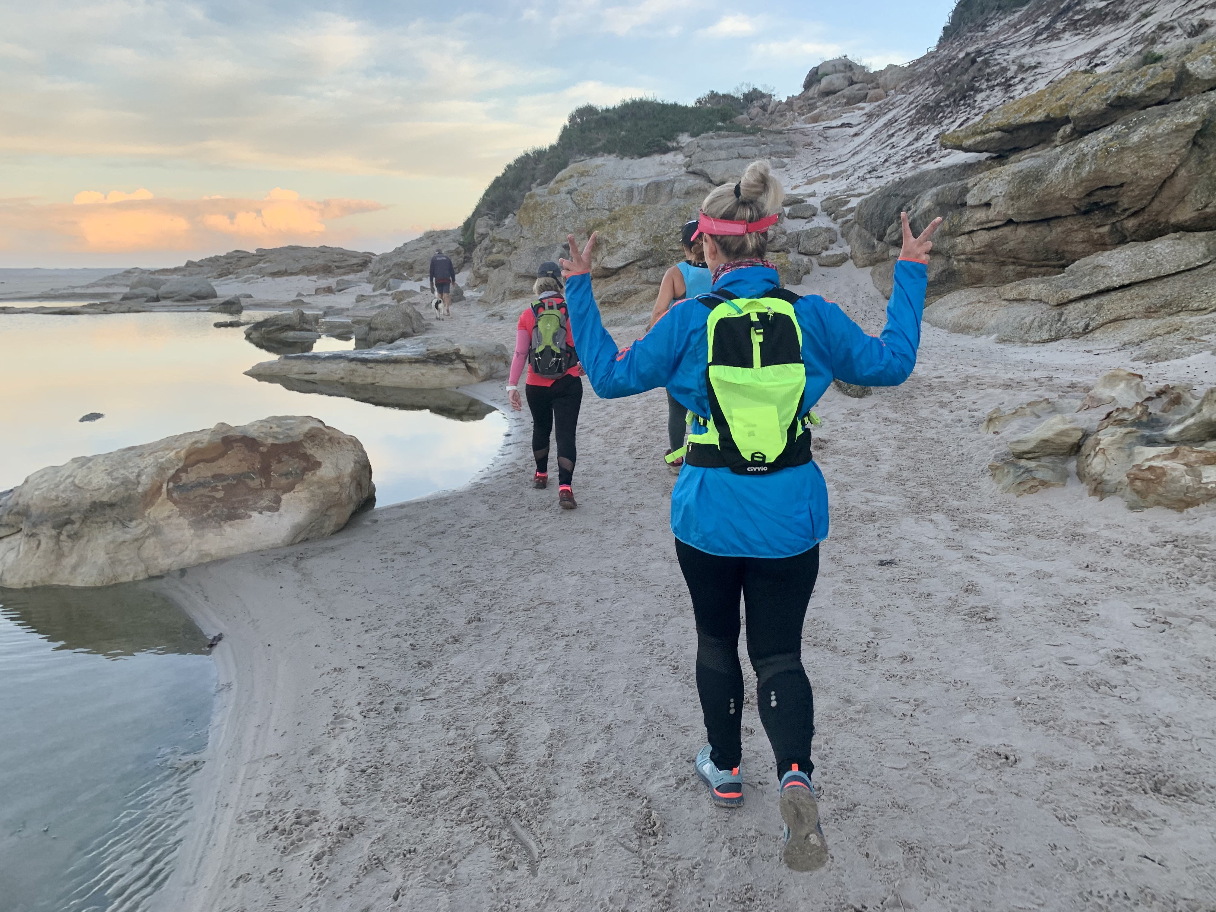
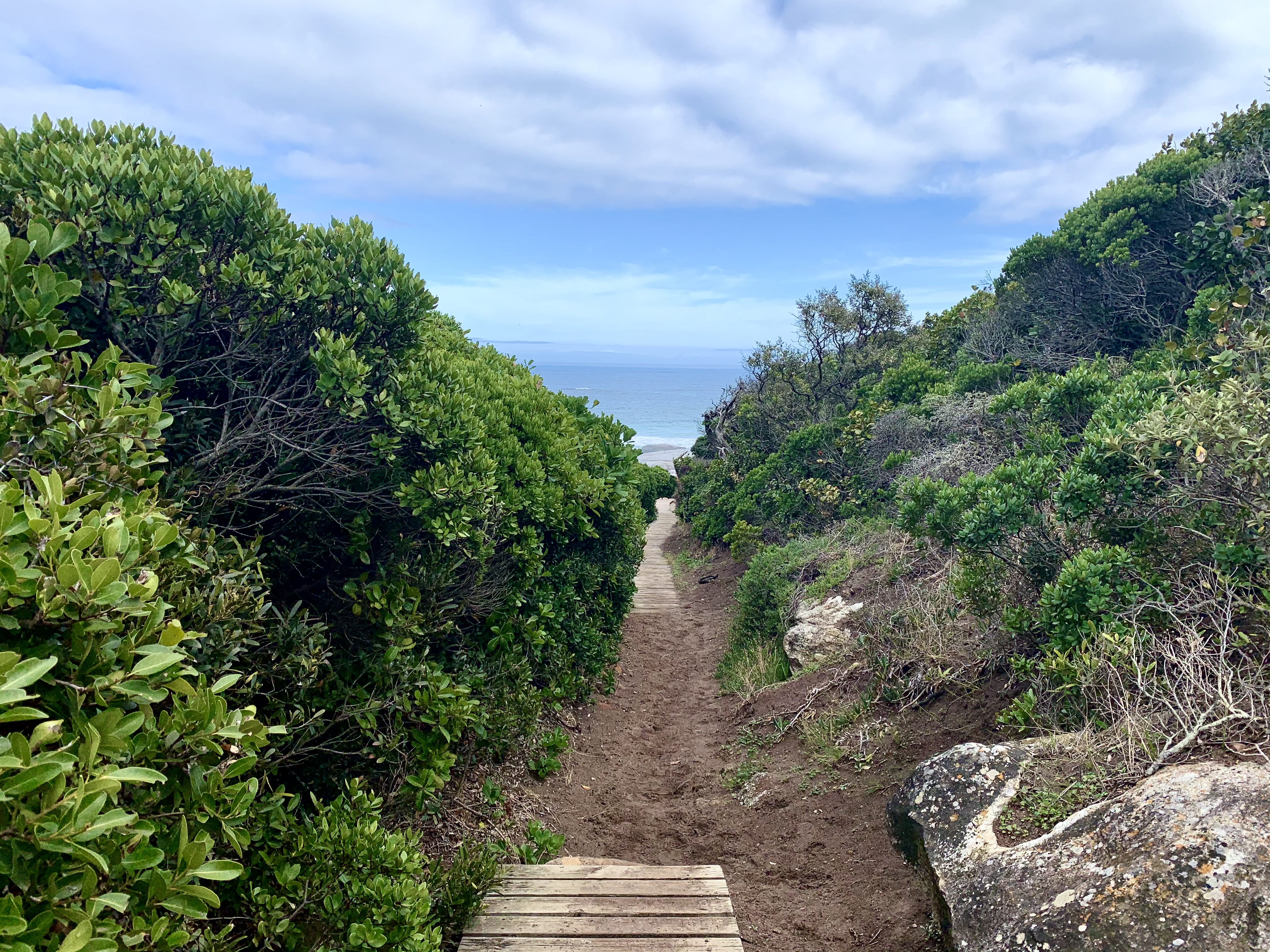
Kilometre 2 took us up a wooden boardwalk through some Milkwood trees (they’re a protected species here in South Africa) and then the uphill began. Up the wooden steps as our thighs began to burn and the panting began. The struggle is REAL!
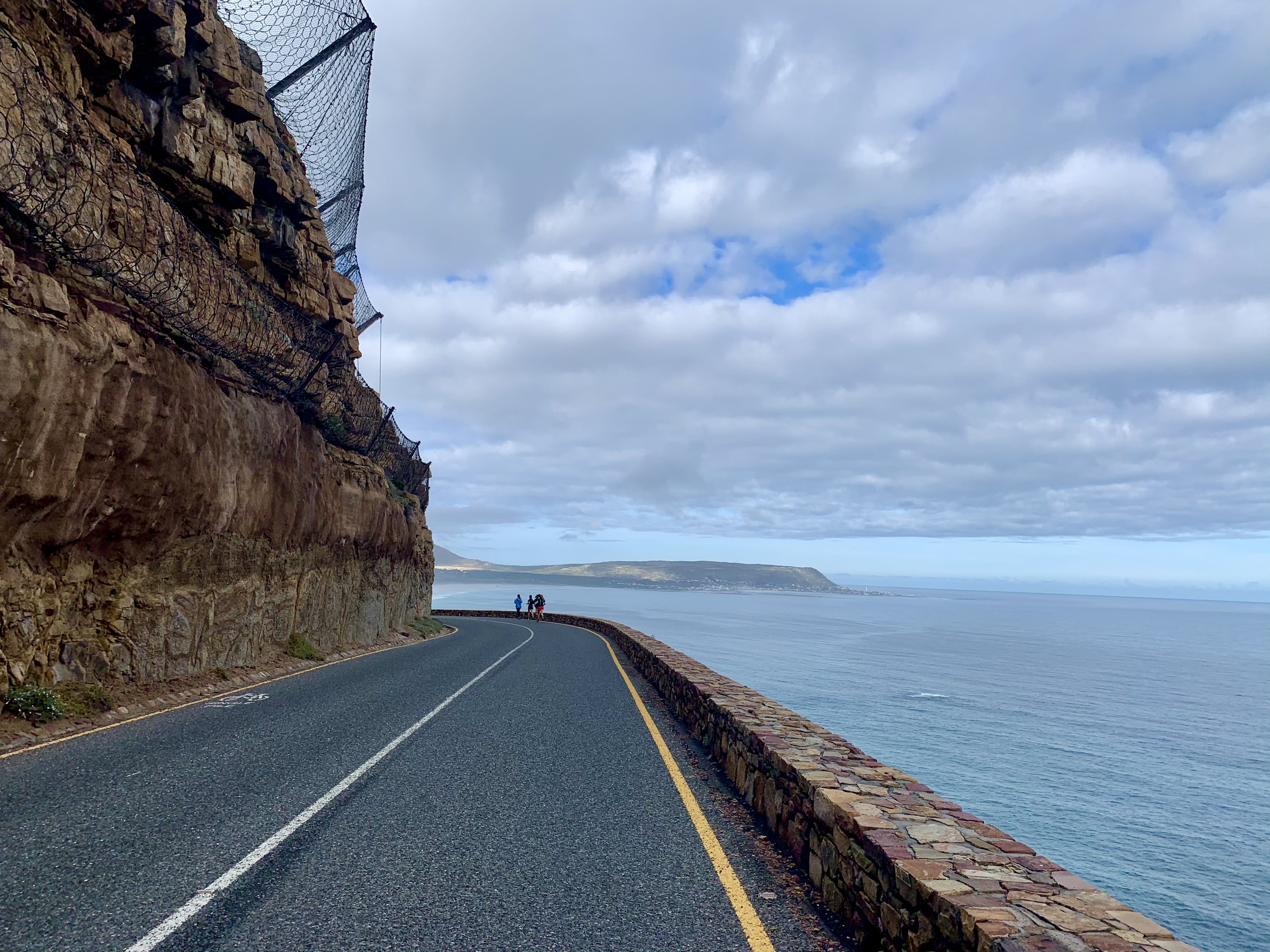
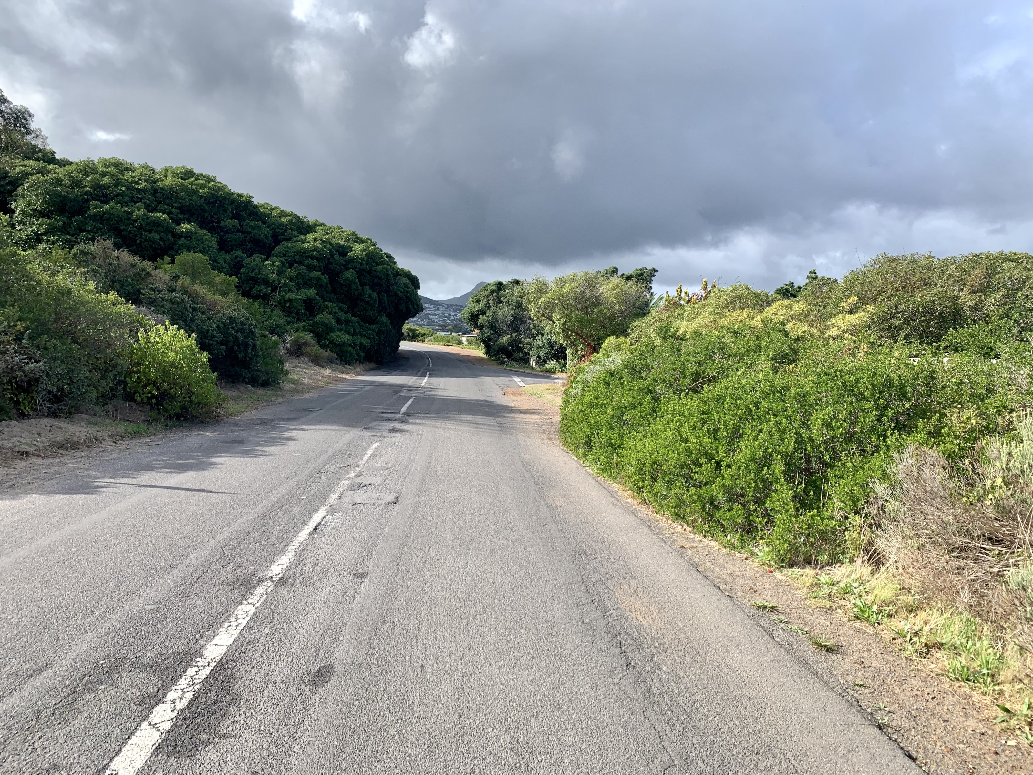
Just when it seemed ridiculous we popped onto Chapmans Peak Drive. It’s a busy road with runners, cyclists and tourists. But at this time of the morning it was all cyclists and runners taking over the road. We crossed over to a wooden fence which I guess was meant to be open but we found closed with barbed wire! No worries! We literally just walked around it at found the slightly hidden path taking us up the next section of the mountain.
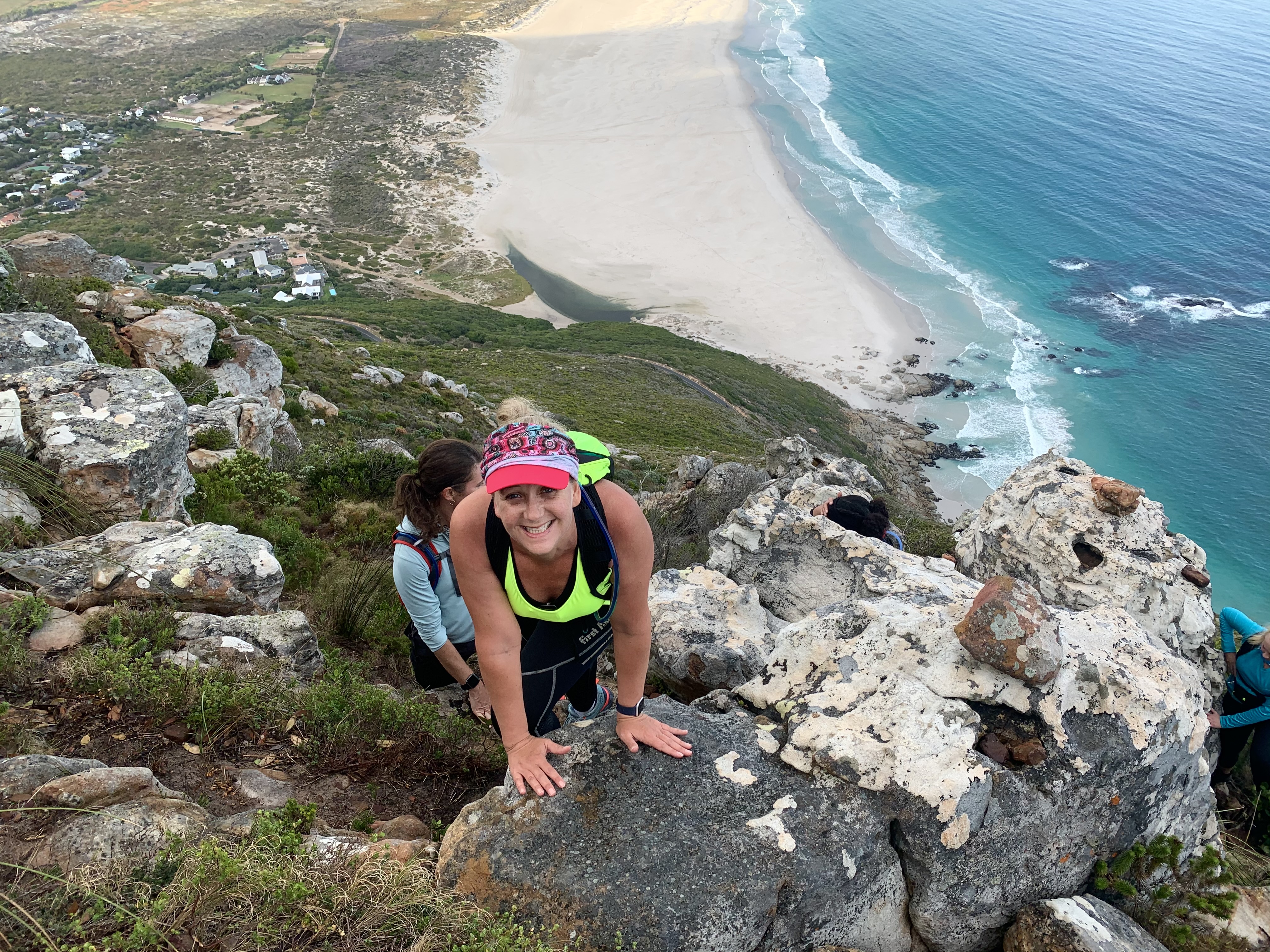
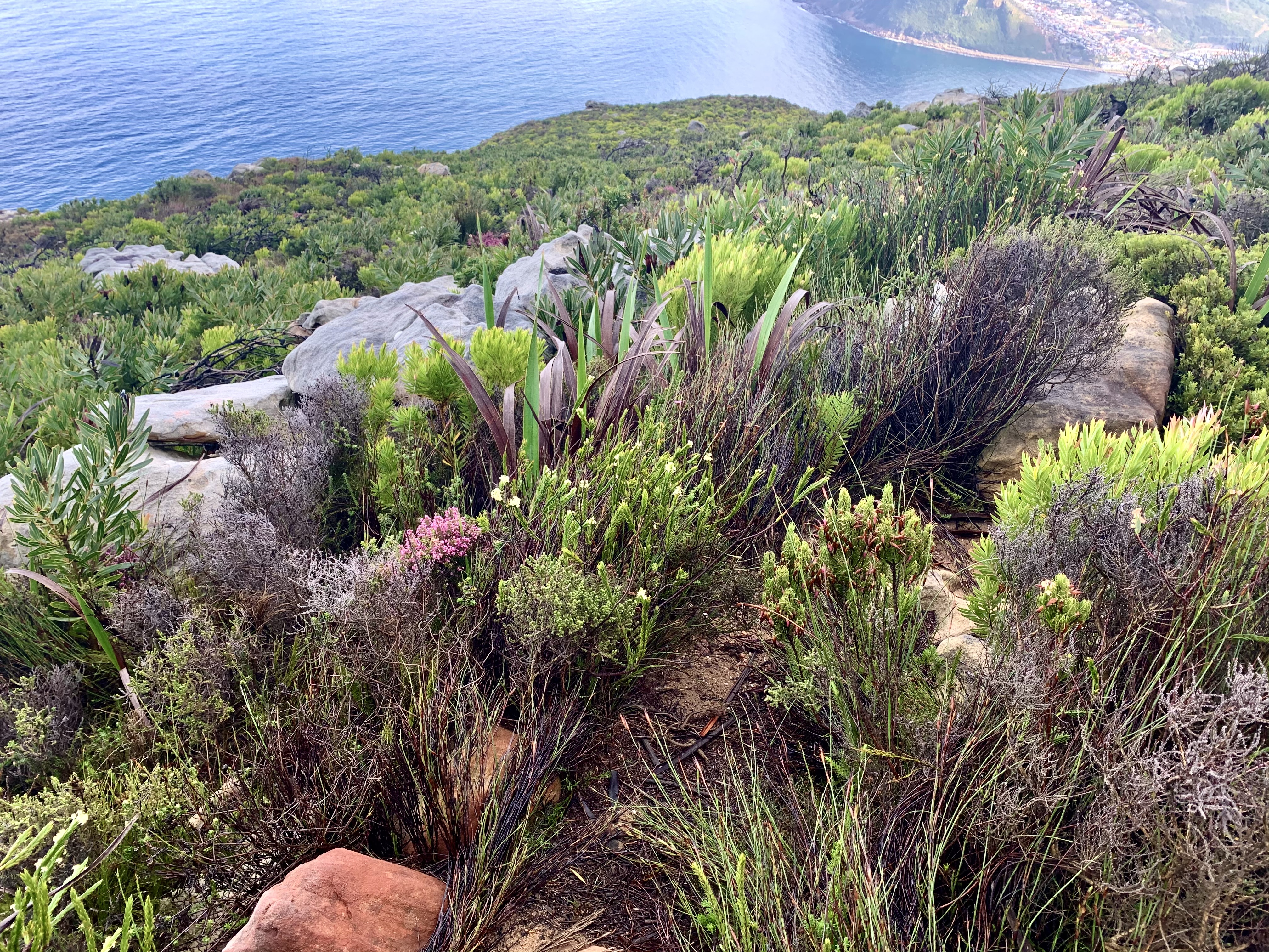
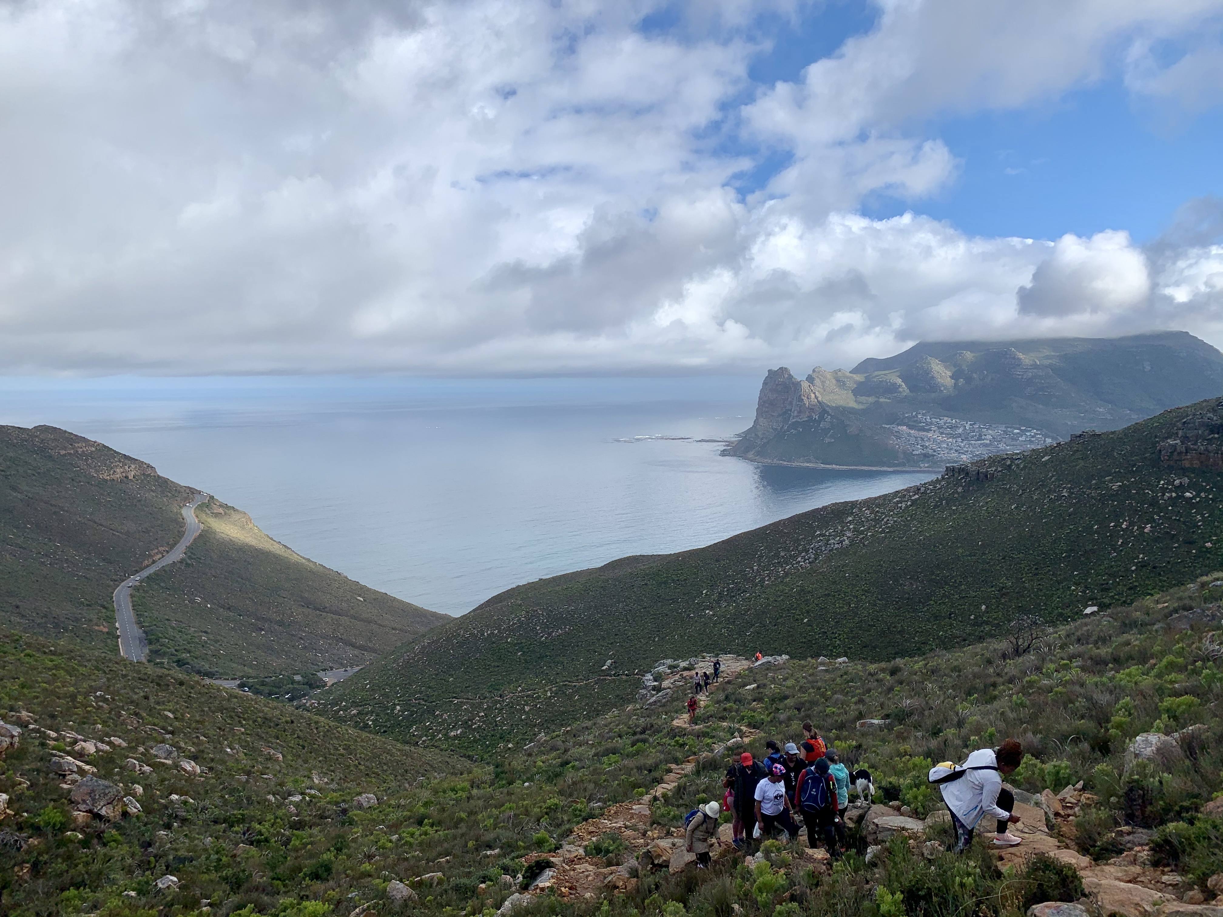
A short way up and views were already stunning. We quickly realised that a few of our team members were quite a bit slower so we ended up stopping every now and then to make sure they were following the path and catching up. I desperately needed these little breaks for my legs to recover.
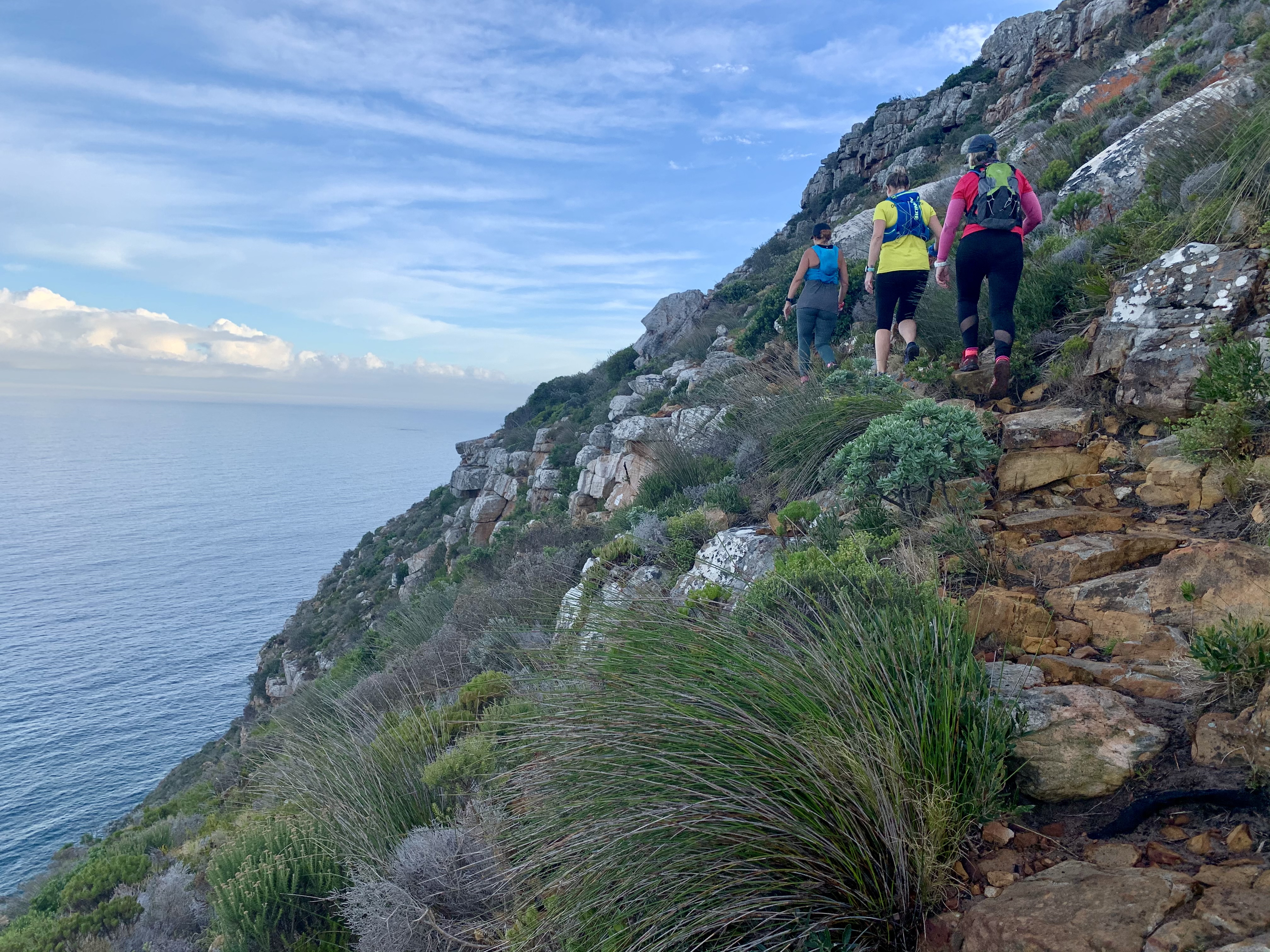
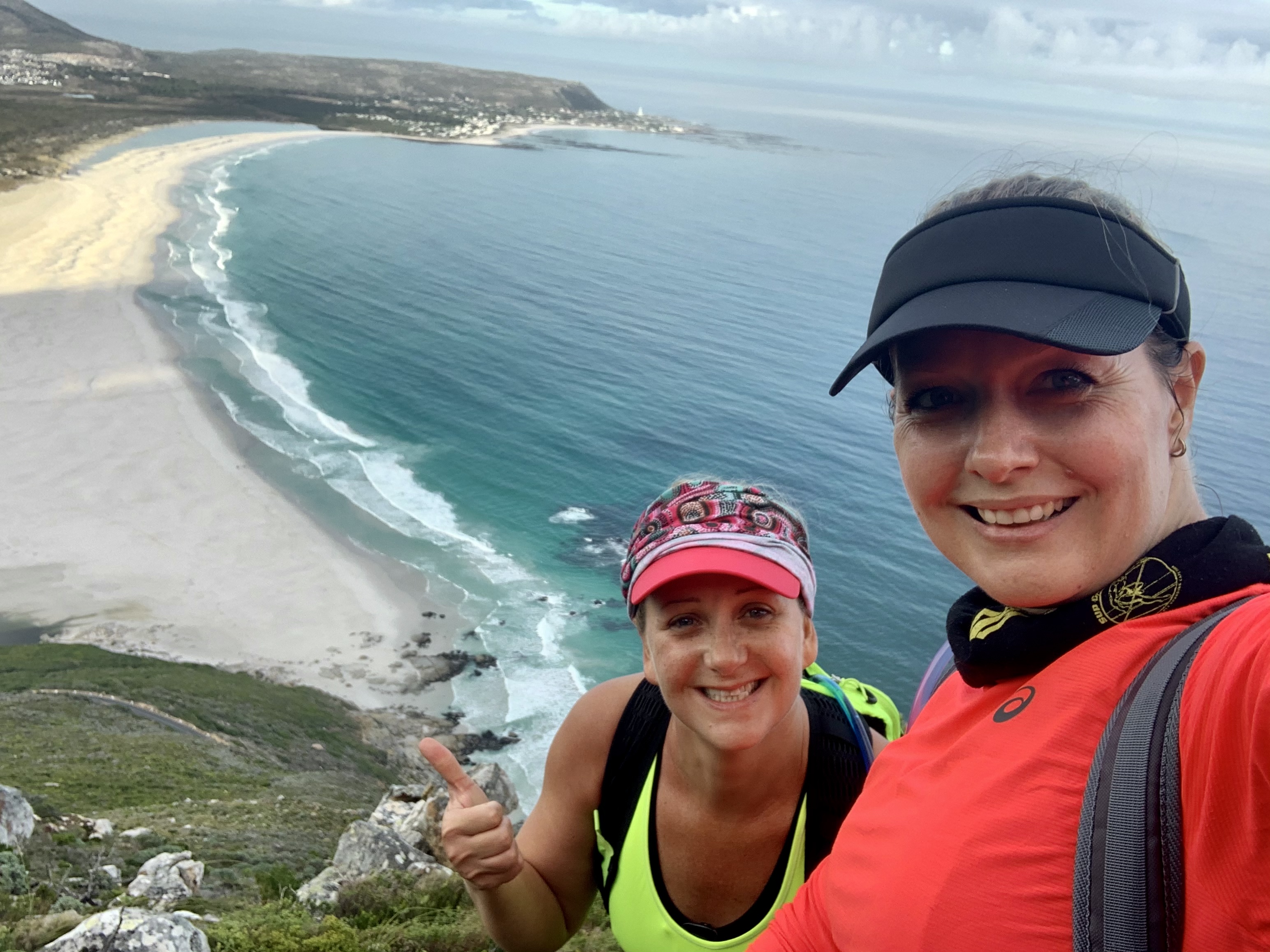
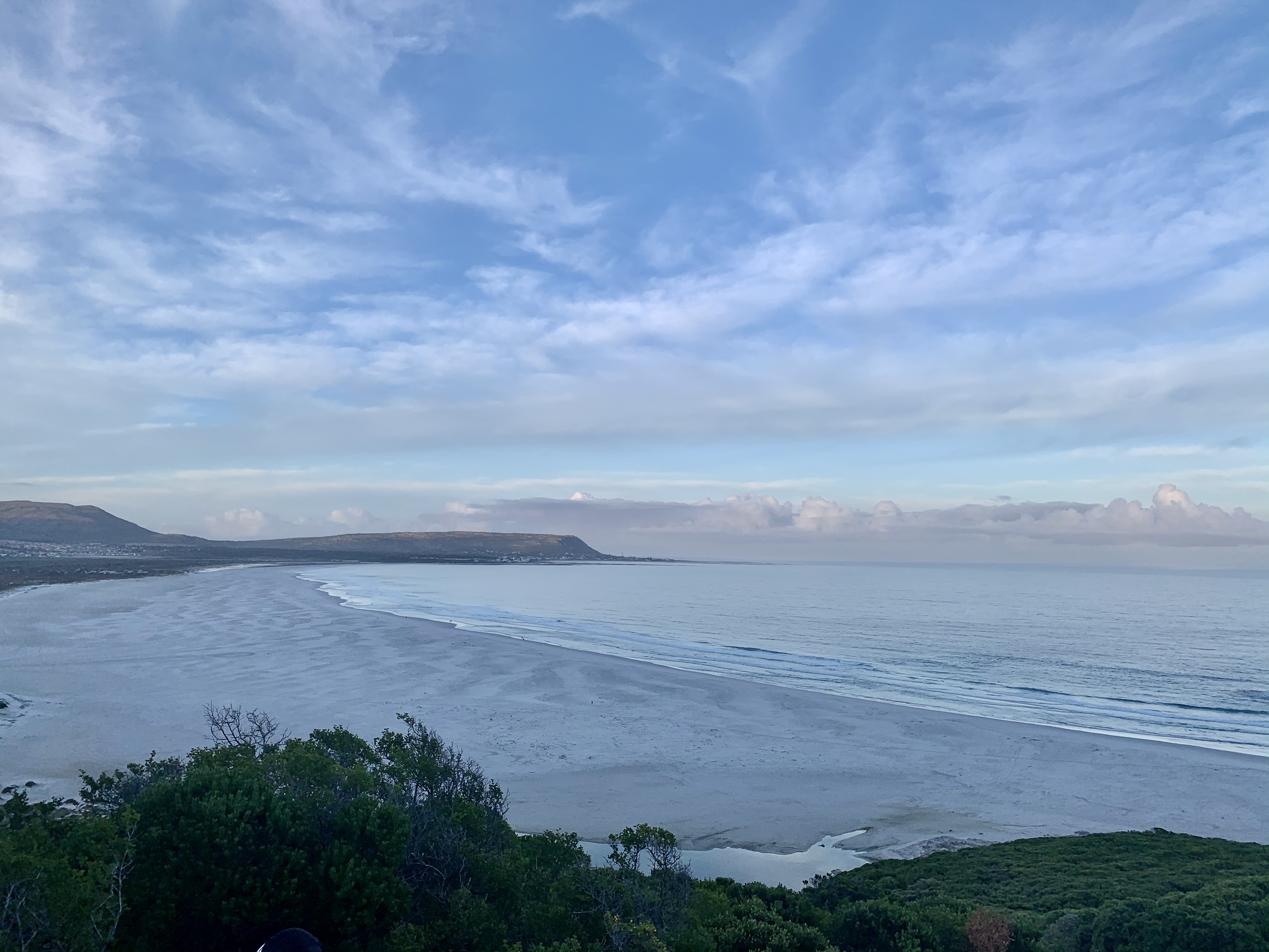
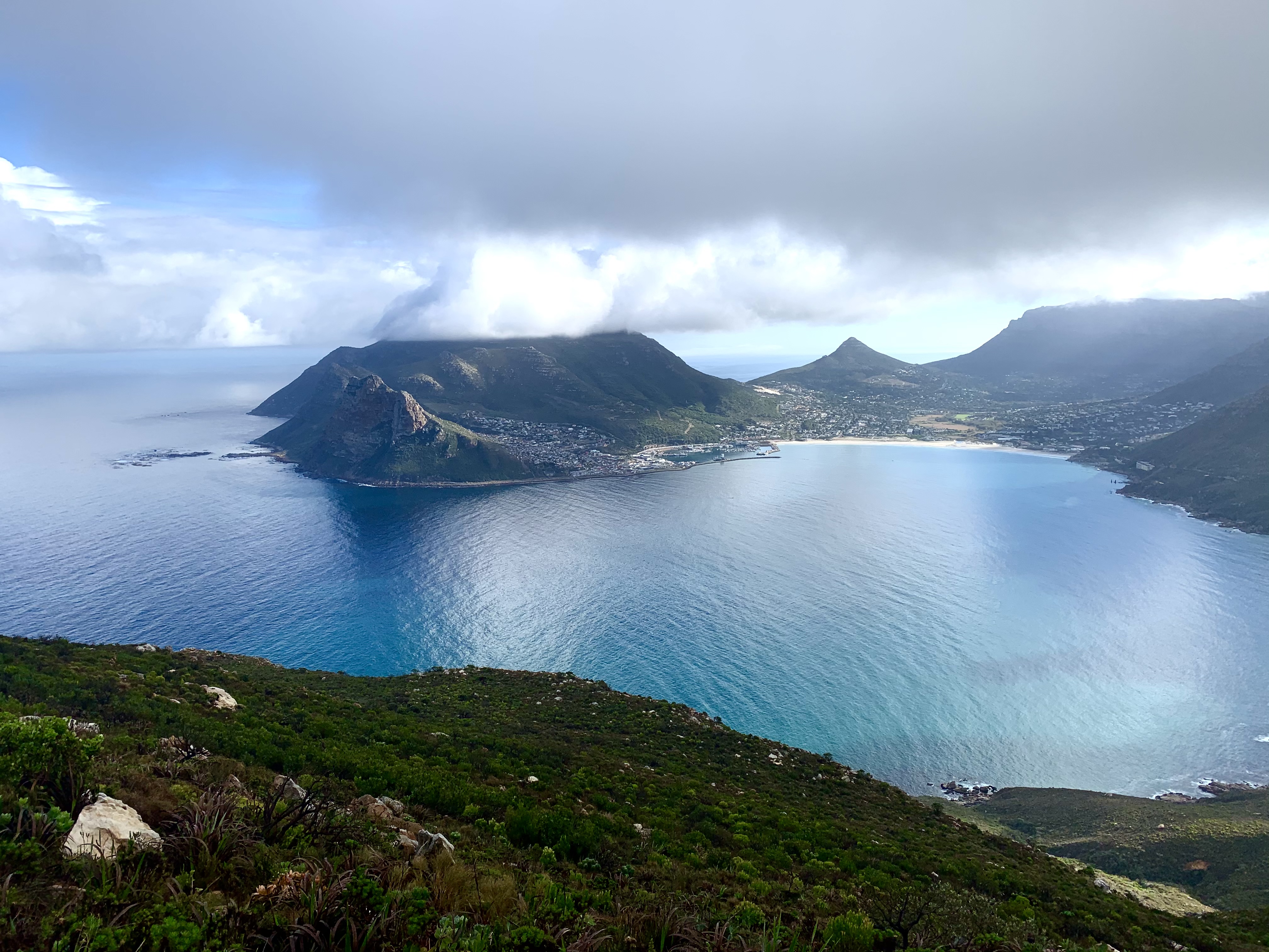
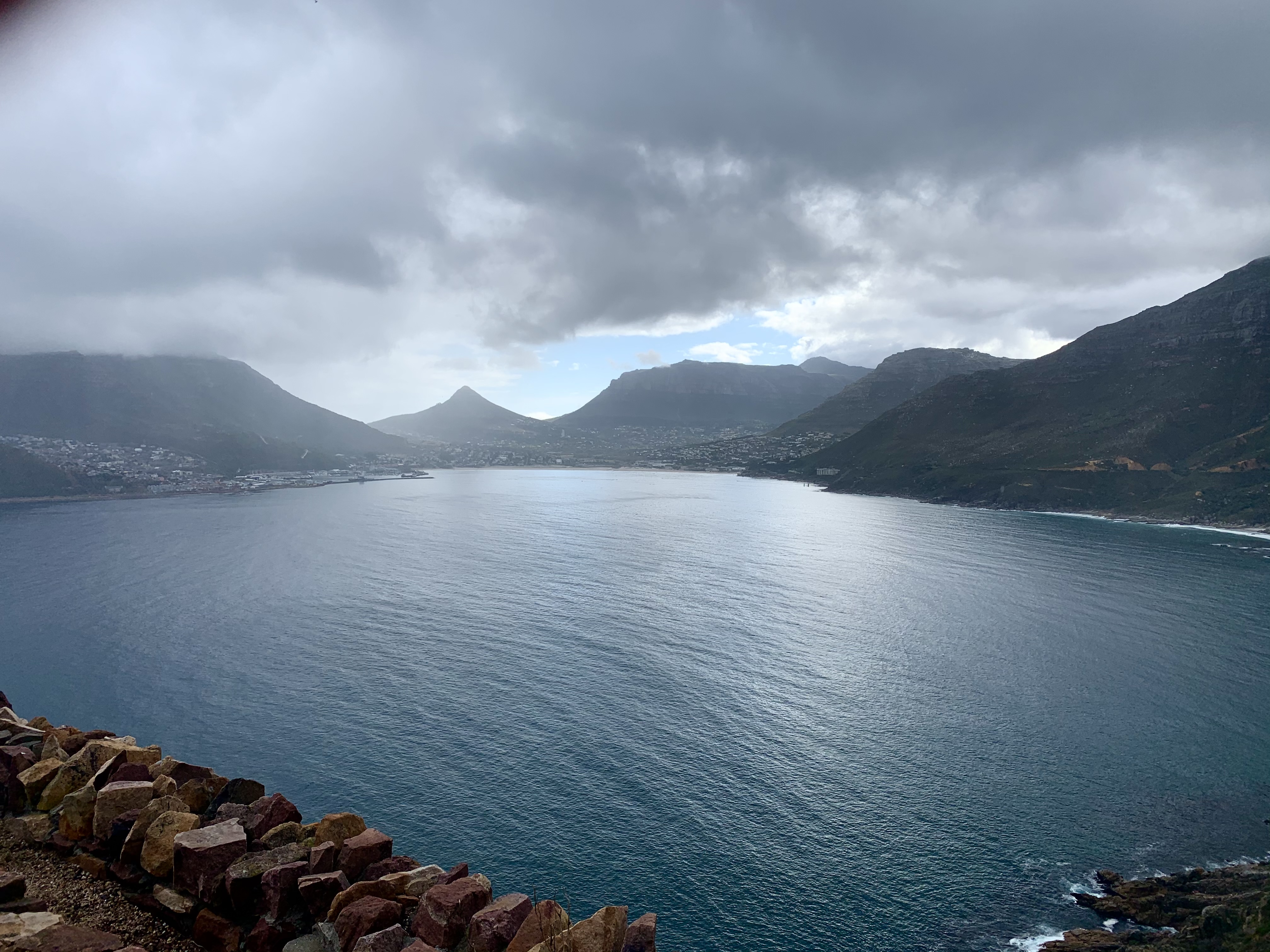
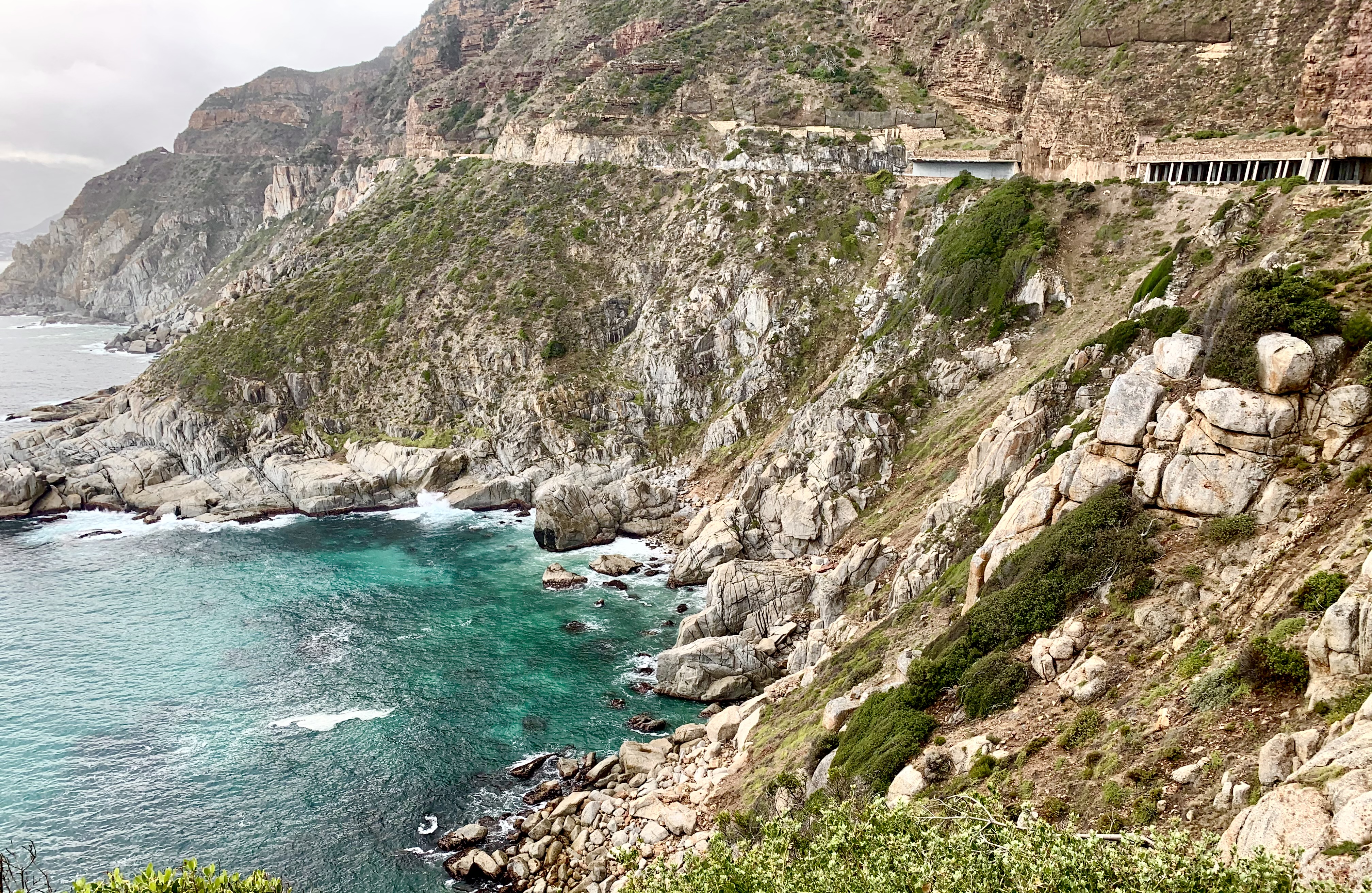
By the start of kilometre three we got the most beautiful view of Hout Bay in the distance and the cliffs of Chapmans Peak right alongside us and directly below.
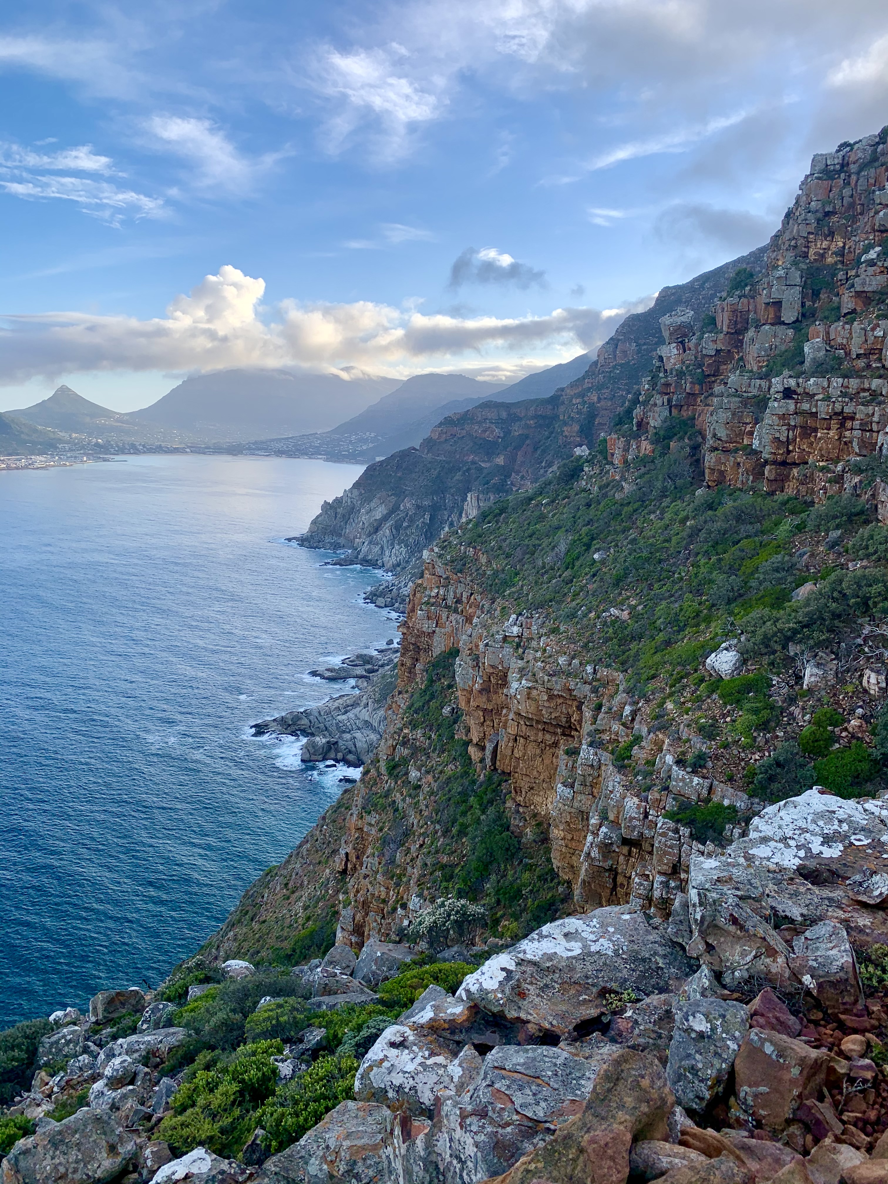
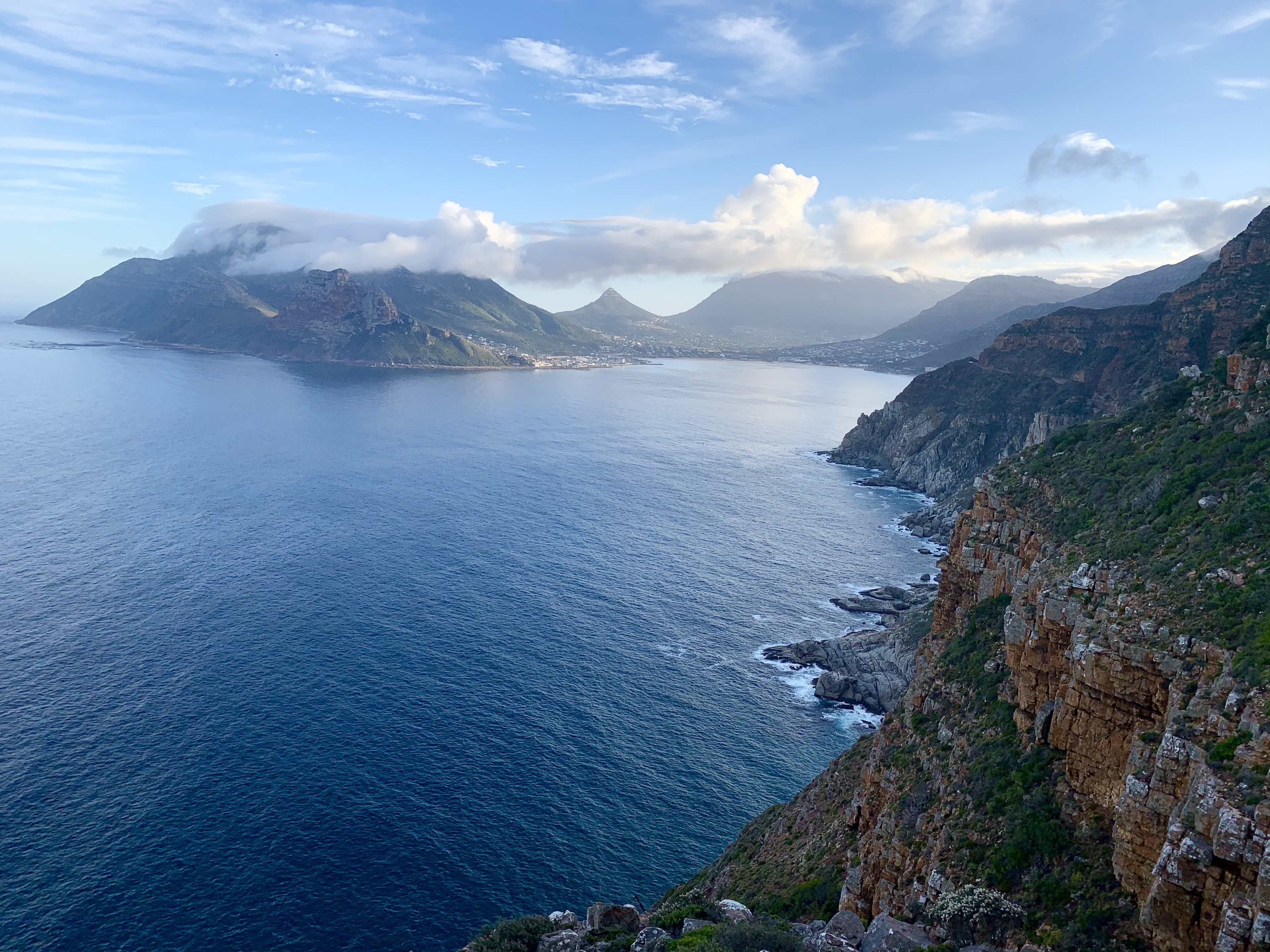
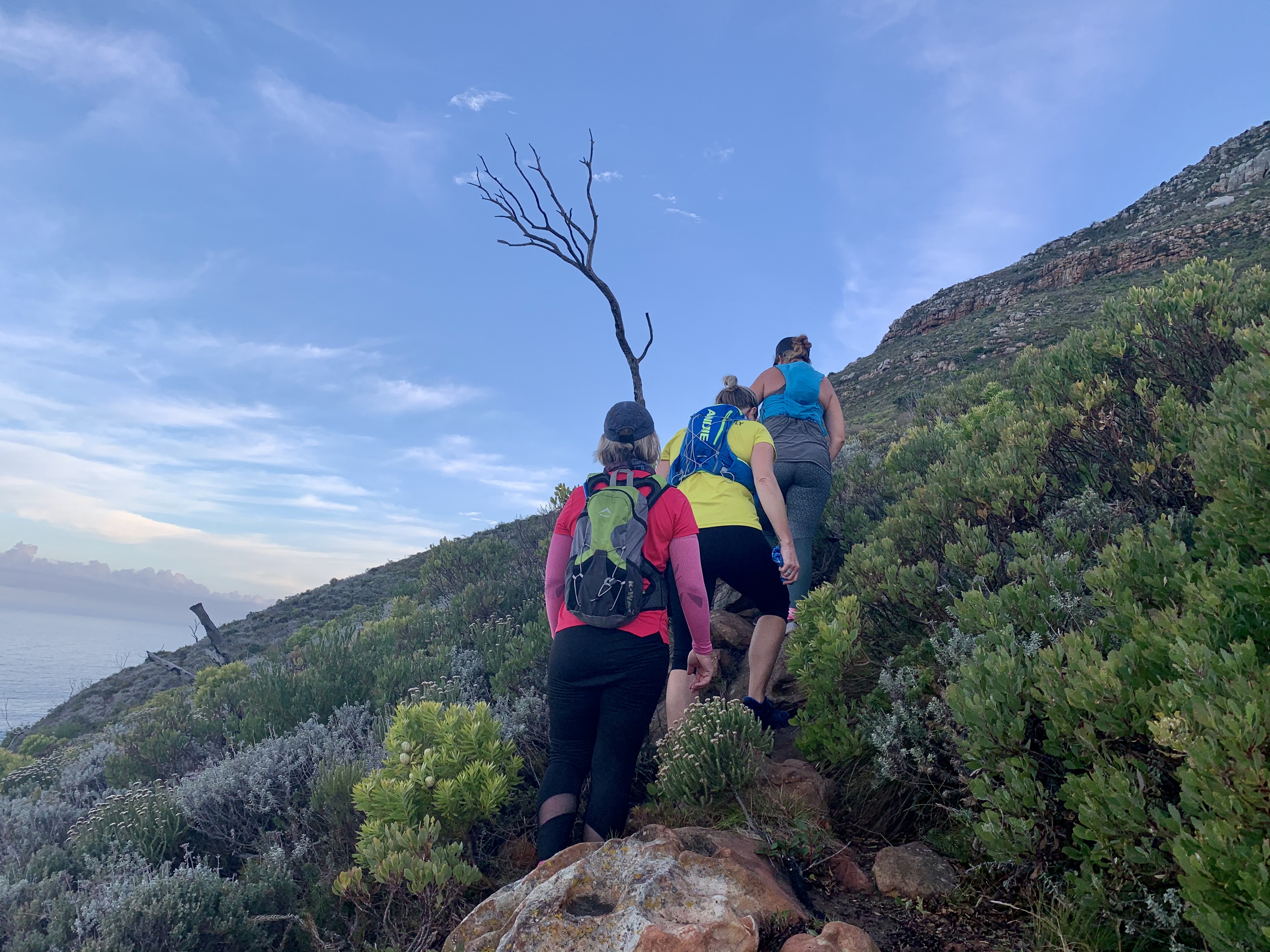
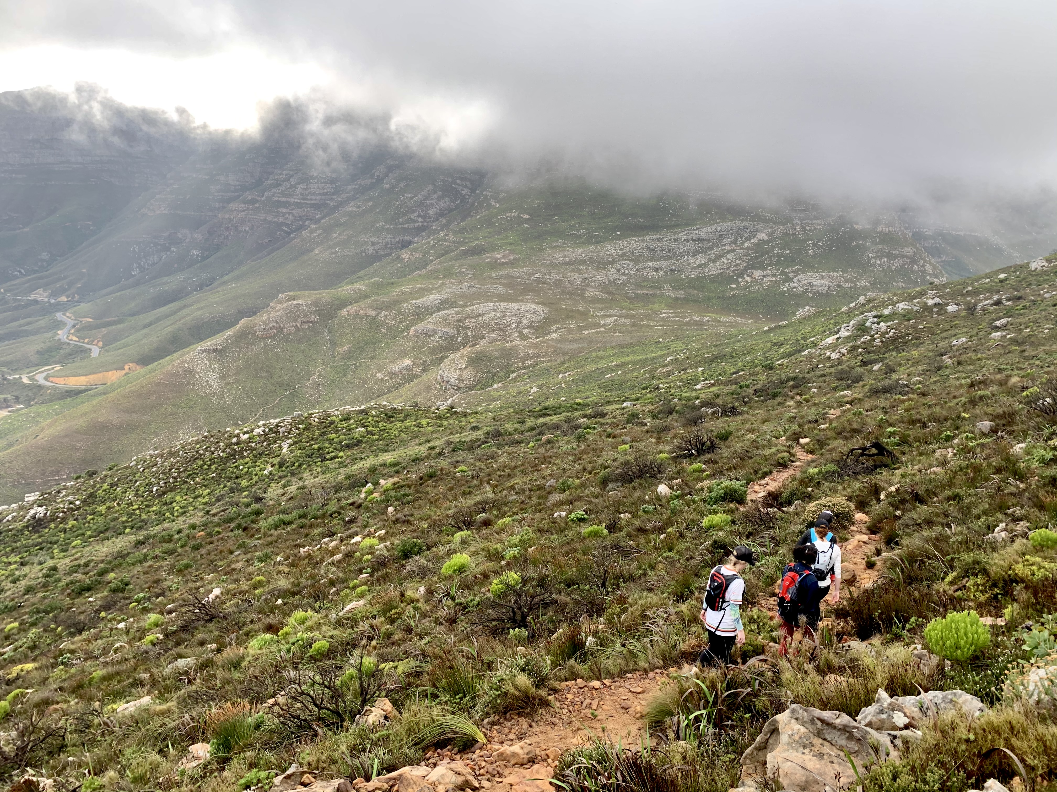
Kilometre three itself got more challenging as it took us up the final steep slopes of the peak. It had a few Boulder climbing sections that the slower girls struggled on but between steep climbs were little contour traverses that gave our legs a break. What’s crazy is that this last steep climb was actually faster than the next 2kms down.
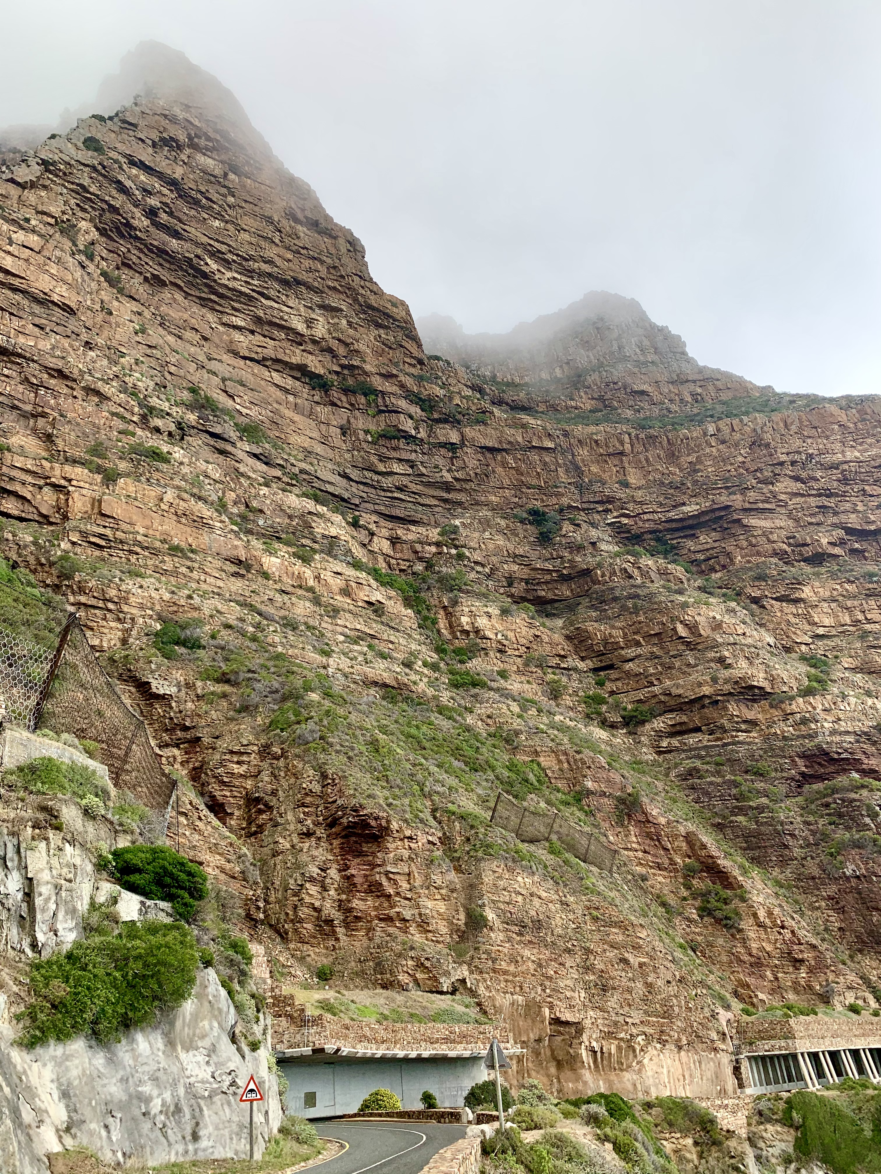
Up above was the Peak shrouded in eery mist now hiding the beach below in a haze.

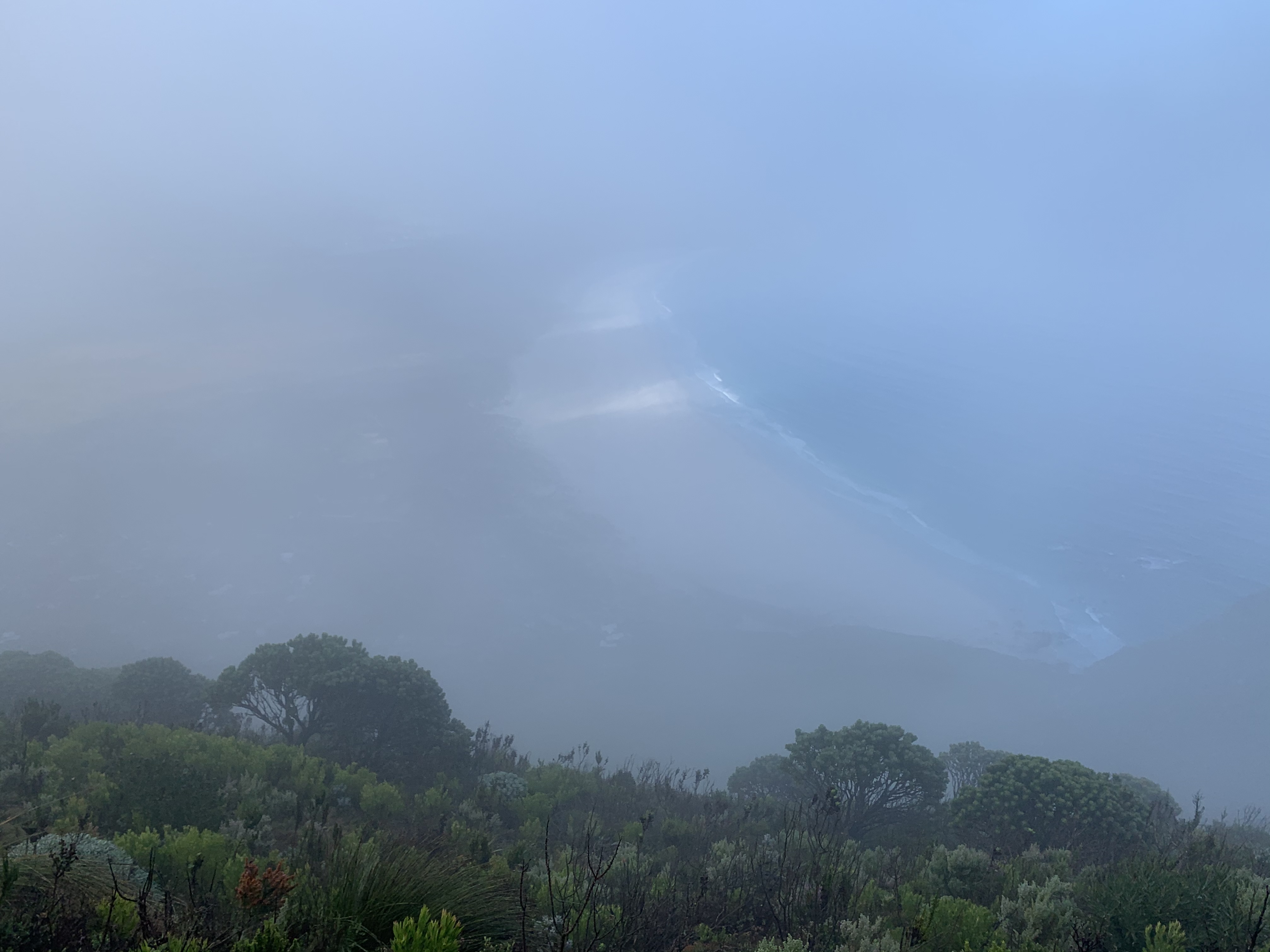
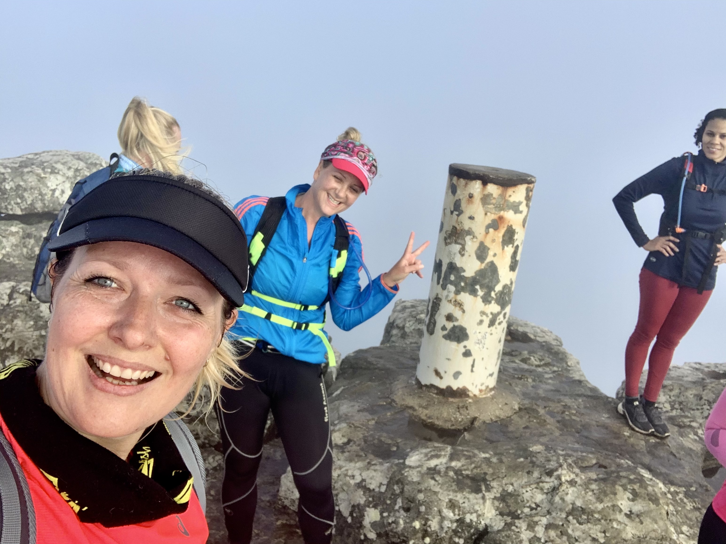
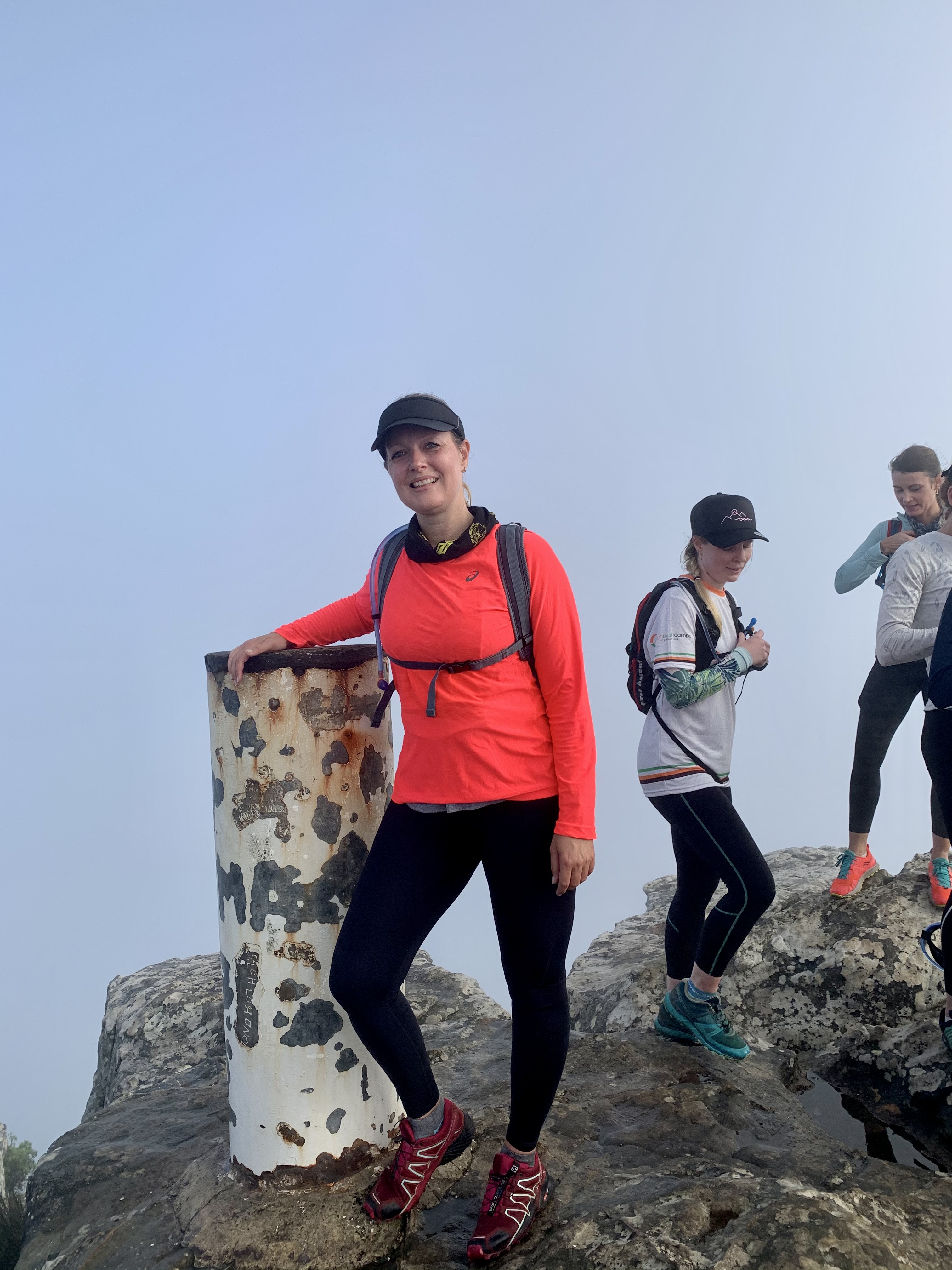
The top!!!! Around kilometre 4. We finally made it and celebrated with a snack and a decent water break. The peak is actually very small and the 15 of us covered every inch. The mist put a damper on any photos of the views so I guess we will have to conquer it again on a sunnier day.
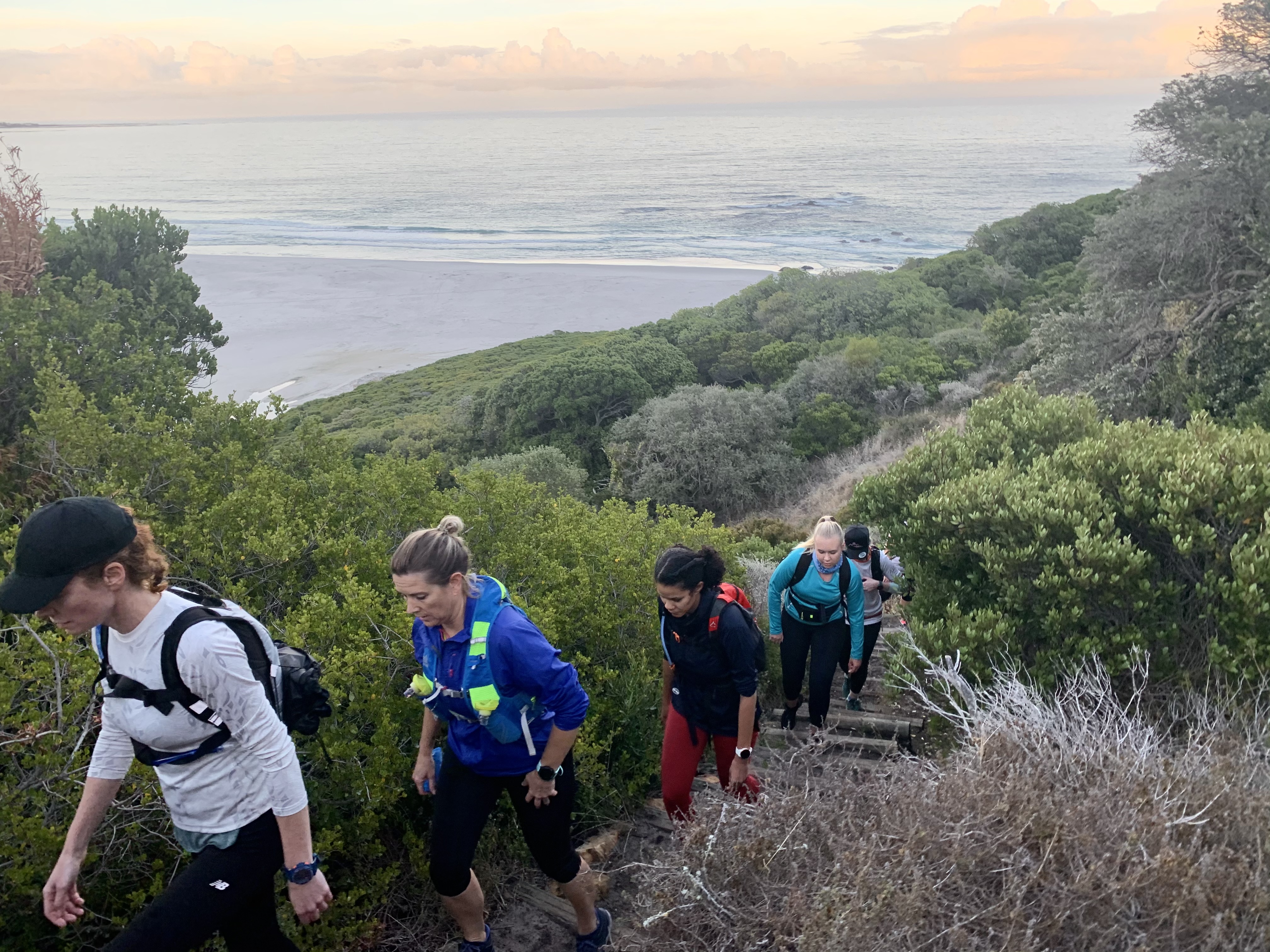
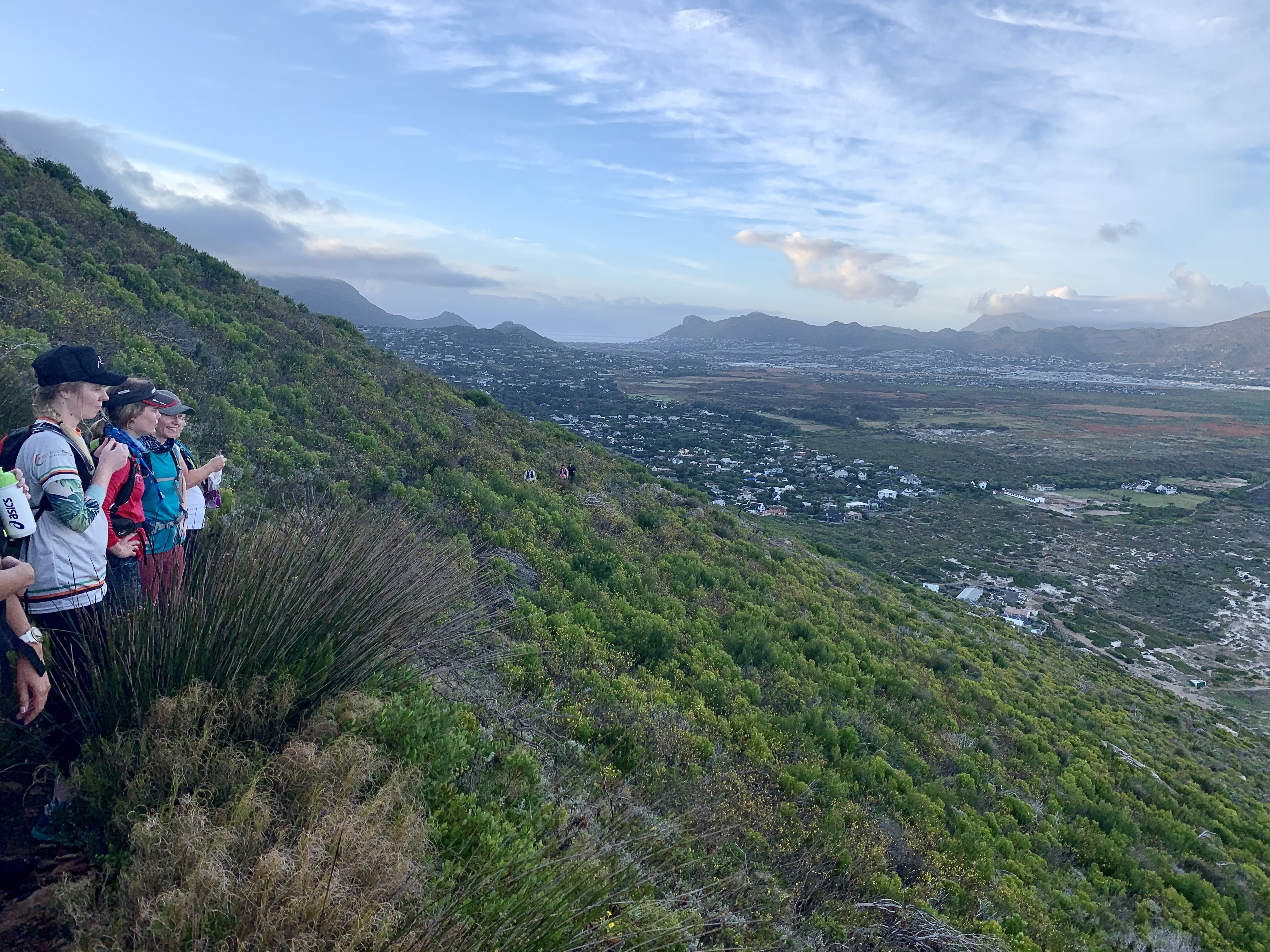
Our route down was different as we were attempting a circular route over the peak. We found the new path down which headed down and around the peak and then in a northerly direction along a contour around the lower peak and then onward to the saddle of the mountain. By now my knees were starting to feel the impact and my right calf that had previously been strained was once again feeling every downward step.

This took us another 2 and a half kilometres down to Chapmans Peak Drive - this had been our slowest section of the walk, even though we had attempted a light jog on the flatter sections. We decided that our motto was “Don’t fall & Don’t break anything!” If we made it down in one piece we were doing well. No point trying to be a hero.
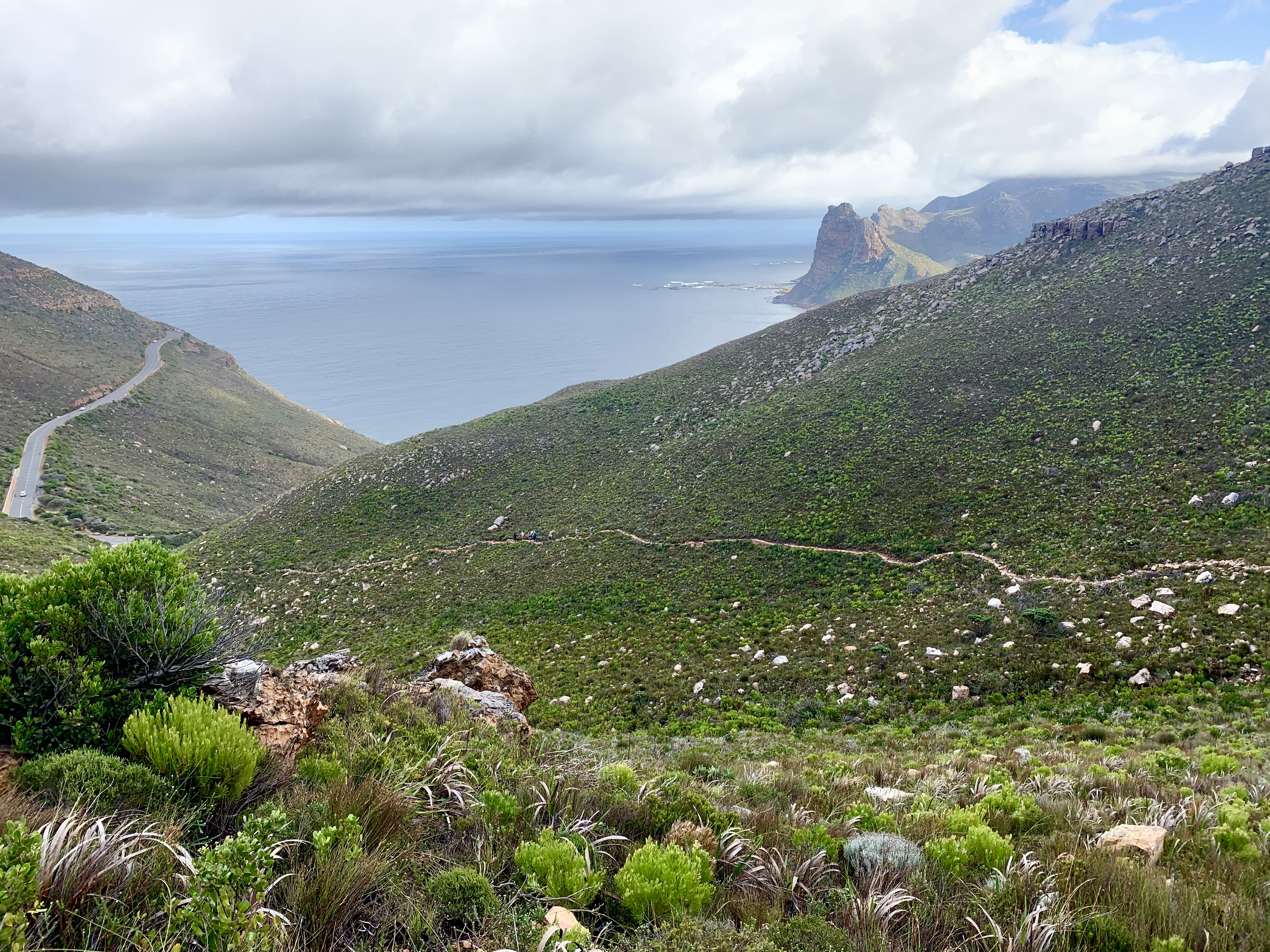
We finally made it to this next milestone of the Chapmans peak day pass turnaround. It’s a carpark for folk coming up the mountain on the regular route. We were so happy just to be off the steps and back on a smooth surface.
Now the jogging began (again). We gave our best running up the hill towards the Hout Bay lookout point on Chapmans Peak drive passing the 8km mark.

As we turned the bend the downhill run began. We took it almost like a freewheel run, just letting the slope take our bodies downhill at a decent pace.
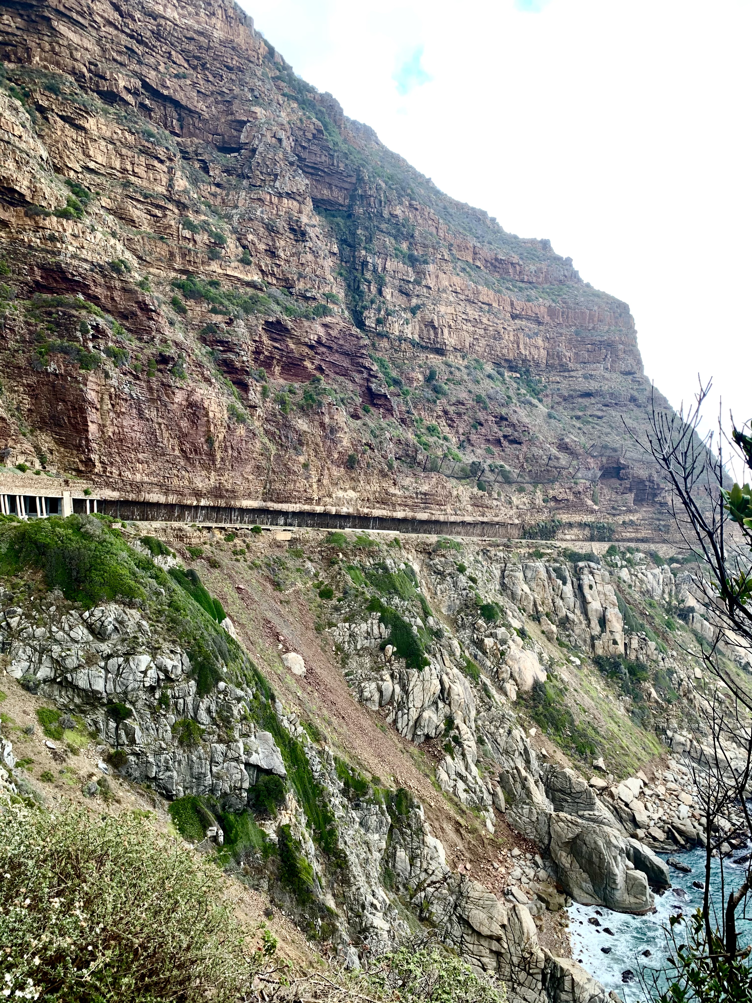
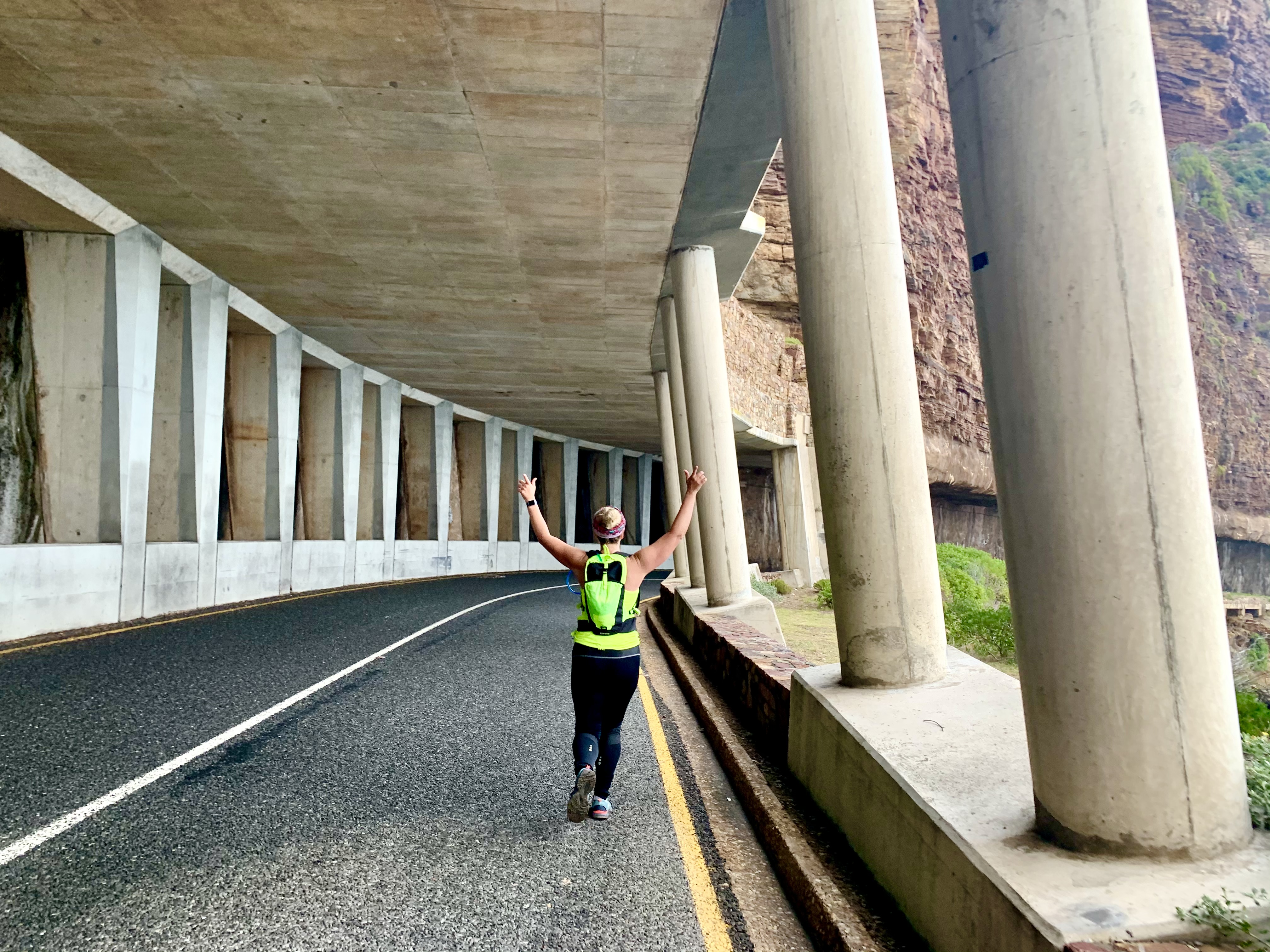
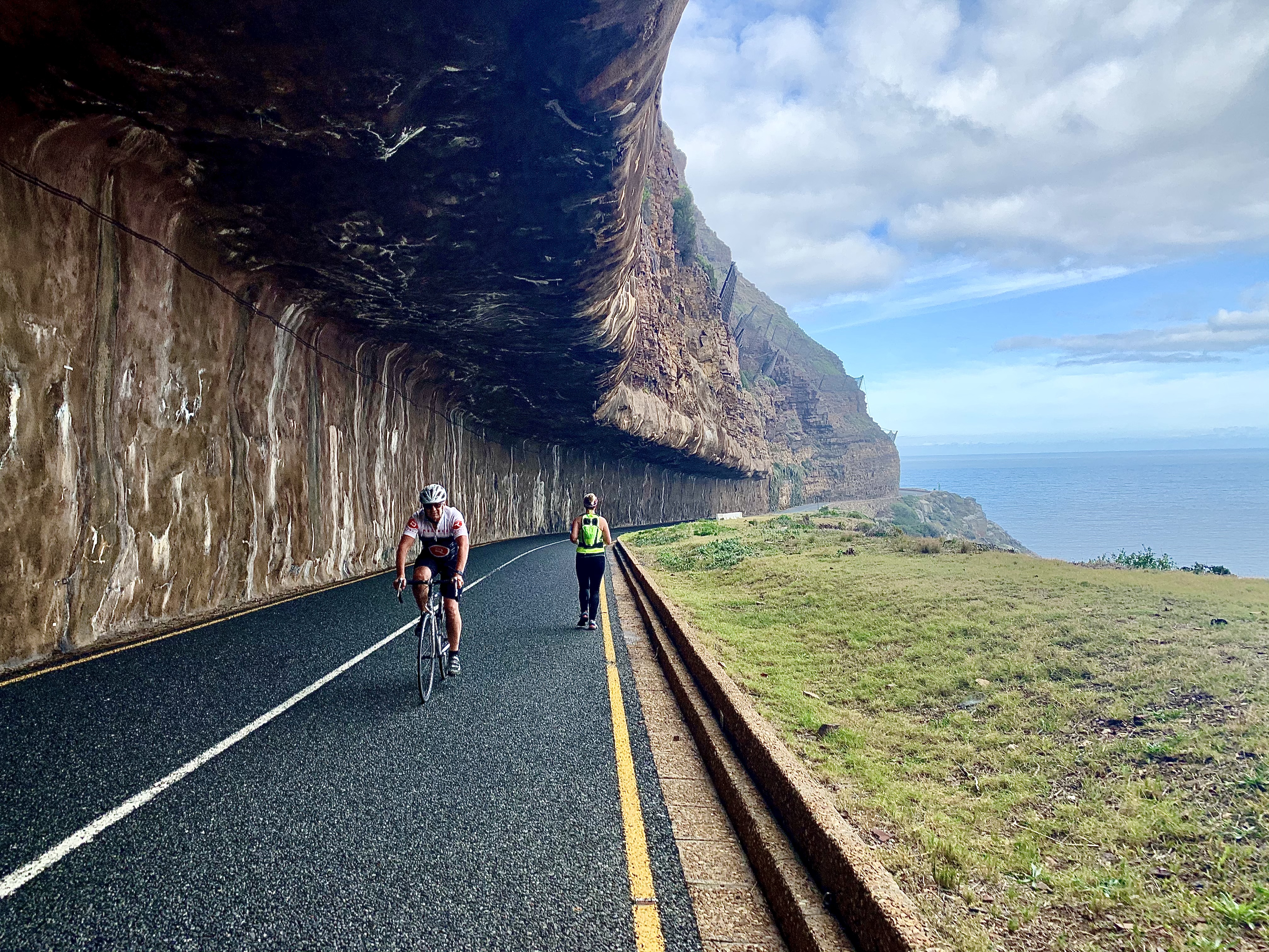
Kilometre 9, 10 and 11 took us below those amazing cliffs that we had photographed from above an hour earlier. But this time we ran through the feat of engineering that are the half tunnel and the eery overhang with thousands of tonnes of mountain above us!
The last ½ kilometre of road was a tough slight uphill and our feet were starting to hurt. Trail shoes are not necessarily the best thing for road running.

We found the small path back to the wooden stairs and slowly and painfully made our way down. By now every muscle and joint hurt. The jog had seemed easy compared to these big stairs that required concentration and a level of agility that no longer existed for us.
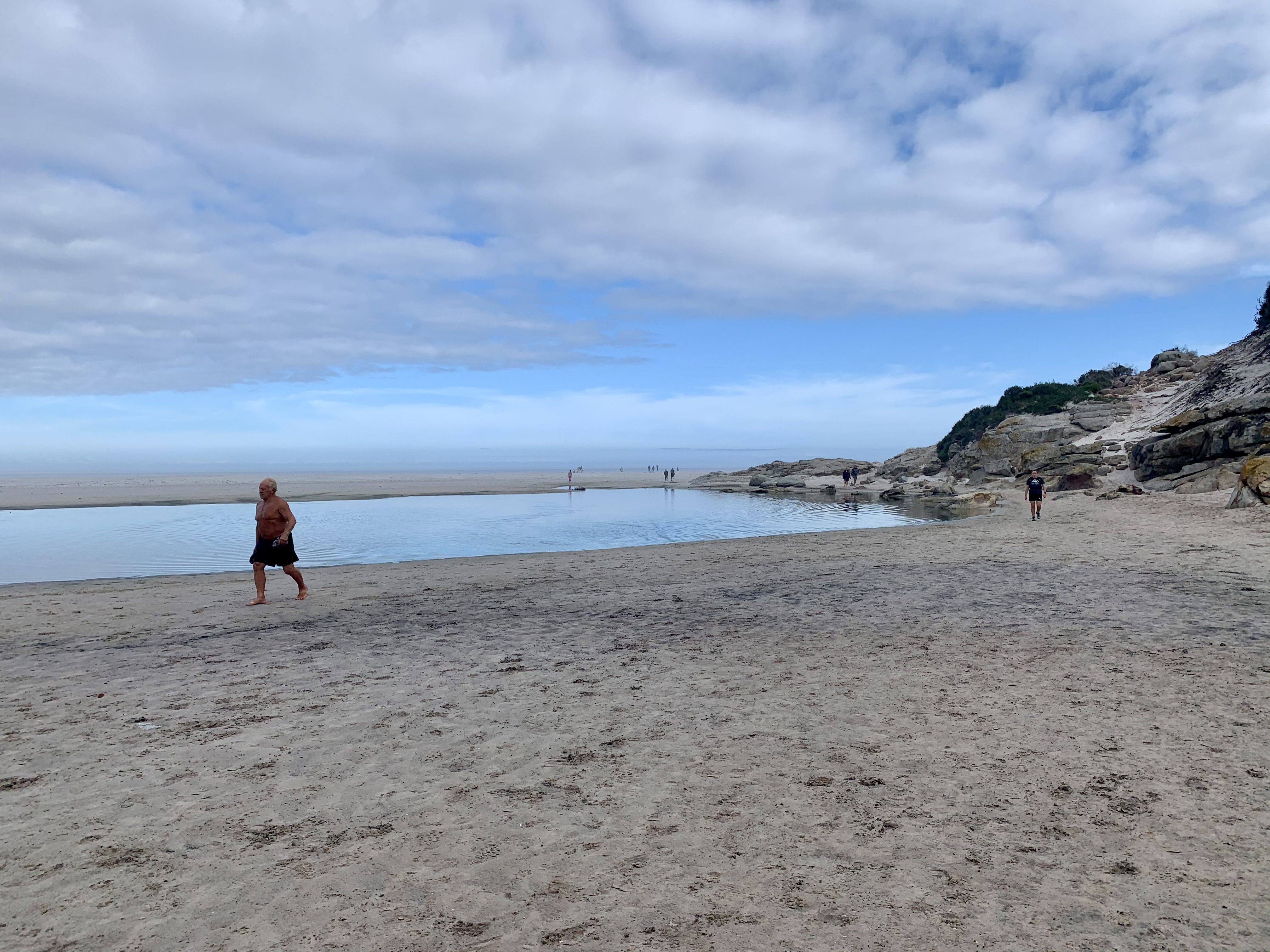
Back at the beach... our final trudge through the sand got us to the end of kilometre 12 and dreams of a cold drink awaiting us.
On the last 770 meters we ran on the downhills and walked the uphills until we got back to Aegir, our finish line. A lot of the social and intermediate ladies had passed us on the mountain and they welcomed us in. With a spot at a long wooden table.
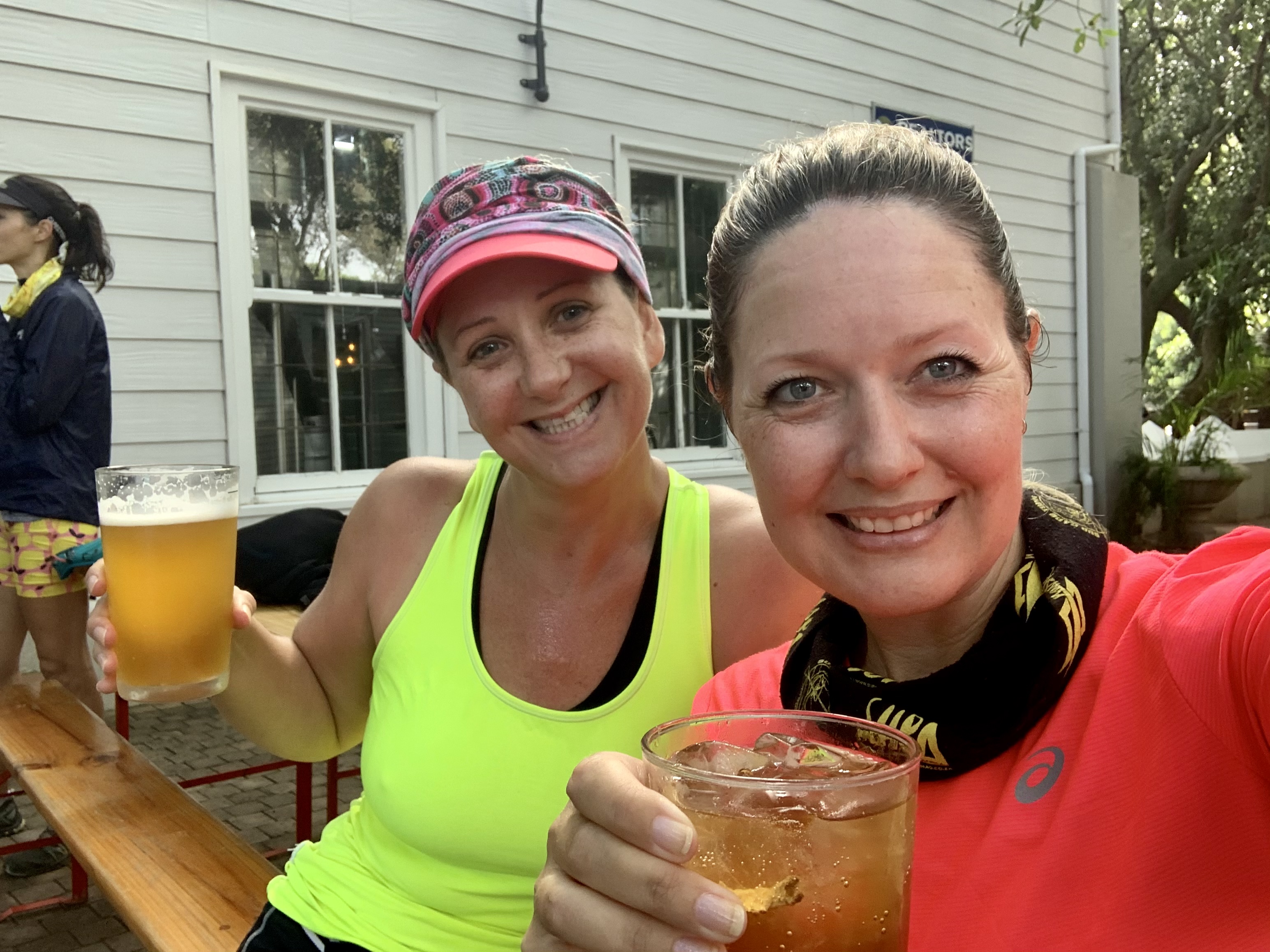
We were so happy just to have done it!!!! A friend said that a 12km trail run is the equivalent of a 25km run. And boy did it feel like it. I’ve done longer hikes than this, but I didn’t feel as smashed. I guess when you’re out on a hike you’re not pushing for a good time, the aim is to enjoy the moment and nature.
Trail running pushes you to be in the zone 100% of the time. Moving at your best pace all of the time and getting down just as fast as you got up (if not faster).

I’ve got to say that the uphill climb to the peak was absolutely beautiful but I have zero desire to do it again. I’d much rather take the regular route and enjoy the hike. It’s also dangerous if you’re not with experienced hikers or trail runners. It’s quite easy to lose the path and a slip and fall in these conditions can be disastrous. The whole Table Mountain range has had mishaps and airlifts due to accidents and falls. I don’t want to be one of those statistics.
The regular routes might be a little busier but they are also usually safer than these back routes.
A day later and stiffness has set into my knees and muscles. But tomorrow is another day and hopefully a little workout with the ladies will work some of that lactic acid out of the old muscles. There’s nothing better than some light exercise to work out the aches and pains.
This might not be for your average hikers but if you’re feeling adventurous then look it up! All the routes are on maps.me but worth doing with someone that’s done it before. The Cape Town Hiking group on Facebook always have folk doing all these routes who don’t mind a couple more tagging along.
I hope you enjoyed the adventure with me!

Congratulations, your post has been added to Pinmapple! 🎉🥳🍍
Did you know you have your own profile map?
And every post has their own map too!
Want to have your post on the map too?
@tipu curate 3
Hiya, @ybanezkim26 here, just swinging by to let you know that this post made it into our Top 3 in Daily Travel Digest #1196.
Your post has been manually curated by the @pinmapple team. If you like what we're doing, please drop by to check out all the rest of today's great posts and consider supporting other authors like yourself and us so we can keep the project going!
Become part of our travel community:
Cool!!! Thanks so much!!!!
The view of the Noordhoek beach is amazing! I really enjoyed to read your post:)
Thanks! Yes it really was beautiful!! I know the views from the peak are amazing in a clear day, so I’ll have to do it again some time when the weather is completely clear. Just not too soon 😅. My legs are recovering.
Oh to see this that would be amazing! haha yeah i can imagine that its hard and you need a little break between:)
You are a strong woman! The view of Hout Bay from distance is amazing. Waiting for your next hiking story :D
Oh thank you! Yes the views were absolutely gorgeous.