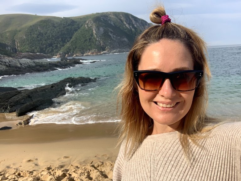
Our road trip continues up the East coast of South Africa to Jeffreys Bay. But on the way we made a stop at the Storms River Mouth which is a part of the Tsitsikama Reserve in the Eastern Cape Province.
Storms River is home to one of South Africa’s highest bridges (a few Kms up river) but today we ventured off the highway towards the coastline. We have done this trip every year all my life but we have never stopped so this was the day to change it.
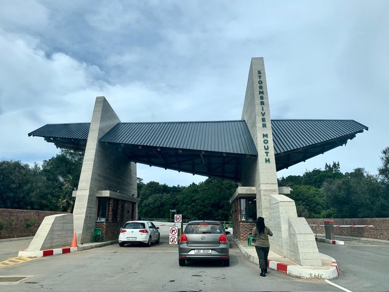
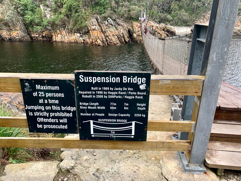
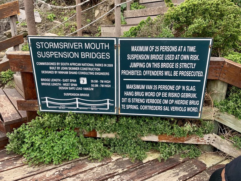
We signed in at the main gates to then Storms River Mouth and paid our small fee per person (there’s an SA citizens rate, residents and then non residents options).
Then took down the windy road down hill through the thick forest. It was awesome to see the hiking trails so well marked on either side of the road for the various trails. But I guess that is to be expected as this is also the start of the famous Otter Trail.
The Otter Trail is a five day hike along the rugged coast starting at the Storms River Mouth in the Eastern Cape and ending at Natures Valley in the Western Cape. We won’t be taking it on right now but it’s on my bucket list!
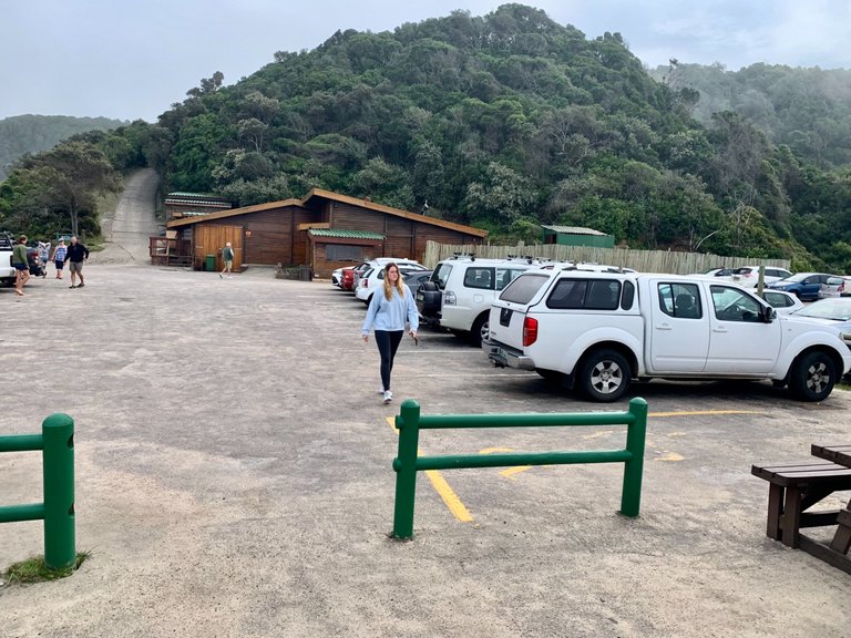
We parked along the road near the main carpark and made our way along the small road to the start of the Storms River Mouth walk to the famous suspension bridges.
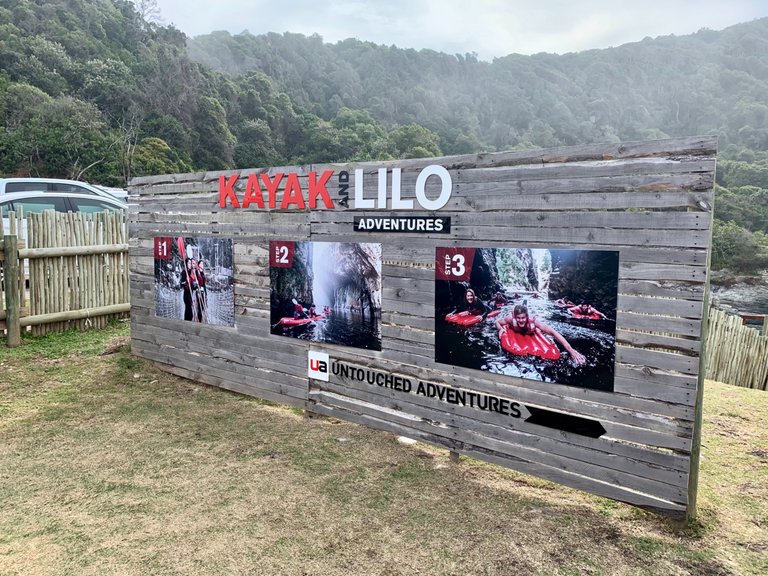
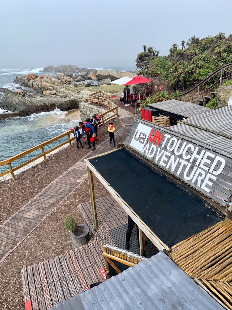
The first thing you see is the Untouched Kayak and Lilo adventures base camp. We didn’t have time for the whole bang shoot so we passed them by and headed for the start of the path leading through the forest along the cliffs.
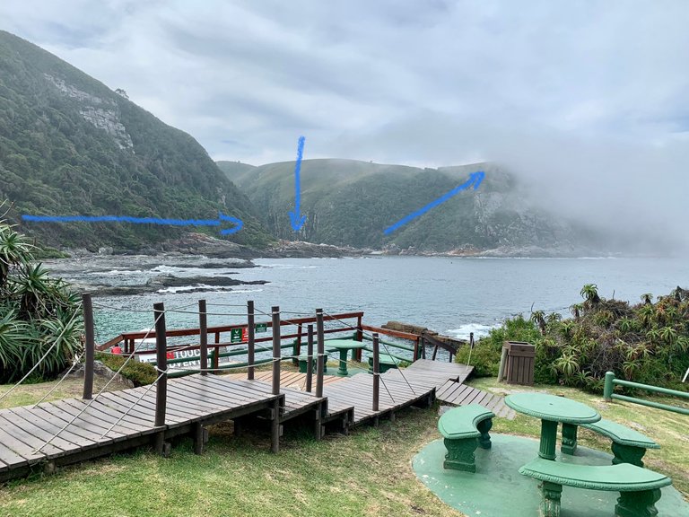
We had a good view of the mouth and the route that we were about to take. There is an option to go up to the lookout point at the top of the next peak as well but with Grants ankle still playing up we decided the bridges were far enough.
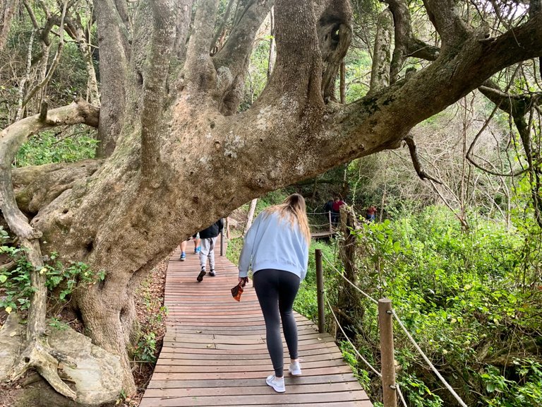
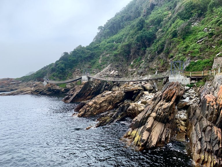
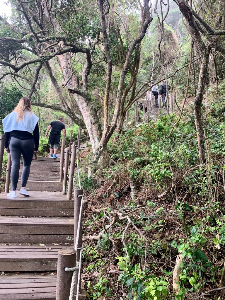
The walk ways are made of recycled plastic planks and easily lead you all the way from the beach to the bridges. There was quite a bit of foot traffic due it being a Sunday.
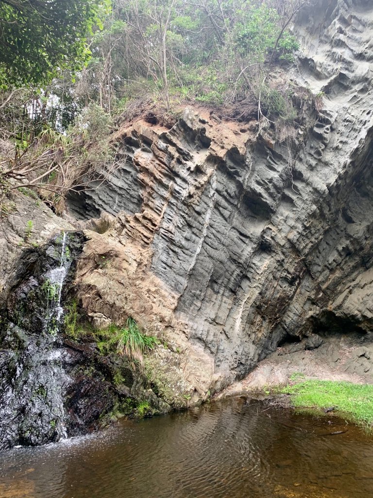
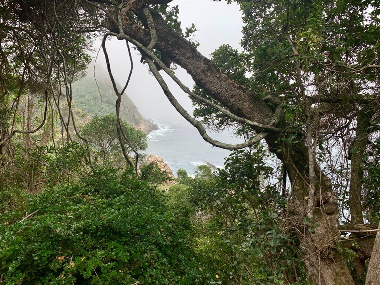
We passed a gorgeous waterfall and then headed deeper into the forest.
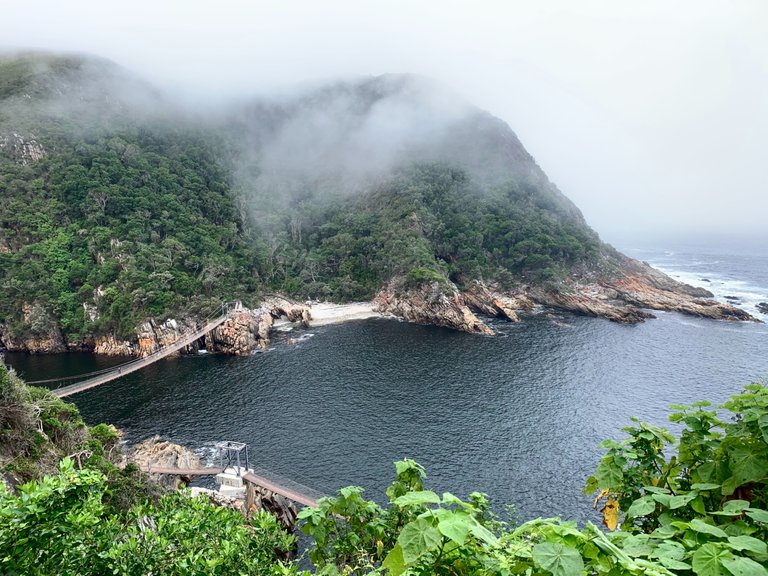
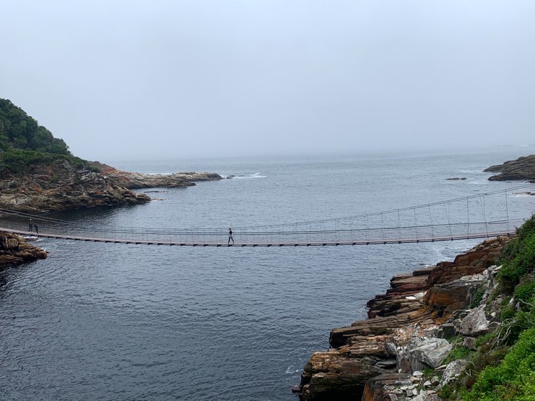
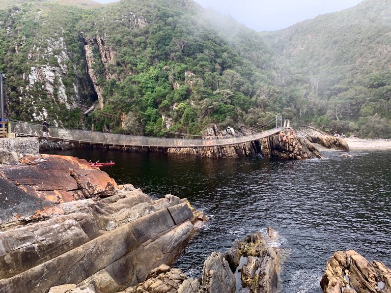
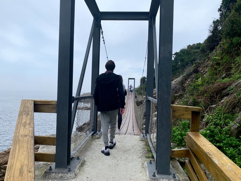
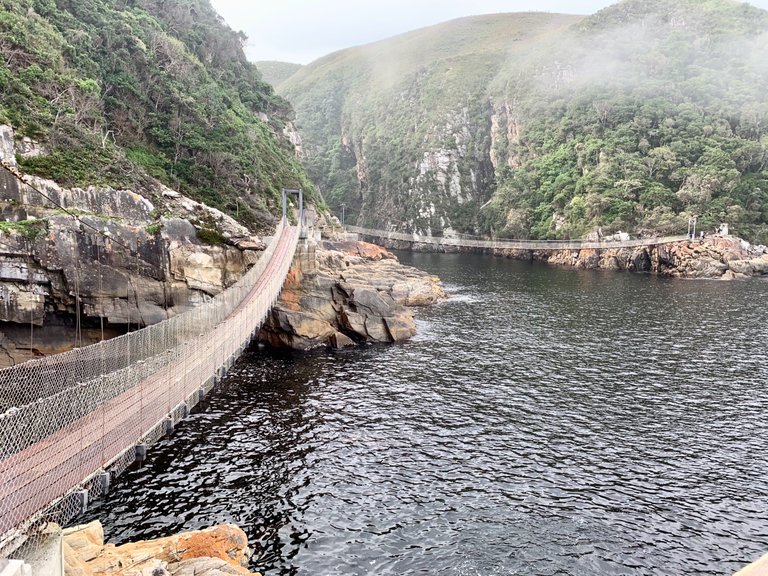
The path was undulating with steps up and then down along the cliffs as it got steeper. The views for more and more beautiful. Until we finally got a view of the largest suspension bridge.
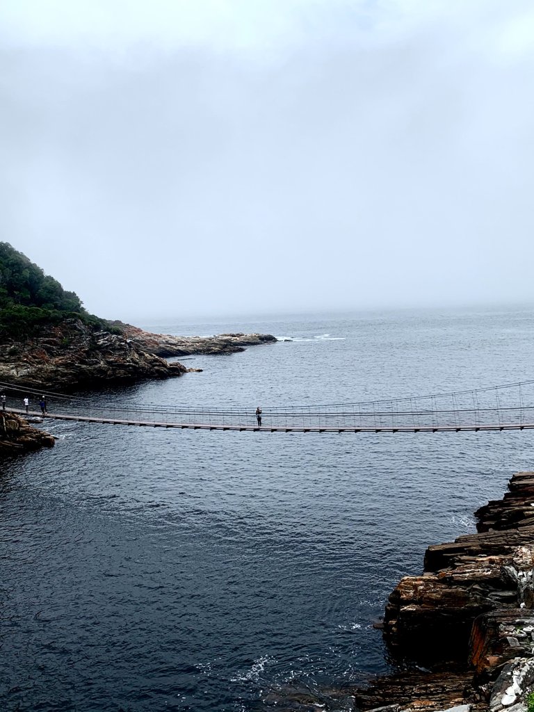
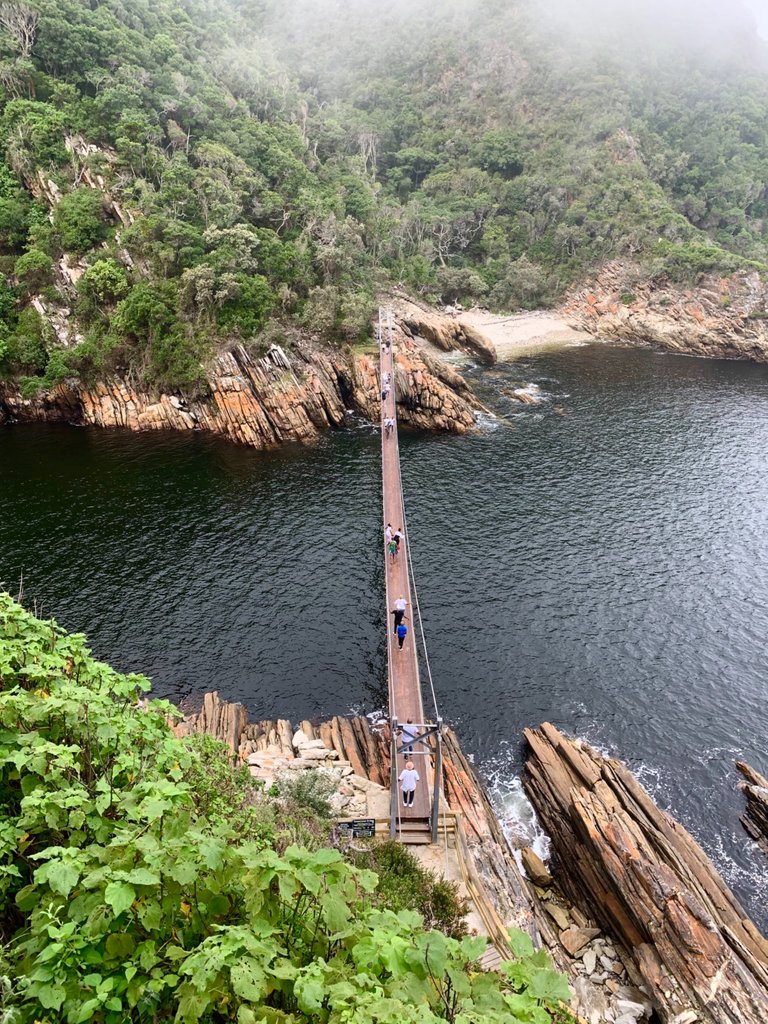
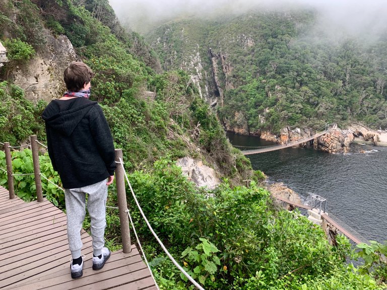
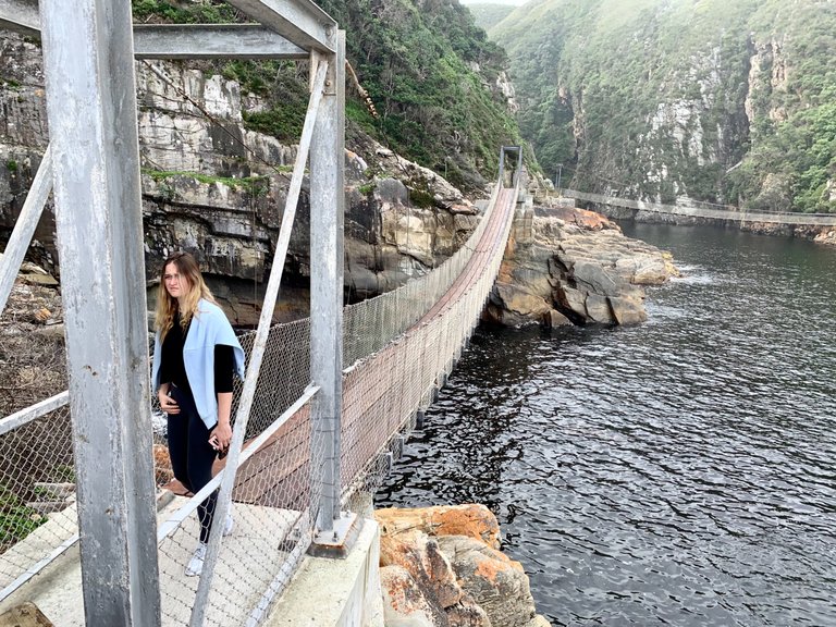
We followed the path along the cliff beyond the bridge a little further to really admire the expanse of the bridge while my daughter walked to the middle of the bridge. You can see her standing alone over the water.
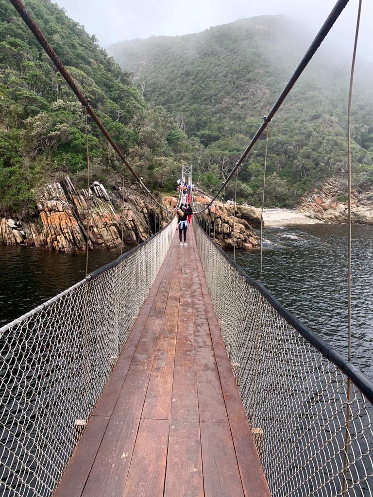
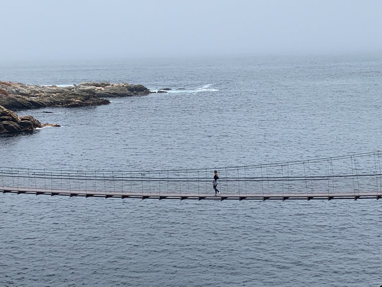
Now it’s our turn to walk on the bridge! You definitely get the feeling that you are swinging as with ever step of every person you can feel the bridge sway from side to side.
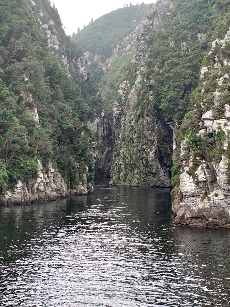
The views up the river are eerily beautiful in the mist and diffused light.
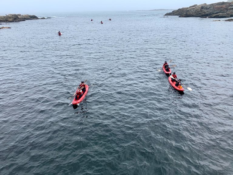
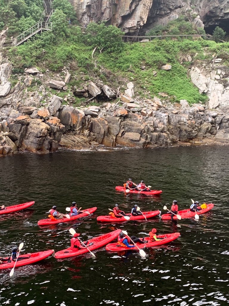
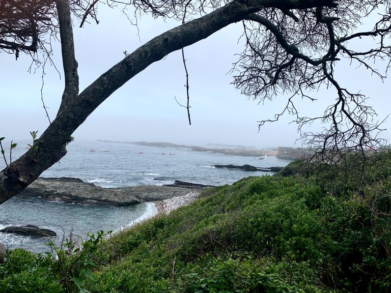
As we walked back and forth a group of kayakers crossed under the bridge headed up river. I can imagine it could get hairy in a big swell but today the sea was calm and the conditions pretty perfect.
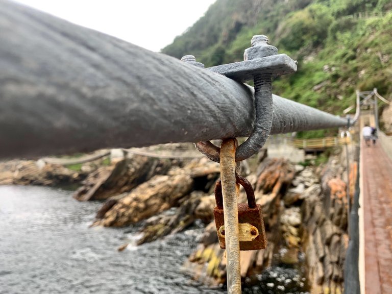
It seems we have some copycat locks along the bridge of couples pledging their love. Grant explained the meaning to Seth and that you will find the same thing on the bridge across the River Seine in Paris.
From our position we can see the other 2 slightly shorter bridges that mark our way back to the path.
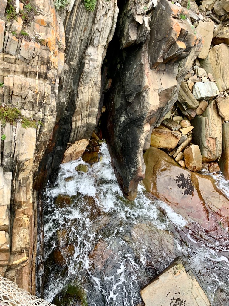
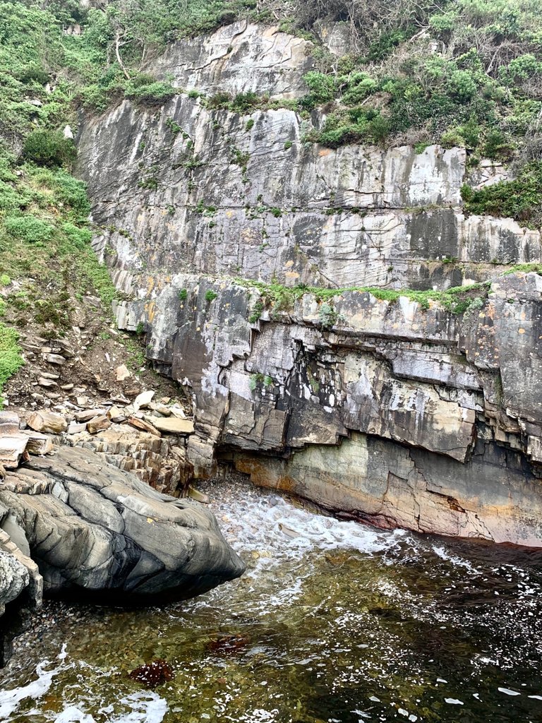
But first we take in the views and various rock formations on either side of the river.
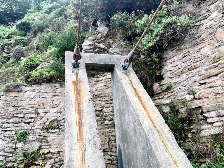
Each bridge seems to be suspended or anchored to large concrete pillars which are then tensioned via these steel structures.
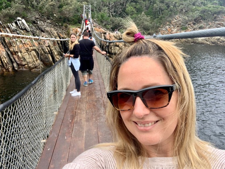
We take a final walk on the two shorter bridges before heading back for a coffee.
This time we have to walk up steep steps to the higher path. It was quite the workout!
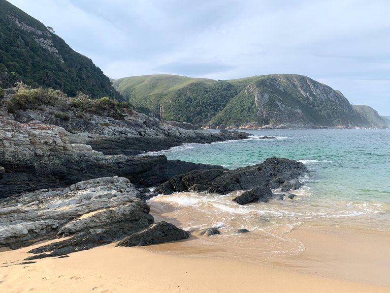
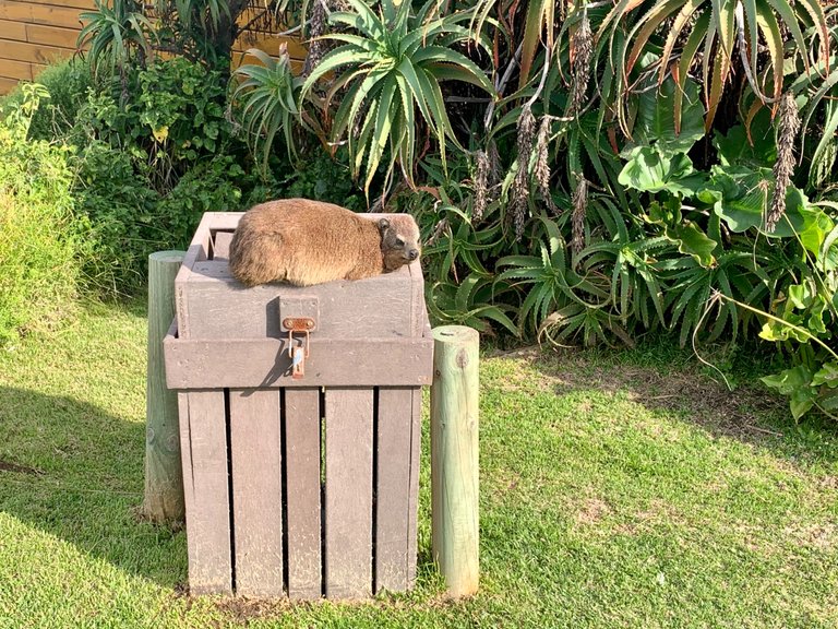
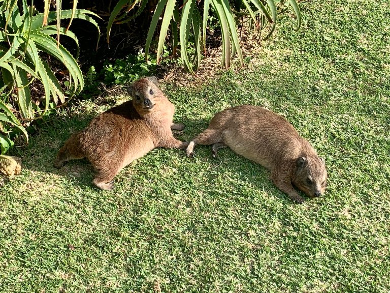
But we eventually made it back through the forest to the gorgeous little beach with the creamy soft sand. As the sun peaked through the clouds the local Dassies basked in the last rays of the day, warming themselves. These guys seem quite tame and didn’t mind a few photos. Shockingly their DNA is related to the elephant!!! How???
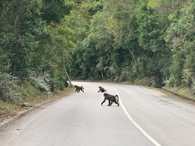
We were now keen to get back on the road to our next destination, Jeffreys Bay. As we made our way back up the winding road we passed a troop of Baboons in search of their sleeping quarters for the afternoon.
Back on the N2 highway. A couple stop / go’s for roadworks and an hour later we were in JBay. Ready for the next part of our holiday adventure.
Congratulations, your post has been added to Pinmapple! 🎉🥳🍍
Did you know you have your own profile map?
And every post has their own map too!
Want to have your post on the map too?
What a gorgeous place!
It really is so unique!!! We loved the whole excursion.
Dramatic part of our coastline (well one of them), booked in for an overnight in the log huts of the Parks Board in the day. Sound of crashing waves one respects nature very quickly along that route.
Unfortunately due to rain we only made it to the starting point of the Otto trail with sons being very young at the time, bad weather.
Definitely a place to go visit again, you have been often... jealous, you have really presented what is found in the region magnificently!
Aaah! Thank you!! I’ll be posting about Jbay really soon too.
Hiya, @LivingUKTaiwan here, just swinging by to let you know that this post made it into our Honorable Mentions in Daily Travel Digest #1185.
Your post has been manually curated by the @pinmapple team. If you like what we're doing, please drop by to check out all the rest of today's great posts and consider supporting other authors like yourself and us so we can keep the project going!
Become part of our travel community:
Oh that’s so cool! Thank you!
How cool, like it 👍
Thanks!