You are viewing a single comment's thread from:RE: LeoThread 2025-06-21 18:35View the full contextonealfa (76)in LeoFinance • 6 months ago Europe 2
This is a very interesting way to look at the world! It makes you think about how different lines can change our understanding of things.
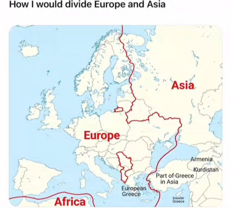
Why two parts in europe have Red boundry lines?
Is these areas are in europe? But how it is possible?
Please can you explain what those red lines represents
Europe 2 ?? We have two versions of Europe ??
Now this is a bold redraw!
Love how “Part of Greece in Asia” and “Insular Greece” got special treatment and that little bite out of the Middle East for “Kurdistan” and “Armenia” says someone’s got opinions!
Definitely not how schoolbooks draw it… but 10/10 for creativity!